Mori Atlas logo
National parkFazao-Malfakassa National Park

Discover the protected mountain landscape and vital forest corridor of this key West African wilderness area.

Fazao-Malfakassa National Park: Togo's Largest National Park and Mountain Wilderness

Fazao-Malfakassa National Park represents Togo's most extensive national park, safeguarding a significant protected mountainous terrain in the country's eastern highlands. This vast protected landscape, characterized by forested ridges, steep valleys, and diverse savanna ecosystems, serves as a critical refuge for forest wildlife and an intact ecological corridor in West Africa. Its dramatic topography and role as a vital watershed anchor it firmly within the region's conservation atlas and natural geography.

Forest Protected AreaMountain LandscapeWest AfricaEastern HighlandsNational ParkWildlife Refuge

Fazao-Malfakassa National Park

National park

Park overview

Structured park overview, official facts, and landscape profile for Fazao-Malfakassa National Park

Fazao-Malfakassa National Park park facts, protected area profile, and essential visitor context

Review the core facts for Fazao-Malfakassa National Park, including designation, size, terrain, visitor scale, habitats, and operating context in one park-focused overview.

About Fazao-Malfakassa National Park

Fazao-Malfakassa National Park stands as the largest protected area in Togo, encompassing a significant portion of the country's eastern highland forests and mountain landscapes. The park was established to protect one of West Africa's remaining substantial forest corridors, recognizing the ecological importance of preserving intact forest ecosystems in a region where agricultural expansion and human settlement have reduced natural habitats. The park's boundaries encompass diverse terrain including forested ridges, steep-sided valleys, and open savanna zones that create a mosaic of habitats supporting varied wildlife populations. This ecological diversity makes the park particularly valuable within Togo's conservation estate, as it protects multiple habitat types within a single protected area. The park serves not only as a biodiversity refuge but also as an important watershed area, with its forests and slopes feeding into river systems that support downstream communities and ecosystems.

Quick facts and research context for Fazao-Malfakassa National Park

Fazao-Malfakassa National Park is located in the Plateaux Region of eastern Togo, covering one of the largest protected areas in the country. The park protects a mountainous landscape with forested slopes, valley systems, and savanna zones that create diverse ecological habitats. It was established to preserve forest ecosystems and the wildlife they support in a region where natural habitats have faced significant pressure. The park forms part of a connected network of protected areas that help maintain ecological corridors across West Africa's coastal and highland zones.

Protection and recognition

Exploring the terrestrial boundaries, official status, and documented geographic scope.

Fazao-Malfakassa National Park Protected Area Designation and Status

Researchers can analyze the documented terrestrial protection scope and official status established for Fazao-Malfakassa National Park. Comparing verified geographic data and conservation records provides essential regional context for understanding West African protected landscapes.

Protection details

Protection scope
Terrestrial
Transboundary protection
No
Park context

Deeper park guide and search-rich context for Fazao-Malfakassa National Park

Fazao-Malfakassa National Park history, landscape, wildlife, and travel context

Explore Fazao-Malfakassa National Park through its history, landscape character, ecosystems, wildlife, conservation priorities, cultural context, and seasonal travel timing in a structured park guide built for atlas discovery and search intent.

Why Fazao-Malfakassa National Park stands out

Fazao-Malfakassa National Park is best known for its role as Togo's primary forest protection area in the eastern highlands, preserving substantial tracts of West African forest that are otherwise rare in the country. The park is recognized for protecting important watersheds that feed into the Ouémé River system and for serving as a refuge for forest-dependent species. Its mountainous terrain creates a distinctive landscape within Togo's protected area network, offering ecological diversity that includes both forest and savanna habitats. The park represents one of the last large-scale wilderness areas remaining in Togo's eastern region.

Fazao-Malfakassa National Park history and protected-area timeline

Fazao-Malfakassa National Park was established as part of Togo's efforts to create a comprehensive national park system that would protect the country's most significant natural landscapes and ecosystems. The designation of this large area as a national park reflected the recognition that Togo's eastern highland forests represented a critical gap in the country's protected area network. The park was created to address the loss of forest cover that had occurred across much of Togo's lowland areas, focusing protection on the more rugged terrain where forests had persisted. Over time, the park has been recognized within regional conservation frameworks as an important component of West Africa's protected area network, particularly as part of efforts to maintain connectivity between coastal and inland protected zones.

Fazao-Malfakassa National Park landscape and geographic character

The landscape of Fazao-Malfakassa National Park is characterized by its mountainous and hilly terrain in eastern Togo's highland region. The park encompasses forested ridges that rise above steep-sided valleys, with the topography creating a varied landscape of slopes, plateaus, and ravines. The vegetation ranges from dense forest cover on the more sheltered slopes and valley bottoms to more open savanna areas on exposed ridges and higher elevations. The park's elevation range creates temperature and moisture gradients that influence the distribution of plant communities across its extent. River courses and streams that originate in the park's higher terrain flow through the landscape, carving valleys and providing water resources for both wildlife and downstream communities.

Fazao-Malfakassa National Park ecosystems, habitats, and plant life

The ecological character of Fazao-Malfakassa National Park is defined by its forest ecosystems, which represent some of the most significant remaining forest cover in Togo. The park protects a transition zone where forest habitats meet savanna environments, creating a mosaic of ecological communities. These forests provide habitat for forest-dependent species and serve as ecological corridors connecting populations across the wider region. The park's position in Togo's eastern highlands places it within a biodiversity zone that supports species adapted to higher-elevation forest environments. The protection of this forest ecosystem is particularly significant given the extensive loss of forest cover that has occurred across much of Togo's lowland areas in recent decades.

Fazao-Malfakassa National Park wildlife and species highlights

Fazao-Malfakassa National Park provides habitat for wildlife species adapted to West African forest and woodland environments. The park's forest habitats support populations of forest-dwelling mammals and birds, while the savanna areas provide habitat for species that prefer more open environments. The protected status of this large area offers refuge for wildlife populations that have been displaced from surrounding lands converted to agriculture. The park's significance as a wildlife refuge is enhanced by its position as one of the largest remaining natural areas in Togo's eastern region, providing contiguous habitat that can support viable populations of forest species.

Fazao-Malfakassa National Park conservation status and protection priorities

Fazao-Malfakassa National Park represents a critical component of Togo's conservation strategy, protecting the largest remaining tract of forest and wilderness in the country's eastern highlands. The park's establishment addressed a significant gap in Togo's protected area network, which historically focused more heavily on the southern and coastal regions. By protecting substantial forest ecosystems, the park helps maintain biodiversity in a region where natural habitats have faced considerable pressure from agricultural expansion and logging. The park also contributes to regional conservation efforts by forming part of a network of protected areas that maintain ecological connectivity across West Africa.

Fazao-Malfakassa National Park cultural meaning and human context

The region surrounding Fazao-Malfakassa National Park is inhabited by communities whose traditional livelihoods include agriculture and natural resource use. The park's creation has involved considerations of how to balance conservation objectives with the needs of local communities who have historically used the land. The highlands of eastern Togo are home to populations with cultural traditions tied to the landscape, and the protected area exists within this broader regional context.

Top sights and standout views in Fazao-Malfakassa National Park

Fazao-Malfakassa National Park offers Togo's most extensive wilderness experience, with its large area of protected forest and mountainous terrain providing a landscape distinct from the country's more developed lowland regions. The park's significance as a forest refuge and watershed area makes it an important area for understanding Togo's ecological heritage. Visitors to the park can experience the natural landscapes of the eastern highlands, with opportunities to observe forest ecosystems and wildlife in one of West Africa's remaining substantial protected wilderness areas.

Best time to visit Fazao-Malfakassa National Park

The optimal period to visit Fazao-Malfakassa National Park falls during the dry season, which typically runs from November through April, offering more favorable conditions for wildlife observation and park exploration. During this season, vegetation is less dense and wildlife tends to concentrate around water sources, making animals easier to spot. The dry conditions also make trails more accessible for hiking and exploration of the park's interior areas. The wet season from May to October brings heavier rainfall that can restrict access to some areas and make travel more challenging, though the landscape becomes lusher during this period.

Monthly climate preview

Long-term representative point measurements tracking annual temperature and precipitation rhythm

Fazao-Malfakassa National Park Climate Normals and Weather by Month

Representative coordinates record sustained temperature shifts and monthly precipitation variations across the year at Fazao-Malfakassa National Park. Examining the complete twelve-month climatology profile reveals detailed averages for multi-year weather patterns at this protected location.
Annual mean26 °C
24 °C29 °C
Jan25°
Feb27°
Mar29°
Apr28°
May27°
Jun26°
Jul25°
Aug24°
Sep25°
Oct25°
Nov25°
Dec25°
Warmest month
March

28.7 °C

Coolest month
August

24.2 °C

Wettest month
September

7.4 mm/day

Driest month
December

0.1 mm/day

Park location guide

Geography guide, regional context, and park location map for Fazao-Malfakassa National Park

Fazao-Malfakassa National Park park geography, regions, and map view in Togo

Understand where Fazao-Malfakassa National Park sits in Togo through a broader geographic reading of the surrounding landscape, nearby location context, and its mapped position within the national park landscape.

How Fazao-Malfakassa National Park fits into Togo

Togo, officially the Togolese Republic, is a narrow West African nation stretching from the Gulf of Guinea to Burkina Faso. It was colonized by Germany in 1884, transferred to France after World War I, and gained independence in 1960. The country has a population of approximately 9.6 million people across an area of about 56,785 km².

Wider geography shaping Fazao-Malfakassa National Park in Togo

Togo is located in West Africa, extending north from the Gulf of Guinea along a narrow coastal strip. It is bordered by Ghana to the west, Benin to the east, and Burkina Faso to the north. The country has a width of less than 115 km between Ghana and Benin. The terrain rises from a coastal plain to an interior plateau.

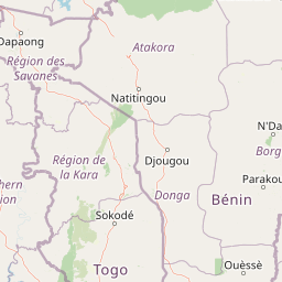
Map view of Fazao-Malfakassa National Park

Use this park location map to pinpoint Fazao-Malfakassa National Park in Togo, understand its exact geographic position, and read its mapped placement within the surrounding landscape more clearly.

Pigeon | © OpenStreetMap contributors
Park atlas

Compare regional park geography and protected landscapes across Togo's eastern highlands and surrounding West Africa.

Explore Nearby National Parks and Protected Areas around Fazao-Malfakassa National Park

Continue your atlas exploration by discovering other national parks and protected areas near Fazao-Malfakassa National Park, encompassing similar mountainous terrain, vital forest corridors, and diverse savanna ecosystems. This comparative overview helps trace the geographic spread of conservation landscapes across Togo's eastern highlands, offering essential context for regional biodiversity protection efforts.
National parkOti Region
About 77 km away#1 closest

Southwest

Kyabobo National Park: Ghana's Highland National Park with Mount Dzebobo and Forest-Savanna Transition

Explore mountainous terrain, park boundaries, and regional geography in Oti Region.

Kyabobo National Park is a significant protected landscape in Ghana's Oti Region, celebrated for its mountainous topography and the commanding presence of Mount Dzebobo. This national park, established in 1993, safeguards a critical ecological transition zone featuring diverse habitats from dense forests to open tree savanna. Its unique geography and protected status make it a vital site for understanding regional conservation and atlas-based landscape exploration in West Africa, offering insights into varied terrain and ecosystems.

Area
360 km²
Established
1993
IUCN
II
Relief
Mountain
National parkKara Region
About 139 km away#2 closest

North

Oti-Kéran National Park: Togo's Vast Protected Savanna Ecosystem and Regional Geography

Explore the mapped terrain and protected landscape of this key national park.

Delve into the geography of Oti-Kéran National Park, Togo's largest national park situated in the Kara Region. This protected savanna landscape, recognized as a Ramsar site, offers insights into its unique sudanian zone terrain, important bird habitats, and its function as a wildlife migration corridor. Understanding its mapped boundaries and ecological significance provides a core piece of the West African protected areas atlas.

Area
690 km²
Established
1950
IUCN
II
Relief
Lowland
Protected areaBorgou
About 204 km away#3 closest

Northeast

Forêt classée de N'Dali: Protected Savanna and Woodland Mosaic in Borgou, Benin

A study in northern Benin savanna and gallery forest geography

Forêt classée de N'Dali stands as a defined protected area within Benin, preserving a complex mosaic of tree savanna and open woodland. This reserve captures the essential Sudano-Sahelian landscape character of the Borgou region, featuring a pattern of vegetation controlled by seasonal drainage and soil variation.

Established
1942
National parkSavanes Region
About 215 km away#4 closest

Northwest

Fosse aux Lions National Park: National Park Exploration in Togo's Savanes Region

Mapped protected area geography and landscape context.

Fosse aux Lions National Park represents a distinct protected landscape within the Savanes Region of Togo. This entry focuses on its identity as a national park, providing structured information on its geographic placement and mapped boundaries. It serves as a core element for understanding the distribution of protected areas and the specific natural terrain within this region of Togo, aiding in comprehensive atlas-style exploration.

Area
16.5 km²
Established
1954
IUCN
II
Relief
Lowland
National parkBono East Region
About 225 km away#5 closest

Southwest

Digya National Park: Ghana's Oldest National Park, Bordering Lake Volta

Explore its unique geography and mapped protected boundaries.

Digya National Park is a significant protected area in Ghana, renowned as the nation's oldest, established in 1900 and gazetted as a national park in 1971. Occupying 3,743 square kilometers in the Bono East Region, it is distinctively bordered on three sides by the vast Lake Volta, creating an unparalleled terrestrial-aquatic habitat interface. This national park represents a key point in Ghana's geographic atlas, situated in a transitional zone between forest and savanna ecosystems, and is a vital hub for wildlife conservation and the study of its unique landscape character.

Area
3,743 km²
Established
1971
IUCN
II
Relief
Lowland
National parkBenin
About 226 km away#6 closest

North

Pendjari National Park: Mapping Benin's Primary Protected Savanna Ecosystem and Wilderness

Located in northwestern Benin, bordering the WAP transboundary complex.

Pendjari National Park represents a significant conservation landscape in West Africa, featuring a complex geography of river-fed riparian forests, sprawling savanna plains, and the high-elevation cliffs of the Atakora mountain range. This protected area offers a look into an intact savanna wilderness, serving as a vital sanctuary for large mammals and diverse bird species within its clearly defined boundaries.

Area
2,755 km²
IUCN
II
Relief
Highland
Climate
Subtropical
National parkAtacora Department
About 226 km away#7 closest

North

Parc national de la Pendjari: Geographic Atlas and Protected Area Overview in Atacora Department

Savanna plains and quartzite mountain ridges in West Africa

Parc national de la Pendjari represents an ecologically vital protected landscape in the Atacora Department of Benin. This atlas overview details its complex geography, ranging from the flat sandstone peneplain to the permanent waters of the Pendjari River. Learn how these boundaries support one of the most significant contiguous savanna ecosystems in West Africa, featuring diverse habitats from gallery forests to open woodlands.

Area
4,700 km²
Established
1961
IUCN
II
Visitors
7K annual
Protected areaOuémé
About 232 km away#8 closest

Southeast

Basse vallée de l'Ouémé, lagune de Porto-Novo, lac Nokoué: Benin Wetland and Protected Area

Geographic analysis of a major West African riverine and lagoon system

Spanning the lower reaches of the Ouémé River, this protected wetland area in southern Benin integrates complex fluvial and coastal landscapes. The territory includes Lake Nokoué and the Porto-Novo lagoon, creating a vital hydrological basin that supports seasonal floodplains, mangrove fringes, and significant ecological connectivity. Examine the mapped boundaries and natural terrain of this unique West African environmental corridor.

Area
916 km²
Relief
Lowland
Climate
Tropical
Access
Access unknown

Common questions about visiting, size, designation, and location context for Fazao-Malfakassa National Park

Fazao-Malfakassa National Park FAQs for park facts, access, geography, and protected area context

Find quick answers about Fazao-Malfakassa National Park, including protected-area facts, park geography, trail and visitor context, and how the park fits into its surrounding country and regional landscape.
MoriAtlas Explorer

Continue Your Protected Areas Search Across the Global Atlas

Deepen your exploration by continuing the structured search for national parks and protected areas worldwide. Utilize the comprehensive filtering capabilities to compare different conservation landscapes and refine your understanding of global park geography. Discover more about the distribution and characteristics of protected natural areas.

Global natural geography