
Mori Atlas logo
Protected landscapeFitzpatrick Wilderness

Mapping the rugged glacial terrain and high country core of the central Rocky Mountains.

Fitzpatrick Wilderness: An Alpine Protected Landscape in the Wind River Range of Wyoming

The Fitzpatrick Wilderness occupies the high-elevation heart of the Wind River Range in western Wyoming, serving as a critical protected landscape within the Shoshone National Forest. Characterized by deep glacial cirques, towering granite peaks like Fremont Peak, and extensive remnant glaciers, the area offers a pristine look at the geologic legacy of the Greater Rockies. This high country environment provides a stark, rugged landscape of alpine meadows and crystal-clear lakes, maintained through strict wilderness preservation.

wilderness areaRocky MountainsWind River Rangealpine landscapeglacial terrainhigh country
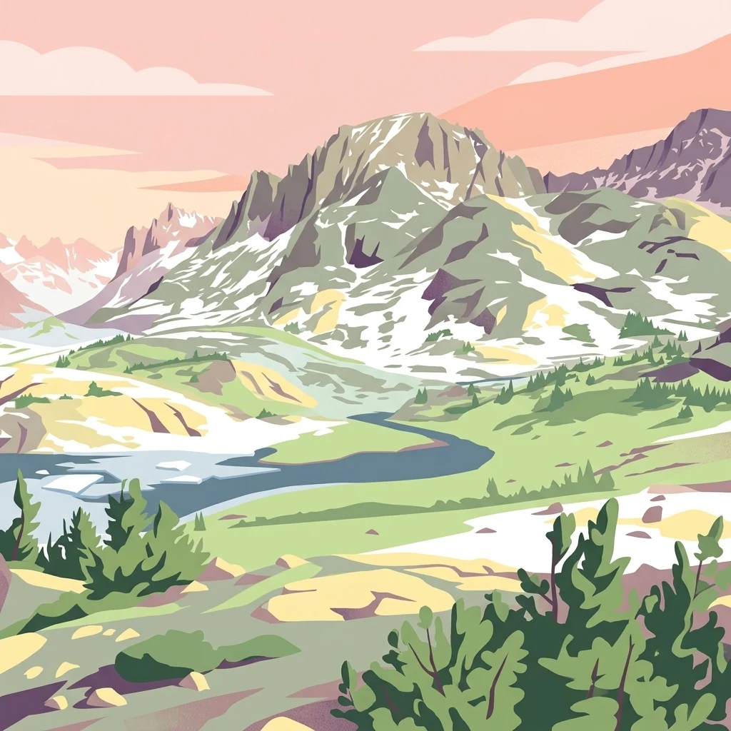
A stylized digital illustration of rugged snow-capped mountains, green alpine meadows, and a winding river under a soft pink and orange sky.

Fitzpatrick Wilderness

Protected landscape

Park overview

Structured park overview, official facts, and landscape profile for Fitzpatrick Wilderness

Fitzpatrick Wilderness park facts, protected area profile, and essential visitor context

Review the core facts for Fitzpatrick Wilderness, including designation, size, terrain, visitor scale, habitats, and operating context in one park-focused overview.

About Fitzpatrick Wilderness

The Fitzpatrick Wilderness occupies a significant portion of the central and northern Wind River Range, one of the great Rocky Mountain ranges of western Wyoming. Embedded within the Shoshone National Forest, the oldest national forest in the United States, the wilderness plays a central role in protecting the most rugged and elevated portions of this renowned mountain system.

The landscape is defined by sharp granite peaks, glacially carved cirques, U-shaped valleys, and a long chain of alpine lakes fed by snowmelt and remnant glaciers. Fremont Peak, one of the most recognizable summits in the range, rises above the wilderness and is crowned by the Upper Fremont Glacier, a small but persistent remnant of the much larger ice sheet that shaped the surrounding topography during the Pleistocene. Below the high crests, forested slopes and meadows extend down toward broader river valleys.

The wilderness is administered by the U.S. Forest Service under the protections of the 1964 Wilderness Act, which restricts motorized and mechanized access and bans logging, mining, road building, and permanent development. As a result, the area remains one of the most purely natural landscapes in the contiguous United States, despite its relatively accessible location in the American West.

Recreation in the Fitzpatrick Wilderness centers on extended backpacking routes, technical mountaineering, and high-country fishing. Trails lead into remote basins and across major divides, attracting experienced outdoor travelers seeking long, self-sufficient journeys through challenging terrain. The wilderness is not a place for casual day use; it is a demanding environment that rewards preparation, route-finding skill, and respect for rapidly changing mountain conditions.

Quick facts and research context for Fitzpatrick Wilderness

Fitzpatrick Wilderness lies in west-central Wyoming, within the Shoshone National Forest and the Wind River Range. It is jointly located in Fremont and Sublette counties, with the nearest significant town being Lander.

The area was originally known as the Glacier Primitive Area before being redesignated as a formal wilderness in 1976. It is administered by the U.S. Forest Service under the provisions of the 1964 Wilderness Act, which prohibits motorized and mechanized use, logging, mining, and road construction.

Protection and recognition

Examine documented terrestrial conservation frameworks and administrative scope for Fitzpatrick Wilderness.

Fitzpatrick Wilderness Protection Status and Territorial Designation Record

Terrestrial protection status records detail the administrative framework governing Fitzpatrick Wilderness within the protected area network. Conservation profiles compile documented designation scope and international recognition sources to support park geography analysis.

Protection details

Protection scope
Terrestrial
Transboundary protection
No
Park context

Deeper park guide and search-rich context for Fitzpatrick Wilderness

Fitzpatrick Wilderness history, landscape, wildlife, and travel context

Explore Fitzpatrick Wilderness through its history, landscape character, ecosystems, wildlife, conservation priorities, cultural context, and seasonal travel timing in a structured park guide built for atlas discovery and search intent.

Why Fitzpatrick Wilderness stands out

Fitzpatrick Wilderness is best known for its dramatic alpine scenery at the heart of the Wind River Range, including the iconic Fremont Peak and the Upper Fremont Glacier on its north slope. The wilderness is recognized for its rugged class 4 and class 5 mountaineering terrain, remnant glaciers that hint at the area's icy past, and numerous glacial cirques filled with clear lakes. The area's combination of high-elevation exposed rock, persistent snowfields, and deeply carved glacial valleys makes it one of the most striking high-country wilderness destinations in the Rocky Mountains. It is also notable for its strict wilderness character, which keeps the landscape largely free of mechanized intrusion and preserves an exceptionally remote backcountry experience.
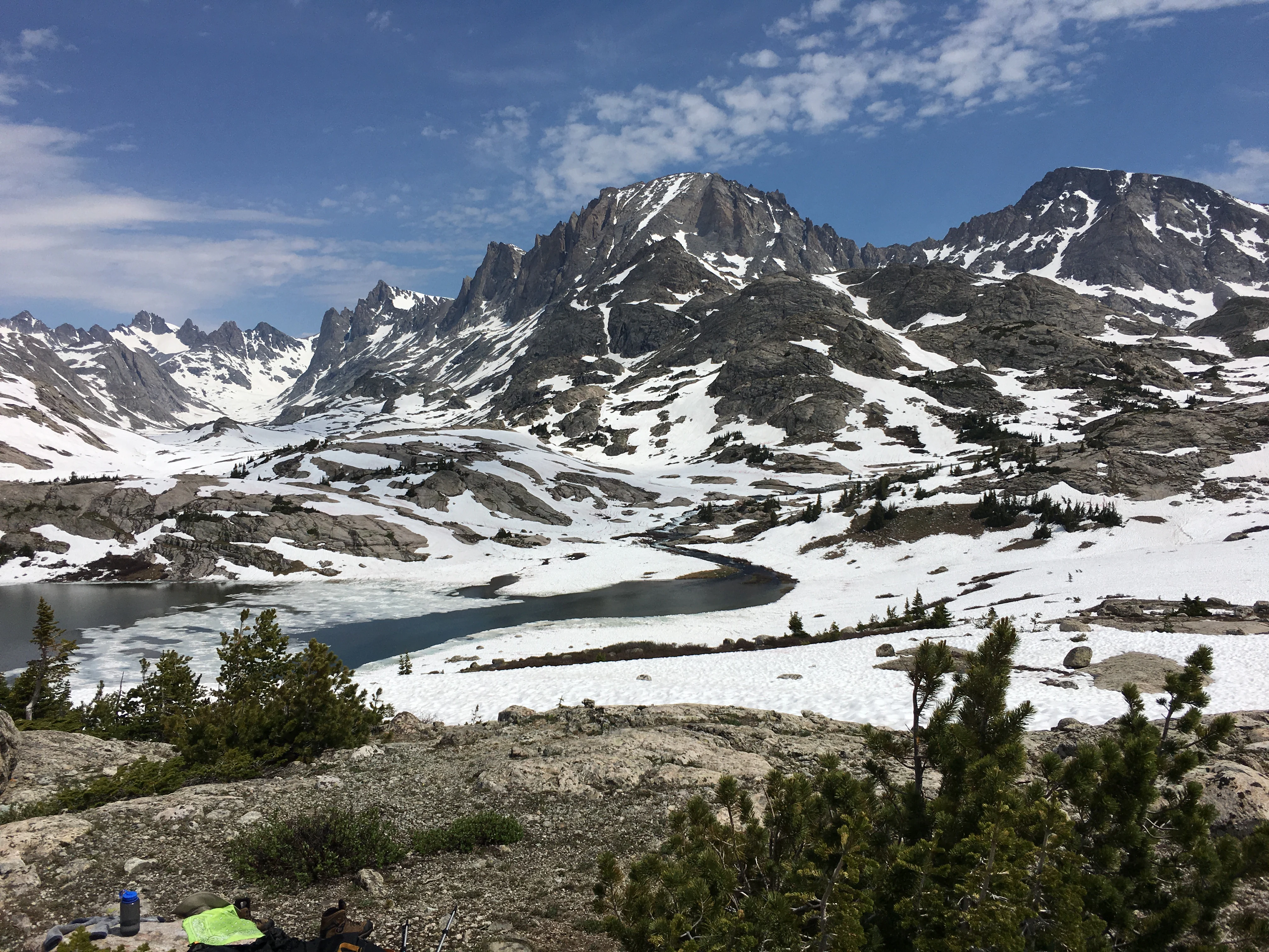
A vast, rugged mountain landscape with jagged, snow-dusted granite peaks reflecting in a partially frozen alpine lake under a blue sky with light clouds.
A view of the snow-capped peaks and glacial lake landscape of the Wind River Range in the Fitzpatrick Wilderness.

Fitzpatrick Wilderness history and protected-area timeline

The land that now constitutes the Fitzpatrick Wilderness has long been part of the broader Shoshone National Forest, established in 1891 as the first national forest in the United States and later named in recognition of the Shoshone people whose ancestral homeland includes this region.

Before receiving its current designation, the area was managed as the Glacier Primitive Area, a category of federal land that anticipated modern wilderness protection by restricting roads, vehicles, and development in especially wild landscapes. In 1976, following the framework established by the Wilderness Act of 1964, the Glacier Primitive Area was formally redesignated as the Fitzpatrick Wilderness.

The transition into wilderness status placed the area under stronger, more enduring protections, formalizing limits on mechanized use, resource extraction, and structural development. Since that time, the wilderness has remained under U.S. Forest Service administration and has continued to function as one of the most strictly protected high-mountain landscapes in the Rocky Mountain region.

Fitzpatrick Wilderness landscape and geographic character

The Fitzpatrick Wilderness occupies the high core of the Wind River Range, a long, fault-block uplift of the Greater Rocky Mountains that forms a major topographic spine across west-central Wyoming. The range rises abruptly above surrounding basins, and the wilderness captures the segment of the mountains where elevations are highest and the relief is most severe.

Cirques, arêtes, and U-shaped valleys dominate the upper elevations, the legacy of repeated Pleistocene glaciation that scoured the bedrock and left behind today's sharply carved alpine topography. Remnant glaciers, including the Upper Fremont Glacier on the north face of Fremont Peak, continue to cling to the colder, shaded flanks of the highest summits, serving as visible reminders of the area's icy past.

Below the alpine zone, the landscape transitions into subalpine forests, glacial moraines, and broad meadows laced with streams and beaver wetlands. Talus slopes, cliff bands, and exposed granite walls make much of the terrain scenic but unforgiving, contributing to the area's reputation as serious mountaineering and backpacking country rather than a gentle recreational landscape.

Fitzpatrick Wilderness ecosystems, habitats, and plant life

Ecologically, the Fitzpatrick Wilderness spans several distinct life zones, from montane forest near its lower edges to true alpine tundra above the highest basins. Forests of lodgepole pine, Engelmann spruce, and subalpine fir clothe much of the mid-elevations, while fragile alpine meadows and fellfields occupy the high cirques and snow-filled couloirs.

Wetlands, glacial lakes, and snowmelt-fed streams form a critical hydrological network across the wilderness. These waters not only sustain native aquatic life but also feed larger rivers that flow outward into the surrounding Wyoming landscape. Cold soils, short growing seasons, and limited human disturbance within the wilderness boundary favor relatively intact ecological processes, including natural disturbance cycles such as avalanches, wildfires in lower forest zones, and shifts in tree line.

The wilderness also functions as an important refugium for high-elevation plant communities that have been heavily impacted elsewhere in the Rockies. By keeping motorized access out and development at bay, the Fitzpatrick Wilderness preserves a high-mountain ecosystem that operates largely on its own ecological terms.

Fitzpatrick Wilderness wildlife and species highlights

The elevation range and habitat diversity of the Fitzpatrick Wilderness support a rich and varied fauna typical of the central Rocky Mountains. Large mammals such as elk, mule deer, moose, and bighorn sheep move through the forests, meadows, and alpine basins, while black bears and the occasional grizzly bear range across the high country. Smaller predators and scavengers, including mountain lions, coyotes, and red foxes, also inhabit the wilderness.

Avian life is similarly diverse, ranging from songbirds and woodpeckers in the forested slopes to high-country specialists such as Clark's nutcracker, gray-crowned rosy-finches, and white-tailed ptarmigan in the alpine zone. Raptors patrol the ridgelines, and waterbirds use the wilderness's many lakes and streams during breeding and migration seasons.

Streams and lakes within the wilderness support native cold-water fish, and the area has long been known for its backcountry fishing opportunities. The overall wildlife character of the wilderness is shaped strongly by its strict protective status, which limits human disturbance and helps maintain more natural patterns of movement and habitat use among the animals that live there.

Fitzpatrick Wilderness conservation status and protection priorities

The Fitzpatrick Wilderness is a core conservation unit within the Shoshone National Forest and a flagship example of the federal wilderness system in the Rocky Mountain West. Its designation under the Wilderness Act places it among the most strongly protected landscapes in the United States, with hard prohibitions against roads, motorized vehicles, mechanized transport, logging, and mining.

From a conservation standpoint, the wilderness is significant because it preserves an unusually large, contiguous block of high-elevation Rocky Mountain wilderness. It safeguards glacial features, rare alpine plant communities, and habitat for wide-ranging species that require large, undeveloped landscapes. Its protected status also helps maintain water quality across the headwaters of several important Wyoming river systems.

Because the area is heavily used by serious backcountry travelers, conservation management also involves balancing recreational pressure with the long-term health of fragile alpine ecosystems. Issues such as bear-human conflict, route proliferation, and the cumulative effects of climate change on remnant glaciers and snowpack represent ongoing concerns for the wilderness's long-term ecological integrity.

Fitzpatrick Wilderness cultural meaning and human context

The land surrounding and underlying the Fitzpatrick Wilderness has deep significance for Indigenous peoples of the Greater Yellowstone and Wind River region, including the Eastern Shoshone and Northern Arapaho, whose historic homelands encompassed the Wind River Range and whose descendants remain connected to the area today. The Shoshone National Forest itself, within which the wilderness sits, takes its name from this Indigenous heritage.

In more recent cultural history, the wilderness has developed a strong identity within American mountaineering and wilderness travel traditions. It is a destination for serious alpine climbers and self-reliant backpackers, and it features prominently in the lore of organizations such as the National Outdoor Leadership School, whose instructors and students have trained and sometimes experienced tragedy on these peaks. This blend of Indigenous history and contemporary backcountry culture gives the wilderness a layered cultural resonance beyond its purely ecological value.

Top sights and standout views in Fitzpatrick Wilderness

The Fitzpatrick Wilderness stands out as one of the most uncompromisingly wild landscapes in the Greater Rockies. Its defining highlights include the towering granite spires and remote cirques of the central Wind River Range, the persistent Upper Fremont Glacier clinging to Fremont Peak, and a remarkable density of clear alpine lakes set among glacial valleys.

It is also distinguished by its rigorous protection under the Wilderness Act, which has preserved the area in a near-natural condition despite more than four decades of growing recreational interest in the American West. For visitors, the wilderness offers a rare combination of high-country solitude, technical terrain, and ecological richness.

Best time to visit Fitzpatrick Wilderness

Summer and early autumn are the most accessible and popular seasons for visiting the Fitzpatrick Wilderness. From roughly mid-June through September, high-country trails become largely free of winter snow, alpine wildflower displays peak in meadows, and the longer daylight hours allow for more ambitious backcountry routes and summit attempts.

Outside this window, conditions in the Wind River Range become significantly more demanding. Deep snow lingers into late spring and returns in early autumn, temperatures drop sharply at night even in summer, and severe storms are common at elevation. Those venturing into the wilderness outside the main season should expect full winter conditions, avalanche risk in snow-loaded terrain, and a much higher level of self-sufficiency.

Monthly climate preview

Track representative annual temperature ranges and precipitation patterns across twelve recorded periods

Fitzpatrick Wilderness Climate Normals and Long Term Weather by Month

Long term coordinate records outline annual temperature fluctuations and monthly precipitation totals for Fitzpatrick Wilderness. Comprehensive twelve month tables provide deeper context for analyzing multi year meteorological averages.
Annual mean1 °C
-10 °C16 °C
Jan-10°
Feb-9°
Mar-5°
Apr-1°
May
Jun11°
Jul16°
Aug15°
Sep
Oct
Nov-5°
Dec-10°
Warmest month
July

15.9 °C

Coolest month
December

-10.1 °C

Wettest month
May

2.3 mm/day

Driest month
July

0.9 mm/day

Park location guide

Geography guide, regional context, and park location map for Fitzpatrick Wilderness

Fitzpatrick Wilderness park geography, regions, and map view in United States of America

Understand where Fitzpatrick Wilderness sits in United States of America through a broader geographic reading of the surrounding landscape, nearby location context, and its mapped position within the national park landscape.

How Fitzpatrick Wilderness fits into United States of America

The United States of America is a federal presidential republic and one of the world's largest countries by area and population. It consists of 50 states across a vast territory spanning multiple time zones, with its capital in Washington, D.C. and largest city in New York City. The nation has a diverse economy, influential political system, and significant cultural and military presence globally.

Wider geography shaping Fitzpatrick Wilderness in United States of America

The United States occupies a vast territory in North America, bordered by Canada to the north and Mexico to the south. The 48 contiguous states stretch from the Atlantic to the Pacific Ocean, while Alaska occupies the northwestern region and Hawaii is an archipelago in the Pacific. The country encompasses diverse terrain including the Rocky Mountains, Appalachian Mountains, Great Plains, and extensive river systems.

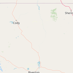
Map view of Fitzpatrick Wilderness

Use this park location map to pinpoint Fitzpatrick Wilderness in United States of America, understand its exact geographic position, and read its mapped placement within the surrounding landscape more clearly.

Pigeon | © OpenStreetMap contributors

Location context for Fitzpatrick Wilderness

Fremont CountySublette CountyWyoming
Recorded earthquake history

Explore the Recorded Earthquake History of the Fitzpatrick Wilderness

Access the historical seismic catalogue for the Fitzpatrick Wilderness to review documented earthquake events near this remote Wyoming backcountry area. This data resource provides a clear, chronological perspective on regional seismic activity recorded in the vicinity of the Wind River Range.

Fitzpatrick Wilderness Earthquake History

Catalogued events

34 events

Strongest magnitude

Magnitude 4.8

Most recent event

Apr 6, 2026

This history includes earthquakes recorded inside the park or within 50 km of its borders

Visual reference of granite peaks, glacial cirques, and protected high-country terrain

Fitzpatrick Wilderness Photos and Rugged Alpine Landscape Scenery

Visual records capture the towering granite spires, remnant glaciers, and deep alpine cirques defining the Fitzpatrick Wilderness. Protected mountain environments and rugged backcountry terrain emerge clearly through detailed landscape photography.

A vast, rugged mountain landscape with jagged, snow-dusted granite peaks reflecting in a partially frozen alpine lake under a blue sky with light clouds.

A wide shot of a high altitude glacier covered in snow with rocky, jagged mountain peaks rising above the snow line against a cloudy sky.

Park atlas

Compare surrounding high country reserves and regional mountain terrain

Other Parks Near Fitzpatrick Wilderness and Related Protected Landscapes

Browse protected areas near Fitzpatrick Wilderness to evaluate adjacent mountain terrain and glacial topography across the surrounding region. Extending the geographic comparison reveals how nearby wilderness reserves share similar high elevation ecosystems and rugged alpine characteristics.
Watercolor painting of a peaceful mountain valley landscape, showing a small winding stream in the foreground, grassy meadows, clusters of pine trees, and rolling mountain peaks in a soft, sunset-colored sky.
Protected landscapeWyoming
Park boundaries overlap#1 closest

North

Shoshone National Forest: A Comprehensive Map and Geography of America's Oldest National Forest

Rugged wilderness and glacial peaks in Wyoming

Discover the immense geographic scale of Shoshone National Forest, which protects a diverse landscape ranging from sagebrush valleys to 13,000-foot granite summits. This atlas overview details its role within the Greater Yellowstone Ecosystem and its expansive, federally designated wilderness areas, offering a clear perspective on its volcanic and glacial terrain.

Area
9,992.69 km²
Established
1891
IUCN
VI
Visitors
500K annual
A pale, wide watercolor landscape illustration depicting mountain peaks above a line of evergreen trees and a flat foreground.
Protected areaWyoming
16 km away#2 closest

Southeast

Popo Agie Wilderness: Protected Landscapes in the Wyoming Wind River Range

High-altitude alpine terrain and glacial basins

The Popo Agie Wilderness in Wyoming encompasses a dramatic vertical landscape, ranging from forested valleys to alpine summits above 13,000 feet. This protected area features the iconic Cirque of the Towers, dense hydrological networks of glacial tarns, and expansive granite formations that anchor its identity within the Greater Yellowstone Ecosystem.

Area
412.3 km²
Established
1984
IUCN
Ib
Relief
Mountain
National parkUnited States of America
63 km away#3 closest

Northwest

Grand Teton National Park: Protected Landscape and Geographic Atlas Exploration

Explore the mapped terrain and regional park geography.

Grand Teton National Park is a protected landscape offering rich geographic discovery opportunities within the United States of America. This detailed entry facilitates an atlas-style exploration of its mapped boundaries, the surrounding regional geography, and its identity as a significant national park. Understand the specific landscape context and discover its placement within the broader natural terrain of North America.

Area
1,300 km²
Established
1929
IUCN
II
Visitors
2.8M annual
National parkWyoming
76 km away#4 closest

Northwest

Yellowstone National Park: US National Park Protected Landscape & Geographic Atlas

Explore mapped boundaries and regional natural landscape context.

Yellowstone National Park represents a significant protected landscape within Wyoming, designated as a US national park. This entry offers detailed insight into its geographic scope, mapped boundaries, and the unique natural terrain that defines it. Understand its role in regional geography and discover its protected-area identity through a structured atlas exploration, providing context for its conservation landscape.

Area
8,983.18 km²
Established
1872
IUCN
II
Visitors
4.7M annual
Wildlife reserveWyoming
89 km away#5 closest

Northwest

Jedediah Smith Wilderness: Protected Alpine Terrain and Teton Range Geography

Glacially sculpted high-country basins in western Wyoming

Spanning the western face of the Teton Range, the Jedediah Smith Wilderness serves as a federally protected buffer for iconic mountain landscapes. The region features dramatic cirques, hanging valleys, and dense subalpine forest habitats, forming an essential, roadless link within the broader Greater Yellowstone Ecosystem. Explore the terrain features and structural geography that define this remote high-country wilderness area.

Area
499.59 km²
Established
1984
IUCN
Ib
Relief
Mountain
A watercolor painting showing a stylized landscape with a light blue lake, soft green rolling hills, and hints of red rock cliffs against a white background.
Protected areaWyoming
165 km away#6 closest

South

Flaming Gorge National Recreation Area: Protected Reservoir and Canyon Landscape Atlas

High desert geography and canyon terrain on the Wyoming and Utah border.

Flaming Gorge National Recreation Area features a complex geography where the Green River carves through vivid red sandstone cliffs. This protected area integrates large-scale reservoir management with mountain forest slopes and diverse river corridors, creating a unique mapped landscape that reflects the geologic character of the intermountain West.

Area
839.17 km²
Established
1968
Relief
Upland
Climate
Arid
Protected landscapeMontana
181 km away#7 closest

Northeast

Bighorn Canyon National Recreation Area: Maps and Protected Landscape Geography

A reservoir-anchored protected area in the Montana high desert

Defined by its striking contrast between deep blue reservoir water and sheer canyon walls, Bighorn Canyon National Recreation Area protects an essential arid landscape in the Mountain West. This region encompasses portions of the Pryor Mountains and the historic Bad Pass Trail, offering a window into the intersection of vast high-desert plains and rugged mountain terrain.

Area
486.82 km²
Established
1966
Visitors
217.7K annual
Relief
Upland
Wildlife reserveMontana
191 km away#8 closest

Northwest

Lee Metcalf Wilderness: Geographic Profile and Protected Landscape Boundaries in Montana

Mapping rugged alpine terrain across four distinct mountainous units

Located in southwestern Montana, the Lee Metcalf Wilderness serves as a cornerstone of ecological connectivity within the Greater Yellowstone Ecosystem. Spanning over 250,000 acres, this protected area features a unique fragmented geography consisting of the Bear Trap Canyon, Spanish Peaks, Taylor-Hilgard, and Monument Mountains units. The landscape is defined by its roadless mountain ridges, forested slopes, and deep river corridors, providing essential sanctuary for large mammal populations.

Area
1,029.07 km²
Established
1983
IUCN
Ib
Relief
Mountain

Common questions about visiting, size, designation, and location context for Fitzpatrick Wilderness

Fitzpatrick Wilderness FAQs for park facts, access, geography, and protected area context

Find quick answers about Fitzpatrick Wilderness, including protected-area facts, park geography, trail and visitor context, and how the park fits into its surrounding country and regional landscape.
MoriAtlas Explorer

Continue Your Protected Areas Search Across the Global Atlas

Deepen your exploration by continuing the structured search for national parks and protected areas worldwide. Utilize the comprehensive filtering capabilities to compare different conservation landscapes and refine your understanding of global park geography. Discover more about the distribution and characteristics of protected natural areas.

Global natural geography