
Mori Atlas logo
Nature reserveFlohrberg und Ohmsberg bei Deisel

A vital protected landscape featuring unique orchid populations and managed dry grassland habitats.

Flohrberg und Ohmsberg bei Deisel: Mapping the Calcareous Grasslands of Northern Hesse

(Naturschutzgebiet Flohrberg und Ohmsberg bei Deisel)

Flohrberg und Ohmsberg bei Deisel represents a core conservation site in northern Hesse, characterized by its distinctive calcareous dry grassland mosaic known as Kalkmagerrasen. This nature reserve, integrated into the European Natura 2000 network, preserves a unique transition between rolling agricultural land and relic limestone scarps. Its geographic boundaries protect rare botanical hotspots including diverse orchid species and the state's largest population of the marsh heartleaf.

calcareous grasslandKalkmagerrasenorchid-rich grasslanddry grasslandnature reserveNaturschutzgebiet
A stylized vector illustration of a valley between two rock cliffs with a small waterfall, green meadows in the foreground, and a sun in the sky.

Flohrberg und Ohmsberg bei Deisel

Nature reserve

Park overview

Structured park overview, official facts, and landscape profile for Flohrberg und Ohmsberg bei Deisel

Flohrberg und Ohmsberg bei Deisel park facts, protected area profile, and essential visitor context

Review the core facts for Flohrberg und Ohmsberg bei Deisel, including designation, size, terrain, visitor scale, habitats, and operating context in one park-focused overview.

About Flohrberg und Ohmsberg bei Deisel

Flohrberg und Ohmsberg bei Deisel is a compact but ecologically rich protected area in the northern Hessian uplands, situated on the northwestern fringe of the Reinhardswald nature park and only a few kilometres from the Weser and Diemel river valleys. Administratively it belongs to the town of Trendelburg in Landkreis Kassel, just north of the regional centre of Hofgeismar, and it sits within an agricultural landscape that has retained, on its calcareous hilltops and slopes, fragments of habitat that have largely vanished from more intensively used farmland elsewhere in Germany.

The protected zone is organised in three separate patches of strictly protected nature reserve, linked together by a surrounding landscape protection area that buffers them against the surrounding fields. The core nature reserve is almost exactly coextensive with the EU Habitats Directive site (FFH-Gebiet) of the same name, reflecting the area's recognised importance at the European level for calcareous grassland habitats. Its protected status dates back to 11 December 1990, and its ongoing management is led by the higher nature conservation authorities at the Regierungspräsidium Kassel.

Ecologically, Flohrberg und Ohmsberg is a classic example of the Hessian Kalkmagerrasen landscape. Calcium-rich soils have produced open, species-rich dry grasslands that are interspersed with hedges (Hecken) and small field copses (Feldgehölze), while small abandoned quarries on the Flohrberg add rocky edge habitats. In one sub-area known as "Auf der Burg," the reserve borders old beech forest to the north, giving an unusually sharp transition from woodland to dry grassland in a very short distance. The combination of habitats at this scale makes the reserve disproportionately valuable for biodiversity research, conservation monitoring and traditional grazing-based land management in central Germany.

Quick facts and research context for Flohrberg und Ohmsberg bei Deisel

Flohrberg und Ohmsberg bei Deisel is a combined Naturschutzgebiet, Landschaftsschutzgebiet and EU Habitats Directive (FFH) site in northern Hesse, Germany, located in the small town of Trendelburg in Landkreis Kassel. The nature reserve covers about 41.8 hectares while the surrounding landscape protection area adds roughly 65.5 hectares, giving a combined protection footprint of around 107 hectares. The strictly protected core (the NSG) is almost identical to the 40.7-hectare FFH-Gebiet 4422-304.

The protected status dates from 11 December 1990 and the area is part of the Naturpark Reinhardswald. It sits between about 200 and 250 metres above sea level near the villages of Deisel and Liebenau, and is administered by the Regierungspräsidium Kassel as the higher nature conservation authority. The landscape is overwhelmingly shaped by calcareous substrate, abandoned small quarries, hedges and field copses that together support one of Hesse's most important stands of orchid-rich dry grassland.

Protection and recognition

Examining official conservation records, Natura 2000 listings, and protected area boundaries

Flohrberg und Ohmsberg bei Deisel Protection Status and International Recognition

Flohrberg und Ohmsberg bei Deisel features documented protection data including Natura 2000 designation records and official boundary listings. Conservation researchers examine these verified international recognition sources to understand protected area frameworks.
Park context

Deeper park guide and search-rich context for Flohrberg und Ohmsberg bei Deisel

Flohrberg und Ohmsberg bei Deisel history, landscape, wildlife, and travel context

Explore Flohrberg und Ohmsberg bei Deisel through its history, landscape character, ecosystems, wildlife, conservation priorities, cultural context, and seasonal travel timing in a structured park guide built for atlas discovery and search intent.

Why Flohrberg und Ohmsberg bei Deisel stands out

The reserve is best known for its large, species-rich calcareous dry grasslands (Kalkmagerrasen) on the slopes of the Flohrberg and Ohmsberg hills near Deisel. These grasslands carry an unusually rich flora that includes wild orchids such as fly orchid, man orchid, military orchid and several gentians, along with the largest known Hessian population of the marsh heartleaf (Sumpf-Herzblatt). It is also recognised for its butterfly fauna, which mirrors the classic species set of well-managed lime-rich grassland in central Germany: swallowtail, marbled white, blues, fritillaries and burnet moths. The combination of dry grassland, hedges, small quarry remnants and edge habitats on calcium-rich soil makes it a textbook example of Hessian calcareous grassland conservation.
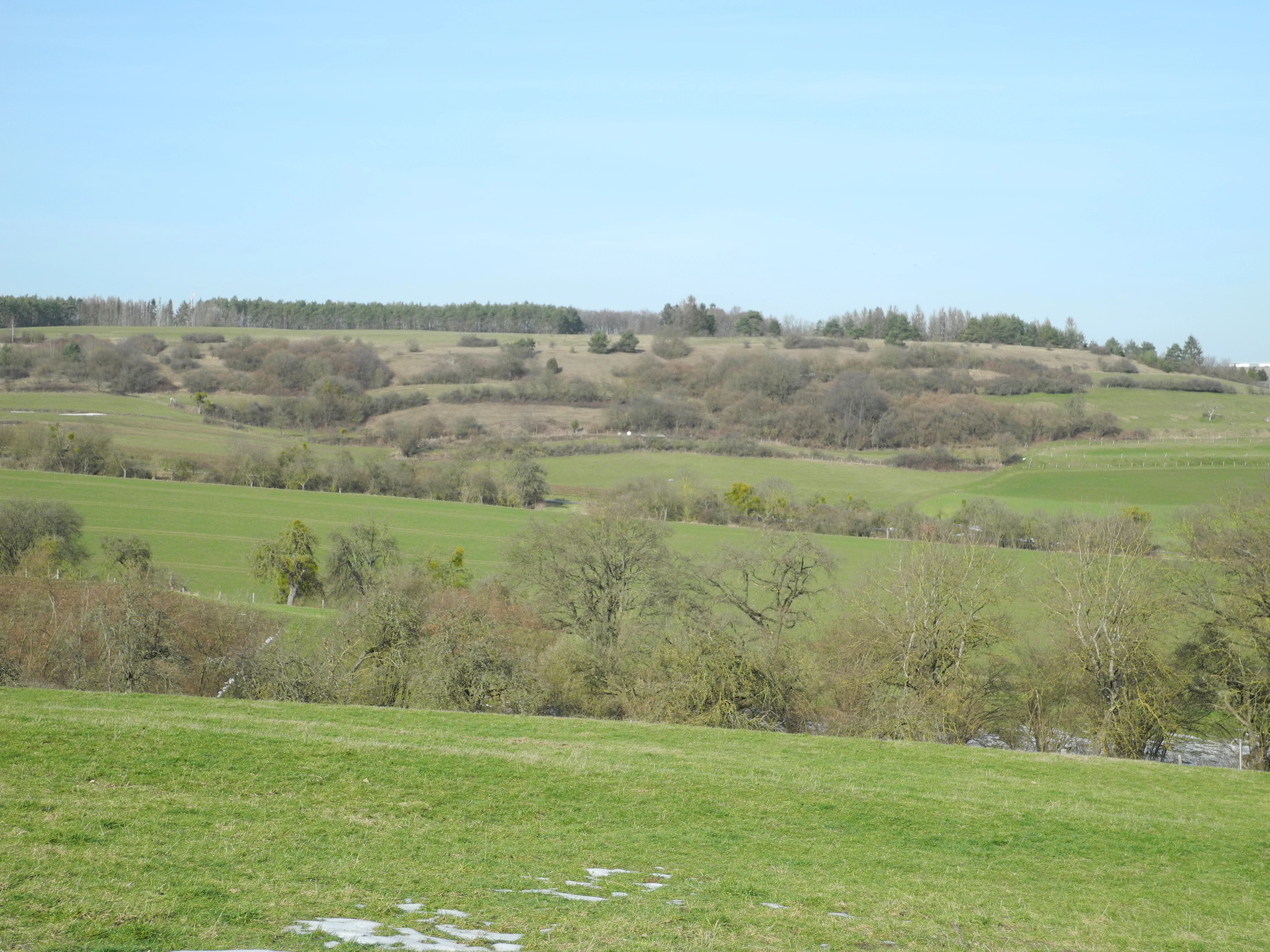
A wide, outdoor shot of a hilly, green rural landscape with scattered bushes and trees under a clear light blue sky.
A view across the open, rolling landscape of the Flohrberg und Ohmsberg bei Deisel nature reserve, featuring patches of grass, shrubs, and scattered trees.

Flohrberg und Ohmsberg bei Deisel history and protected-area timeline

The protected status of Flohrberg und Ohmsberg bei Deisel was formally established on 11 December 1990, when both the Naturschutzgebiet and the surrounding Landschaftsschutzgebiet were designated under Hessian nature conservation law. The nature reserve carries the official area number 1633027, and the site was also identified a short time later as an FFH-Gebiet under the EU Habitats Directive, receiving the Natura 2000 site code 4422-304.

Detailed baseline ecological surveys of the area were begun by the Regierungspräsidium Kassel as the higher nature conservation authority, and in November 2003 the Grunddatenerfassung (baseline data assessment) for monitoring and management of the FFH-Gebiet was published. This was followed in January 2011 by a formal Maßnahmenplan (measures plan) setting out the management programme for the protected area.

Aside from these administrative milestones, the grasslands themselves reflect a long history of traditional low-intensity agricultural use. The calcareous slopes around Deisel have been kept open through centuries of grazing, and the current management plan continues this approach through sheep grazing on the dry grasslands combined with fringe management to protect the surrounding buffer zones.

Flohrberg und Ohmsberg bei Deisel landscape and geographic character

The reserve lies on gently undulating hill country in the northern part of Landkreis Kassel, between roughly 200 and 250 metres above sea level on the edges of the Reinhardswald. Its name comes from the two hills Flohrberg and Ohmsberg near the village of Deisel, whose calcareous ground has shaped the entire character of the landscape.

Rather than dramatic relief, the area is defined by subtle topography: open, south- and west-facing slopes of dry grassland, shallow dry valleys, and the scarps and ledges of small disused quarries on the Flohrberg. Where the bedrock allows, juniper bushes stand isolated in the turf, and hedges and small field copses stitch the grassland patches together. The "Auf der Burg" sub-area in particular contrasts sharply with the rest of the reserve, as it borders mature beech forest to the north, producing a tight forest-to-grassland transition within a very short distance.

Below the grassland zone, farmland dominates the wider view. Pastures and arable fields form a soft agricultural matrix that is administratively part of the surrounding landscape protection area, providing a managed buffer between the strictly protected core and the more intensively used surrounding countryside.

Flohrberg und Ohmsberg bei Deisel ecosystems, habitats, and plant life

Flohrberg und Ohmsberg bei Deisel is fundamentally a Kalkmagerrasen landscape, that is, dry, semi-natural grassland developed on calcareous soils that have never been heavily fertilised or ploughed. The combination of shallow calcareous substrate, traditional grazing and a warm, dry local microclimate maintains the open structure of these grasslands and prevents them from turning into scrub.

The botanical interest of the area is unusually high. The reserve supports a particularly rich orchid flora along with characteristic herbs of calcareous grassland, including gentians, eyebrights, centaury, centaureas, centaury relatives and various clovers and vetches, complemented by grasses such as false oat-grass and sweet vernal-grass. Hedges and field copses add shrub and woodland edge elements, while small abandoned quarries provide bare-rock and scree habitats. The most distinctive natural feature, however, is that the reserve contains the most important population of the Sumpf-Herzblatt (marsh heartleaf) anywhere in Hesse, a species more typical of wetter habitats that finds a refuge here in specialised conditions.

Beyond flowering plants, the reserve supports a rich assemblage of lichens, mosses and invertebrates associated with undisturbed calcareous grassland. The overall vegetation mosaic of dry turf, hedge, copse, quarry and grassy edge creates a structural diversity well beyond what the modest hectare figure of the reserve would suggest.

Flohrberg und Ohmsberg bei Deisel wildlife and species highlights

The wildlife value of the reserve is centred on the invertebrate fauna of calcareous grassland, which is exceptionally diverse. Butterflies recorded here include the swallowtail, marbled white, pearl grass butterfly, comma, small pearl fritillary, wall brown, spotted fritillary, thyme blue, short-tailed blue, violet wood blue, silver-studded blue, large grizzled skipper and small grizzled skipper, together with burnet moths such as the thyme burnet and sainfoin burnet.

Grasshoppers and crickets typical of warm dry grassland are also present, including the short-winged toothed grasshopper, the spotted club-horned grasshopper and the heath grasshopper, while snail species associated with old limestone grassland, such as the Roman snail and the common heath snail, complete the picture of a well-developed dry grassland malacofauna.

Among vertebrates, the dry warm slopes are inhabited by the sand lizard, while breeding birds of hedges and open scrub around the grassland include red-backed shrike, grey partridge, wryneck and grey-headed woodpecker. The red kite uses the area for hunting. The narrow edge with beech forest in the "Auf der Burg" sub-area additionally supports typical woodland boundary species, increasing the habitat variety for wildlife within a very small footprint.

Flohrberg und Ohmsberg bei Deisel conservation status and protection priorities

From a conservation standpoint, Flohrberg und Ohmsberg bei Deisel is significant as one of the more intact remnants of calcareous dry grassland in northern Hesse and as a formally recognised European habitat site. Its FFH designation under the EU Habitats Directive reflects the high value of its Kalkmagerrasen for habitat types and species protected at the European level, while Hessian domestic designations as both Naturschutzgebiet and Landschaftsschutzgebiet provide a layered protection framework that includes a wide buffer of agricultural land around the strictly protected core.

The reserve also holds an unusually strong regional importance for the Sumpf-Herzblatt, whose Hessian strongholds have been greatly reduced by agricultural intensification. Its continued presence here is one of the key reasons the area receives active monitoring and targeted management. Conservation management is centred on traditional sheep grazing of the dry grasslands to keep the turf open, combined with buffer-zone management on adjacent permanent grassland to reduce the impact of fertiliser drift and ploughing from neighbouring farmland.

The reserve is one of many protected sites in Landkreis Kassel, where it sits within a network of Natura 2000 sites coordinated by the Regierungspräsidium Kassel. Compared with those neighbours, it is small in area but disproportionately rich in habitat quality, and so functions as an important reference site for calcareous grassland conservation practice in the region.

Flohrberg und Ohmsberg bei Deisel cultural meaning and human context

Culturally, the area around Flohrberg und Ohmsberg reflects the long continuity of small-scale mixed farming in the Diemel and Weser hill country of northern Hesse. The dry calcareous grasslands around Deisel are not a product of modern rewilding but of centuries of grazing, shepherding and low-intensity land use that have maintained open habitat in an otherwise heavily cultivated landscape.

The local villages of Deisel and Liebenau give the site its human geography, and the wider Reinhardswald region has a strong tradition of nature-based recreation. The reserve is touched by stage 8 of the Diemeltaler Schmetterlings-Steig, a butterfly-themed long-distance trail that runs between Liebenau and Deisel, connecting the protection of the area to broader regional eco-tourism around the butterfly fauna of the Diemel valley.

Top sights and standout views in Flohrberg und Ohmsberg bei Deisel

Flohrberg und Ohmsberg bei Deisel combines three layers of protection in one small area: Naturschutzgebiet, Landschaftsschutzgebiet and Natura 2000 FFH-Gebiet, all on the same calcareous hills northwest of Trendelburg. Its three-part core of strictly protected dry grassland is unusually rich for its size and forms a textbook example of Hessian Kalkmagerrasen.

Standout features include the most important Hessian population of the marsh heartleaf, an unusually rich orchid flora including fly orchid, man orchid and military orchid, and a butterfly fauna that covers virtually the classic species set of well-managed Central European calcareous grassland. Small abandoned quarries on the Flohrberg and the abrupt transition to beech forest in the "Auf der Burg" sub-area add physical diversity, while ongoing sheep grazing ties the reserve into the long regional tradition of low-intensity land use in the Diemel and Weser hill country.

Best time to visit Flohrberg und Ohmsberg bei Deisel

The reserve is best experienced in late spring and early summer, when the calcareous grasslands reach their botanical peak. This is when the wild orchids flower and gentians, eyebrights and the Sumpf-Herzblatt are most easily seen, and when the butterfly fauna is most active on warm, still days. Early summer visits also offer the best chance to see grassland birds such as the wryneck and red-backed shrike.

Late summer and early autumn bring a second, quieter phase, when grasses dominate the visual character of the slopes and grazing activity is most visible on the turf. Winters are mild underfoot in the open grassland but offer far less to see in the way of flowers or insects. Visitors using the Diemeltaler Schmetterlings-Steig between Liebenau and Deisel will find stage 8 of that trail particularly rewarding in the warm weeks of late spring and early summer.

Monthly climate preview

Long-term monthly temperature and precipitation data recorded at a representative elevation

Climate Normals and Annual Weather Patterns for Flohrberg und Ohmsberg bei Deisel

Representative coordinate records show measured temperature variation alongside steady precipitation levels across the annual cycle at Flohrberg und Ohmsberg bei Deisel. Detailed month-by-month climate metrics provide complete historical context for the protected landscape.
Annual mean8 °C
-1 °C18 °C
Jan-1°
Feb
Mar
Apr
May12°
Jun16°
Jul18°
Aug18°
Sep14°
Oct
Nov
Dec
Warmest month
July

18 °C

Coolest month
January

-0.6 °C

Wettest month
July

2.5 mm/day

Driest month
April

1.5 mm/day

Park location guide

Geography guide, regional context, and park location map for Flohrberg und Ohmsberg bei Deisel

Flohrberg und Ohmsberg bei Deisel park geography, regions, and map view in Germany

Understand where Flohrberg und Ohmsberg bei Deisel sits in Germany through a broader geographic reading of the surrounding landscape, nearby location context, and its mapped position within the national park landscape.

How Flohrberg und Ohmsberg bei Deisel fits into Germany

Germany is a federal republic in Western and Central Europe with a population of over 83 million across sixteen constituent states. It is Europe's largest economy by nominal GDP and a major global exporter and importer. The capital is Berlin, and the country borders Denmark, Poland, Czech Republic, Austria, Switzerland, France, Luxembourg, Belgium, and the Netherlands.

Wider geography shaping Flohrberg und Ohmsberg bei Deisel in Germany

Germany is located in Western and Central Europe, spanning 357,022 km². It borders Denmark to the north, Poland and the Czech Republic to the east, Austria and Switzerland to the south, and France, Luxembourg, Belgium, and the Netherlands to the west. The country has coastlines on the Baltic Sea and North Sea to the north, with the Alps located in the southern region.

Map view of Flohrberg und Ohmsberg bei Deisel

Use this park location map to pinpoint Flohrberg und Ohmsberg bei Deisel in Germany, understand its exact geographic position, and read its mapped placement within the surrounding landscape more clearly.

Pigeon | © OpenStreetMap contributors

Location context for Flohrberg und Ohmsberg bei Deisel

Hesse

Visualizing calcareous grasslands, quarry scarps, and protected hill habitats in northern Hesse

Flohrberg und Ohmsberg bei Deisel Photos and Landscapes: Protected Area Scenery

Visual documentation captures the calcareous dry grasslands, patchy hedgerows, and limestone terrain characteristic of this protected reserve. Photographic records reveal the botanical micro-habitats, butterfly zones, and subtle topography defining the landscape character around Deisel.

A wide, outdoor shot of a hilly, green rural landscape with scattered bushes and trees under a clear light blue sky.

Park atlas

Discover adjacent calcareous grasslands and regional reserves across the northern hill country

Explore Protected Areas Near Flohrberg und Ohmsberg bei Deisel in Northern Hesse

Compare Flohrberg und Ohmsberg bei Deisel with other protected landscapes and nature reserves across the surrounding Weser and Diemel river region. Expanding the search helps reveal connected conservation habitats and regional hill country park geography.
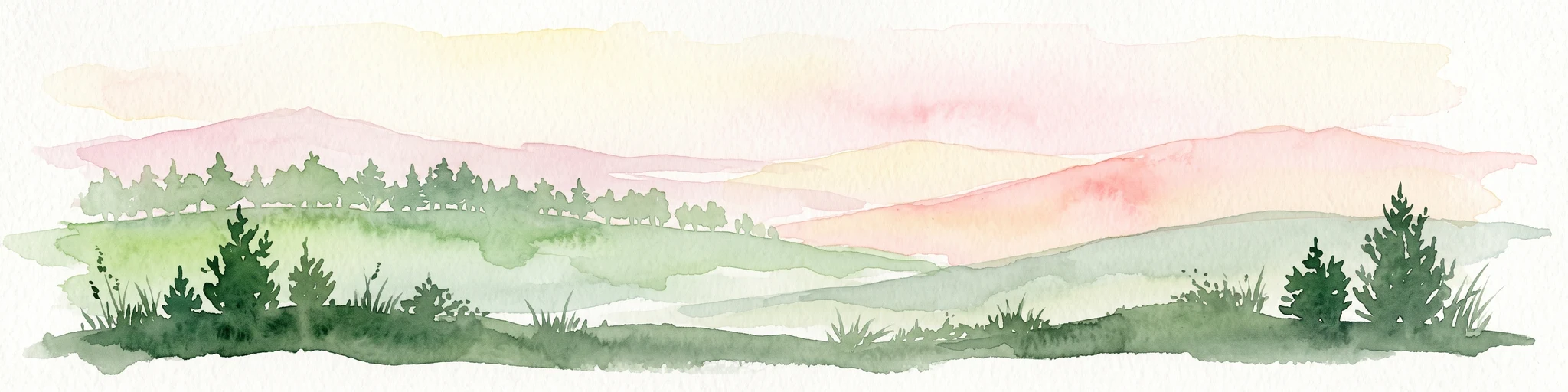
A soft watercolor illustration showing rolling green hills, distant mountains, and forested slopes on a white background.
Nature reserveHesse
4.7 km away#1 closest

South

Dingel und Eberschützer Klippen: Protected Landscapes and Geography in Hesse, Germany

A dense mosaic of limestone slopes, juniper scrub, and beech forest communities.

Discover the geographic identity of Dingel und Eberschützer Klippen, a combined nature reserve and Natura 2000 site in northern Hesse. The protected area features a unique concentration of orchid-rich habitats, south-facing limestone slopes, and broadleaf forest blocks that define this essential part of the Reinhardswald region.

Area
1.123 km²
Established
1987
Relief
Upland
Climate
Temperate
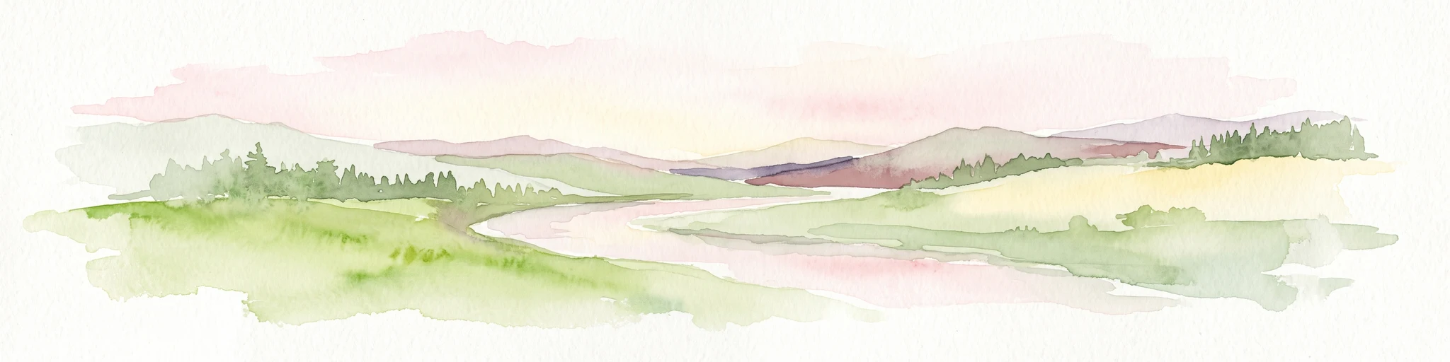
A soft watercolor illustration showing rolling green hills, small groups of conifer trees, and a pale pink and peach sky in the background.
Natural monumentEberschütz
5.5 km away#2 closest

Southwest

Der Bunte Berg bei Eberschütz: Natural Monument and Landscape Geography

Limestone ridge and calcareous grassland habitat in Germany

Examine the topography and protected land features of Der Bunte Berg bei Eberschütz. This compact reserve provides a critical study of limestone-influenced terrain, transitioning from mature pine and beech woodland to specialized juniper heath and dry grassland habitats essential for regional biodiversity.

A soft watercolor painting showing a winding river flowing through a green meadow with rolling hills and distant forested ridges under a pale, warm sky.
Nature reserveLandkreis Kassel
6.8 km away#3 closest

Southwest

Kalkmagerrasen und Diemelaltwasser bei Lamerden Nature Reserve and Landscape Overview

A rare protected mosaic in the Landkreis Kassel district

Investigate the distinctive geography of Kalkmagerrasen und Diemelaltwasser bei Lamerden, where shell limestone slopes rise above the Diemel river oxbow. This protected habitat complex serves as an important ecological anchor in northern Germany, preserving the delicate balance between riparian flood zones and orchid-rich calcareous grasslands that define this regional landscape.

Area
0.175 km²
Established
1989
Relief
Upland
Climate
Temperate
Nature reserveNiedersachsen
8.3 km away#4 closest

Northeast

Wälder im südlichen Solling Nature Reserve: A Detailed Atlas of German Protected Woodlands

Ecological mapping of Niedersachsen's southern Solling forest complexes.

Navigate the protected boundaries and landscape character of Wälder im südlichen Solling. This nature reserve provides an essential study in forest conservation, highlighting the intersection of traditional wood-pasture management and steep, near-natural slope forest ecosystems within the Solling-Vogler upland.

Area
10.16 km²
Established
2020
Relief
Upland
Climate
Temperate
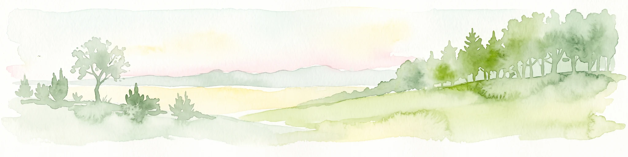
A watercolor painting showing a rolling landscape with sparse trees on the left, a grassy slope rising to a small forest on the right, and distant hills under a pale, soft sky.
Nature reserveLandkreis Kassel
9 km away#5 closest

Southwest

Ostheimer Hute Nature Reserve: Protected Calcareous Grassland Landscapes in Landkreis Kassel

A preserved limestone slope habitat in northern Hesse

Ostheimer Hute is a protected nature reserve characterized by species-rich calcareous dry grasslands on Triassic Muschelkalk limestone. Located within the Diemel Valley, this site preserves a traditional open landscape through managed grazing, supporting diverse invertebrate fauna and specialized flora across its distinct hill-slope parcels.

Area
0.162 km²
Established
1989
Relief
Upland
Climate
Temperate
Protected landscapeHessen
About 10 km away#6 closest

East

Naturpark Reinhardswald: A Comprehensive Protected Landscape Atlas for Northern Hessen

Mapping forest ecosystems and limestone river valleys

Naturpark Reinhardswald protects a diverse mosaic of environments across northern Hessen, characterized by the contrast between extensive sandstone-dominated forests and open limestone grasslands. The terrain features historic woodland pastures, basalt outcrops, and riverine floodplains, providing a significant regional network of nature reserves and protected areas that represent both upland forest and valley ecosystems.

Area
448.51 km²
Established
2017
Relief
Mixed relief
Scope
Terrestrial
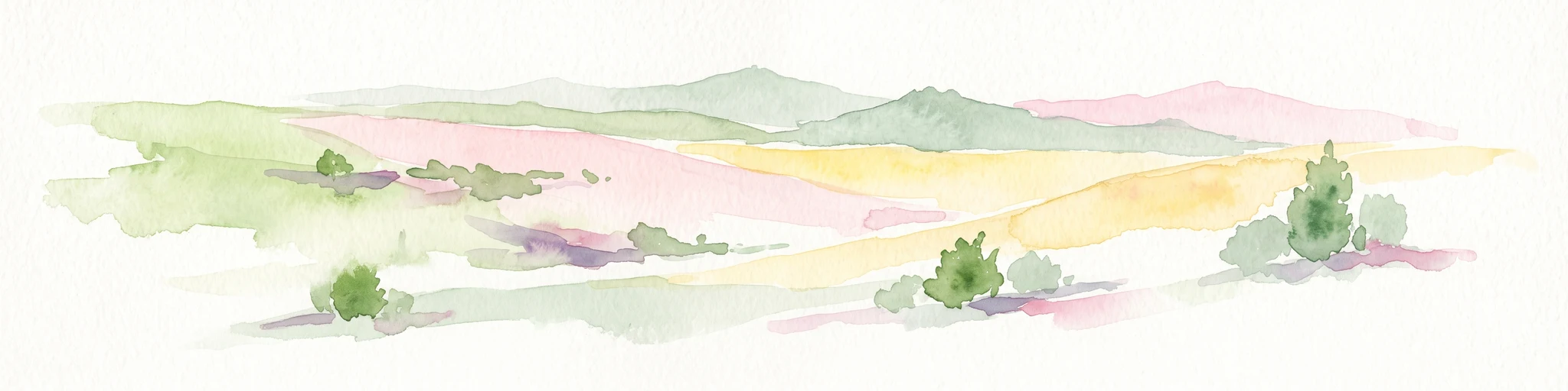
A soft watercolor painting of rolling green and yellow hills under a clear sky, featuring sparse shrubbery and a gentle, layered horizon.
Nature reserveHessen
11 km away#7 closest

South

Mittelberg bei Hofgeismar: Nature Reserve and Protected Calcareous Grassland Site

A high-quality conservation landscape located in northern Hessen, Germany.

This nature reserve protects an ecologically rich slope habitat west of Hofgeismar. Defined by its sun-exposed calcareous soil and dry grassland, the site supports ten orchid species and a diverse assemblage of Red List butterflies. It stands as a textbook example of a small, high-density biodiversity hotspot embedded within the broader agricultural geography of the Kassel district.

Area
0.432 km²
Established
1991
Relief
Upland
Climate
Temperate
Nature reserveHesse
About 13 km away#8 closest

South

Kelzer Teiche Nature Reserve: Mapped Geography and Protected Wetland Boundaries in Hesse

A historic managed fishpond landscape in the Kassel region of northern Germany.

Kelzer Teiche encompasses 18.5 hectares of lowland countryside defined by its twin fishponds and fringe habitats. This nature reserve plays a recognizable role in the regional network of protected sites in Hesse, offering essential shelter for reed dwelling and migratory birds within a broader agricultural setting.

Area
0.185 km²
Established
1977
Water
Major water bodies

Common questions about visiting, size, designation, and location context for Flohrberg und Ohmsberg bei Deisel

Flohrberg und Ohmsberg bei Deisel FAQs for park facts, access, geography, and protected area context

Find quick answers about Flohrberg und Ohmsberg bei Deisel, including protected-area facts, park geography, trail and visitor context, and how the park fits into its surrounding country and regional landscape.
MoriAtlas Explorer

Continue Your Protected Areas Search Across the Global Atlas

Deepen your exploration by continuing the structured search for national parks and protected areas worldwide. Utilize the comprehensive filtering capabilities to compare different conservation landscapes and refine your understanding of global park geography. Discover more about the distribution and characteristics of protected natural areas.

Global natural geography