

Mori Atlas logo
Marine protected areaFlorida Keys National Marine Sanctuary

Examine the submerged topography and marine protected boundaries of this vital Florida archipelago ecosystem.

Florida Keys National Marine Sanctuary: A Mapped Atlas of North America's Only Barrier Coral Reef

The Florida Keys National Marine Sanctuary preserves a vast aquatic landscape stretching across the Florida Keys archipelago. This marine protected area encompasses the Florida Reef, which serves as the only barrier coral reef system in North America, alongside expansive seagrass meadows and mangrove-lined island shores. Through detailed map data, understand the transition between shallow Florida Bay, the deep Atlantic passages of Hawk Channel, and the isolated reef environments extending to the Dry Tortugas.

marine sanctuarycoral reefFlorida Reefbarrier reefmangrove forestseagrass

Florida Keys National Marine Sanctuary

Marine protected area

Park overview

Structured park overview, official facts, and landscape profile for Florida Keys National Marine Sanctuary

Florida Keys National Marine Sanctuary park facts, protected area profile, and essential visitor context

Review the core facts for Florida Keys National Marine Sanctuary, including designation, size, terrain, visitor scale, habitats, and operating context in one park-focused overview.

About Florida Keys National Marine Sanctuary

The Florida Keys National Marine Sanctuary is one of the largest and most ecologically complex marine protected areas in the United States. It spans the full length of the Florida Keys archipelago, beginning in the tidal estuaries of the South Florida mainland and stretching southwest past Key Largo, the Middle Keys, the Lower Keys, and the remote Marquesas, all the way to the Dry Tortugas. This geography places the sanctuary at a crossroads between the Atlantic Ocean, Florida Bay, and the Gulf of Mexico, producing a rare mixing of marine environments within a single protected system.

Coral reef is the sanctuary's signature feature. The Florida Reef runs along the seaward edge of the Keys as the only true barrier coral reef in North America, and forms the structural backbone for most of the region's marine biodiversity. Hard and soft coral communities grow across shallow banks, patch reefs, and deeper outer reef structures, providing shelter and feeding grounds for reef fish, sponges, sea fans, crustaceans, and many other organisms. Several well-known reef sites within the sanctuary, including Molasses Reef, French Reef, Looe Key, Sombrero Key, and Conch Reef, are widely recognized for their ecological value and are closely monitored by scientists studying reef health.

Equally important is the sanctuary's soft-bottom and vegetated habitat. The shallow flats of Florida Bay and the backcountry support extensive seagrass meadows that are among the largest documented contiguous seagrass communities in the Northern Hemisphere. These underwater pastures are a critical nursery for many commercially and ecologically important species. Mangrove islands line much of the shoreline, providing shelter for juvenile fish, crustaceans, and birds while also stabilizing sediments and protecting the coast from storms.

Managed by NOAA's National Ocean Service, the sanctuary operates under a mandate to balance conservation with compatible human uses, including recreational fishing, commercial fishing, boating, diving, and tourism. Its management approach addresses challenges such as coral bleaching, water quality from mainland runoff, overfishing, invasive species, and climate impacts, making the sanctuary both a refuge for marine life and an active laboratory for marine science and policy.

Because the Florida Keys are a popular destination and host a permanent human population connected by the Overseas Highway, the sanctuary also plays an unusually visible role in public marine conservation. Educational programs, mooring buoys at popular reef sites, visitor centers, and partnerships with research institutions all reflect the sanctuary's role as a working marine landscape where protection and human activity must be carefully balanced.

Quick facts and research context for Florida Keys National Marine Sanctuary

The Florida Keys National Marine Sanctuary was established on December 28, 1990, and expanded in 2001, making it the ninth sanctuary in the U.S. National Marine Sanctuary system. It covers roughly 2,900 square nautical miles of coastal and oceanic waters, encompassing Florida Bay, the Hawk Channel, the Atlantic Ocean side of the Keys, and waters reaching into the Gulf of Mexico.

The sanctuary is administered by the NOAA National Ocean Service and is widely recognized for containing the Florida Reef, the only living barrier coral reef in North America and one of the largest barrier reefs globally. It also contains what is described as the largest documented contiguous seagrass community in the Northern Hemisphere, alongside extensive mangrove habitat.

Protection and recognition

Examine the documented marine protection scope, establishment year, and management details.

Florida Keys National Marine Sanctuary Protection Status and Designation History

Florida Keys National Marine Sanctuary maintains an established marine protection scope, originating from designation records established in 1990. Review the documented conservation framework, management parameters, and official baseline data compiled for this protected area.

Protection details

Protection scope
Marine
Designated year
1990
Transboundary protection
No
Park context

Deeper park guide and search-rich context for Florida Keys National Marine Sanctuary

Florida Keys National Marine Sanctuary history, landscape, wildlife, and travel context

Explore Florida Keys National Marine Sanctuary through its history, landscape character, ecosystems, wildlife, conservation priorities, cultural context, and seasonal travel timing in a structured park guide built for atlas discovery and search intent.

Why Florida Keys National Marine Sanctuary stands out

The sanctuary is most famous for the Florida Reef, the only barrier coral reef along the North American continent and the third-largest barrier reef system in the world. This living reef structure is the centerpiece of the sanctuary's identity and a defining natural feature of the Florida Keys. Beyond the reef itself, the sanctuary is known for its remarkably high marine biodiversity, driven by the overlap of tropical and subtropical species in a single geographic zone. The combination of clear Atlantic waters, shallow banks, mangrove islands, and seagrass flats creates habitats for everything from large reef fish and sea turtles to tiny invertebrates living within the reef structure.
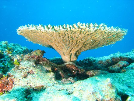
An underwater view of a large, flat, fan-shaped table coral structure growing from a rocky reef against a deep blue background.
A table coral specimen thriving on the seafloor.

Florida Keys National Marine Sanctuary history and protected-area timeline

Florida Keys National Marine Sanctuary was designated on December 28, 1990, as the ninth addition to the United States National Marine Sanctuary system. Its creation reflected growing concern about the long-term health of the Florida Reef and the surrounding waters amid rapid coastal development, expanding tourism, and increasing pressure from recreational and commercial fishing.

In 2001, the sanctuary was expanded to incorporate additional state waters, increasing its size and giving it jurisdiction over a more complete sweep of the Florida Keys marine environment. This expansion strengthened the federal government's ability to coordinate management across the region's reef, seagrass, and mangrove habitats.

Over the decades, the sanctuary has accumulated a substantial record of scientific monitoring and conservation action. Programs addressing coral bleaching, invasive species such as lionfish, water quality, and fisheries management have become central to its identity, and the sanctuary is widely viewed as a flagship site for U.S. marine resource protection in a region where coral reef ecosystems and human population centers exist in close proximity.

Florida Keys National Marine Sanctuary landscape and geographic character

The sanctuary's landscape is almost entirely submerged, yet extraordinarily varied. From the surface, the visual signature of the Florida Keys is a curving chain of low mangrove-vegetated islands stitched together by bridges and framed by shallow turquoise water. Beneath that surface geometry lies a far more dramatic physical environment.

The Florida Reef defines the seaward edge of the sanctuary, running parallel to the Keys as the only living barrier coral reef in North America. Inland of the reef, the Hawk Channel forms a deep natural passage between the outer reef line and the Keys themselves. To the north and west, the sanctuary encompasses the shallow, lagoon-like waters of Florida Bay, an area dotted with banks, mud flats, and patches of seagrass that rise and fall with the tides.

The seafloor transitions between hard-bottom reef structures, coral rubble, sandy channels, and vast seagrass plains. In deeper Atlantic waters beyond the reef, the bottom slopes gradually into dimmer offshore environments. Along the Gulf of Mexico side, the seafloor tends to be softer and more sediment-rich, supporting different communities of marine life. The Marquesas and the Dry Tortugas, at the far western end of the sanctuary, sit in some of the most isolated waters of the system, where reefs and banks rise sharply from surrounding depths.
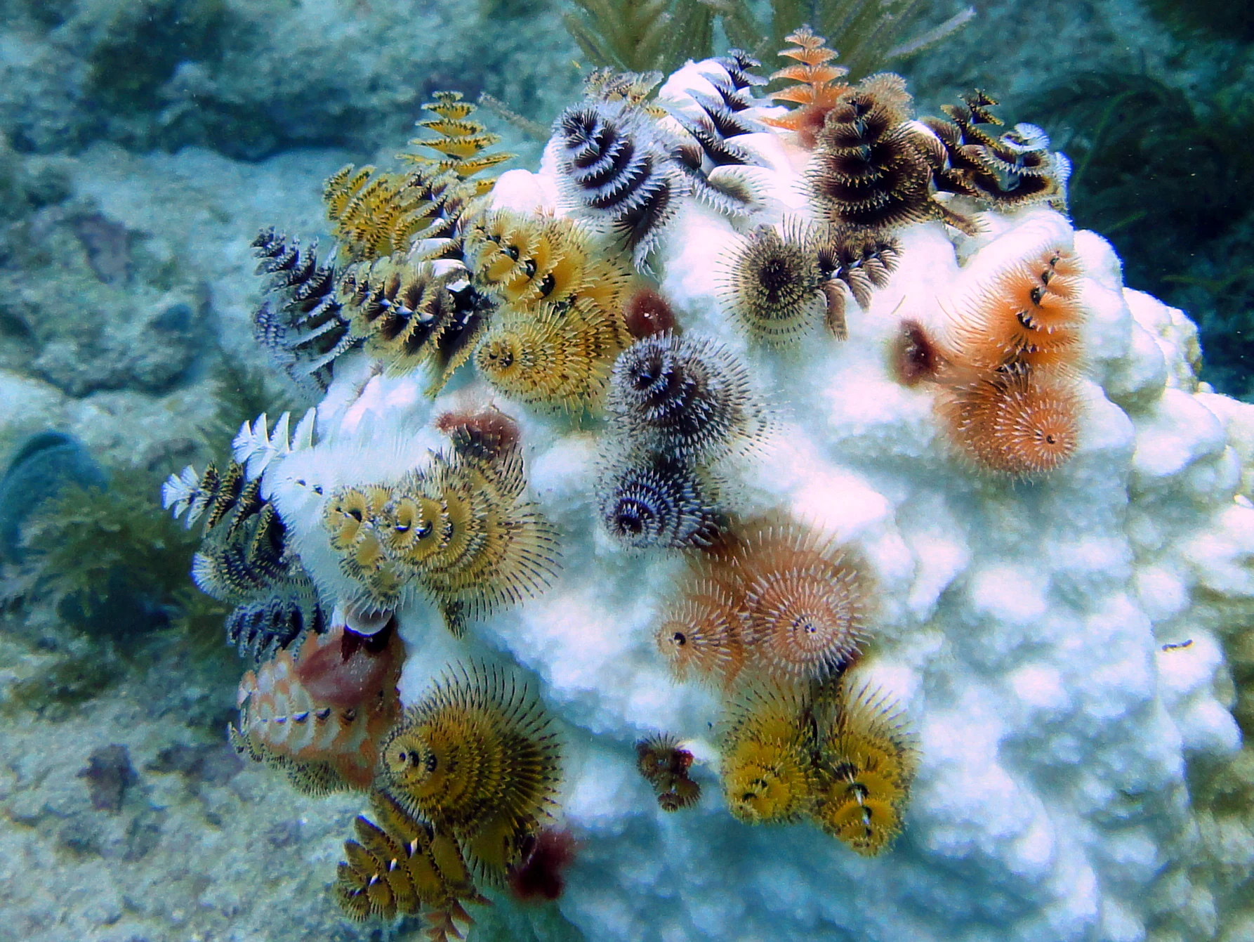
Close-up underwater view of numerous colorful spiral-shaped Christmas tree worms attached to a bright white bleached coral structure.
A cluster of colorful Christmas tree worms living on a bleached coral head in the Florida Keys National Marine Sanctuary.

Florida Keys National Marine Sanctuary ecosystems, habitats, and plant life

The sanctuary's ecological value stems from the convergence of tropical and subtropical marine environments within a single protected area. The Florida Keys sit at a meeting point where warm Gulf Stream-influenced waters to the east and more variable, nutrient-rich Gulf of Mexico waters to the west create conditions for exceptionally high species diversity.

Coral reef habitat is the most iconic ecosystem within the sanctuary. Hard corals, soft corals, and sponges create complex three-dimensional structures across shallow patch reefs, deeper outer reefs, and transitional hard-bottom areas. These structures shelter reef fish, lobsters, octopuses, sea turtles, and countless smaller organisms. Sea fans and other soft corals add color and texture to vertical reef walls, while encrusting organisms coat nearly every available surface.

Behind the reef, the sanctuary's seagrass meadows form one of its most important yet least visible ecosystems. Often referred to as the largest documented contiguous seagrass community in the Northern Hemisphere, this underwater grassland filters water, stabilizes sediment, and serves as a nursery for shrimp, crabs, conch, and juvenile fish. Mangrove forests line the shoreline of many islands, with their submerged root systems providing shelter for juvenile reef fish before they move offshore.

The variability of the sanctuary's habitats, from clear oceanic reef to brackish bay waters and dense mangrove channels, is central to its ecological identity and a major reason for its biodiversity.
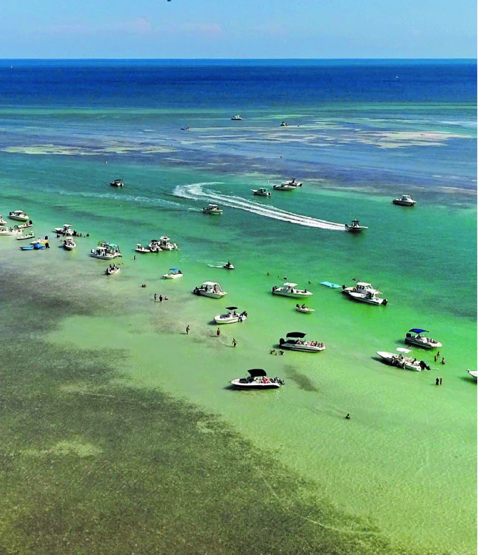
An aerial view of many small motorboats and pontoons gathered in very shallow, clear, turquoise water, with people wading nearby.
Recreational boaters enjoy the shallow, clear waters of the Florida Keys National Marine Sanctuary.

Florida Keys National Marine Sanctuary wildlife and species highlights

Marine wildlife in the sanctuary reflects the mix of ecosystems the area protects. Reef fish such as grouper, snapper, parrotfish, and angelfish are common sights along the Florida Reef, where they graze on algae, hunt smaller prey, and shelter among coral heads. Parrotfish in particular play a key ecological role by keeping algae in check, which helps corals survive.

Sea turtles, including green, loggerhead, and hawksbill turtles, are regular inhabitants of the sanctuary's waters. They use seagrass beds as feeding grounds and reef areas for shelter, and their presence is one of the signature features of Florida Keys marine life. Nurse sharks, stingrays, moray eels, and barracudas are among the larger predators and scavengers that visitors may encounter.

Invertebrate life is equally rich. Spiny lobsters populate reef crevices, queen conch graze seagrass flats, and countless species of shrimp, crabs, and smaller crustaceans fill nearly every habitat. The reef itself is also home to colorful small species such as Christmas tree worms and a wide variety of sponges.

The sanctuary is also a critical habitat for migratory and offshore species, including various shark species, pelagic fish, and the seabirds and shorebirds that use the Keys as breeding and feeding grounds. The interplay between reef, seagrass, mangrove, and open ocean supports food webs ranging from tiny reef invertebrates to large marine predators.

Florida Keys National Marine Sanctuary conservation status and protection priorities

The sanctuary exists because the Florida Reef and surrounding marine environments were recognized as globally significant and locally threatened. The Florida Reef is the only barrier coral reef in North America, placing the sanctuary among the few places on the continent where coral reef conservation is a central management priority. Protecting it is the sanctuary's defining conservation role.

Active conservation work in the sanctuary addresses several major pressures. Coral bleaching caused by elevated sea temperatures, especially during strong El Niño years, is monitored and studied through programs such as the Coral Bleaching Early Warning Network run in partnership with Mote Marine Laboratory. Water quality concerns stemming from mainland stormwater runoff, fertilizers, and sediment loading are tracked because they directly affect reef health. Nutrient-rich runoff can fuel algal overgrowth that smothers corals.

Invasive species management is another pillar of the sanctuary's conservation work. The Indo-Pacific lionfish, first documented in the Keys in 2009, has become one of the most damaging invasive marine species in the region, preying on native reef fish and reproducing at a rate that places continuous pressure on local ecosystems. On land, invasive plants such as Australian pine, Brazilian pepper, Asiatic colubrine, and Melaleuca threaten mangrove islands and native plant communities that sustain wildlife.

Fishing, tourism, and recreation also shape the sanctuary's management strategy. Sustainable-use regulations, marine zoning, mooring buoys at sensitive reef sites, and educational outreach are all part of the effort to keep human activity compatible with long-term ecosystem health. In this way, the sanctuary functions both as a refuge and as a working landscape where conservation is integrated into a popular recreational destination.

Florida Keys National Marine Sanctuary cultural meaning and human context

The Florida Keys have a distinctive cultural identity shaped by their isolation, maritime livelihood, and connection to the sea. Long before the sanctuary existed, the Keys supported communities built around fishing, sponging, wrecking, and boat-building, with small settlements strung across the island chain and tied together more by water than by road.

The completion of the Overseas Highway accelerated tourism and permanent settlement, transforming the Keys from a quiet outpost chain into a heavily visited coastal corridor. That human presence is part of why the sanctuary is so culturally significant: it protects a marine environment next to one of the most intensively used recreational coastlines in the United States, and its management reflects the ongoing negotiation between traditional maritime culture, modern tourism, and conservation.

Maritime heritage resources are recognized as part of the sanctuary's mission, reflecting the longstanding human relationship with these waters through shipwrecks, navigation routes, and historic working harbors. The sanctuary today sits at the intersection of Florida Keys community life, a thriving marine tourism economy, and national-level ocean conservation policy.

Top sights and standout views in Florida Keys National Marine Sanctuary

The defining highlight of the Florida Keys National Marine Sanctuary is the Florida Reef, the only barrier coral reef in North America and one of the largest barrier reef systems in the world. This single reef structure shapes the entire region's marine character and gives the sanctuary global conservation significance.

Equally notable are the extensive seagrass meadows of Florida Bay, described as the largest documented contiguous seagrass community in the Northern Hemisphere, and the mangrove forests that line the island chain. Together with the reef, these habitats support a remarkable mix of tropical and subtropical marine life.

The sanctuary also stands out for its combination of ecological importance and human accessibility. It lies alongside one of the most popular recreational coastlines in the country, and its management, balancing heavy tourism, fishing, and shoreline towns with the protection of coral reefs, seagrass, and mangroves, makes it a leading example of integrated marine conservation in a populated region.

Best time to visit Florida Keys National Marine Sanctuary

The Florida Keys enjoy a subtropical climate, with mild winters, warm summers, and generally pleasant conditions much of the year. Winter and spring often bring calmer seas, excellent underwater visibility along the reef, and cooler air temperatures that make boat trips and diving more comfortable. This is widely considered one of the most rewarding periods for snorkeling and diving on the outer reef.

Summer brings warmer water and the risk of more frequent afternoon thunderstorms, but it is also a peak period for marine life activity. Warmer sea temperatures, however, coincide with greater risk of coral bleaching events, particularly during strong El Niño years, which can temporarily reduce the vibrancy of reef communities. Visibility and water conditions can also vary as storm activity increases later in the season.

Overall, late winter through spring typically offers the most balanced combination of calm seas, good visibility, stable weather, and active reef life, while summer and fall appeal to visitors interested in warmer water, pelagic species, and the broader Keys atmosphere. Because conditions can vary year to year, many visitors favor the cooler dry season for reef-focused visits, while accepting that summer offers its own distinct character.
Monthly climate preview

Long-term temperature ranges and monthly precipitation averages for the Florida Keys marine environment

Florida Keys National Marine Sanctuary Climate Normals and Annual Weather Patterns

Representative coordinate records outline the measured annual temperature rhythm and monthly precipitation variations across the Florida Keys National Marine Sanctuary. Examining the complete twelve-month climatology profile provides deeper reference data regarding long-term environmental norms.
Annual mean26 °C
22 °C29 °C
Jan22°
Feb23°
Mar23°
Apr25°
May27°
Jun28°
Jul29°
Aug29°
Sep29°
Oct27°
Nov25°
Dec24°
Warmest month
August

29.3 °C

Coolest month
January

22.3 °C

Wettest month
June

5.9 mm/day

Driest month
March

1.1 mm/day

Park location guide

Geography guide, regional context, and park location map for Florida Keys National Marine Sanctuary

Florida Keys National Marine Sanctuary park geography, regions, and map view in United States of America

Understand where Florida Keys National Marine Sanctuary sits in United States of America through a broader geographic reading of the surrounding landscape, nearby location context, and its mapped position within the national park landscape.

How Florida Keys National Marine Sanctuary fits into United States of America

The United States of America is a federal presidential republic and one of the world's largest countries by area and population. It consists of 50 states across a vast territory spanning multiple time zones, with its capital in Washington, D.C. and largest city in New York City. The nation has a diverse economy, influential political system, and significant cultural and military presence globally.

Wider geography shaping Florida Keys National Marine Sanctuary in United States of America

The United States occupies a vast territory in North America, bordered by Canada to the north and Mexico to the south. The 48 contiguous states stretch from the Atlantic to the Pacific Ocean, while Alaska occupies the northwestern region and Hawaii is an archipelago in the Pacific. The country encompasses diverse terrain including the Rocky Mountains, Appalachian Mountains, Great Plains, and extensive river systems.

Map view of Florida Keys National Marine Sanctuary

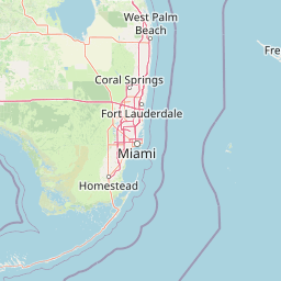
Use this park location map to pinpoint Florida Keys National Marine Sanctuary in United States of America, understand its exact geographic position, and read its mapped placement within the surrounding landscape more clearly.

Pigeon | © OpenStreetMap contributors

Location context for Florida Keys National Marine Sanctuary

Florida Keys

Visualizing marine habitats, coral reefs, and island geography

Florida Keys National Marine Sanctuary Photos and Landscape Scenery

Examine detailed photography highlighting the submerged terrain, coral formations, and mangrove islands defining Florida Keys National Marine Sanctuary. Visual archives provide clear geographic context for understanding regional habitats, shallow waters, and protected marine environments.

An underwater view of a large, flat, fan-shaped table coral structure growing from a rocky reef against a deep blue background.

An underwater view of a coral reef with visible bleaching on many of the structures and several small fish swimming nearby.

Close-up underwater view of numerous colorful spiral-shaped Christmas tree worms attached to a bright white bleached coral structure.

An aerial view of many small motorboats and pontoons gathered in very shallow, clear, turquoise water, with people wading nearby.

Park atlas

Compare connected marine reserves and surrounding coastal landscapes across South Florida

Parks Near Florida Keys National Marine Sanctuary And Regional Protected Areas

Explore other protected areas near Florida Keys National Marine Sanctuary to understand the broader marine geography of South Florida. Compare adjacent coastal habitats, island chains, and regional conservation zones in a unified geographic view.
National parkMiami-Dade County
Park boundaries overlap#1 closest

Northeast

Biscayne National Park: Mapped Protected Area and Coastal Landscape

Explore its protected status and geographic setting in Miami-Dade County.

Biscayne National Park represents a significant protected area managed as a U.S. National Park, safeguarding extensive coastal and marine environments. This page offers detailed insight into the park's geographic placement within Miami-Dade County, Florida, focusing on its mapped boundaries and the unique landscape it encompasses. Understand its ecological importance and its distinct contribution to the atlas of protected lands.

Area
700 km²
Established
1980
IUCN
V
Visitors
701K annual
National parkMonroe County
Park boundaries overlap#2 closest

West

Dry Tortugas National Park: Mapped Boundaries and Geographic Context in Monroe County

Explore the protected landscape and regional geography.

Uncover the protected landscape of Dry Tortugas National Park, a significant U.S. National Park located in Monroe County. This atlas entry details its mapped boundaries and unique geographic features, providing essential context for understanding its place in regional geography. Discover the distinct natural terrain and protected area identity that define Dry Tortugas National Park, supporting deeper geographic exploration.

Area
261.84 km²
Established
1935
IUCN
II
Visitors
89.4K annual
National parkFlorida
Park boundaries overlap#3 closest

Northeast

Everglades National Park: Protected Landscape Identity and Regional Geographic Context

Explore its unique natural terrain and mapped boundaries.

Understand Everglades National Park as a distinct protected landscape with significant geographic features within Florida. This page offers an atlas-driven view of its protected area, detailing its mapped boundaries and the surrounding regional natural terrain. Discover the core identity of this national park through its landscape and geographic setting, providing context for broader atlas exploration.

Area
6,106.61 km²
Established
1947
IUCN
II
Visitors
1.2M annual
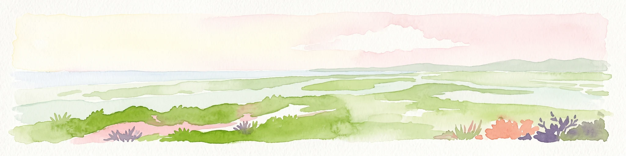
Watercolor illustration depicting a panoramic view of a coastal estuary with green mangrove islands, tidal channels, and a soft pink sunset sky.
Marine protected areaFlorida
About 128 km away#4 closest

North

Rookery Bay National Estuarine Research Reserve: Coastal Geography and Protected Estuarine Waters

Subtropical mangrove landscapes within the Florida Gulf Coast region.

This marine protected area encompasses a vast sweep of sheltered coastal waters and tidal forests at the northern edge of the Ten Thousand Islands. The reserve stands as a prime example of an undisturbed subtropical estuary, characterized by continuous mangrove shorelines and intricate hydrologic networks that provide critical habitat for numerous estuarine dependent species.

Area
445.15 km²
Established
1980
Relief
Lowland
Climate
Subtropical
National parkGrand Bahama
About 197 km away#5 closest

Northeast

Lucayan National Park: National Park Geography and Mapped Landscape Exploration

Discover protected area boundaries on Grand Bahama.

Lucayan National Park stands as a distinct national park entity within the geography of Grand Bahama. This page provides a focused atlas-style exploration of the park's protected landscape, detailing its mapped area and contributing to a structured understanding of its regional context. Delve into the geographic specifics that define Lucayan National Park as a key element of the Bahamas' protected lands, suitable for detailed map-based discovery and analysis.

Area
7.84 km²
Established
1982
IUCN
II
Climate
Tropical
National parkAndros
About 227 km away#6 closest

East

Blue Holes National Park: A National Park for Detailed Geographic and Landscape Exploration

Explore mapped boundaries and regional terrain context.

Delve into the specifics of Blue Holes National Park, a designated national park offering rich opportunities for geographic discovery. This entry provides structured information focused on its protected landscape identity, mapped outlines, and its contribution to the regional geography of Andros, Bahamas. Understand the park's unique setting through detailed map context and atlas-driven insights.

Area
162 km²
Established
2002
IUCN
II
Relief
Mixed relief
National parkBahamas
About 231 km away#7 closest

East

North and South Marine Parks National Park: Geographic Atlas and Protected Landscape in the Bahamas

Mapping Bahamian protected marine geography and its national park boundaries.

Delve into the atlas-view of North and South Marine Parks, a key national park in the Bahamas. This page details the park's specific geographic features and its protected landscape identity within the island nation. Understand its placement and significance as a protected marine area contributing to the regional geography.

Area
20 km²
Established
2002
IUCN
II
Climate
Tropical
National parkBahamas
About 246 km away#8 closest

Northeast

Walker's Cay National Park: Bahamas National Park Featuring a Premier Barrier Reef Ecosystem

Explore mapped underwater geography and marine protected boundaries.

Walker's Cay National Park is a vital marine protected area located in the Bahamas, safeguarding approximately 3,840 acres of coastal and ocean waters. Its most distinguishing feature is the expansive barrier reef, a complex underwater geography teeming with diverse marine species that draws attention for diving and snorkeling. This park serves as a crucial element within the atlas of Bahamian protected lands, offering structured insights into marine conservation and the mapped distribution of critical reef habitats.

Area
16 km²
Established
2002
IUCN
II
Relief
Lowland

Common questions about visiting, size, designation, and location context for Florida Keys National Marine Sanctuary

Florida Keys National Marine Sanctuary FAQs for park facts, access, geography, and protected area context

Find quick answers about Florida Keys National Marine Sanctuary, including protected-area facts, park geography, trail and visitor context, and how the park fits into its surrounding country and regional landscape.
MoriAtlas Explorer

Continue Your Protected Areas Search Across the Global Atlas

Deepen your exploration by continuing the structured search for national parks and protected areas worldwide. Utilize the comprehensive filtering capabilities to compare different conservation landscapes and refine your understanding of global park geography. Discover more about the distribution and characteristics of protected natural areas.

Global natural geography
