
Mori Atlas logo
Protected areaFogo Natural Park

Discover the mapped boundaries and dramatic terrain of this key Atlantic island protected area.

Fogo Natural Park: Protected Area and Volcanic Landscape in Cabo Verde

(Parque Natural do Fogo)

Fogo Natural Park represents a significant protected area on Fogo Island, a key component of Cabo Verde's unique volcanic archipelago geography. This park encompasses the dramatic interior, centered around Pico do Fogo, the nation's highest peak and an active stratovolcano. Its protected status safeguards a striking volcanic landscape, crucial endemic ecosystems, and the island's overall natural heritage for atlas-based exploration and geographic understanding.

Volcanic landscapeProtected areaImportant Bird AreaEndemic speciesActive volcanoIsland conservation

Fogo Natural Park

Protected area

Park overview

Structured park overview, official facts, and landscape profile for Fogo Natural Park

Fogo Natural Park park facts, protected area profile, and essential visitor context

Review the core facts for Fogo Natural Park, including designation, size, terrain, visitor scale, habitats, and operating context in one park-focused overview.

About Fogo Natural Park

Fogo Natural Park encompasses the volcanic heart of Fogo Island, protecting one of the most geologically significant landscapes in Cape Verde. The park's territory includes Pico do Fogo, an active stratovolcano that dominates the island's topography and serves as its defining natural landmark. The volcano's presence has shaped both the physical landscape and the cultural identity of Fogo, with regular eruptions contributing volcanic soil that supports agriculture on the island's slopes. The park covers the volcano's central crater, the dramatic Bordeira crater rim, and the relatively untouched Monte Velha forest area. The landscape transitions dramatically from the lunar terrain near the summit through forested zones to the populated coastal areas where volcanic lava has historically reached the sea. This protected area represents Cape Verde's commitment to preserving its natural heritage while allowing for scientific study of volcanic processes and conservation of endemic species that have evolved in isolation on this mid-Atlantic island.

Quick facts and research context for Fogo Natural Park

Fogo Natural Park occupies 84.69 square kilometers along the interior of Fogo Island in central Cape Verde. The park was established on February 24, 2003, and is managed as one of the nation's ten natural parks. Its defining feature is Pico do Fogo, an active stratovolcano that forms the island's highest elevation. The park includes the volcano's crater, its rim known as the Bordeira, and the Monte Velha forests. Fogo has experienced significant volcanic activity five times over the past five centuries, with the most recent eruption occurring in 2014-15. The park is recognized as an Important Bird Area, spanning both terrestrial and marine zones.

Protection and recognition

Verifying terrestrial management boundaries and documented legal frameworks for the island landscape.

Fogo Natural Park Official Protection Status and Land Designation

Exploring the official conservation boundaries of Fogo Natural Park reveals a terrestrial protection scope designed to safeguard crucial volcanic environments and island terrain. Navigating formal conservation designations provides researchers and geographers with verified land data regarding documented local management frameworks.

Protection details

Protection scope
Terrestrial
Transboundary protection
No
Park context

Deeper park guide and search-rich context for Fogo Natural Park

Fogo Natural Park history, landscape, wildlife, and travel context

Explore Fogo Natural Park through its history, landscape character, ecosystems, wildlife, conservation priorities, cultural context, and seasonal travel timing in a structured park guide built for atlas discovery and search intent.

Why Fogo Natural Park stands out

Fogo Natural Park is best known for protecting Pico do Fogo, one of Africa's most accessible active volcanoes and the highest peak in Cape Verde. The park is distinguished by its dramatic volcanic landscape, including a roughly nine-kilometer-wide caldera with a breach in its eastern rim that allows lava flows to reach the coast during eruptions. The Monte Velha forests within the park shelter critically endangered and endangered endemic plant species found nowhere else on Earth. The park's status as an Important Bird Area further distinguishes it as a haven for seabirds including Fea's petrel and Boyd's shearwater.

Fogo Natural Park history and protected-area timeline

Fogo Natural Park was officially established on February 24, 2003, as part of Cape Verde's developing network of protected areas. The creation of the park reflected growing recognition of the ecological and geological importance of Fogo's interior, particularly the unique habitats found around the volcanic peak and in the Monte Velha forest zone. Prior to formal protection, the area had no formal conservation status despite its scientific and natural value. The park's establishment came during a period when Cape Verde was expanding its environmental protection framework, with the government designating multiple natural parks across the archipelago. The 2014-15 eruption of Pico do Fogo, which caused significant changes to the island's landscape, highlighted both the dynamic nature of the protected area and the importance of maintaining conservation zones that encompass active geological features.

Fogo Natural Park landscape and geographic character

The landscape of Fogo Natural Park is defined by volcanic terrain of extraordinary dramatic quality. At its center stands Pico do Fogo, a classic stratovolcano that rises sharply from the Atlantic to reach 2,829 meters, visible from great distances at sea. The volcano features a large caldera approximately nine kilometers wide, with steep inner walls rising hundreds of meters above the crater floor. A notable feature of the caldera is the breach in its eastern rim, known as the Bordeira, through which lava flows have historically traveled downslope to reach the coast. The terrain ranges from the barren, rock-strewn volcanic summit and crater region through zones of sparse vegetation to the denser Monte Velha forest area. The contrast between the dark volcanic rocks and any vegetation creates a striking visual landscape. Lower slopes show evidence of past lava flows, with varying degrees of erosion and soil development depending on the age of the volcanic deposits.

Fogo Natural Park ecosystems, habitats, and plant life

The ecological significance of Fogo Natural Park extends far beyond its dramatic volcanic scenery. The park protects unique habitats that have developed in isolation on this mid-Atlantic island, resulting in endemic species found nowhere else on the planet. The Monte Velha forest area represents one of the most important remaining woodland zones on Fogo, providing habitat for species adapted to the island's specific conditions. The park is recognized as an Important Bird Area, with the protected zone and surrounding marine waters covering 2,473 square kilometers designated for bird conservation. The transition from volcanic summit through forest zones to coastal areas creates diverse ecological niches, though the harsh conditions near the active volcano limit vegetation to specialized species capable of surviving in this challenging environment.

Fogo Natural Park wildlife and species highlights

Fogo Natural Park provides crucial habitat for several bird species of conservation concern. The park's status as an Important Bird Area recognizes its significance for seabirds that breed on the island's cliffs and offshore islets. Fea's petrel, a small shearwater species, breeds in burrows on the island's slopes, while Boyd's shearwater also nests in the rocky terrain. The Cape Verde swift, an endemic subspecies, can be observed flying above the volcanic slopes. These seabird species rely on the island's isolated position in the Atlantic, far from mainland predators, making Fogo an important breeding site. While the park's terrestrial wildlife is limited by the volcanic environment, the surrounding marine waters also fall within the protected zone, acknowledging the interconnected nature of terrestrial and marine ecosystems.

Fogo Natural Park conservation status and protection priorities

Fogo Natural Park plays a critical role in Cape Verde's conservation framework by protecting the island's most significant geological feature and its associated endemic species. The park's designation as an Important Bird Area places it within the global network of sites critical for bird conservation, particularly for seabird species that depend on the island for breeding. The presence of critically endangered and endangered endemic plant species on the crater rim adds international conservation significance to the protected area. Managing an active volcanic zone presents unique challenges, as the 2014-15 eruption demonstrated, but also provides opportunities for scientific research into volcanic processes and ecological succession on newly formed lava fields. The park represents Cape Verde's effort to balance sustainable use of natural resources with protection of irreplaceable geological and biological heritage.

Fogo Natural Park cultural meaning and human context

Fogo Island has a long history of human settlement shaped by its volcanic landscape. Communities on the island have developed in the shadow of Pico do Fogo, with volcanic activity both threatening and benefiting local populations through the fertility that volcanic soils provide to agricultural land. The Monte Velha forest has historically served as a resource for local communities, though the establishment of the natural park has changed how these resources are managed. The volcano holds cultural significance in local traditions and narratives, representing both the power of nature and the resilience of island communities who have rebuilt following eruptions. The park's boundaries spanning three municipalities reflect both the geographic extent of the volcanic feature and the need for coordinated management across administrative divisions.

Top sights and standout views in Fogo Natural Park

Fogo Natural Park offers access to one of the world's most visually striking volcanic landscapes, with Pico do Fogo providing a dramatic backdrop for exploration and scientific study. The opportunity to hike to the crater rim and peer into an active volcano's caldera represents a unique experience among Atlantic islands. The park protects endangered endemic plant species that exist nowhere else on Earth, making it significant for global biodiversity conservation. Birdwatchers can observe rare seabird species in their natural island habitat. The 2014-15 eruption zone provides researchers and visitors with a visible example of volcanic succession and landscape regeneration following geological disturbance.

Best time to visit Fogo Natural Park

The dry season from November to May generally offers the most stable weather conditions for visiting Fogo Natural Park, with lower precipitation and clearer skies that allow for views from the volcano's summit. The cooler months provide more comfortable conditions for hiking, particularly at higher elevations where temperatures can be significantly lower than on the coast. Visitors should be aware that volcanic activity can lead to temporary access restrictions, as the park encompasses an active geological feature. The period following the 2014-15 eruption continues to affect trail conditions and access to certain zones within the park.
Monthly climate preview

Analyzing long-term temperature and precipitation trends across Cabo Verde protected landscapes

Average Temperatures and Monthly Climate Normals in Fogo Natural Park

Long-term meteorological data reveal a warm marine climate with average monthly temperatures peaking above 26 degrees Celsius alongside seasonal rainfall variations. Accessing the complete month-by-month profile provides detailed historical statistics on temperature ranges and daily precipitation averages to clarify the local baseline.
Annual mean24 °C
22 °C27 °C
Jan22°
Feb22°
Mar22°
Apr22°
May23°
Jun24°
Jul25°
Aug26°
Sep27°
Oct26°
Nov25°
Dec24°
Warmest month
September

26.6 °C

Coolest month
February

21.8 °C

Wettest month
September

2.5 mm/day

Driest month
June

0.2 mm/day

Park location guide

Geography guide, regional context, and park location map for Fogo Natural Park

Fogo Natural Park park geography, regions, and map view in Cabo Verde

Understand where Fogo Natural Park sits in Cabo Verde through a broader geographic reading of the surrounding landscape, nearby location context, and its mapped position within the national park landscape.

How Fogo Natural Park fits into Cabo Verde

Cabo Verde is an island nation in the central Atlantic Ocean consisting of ten volcanic islands located 600, 850 km west of the West African coast. Formerly a Portuguese colony, it gained independence in 1975 and has become one of Africa's most stable democracies. The population is approximately 491,000, with Praia as the capital and largest city.

Wider geography shaping Fogo Natural Park in Cabo Verde

Cabo Verde is an archipelagic nation in the central Atlantic Ocean, lying between 600 and 850 kilometres west of Cap-Vert, the westernmost point of continental Africa. The country consists of ten volcanic islands with a combined land area of approximately 4,033 km². It forms part of the Macaronesia ecoregion, along with the Azores, Canary Islands, Madeira and the Savage Isles.

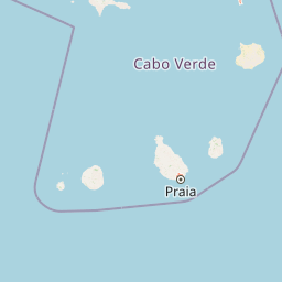
Map view of Fogo Natural Park

Use this park location map to pinpoint Fogo Natural Park in Cabo Verde, understand its exact geographic position, and read its mapped placement within the surrounding landscape more clearly.

Pigeon | © OpenStreetMap contributors
Park atlas

Trace the broader geographic context of Cape Verde's protected landscapes and compare adjacent island park ecosystems

Discover Nearby Protected Areas and Regional Parks Beyond Fogo Natural Park

After exploring Fogo Natural Park's dramatic volcanic landscape and unique biodiversity, browse a curated list of other protected areas and national parks within Cape Verde and its surrounding Atlantic region. Continue your geographic exploration to compare diverse conservation zones, map regional park spread, and understand the interconnectedness of Atlantic island ecosystems.
Protected areaCabo Verde
Mapped park locations coincide#1 closest

Fogo National Park Protected Area: Cabo Verde Regional Landscape Atlas

Explore the unique volcanic terrain and mapped protected boundaries.

Fogo National Park represents a significant protected area within the island nation of Cabo Verde. This entry provides detailed atlas-level insight into its geographic setting, focusing on the park's mapped boundaries and its role within the archipelago's distinctive volcanic landscapes. Understanding Fogo National Park offers a valuable perspective on conservation geography and the mapping of natural terrain across this Atlantic island group.

Watercolor artwork depicting green hills and a colorful sky
Protected areaSanto Antão
About 251 km away#2 closest

North

Cova-Paul-Ribeira da Torre Natural Park: Protected Area Atlas View and Geographic Context

Discover the mapped landscape and regional setting of this protected area.

Delve into Cova-Paul-Ribeira da Torre Natural Park, a crucial protected area situated on Santo Antão, Cape Verde. This atlas-focused entry provides essential details about its geographic boundaries and its role as a mapped natural landscape, facilitating a structured understanding of its protected status and regional importance.

Area
20.92 km²
Relief
Mountain
Scope
Terrestrial
Water
Minor water
National parkSenegal
About 742 km away#3 closest

East

Isles des Madeleines National Park: Senegal National Park Atlas and Geographic Boundaries

Explore its mapped natural terrain and protected landscape identity.

Isles des Madeleines National Park is a designated protected area offering specific geographic features within Senegal. This page provides foundational atlas context, detailing the park's mapped boundaries and its role as a conservation landscape. Users can leverage this information to understand its regional setting and the nature of its protected terrain.

National parkSenegal
About 821 km away#4 closest

East

Saloum Delta National Park: Detailed Map Exploration of Senegal's Protected Landscape

Explore the mapped boundaries and regional terrain of this national park.

Saloum Delta National Park, a designated national park in Senegal, serves as a key entity for understanding protected landscapes in West Africa. This entry focuses on its geographic specificities, providing mapped context and details about its natural terrain. Users can explore the park's boundaries and regional landscape character, contributing to a richer atlas-based discovery of Senegal's conservation areas and natural geography.

Area
760 km²
Established
1976
Relief
Lowland
Climate
Tropical
National parkGambia
About 835 km away#5 closest

East

Tanji Bird Reserve National Park: Coastal Wetlands and Avian Diversity in Gambia

Explore unique geography and protected landscape boundaries.

Tanji Bird Reserve National Park showcases a distinctive coastal landscape where the Atlantic Ocean meets lagoons, dry woodland, and dune scrub. This 612-hectare protected area in The Gambia is celebrated for its incredible birdlife, with nearly 300 species recorded, including significant Palearctic migrants and the nation's sole breeding seabird colonies on the Bijol Islands. The reserve offers a rich context for understanding West African protected areas, mapped terrain, and coastal ecosystem geography.

Area
6.12 km²
Established
1993
IUCN
II
Relief
Lowland
National parkGambia
About 841 km away#6 closest

East

Bijilo National Park: A Protected National Park in Gambia's Geographic Atlas

Explore mapped boundaries and natural landscape context.

Delve into Bijilo National Park, a distinct national park situated within Gambia. This page provides a focused view of the park's protected landscape, its defined geographic boundaries, and its significance within the broader regional atlas. Understand the natural terrain and conservation context specific to Bijilo National Park for a comprehensive geographic discovery.

Area
0.513 km²
Established
1982
Visitors
23K annual
Relief
Lowland
National parkSenegal
About 843 km away#7 closest

East

Langue de Barbarie National Park: A Protected National Park in Senegal's Geography

Explore its mapped boundaries and regional landscape context.

Langue de Barbarie National Park is a protected national park located in Senegal, offering a distinct geographic focus for atlas exploration. Understanding this protected area involves examining its mapped boundaries and its place within the broader coastal geography of West Africa. This entry provides structured information to comprehend the park's identity as a conservation landscape and its contribution to Senegal's natural territory.

Area
20 km²
Relief
Lowland
Scope
Mixed
Water
Major water bodies
National parkGambia
About 850 km away#8 closest

East

Abuko National Park: Key Protected Landscape and National Park in Gambia

Mapped terrain and regional geography within the park's boundaries.

Abuko National Park is a significant protected area within Gambia, offering a detailed view of its national park identity and geographic presence. This page provides essential atlas context for understanding the park's specific landscape character and its role as a mapped natural territory. Explore how this protected land contributes to the regional geography and provides a distinct environmental canvas for discovery.

Area
1.07 km²
Established
1968
Relief
Lowland
Climate
Tropical

Common questions about visiting, size, designation, and location context for Fogo Natural Park

Fogo Natural Park FAQs for park facts, access, geography, and protected area context

Find quick answers about Fogo Natural Park, including protected-area facts, park geography, trail and visitor context, and how the park fits into its surrounding country and regional landscape.
MoriAtlas Explorer

Continue Your Protected Areas Search Across the Global Atlas

Deepen your exploration by continuing the structured search for national parks and protected areas worldwide. Utilize the comprehensive filtering capabilities to compare different conservation landscapes and refine your understanding of global park geography. Discover more about the distribution and characteristics of protected natural areas.

Global natural geography

