
Mori Atlas logo
Protected areaFoloi oak forest

Explore the geographic boundaries and plateau terrain of this rare Greek oak woodland

Foloi Oak Forest Protected Area: Mapping the Ancient Deciduous Woodlands of Western Peloponnese

Foloi Oak Forest sits as a dense, seed-regenerated deciduous expanse upon a high plateau in the Elis regional unit of Greece. This protected area represents a distinct geographic feature within the western Peloponnese, characterized by its dominant Hungarian oak canopy and complex system of gorges and drainage basins. The woodland serves as a vital ecological corridor, preserving ancient forest character while bridging the historical landscape of the region with its contemporary conservation role as a recognized natural habitat.

oak forestdeciduous forestbroadleaf woodlandPeloponneseGreek forestmountain plateau
A flat vector illustration of a scenic valley with a waterfall flowing down a cliff, a winding river in the foreground, coniferous trees, and fern plants.

Foloi oak forest

Protected area

Park overview

Structured park overview, official facts, and landscape profile for Foloi oak forest

Foloi oak forest park facts, protected area profile, and essential visitor context

Review the core facts for Foloi oak forest, including designation, size, terrain, visitor scale, habitats, and operating context in one park-focused overview.

About Foloi oak forest

The Foloi oak forest sits on a high inland plateau in western Greece, at the southwestern foothills of Mount Erymanthos along the border between Elis, Arcadia, and Achaea. Its administrative setting straddles several municipalities within Elis, and its geographic character is that of a mountain plateau forest rather than a coastal or lowland woodland. At elevations of roughly 600 to 688 meters, the site forms a continuous green island above the surrounding agricultural lowlands.

Ecologically, the forest is dominated by the broadleaf Quercus frainetto, the Hungarian oak, which forms straight-trunked, tall trees with a dense canopy. Underneath this primary oak species, smaller populations of the downy oak (Quercus pubescens) and the evergreen holm oak (Quercus ilex) are also present. The canopy is so dense that little light reaches the forest floor, and the characteristic companions of the oaks are ferns and asphodels growing in the gaps between trunks. The setting is particularly valued because the forest arose from natural seed regeneration rather than planting, a rare pattern across Europe.

The woodland is more than a botanical site. It is recognized as a Natura 2000 protected area under the European Union's Habitats Directive and is also classified as an important bird area for Greece. Together, these designations mark Foloi as a site of broad ecological importance, both for its unusual oak ecosystem and for the raptors, woodpeckers, and other species it supports. Its location close to ancient Olympia gives it additional value as part of a historically loaded Greek landscape.

Quick facts and research context for Foloi oak forest

The Foloi oak forest lies on a plateau at roughly 600 to 688 meters in altitude in the regional unit of Elis, on the western side of the Peloponnese. Its core woodland extends across approximately 40 to 42 square kilometers, making it one of the largest and most ecologically coherent oak forests in Greece. It is identified as a Natura 2000 protected site and as a significant area for birds in Greece, with documented breeding populations of short-toed snake eagles, golden eagles, peregrine falcons, and white-backed woodpeckers, among others.

Protection and recognition

Examine documented protection scope and international recognition records for Foloi oak forest.

Foloi Oak Forest Protection Status and Terrestrial Conservation Data

Foloi oak forest maintains a defined terrestrial protection scope within its regional conservation framework. Documented governance records outline the administrative management boundaries and official recognition status associated with the landscape.

Protection details

Protection scope
Terrestrial
Transboundary protection
No
Park context

Deeper park guide and search-rich context for Foloi oak forest

Foloi oak forest history, landscape, wildlife, and travel context

Explore Foloi oak forest through its history, landscape character, ecosystems, wildlife, conservation priorities, cultural context, and seasonal travel timing in a structured park guide built for atlas discovery and search intent.

Why Foloi oak forest stands out

The forest is best known for being one of the very few pure, seed-regenerated deciduous oak forests in the Balkans, dominated by Hungarian oak and forming an exceptionally dense canopy on a high Peloponnese plateau. It also stands out for its mythological associations: the ancient Greeks envisioned this woodland as a habitat of centaurs and dryads, and it preserves the toponym Pholoë connected to the centaur Pholos. The combination of ecological uniqueness and classical heritage gives the site a distinctive double identity.
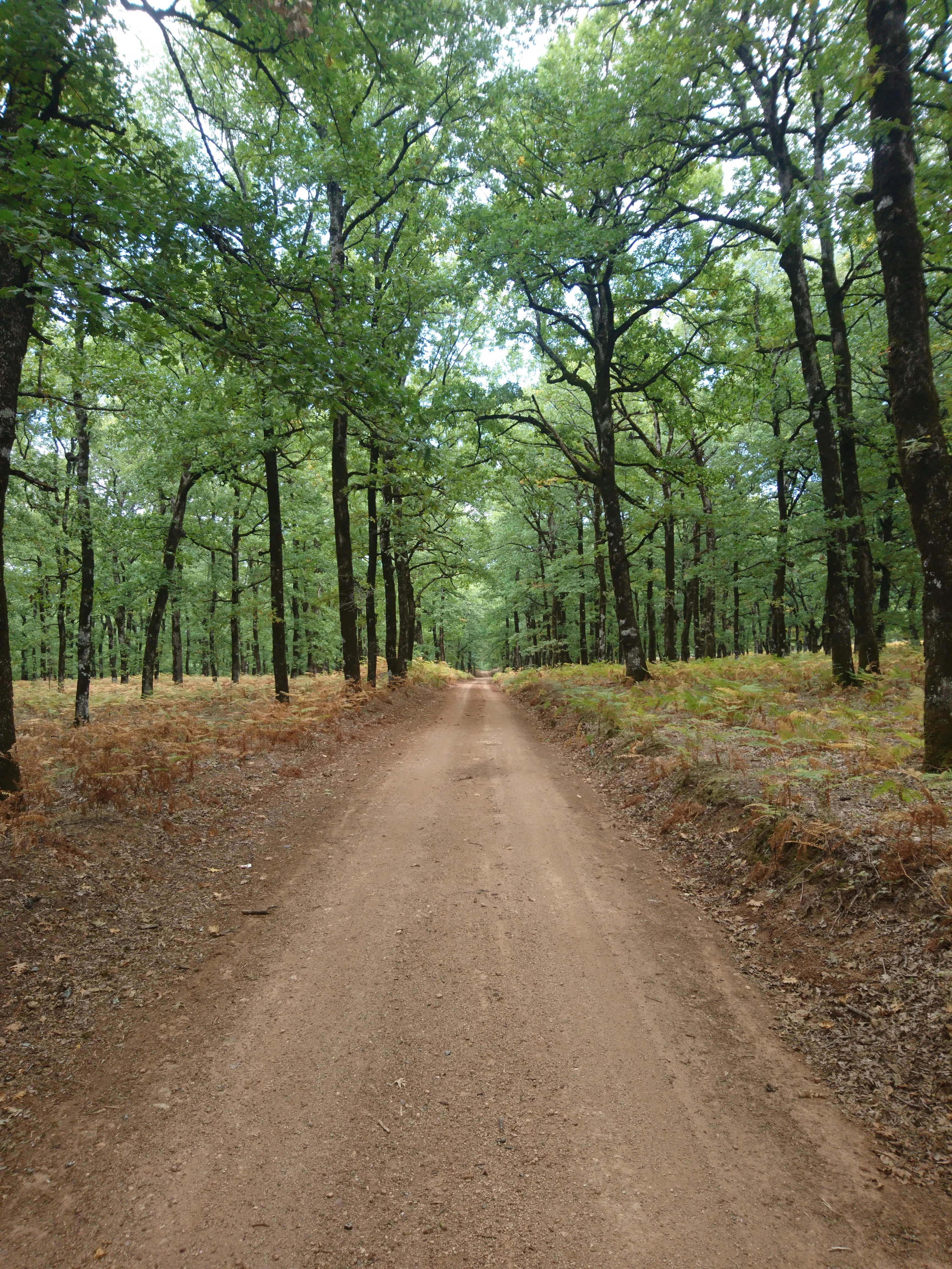
A wide, unpaved dirt path extending into the distance through a lush forest of tall, mature oak trees.
A dirt forest road winding through the dense canopy of the Foloi oak forest.

Foloi oak forest history and protected-area timeline

The forest's name, Pholoë, traces directly back to Greek mythology, where the woodland was imagined as the home of centaurs and the dryads, the spirits of the oaks. The Greeks gave the chief centaur of the region the name Pholos, and the wooded plateau took the name Pholoë in association. Local tradition preserves a memory of Heracles hunting the Erymanthian Boar nearby, and the site remains tied to that mythic landscape.

In more recent centuries parts of the forest were cut or cleared to expand cultivation and to harvest timber, gradually fragmenting what was once a more unified woodland. Today the forest is recognized as a protected site within the Natura 2000 network and is inventoried under the European Habitats Directive, which has helped anchor its conservation status. Local communities continue to draw limited firewood and timber from the forest, though annual production no longer meets regional needs.

Foloi oak forest landscape and geographic character

The Foloi oak forest spreads across a roughly circular mountain plateau at about 600 to 688 meters above sea level, near the southwestern slopes of Mount Erymanthos. From higher surrounding peaks the forest reads like a great open threshing floor about ten kilometers across, while from lower vantage points its edge resembles the curve of a sickle. The terrain is varied, with deep ravines, including the gorge formed where the Pineios River rises, cutting into the plateau and breaking the woodland into separate masses known locally as Androneiki, Koumaneiki, and Yarmeneiki.

The plateau lies within the drainage basins of the Erymanthos and Pineios rivers, and the forest plays a protective role for soils, agriculture, and cultural sites further downstream along the Alpheios and Pineios rivers. The high position, combined with relatively dry summer conditions, makes rainfall limited, but the dense oak cover retains enough soil moisture to keep the woodland viable. Forest roads cross the plateau and provide access for hiking, cycling, and horse riding through the stands of tall, straight oaks.
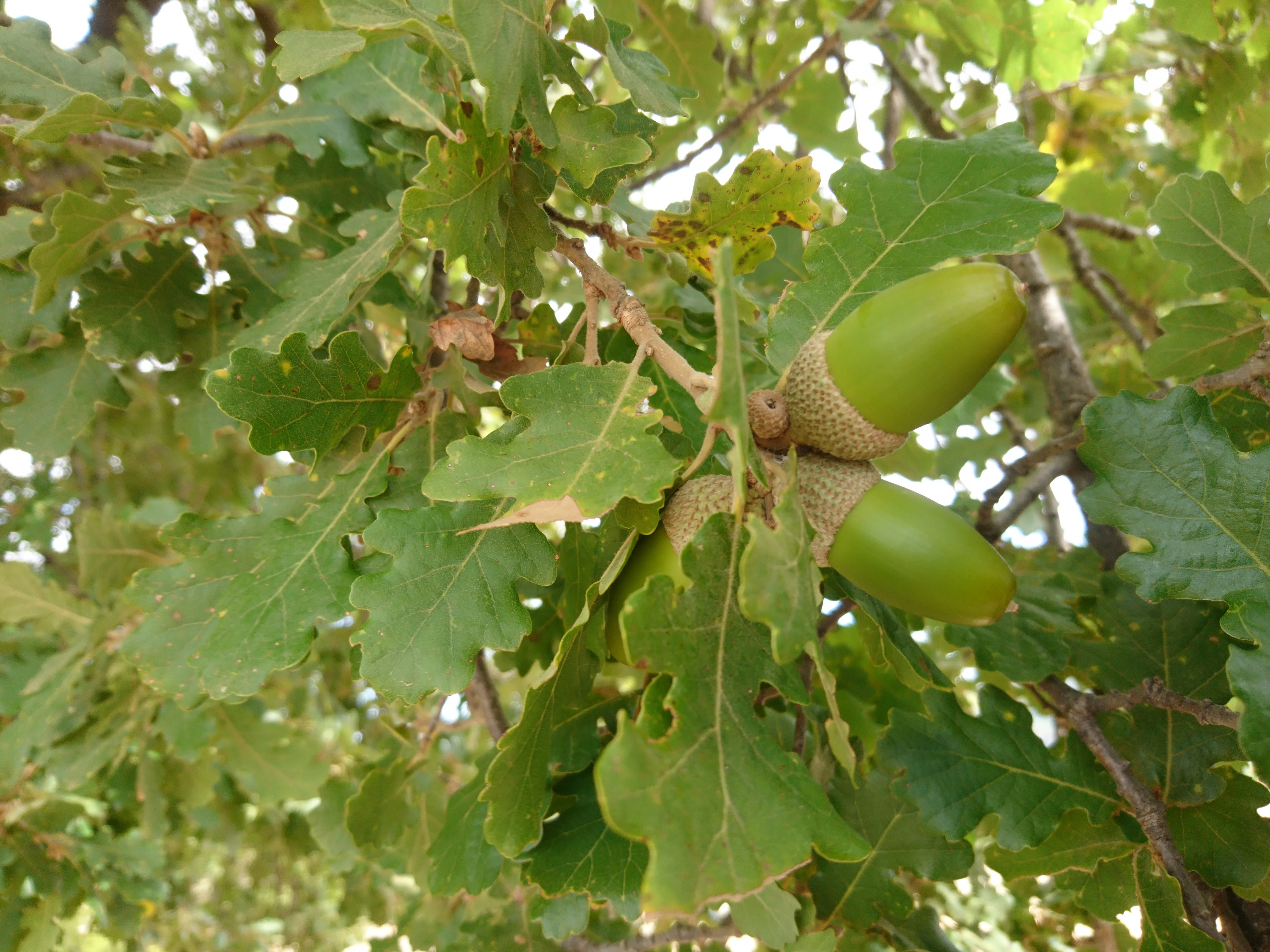
A close-up view of vibrant green oak leaves and two developing acorns attached to a branch.
Close-up of oak leaves and green acorns in the Foloi oak forest.

Foloi oak forest ecosystems, habitats, and plant life

The forest is overwhelmingly deciduous, and its primary canopy is dominated by Quercus frainetto, the Hungarian oak, which can reach 15 to 20 meters in height and live for up to two centuries. Smaller numbers of downy oak and evergreen holm oak contribute to the structure. Beneath the trees, ferns and asphodels thrive in the inter-trunk spaces, while the closed canopy restricts ground vegetation to shade-adapted species.

Near settlements and along the ravines the composition shifts, with chestnuts, beeches, plane trees, holm oaks, strawberry trees, walnut trees, and fruit trees appearing alongside the dominant oaks. The dense cover and persistent leaf litter give the forest a relatively moist microclimate compared with the dry summer plateau, allowing ferns and other soft undergrowth to flourish under the oaks' shade.
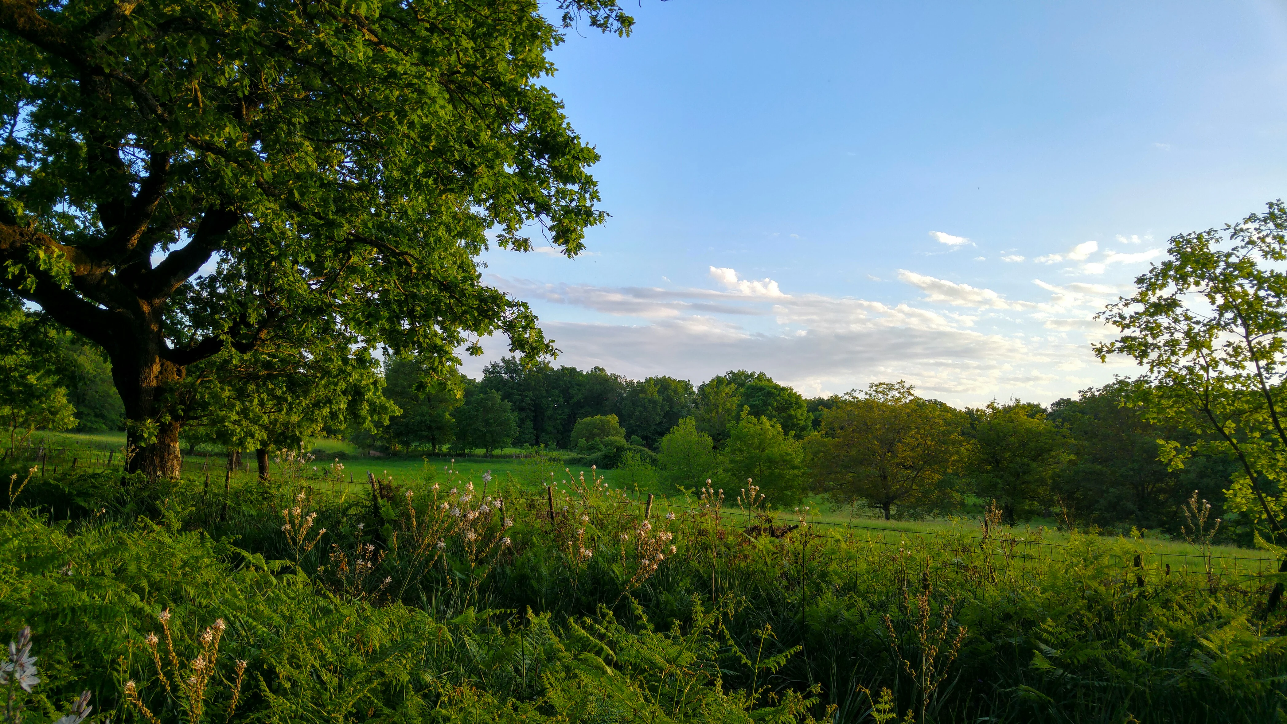
A wide view of a sunlit oak forest with a green meadow in the foreground and a dense line of trees in the background under a blue sky with light clouds.
A scenic view of the lush deciduous oak woodland on the Foloi plateau.

Foloi oak forest wildlife and species highlights

Acorns are the foundation of a rich food web, supporting hares, squirrels, and hedgehogs in significant numbers. These smaller mammals in turn sustain predators and competitors including badgers, pine martens, foxes, weasels, jackals, and turtles. Reptile life includes vipers and rat snakes among other snakes and lizards, adding a further layer to the forest's animal community.

Birdlife is notable. The forest is classified as an important area for birds in Greece, with breeding short-toed snake eagles, golden eagles, peregrine falcons, Eurasian eagle owls, white-backed woodpeckers, and Rüppell's warblers recorded. Woodpeckers, cuckoos, jays, turtle doves, skylarks, magpies, partridges, and hoopoes contribute to a varied songbird and gamebird presence. Historically the area also supported larger mammals: wild boar, roe deer, red deer, and Egyptian vultures were recorded until around 1950, though these have since retreated.
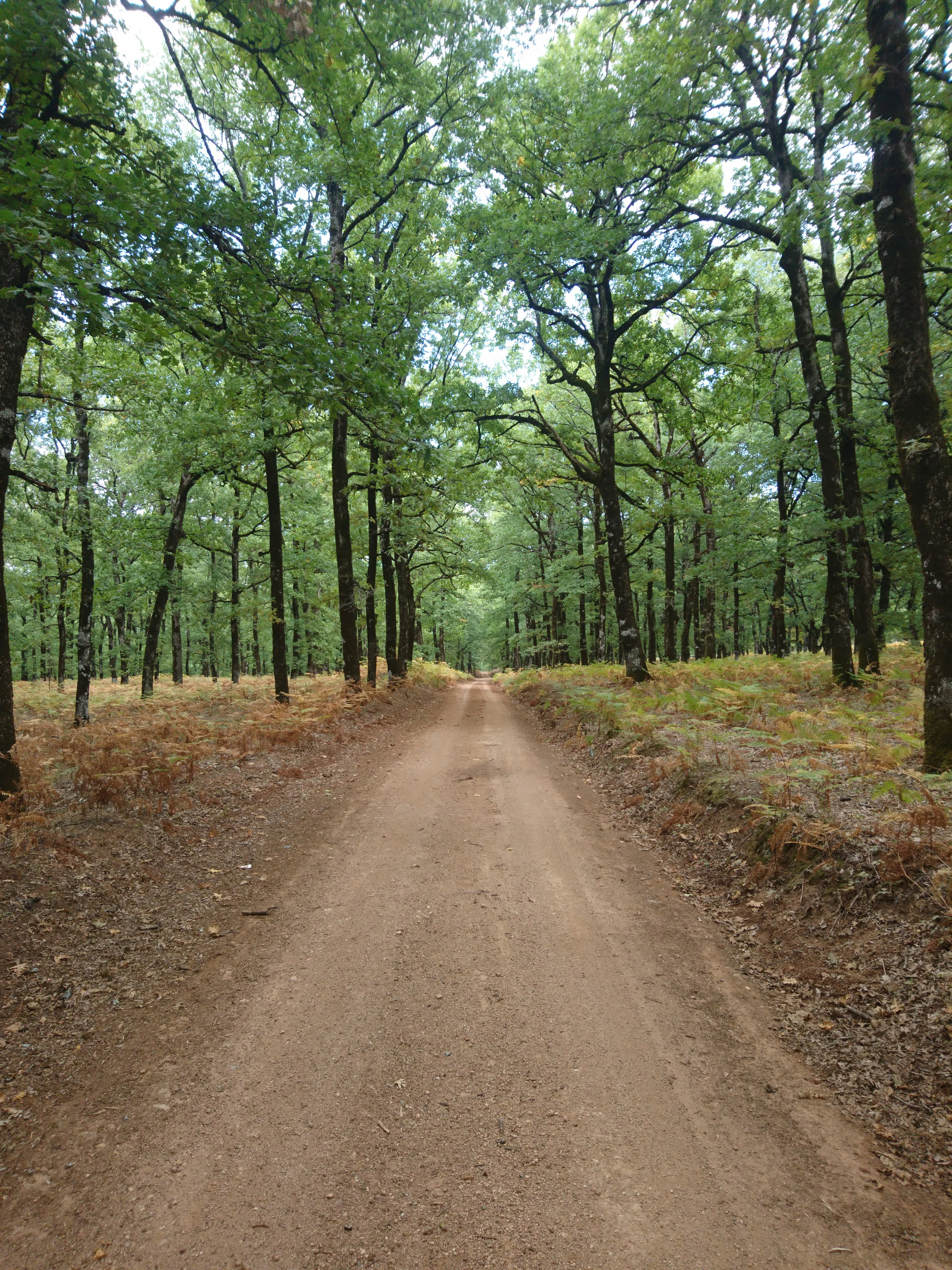
A straight, unpaved dirt road leads into the distance, framed by tall, mature oak trees on both sides in a dense, green woodland setting.
A dirt road winding through the dense oak forest of the Foloi plateau.

Foloi oak forest conservation status and protection priorities

The Foloi oak forest is officially listed as a Natura 2000 site under the European Union's ecological network, covering roughly 97 square kilometers of the broader Foloi plateau area, and is also inventoried under the EU Habitats Directive. These designations recognize the forest as one of the few pure seed-regenerated oak woodlands in the Balkans, an ecological rarity of European significance. Its value to raptors and woodpeckers adds further conservation weight, reinforced by its classification as an important bird area for Greece.

Conservation concerns are nonetheless real. Fragmentation from past clearance for agriculture and timber has reduced what was historically a continuous woodland. Continued small-scale local use of firewood and timber persists, and official hunting regulation applies seasonally in defined zones, with protected no-hunting areas intended to allow wildlife and birds to breed without disturbance. Reforestation efforts in designated zones have aimed to replenish young stock.

Foloi oak forest cultural meaning and human context

The forest carries a strong mythological layer, having been conceived in classical Greek imagination as the homeland of centaurs and as a place sacred to the dryads, the spirit-guardians of the oaks themselves. The name Pholoë derives from the centaur king Pholos, a companion of Heracles, and local tradition still links sites within and around the forest to the narrative of Heracles capturing the Erymanthian Boar. Visitors walking the gorge and the woodland trails today encounter a landscape that has been imagined as mythical for more than two thousand years.

The forest also shapes the everyday culture of the surrounding villages. Most of the local workforce is engaged in livestock raising, producing feta and mizithra cheeses, yogurt, and high-quality meat. The soils and climate also support walnuts, cherries, and local grape-based wines, while honey from chestnut and oak blossom gives a characteristic dark color and a strong regional flavor. In popular speech the woodland itself is called Kapeli, meaning dense or abundant forest, and the plateau is nicknamed the balcony of Elis.
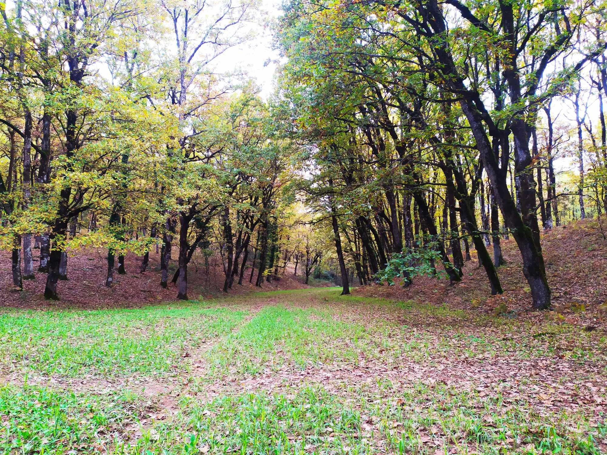
A wide angle shot of a deciduous forest path covered in fallen leaves, lined with tall oak trees on both sides.
A view through the deciduous oak woodland of the Foloi plateau.

Top sights and standout views in Foloi oak forest

A rare, seed-regenerated broadleaf oak forest on a 600-meter Peloponnese plateau, with Quercus frainetto as the dominant species and a closed canopy that supports ferns, asphodels, and a multilayered food web of mammals, reptiles, and raptors. The site is recognized within the Natura 2000 network and the EU Habitats Directive, with documented breeding populations of golden eagles, short-toed snake eagles, peregrine falcons, and white-backed woodpeckers. Layered on top of this ecological significance is a centuries-old mythological identity, with the ancient Greek traditions of centaurs, dryads, and Heracles still echoing through local place names and the surrounding gorge.
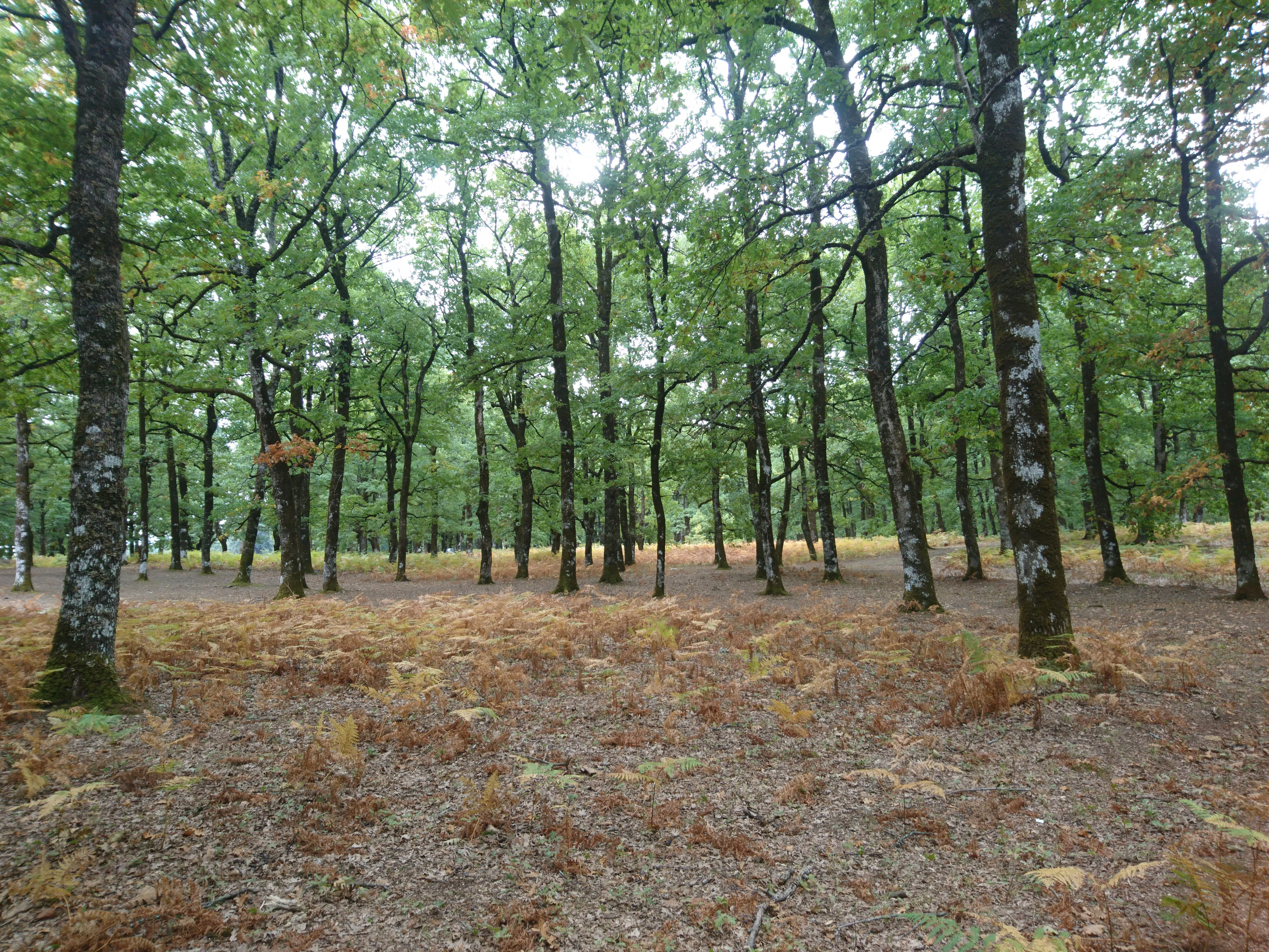
A view through a mature deciduous oak forest with a ground layer of dried ferns and fallen leaves.
A stand of deciduous oak trees in the Foloi oak forest.

Best time to visit Foloi oak forest

Spring is especially rewarding for visiting the Foloi oak forest, with mild weather, fresh growth under the canopy, and active birdlife, including breeding raptors and early songbird presence. Early summer, when the leaves are fully formed and the canopy closes, offers the most striking sense of the woodland's density, though summer itself is dry and the plateau becomes more arid. Autumn is the season when the broadleaf oaks show their character most clearly, with mast and changing light filtering through the trees, and the forest roads are well suited to walking, cycling, and horse riding in these milder seasons.

Monthly climate preview

Measured monthly temperature ranges and precipitation rhythm from NASA coordinate data

Foloi Oak Forest Climate Normals and Long Term Temperature Patterns

Long-term climate data for Foloi oak forest reveals a measured annual cycle of shifting temperatures and monthly precipitation volumes recorded at a representative coordinate. Examining the complete twelve-month normals profile provides deeper analytical context on average monthly weather patterns across the landscape.
Annual mean14 °C
5 °C25 °C
Jan
Feb
Mar
Apr11°
May16°
Jun22°
Jul25°
Aug25°
Sep20°
Oct15°
Nov11°
Dec
Warmest month
August

24.8 °C

Coolest month
January

5 °C

Wettest month
November

3.6 mm/day

Driest month
July

0.5 mm/day

Park location guide

Geography guide, regional context, and park location map for Foloi oak forest

Foloi oak forest park geography, regions, and map view in Greece

Understand where Foloi oak forest sits in Greece through a broader geographic reading of the surrounding landscape, nearby location context, and its mapped position within the national park landscape.

How Foloi oak forest fits into Greece

Greece, officially the Hellenic Republic, is a country in Southeast Europe occupying the southern Balkans. It borders Albania, North Macedonia, Bulgaria, and Turkey, with coastlines on the Aegean, Ionian, and Mediterranean seas. The country has over 10 million people and is renowned for its ancient Greek heritage, philosophy, democracy, and the Olympic Games.

Wider geography shaping Foloi oak forest in Greece

Greece occupies the southern tip of the Balkan peninsula in Southeast Europe. It shares land borders with Albania to the northwest, North Macedonia and Bulgaria to the north, and Turkey to the east. The Aegean Sea lies to the east of the mainland, the Ionian Sea to the west, and the Sea of Crete and Mediterranean Sea to the south. The country spans thousands of islands across nine traditional geographic regions and has the longest coastline in the Mediterranean basin.

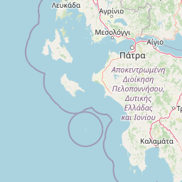
Map view of Foloi oak forest

Use this park location map to pinpoint Foloi oak forest in Greece, understand its exact geographic position, and read its mapped placement within the surrounding landscape more clearly.

Pigeon | © OpenStreetMap contributors

Location context for Foloi oak forest

Elis

Explore protected area views, woodland habitats, and mountain plateau terrain.

Foloi Oak Forest Photos and Landscape Scenery Visual Guide

Visual records capture the dense canopy, tall Hungarian oaks, and deep ravines that define the protected landscape across the mountain plateau. Examining high-resolution photography reveals the unique ecological structure and terrain features preserved within the Balkan oak woodland.

A wide, unpaved dirt path extending into the distance through a lush forest of tall, mature oak trees.

A close-up of a single purple iris flower with yellow and white striped markings on the petals, growing amongst green grass and dried oak leaves.

A close-up view of vibrant green oak leaves and two developing acorns attached to a branch.

A wide view of a sunlit oak forest with a green meadow in the foreground and a dense line of trees in the background under a blue sky with light clouds.

A straight, unpaved dirt road leads into the distance, framed by tall, mature oak trees on both sides in a dense, green woodland setting.

A dense grove of tall deciduous oak trees with light green foliage and dark trunks standing on a forest floor covered with dried, reddish-brown ferns.

A wide angle shot of a deciduous forest path covered in fallen leaves, lined with tall oak trees on both sides.

A view through a mature deciduous oak forest with a ground layer of dried ferns and fallen leaves.

A paved road stretches into the distance, framed by tall, bare-branched oak trees and rust-colored undergrowth in the Foloi oak forest.

A vertical view inside a dense oak forest with tall, slender tree trunks and a canopy of green leaves, with ferns on the forest floor.

A close up view of serrated green oak leaves hanging from a branch in a forest setting.

Eye-level view of a dense deciduous oak forest with many slender, dark-barked tree trunks standing on a leaf-covered forest floor.

A straight asphalt road extending into the distance through a dense forest of mature deciduous oak trees.

A medium distance shot of an open, deciduous oak forest with tall, dark-barked tree trunks and a canopy of green leaves, showing a flat forest floor covered in leaf litter.

A mountain bike parked on a dirt path in a deciduous oak forest during spring with light green foliage.

A wide shot looking into a dense, mature forest of tall, dark oak trees with a forest floor completely covered in fallen brown autumn leaves during an overcast day.

Park atlas

Compare regional mountain plateaus and protected woodland geography

Parks near Foloi oak forest and related protected landscapes

Browsing parks near Foloi oak forest reveals wider ecological patterns across the western Peloponnese mountain plateaus. Comparing these adjacent protected areas provides deeper geographic context for southern European broadleaf habitats.
Watercolor illustration of a mountain range with greenery and distant peaks under a light sky
Marine protected areaGreece
About 76 km away#1 closest

West

National Marine Park of Zakynthos: Detailed Protected Marine Area & Geographic Context

Mapping Zakynthos's protected marine territory and regional geography

Investigate the National Marine Park of Zakynthos, a distinguished marine protected area situated in Greece. This dedicated page provides detailed insights into its protected landscape, focusing on its mapped geographic extent and its significance within the Mediterranean. Users can explore the specific boundaries of this protected marine territory and understand its place in the wider regional geography, enhancing atlas-based discovery of Greece's conservation areas.

IUCN
II
Scope
Marine
Water
Water-dominated
A watercolor painting showing a soft, atmospheric landscape with a pink-toned lagoon in the foreground, green hills in the midground, and a hazy purple mountain in the background.
National parkGrèce-Occidentale
About 84 km away#2 closest

Northwest

Parc national de Missolonghi-Etolikó: Coastal Lagoons and Limestone Geography

Protected wetlands and river delta landscapes in Western Greece

Tracing the interface of the Acheloos and Evinos river deltas with the Ionian Sea, this national park protects a mosaic of saltpans, reedbeds, and mountain massifs. Its mapped boundaries encompass the historic Missolonghi lagoon, the vertical limestone cliffs of Mount Varasova, and rare riverine woodlands, providing a detailed look at one of the most vital wetland complexes in the Mediterranean.

Area
360.73 km²
Established
2006
IUCN
VI
A soft, watercolor painting of a mountain range in the distance, featuring a band of evergreen trees in the midground and a grassy foreground on a plain white background.
National parkGreece
About 115 km away#3 closest

Northeast

Parc national du Mont Parnasse: Mapping the Limestone Massif and Alpine Geography of Greece

A protected national park blending karst geology and mountain ecosystems.

Parc national du Mont Parnasse stands as a prominent protected landscape in Central Greece, defined by its fractured limestone geology and subalpine forests. This national park serves as a vital ecological refuge that preserves karst terrain, sinkholes, and diverse Mediterranean mountain habitats rising toward steep alpine summits.

Relief
Mountain
Climate
Mediterranean
Scope
Terrestrial
Water
Minor water
Protected areaAetolia-Acarnania
About 122 km away#4 closest

Northwest

Lake Amvrakia Protected Area: Atlas of a Tectonic Freshwater Basin in Aetolia-Acarnania

Mapped geography of a unique karstic semipolje in western Greece.

Lake Amvrakia is a distinct tectonic basin located in western Greece. This protected area represents a complex karstic landscape formed in Mesozoic limestone, supporting diverse birdlife and endemic species. The geography reveals a stark contrast between agricultural eastern shores and the preserved riparian zones of the west, marking it as a significant case of human-environment interaction in the region.

Area
13.6 km²
Relief
Lowland
Climate
Mediterranean
Access
Access unknown
A horizontal watercolor painting showing a soft mountain landscape with green forests and a central light-colored area under a pale sky.
National parkGreece
About 179 km away#5 closest

East

Parc national du Parnès: Geographic Overview of the Attica Peninsula's Protected Massif

Explore the karst gorges, high-altitude fir forests, and protected red deer habitats

Parc national du Parnès dominates the northern skyline of Attica with a complex limestone massif featuring deep ravines like the Keladonas gorge. This atlas entry provides geographic insights into the park's summit network, karst features, and its critical role in Mediterranean forest resilience. Understand the rugged terrain and natural boundaries that define this essential protected area within Greece.

Area
38.16 km²
Established
1961
Relief
Mountain
Climate
Mediterranean
National parkGreece
About 201 km away#6 closest

East

Sounio National Park: Protected Coastal Geography and Mediterranean Terrain in Greece

A rugged maritime landscape on the Attica headland

Sounio National Park occupies the dramatic southernmost tip of the Attica peninsula in Greece. The protected area features vertical limestone cliffs, scrub-covered coastal hills, and a strategic headland overlooking the Aegean. This atlas entry provides a detailed look at the park boundaries, surrounding maritime geography, and the unique integration of classical heritage sites within an exposed Mediterranean conservation zone.

Area
0.75 km²
Established
1974
Relief
Upland
Climate
Mediterranean
National parkGreece
About 207 km away#7 closest

North

Parc national de Tzoumérka-Achelóos-Ágrafa-Météores National Park: Geography and Landscape Atlas

Central Greece Pindus mountain protected wilderness zone

An extensive protected landscape bridging Thessaly and Epirus, this national park showcases the ecological and geological diversity of the central Pindus Mountains. Analyze the geographic layout of the Athamanian ranges, the Acheloos river corridor, and the unique conglomerate formations at Meteora through a detailed protected-area lens.

Area
3,379.94 km²
Established
2009
IUCN
VI
Relief
Mountain
Watercolor illustration of a coastal landscape with hills, trees, and a body of water
Marine protected areaGreece
About 232 km away#8 closest

Northeast

National Marine Park of Alonnisos Northern Sporades: Protected Marine Landscape and Aegean Geography

Explore Greece's largest marine protected area and its vital ecosystems.

Investigate the National Marine Park of Alonnisos Northern Sporades, an extensive marine protected area situated in the northern Aegean Sea. This protected landscape is internationally significant for its role in conserving the Mediterranean monk seal and for its healthy Posidonia oceanica seagrass meadows. Understanding this park's geographic scope and its protected marine terrain offers crucial insights into Mediterranean island ecosystems and conservation efforts within the region.

Area
2,260 km²
Established
1992
IUCN
II
Relief
Mixed relief

Common questions about visiting, size, designation, and location context for Foloi oak forest

Foloi oak forest FAQs for park facts, access, geography, and protected area context

Find quick answers about Foloi oak forest, including protected-area facts, park geography, trail and visitor context, and how the park fits into its surrounding country and regional landscape.
MoriAtlas Explorer

Continue Your Protected Areas Search Across the Global Atlas

Deepen your exploration by continuing the structured search for national parks and protected areas worldwide. Utilize the comprehensive filtering capabilities to compare different conservation landscapes and refine your understanding of global park geography. Discover more about the distribution and characteristics of protected natural areas.

Global natural geography