Mori Atlas logo
National parkForillon National Park

Discover the mapped boundaries and natural terrain of this national park in Quebec.

Forillon National Park: Quebec's Protected Landscape and Regional Geography Explored

(Parc national Forillon)

Forillon National Park stands as a significant protected area within Quebec, offering a distinct geographic identity for atlas-based exploration. This national park's mapped boundaries and natural landscape context provide a unique vantage point for understanding regional conservation within Canada. Explore the terrain and geography that define this protected territory, contributing valuable insights to the national atlas.

Coastal landscapesForestsMarine ecosystemsWildlife viewingWhale watchingHistorical sites

Forillon National Park

National park

Park overview

Structured park overview, official facts, and landscape profile for Forillon National Park

Forillon National Park park facts, protected area profile, and essential visitor context
Review the core facts for Forillon National Park, including designation, size, terrain, visitor scale, habitats, and operating context in one park-focused overview.

About Forillon National Park

Forillon National Park stands as a testament to Quebec's commitment to preserving its natural heritage at the eastern gateway to the province. The park occupies a strategic position at the tip of the Gaspé Peninsula, where the Appalachian mountain range descends dramatically into the Gulf of St. Lawrence. This geographical position creates a remarkable diversity of ecosystems within a relatively compact area, ranging from inland forests dominated by balsam fir and white birch to coastal environments featuring salt marshes, sand dunes, and towering sea cliffs. The landscape reflects the ancient geological history of the Appalachians, with the park protecting the eastern terminus of this mountain system that stretches southward along the North American coast. The name Forillon itself carries historical significance, referring to a distinctive sea stack that once served as a navigational landmark for maritime travelers but has since collapsed into the ocean. The park's establishment in 1970 marked a pivotal moment in Canadian conservation history as Quebec's inaugural national park, representing a new chapter in the province's approach to protected area management. Today, Forillon continues to serve as both a ecological sanctuary and a window into the cultural history of the Gaspé Peninsula, where Indigenous peoples, fishermen, and forest workers shaped the landscape over centuries.

Quick facts and research context for Forillon National Park

Forillon National Park spans 244 square kilometers along the eastern tip of Quebec's Gaspé Peninsula, where the Appalachians meet the Gulf of St. Lawrence. As Quebec's first national park, established in 1970, it protects a remarkable diversity of habitats including coastal cliffs, salt marshes, sand dunes, and Appalachian forest. The park is home to significant wildlife populations including black bears, moose, white-tailed deer, and more than 20 species of marine mammals and birds. The area holds deep cultural significance as a traditional summer hunting and fishing ground for Indigenous peoples, particularly the Mi'kmaq and Haudenosaunee. The park's creation involved significant historical controversy, including the expropriation of 225 families, for which the Canadian House of Commons issued an official apology in 2011.

Park context

Deeper park guide and search-rich context for Forillon National Park

Forillon National Park history, landscape, wildlife, and travel context
Explore Forillon National Park through its history, landscape character, ecosystems, wildlife, conservation priorities, cultural context, and seasonal travel timing in a structured park guide built for atlas discovery and search intent.

Why Forillon National Park stands out

Forillon National Park is best known for its dramatic clash of terrestrial and maritime environments at the eastern edge of the Gaspé Peninsula. The park protects a unique combination of Appalachian forest ecosystems transitioning into coastal habitats along the Gulf of St. Lawrence. Visitors are drawn to the spectacular sea cliffs, nesting seabird colonies, and the opportunity to observe whales and seals in their natural habitat. The park's cultural heritage sites, including the preserved fishing village at Grande-Grave and the World War II fortifications at Fort Péninsule, provide additional layers of historical significance. The panoramic views from Mount St. Alban offer one of the most sweeping vistas in eastern Quebec, encompassing both the park's interior forests and the open gulf waters.

Forillon National Park history and protected-area timeline

The history of Forillon National Park extends far beyond its 1970 establishment, encompassing millennia of Indigenous occupation and more recent European settlement. The area served as a traditional summer hunting and fishing ground for the Mi'kmaq and Haudenosaunee peoples, who valued the rich marine resources and abundant game of this coastal landscape. Following European colonization, the region became involved in the lumber industry, with residents of L'Anse-au-Griffon participating in timber extraction from the forests that now lie within the park boundaries. The creation of the park in 1970 represented a significant turning point, requiring the expropriation of 225 families who had lived on the land for generations. This process, managed by a private contractor on behalf of the Quebec government, reportedly involved coercive tactics that resulted in unfairly reduced settlements for many residents. The controversy surrounding these expropriations remained a significant issue for decades, eventually leading to a formal motion in the Canadian House of Commons on February 14, 2011, which issued an official apology to the affected families and their descendants. The park's cultural landscape retains physical evidence of this human history, including the preserved fishing heritage site at Grande-Grave and the Hyman Store, which offer insights into the coastal communities that once thrived in this region.

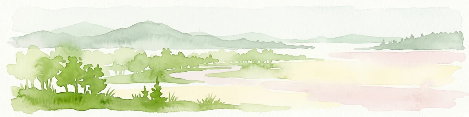
Forillon National Park landscape and geographic character

The landscape of Forillon National Park presents a striking contrast between the forested Appalachian interior and the dramatic coastal environments facing the Gulf of St. Lawrence. The park encompasses the eastern terminus of the Appalachian mountain range, where ancient hills composed of sedimentary and metamorphic rocks have been worn down over millions of years but still present a rugged terrain. Dense forests of balsam fir, white birch, and white spruce cover the inland areas, creating a backdrop of green that changes dramatically with the seasons. Along the coastline, the landscape transforms completely, with sea cliffs rising sharply from the water, salt marshes forming in sheltered coves, and sand dunes accumulating along certain stretches of shore. The most iconic geological feature is the collapsed sea stack known as Forillon, after which the park is named, though the original landmark no longer exists. The peninsula's position at the confluence of major marine ecosystems makes it a visually striking location where the vast grey waters of the gulf meet the forested land, creating panoramas that are particularly spectacular from elevated viewpoints such as Mount St. Alban. This juxtaposition of mountain and sea defines the park's visual identity and creates the diverse habitats that support both terrestrial and marine wildlife.

Forillon National Park ecosystems, habitats, and plant life

The ecological character of Forillon National Park reflects its position at the intersection of multiple habitat types, creating a surprising biodiversity for its relatively northern latitude. The park protects a transition zone where boreal forest ecosystems meet coastal marine environments, supporting species characteristic of both realms. The inland forests provide habitat for typical boreal species including moose, black bear, Canada lynx, and snowshoe hare, while the presence of white-tailed deer indicates the influence of more southerly forest types. The salt marshes and coastal areas serve as critical habitat for migratory waterfowl and support nesting colonies of seabirds that gather on the sea cliffs to breed away from terrestrial predators. The marine environment of the Gulf of St. Lawrence brings additional biodiversity, with the cold waters supporting populations of seals and cetaceans that can be observed from the shore or during whale-watching excursions. The diverse habitats within the park create ecological connectivity, allowing species to move between different environments and maintaining the health of the overall ecosystem. This combination of terrestrial and marine environments within a single protected area makes Forillon particularly valuable for conservation in the eastern Quebec region.

Forillon National Park wildlife and species highlights

Forillon National Park supports a remarkable diversity of wildlife, from large mammals roaming the forest interior to marine mammals inhabiting the coastal waters. The park's terrestrial mammalian community includes species typical of the boreal and mixed forests of eastern Canada, with black bear and moose representing the largest mammals present. Smaller mammals include red fox, coyote, Canada lynx, American mink, North American beaver, North American porcupine, and ermine. The snowshoe hare provides an important prey species for several predators, while woodchucks inhabit the more open areas. The birdlife of the park is particularly noteworthy, with the sea cliffs providing nesting habitat for colonial seabirds while the forests support a variety of songbirds and raptors. The raptor community is especially diverse, including great horned owls, northern harriers, peregrine falcons, American kestrels, bald eagles, rough-legged hawks, and ospreys. The coastal and marine environments add significantly to the park's wildlife diversity, with seals regularly hauled out on rocky shores and various whale species passing through the Gulf waters, creating exceptional opportunities for wildlife observation.

Forillon National Park conservation status and protection priorities

Forillon National Park represents a significant conservation achievement as Quebec's first national park and one of 42 national parks and park reserves across Canada. The protected status of this coastal peninsula ensures the preservation of important ecological connections between terrestrial and marine environments that would otherwise face development pressures. The park protects critical habitat for species at risk and maintains migration corridors for wildlife moving between different seasonal habitats. As part of the national parks system managed by Parks Canada, Forillon benefits from ongoing ecological monitoring, research programs, and management strategies designed to maintain biodiversity while providing opportunities for public enjoyment. The park's ecosystems face ongoing challenges related to climate change, particularly in the coastal zone where sea level rise and changing ice conditions may alter habitat availability for species dependent on current conditions. Conservation efforts within the park also consider the cultural landscape, preserving historical sites that reflect human relationship with this coastline over generations.

Forillon National Park cultural meaning and human context

The cultural context of Forillon National Park reflects a long history of human presence on the Gaspé Peninsula, beginning with Indigenous peoples who used the area as a summer hunting and fishing ground. The Mi'kmaq and Haudenosaunee communities valued the rich marine resources and the abundant game of this coastal landscape, establishing patterns of seasonal occupation that continued for centuries before European contact. The more recent cultural history includes the fishing communities that developed along the coast during the 18th and 19th centuries, leaving architectural and structural remnants that have been preserved within the park boundaries. The Grande-Grave National Heritage Site preserves the physical remains of a fishing village, while the Hyman Store provides insights into the commercial life of the early 20th century. The World War II fortifications at Fort Péninsule and Fort Prével represent a later chapter in the human history of the peninsula, built to protect British warships from potential German submarine attack had Europe fallen to Nazi Germany. The park also contains intangible cultural heritage, as evidenced by the song "Forillon" by the group Le Vent du Nord, which draws on Maurice Joncas' poem "La complainte de Forillon" to preserve the memory of the expropriated communities.

Top sights and standout views in Forillon National Park

Forillon National Park offers visitors multiple standout experiences that combine natural beauty with cultural interpretation. The panoramic view from Mount St. Alban provides one of the most spectacular vistas in eastern Quebec, encompassing the park's forested interior descending to the dramatic coastline and the open waters of the Gulf of St. Lawrence. The preserved fishing heritage at Grande-Grave National Heritage Site transports visitors to the early 20th century, allowing them to walk through restored buildings and learn about the lives of the fishing families who once lived there. Whale watching along the park's coastline offers encounters with marine mammals in their natural habitat, with several species of cetaceans regularly passing through the gulf waters. The World War II fortifications at Fort Péninsule provide a unique historical experience, with visitors able to walk through tunnels and see original cannons in place. The diverse hiking trails allow visitors to explore everything from coastal cliffs to forest interior, while the interpretation programs at various sites enrich the visitor experience with insights into both natural and cultural history.

Best time to visit Forillon National Park

The best time to visit Forillon National Park depends on what visitors hope to experience, with each season offering distinct advantages. The summer months of July and August bring the warmest temperatures and longest days, making them ideal for coastal activities, hiking, and wildlife observation. This period also corresponds with peak whale-watching season in the gulf waters, when many species are most actively feeding in the productive marine environment. Autumn in September and October offers spectacular fall foliage as the deciduous trees display their colors against the grey backdrop of the gulf, and this season often provides comfortable temperatures for hiking with fewer crowds. The shoulder seasons of late spring and early fall tend to be less busy while still offering excellent conditions for experiencing the park's landscapes. Winter visits are possible but facilities are more limited, though the snow-covered landscape offers a completely different perspective on this northern park. Visitors interested in wildlife observation should note that different species are more observable at different times of year, with migratory birds present during spring and fall and marine mammals most reliably seen during the summer months.

Park location guide

Geography guide, regional context, and park location map for Forillon National Park

Forillon National Park park geography, regions, and map view in Canada
Understand where Forillon National Park sits in Canada through a broader geographic reading of the surrounding landscape, nearby location context, and its mapped position within the national park landscape.

How Forillon National Park fits into Canada

Canada is a federal parliamentary constitutional monarchy spanning North America from the Atlantic to the Pacific and Arctic Oceans. With a population of over 41 million, it is officially bilingual in English and French at the federal level. The country gained independence from the United Kingdom through a gradual process culminating in 1982.

Wider geography shaping Forillon National Park in Canada

Canada occupies the northern portion of North America, sharing its longest international border with the United States. The country extends from the Atlantic Ocean to the Pacific Ocean and northward into the Arctic Ocean, giving it the longest coastline of any nation.

Map view of Forillon National Park

Use this park location map to pinpoint Forillon National Park in Canada, understand its exact geographic position, and read its mapped placement within the surrounding landscape more clearly.

Pigeon | © OpenStreetMap contributors

Location context for Forillon National Park

Gaspésie–Îles-de-la-MadeleineQuebec
Park atlas

Uncover the geographic context of protected areas across the Gaspé Peninsula, comparing diverse coastal and Appalachian landscapes.

Explore Nearby National Parks and Protected Areas Beyond Forillon National Park, Quebec
Explore other national parks and protected areas situated around Forillon National Park, tracing their geographic distribution across the Gaspé Peninsula and adjacent regions. This enables a rich comparative analysis of protected landscapes, highlighting how diverse coastal and Appalachian environments are conserved within a broader regional context.
National parkMinganie Regional County Municipality

Mingan Archipelago National Park Reserve: Mapped Protected Landscape

Discover its national park geography in Minganie

Mingan Archipelago National Park Reserve is a designated national park offering a distinct protected landscape within the Minganie Regional County Municipality. This entry provides core geographic context and mapped details crucial for atlas exploration. Understand the park's boundaries and its regional landscape setting for comprehensive discovery of Canada's protected natural areas.

Area
151 km²
Established
1984
IUCN
II
Visitors
44K annual
National parkNew Brunswick

Kouchibouguac National Park: New Brunswick Protected Landscape Atlas

Mapped protected area boundaries and regional geography.

Kouchibouguac National Park is a designated national park offering a rich canvas for geographic discovery. This entry focuses on understanding its protected landscape, detailing its specific mapped boundaries within New Brunswick. It serves as a vital component for atlas exploration, providing the context needed to grasp the park's natural terrain and its significance within the regional geography.

Area
238 km²
Established
1969
IUCN
II
Visitors
243.5K annual
National parkPrince Edward Island

Prince Edward Island National Park: A Mapped Protected Landscape within Canada's Maritime Region

Discover its geographic context and natural terrain.

Prince Edward Island National Park offers a distinct protected area for exploration within the Canadian Maritimes. As a national park, it represents a commitment to preserving specific natural landscapes and their geographic characteristics. This resource provides insight into its mapped boundaries, regional setting on Prince Edward Island, and its contribution to the broader atlas of protected lands.

Area
27 km²
Established
1937
IUCN
II
Relief
Lowland
National parkNova Scotia

Cape Breton Highlands National Park: Mapped Protected Landscape in Nova Scotia

Discover its national park geography and natural terrain.

Uncover the protected landscape identity of Cape Breton Highlands National Park, a national park situated in Nova Scotia. This atlas-focused content details its mapped boundaries, regional geographic context, and natural terrain. It serves as a definitive resource for understanding the park's protected-area status and its contribution to the mapped natural landscapes of the region.

Area
949 km²
Established
1936
IUCN
II
Visitors
277.2K annual
National parkNew Brunswick

Fundy National Park: New Brunswick National Park Atlas and Geographic Exploration

Mapped protected landscape and regional park context.

Fundy National Park represents a vital protected area, offering rich geographic discovery within New Brunswick, Canada. This national park detail provides context for its mapped boundaries and landscape, supporting atlas-based exploration of its regional significance. Understand Fundy National Park's protected status and its contribution to the mapped natural terrain of eastern Canada.

Area
207 km²
Established
1948
IUCN
II
Visitors
303.6K annual
National parkCanada

Gros Morne National Park: A Canadian National Park for Geographic Exploration

Discover its mapped protected boundaries and regional landscape context.

Explore Gros Morne National Park, a designated National Park within Canada, offering deep insights into its protected landscape and geographic significance. This page details its mapped boundaries and natural terrain, providing essential context for understanding its role within Canada's broader atlas of protected areas. Engage with the specific geography of this park to deepen your knowledge of natural landscapes and conservation.

Area
1,805 km²
Established
2005
IUCN
II
Relief
Mountain
Watercolor painting showing a river landscape with green trees, rolling hills, and mountains in the background
National parkNova Scotia

Kejimkujik National Park: Detailed Protected Landscape and Regional Geography

Explore mapped boundaries and geographic context in Nova Scotia.

Kejimkujik National Park offers a dedicated entry for understanding protected natural areas. As a national park in Nova Scotia, its geographic features and protected boundaries are detailed here to support atlas-based exploration. Discover the park's unique landscape context and its positioning within regional geography, providing a factual basis for comprehending its role as a conservation area.

Area
404 km²
Established
1967
IUCN
II
Visitors
75.3K annual
National parkMaine

Acadia National Park: A Protected Landscape within Maine's Regional Geography

Discover mapped boundaries and natural terrain context.

Delve into the protected landscape of Acadia National Park, a key entity within the geography of Maine. This dedicated atlas view helps you understand the park's mapped boundaries and its role within the broader regional context. Explore the natural terrain and understand how protected areas are situated geographically, enriching your understanding of conservation landscapes.

Area
198.6 km²
Established
1919
IUCN
V
Visitors
3.9M annual

Common questions about visiting, size, designation, and location context for Forillon National Park

Forillon National Park FAQs for park facts, access, geography, and protected area context
Find quick answers about Forillon National Park, including protected-area facts, park geography, trail and visitor context, and how the park fits into its surrounding country and regional landscape.
MoriAtlas Explorer

Continue Your Protected Areas Search Across the Global Atlas

Deepen your exploration by continuing the structured search for national parks and protected areas worldwide. Utilize the comprehensive filtering capabilities to compare different conservation landscapes and refine your understanding of global park geography. Discover more about the distribution and characteristics of protected natural areas.

Global natural geography