
Mori Atlas logo
Nature reserveForster Bruch

A critical ecological refuge preserving historical wet meadow terrain within the Rhineland-Palatinate agricultural mosaic.

Forster Bruch Nature Reserve: Mapping the Protected Wetland Landscapes of the Palatinate Region

(Naturschutzgebiet Forster Bruch (NSG-7300-220))

Forster Bruch stands as a significant nature reserve in the Bad Dürkheim district, protecting a vital fragment of the wet meadow belt that once stretched between the forested Haardtrand and the fertile loess plains. This site reveals a complex landscape defined by the interplay between moist grassland pockets, the historic Pfälzische Nordbahn railway embankment, and the actively managed bird sanctuary known as Vogelschutzanlage Ganswiesen. By safeguarding this distinct transition zone, the area offers a clear look at regional conservation efforts within a heavily viticultural and agricultural environment.

wet meadowFeuchtgrünlandnature reserveNaturschutzgebietRhineland-PalatinatePalatinate
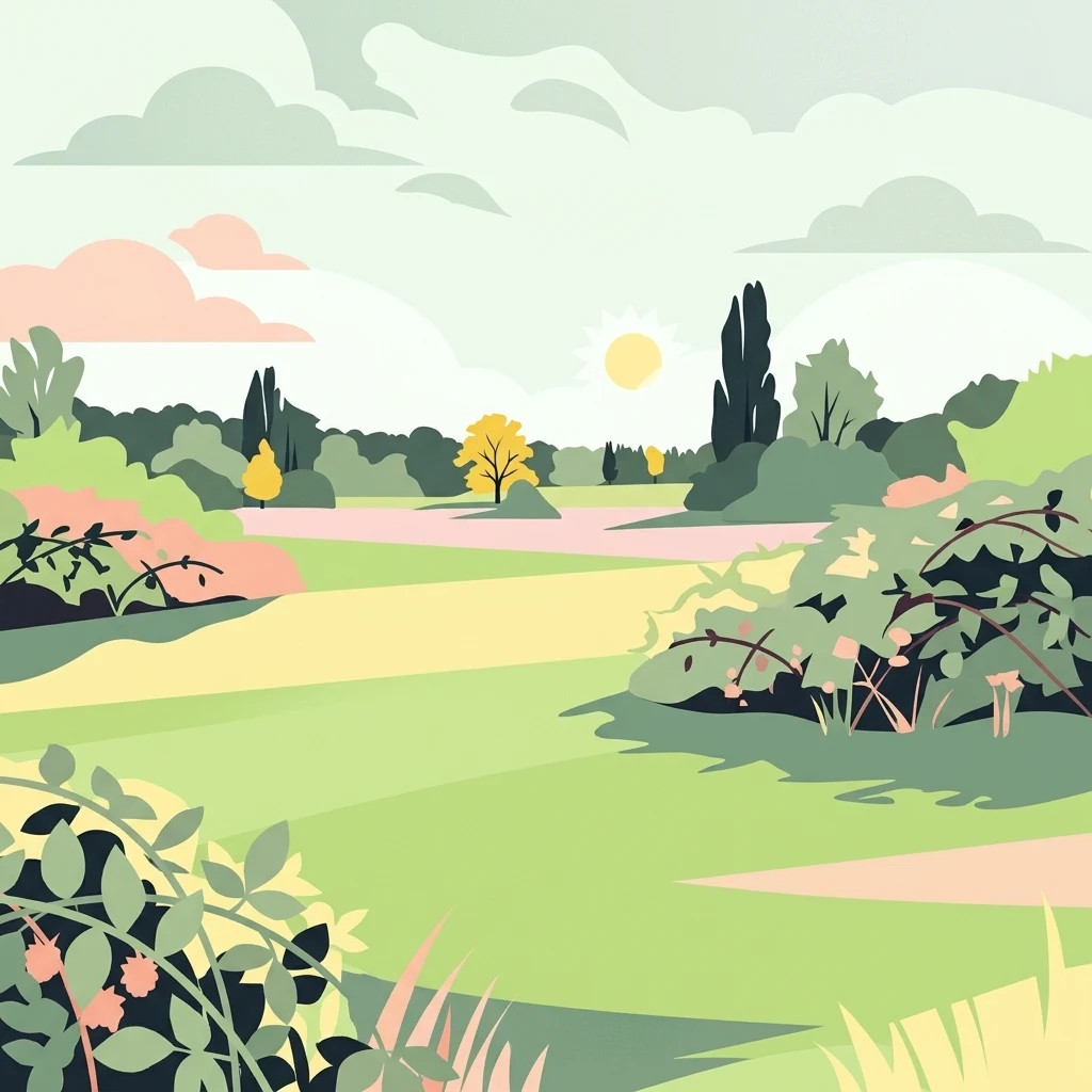
A minimalist flat illustration of a grassy meadow with bushes and distant trees under a soft sun.

Forster Bruch

Nature reserve

Park overview

Structured park overview, official facts, and landscape profile for Forster Bruch

Forster Bruch park facts, protected area profile, and essential visitor context

Review the core facts for Forster Bruch, including designation, size, terrain, visitor scale, habitats, and operating context in one park-focused overview.

About Forster Bruch

Forster Bruch is a small but ecologically focused nature reserve set in the eastern foothills of the Palatinate forest region in southwestern Germany. It lies within the Landkreis Bad Dürkheim, the heart of one of Germany's most prominent wine-producing regions, and serves as a reminder that the modern vineyard-dominated landscape of the area was once interwoven with extensive wet meadows and marshy ground. The reserve's position between the Haardtrand, the forested eastern edge of the Palatinate, and the Böhler Lößplatte, a fertile loess plateau, places it ecologically at the transition between woodland, vineyard, and traditional grassland.

Geographically, the protected area extends east of the built-up zone of Forst an der Weinstraße and reaches as far as the Bundesstraße 271. The Pfälzische Nordbahn railway line runs through the reserve, and its embankment acts as both a boundary and an internal structural feature of the habitat. The northern portion sits predominantly within Forst an der Weinstraße's municipal boundaries, while a smaller, but still meaningful, section lies within Deidesheim's territory, linking the reserve to two communities that are otherwise better known for their wine than for their conservation areas.

Ecologically, the site is valued as a representative fragment of a once-larger Feuchtgrünland, or wet meadow, system. Such meadows have been dramatically reduced across central Europe through drainage, agricultural intensification, and conversion to arable or vineyard land. By preserving a working example of this habitat, the reserve supports species and ecological processes that have largely vanished from the surrounding countryside. Its presence also complements a network of other small nature reserves along the Haardtrand, many of which protect forest and slope habitats, making Forster Bruch one of the key lowland meadow refuges in the local protected-area system.

The reserve's atmosphere is shaped by the combination of open meadow, scattered wetland vegetation, and infrastructure edges along the railway and road. The Vogelschutzanlage Ganswiesen, a separately designated natural monument inside the protected zone, signals the site's importance for birds and gives it a stronger identity as a piece of living conservation infrastructure rather than a purely passive protected landscape. Together, these characteristics make Forster Bruch a meaningful, if compact, element of Rhineland-Palatinate's protected-area network.

Quick facts and research context for Forster Bruch

Forster Bruch is a German nature reserve (Naturschutzgebiet) in the Landkreis Bad Dürkheim, Rhineland-Palatinate. The full protected area covers roughly 49 hectares and falls mostly within the municipal area of Forst an der Weinstraße, with a smaller portion belonging to the town of Deidesheim. It was first designated as a landscape protection area (Landschaftsschutzgebiet) on 7 September 1982 over 30 hectares and was elevated to a stricter nature reserve status by ordinance on 15 September 2008, at which point its area was expanded. The site is classified as an IUCN Category IV Habitat/Species Management Area and is recorded in the World Database on Protected Areas under WDPA ID 555514064. It protects a fragment of historical wet meadow landscape between the Haardtrand and the Böhler Lößplatte, and contains within it the natural monument Vogelschutzanlage Ganswiesen.

Protection and recognition

Documented terrestrial conservation metrics and official designation history

Forster Bruch Protection Status and Designated Area Records

Forster Bruch maintains a recorded terrestrial protection status established in two thousand eight within international conservation datasets. Official designation records outline the management scope and registry history for this protected landscape.

Protection details

Protection scope
Terrestrial
Designated year
2008
Transboundary protection
No
WDPA ID
555514064
Park context

Deeper park guide and search-rich context for Forster Bruch

Forster Bruch history, landscape, wildlife, and travel context

Explore Forster Bruch through its history, landscape character, ecosystems, wildlife, conservation priorities, cultural context, and seasonal travel timing in a structured park guide built for atlas discovery and search intent.

Why Forster Bruch stands out

Forster Bruch is best known for protecting a surviving remnant of the wet grassland landscape that historically ran along the lower edge of the Palatinate forest between the Haardtrand and the fertile loess plateau near Deidesheim. Its identity is shaped by the contrast between this open, moisture-dependent meadow habitat and the surrounding intensively used agricultural and viticultural land. The reserve is also notable for integrating the Vogelschutzanlage Ganswiesen, a protected bird sanctuary that reinforces its role as a refuge for meadow and wetland birdlife in an otherwise heavily cultivated district.
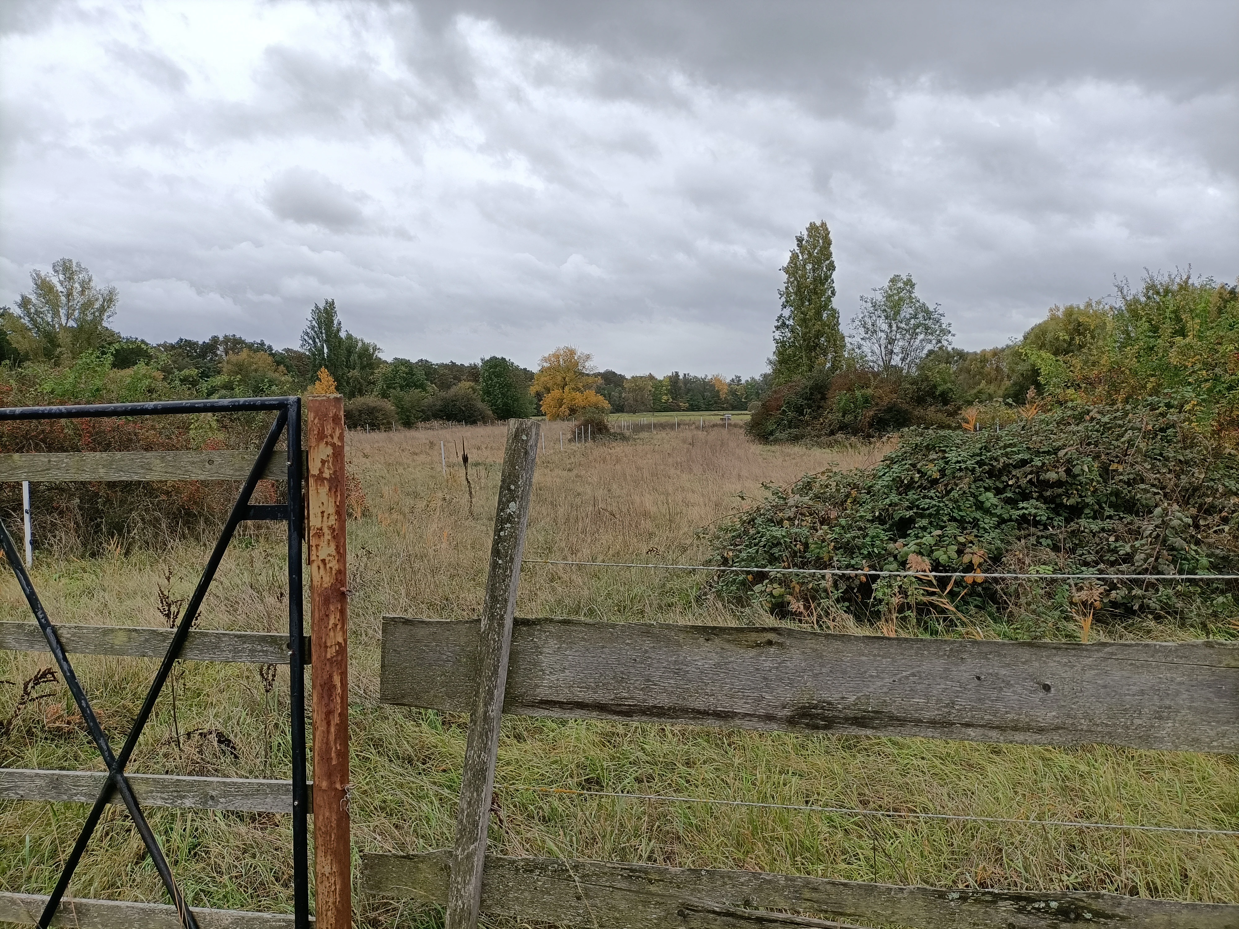
An eye level shot of a flat, grassy nature reserve field bordered by a wooden fence and a black metal gate in the foreground, with trees and shrubs in the distance under a cloudy sky.
A view across the wet grasslands of the Forster Bruch nature reserve.

Forster Bruch history and protected-area timeline

The conservation history of Forster Bruch began on 7 September 1982, when an initial 30-hectare portion of the area was designated as a Landschaftsschutzgebiet, or landscape protection area, under the designation 07-LSG-7332-012. This first designation recognized the cultural and ecological value of the wet meadow landscape at a time when such habitats were already under significant pressure from agricultural change across the region.

The site was given stronger legal protection on 15 September 2008, when a new ordinance elevated it to the status of a Naturschutzgebiet, a stricter nature reserve category in German conservation law. Under this new designation, the protected area was significantly expanded from its original 30 hectares to approximately 49 hectares, consolidating the landscape protections and providing a more coherent habitat block. The reserve received the official identifier NSG-7300-220, still in use today, and was registered internationally in the World Database on Protected Areas under WDPA ID 555514064. It is classified under IUCN Category IV as a Habitat/Species Management Area.

In 2022, the older landscape protection area ordinance was formally repealed, reflecting the modern reality that the stricter nature reserve status had superseded the earlier designation. Throughout these administrative changes, the underlying conservation purpose remained consistent: to preserve a representative fragment of the historic Palatinate wet meadow landscape that once stretched between the Haardtrand forest edge and the surrounding agricultural plateau.

Forster Bruch landscape and geographic character

The landscape of Forster Bruch is defined by its position at the transition between the wooded slopes of the Palatinate and the open agricultural lowlands of the middle Rhine region. The terrain consists of flat to gently undulating ground, shaped by the moist conditions that once supported the wider Feuchtgrünland, or wet meadow, system. To the west rises the Haardtrand, the forested edge of the Palatinate, while to the east the land drops toward the loess-rich Böhler Lößplatte, one of the most agriculturally productive and vineyard-dominated surfaces in Rhineland-Palatinate.

The reserve itself is open in character, dominated by meadow vegetation rather than forest, which gives it a distinctly different feel from the wooded reserves typical of the Palatinate forest. The Pfälzische Nordbahn embankment passes through the area, introducing a strong linear feature that structures the site and creates drier elevated margins alongside the wetter central stretches. The nearby Bundesstraße 271 forms a clear southern and eastern boundary, emphasizing the reserve's role as a refuge bordered and constrained by transport infrastructure.

Seen in regional context, the Forster Bruch today represents only a fraction of the original wet meadow belt that once characterized this transition zone. The surviving mosaic of damp grassland, small wetland features, and infrastructural edges gives the reserve an unusual landscape character that contrasts sharply with the surrounding vineyards, fields, and forest slopes, making it a visually distinctive as well as ecologically distinctive protected site.

Forster Bruch ecosystems, habitats, and plant life

Ecologically, Forster Bruch preserves a representative example of Feuchtgrünland, the wet meadow habitat that was once widespread along the lower edge of the Palatinate forest. Such habitats are shaped by a combination of high groundwater, periodic flooding or saturation, and traditional management practices like late mowing, all of which support distinctive plant communities. The reserve acts as a refuge for this habitat type in a region where it has otherwise been almost entirely displaced by drainage and conversion to arable land or vineyards.

The habitat mosaic within the reserve is shaped both by natural moisture gradients and by the human-made features that cross it. The railway embankment of the Pfälzische Nordbahn creates drier, elevated microhabitats along its length, providing structural variation that contrasts with the wetter central areas. The result is a small but ecologically layered site in which open meadow, damp ground, and transitional marginal habitats occur in close proximity.

Forster Bruch wildlife and species highlights

The wildlife significance of Forster Bruch is closely tied to its character as one of the few surviving wet meadow habitats in the district and to the presence of the Vogelschutzanlage Ganswiesen, a designated natural monument within the reserve dedicated specifically to bird protection. This integrated bird sanctuary reinforces the site's role as a refuge for meadow and wetland-associated bird species that have lost much of their natural habitat in the surrounding agricultural and vineyard landscape.

The combination of open grassland, damp ground, and infrastructure edges along the railway and road creates a varied microhabitat structure that supports a range of birdlife and other animal species typical of lowland Palatinate meadows. Although the reserve is small, the persistence of this habitat mosaic and the formal protection of its bird sanctuary component give it a meaningful role in maintaining local biodiversity.

Forster Bruch conservation status and protection priorities

Forster Bruch holds clear conservation significance because it maintains a habitat type that has been largely lost from the surrounding landscape. The wet meadows it protects were once part of a much more extensive ecological system that connected the forested Haardtrand with the open Böhler Lößplatte, but decades of drainage, agricultural intensification, and viticultural expansion have reduced this habitat to isolated fragments. By safeguarding a coherent example of the Feuchtgrünland, the reserve contributes to the broader preservation of meadow-dependent species and ecological processes in Rhineland-Palatinate.

The reserve's international recognition as an IUCN Category IV Habitat/Species Management Area and its inclusion in the World Database on Protected Areas frame its local importance within a wider conservation framework. Its strict protection as a Naturschutzgebiet, replacing the earlier landscape protection area designation, reflects a stronger commitment to active habitat management rather than purely scenic protection. The embedded Vogelschutzanlage Ganswiesen adds a targeted, species-focused layer to this protection. Together, these designations mark Forster Bruch as a small but well-integrated element of the protected-area network along the eastern edge of the Palatinate forest.

Forster Bruch cultural meaning and human context

Although Forster Bruch is primarily valued for its ecological character, its cultural setting is closely tied to the wine-producing identity of the Landkreis Bad Dürkheim and the communities of Forst an der Weinstraße and Deidesheim, both of which are renowned for their viticulture. The reserve sits as a green contrast within a cultural landscape otherwise dominated by vineyards, orchards, and small historic villages, and its survival reflects the gradual recognition that traditional agricultural landscapes also depend on preserved non-cultivated habitats.

The Pfälzische Nordbahn railway, which runs through the reserve, adds another cultural layer, linking the site to the broader historical infrastructure of the Palatinate. Together, these features place the nature reserve within a regionally distinctive cultural framework where wine, forest, agriculture, and traditional transport routes all converge.

Top sights and standout views in Forster Bruch

Forster Bruch stands out for preserving a rare fragment of historical Palatinate wet meadow habitat within a district otherwise shaped by vineyards and intensive agriculture. Its position between the Haardtrand forest and the Böhler Lößplatte gives it a transitional ecological identity, reinforced by the structural contrast between the Pfälzische Nordbahn embankment and the open meadow areas. The inclusion of the Vogelschutzanlage Ganswiesen as a natural monument dedicated to bird protection elevates the site from a generic meadow reserve to an actively managed bird-focused habitat. Its progression from a 1982 landscape protection area to a 2008 nature reserve, with later repeal of the older ordinance in 2022, also reflects a clear trajectory of strengthening conservation commitment in this part of Rhineland-Palatinate.

Best time to visit Forster Bruch

Because Forster Bruch is a meadow-based wetland reserve, late spring and early summer are generally the most expressive time to experience the area, when wet grassland vegetation is most developed and meadow birdlife is at its peak activity. Late summer and early autumn can also be rewarding, with mature grasses, autumnal seed heads, and migratory bird presence shaping the atmosphere of the reserve. The surrounding vineyards near Forst an der Weinstraße and Deidesheim add seasonal character through the agricultural cycle of the Palatinate, making the reserve a particularly fitting stop for visitors interested in the interplay between traditional wine country and surviving natural habitats. Visitors should be aware that the site is a working nature reserve, and its character is defined by quiet observation rather than active visitor infrastructure.


Monthly climate preview

Long-term representative measurements and monthly weather patterns in Rheinland-Pfalz

Forster Bruch Climate Normals: Annual Temperature and Precipitation Rhythm

Representative coordinate records show measured monthly temperature variation alongside consistent precipitation values across the year at Forster Bruch. Reviewing the complete twelve-month climatology profile provides deeper analytical insight into long-term environmental patterns.
Annual mean10 °C
0 °C20 °C
Jan
Feb
Mar
Apr
May14°
Jun18°
Jul20°
Aug20°
Sep15°
Oct10°
Nov
Dec
Warmest month
July

20.4 °C

Coolest month
January

0.3 °C

Wettest month
July

2.2 mm/day

Driest month
April

1.4 mm/day

Park location guide

Geography guide, regional context, and park location map for Forster Bruch

Forster Bruch park geography, regions, and map view in Germany

Understand where Forster Bruch sits in Germany through a broader geographic reading of the surrounding landscape, nearby location context, and its mapped position within the national park landscape.

How Forster Bruch fits into Germany

Germany is a federal republic in Western and Central Europe with a population of over 83 million across sixteen constituent states. It is Europe's largest economy by nominal GDP and a major global exporter and importer. The capital is Berlin, and the country borders Denmark, Poland, Czech Republic, Austria, Switzerland, France, Luxembourg, Belgium, and the Netherlands.

Wider geography shaping Forster Bruch in Germany

Germany is located in Western and Central Europe, spanning 357,022 km². It borders Denmark to the north, Poland and the Czech Republic to the east, Austria and Switzerland to the south, and France, Luxembourg, Belgium, and the Netherlands to the west. The country has coastlines on the Baltic Sea and North Sea to the north, with the Alps located in the southern region.

Map view of Forster Bruch

Use this park location map to pinpoint Forster Bruch in Germany, understand its exact geographic position, and read its mapped placement within the surrounding landscape more clearly.

Pigeon | © OpenStreetMap contributors

Location context for Forster Bruch

Rheinland-Pfalz

Visual reference guide examining the wet meadow terrain, railway margins, and habitat character of this Palatinate nature reserve.

Forster Bruch Photos, Landscape Scenery, and Protected Wetland Views

Visual records capture the open grassland terrain and moisture-dependent habitats defining Forster Bruch between the forested Haardtrand and cultivated lowlands. Detailed photography reveals the ecological character and landscape boundaries of this protected wet meadow remnant in Rhineland-Palatinate.

An eye level shot of a flat, grassy nature reserve field bordered by a wooden fence and a black metal gate in the foreground, with trees and shrubs in the distance under a cloudy sky.

Park atlas

Compare nearby reserves and wetland habitats across the Palatinate region

Explore Parks Near Forster Bruch and Surrounding Protected Landscapes

Discover other protected areas near Forster Bruch to examine related wet meadow habitats and regional conservation networks. Expanding the geographic scope reveals how similar reserves maintain ecological connectivity along the forest transition zone.
A soft, light watercolor painting of a rolling rural landscape featuring rows of vineyards in the foreground and tree-covered hills in the distance.
Nature reserveRheinland-Pfalz
About 0.4 km away#1 closest

Southeast

Haardtrand Nature Reserve: Geographic Overview and Protected Landscape Mapping

Bird protection area within the Rheinland-Pfalz region.

Spanning roughly 14,700 hectares, Haardtrand serves as a critical link between the Palatinate Forest and the Rhine valley. This nature reserve is composed of a distinctive mosaic of habitat types, including mature broadleaf woodlands, traditional orchard meadows, and sandy terraces, which together create a highly structured environment for diverse raptors and forest-dwelling bird species.

Area
147.28 km²
Established
2004
A minimalist watercolor illustration featuring a soft, light-toned marsh landscape with green trees, reeds, and rolling hills in the background.
Nature reserveLandkreis Bad Dürkheim
About 4.8 km away#2 closest

Northeast

Dürkheimer Bruch: An Ecological Mosaic in the Palatinate Landscape of Germany

A protected Natura 2000 wetland and salt meadow reserve

Dürkheimer Bruch features a finely textured lowland mosaic of wet meadows, streams, and shrubs. This nature reserve, located within the broader geography of Landkreis Bad Dürkheim, is notable for its rare inland salt meadows and its critical role in supporting protected bird species and wetland fauna.

Area
6.98 km²
Established
2005
IUCN
IV
Relief
Lowland
A horizontal watercolor illustration depicting a calm lake with grassy foreground reeds and distant soft purple hills under a clear sky.
Nature reserveRhineland-Palatinate
About 6.8 km away#3 closest

South

Mußbacher Baggerweiher Nature Reserve in the Rhineland-Palatinate Protected Landscape Atlas

Wetland habitat mosaic and post-industrial geography

Mußbacher Baggerweiher stands as a textbook example of industrial recovery, where a former extraction site for motorway construction transformed into a thriving protected wetland. Situated in the eastern reaches of Neustadt an der Weinstraße, the reserve offers a dense mosaic of shoreline habitats, sheltered water, and small islands that contribute significantly to regional conservation in the Upper Rhine Plain.

Area
0.205 km²
Established
1989
A watercolor painting showing a soft, panoramic landscape of rolling hills, scattered trees, and grassland on a white background.
Nature reserveRhineland-Palatinate
About 8.5 km away#4 closest

North

Felsenberg-Berntal Nature Reserve: Mapped Protected Landscapes in Rhineland-Palatinate

Geographic analysis of dry grasslands and forest transition zones.

Felsenberg-Berntal is a distinguished nature reserve that defines the transition from forested uplands to open vine country. This site preserves unique limestone and tertiary rock formations that host steppe-like vegetation and diverse insect populations, serving as a landmark example of ecological restoration in the Haardtrand region of western Germany.

Area
3 km²
Established
2000
IUCN
IV
Relief
Upland
Nature reserveRheinland-Pfalz
About 10 km away#5 closest

Southwest

Naturschutzgebiet Am Wolfsberg: Protected Nature Reserve and Botanical Landscape Atlas

Ecological terrain and geological layers in the Palatinate Forest

Naturschutzgebiet Am Wolfsberg is a specialized nature reserve in Rheinland-Pfalz, characterized by its steep, sun-exposed sandstone slopes and rare dry grassland vegetation. This protected area serves as an essential site for studying submediterranean flora and the interplay between historical quarry workings and forest ecosystems. The reserve provides a distinct glimpse into the climatic and geological variety of the Haardt massif.

Area
0.03 km²
Established
1984
Relief
Mountain
Climate
Temperate
Watercolor painting of a rolling landscape with green fields, forested hills in the distance, and soft hazy lighting.
Nature reserveRheinland-Pfalz
About 10 km away#6 closest

West

Drachenfels Nature Reserve: Geography and Protected Landscapes of the Palatinate Forest

A sandstone summit and protected ecosystem in Rheinland-Pfalz

The Drachenfels massif is a classic blocky sandstone summit located in the Palatinate Forest, characterized by its 13-hectare protected summit plateau and weathered rock outcrops. This area provides a look into the region's complex sedimentary history, where Bunter sandstone cliffs meet dense forest slopes. The site serves as a distinct landmark within the broader landscape of the Middle Palatinate Forest, showcasing geological features and natural terrain patterns that define the local environment.

Area
0.125 km²
Established
1972
Relief
Mountain
Climate
Temperate
A horizontal watercolor painting showing a stylized, soft-focus forest landscape with green trees against a pale, warm-toned ground.
Protected areaRhineland-Palatinate
About 11 km away#7 closest

Southeast

Speyerer Wald: Protected Alluvial Forest and Inland Sand Dune Landscape

Regional geography and protected area context in Rhineland-Palatinate.

Speyerer Wald offers a look into the formation of Rhine Plain alluvial fans and the survival of forest ecosystems on poor, sandy soils. This protected expanse showcases the intersection of inland dunes, dry sand grasslands, and riparian stream corridors. It serves as a key case study in regional landscape evolution, highlighting how ice age deposits continue to dictate current habitat distribution and nature conservation priorities.

Established
1981
Relief
Lowland
Climate
Temperate
Access
Easy access
A minimalist watercolor illustration of a wetland scene with soft green hills in the distance, a central water body, and faint pink and green vegetation in the foreground against a white background.
Protected areaRhineland-Palatinate
About 13 km away#8 closest

East

Maudacher Bruch: Protected Wetland and Historical Meander in Rhineland-Palatinate

Mapping the urban marshes and meadows of Ludwigshafen

Maudacher Bruch is a significant protected area in Rhineland-Palatinate, defined by its origin as an ancient silted-up meander of the River Rhine. This horseshoe-shaped landscape sustains diverse wetland habitats and serves as a natural counterpoint to the surrounding industrial city. Explore its complex geography, from the central marshland meadows and ponds to the elevated views across the Upper Rhine Plain.

Area
5.23 km²
Relief
Lowland
Climate
Temperate
Access
Easy access

Common questions about visiting, size, designation, and location context for Forster Bruch

Forster Bruch FAQs for park facts, access, geography, and protected area context

Find quick answers about Forster Bruch, including protected-area facts, park geography, trail and visitor context, and how the park fits into its surrounding country and regional landscape.
MoriAtlas Explorer

Continue Your Protected Areas Search Across the Global Atlas

Deepen your exploration by continuing the structured search for national parks and protected areas worldwide. Utilize the comprehensive filtering capabilities to compare different conservation landscapes and refine your understanding of global park geography. Discover more about the distribution and characteristics of protected natural areas.

Global natural geography