

Mori Atlas logo
National parkGalápagos National Park

Discover mapped park boundaries, unique landscapes, and global geographic significance of the Galápagos Islands.

Galápagos National Park: Protected Volcanic Archipelago & Evolutionary Atlas

Galápagos National Park represents a critical protected landscape within the remote Galápagos Islands archipelago, a globally recognized natural laboratory for evolutionary studies. This national park safeguards approximately 97% of the land area, showcasing unique volcanic terrain and unparalleled endemic biodiversity that has developed in isolation. Understanding this protected region through detailed maps and geographic context reveals its profound importance as a living testament to ecological processes and evolutionary science.

volcanic islandsendemic speciesUNESCO World Heritage Sitemarine protected areaevolutionisland ecosystem
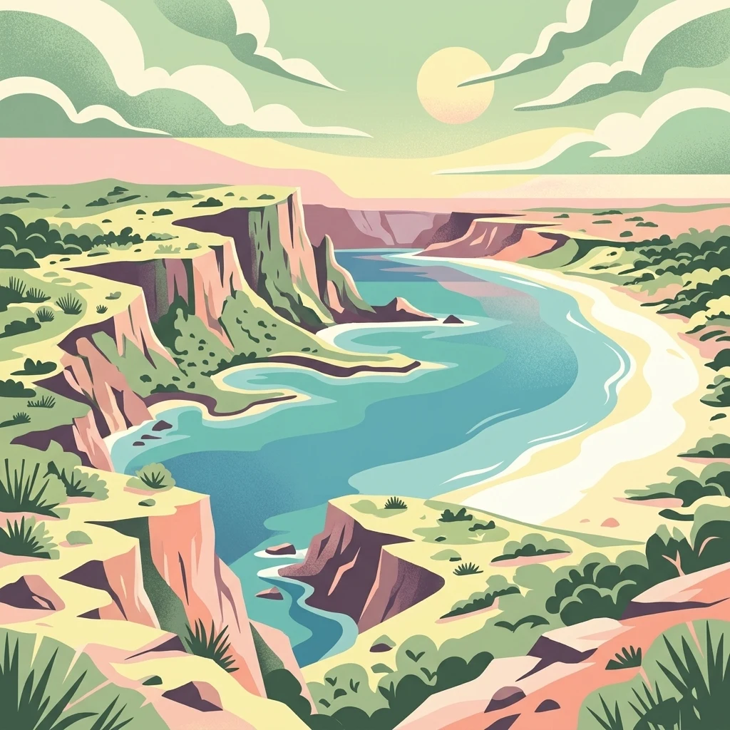
Illustration of cliffs, blue water, sandy beach, and green vegetation under a partly cloudy sky with the sun

Galápagos National Park

National park

Park overview

Structured park overview, official facts, and landscape profile for Galápagos National Park

Galápagos National Park park facts, protected area profile, and essential visitor context

Review the core facts for Galápagos National Park, including designation, size, terrain, visitor scale, habitats, and operating context in one park-focused overview.

About Galápagos National Park

Galápagos National Park represents one of the world's most significant protected areas, encompassing the majority of the Galápagos archipelago that remains one of the few remaining relatively pristine island ecosystems on the planet. The park protects not only terrestrial environments but works in concert with the surrounding marine waters designated as the Galápagos Marine Reserve, creating an integrated conservation framework for the entire archipelago. The islands' geological youth and continued volcanic activity provide ongoing opportunities to observe ecological succession and island formation processes. The park's management operates through the Galápagos National Park Service, which coordinates conservation activities, visitor access, and scientific research programs. Visitor access is carefully regulated to minimize human impact while allowing people to experience the islands' extraordinary natural values, with designated trails and visitor zones protecting sensitive areas.

Quick facts and research context for Galápagos National Park

The park covers roughly 7,995 square kilometers across the Galápagos archipelago, protecting a chain of volcanic islands formed from hotspot volcanism. The islands feature dramatic terrain ranging from recent lava fields to older highlands with cloud forests. Seven distinct vegetation zones have been identified across the islands, from coastal littoral zones through arid lowlands to humid highland forests dominated by Scalesia trees. The protected area also encompasses surrounding marine waters through the adjacent Galápagos Marine Reserve, created in 1986.

Protection and recognition

Tracking documented terrestrial boundaries and official UNESCO Biosphere Reserve designation

Galpagos National Park Protection Status and International Recognition

Comprehensive mapping of Galpagos National Park reveals a terrestrial protection scope designed to safeguard critical equatorial island geography. Reviewing established conservation frameworks and official UNESCO Biosphere Reserve designations provides essential context for geographic research and regional park exploration.

International recognition

Protection details

Protection scope
Terrestrial
Designated year
1984
Transboundary protection
No
Core area
8,997.07 km²
Buffer area
498.16 km²
Park context

Deeper park guide and search-rich context for Galápagos National Park

Galápagos National Park history, landscape, wildlife, and travel context

Explore Galápagos National Park through its history, landscape character, ecosystems, wildlife, conservation priorities, cultural context, and seasonal travel timing in a structured park guide built for atlas discovery and search intent.

Why Galápagos National Park stands out

Galápagos National Park is best known for its extraordinary endemic wildlife that inspired Charles Darwin's theory of natural selection. The islands host unique species found nowhere else on Earth, including the giant Galápagos tortoise, marine iguana (the only sea-going lizard in the world), flightless cormorant, and numerous finch species that demonstrate adaptive radiation. The park's volcanic landscapes, with active and dormant volcanoes creating dramatic backdrops, combine with remarkably approachable wildlife that has evolved without fear of humans.
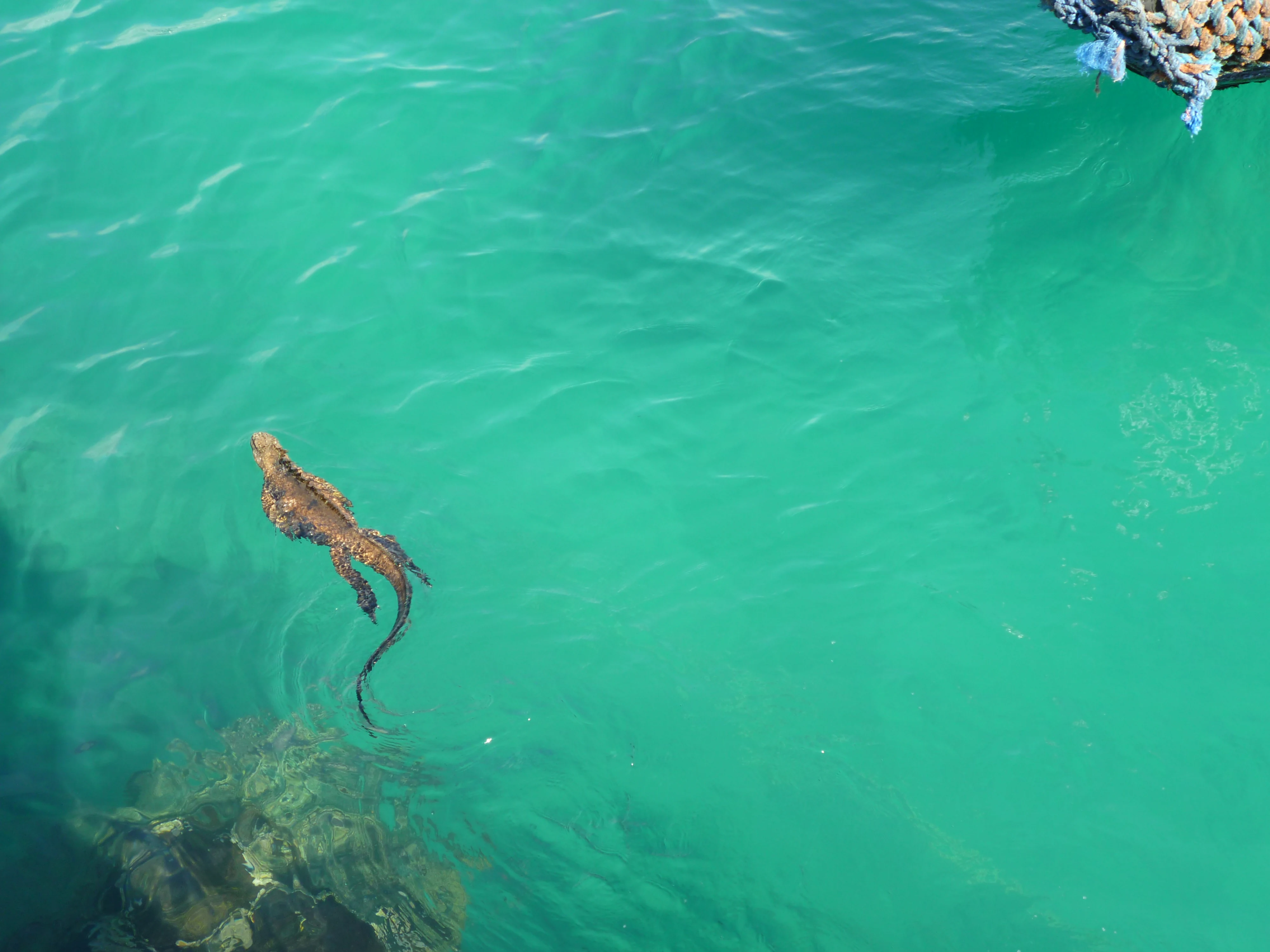
Marine iguana (Amblyrhynchus cristatus) swimming in clear turquoise water with rocky seabed visible
Marine iguana swimming in turquoise water near rocky shoreline

Galápagos National Park history and protected-area timeline

The Galápagos Islands were first protected as a national park in 1959, making this Ecuador's first national park and one of the earliest protected areas in South America. The park officially began operations in 1968, with initial management focusing on establishing boundaries and basic protection measures. In 1971, the park service had its first Superintendent along with a small team of rangers based on Santa Cruz Island. By 1974, the first formal management plan was developed, expanding the ranger force to 40 personnel. The Charles Darwin Research Station, established on Santa Cruz, became a key partner in scientific research and conservation programs, particularly giant tortoise breeding efforts. UNESCO declared the islands a Natural Heritage for Humanity in 1979, elevating international recognition of their irreplaceable value. In 1986, the Galápagos Marine Reserve was created to protect surrounding waters. The park was added to UNESCO's List of World Heritage Sites in Danger in 2007 due to increasing pressures from development, tourism, and invasive species, prompting enhanced conservation measures.

Galápagos National Park landscape and geographic character

The Galápagos Islands consist of 19 volcanic islands rising from the Pacific Ocean floor, formed through hotspot volcanic activity over millions of years. The landscape is dominated by volcanic terrain ranging from recent black lava fields to older, eroded volcanic peaks. Many islands feature dramatic caldera formations and volcanic craters. The islands display stark contrasts between young volcanic terrain with minimal vegetation and older islands with developed soil and lush highland forests. Coastal areas feature beaches ranging from white coral sands to black volcanic sand beaches, with dramatic cliff formations and rocky shores. The island chain straddles the equator, creating unique climatic patterns with distinct wet and dry seasons. Elevations range from sea level to over 1,700 meters on Isabela Island's Wolf Volcano.
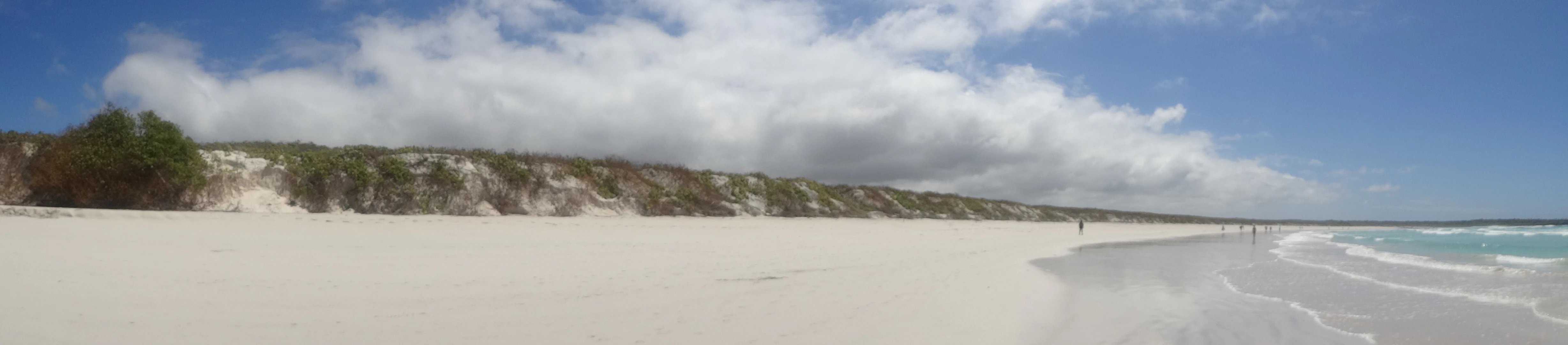
Wide sandy beach with turquoise ocean waves, white clouds in blue sky, and sparse coastal vegetation on the horizon
Panoramic view of Tortuga Bay beach and Pacific Ocean

Galápagos National Park ecosystems, habitats, and plant life

The Galápagos ecosystem represents a remarkable example of isolated evolution, with species arriving over millions of years and adapting to specific island conditions. Seven distinct vegetation zones have been identified across the archipelago, distributed according to altitude and moisture availability. The littoral zone along coastlines features mangroves and salt-tolerant vegetation. The arid lowland zone dominates lower elevations with drought-tolerant plants. The transition zone provides intermediate conditions with greater epiphyte and lichen diversity. The Scalesia zone, occurring between 300-500 meters, features forests dominated by the endemic Scalesia trees, closely related to the sunflower family. Above this, the Parda zone and higher humid zones host increasingly dense vegetation including ferns and mosses. The unique vegetation patterns reflect both the islands' geological age differences and varied precipitation patterns.
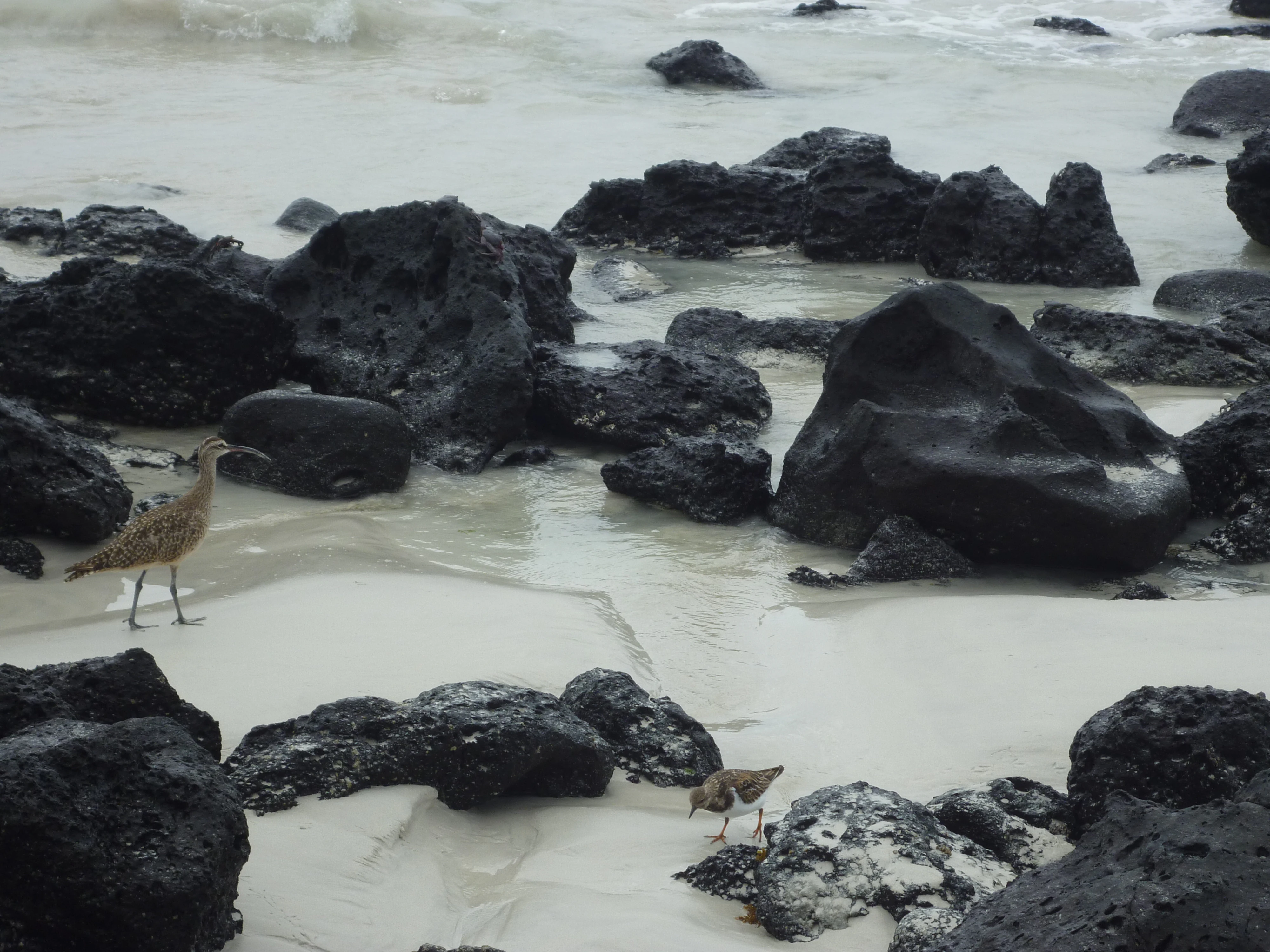
Two birds walking on a sandy beach with dark volcanic rocks and shallow water
Whimbrel and Ruddy Turnstone birds on volcanic rocks at Tortuga Bay beach

Galápagos National Park wildlife and species highlights

Galápagos wildlife is extraordinary for its high degree of endemism and remarkable adaptations. The iconic Galápagos tortoise, the largest living tortoise species, inhabits several islands with distinct shell variations between populations. The marine iguana represents the only lizard species that regularly feeds in the sea, diving to graze on underwater algae. Land iguanas, including the distinctive yellow land iguana, inhabit multiple islands. The islands support endemic bird species including the flightless cormorant, the only cormorant that has lost the ability to fly, as well as numerous finch species that demonstrated adaptive radiation to Darwin. Marine life includes significant populations of scalloped hammerhead sharks, sea lions, and numerous fish species. The wildlife's remarkable tameness results from evolutionary absence of terrestrial mammalian predators.
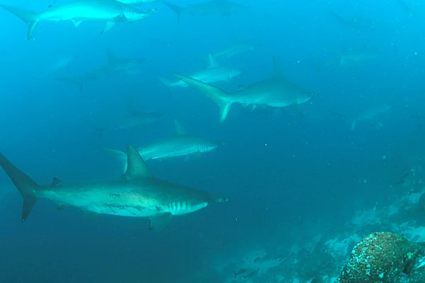
Underwater scene showing multiple hammerhead sharks swimming in blue water with rocky seabed in background
School of hammerhead sharks swimming in the ocean near Wolf Island

Galápagos National Park conservation status and protection priorities

Galápagos National Park faces significant conservation challenges despite its protected status. Invasive species pose the greatest threat, with introduced plants, insects, and animals competing with native and endemic species. The park was placed on UNESCO's World Heritage in Danger list in 2007 due to pressures from immigration, tourism, and the associated risk of invasive species introduction. Conservation programs focus on invasive species eradication, particularly on islands where introduced vertebrates threaten native wildlife. Giant tortoise conservation programs have proven successful, with captive breeding and head-starting programs restoring populations to multiple islands. The park works with Conservation International and other partners on biosecurity measures and ecosystem restoration. The integration of marine protection through the adjacent marine reserve creates a more comprehensive conservation framework for the entire archipelago ecosystem.

Galápagos National Park cultural meaning and human context

The Galápagos Islands hold profound scientific significance as the location where Charles Darwin developed his theory of evolution following his 1835 visit aboard HMS Beagle. The islands' name derives from the Spanish word for saddle, referring to the shape of the giant tortoise shells. The archipelago has been inhabited by humans only relatively recently, with the first permanent settlements established in the 19th century. The current human population remains concentrated in a few areas representing about 3% of the total land area, primarily on Santa Cruz, San Cristóbal, and Isabela islands. Traditional fishing and tourism now form the basis of local economies. The islands' cultural heritage includes both the scientific legacy of Darwin's research and the more recent human history of settlement and resource use.

Top sights and standout views in Galápagos National Park

The park offers visitors extraordinary encounters with wildlife found nowhere else on Earth, from giant tortoises roaming freely to marine iguanas basking on coastal rocks. Tortuga Bay provides one of the most accessible and beautiful beaches, requiring a walk through arid zone terrain to reach its sheltered cove where white-tip reef sharks and marine life are commonly observed. The diverse vegetation zones, ranging from coastal mangroves to cloud forest, can be experienced on trails across multiple islands. The volcanic landscapes provide hiking opportunities on both dormant and recently active volcanoes, with dramatic craters and lava formations. The underwater experience through snorkeling reveals the marine iguana's unique sea-feeding behavior and diverse marine life.

Best time to visit Galápagos National Park

The Galápagos can be visited year-round, though different seasons offer distinct experiences. The warm season from December through May brings higher temperatures, calmer seas, and clearer water for snorkeling, with the ocean surface often calmer for boat travel. The garúa season from June to November brings cooler temperatures, more frequent mist in the highlands, and rougher sea conditions but tends to bring more marine life activity, including the arrival of migratory species. Wildlife viewing remains excellent throughout the year, though animal behavior varies with seasonal changes. The dry season often brings more active wildlife in the lowlands as water sources become limited, while the wet season promotes lush vegetation in the highlands.

Monthly climate preview

Long term weather by month averages and coastal precipitation cycles across the archipelago

Galápagos National Park Climate Normals and Average Temperature Patterns

Long-term meteorological records at the representative coastal coordinate show a tropical maritime cycle where average temperatures fluctuate between 21 and 26 degrees Celsius. Accessing the complete twelve-month profile highlights the gradual transition in precipitation from wetter equatorial months to prolonged dry intervals.
Annual mean24 °C
22 °C26 °C
Jan25°
Feb26°
Mar26°
Apr26°
May25°
Jun24°
Jul23°
Aug22°
Sep22°
Oct22°
Nov23°
Dec24°
Warmest month
March

26.4 °C

Coolest month
September

21.8 °C

Wettest month
February

2.4 mm/day

Driest month
September

0.2 mm/day

Park location guide

Geography guide, regional context, and park location map for Galápagos National Park

Galápagos National Park park geography, regions, and map view in Ecuador

Understand where Galápagos National Park sits in Ecuador through a broader geographic reading of the surrounding landscape, nearby location context, and its mapped position within the national park landscape.

How Galápagos National Park fits into Ecuador

Ecuador is a presidential republic located in northwestern South America, with Quito as its capital and Guayaquil as its largest city. The country spans 283,561 km² and encompasses the Galápagos Islands, a volcanic archipelago famous for unique wildlife that helped shape Darwin's theory of evolution. Ecuador is a plurinational state with Spanish as the official language, though Kichwa and Shuar are recognized for indigenous peoples.

Wider geography shaping Galápagos National Park in Ecuador

Ecuador is located in northwestern South America along the Pacific coast. It shares borders with Colombia to the north and Peru to the east and south. The country includes the Galápagos Islands, a volcanic archipelago in the Pacific Ocean approximately 1,000 km west of the mainland. The territory encompasses diverse terrain including the Amazon rainforest in the east, the Andean highlands in the center, and coastal plains along the Pacific.

Map view of Galápagos National Park

Use this park location map to pinpoint Galápagos National Park in Ecuador, understand its exact geographic position, and read its mapped placement within the surrounding landscape more clearly.

Pigeon | © OpenStreetMap contributors

Location context for Galápagos National Park

Galápagos Islands
Natural feature types

Explore the Complete Index of Natural Features in Galápagos National Park

Delve into the geography of Galápagos National Park through this structured collection of named natural landforms and coastal features. MoriAtlas enables users to navigate the volcanic terrain and isolated island systems that define this protected archipelago, connecting distinct geological locations across the entire park area.
Recorded earthquake history

Explore Historical Earthquake Records for Galápagos National Park

Navigate the historical database of seismic events associated with the islands of Galápagos National Park. MoriAtlas provides a clear, data-driven view of recorded epicentres, magnitudes, and distances to help ground your understanding of the region's long-term tectonic history.

Galápagos National Park Earthquake History

Catalogued events

101 events

Strongest magnitude

Magnitude 5.8

Most recent event

Nov 18, 2025

This history includes earthquakes recorded inside the park or within 50 km of its borders

Browse imagery that reveals the park's distinct volcanic terrain, diverse island ecosystems, and unique protected-area character.

Discover Galápagos National Park: Visual Atlas of its Iconic Volcanic Landscapes and Endemic Wildlife

Explore a curated collection of photographs showcasing the unique landscapes and extraordinary endemic wildlife of Galápagos National Park, from its dramatic volcanic islands to vibrant coastal ecosystems. This visual survey offers a deeper understanding of the park's diverse terrain, critical habitats, and the unparalleled ecological significance of this protected archipelago.

Marine iguana (Amblyrhynchus cristatus) swimming in clear turquoise water with rocky seabed visible

Aerial view showing Santa Cruz Island with turquoise water of Itabaca Channel, coastal terrain, and distant hills.

Wide sandy beach with turquoise ocean waves, white clouds in blue sky, and sparse coastal vegetation on the horizon

Two birds walking on a sandy beach with dark volcanic rocks and shallow water

Underwater scene showing multiple hammerhead sharks swimming in blue water with rocky seabed in background

Yellow Land Iguana on rocky ground with sparse vegetation and a burrow entrance

Park atlas

Expand your atlas perspective, comparing diverse protected areas and their surrounding geographic context across the region.

Continue Your Park Discovery: Explore National Parks and Protected Areas Near Galápagos National Park

After exploring Galápagos National Park's unique island ecosystems, you can browse other national parks and protected areas within the broader region, revealing a wider scope of conservation landscapes. Review mapped park geography, compare different protected areas, and trace how diverse ecosystems are preserved across varied terrain.
National parkCosta Rica
About 657 km away#1 closest

Northeast

Cocos Island National Park: Mapped Protected Area and Geographic Identity in Costa Rica

Explore the unique landscape and regional geography of this national park.

Delve into the specific geographic identity of Cocos Island National Park, a protected landscape designated as a national park within Costa Rica. This dedicated page facilitates structured exploration of its mapped boundaries and regional terrain. Understand the park's place in the broader atlas, focusing on its protected-area significance and unique landscape context for detailed discovery.

Area
23.52 km²
Established
1978
IUCN
II
Relief
Mountain
National parkManabí Province
910 km away#2 closest

East

Machalilla National Park: Protected Area and Geographic Context in Manabí Province

Explore mapped natural landscapes and regional geography.

Delve into Machalilla National Park, a protected national park situated in Ecuador's Manabí Province. This page provides a focused view on its protected landscape character, emphasizing its geographic setting and mapped natural terrain. Understand how Machalilla National Park fits into the regional geography, offering a distinct case study for protected-area discovery and landscape atlas exploration.

Area
750.59 km²
Established
1979
IUCN
II
Wildlife reserveSanta Elena
About 926 km away#3 closest

East

Reserva de Producción de Fauna Marino Costero Puntilla Santa Elena Protected Area Map

Coastal marine geography and Pacific wildlife habitat exploration.

Investigate the marine-coastal expanse of the Reserva de Producción de Fauna Marino Costero Puntilla Santa Elena. This protected area encompasses diverse Pacific habitats, from arid shoreline vegetation to vast ocean sectors, serving as a critical environment for marine mammal migration and conservation in Santa Elena.

Area
524.34 km²
Relief
Lowland
Climate
Arid
Access
Easy access
Wildlife reserveManabí
About 930 km away#4 closest

East

Refugio de Vida Silvestre Marino Costera Pacoche: Geography and Protected Area Atlas

Coastal and forest protected landscapes in Manabí, Ecuador

Examine the unique geographic structure of Refugio de Vida Silvestre Marino Costera Pacoche, a protected reserve bridging the Tumbesian dry forest and the Pacific Ocean. This atlas entry focuses on the park's coastal cliffs, sediment-rich marine zones, and forest ridges, providing a clear visual and descriptive record of this ecologically significant Manabí sanctuary.

Established
2008
IUCN
V
Visitors
3.2K annual
Relief
Mixed relief
Marine protected areaSanta Elena
About 950 km away#5 closest

East

Reserva Marina El Pelado: Coastal Marine Protected Area and Underwater Reef Geography

Oceanic convergence zone within the Santa Elena province

Reserva Marina El Pelado features a distinct maritime landscape defined by thirteen submarine shoals, octocoral forests, and coastal mangrove systems. Located within the Santa Elena province, this protected area serves as an essential biological laboratory where tropical and temperate current systems collide, shaping a complex mosaic of rocky reefs and diverse marine habitats.

Area
131.55 km²
Established
2012
IUCN
VI
Relief
Lowland
Wildlife reservePiura Region
1,006 km away#6 closest

Southeast

El Angolo Game Reserve: Mapped Terrain and Protected Forest Geography in Peru

Seasonally dry tropical forest landscapes in the Piura Region

El Angolo Game Reserve encompasses vast hectares of hilly, dry forest terrain in northwestern Peru. This wildlife reserve is defined by its complex mosaic of trees and seasonal drainages, representing a core component of the regional conservation network. Explore the geographic boundaries and ecological features that characterize this protected area within the northern Peruvian landscape.

Area
650 km²
Established
1975
IUCN
VI
Relief
Upland
National parkPeru
1,014 km away#7 closest

East

Cerros de Amotape National Park: Peru's Protected Pacific Tropical Forest Atlas

Explore mapped boundaries and diverse terrain of this unique landscape.

Cerros de Amotape National Park stands as a significant protected area within Peru, meticulously preserving remnants of the Tumbes-Piura dry forests and Pacific tropical forests. Situated within the Cordillera de los Amotapes, the park features a dynamic landscape from riverine habitats to elevated mountain terrain. This park detail page offers an atlas-style view, focusing on its geographic context, mapped protected boundaries, and its importance as a conservation corridor for unique biodiversity.

Area
1,515.61 km²
Established
1975
IUCN
II
Relief
Mountain
Wildlife reserveEsmeraldas
About 1,014 km away#8 closest

East

Refugio de Vida Silvestre Manglares Estuario Río Muisne Coastal Wildlife Reserve

Esmeraldas, Ecuador protected estuarine landscape

Discover the complex geography of Refugio de Vida Silvestre Manglares Estuario Río Muisne, a vital wildlife refuge protecting all six native mangrove species. This area spans a rich transition of marine and brackish waters, tidal flats, and forest stands that define the northwestern Pacific coastline of Ecuador.

Area
922.46 km²
Established
2003
Relief
Lowland
Access
Access unknown

Common questions about visiting, size, designation, and location context for Galápagos National Park

Galápagos National Park FAQs for park facts, access, geography, and protected area context

Find quick answers about Galápagos National Park, including protected-area facts, park geography, trail and visitor context, and how the park fits into its surrounding country and regional landscape.
MoriAtlas Explorer

Continue Your Protected Areas Search Across the Global Atlas

Deepen your exploration by continuing the structured search for national parks and protected areas worldwide. Utilize the comprehensive filtering capabilities to compare different conservation landscapes and refine your understanding of global park geography. Discover more about the distribution and characteristics of protected natural areas.

Global natural geography
