
Why Galeras stands out
Galeras is best known for its status as Colombia's most active volcano and for the tragic 1993 eruption that killed six scientists and three tourists at the summit. The volcano is also renowned for its tornillo seismic events, low-frequency seismic signatures that have proven to be reliable precursors to explosive eruptions, occurring before approximately 80 percent of recorded explosions. Its ongoing activity has made it a critical natural laboratory for understanding volcanic behavior and improving eruption prediction capabilities.
Galeras history and protected-area timeline
Galeras has been active for at least one million years, with andesite as the dominant volcanic product throughout its geological history. Two catastrophic caldera-forming eruptions shaped the volcano's present form: the first approximately 560,000 years ago expelled roughly 15 cubic kilometers of material, while a second eruption between 40,000 and 150,000 years ago released about 2 cubic kilometers of material. Following these events, partial collapse of the caldera wall, possibly related to hydrothermal activity, created the distinctive horseshoe-shaped depression visible today. Subsequent eruptions built a smaller cone within this caldera. The first documented historical eruption occurred on December 7, 1580, beginning a pattern of frequent activity that continues to the present. The volcano reactivated in 1988 after a decade of dormancy, setting the stage for the tragic events of January 1993 when an unexpected eruption during a scientific expedition claimed nine lives. This disaster led to significant changes in volcanic monitoring protocols and hazard communication practices.
Galeras landscape and geographic character
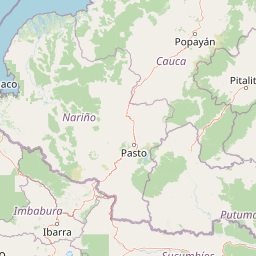
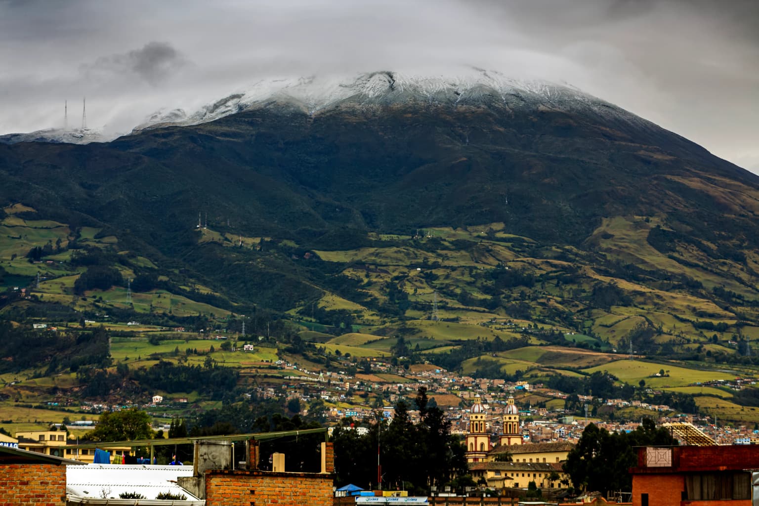
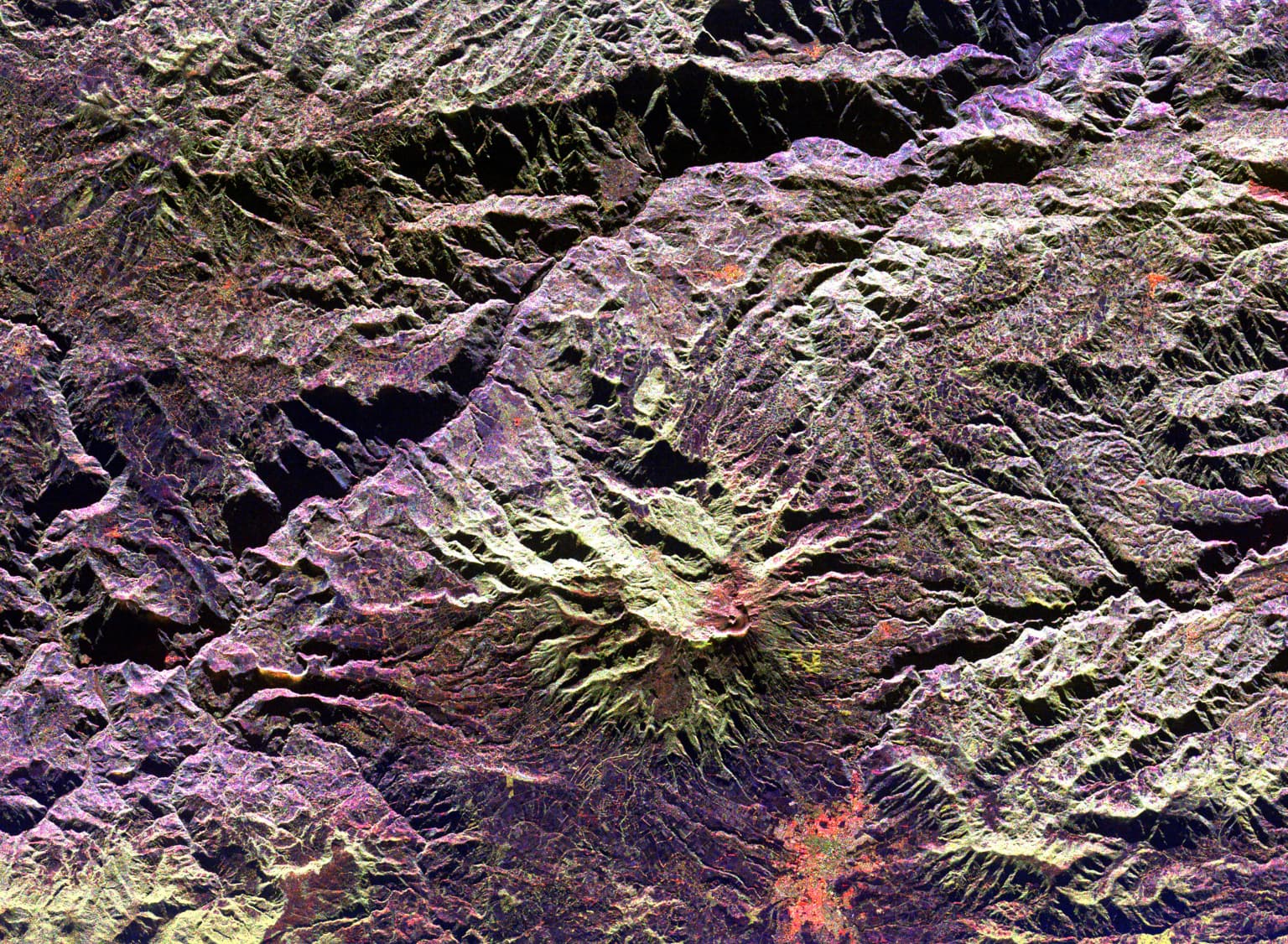
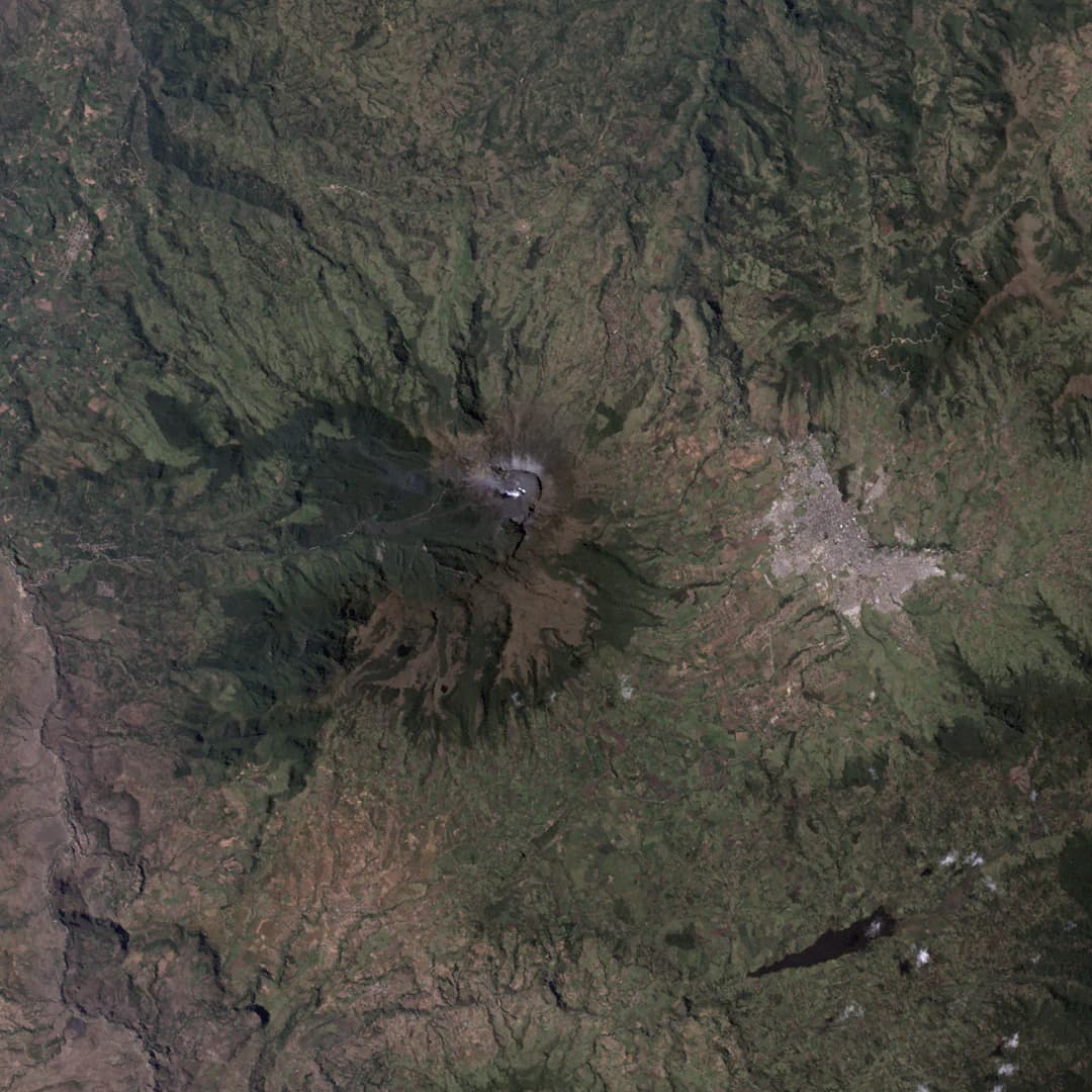
Galeras rises as a prominent conical peak within the Central Ranges of the Colombian Andes, its summit reaching 4,276 meters above sea level. The volcano features a horseshoe-shaped caldera open to the west, formed by ancient collapses and subsequent volcanic construction. The modern volcanic cone occupies the northeastern portion of this caldera depression. The landscape around Galeras is characterized by steep slopes descending into valleys inhabited by rural communities engaged in agriculture. The city of Pasto sits at the volcano's base approximately 9 kilometers to the northeast, with the volcano's profile forming a dramatic backdrop to the urban area. The region experiences a tropical highland climate influenced by the volcano's elevation and the surrounding Andean terrain.
Galeras ecosystems, habitats, and plant life
The ecosystems around Galeras reflect the dramatic altitudinal gradient from the volcano's summit to the surrounding valleys and plains. The Andean forest zones at mid-elevations host diverse vegetation adapted to the cool, humid conditions characteristic of this latitude. Paramo ecosystems occur at higher elevations, featuring specialized vegetation adapted to the harsh conditions above the tree line. The volcanic activity influences local soil chemistry and creates unique habitat conditions in areas where volcanic deposits have weathered. While the active volcanic zone itself supports limited vegetation due to repeated disturbance, the surrounding protected areas contain ecosystems important for regional biodiversity conservation.
Galeras wildlife and species highlights
The wildlife in the Galeras region reflects the ecological diversity of the Andean foothills of southwestern Colombia. The surrounding forests and protected areas provide habitat for various bird species common to the Colombian Andes, including numerous species of hummingbirds, tanagers, and raptors. The paramo zones above the tree line support specialized high-altitude fauna adapted to the harsh conditions. Mammals present in the region include various species of rodents, and larger mammals such as spectacled bears and pumas have been recorded in the broader Andean landscape. The volcanic nature of the area limits wildlife distribution in the most active zones, but the surrounding habitats maintain ecological value.
Galeras conservation status and protection priorities
Galeras holds significant conservation importance through its designation as a Decade Volcano, which identifies it as a priority target for international volcanic hazard research and monitoring. This recognition by the United Nations International Decade for Natural Disaster Reduction reflects both the volcano's activity level and the population exposure risk from potential eruptions. The ongoing scientific monitoring programs at Galeras have contributed substantially to global understanding of volcanic precursor phenomena and eruption prediction. The volcano serves as a natural laboratory for developing and testing monitoring techniques that can be applied to other active volcanic systems worldwide. While the immediate volcanic hazard precludes traditional conservation designations, the scientific value of the area is recognized through its inclusion in international volcanic monitoring networks.
Galeras cultural meaning and human context
The indigenous name Urcunina reflects the historical presence of pre-Columbian peoples in the Galeras region, where native groups inhabited the Andean foothills long before Spanish colonization. The city of Pasto, located at the volcano's base, grew in the shadow of Galeras and developed alongside the volcano's periodic activity. Local communities have adapted to living with volcanic risk over generations, developing traditional knowledge about precursor signs and evacuation procedures. The 1993 tragedy brought international attention to the region and led to improvements in community preparedness and emergency response systems. The ongoing relationship between Pasto's residents and Galeras exemplifies the broader pattern of human adaptation to active volcanic landscapes throughout Colombia.
Top sights and standout views in Galeras
Galeras stands as Colombia's most active volcano with a documented history spanning over a thousand recorded eruptions. The distinctive tornillo seismic events serve as reliable eruption precursors, making this volcano particularly valuable for volcanic science. The 1993 eruption that claimed nine lives remains one of the most tragic incidents in modern volcanology. The volcano's proximity to 450,000 residents of Pasto makes it one of the most densely populated volcanic danger zones in the world. As a Decade Volcano, Galeras receives continuous international scientific attention aimed at improving eruption prediction and hazard mitigation.
Best time to visit Galeras
Galeras is not a standard tourist destination due to the inherent dangers of its ongoing volcanic activity. Access to the summit and higher elevations is restricted by Colombian authorities, and evacuations are commonly ordered during periods of increased activity. The volcano exhibits low-level persistent activity with small explosions occasionally dusting nearby communities with ash. For those interested in observing volcanic activity safely, the surroundings of Pasto offer views of the volcano from appropriate distances, though any visit should be coordinated with local authorities and monitoring agencies to ensure safety.