Mori Atlas logo
Protected areaGanga Lake

A distinct saline wetland basin marking the transition between Mongolian grasslands and the northern Gobi

Ganga Lake Protected Area: Mapping the Steppe and Desert Landscapes of Sükhbaatar Province

(Lake Ganga and its surrounding wetlands)

Ganga Lake serves as an essential ecological link within the eastern Mongolian steppes of Sükhbaatar Province, characterized by its shallow saline basins and surrounding sandy dunes. This protected area landscape bridges the broad, grassy plains with the northern fringes of the Gobi Desert, creating a vital mosaic of water, marshland, and arid relief. The site remains a critical refuge for migratory waterbirds, reflecting the complex interplay between highland steppe geography and shifting desert margins in this unique corner of central Asia.

saltwater lakeRamsar WetlandImportant Bird Areamigratory birdssteppegobi transition

Ganga Lake

Protected area

Park overview

Structured park overview, official facts, and landscape profile for Ganga Lake

Ganga Lake park facts, protected area profile, and essential visitor context

Review the core facts for Ganga Lake, including designation, size, terrain, visitor scale, habitats, and operating context in one park-focused overview.

About Ganga Lake

Ganga Lake is a saltwater lake in the Dariganga District of Sükhbaatar Province, in the far east of Mongolia near the border with neighboring regions and states. The lake lies in a transitional landscape where the wide southern Mongolian steppes meet the encroaching influence of the Gobi Desert. In this zone, water is scarce and highly localized, so even a relatively small lake like Ganga becomes ecologically significant.

The lake sits in a wider cluster of similar steppe lakes, with neighbors such as Duut Lake, Sumtiin Lake, Erdene Lake, Kholboo Lake, Züün Kholboo Lake, Tsagaan Lake, Khoshmogt Lake, and Zegst Lake, along with Red Lake, which has already dried up. The combination of open water, marshy margins, and dry steppe around Ganga Lake creates a mosaic of habitats that supports diverse birdlife, especially during migration and breeding seasons.

Beyond its ecological value, Ganga Lake also has a quietly distinct cultural and historical layer. Local legend ties the lake's name "Ganga" to the sacred River Ganges of India through an 8th-century Mongol nobleman said to have brought water from the holy river to the site. While the lake remains relatively obscure on the international travel map, its protected status and internationally recognized wetlands make it one of the more important small-scale natural sites in eastern Mongolia.

Quick facts and research context for Ganga Lake

Ganga Lake is a saltwater lake located in Dariganga District, Sükhbaatar Province, in eastern Mongolia. Its surface sits at roughly 1,294 meters above sea level in a landscape where steppe gives way to Gobi desert terrain. The lake measures about 2.1 kilometers in length and 1.6 kilometers in width, occupying a surface area near 2.2 square kilometers, while the broader wetland complex it belongs to covers around 32.8 square kilometers.

The site is internationally recognized for its bird conservation value. It was listed as a Ramsar Wetland in March 2004 under the official name "Lake Ganga and its surrounding wetlands" and also holds Important Bird Area status. Its remote eastern Mongolian setting places it near a chain of other small steppe lakes that together form one of the country's more important waterbird habitats.

Protection and recognition

Documented terrestrial protection scope, designation year, and Ramsar wetland recognition

Ganga Lake Protection Status, Designation History, and International Recognition

Ganga Lake maintains a documented terrestrial protection status established in 2004, accompanied by official Ramsar wetland recognition for Lake Ganga and its surrounding wetlands. Structured facts summarize the recorded designation history, management scope, and international recognition sources associated with the protected area.

International recognition

Protection details

Protection scope
Terrestrial
Designated year
2004
Transboundary protection
No
Park context

Deeper park guide and search-rich context for Ganga Lake

Ganga Lake history, landscape, wildlife, and travel context

Explore Ganga Lake through its history, landscape character, ecosystems, wildlife, conservation priorities, cultural context, and seasonal travel timing in a structured park guide built for atlas discovery and search intent.

Why Ganga Lake stands out

Ganga Lake is best known as a steppe-to-desert transition wetland holding Ramsar and Important Bird Area recognition. Its defining identity is the combination of a saline lake basin, surrounding steppe and dunes, and its role as a breeding and resting site for endangered migratory waterbirds. The contrast between open grassland, drifting sand, and shallow water bodies in an otherwise arid corner of eastern Mongolia gives the place its distinctive character.

Ganga Lake history and protected-area timeline

Ganga Lake does not have a heavily documented modern history, but its name carries an old folk tradition. According to a local legend, the 8th-century Mongol nobleman Togtokhtör wang had two flasks of water brought from the holy River Ganga in India and poured into the lake, giving the site its name.

In more recent history, the lake's significance shifted decisively toward formal conservation. On 22 March 2004, Lake Ganga and its surrounding wetlands were designated as a Ramsar Wetland of International Importance under reference number 1378. The site was also recognized as an Important Bird Area by BirdLife International, cementing its role as a protected wetland within Mongolia's broader network of migratory bird habitats.

Ganga Lake landscape and geographic character

The setting of Ganga Lake is defined by the meeting of two contrasting natural regions: the broad southern Mongolian steppes and the northern edge of the Gobi Desert. Around the lake, open grasslands spread outward across gently rolling terrain, while sandy areas contribute patches of dune-like relief typical of this transitional zone.

The lake itself is modest in size, oval in shape, and bordered by shallow margins and wetland vegetation. Its elevated position at roughly 1,294 meters above sea level reflects the high, dry character of eastern Mongolia. What the lake lacks in scale, it gains in visual contrast, with bands of water, damp margins, grassy steppe, and pale sand forming a layered mosaic that is characteristic of this part of the country. The presence of a chain of similar nearby lakes further emphasizes the landscape's identity as a steppe wetland system rather than a single isolated water body.

Ganga Lake ecosystems, habitats, and plant life

Ecologically, Ganga Lake sits in a fragile zone where water scarcity and transitional climate define the character of life around it. The lake is saline rather than freshwater, which influences the vegetation patterns along its shores and shapes which species can use the habitat. Surrounding steppe vegetation extends right to the wetlands' edges, while patches of dune and dry ground interrupt the plant cover, giving rise to a varied habitat mosaic across the wider 32.8 square kilometer wetland complex.

This combination of open water, saline margins, marshy patches, and adjacent steppe is exactly what makes the site attractive to migratory waterbirds. The lake offers feeding, resting, and breeding conditions that are otherwise hard to find across the predominantly dry landscapes of eastern Mongolia. As climate change has begun to reduce the lake's surface extent, the ecological fragility of this transitional habitat mosaic has become increasingly apparent.

Ganga Lake wildlife and species highlights

Ganga Lake's wildlife profile is centered on migratory and breeding waterbirds. The lake and its wetlands serve as both a breeding ground and a stopover for endangered species, including the great crested grebe, the whooper swan, and the ruddy shelduck. These species reflect the value of the site for birds that rely on shallow, relatively undisturbed steppe lakes during vulnerable parts of their annual cycle.

Beyond these highlighted species, the broader habitat mosaic of water, marsh, steppe, and sand also supports a wider community of wetland and steppe birds typical of eastern Mongolia. The site's recognition as a Ramsar Wetland and an Important Bird Area reflects the consistent presence of internationally significant bird populations here, rather than merely occasional sightings.

Ganga Lake conservation status and protection priorities

Ganga Lake holds clear international conservation significance, primarily because of its role in supporting migratory waterbirds at a key point on their flyway. The lake's designation as a Ramsar Wetland of International Importance under the name "Lake Ganga and its surrounding wetlands" in 2004 formally recognized the ecological value of the lake and its associated wetland system.

The site's additional recognition as an Important Bird Area by BirdLife International reinforces its importance for threatened and migratory bird species. Conservation concerns at Ganga Lake are increasingly shaped by climate change, which is shrinking the lake's surface area and putting pressure on the very wetlands that make the site important. This combination of formal protection and active environmental stress gives Ganga Lake an outsized conservation profile relative to its modest size.

Ganga Lake cultural meaning and human context

The cultural identity of Ganga Lake is rooted in a local folk legend linking the lake to India's sacred River Ganges. According to this tradition, the 8th-century Mongol nobleman Togtokhtör wang had two flasks of water carried from the holy River Ganga in India and poured into the lake, an act said to have given the lake its name.

While the legend is part of the lake's regional heritage rather than a major pilgrimage or tourism phenomenon, it gives Ganga Lake a distinctive cultural layer that is unusual for a small steppe lake.

Top sights and standout views in Ganga Lake

Ganga Lake stands out for the way it combines a saline steppe lake, surrounding wetlands, and a transition landscape between steppe and Gobi desert, all within a compact area in eastern Mongolia. Its international recognition, as both a Ramsar Wetland and an Important Bird Area, sets it apart from many other small Mongolian lakes.

The lake's importance for endangered migratory species such as the great crested grebe, whooper swan, and ruddy shelduck gives it real ecological weight, while the cultural legend surrounding its name adds an unexpected historical dimension to an otherwise quiet natural site.

Best time to visit Ganga Lake

The most rewarding periods to experience Ganga Lake tend to align with the bird migration and breeding seasons, when waterbird activity on the lake and its surrounding wetlands is at its peak. Visiting during the warmer months of late spring and summer typically offers easier access to the remote eastern Mongolian landscape and the best chance to see breeding and staging waterbird populations.

Winter conditions in Sükhbaatar Province are harsh and high-altitude, with temperatures far below freezing in this region. While the lake area remains ecologically important year-round, travelers should be aware that winter visit conditions are demanding and that seasonal climate effects, including ongoing lake shrinkage, can visibly shape the landscape at any time of year.
Monthly climate preview

Long-term representative monthly temperature and precipitation data for Sükhbaatar Province

Ganga Lake Climate Normals and Annual Temperature Rhythm

Ganga Lake records a measured annual temperature span from severe sub-zero winter minimums to warm summer maximums alongside low precipitation rates. Examining the full twelve-month weather profile reveals detailed long-term averages across all seasonal shifts.
Annual mean2 °C
-19 °C21 °C
Jan-19°
Feb-14°
Mar-6°
Apr
May11°
Jun18°
Jul21°
Aug19°
Sep11°
Oct
Nov-9°
Dec-17°
Warmest month
July

21 °C

Coolest month
January

-18.6 °C

Wettest month
July

1.9 mm/day

Driest month
January

0.1 mm/day

Park location guide

Geography guide, regional context, and park location map for Ganga Lake

Ganga Lake park geography, regions, and map view in Mongolia

Understand where Ganga Lake sits in Mongolia through a broader geographic reading of the surrounding landscape, nearby location context, and its mapped position within the national park landscape.

How Ganga Lake fits into Mongolia

Mongolia is a landlocked sovereign state in East Asia, known for its vast steppe landscapes, nomadic culture, and historical significance as the heartland of the Mongol Empire founded by Genghis Khan in 1206. The country has a population of approximately 3.5 million people and is the world's most sparsely populated sovereign state. Ulaanbaatar is the capital and largest city, home to roughly half the population.

Wider geography shaping Ganga Lake in Mongolia

Mongolia is located in East Asia, landlocked between Russia to the north and China to the south. The country occupies the Mongolian Plateau and features diverse terrain including grassy steppe, mountains in the north and west, and the Gobi Desert in the south. It covers 1,564,116 km2, making it the second largest landlocked country in the world.

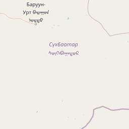
Map view of Ganga Lake

Use this park location map to pinpoint Ganga Lake in Mongolia, understand its exact geographic position, and read its mapped placement within the surrounding landscape more clearly.

Pigeon | © OpenStreetMap contributors

Location context for Ganga Lake

Sükhbaatar Province
Park atlas

Compare adjacent steppe wetlands and regional conservation areas in the Gobi transition zone

Explore Parks Near Ganga Lake and Surrounding Protected Landscapes in Eastern Mongolia

Visitors exploring Ganga Lake can browse other protected areas sharing the same arid steppe and wetland ecology across eastern Mongolia. Comparing neighboring sanctuaries reveals the broader geographic patterns of regional waterbird habitats and transitional desert terrain.
Protected areaDornod Province
About 401 km away#1 closest

Northeast

Buir Lake Protected Area: Geographic Overview and Steppe Landscape Context

Mapping the transboundary freshwater wetlands of Dornod Province

Buir Lake occupies a expansive depression in the eastern Mongolian steppe, characterized by its shallow seasonal hydrology and fringing marshlands. This protected area serves as a primary geographic feature within Dornod Province, linking regional steppe systems and migratory bird corridors. The site offers a clear look at the interplay between water and grassland in a unique transboundary setting.

Established
2004
Relief
Lowland
Scope
Terrestrial
Water
Water-dominated
Nature reserveDornogovi Province
About 422 km away#2 closest

West

Ikh Nartiin Chuluu Nature Reserve: Mapping Granite Outcrops and Steppe in Dornogovi Province

A vital protected sanctuary within the Mongolian Gobi desert landscape

Ikh Nartiin Chuluu Nature Reserve occupies a unique position in the Dornogovi Province of Mongolia, where granite skeletons meet arid plains. The protected area serves as a significant biological stronghold, offering a detailed study of how rocky crevices and sheltered valleys support diverse steppe life. Use this atlas resource to understand the park boundaries, terrain features, and regional landscape context that make this reserve a reference site for desert conservation.

Area
660 km²
Established
1996
Relief
Upland
Climate
Arid
A watercolor painting showing a winding river flowing through a soft green landscape with grassy banks under a white sky.
National parkDornod Province
About 466 km away#3 closest

Northeast

Numrug National Park: Mapping the Transitional Geography of Eastern Mongolia

Protected river valleys and forest foothills in Dornod Province

Spanning the easternmost edge of Mongolia, Numrug National Park showcases a layered landscape where mountainous woodland merges with open grassland. The park's hydrological character, defined by the Degee and Khalkh rivers, creates a complex network of riparian habitat that serves as a vital ecological boundary within the broader Dornod Province terrain.

Established
1992
Relief
Mountain
Water
Major water bodies
Watercolor illustration showing a mountainous landscape with green valleys and a river, rendered in soft pink and green hues
National parkKhentii Province
About 469 km away#4 closest

Northwest

Onon-Balj National Park: A Protected River Valley in Mongolia's Khentii Province

Explore unique geography and diverse ecosystems at a steppe-forest transition.

Onon-Balj National Park safeguards a critical river valley area in Khentii Province, Mongolia, marking an important ecological transition zone between Siberian forests and the Daurian steppe. Discover the park's mapped landscape, characterized by mid-sized mountains and riparian habitats along the Onon and Balj rivers. This protected area offers insights into regional geography, biodiversity, and the unique natural heritage of northern Mongolia.

Area
4,158 km²
Established
2000
IUCN
II
Relief
Mountain
Nature reserveDornod Province
About 502 km away#5 closest

North

Mongol Daguur Nature Reserve: Steppe and Wetland Geography in Eastern Mongolia

Protected landscape boundaries within Dornod Province

An authoritative overview of the Mongol Daguur protected area, focusing on its role as a core element of the Daurian landscape. Discover the spatial distribution of its steppe habitats, wetland systems, and mountain-grassland terrain that define this eastern Mongolian region.

Area
156 km²
Established
1998
IUCN
Ib
Relief
Lowland
Watercolor painting of a river winding through hills with trees and vegetation
National parkZabaykalsky Krai
About 574 km away#6 closest

Northwest

Chikoy National Park: Protected National Park with Highland Landscape and River Basin Geography

Explore its protected boundaries and unique taiga-steppe transition in Zabaykalsky Krai.

Chikoy National Park, a protected area in Russia's Zabaykalsky Krai, showcases the rugged geography of the Khentei-Daur Highlands. As a national park, it preserves the upper Chikoy River basin and represents a significant ecological borderland, marking the transition from Siberian taiga to Mongolian steppe. This page facilitates a structured understanding of the park's mapped landscape, its prominent natural monument Bystrinsky Golets, and its role within the broader atlas of protected natural areas.

Area
6,665 km²
Established
2014
IUCN
II
Relief
Mountain
Wildlife reserveKhentii Province
About 579 km away#7 closest

Northwest

Khan Khentii Strictly Protected Area: Geographic Overview and Protected Landscape Mapping

Eastern Mongolia wilderness and Khentii mountain terrain

Explore the expansive reaches of Khan Khentii Strictly Protected Area, a cornerstone of Mongolian conservation. This reserve shields intact taiga forests, river valley habitats, and the historic Burkhan Khaldun mountain from industrial activity, preserving one of the most significant mountain wilderness regions in the province of Khentii.

Area
12,270 km²
Established
1992
IUCN
Ib
Relief
Mountain
National parkTöv Province
About 587 km away#8 closest

Northwest

Gorkhi-Terelj National Park: Mapped Protected Landscape in Töv Province

Explore the geographic context and park boundaries.

Gorkhi-Terelj National Park is a designated national park offering rich opportunities for geographic exploration and protected landscape discovery. This entity page provides detailed insights into its mapped boundaries and its position within the regional geography of Töv Province. Understand the specific landform and terrain characteristics that define this protected natural area, central to understanding Mongolia's conservation landscapes.

Area
2,920 km²
Established
1993
IUCN
II
Relief
Mountain

Common questions about visiting, size, designation, and location context for Ganga Lake

Ganga Lake FAQs for park facts, access, geography, and protected area context

Find quick answers about Ganga Lake, including protected-area facts, park geography, trail and visitor context, and how the park fits into its surrounding country and regional landscape.
MoriAtlas Explorer

Continue Your Protected Areas Search Across the Global Atlas

Deepen your exploration by continuing the structured search for national parks and protected areas worldwide. Utilize the comprehensive filtering capabilities to compare different conservation landscapes and refine your understanding of global park geography. Discover more about the distribution and characteristics of protected natural areas.

Global natural geography