Mori Atlas logo
Park earthquake history

A historical archive of seismic events mapped by distance from park boundaries and terrain

Recorded Earthquake History and Seismic Activity Records for Garibaldi Provincial Park

This comprehensive collection provides a historical record of seismic activity documented in the region surrounding Garibaldi Provincial Park. Each entry includes essential event data such as magnitude, depth, and the calculated distance between the earthquake epicentre and the park landscape. The catalogue serves as a reliable reference for observing past seismic patterns within the mountainous geography of British Columbia without implying current hazard or geological prediction.

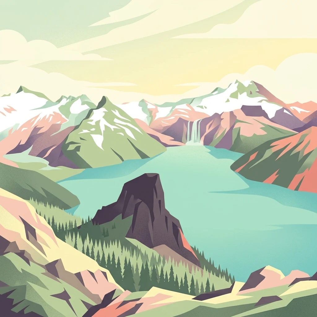
A digital illustration of a turquoise alpine lake nested within jagged, snow capped mountains, with a prominent volcanic peak in the foreground and a waterfall in the distance.

A wilderness park of volcanic peaks, glacial lakes, and coastal forest in British Columbia.

Garibaldi Provincial Park

Garibaldi Provincial Park is a wilderness park on the coastal mainland of British Columbia, Canada, located roughly 70 kilometres north of Vancouver between the communities of Squamish and Whistler. It protects the heart of the Garibaldi Range, a dramatic mountainous landscape shaped by glaciers and past volcanic activity that belongs to the broader Garibaldi Volcanic Belt. The park's terrain combines steep, rugged peaks, deep alpine lakes, meadows, and lower-elevation coastal forests, creating one of the most visually striking alpine environments in southwestern Canada. The park is best known for its combination of glaciated scenery and volcanic landforms, including Mount Garibaldi, The Black Tusk, the Opal Cone, and The Table, alongside blue-green lakes such as Garibaldi Lake, Elfin Lakes, Cheakamus Lake, and Wedgemount Lake. More than 150 glaciers and expansive icefields still shape the high country, while subalpine wildflower meadows bring vivid seasonal color. Since its early protection in 1920 and its formal designation as a Class A Provincial Park in 1927, Garibaldi Park has become one of British Columbia's most popular outdoor recreation destinations, drawing large numbers of hikers, campers, mountaineers, and backcountry enthusiasts. Beyond its recreation appeal, the park holds deep cultural significance for the Squamish and Lil'wat peoples, whose traditional names and stories are tied to its mountains and landscape. Its combination of accessibility from the Sea to Sky Highway and rugged interior wilderness makes it a defining protected landscape of British Columbia's south coast.

Location
Canada
Park type
State or regional park
Established
1920
Area
1,950 km²
Highest point
2,891 m
Garibaldi Provincial Park Geography and Atlas

Review Garibaldi Provincial Park dates, depths, places, and distances

Study historical earthquake records around Garibaldi Provincial Park

Garibaldi Provincial Park’s results place earthquakes relative to its volcanic, glacial mountain landscape through epicentre coordinates and distance, rather than treating proximity as an inside-boundary finding. Dates, magnitudes, depths, locations, distances, and sources remain available for historical comparison, with no inference about park influence, current safety, impacts, or later activity.

Sort by
Magnitude
Location

This page describes catalogued earthquakes associated with the park by epicentre location and distance. It does not establish causation, assess current danger, or predict future earthquakes.

No earthquake records match the current filters

Park atlas

Go beyond Garibaldi Provincial Park earthquake history in the atlas

Discover other protected parks after Garibaldi Provincial Park

The collection following Garibaldi Provincial Park moves from its earthquake evidence into other park landscapes with separate identities. It does not imply common alpine, volcanic, or glacial geography, British Columbia status, nearby location, seismic history, hazard, risk, or dedicated earthquake content; every destination supplies its own context.
A watercolor painting showing a soft-focus landscape with rolling green hills, distant mountains, and a central river or water feature.
State or regional parkBritish Columbia
Park boundaries overlap#1 closest

Southeast

Golden Ears Provincial Park: Geographic Atlas and Protected Landscape Overview

Coast Mountains terrain and protected wilderness boundaries

Golden Ears Provincial Park is a major protected wilderness in British Columbia, defined by the twin peaks of the Golden Ears massif and vast glacial lake systems like Alouette and Pitt. This site serves as a vital ecological corridor where lowland forests meet high subalpine ridges. Explore the park through its mapped boundaries and diverse ecological zones within the Pacific Northwest mountain landscape.

Area
609 km²
Established
1967
IUCN
II
Visitors
956.5K annual
A watercolor illustration of a mountain landscape featuring soft rolling hills, evergreen trees, and low-lying vegetation on a white background.
State or regional parkBritish Columbia
Park boundaries overlap#2 closest

South

Pinecone Burke Provincial Park: Coast Mountain Wilderness and Protected Terrain Geography

Mapping a vast ecological corridor in British Columbia

Spanning over 38,000 hectares, Pinecone Burke Provincial Park represents a dramatic transition from the urban proximity of Coquitlam to the remote interiors of the southern Coast Mountains. The landscape is defined by its rugged relief, featuring subalpine meadows, deep freshwater systems, and historically significant forested slopes. This park provides a critical look at the complex topography of the Pacific Northwest, serving as a sanctuary for wildlife and a foundational piece of regional conservation.

Area
380 km²
Established
1995
IUCN
II
Relief
Mountain
A watercolor illustration of a mountain range behind a calm lake with evergreen trees and grassy banks.
State or regional parkBritish Columbia
About 14 km away#3 closest

North

Joffre Lakes Provincial Park: Geographic Atlas of Southwestern British Columbia Mountains

Glacial valleys and alpine wilderness protected areas

Joffre Lakes Provincial Park serves as a benchmark for alpine geography in British Columbia, showcasing a compact amphitheater of polished bedrock, moraines, and intense turquoise lakes. This protected area offers a focused look at the intersection of glacial hydrography and high-mountain terrain within the Coast Mountains, illustrating how meltwater and high-altitude peaks define this regional ecosystem.

Area
14.87 km²
Established
1996
Relief
Mountain
Climate
Alpine
A horizontal watercolor illustration depicting soft green rolling hills and distant purple mountains above a flat shoreline with patches of marsh grasses.
State or regional parkBritish Columbia
24 km away#4 closest

Southwest

Porteau Cove Provincial Park: Mapping Coastal Protected Landscapes in British Columbia

Geography of Howe Sound shorelines and marine habitats

Porteau Cove Provincial Park offers a unique geographic vantage point at the meeting of granite-sloped mountains and the Pacific waters of Howe Sound. This park detail covers the coastal landscape, including protected intertidal zones, artificial reef structures, and the surrounding terrain that characterizes this segment of the British Columbia coastline.

Area
0.5 km²
Established
1981
IUCN
II
Visitors
611.8K annual
State or regional parkBritish Columbia
About 48 km away#5 closest

Southwest

Plumper Cove Marine Provincial Park: Protected Marine Geography and Coastal Landscapes in Howe Sound

Exploring the forested trails and sheltered marine anchorages of Keats Island.

Plumper Cove Marine Provincial Park represents a vital protected landscape on the coast of British Columbia, defined by its blend of upland coastal forest and intimate, boat-accessed marine anchorages. This geography-focused profile traces the park's terrain, including its rocky shorelines, forest-covered bluffs, and the trail networks that connect visitors to the broader Howe Sound maritime environment.

Area
0.66 km²
Established
1960
IUCN
II
Relief
Upland
A watercolor painting showing a soft, hazy landscape of a lake with green forest along the shore and distant purple mountains under a pale sky.
State or regional parkBritish Columbia
About 50 km away#6 closest

Southeast

Davis Lake Provincial Park: Protected Forest and Lake Geography in British Columbia

Regional protected area with old-growth forest and waterfalls

Davis Lake Provincial Park represents a significant protected area in the Fraser Valley, characterized by its undisturbed Western Hemlock forest and the scenic descent of Murdo Creek into McDonald Falls. The park provides an essential look at the regional geography of southwestern British Columbia, balancing dense coniferous canopy with accessible lake-based terrain in a quiet, natural setting.

Area
0.75 km²
Established
1963
IUCN
II
Relief
Upland
A soft watercolor painting of a landscape featuring a lake, low rolling hills in the background, and grassy vegetation along the foreground shoreline under a warm, pale yellow sky.
State or regional parkFraser Valley Regional District
About 55 km away#7 closest

South

Rolley Lake Provincial Park: An Atlas of Protected Landscapes and Regional Geography

Lakeshore forest terrain and protected park geography

Delve into the geographic identity of Rolley Lake Provincial Park, a state-protected landscape in the Fraser Valley Regional District. This documentation traces the park's internal map, including its central freshwater lake, loop trail connectivity, and surrounding second-growth forest topography, providing essential context for understanding this localized wilderness zone.

Area
1.15 km²
Established
1961
IUCN
II
State or regional parkBritish Columbia
About 63 km away#8 closest

Southeast

Kilby Provincial Park: Protected Riverfront Geography and Historic Sites in BC

A unique riparian landscape along the Harrison River

Kilby Provincial Park offers an intimate look at the flood plain geography of the Harrison River. The site features an elevated, boardwalk-linked heritage environment integrated with sandy riverfronts and seasonal wildlife corridors. This protected area stands out for its combination of historical pioneer preservation and river-based ecosystem monitoring within the Upper Fraser Valley region of British Columbia.

Area
0.03 km²
Established
1973
IUCN
II
Relief
Lowland
MoriAtlas Explorer

Examine the Mapped Landscapes and Glacial Terrain of Garibaldi Provincial Park

Continue exploring the intricate geography and protected wilderness features of Garibaldi Provincial Park. Through the MoriAtlas database, gain deeper insights into the volcanic summits, icefields, and alpine lake networks that define this vital British Columbia landscape.