
Mori Atlas logo
Protected landscapeGila National Forest

Tracing the boundaries and rugged terrain of a historic wilderness spanning New Mexico

Gila National Forest: An Authoritative Atlas of a Vast Southwestern Protected Landscape

Gila National Forest represents a monumental protected landscape within southwestern New Mexico, covering nearly three million acres of diverse terrain. This geography spans from alpine forests and the Continental Divide to deep river canyons and arid semi-desert basins. The area preserves a complex network of protected wilderness zones and rare geothermal features, offering a deep look into the ecological variety and topographic scale of the American Southwest through comprehensive mapping.

national forestwildernessmountainscanyonssemi-desertriparian habitat
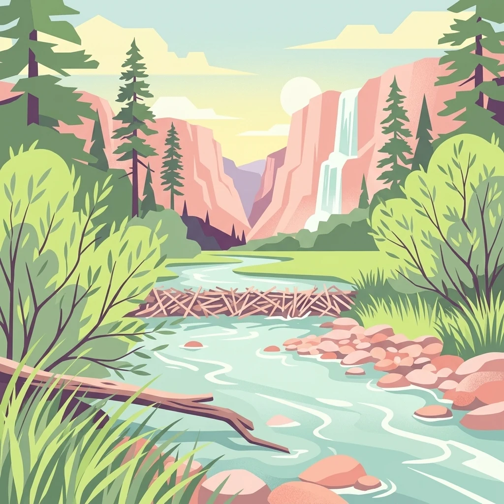
A digital illustration depicting a river flowing past a beaver dam, framed by tall evergreen trees and cliffs with a waterfall in the background.

Gila National Forest

Protected landscape

Park overview

Structured park overview, official facts, and landscape profile for Gila National Forest

Gila National Forest park facts, protected area profile, and essential visitor context

Review the core facts for Gila National Forest, including designation, size, terrain, visitor scale, habitats, and operating context in one park-focused overview.

About Gila National Forest

Gila National Forest stands as one of the most significant protected landscapes in the American Southwest. Located in southwestern New Mexico and administered by the U.S. Forest Service, it ranks among the largest national forests in the contiguous United States, with an area that places it well ahead of many American national parks in sheer size. The forest encompasses rugged mountain ranges, deeply incised river canyons, high mesas, and stretches of semi-desert, making it a single administrative unit that nonetheless contains multiple distinct ecological worlds.

The forest's identity is inseparable from its wilderness heritage. The Gila Wilderness, created within the forest in 1924, was the world's first formally designated wilderness area, setting a precedent that would eventually shape the 1964 Wilderness Act. Today, the forest contains three wilderness areas: the Gila Wilderness, the Aldo Leopold Wilderness, and the Blue Range Wilderness. Together, these protected cores preserve some of the most remote and unspoiled backcountry remaining in the Southwest, with hundreds of miles of trails traversing canyon floors, forested slopes, and ridgetops along the Continental Divide.

Beyond wilderness, the forest is notable for the Gila Cliff Dwellings National Monument, an iconic cultural site preserved within its boundaries. The forest also encompasses hot springs tucked into remote canyons, dark-sky viewing opportunities at Cosmic Campground, and extensive road and trail networks that allow for both developed and dispersed recreation. The headwaters of the Gila River system run through the forest, and broad valleys of mixed conifer and ponderosa pine give way to piñon-juniper woodland and dry lowland basins as elevation changes, illustrating the dramatic ecological transitions that occur across the landscape.

For the Forest Service and the broader conservation community, Gila represents both a foundational chapter in the history of American wilderness preservation and a continuously evolving conservation challenge, including management of free-roaming feral cattle, sensitive predator recovery programs, and habitat protection for endangered species. Its combination of cultural significance, pioneering wilderness status, and ecological diversity makes it a defining reference point in the national forest system.

Quick facts and research context for Gila National Forest

Gila National Forest is located in southwestern New Mexico, spanning portions of Catron, Grant, Sierra, and Hidalgo counties, with its headquarters in Silver City, New Mexico. It covers roughly 2.7 million acres of federally protected land managed by the U.S. Forest Service, and the Gila National Forest administration also co-manages about 614,000 acres of the Apache National Forest in New Mexico, bringing the total administered area to about 3.3 million acres.

The forest was first protected in 1899 as the Gila River Forest Reserve, redesigned as a national forest in 1907, and grew through the addition of neighboring reserves. It is home to three designated wilderness areas, including the Gila Wilderness, the first wilderness of its kind in the United States. The landscape ranges from deep river canyons and forested mountains to arid semi-desert, supporting wildlife such as black bears, elk, Mexican gray wolves, bald eagles, and the endemic Gila trout.

Protection and recognition

Documented management scope and official establishment milestones for Gila National Forest

Gila National Forest Protection Status and Terrestrial Designation History

Gila National Forest maintains a documented terrestrial protection status established in nineteen twenty-four. Official conservation records outline the protected area designation history and management scope.

Protection details

Protection scope
Terrestrial
Designated year
1924
Transboundary protection
No
Park context

Deeper park guide and search-rich context for Gila National Forest

Gila National Forest history, landscape, wildlife, and travel context

Explore Gila National Forest through its history, landscape character, ecosystems, wildlife, conservation priorities, cultural context, and seasonal travel timing in a structured park guide built for atlas discovery and search intent.

Why Gila National Forest stands out

Gila National Forest is best known as the cradle of the American wilderness movement. The Gila Wilderness, established within its boundaries in 1924, was the first area in the world to receive that designation and inspired the eventual passage of the Wilderness Act decades later. This wilderness legacy, combined with the forest's enormous size and rugged character, defines the park's identity. A second defining trait is the forest's extraordinary ecological and topographic diversity within a single administrative unit. Visitors encounter everything from cool mountain forests along the Continental Divide to arid canyon country and semi-desert basins, all within the forest's boundaries. This blend of ecological zones, paired with species that bear the river's name, such as the Gila monster, Gila trout, and Gila topminnow, gives Gila a distinctive biological identity within the broader network of U.S. national forests.
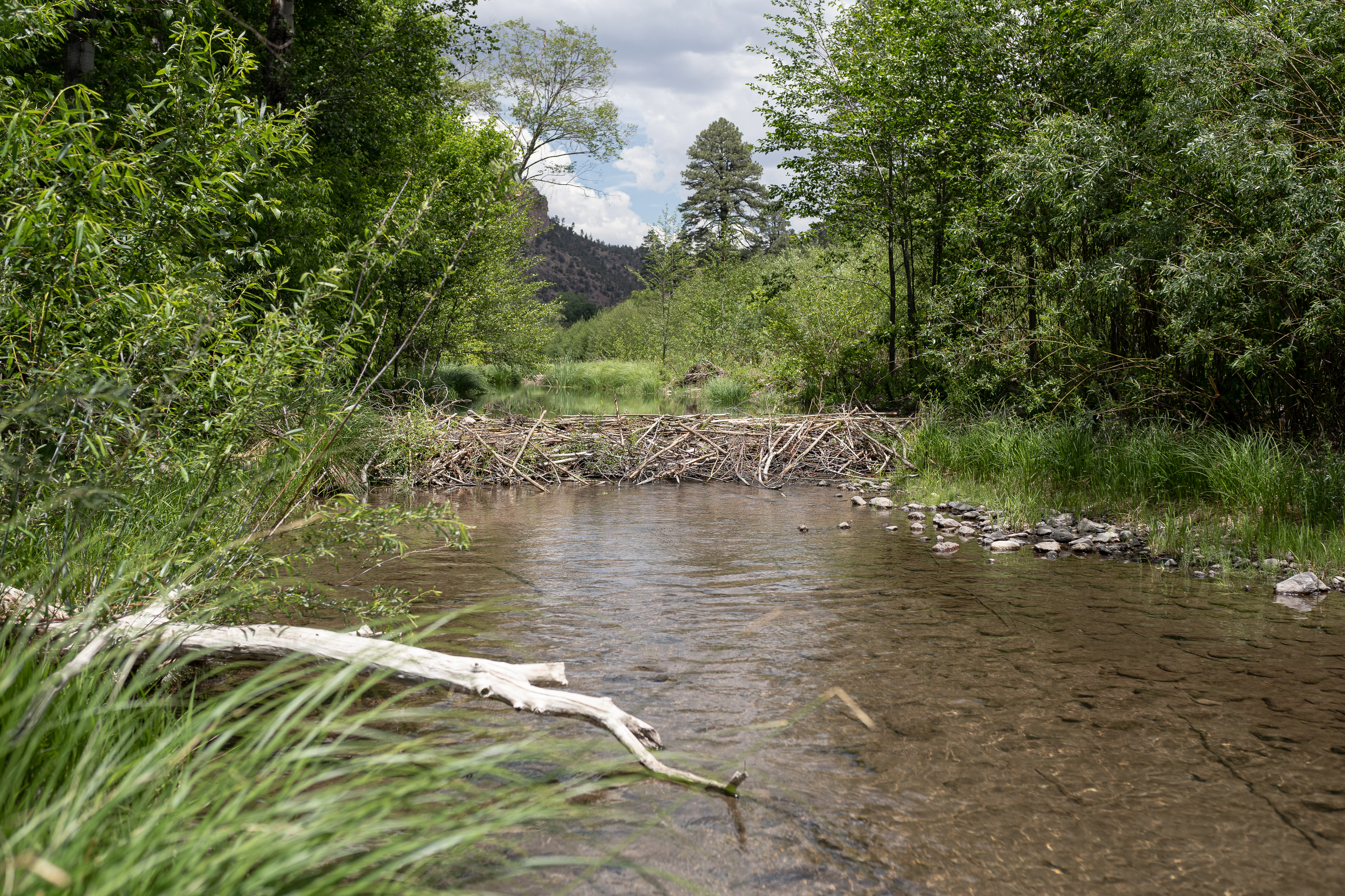
A beaver dam constructed of sticks and branches spanning a calm river, surrounded by lush green riparian vegetation and trees.
A beaver dam crossing the Middle Fork of the Gila River in Gila National Forest.

Gila National Forest history and protected-area timeline

The history of Gila National Forest dates back to the late nineteenth century, when efforts to protect Western timber and watershed resources led to the creation of forest reserves under the federal General Land Office. The Gila River Forest Reserve was first established on March 2, 1899, becoming one of the early federal reserves in the American Southwest. On July 21, 1905, it was officially renamed the Gila Forest Reserve, the date now recognized as the establishment anniversary of the national forest.

A year after the reserve was renamed, administrative responsibility for the forest was transferred to the newly created U.S. Forest Service, and on March 4, 1907, the area was redesignated as a National Forest. The forest then expanded through a series of administrative mergers. The Big Burros National Forest was incorporated in 1908, the Datil National Forest was added in 1931, and part of the Crook National Forest was merged into Gila in 1953, producing the broad landscape that exists today.

The most consequential event in the forest's history, however, occurred on June 3, 1924, when the Gila Wilderness was designated within the forest's core. At roughly 755,000 acres, it was the first area in the world to be formally designated as wilderness, preceding the national Wilderness Act by four decades. Although administrative in nature at first, the designation fundamentally shaped American conservation thinking. Following the 1964 Wilderness Act, additional wilderness areas were later recognized within the forest, including the Aldo Leopold Wilderness and the Blue Range Wilderness, strengthening Gila's role as the birthplace of the U.S. wilderness idea.

Gila National Forest landscape and geographic character

The landscape of Gila National Forest is defined by striking topographic variety within a single, large protected unit. In the higher elevations, the forest includes portions of the rugged mountain ranges of southwestern New Mexico, including areas near the Continental Divide, where mixed conifer forests and stands of ponderosa pine cling to slopes and ridgetops. Deep river canyons cut through these uplands, with the Middle Fork of the Gila River and other tributaries carving narrow valleys where beaver dams span sections of the river and dense riparian vegetation lines the water.

Below the forested mountains, the terrain transitions into high mesas and piñon-juniper woodland, eventually giving way to semi-desert environments at lower elevations. This gradient from cool, forested highlands to arid lowland basins gives the forest a layered character, where conditions can shift dramatically over short geographic distances. Black Range canyon country exemplifies this, with sheer cliffs and narrow gorges framing the broader forest.

Hot springs are scattered through the more remote parts of the landscape, including Middle Fork Hot Springs, Jordan Hot Springs, and Turkey Creek Hot Springs, both indicating active geothermal conditions and offering destinations for backcountry travelers. The forest also contains broad, sparsely populated plateaus and basins that are largely unspoiled due to the difficulty of access. Across all these terrain types, the relatively undeveloped character of much of Gila allows landscapes to retain a sense of scale and remoteness unusual in the modern American West.
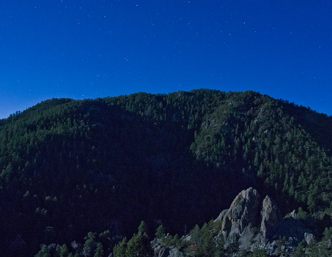
A moonlit landscape showing a dark, forested mountain range against a clear night sky with visible stars.
A moonlit night view of Gallinas Canyon within Gila National Forest.

Gila National Forest ecosystems, habitats, and plant life

Gila National Forest spans a broad ecological gradient, encompassing vegetation zones from cool montane conifer forests to warm semi-desert scrub. Its higher elevations support mixed conifer stands, including ponderosa pine along with other evergreens, while mid-elevations are characterized by piñon-juniper woodland and oak. Lower elevations transition into grasslands and arid shrublands typical of the Chihuahuan Desert region, contributing to the forest's unusually wide range of plant communities within a single administrative landscape.

Riparian systems are particularly important to the forest's ecology. The Gila River and its tributaries, especially the Middle Fork, sustain corridors of willow, cottonwood, and other water-loving vegetation that contrast sharply with the dry surrounding slopes. These river corridors provide habitat for beavers and are critical refuges for aquatic species such as the Gila trout. The forest's combination of high mountains, deep canyons, river valleys, and arid lowlands supports ecological transitions that are unusually compressed, giving Gila a biogeographic richness that mirrors the larger Southwest.

This ecological layering is reinforced by the large designated wilderness areas within the forest. The Gila Wilderness, Aldo Leopold Wilderness, and Blue Range Wilderness protect extensive tracts from heavy human modification, allowing ecological processes to unfold more naturally and serving as core habitat for many of the region's sensitive species. As a result, Gila is both an ecological transition zone and a refuge, with vegetation patterns that shift in response to elevation, moisture, and substrate across the broader forest.
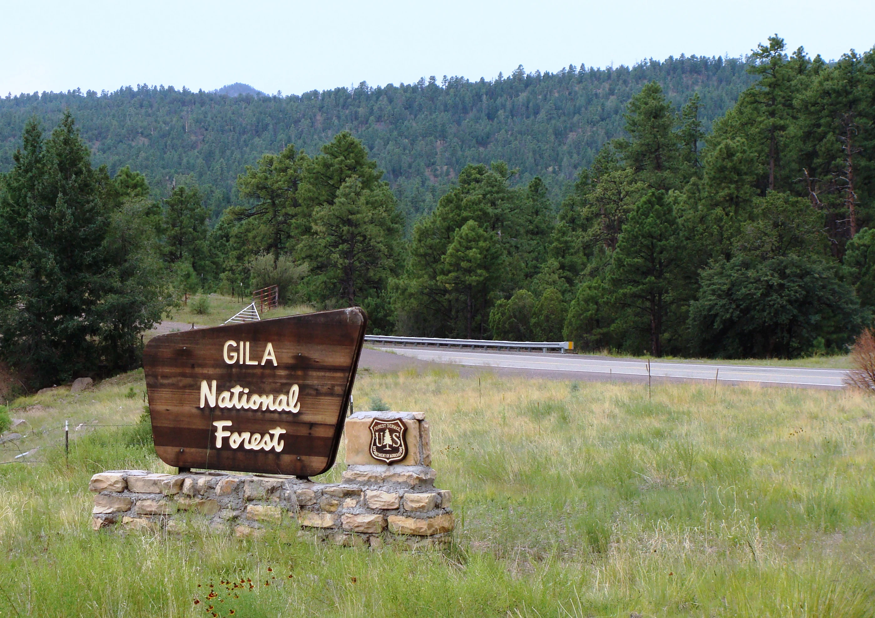
A brown wooden entrance sign for Gila National Forest sitting on a stone base, with a forested hillside in the background.
The entrance sign for Gila National Forest along a highway in New Mexico.

Gila National Forest wildlife and species highlights

The wildlife of Gila National Forest is unusually varied, owing to the forest's size and the wide range of habitats it protects. The forest is the namesake habitat for several distinctive species, including the Gila monster, a venomous lizard native to the Southwest; the Gila trout, a native salmonid confined to cool streams in the Gila River watershed; the Gila topminnow, a small endangered fish; and several members of the Gila genus of western chub. The Gila woodpecker also takes its name from the broader Gila region.

Beyond these namesake species, the forest supports a rich community of large mammals. Black bears, elk, mule deer, white-tailed deer, and cougars roam the forested higher elevations, while desert bighorn sheep occupy the more arid canyon country. Coyotes, bobcats, gray foxes, white-nosed coatis, raccoons, collared peccaries, and wild turkeys are also present, often near watercourses and at forest edges. Beavers are particularly notable along the Middle Fork of the Gila River, where their dams shape local hydrology and create wetland habitat that benefits many other species.

Birdlife is equally diverse. Bald eagles, peregrine falcons, ospreys, and spotted owls are among the raptors that either nest or forage within the forest. The rare and endangered Mexican gray wolf has been reintroduced into the broader Gila region, making the forest one of the core areas for this historic recovery effort. The endangered Sonoran pronghorn, although more strongly associated with desert habitats further west, is also connected to the region's broader conservation landscape. Taken together, these populations give Gila a wildlife profile of unusual regional importance within the U.S. National Forest System.

Gila National Forest conservation status and protection priorities

Gila National Forest occupies a foundational place in American conservation history, both as a cradle of the wilderness idea and as a working landscape for ongoing ecological management. Its wilderness areas, including the Gila, Aldo Leopold, and Blue Range Wilderness, protect nearly 800,000 acres of backcountry from significant development, allowing ecological processes to operate over very large, connected areas. These wildernesses serve as refugia for sensitive species and as benchmarks for ecosystem integrity in a region facing significant human pressures.

Beyond wilderness protection, the forest hosts active conservation programs targeting rare and endangered wildlife. The Mexican gray wolf reintroduction program, one of the most high-profile predator recovery efforts in the United States, uses portions of the Gila region as core habitat. Native fish conservation, particularly work to protect the Gila trout and Gila topminnow, has made the forest's streams and rivers focal points for aquatic species recovery. The presence of bald eagles, peregrine falcons, and spotted owls adds further conservation significance, as these species are indicators of broader environmental health.

At the same time, the forest faces ongoing conservation challenges. Hundreds of unregulated cattle roam parts of the forest, damaging riparian vegetation, trampling habitat, and competing with native wildlife; the U.S. Forest Service has used aerial gunning to reduce these feral herds. Proposals to expand herbicide use within the forest have also raised ecological concerns, particularly regarding risks to monarch butterfly habitat from chemicals like dicamba and to ponderosa pines from aminocyclopyrachlor. These debates reflect the broader tension the forest embodies, serving simultaneously as a pioneer of wilderness preservation and as a working landscape subject to modern management controversies.

Gila National Forest cultural meaning and human context

Gila National Forest carries strong cultural significance, anchored by one of the most iconic archaeological sites in the American Southwest. The Gila Cliff Dwellings National Monument, located within the Catron County portion of the forest, preserves the remains of dwellings built by the ancestral Puebloan peoples in caves and alcoves along the Gila River's headwaters. This site links the forest to a longer human story of the Southwest, connecting modern visitors to landscapes that have supported human life for centuries.

The forest's name itself reflects the deeper cultural geography of the region. The Gila River is named in connection with Indigenous peoples of the Southwest, and the broader landscape incorporates places, canyons, and trails that long predate the establishment of the federal forest system. Today, traditional communities, ranchers, recreationists, conservationists, and agency staff all have a stake in how the landscape is interpreted and managed, contributing to an evolving cultural context that stretches well beyond the boundaries of any single monument or trail.

Top sights and standout views in Gila National Forest

Gila National Forest's strongest distinguishing feature is the Gila Wilderness, founded in 1924 as the world's first designated wilderness and a direct ancestor of the modern U.S. Wilderness System. The forest's sheer size, ranking among the largest in the contiguous United States, allows it to hold not just one but three wilderness areas, with Aldo Leopold Wilderness and Blue Range Wilderness rounding out its protected core.

Equally compelling are the forest's ecological breadth and cultural depth. Within a single landscape, visitors can move from semi-desert basins through piñon-juniper woodland and ponderosa pine forests up to cool montane canyons, encountering native Gila-region wildlife such as the Gila monster, Gila trout, Mexican gray wolf, and desert bighorn sheep. Add to this the Gila Cliff Dwellings National Monument, isolated hot springs, dark-sky viewing at Cosmic Campground, and more than 1,600 miles of non-motorized trails, and the forest emerges as one of the most varied and historically significant protected landscapes in the Southwest.

Best time to visit Gila National Forest

Seasonality in Gila National Forest is shaped strongly by elevation and latitude, with cooler, snow-influenced conditions in the higher mountains and warmer, drier conditions in the lower desert country. Spring and early summer tend to bring mild temperatures, blooming high-country wildflowers, and active wildlife such as elk and deer, while also offering comfortable conditions for hiking, camping, and visiting the cliff dwellings before monsoon heat sets in.

Summer monsoons regularly bring afternoon thunderstorms across southwestern New Mexico, particularly from mid-summer onward. These rains can rapidly change canyon conditions and produce dramatic skies, but they also create flash flood risk in narrow drainages and make some backcountry routes more difficult. Fall is widely considered an attractive time to visit, with cooler temperatures, reduced crowds compared to peak summer, and strong visibility for both scenic driving and night-sky viewing. Winter brings snow to the higher elevations, which can limit access to remote roads but also offers solitude and excellent stargazing conditions, especially around the Cosmic Campground dark-sky area.
Monthly climate preview

Long-term representative coordinate records detailing temperature ranges and precipitation rhythm

Gila National Forest Climate Normals and Measured Monthly Weather Patterns

Representative coordinates record measured monthly temperature swings from sub-zero winter minimums to warm summer maximums alongside seasonal precipitation shifts. Detailed monthly climate records provide a complete twelve-month breakdown of long-term temperature and precipitation normals for Gila National Forest.
Annual mean10 °C
1 °C21 °C
Jan
Feb
Mar
Apr
May14°
Jun20°
Jul21°
Aug20°
Sep17°
Oct11°
Nov
Dec
Warmest month
July

20.7 °C

Coolest month
December

0.8 °C

Wettest month
August

2.8 mm/day

Driest month
April

0.4 mm/day

Park location guide

Geography guide, regional context, and park location map for Gila National Forest

Gila National Forest park geography, regions, and map view in United States of America

Understand where Gila National Forest sits in United States of America through a broader geographic reading of the surrounding landscape, nearby location context, and its mapped position within the national park landscape.

How Gila National Forest fits into United States of America

The United States of America is a federal presidential republic and one of the world's largest countries by area and population. It consists of 50 states across a vast territory spanning multiple time zones, with its capital in Washington, D.C. and largest city in New York City. The nation has a diverse economy, influential political system, and significant cultural and military presence globally.

Wider geography shaping Gila National Forest in United States of America

The United States occupies a vast territory in North America, bordered by Canada to the north and Mexico to the south. The 48 contiguous states stretch from the Atlantic to the Pacific Ocean, while Alaska occupies the northwestern region and Hawaii is an archipelago in the Pacific. The country encompasses diverse terrain including the Rocky Mountains, Appalachian Mountains, Great Plains, and extensive river systems.

Map view of Gila National Forest

Use this park location map to pinpoint Gila National Forest in United States of America, understand its exact geographic position, and read its mapped placement within the surrounding landscape more clearly.

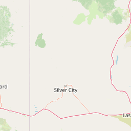
Pigeon | © OpenStreetMap contributors

Location context for Gila National Forest

New Mexico
Recorded earthquake history

Examine the Recorded Earthquake History of Gila National Forest

MoriAtlas maintains a precise historical catalogue of seismic events recorded near the Gila National Forest. Review documented earthquake data, including magnitudes and epicentral distances, to better understand the seismic history within this significant New Mexico protected landscape.

Gila National Forest Earthquake History

Catalogued events

46 events

Strongest magnitude

Magnitude 5.3

Most recent event

Jul 25, 2026

This history includes earthquakes recorded inside the park or within 50 km of its borders

Visual reference for rugged mountain terrain, deep river canyons, and diverse habitats.

Gila National Forest Photos: Exploring Protected Landscapes and Scenery

Visual documentation reveals the dramatic topographic shifts across Gila National Forest, moving from high coniferous mountain ranges down to arid canyon country. Examining field photography helps researchers understand the complex ecological gradients and remote protected terrain defining this historic wilderness.

A beaver dam constructed of sticks and branches spanning a calm river, surrounded by lush green riparian vegetation and trees.

A small clear spring-fed pool surrounded by rocky terrain and dense green trees, with a large fallen log spanning across the water.

A moonlit landscape showing a dark, forested mountain range against a clear night sky with visible stars.

A brown wooden entrance sign for Gila National Forest sitting on a stone base, with a forested hillside in the background.

Park atlas

Compare surrounding rugged mountain ranges, deep river canyons, and adjacent wilderness lands.

Explore Parks Near Gila National Forest and Connected Regional Protected Areas

Compare Gila National Forest against surrounding public lands and nearby protected areas in the American Southwest. Broaden geographic comparison by browsing related mountain terrain, river canyons, and regional wilderness designations.
A horizontal watercolor illustration showing green foreground vegetation, rolling light green hills in the midground, and purple hazy mountains in the background against a white sky.
Wildlife reserveNew Mexico
Park boundaries overlap#1 closest

Southeast

Gila Wilderness: An In-Depth Look at the Protected Landscape and Geography of New Mexico

Mapped terrain, alpine peaks, and diverse forest ecosystems within the American Southwest

The Gila Wilderness stands as a primary case study in landscape conservation, protecting a massive network of unroaded river canyons and forest-covered mountains in New Mexico. This region serves as a bridge between temperate montane zones and arid desert environments, creating a unique ecological atlas defined by significant altitudinal gradients, volcanic features, and extensive watershed networks across the Mogollon range.

Area
225,820 km²
Established
1924
IUCN
Ib
Relief
Mountain
Wildlife reserveArizona
About 87 km away#2 closest

West

Fishhooks Wilderness: An Arizona Desert Wildlife Reserve and Protected Landscape Atlas

Mapped terrain and arid geography in Graham County

Fishhooks Wilderness represents an intact, undeveloped stretch of southeastern Arizona desert managed by the Bureau of Land Management. The area provides a critical example of basin-and-range topography, where volcanic ridges and desert flats border the San Carlos Apache Indian Reservation. This record offers a clear perspective on the wilderness boundaries, ecological transition zones, and remote backcountry character of this distinctive regional landscape.

Area
42 km²
IUCN
Ib
Relief
Upland
Climate
Arid
National parkNavajo County
105 km away#3 closest

Northwest

Petrified Forest National Park: National Park Protected Landscape and Geographic Atlas

Explore its mapped terrain and regional park context.

Petrified Forest National Park represents a significant protected landscape within Navajo County, Arizona, offering focused insights into its unique terrain and geographic distribution. As a national park, it provides valuable data for understanding mapped park boundaries, regional landscape context, and its role within the broader atlas of protected areas. Discover the specific geographic features and natural identity that define this unique natural reserve.

Area
895.94 km²
Established
1962
IUCN
II
Visitors
644.9K annual
National parkNew Mexico
108 km away#4 closest

East

White Sands National Park: National Park with Unique Dune Landscape in New Mexico

Explore its protected boundaries and desert geography.

White Sands National Park is a protected national park renowned for its stunning gypsum dunes, offering a unique landscape within New Mexico's geography. This page provides detailed information on its mapped protected area, serving as a valuable resource for understanding the park's specific geographic context and its identity as a significant protected natural landscape.

Area
601.3 km²
Established
2019
IUCN
V
Visitors
729.1K annual
A soft watercolor painting of a wide, rolling mountain landscape with muted greens, yellows, and purples.
Wildlife reserveArizona
119 km away#5 closest

Southwest

Galiuro Wilderness: A Protected Mountain Landscape in Southeastern Arizona

Mapped geography and terrain of the Galiuro range

Trace the uplifted slabs and eroded canyons that define Galiuro Wilderness. This protected area rises from the Arizona plains to reveal a complex geography of brushy slopes, spring-fed riparian zones, and sky-high summit vistas.

Area
309 km²
Established
1932
IUCN
Ib
Relief
Mountain
Protected landscapeArizona
137 km away#6 closest

West

Tonto National Forest: Understanding the Geography of an Expansive Protected Landscape

Exploring the vertical ecosystem gradients in Central Arizona

Spanning from arid Sonoran basins to the towering Mogollon Rim, Tonto National Forest offers a unique study in vertical geography and protected land management. This expansive territory provides a vital map of Southwest life zones, encompassing reservoir systems, rugged river canyons, and critical wilderness habitat that define the environmental identity of the region.

Area
11,627 km²
Established
1905
Visitors
5.9M annual
Relief
Mountain
Wildlife reserveArizona
About 146 km away#7 closest

West

Needle's Eye Wilderness: Protected Desert Geography and Mescal Mountain Topography

Gila River canyons and limestone desert landscapes in Arizona

Needle's Eye Wilderness encompasses a rugged segment of the Mescal Mountains where the Gila River has incised deep limestone gorges. This protected area features a striking shift between harsh arid uplands and a dense riparian corridor, offering a study in concentrated desert canyon topography and dramatic geological formations within southern Arizona.

Area
35.5 km²
Established
1990
IUCN
Ib
Relief
Mountain
A minimalist watercolor painting depicting soft green rolling hills in the foreground and faded pink mountain ridges in the background on a white paper background.
Protected areaNew Mexico
150 km away#8 closest

Northeast

Manzano Mountain Wilderness: Rugged Protected Landscapes in Central New Mexico

Canyon-scarred mountain geography and forest ecosystems.

Manzano Mountain Wilderness is a significant protected area defined by its deep, radiating canyons and compressed elevational ranges. From pinyon-juniper foothills to the spruce-fir heights of the crest, this landscape offers a detailed look at the varied natural terrain found within the Cibola National Forest in New Mexico.

Area
149.23 km²
Established
1978
IUCN
Ib
Relief
Mountain

Common questions about visiting, size, designation, and location context for Gila National Forest

Gila National Forest FAQs for park facts, access, geography, and protected area context

Find quick answers about Gila National Forest, including protected-area facts, park geography, trail and visitor context, and how the park fits into its surrounding country and regional landscape.
MoriAtlas Explorer

Continue Your Protected Areas Search Across the Global Atlas

Deepen your exploration by continuing the structured search for national parks and protected areas worldwide. Utilize the comprehensive filtering capabilities to compare different conservation landscapes and refine your understanding of global park geography. Discover more about the distribution and characteristics of protected natural areas.

Global natural geography