
Mori Atlas logo
Wildlife reserveGila Wilderness

Mapping the rugged Mogollon Mountain terrain, deep river canyons, and historic conservation legacy of the southwestern United States

Gila Wilderness: A Landmark Protected Landscape and Geographic Atlas of New Mexico High Country

The Gila Wilderness occupies a vast, unroaded expanse in southwestern New Mexico, representing a vital intersection between Rocky Mountain coniferous forests and the Chihuahuan Desert. This protected wildlife reserve preserves a complex mosaic of high-altitude alpine summits, ponderosa pine woodlands, and isolated river gorges formed by the headwaters of the Gila River. The mapped landscape chronicles a historic transition in conservation land management, reflecting deep geological shifts from volcanic mesas to riparian corridors that sustain rare ecosystems.

wilderness areaMogollon Mountainsponderosa pine forestriver canyonshot springscliff dwellings
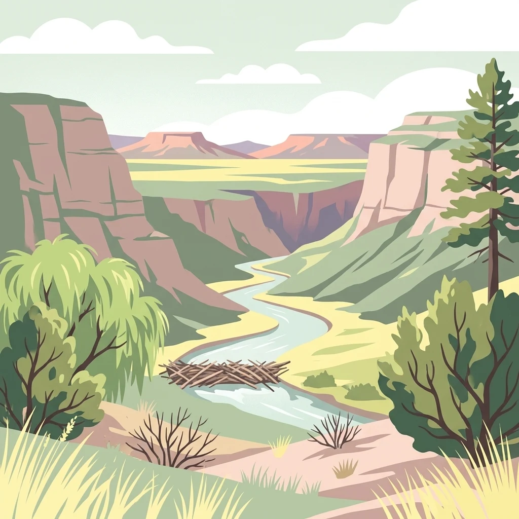
A digital illustration depicting a river flowing through a deep, layered canyon with steep cliffs, desert vegetation, and a beaver dam in the foreground.

Gila Wilderness

Wildlife reserve

Park overview

Structured park overview, official facts, and landscape profile for Gila Wilderness

Gila Wilderness park facts, protected area profile, and essential visitor context

Review the core facts for Gila Wilderness, including designation, size, terrain, visitor scale, habitats, and operating context in one park-focused overview.

About Gila Wilderness

The Gila Wilderness stands as both a birthplace of the wilderness concept and one of the Southwest's most ecologically diverse protected landscapes. Located in the Mogollon Mountains of southwestern New Mexico, it stretches across a sweeping arc of forested ridges, deep river canyons, and desert foothills within the broader Gila National Forest.

The wilderness encompasses the headwaters of the Gila River, with three major forks carving narrow canyons through forest and rock. Elevations climb from riverside terrain near 4,800 feet to alpine summits along the Mogollon crest. Whitewater Baldy, the highest peak at 10,895 feet, anchors the northwestern corner of the range, while Black Mountain rises prominently at the northeast. The Gila Cliff Dwellings National Monument adjoins the wilderness, preserving the cultural depth of the region.

Ecologically, the Gila occupies a remarkable transition zone. High elevation forests of spruce, fir, and quaking aspen give way to extensive ponderosa pine stands, pinyon-juniper woodlands, and desert vegetation on dry southern slopes. Riparian corridors of sycamore, walnut, cottonwood, and willow line the rivers. This ecological range supports a corresponding richness of wildlife, from elk, deer, and black bears to mountain lions and reintroduced Mexican wolves.

The Gila is more than a scenic landscape; it is a foundational place in American conservation history. Designated as the world's first wilderness area in 1924 and later confirmed under the 1964 Wilderness Act, it set the model for preserving wildlands without roads, buildings, or mechanical intrusion. Today, the wilderness continues that legacy as a stronghold of natural processes, solitude, and biological diversity in a region where mountains and desert converge.

Quick facts and research context for Gila Wilderness

The Gila Wilderness covers approximately 558,014 acres in Catron and Grant counties of southwestern New Mexico, making it the largest designated wilderness area in the state. It is administered by the United States Forest Service as part of the Gila National Forest, alongside the adjacent Aldo Leopold Wilderness and Blue Range Wilderness.

Located north of Silver City, the wilderness extends roughly 27 miles north to south and 39 miles east to west. It contains the West Fork, Middle Fork, and a large portion of the East Fork of the Gila River, with riverside elevations around 4,850 feet forming its lowest terrain.

Protection and recognition

Documented terrestrial conservation metrics and official establishment year data

Gila Wilderness Protection Status and Designated History Records

Gila Wilderness holds documented terrestrial protection status established in the year 1964 across the managed conservation landscape. Review official designation history and verified administrative records for this protected natural area.

Protection details

Protection scope
Terrestrial
Designated year
1964
Transboundary protection
No
Park context

Deeper park guide and search-rich context for Gila Wilderness

Gila Wilderness history, landscape, wildlife, and travel context

Explore Gila Wilderness through its history, landscape character, ecosystems, wildlife, conservation priorities, cultural context, and seasonal travel timing in a structured park guide built for atlas discovery and search intent.

Why Gila Wilderness stands out

The Gila Wilderness is best known as the world's first designated wilderness area, established through the advocacy of Aldo Leopold in 1924. Its rugged Mogollon Mountain terrain, ancient cliff dwellings, hot springs, and unroaded river canyons define its identity as a defining landscape of the American wilderness movement. Equally distinctive is its ecological role as a transition zone between Rocky Mountain coniferous forests and the northern Chihuahuan Desert. The wilderness harbors one of the largest and healthiest ponderosa pine forests in the world, along with the northernmost stands of Chihuahua pine and a thriving population of reintroduced Mexican wolves.
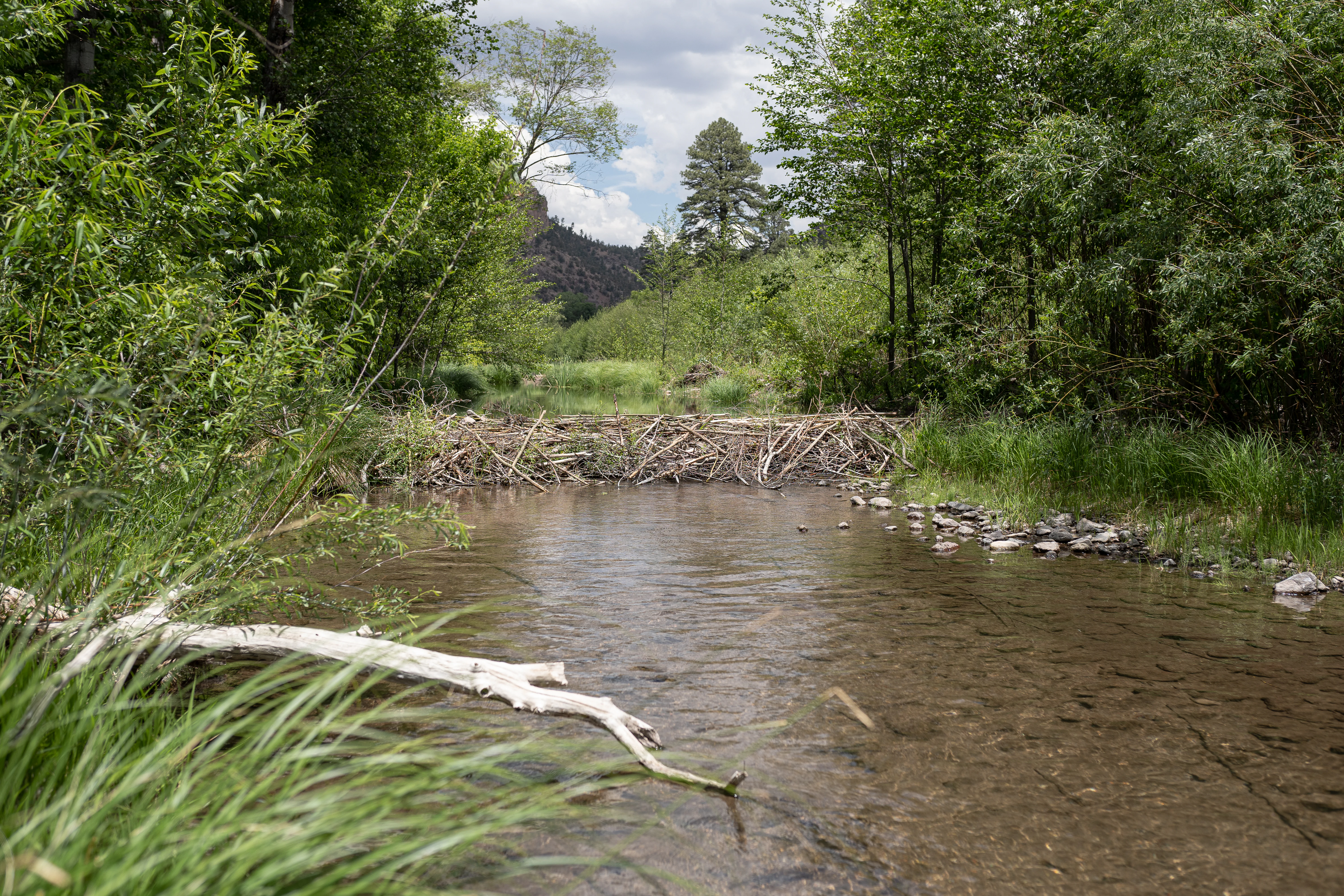
A beaver dam constructed of sticks and logs blocks a section of a clear, shallow river, surrounded by lush green trees and grasses.
A beaver dam spanning the Middle Fork of the Gila River within the Gila Wilderness.

Gila Wilderness history and protected-area timeline

The Gila Wilderness carries layers of human history stretching back more than a thousand years. Between roughly 1000 and 1130 CE, the Mimbres people, a subgroup of the broader Mogollon culture, inhabited the area, leaving behind cliff dwellings, pottery traditions, and architectural ruins that remain embedded in the landscape. Later, between approximately 1200 and 1600, the Chiricahua band of Apache moved into the region. Their fierce defense of the land kept it largely undeveloped well into the late nineteenth century, preserving its character during a period when much of the West was being transformed by settlement.

The modern conservation history of the Gila began in 1922, when Aldo Leopold, then a United States Forest Service supervisor working in the Carson National Forest, proposed that the headwaters of the Gila River should be protected by administrative action. He advocated an approach that excluded roads and denied use permits for damaging activities, setting the philosophical foundation for wilderness protection.

In 1924, through Leopold's efforts, the headwaters area of the Gila became recognized as the first wilderness area within the National Forest System. This designation marked a global milestone: the Gila was the world's first designated wilderness area, introducing a concept that would eventually shape conservation policy worldwide. In 1964, the Wilderness Act, signed into law by President Lyndon B. Johnson, codified the wilderness system at the federal level. The Gila became the first congressionally designated wilderness within the National Wilderness Preservation System, securing its place at the origin of American wilderness protection.

Gila Wilderness landscape and geographic character

The Gila Wilderness is defined by the sweeping arc of the Mogollon Mountains, which traverse the area from northwest to southeast. These mountains create a complex terrain of forested ridges, sheer cliffs, deep canyons, and rounded mesas. Elevations range from riverside floors near 4,850 feet to alpine summits exceeding 10,000 feet, with Whitewater Baldy standing at 10,895 feet as the highest point in the range and Black Mountain rising to 9,287 feet at the northeast corner.

The wilderness is profoundly shaped by water, even where it is scarce. The West Fork, Middle Fork, and a large portion of the East Fork of the Gila River carve through the mountains, creating narrow gorges, cliff-bordered valleys, and isolated box canyons. One of the most iconic features, the Catwalk, is a narrow gorge only a few feet wide where a rushing stream tumbles beneath overhanging rock walls. The Middle Fork of the Gila River runs for roughly 41 miles through the wilderness, while the West Fork extends about 34.5 miles.

Below the montane forests, the terrain transitions into broad mesas, dry southern slopes, and desert foothills characteristic of the northern Chihuahuan Desert. This mixture of montane and arid landscapes creates a visual and ecological mosaic: cool pine-clad highlands give way to warm, sun-baked canyons in a matter of miles.
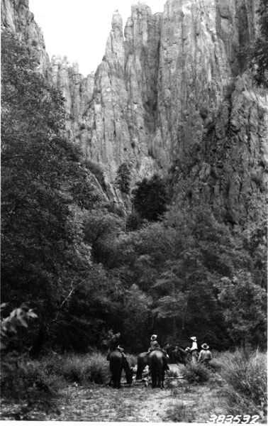
A black and white historical photograph showing a small group of people riding horses on a dirt trail at the base of tall, jagged rock cliffs.
A 1922 historical photograph of horseback riders on a trail in the Gila Wilderness.

Gila Wilderness ecosystems, habitats, and plant life

The wilderness contains a remarkable range of vegetation zones that reflect its role as a transitional landscape between the Rocky Mountains and the Chihuahuan Desert. Above 9,000 feet, spruce-fir forests and stands of quaking aspen dominate the high country, giving the upper elevations a distinctly northern character. Between 6,500 and 9,000 feet, extensive ponderosa pine forests flourish, including one of the largest and healthiest ponderosa pine ecosystems in the world. Below 6,500 feet and on dry southern exposures, the vegetation shifts to pinyon-juniper woodland, brushy grasslands, and desert scrub.

The Gila marks the northernmost extent of the Chihuahua pine, and unique stands of Apache pine and mesquite occur within its borders. Along the river corridors and in shaded canyons, the vegetation transitions dramatically: Arizona sycamore, walnut, maple, ash, cottonwood, alder, and willow create thriving riparian communities that contrast with the surrounding arid slopes.

Frequent fires have shaped the wilderness, leading to mosaic patterns of burned and recovering forest that contribute to habitat diversity. Gambel oak understory and Douglas-fir stands provide key habitats for sensitive species, and pockets of Arizona Mountains forest ecosystems are scattered throughout the area, bridging the desert and montane worlds.
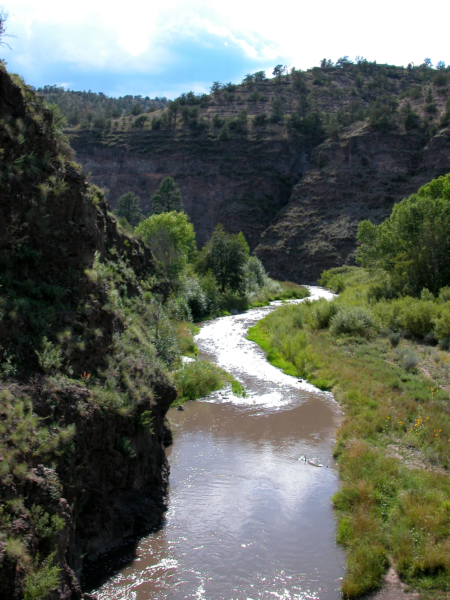
A river flows through a canyon with steep, dark, rocky cliffs on one side and riparian vegetation along the banks.
The Middle Fork of the Gila River winding through a rugged canyon in the Gila Wilderness.

Gila Wilderness wildlife and species highlights

The Gila Wilderness supports a rich and varied fauna that reflects its mosaic of habitats. Among the most prominent predators are mountain lions and bobcats, while black bears, gray foxes, and the unusual white-nosed coati roam the canyons and forests. Mule deer, white-tailed deer, and pronghorn inhabit the open terrain, completing the picture of a thriving southwestern mammal community.

The wilderness is notable as a reintroduction site for the Mexican wolf, a critically endangered subspecies. In 1998, eleven captive-raised Mexican wolves were released into the Gila. After significant early losses, additional animals were released the following year, and by 2006 four packs had established themselves within the wilderness, marking an important milestone for species recovery despite ongoing conflicts with livestock interests.

Bighorn sheep, locally extinct by around 1900, were reintroduced after 1958 using Rocky Mountain bighorn stock descended from Canadian releases in the Sandia Mountains. Elk were also reintroduced in 1954, when sixteen animals from Yellowstone National Park were brought to the area, and today elk are an established presence in the high country.

Birdlife is similarly diverse. The wilderness holds the largest known population of near-threatened spotted owls, which favor Douglas-fir and white fir stands as well as ponderosa forests with a developed Gambel oak understory. Game birds such as wild turkey and dusky grouse are present, and birds of prey include common black hawks, zone-tailed hawks, northern goshawks, ospreys, and bald eagles. American dippers inhabit the cold mountain streams.

Reptiles include the rarely seen Arizona coral snake and the iconic Gila monster, alongside more common species like the black-tailed rattlesnake, rock rattlesnake, and Sonora mountain kingsnake. The rivers and streams support brown trout, rainbow trout, catfish, and bass, while the threatened Gila trout persists in the deep, beaver-modified pools of Iron, McKenna, and Spruce Creeks.
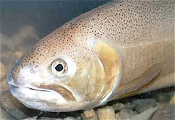
A close-up photograph of a Gila trout showing its speckled head and eye, underwater.
A close-up view of a Gila trout, a species native to the waterways of the Gila Wilderness.

Gila Wilderness conservation status and protection priorities

The Gila Wilderness carries global conservation significance as the birthplace of the wilderness concept. Its 1924 designation as the first wilderness area in the world, driven by Aldo Leopold's vision of preserving forests through administrative protection rather than resource extraction, set a model that would later be codified in the 1964 Wilderness Act. When the Act passed, the Gila became the first congressionally designated wilderness within the National Wilderness Preservation System.

Ecologically, the wilderness preserves a rare transition zone between the Rocky Mountains and the northern Chihuahuan Desert, protecting the genetic and ecological integrity of species at the edges of their ranges. Its extensive ponderosa pine forests are among the largest and healthiest in the world, while its riparian corridors support rare aquatic species such as the threatened Gila trout.

Wildlife recovery efforts have been central to the conservation profile of the Gila. The reintroduction of the Mexican wolf beginning in 1998 marked one of the most ambitious carnivore recovery programs in North American history, while bighorn sheep and elk have been reestablished as functioning populations. Park policy strictly prohibits roads, buildings, logging, mining, and motorized or mechanized vehicle use, ensuring that natural processes continue to shape the landscape.

Gila Wilderness cultural meaning and human context

The Gila Wilderness holds deep cultural resonance extending back more than a millennium. The Mogollon people, and later the Mimbres, a subgroup of that broader culture, inhabited the region between roughly 1000 and 1130, creating cliff dwellings and ceramic traditions whose traces remain visible along the river corridors. The Middle Fork of the Gila River in particular is bordered by ancient cliff dwellings, anchoring these landscapes in the human history of the Southwest.

Between 1200 and 1600, the Chiricahua Apache established themselves in the area, and their defensive stewardship of the land kept the region largely undeveloped into the 1870s. This period of relative isolation helped preserve both the natural condition and the archaeological record that scholars and visitors encounter today.

The adjacent Gila Cliff Dwellings National Monument preserves some of the most significant Mogollon-era sites and serves as a focal point for visitors exploring the area. The cultural continuity of the landscape, from ancient cliff dwellers to the Apache to the American conservation movement, makes the Gila a place where natural and human history are inseparably intertwined.

Top sights and standout views in Gila Wilderness

The Gila Wilderness stands out for its singular place in the history of wilderness conservation, its status as the world's first designated wilderness area, and the ecological richness of its transitional landscape. Within its borders lie some of the largest ponderosa pine forests on earth, the northernmost stands of Chihuahua pine, and populations of reintroduced Mexican wolves, bighorn sheep, and elk.

Visitors encounter natural hot springs scattered throughout the wilderness, ancient Mogollon cliff dwellings along the Middle Fork of the Gila River, and a network of trails that follow river valleys and mountain ridges. The Catwalk trail, suspended above a narrow gorge, and the Crest Trail, winding through sub-alpine forests above 10,000 feet, are standout routes that capture the range of the wilderness experience.

Best time to visit Gila Wilderness

The U.S. Forest Service characterizes the climate of the Gila Wilderness as having four relatively gentle seasons. Lower elevations below about 7,000 feet are accessible year-round and rarely see heavy winter snowfall, while higher elevations experience deeper snowpack in winter and cooler temperatures in summer. Elevation moderates the heat of the surrounding Chihuahuan Desert, though summer temperatures at lower elevations can approach 100 degrees Fahrenheit, with May and June being the hottest and driest months.

Spring brings snowmelt-driven high water on the Gila River, which is the traditional season for rafting. Cooler temperatures and active wildlife make spring and fall pleasant periods for hiking and backpacking. Summer offers the warmest high-country experience, though water becomes scarce in many areas and afternoon storms are common. Winter transforms the higher elevations into quiet, snow-covered terrain, offering a different and more solitary experience of the wilderness.

Monthly climate preview

Long-term representative averages tracking monthly temperature and precipitation variations

Gila Wilderness Climate Normals, Annual Temperature and Precipitation Rhythm

Representative coordinates record measured long-term annual temperature swings alongside monthly precipitation rhythms across the high-elevation terrain of Gila Wilderness. Examining the complete twelve-month statistical profile clarifies detailed thermal shifts and moisture patterns throughout the protected area.
Annual mean11 °C
2 °C22 °C
Jan
Feb
Mar
Apr10°
May16°
Jun21°
Jul22°
Aug20°
Sep17°
Oct12°
Nov
Dec
Warmest month
July

21.6 °C

Coolest month
December

1.6 °C

Wettest month
July

2.5 mm/day

Driest month
April

0.3 mm/day

Park location guide

Geography guide, regional context, and park location map for Gila Wilderness

Gila Wilderness park geography, regions, and map view in United States of America

Understand where Gila Wilderness sits in United States of America through a broader geographic reading of the surrounding landscape, nearby location context, and its mapped position within the national park landscape.

How Gila Wilderness fits into United States of America

The United States of America is a federal presidential republic and one of the world's largest countries by area and population. It consists of 50 states across a vast territory spanning multiple time zones, with its capital in Washington, D.C. and largest city in New York City. The nation has a diverse economy, influential political system, and significant cultural and military presence globally.

Wider geography shaping Gila Wilderness in United States of America

The United States occupies a vast territory in North America, bordered by Canada to the north and Mexico to the south. The 48 contiguous states stretch from the Atlantic to the Pacific Ocean, while Alaska occupies the northwestern region and Hawaii is an archipelago in the Pacific. The country encompasses diverse terrain including the Rocky Mountains, Appalachian Mountains, Great Plains, and extensive river systems.

Map view of Gila Wilderness

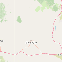
Use this park location map to pinpoint Gila Wilderness in United States of America, understand its exact geographic position, and read its mapped placement within the surrounding landscape more clearly.

Pigeon | © OpenStreetMap contributors

Location context for Gila Wilderness

New Mexico
Recorded earthquake history

View Historical Earthquake Records for the Gila Wilderness Area

Examine the technical archive of seismic activity associated with the geography of the Gila Wilderness. This MoriAtlas collection provides documented event data, including location coordinates, depth, and magnitude, for researchers and individuals seeking a comprehensive view of regional historical seismic patterns.

Gila Wilderness Earthquake Records

Catalogued events

8 events

Strongest magnitude

Magnitude 3.9

Most recent event

Feb 16, 2013

This history includes earthquakes recorded inside the park or within 50 km of its borders

Explore photographic records of Mogollon Mountain terrain, river canyons, and desert transition zones.

Gila Wilderness Photos and Landscapes: Visualizing the First Protected Area

Visual documentation reveals the rugged topography and transitional habitats characterizing the Gila Wilderness landscape. Photographic archives provide essential visual context for understanding remote mountain ridges, deep river gorges, and native ecological zones.

A beaver dam constructed of sticks and logs blocks a section of a clear, shallow river, surrounded by lush green trees and grasses.

A wide panoramic photograph showing a dry, grassy landscape with rolling hills, distant mountains, and scattered brush under a clear blue sky.

A black and white historical photograph showing a small group of people riding horses on a dirt trail at the base of tall, jagged rock cliffs.

A river flows through a canyon with steep, dark, rocky cliffs on one side and riparian vegetation along the banks.

A close-up photograph of a Gila trout showing its speckled head and eye, underwater.

Park atlas

Compare surrounding regional geography and connected wilderness terrain

Explore Parks Near Gila Wilderness and Related Protected Landscapes

Browse protected areas near Gila Wilderness to examine similar transitional mountain ecosystems and rugged river canyons. Comparing adjacent wild lands reveals broader ecological patterns across the southwestern borderlands.
A horizontal watercolor painting showing distant mountains in shades of purple, soft green rolling hills, a central winding river or stream, and grassy foreground elements on a white background.
Protected landscapeNew Mexico
Park boundaries overlap#1 closest

Northwest

Gila National Forest: A Geographic Overview of New Mexico's Protected Wilderness Core

Mapped terrain, forest boundaries, and regional wilderness character

Gila National Forest stands as a critical protected landscape in New Mexico, encompassing immense mountain ranges, narrow river gorges, and extensive backcountry basins. This atlas entry details the forest's topographic transition from high-altitude ponderosa stands to desert lowlands, highlighting its status as the foundational site for the global wilderness movement and a stronghold for regional ecological diversity.

Area
10,969.7 km²
Established
1905
Relief
Mountain
Climate
Temperate
Wildlife reserveArizona
About 108 km away#2 closest

West

Fishhooks Wilderness: An Arizona Desert Wildlife Reserve and Protected Landscape Atlas

Mapped terrain and arid geography in Graham County

Fishhooks Wilderness represents an intact, undeveloped stretch of southeastern Arizona desert managed by the Bureau of Land Management. The area provides a critical example of basin-and-range topography, where volcanic ridges and desert flats border the San Carlos Apache Indian Reservation. This record offers a clear perspective on the wilderness boundaries, ecological transition zones, and remote backcountry character of this distinctive regional landscape.

Area
42 km²
IUCN
Ib
Relief
Upland
Climate
Arid
National parkNew Mexico
146 km away#3 closest

East

White Sands National Park: National Park with Unique Dune Landscape in New Mexico

Explore its protected boundaries and desert geography.

White Sands National Park is a protected national park renowned for its stunning gypsum dunes, offering a unique landscape within New Mexico's geography. This page provides detailed information on its mapped protected area, serving as a valuable resource for understanding the park's specific geographic context and its identity as a significant protected natural landscape.

Area
601.3 km²
Established
2019
IUCN
V
Visitors
729.1K annual
A soft watercolor painting of a wide, rolling mountain landscape with muted greens, yellows, and purples.
Wildlife reserveArizona
151 km away#4 closest

West

Galiuro Wilderness: A Protected Mountain Landscape in Southeastern Arizona

Mapped geography and terrain of the Galiuro range

Trace the uplifted slabs and eroded canyons that define Galiuro Wilderness. This protected area rises from the Arizona plains to reveal a complex geography of brushy slopes, spring-fed riparian zones, and sky-high summit vistas.

Area
309 km²
Established
1932
IUCN
Ib
Relief
Mountain
Protected landscapeArizona
162 km away#5 closest

West

Tonto National Forest: Understanding the Geography of an Expansive Protected Landscape

Exploring the vertical ecosystem gradients in Central Arizona

Spanning from arid Sonoran basins to the towering Mogollon Rim, Tonto National Forest offers a unique study in vertical geography and protected land management. This expansive territory provides a vital map of Southwest life zones, encompassing reservoir systems, rugged river canyons, and critical wilderness habitat that define the environmental identity of the region.

Area
11,627 km²
Established
1905
Visitors
5.9M annual
Relief
Mountain
Wildlife reserveArizona
About 168 km away#6 closest

West

Needle's Eye Wilderness: Protected Desert Geography and Mescal Mountain Topography

Gila River canyons and limestone desert landscapes in Arizona

Needle's Eye Wilderness encompasses a rugged segment of the Mescal Mountains where the Gila River has incised deep limestone gorges. This protected area features a striking shift between harsh arid uplands and a dense riparian corridor, offering a study in concentrated desert canyon topography and dramatic geological formations within southern Arizona.

Area
35.5 km²
Established
1990
IUCN
Ib
Relief
Mountain
National parkNavajo County
180 km away#7 closest

Northwest

Petrified Forest National Park: National Park Protected Landscape and Geographic Atlas

Explore its mapped terrain and regional park context.

Petrified Forest National Park represents a significant protected landscape within Navajo County, Arizona, offering focused insights into its unique terrain and geographic distribution. As a national park, it provides valuable data for understanding mapped park boundaries, regional landscape context, and its role within the broader atlas of protected areas. Discover the specific geographic features and natural identity that define this unique natural reserve.

Area
895.94 km²
Established
1962
IUCN
II
Visitors
644.9K annual
National parkPima County
194 km away#8 closest

Southwest

Saguaro National Park: Discover Its Protected Landscape Geography and Mapped Boundaries

Explore the natural terrain and regional context of this national park.

Saguaro National Park offers a focused exploration of a specific protected landscape, highlighting its unique geographic features and mapped boundaries within Pima County. This detail page provides an atlas perspective, allowing for a deep dive into the park's natural terrain and its regional significance. Understand the protected area's identity and its place within the wider geographical context.

Area
371.16 km²
Established
1994
IUCN
II
Visitors
946.4K annual

Common questions about visiting, size, designation, and location context for Gila Wilderness

Gila Wilderness FAQs for park facts, access, geography, and protected area context

Find quick answers about Gila Wilderness, including protected-area facts, park geography, trail and visitor context, and how the park fits into its surrounding country and regional landscape.
MoriAtlas Explorer

Continue Your Protected Areas Search Across the Global Atlas

Deepen your exploration by continuing the structured search for national parks and protected areas worldwide. Utilize the comprehensive filtering capabilities to compare different conservation landscapes and refine your understanding of global park geography. Discover more about the distribution and characteristics of protected natural areas.

Global natural geography