Why Glacier National Park stands out
Glacier National Park is best known for its extensive glacier systems and dramatic alpine scenery within the Selkirk Mountains. The Illecillewaet Glacier, formerly called the Great Glacier, was a major tourist attraction during the early 20th century and remains the most visited and photographed glacier in the park. The park is also famous for Rogers Pass, a historic mountain corridor that was the site of significant railway engineering achievements and avalanche control efforts. The Nakimu Caves, one of Canada's largest cave systems, are another distinctive feature. The park's significance as an early center of alpinism in North America, centered around the historic Glacier House hotel, established its reputation in mountaineering circles worldwide.
Glacier National Park history and protected-area timeline
The history of Glacier National Park is intimately tied to the development of transcontinental transportation in Canada. The Selkirk Mountains were first noted by European explorers when David Thompson of the North West Company skirted around them along the Columbia River in 1811, naming them Nelson's Mountains after Lord Horatio Nelson. They were later renamed after Lord Thomas Douglas Selkirk, an executive of the rival Hudson's Bay Company.
Finding a pass through the Selkirks became critical after construction of the Canadian Pacific Railway began in the 1870s, as completion of the railway was a condition of British Columbia's entry into Canadian Confederation in 1867. After numerous failed attempts by surveyors including Walter Moberly, Major Albert Bowman Rogers discovered a viable pass in 1881 through the Illecillewaet River valley, earning a five thousand dollar prize for his discovery. The railway was completed in 1885, and the following year trains traveled west to the Pacific for the first time in Canada.
Recognizing the tourism potential of the mountainous, heavily glaciated area, Prime Minister John A. Macdonald returned from his journey through the Rockies inspired and led the creation of Glacier and Yoho National Parks, both established on October 10, 1886. The Canadian Pacific Railway built Glacier House hotel near the Illecillewaet Glacier terminus in 1886, which became a center for tourism, mountaineering, glaciology, and photography. The hotel attracted world-renowned alpinists and naturalists, including Mary Vaux Walcott who began the first scientific studies of the Illecillewaet Glacier. The hotel was expanded in 1905 and 1911 but declined after the Connaught Tunnel opened in 1916, which bypassed the Glacier House siding. It closed in 1925 and was torn down four years later.
The park experienced a revival in the 1960s when the Trans-Canada Highway was built through Rogers Pass in 1963, bringing tourists back to the park in large numbers. Parks Canada subsequently built new campgrounds and expanded the trail system to accommodate increasing visitation.
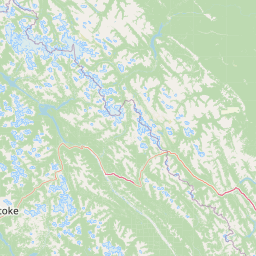
Glacier National Park landscape and geographic character
The landscape of Glacier National Park is defined by the northern Selkirk Mountains, a spectacular subrange of the Columbia Mountains that rise from the plateaus of British Columbia's Central Interior and extend eastward to the Rocky Mountain Trench. The park encompasses a portion of the northern Selkirks along with a narrow strip of the northern Purcells, creating a landscape of remarkable topographic diversity.
The topography varies significantly across the park, with rounded mountains and ridges dominating the eastern, northern, and western regions, while the central and southern areas feature sharp, steep-sided peaks that reflect more recent glacial carving. The highest peak in the park is Mount Dawson at 3,377 meters, while the dramatic Mount Sir Donald stands at 3,284 meters and has been a celebrated objective for mountaineers since the late 19th century.
The park contains 131 glaciers covering approximately 133 square kilometers, some of the most studied in North America. These glaciers have been dramatically reducing in size, with the most recent inventory noting a loss of 19.4 square kilometers of glacial surface area between 2000 and 2011. The Illecillewaet Glacier, formerly known as the Great Glacier, has retreated far up the mountainside from its former terminus near the Glacier House site. The glaciers exhibit a variety of appearances: high altitude features are smooth and uniform, while those on slopes are cracked and riddled with crevasses, and valley-bottom glaciers are often black with debris.
All watercourses in the park are part of the Columbia River drainage basin. The major rivers include the Illecillewaet, the Beaver, and the headwaters of the Incomappleux and Duncan Rivers. These glacially-fed rivers are swift-running, carry significant silt and rocky debris, and often appear milky white. They display notable diurnal cycles, running high in afternoons during peak snow and ice melt, then dropping considerably at night.
The park also contains one of Canada's largest cave systems, the Nakimu Caves, formed through water erosion of limestone strata by Cougar Brook. This six-kilometer cave system contains a rare substance known as moonmilk.
Glacier National Park ecosystems, habitats, and plant life
Glacier National Park encompasses a remarkable range of habitats across its elevation gradient, from lush temperate rainforest in the western valleys to inhospitable ice- and rock-covered alpine areas, to drier fir and pine forests on the eastern boundary. Four of British Columbia's biogeoclimatic zones are found within the park: Interior cedar/hemlock, Engelmann spruce/subalpine fir, Interior Douglas-fir in the eastern extremities, and alpine tundra at high elevations.
The western valleys support dense wet forests with a thick understory. The widest valleys, including the Illecillewaet, contain rare wetlands featuring skunk cabbage and water hemlock. Outside the wetlands, lower valleys are covered by Western Red cedar, western white pine, western hemlock, Interior Douglas-fir, and white birch, with ground species including devil's club, blueberries, liverwort, and various fern species.
The subalpine zone at middle elevations features Engelmann spruce, mountain hemlock, and subalpine fir, with a thick understory of rhododendron, berry species, and deep beds of moss and lichens. At higher elevations, this forest opens to meadows and slide chutes covered in grasses, herbaceous shrubs, and alpine wildflowers. Parks botanists have identified 546 species of flowering plants in the park, with late July to mid-September bringing an impressive display of alpine blooms.
The harsh alpine tundra zone at the highest elevations features poor soil, heavy snowfall, cold temperatures, and a very short growing season that discourages all but the hardiest sedge grasses, heathers, and lichens. The climate is heavily influenced by the Interior Wetbelt, with the park straddling Pacific maritime and continental weather systems, resulting in extremely high precipitation, particularly in winter months.
Glacier National Park wildlife and species highlights
Glacier National Park supports a rich wildlife population across its diverse habitats. The park is home to fifty-three mammal species, with bears dominating the snow zone. Both black bears and grizzly bears inhabit the park, with the berry-rich avalanche slides providing important food sources. They spend winters in deep dens hibernating. Other predators include timber wolves, coyotes, red foxes, wolverines, cougars, and lynx.
Mountain goats are the most common ungulates in the park, with a 1985 study counting approximately 300 individuals in the high peaks and valleys. Boreal woodland caribou migrate through certain park valleys, while elk, mule deer, and white-tailed deer can be found throughout. The deep snows of winter drive most ungulates out of the park into the lower elevations of the nearby Rocky Mountain Trench and Columbia valleys. Moose are occasionally seen in the park.
Small mammals in the lower forests include several species of squirrels, while alpine mammals include pikas, hoary marmots, and martens. The park supports 235 observed bird species, though the majority are migratory and only seen in summer. The thirty year-round resident species include woodpeckers, golden eagles, owls, ravens, Steller's jays, and golden-crowned kinglets. American dippers feed in the many waterfalls and cascades of the park.
Glacier National Park conservation status and protection priorities
Glacier National Park serves as a critical protected area within British Columbia's mountain ecosystems. The park's glaciers, some of the most studied in North America, serve as important indicators of climate change, with dramatic retreats documented over the past century. The park protects representative samples of the Columbia Mountains' ecological diversity, encompassing four biogeoclimatic zones from temperate rainforest to alpine tundra.
The protection of wildlife corridors through the park is essential for species like woodland caribou, whose migratory routes pass through the valley bottoms. The park's dense forests provide habitat for both black bears and grizzly bears, species that require large territories and intact ecological connections. The rare wetlands environment in the wider valleys, featuring species like skunk cabbage and water hemlock, represents a limited habitat type that the park helps preserve.
The Nakimu Caves, containing significant geological features including rare moonmilk formations, have been closed to general public access to protect their sensitive cave environment, demonstrating the park's commitment to balancing visitor access with conservation. The ongoing monitoring of wildlife populations, glacier retreat, and ecosystem health reflects the park's role in understanding and preserving mountain environments.
Glacier National Park cultural meaning and human context
The cultural heritage of Glacier National Park is deeply connected to transportation history and the development of Canada as a nation. Rogers Pass, located within the park, was the key to completing the Canadian Pacific Railway and achieving transcontinental unity. The pass was named after Major Albert Bowman Rogers, who discovered it in 1881, earning a substantial reward for his contribution to Canadian railway expansion.
The park's establishment in 1886 reflected the emerging Canadian philosophy of preserving natural landscapes for public enjoyment and national identity. The creation of Glacier and Yoho National Parks alongside Banff established a tradition of national park protection that continues to this day. The Glacier House hotel, built by the Canadian Pacific Railway, represented the company's strategy of using tourism to promote rail travel and showcase Canada's natural wonders to the world.
The history of the pass also includes a darker chapter. During the construction and operation of the railway through Rogers Pass, many workers of Japanese descent were employed, and more than half of the workers killed in the devastating 1910 avalanche were of Japanese descent. Between 1886 and 1916, two hundred railway employees lost their lives in the pass, a testament to the human cost of mountain transportation development.
Top sights and standout views in Glacier National Park
Glacier National Park offers exceptional alpine experiences across its dramatic landscape. The park contains over 140 kilometers of established hiking trails, with the Illecillewaet area serving as the primary access point for visitors. The Arthur O. Wheeler Hut, the oldest and largest alpine hut in the park, provides backcountry users with access to high-altitude routes and offers stunning views of the surrounding peaks and glaciers.
The Rogers Pass Discovery Centre provides interpretive programming about the park's natural and human history, including exhibits on railway engineering, avalanche control, and the region's glaciology. The three campgrounds at Illecillewaet, Loop Brook, and Sir Donald offer various camping experiences, while five designated backcountry camping areas and additional alpine huts provide opportunities for deeper exploration of the park's wilderness.
The dramatic peaks of the Sir Donald Range, including Mount Sir Donald itself, remain celebrated mountaineering objectives, continuing the park's legacy as one of North America's premier climbing destinations. The ongoing retreat of glaciers like the Illecillewaet provides visitors with the opportunity to witness landscape change in real time, while the remaining ice bodies continue to define the park's character.
Best time to visit Glacier National Park
The best time to visit Glacier National Park depends on the experience sought. Summer months from June through September offer the most accessible conditions, with hiking trails open and campgrounds operational. This period brings warm temperatures in the valley bottoms and subalpine zones, with average high temperatures reaching the high teens Celsius. Wildflower displays in alpine meadows are particularly impressive from late July through mid-September.
Autumn can bring excellent conditions for photography and wildlife viewing, with fewer visitors and the potential for early snow on higher peaks. Winter transforms the park into a world of deep snow and ice, but access is limited and avalanche hazards are extreme. The extreme snowfall at Rogers Pass, which can receive up to 17 meters in a winter, creates challenging conditions that make most of the park inaccessible to casual visitors.
Spring conditions are highly variable, with snow lingering at higher elevations while lower trails begin to clear. The diurnal cycles of river flows mean that afternoon water levels in glacially-fed streams are highest during summer months as snow and ice melt peaks. Visitors should be aware that the majority of park visitors pass through on the Trans-Canada Highway rather than stopping to explore the backcountry, meaning that more remote areas can offer solitude even during peak summer months.