Mori Atlas logo
National parkGonarezhou National Park

Discover the geographic context and park boundaries of this national park

Gonarezhou National Park: Mapped Protected Landscape in Masvingo Province, Zimbabwe

Gonarezhou National Park serves as a key protected landscape within Masvingo Province, Zimbabwe. This page focuses on its geographic identity, providing users with detailed information about its mapped boundaries and regional context. Explore Gonarezhou National Park as a significant component of the natural geography within its province, ideal for atlas-based discovery of protected areas and natural terrain.

Wilderness AreaElephant HabitatTransfrontier ParkSandstone CliffsRiver ValleyMopane Woodland

Gonarezhou National Park

National park

Park overview

Structured park overview, official facts, and landscape profile for Gonarezhou National Park

Gonarezhou National Park park facts, protected area profile, and essential visitor context
Review the core facts for Gonarezhou National Park, including designation, size, terrain, visitor scale, habitats, and operating context in one park-focused overview.

About Gonarezhou National Park

Gonarezhou National Park represents one of Africa's last great untouched wilderness areas, a vast expanse of savanna, woodland, and rocky outcrops that has preserved its ecological integrity despite decades of regional political instability. Located in the remote southeastern corner of Zimbabwe, the park sits in a transitional zone between the Zambezian bioregion to the north and the Southern African bushveld to the south, creating a mosaic of habitats that supports remarkable biodiversity. The park's relative isolation from major tourist routes has proven to be both a challenge for tourism development and a blessing for conservation, as the lack of heavy visitor pressure has allowed natural processes to continue with minimal interference. The Mwenezi River Valley cuts through the heart of the park, providing a vital water source that sustains ecosystems throughout the dry season and draws concentrations of wildlife to its banks and surrounding floodplains. The Chilojo Cliffs serve as the park's most dramatic geological feature, a massive sandstone formation that not only provides a stunning visual backdrop but also creates unique microhabitats for specialized species. Beyond the cliffs, the park encompasses diverse terrain including the Naymtongwe Plateau, the red hills of Ntambambomvu, and the Samalema Gorge where the Mwenezi River has carved a braided channel through ancient igneous rock.

Quick facts and research context for Gonarezhou National Park

Gonarezhou National Park covers 5,053 square kilometers, making it Zimbabwe's second-largest protected area after Hwange National Park. The park was originally established as a Game Reserve in 1936 and officially proclaimed a national park in 1975. Its most iconic geological feature is the Chilojo Cliffs, towering 180 meters high and stretching for approximately 20 kilometers along the southern bank of the Runde River. The park contains several significant natural pans including Tembwahata and Machanu, formed where the Save and Runde rivers converge. Gonarezhou operates under a co-management arrangement between the Zimbabwe Parks and Wildlife Management Authority and the Frankfurt Zoological Society through the Gonarezhou Conservation Trust, established in 2017. The park is home to all of Zimbabwe's major large mammal species and has historically supported populations of endangered Cape wild dogs.

Park context

Deeper park guide and search-rich context for Gonarezhou National Park

Gonarezhou National Park history, landscape, wildlife, and travel context
Explore Gonarezhou National Park through its history, landscape character, ecosystems, wildlife, conservation priorities, cultural context, and seasonal travel timing in a structured park guide built for atlas discovery and search intent.

Why Gonarezhou National Park stands out

Gonarezhou is best known for its dramatic Chilojo Cliffs, a spectacular 180-meter-high sandstone escarpment that runs for roughly 20 kilometers along the Runde River, creating one of Africa's most recognizable wilderness silhouettes. The park's elephant populations are legendary, both in historical significance and contemporary conservation value, which is why the Shona name Gonarezhou translates as The Place of Elephants. The park's transboundary connection to the Greater Limpopo Transfrontier Park positions it as a vital corridor for regional wildlife migration, particularly for species that require large ranges to maintain viable populations. Despite its vast size and ecological importance, Gonarezhou remains one of Africa's lesser-visited major wilderness areas, offering visitors an authentic safari experience in a landscape that has retained its primeval character far more than many more accessible parks.

Gonarezhou National Park history and protected-area timeline

The protection of Gonarezhou's wildlife dates back to 1936 when the area was first established as a Game Reserve, making it one of the older protected areas in Zimbabwe. The territory was officially proclaimed as a National Park in 1975, formalizing its conservation status within the country's growing network of protected areas. The park's modern history has been marked by significant periods of closure and instability, first during the Rhodesian War and later during the Mozambique civil conflict, both of which prevented effective park management and limited public access. Gonarezhou reopened to visitors in 1994 following the end of regional conflicts, though the subsequent economic challenges in Zimbabwe limited the government's capacity to invest in infrastructure and anti-poaching efforts. In 2007, the Zimbabwe Parks and Wildlife Management Authority entered into a partnership with the Frankfurt Zoological Society to provide financial and technical assistance for park management, a relationship that lasted a decade and focused on rebuilding infrastructure and strengthening protection. The most significant development came in March 2017 when management was transferred to the Gonarezhou Conservation Trust, a co-management entity equally represented by the parks authority and the Frankfurt Zoological Society, designed to retain tourism revenue at the park level for direct reinvestment into conservation and community development.

Gonarezhou National Park landscape and geographic character

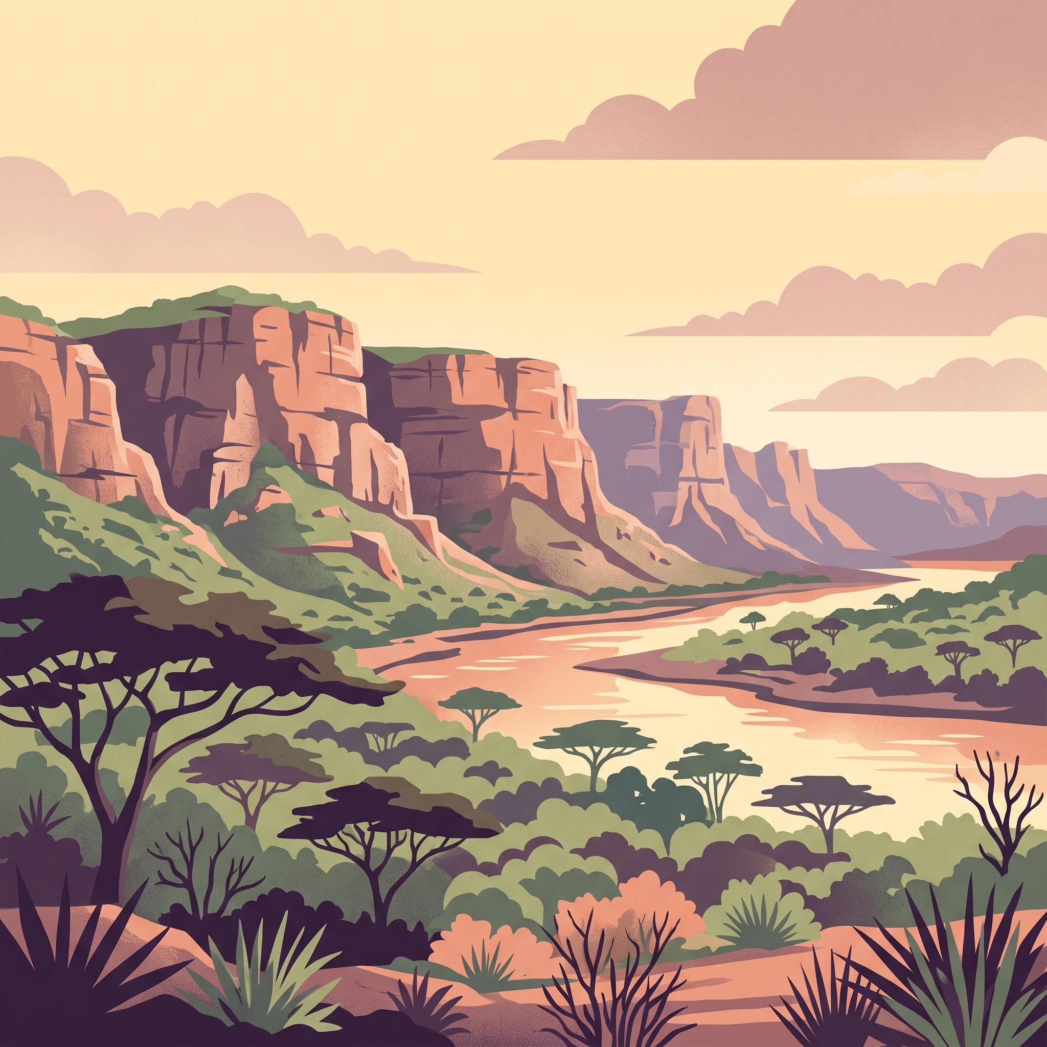
The landscape of Gonarezhou National Park is characterized by a dramatic combination of river valleys, sandstone cliffs, open savanna, and woodland corridors that create one of Zimbabwe's most scenically varied protected areas. The Chilojo Cliffs stand as the park's most impressive geological feature, rising 180 meters above the Runde River and extending for approximately 20 kilometers along its southern bank, their red and orange hues contrasting sharply with the green vegetation of the floodplain below. The northern portion of the park contains two large natural pans, Tembwahata and Machanu, which form at the confluence of the Save and Runde rivers and provide essential wet-season habitat for waterfowl and large mammals alike. The central and southern regions feature the Naymtongwe Plateau, a remnant of the same geological processes that created the Chilojo Cliffs, while the Ntambambomvu Red Hills rise above densely wooded slopes that overlay the sandy soils of the Malvernia basin. The Mwenezi River Valley represents a critical landscape feature, with its braided channel system cutting through solid igneous rock to create the Samalema Gorge, a narrow defile that provides both a scenic attraction and important dry-season refuge for wildlife.

Gonarezhou National Park ecosystems, habitats, and plant life

The ecological character of Gonarezhou spans two distinct bioregions, with the northeastern portions falling within the Zambezian and mopane woodlands while the southwestern areas represent the Southern Africa bushveld ecoregion. This transitional position creates a diverse mosaic of habitats ranging from dense mopane woodland on the deeper soils to more open savanna on the sandier substrates. The park's extensive river systems, particularly the Mwenezi and Runde rivers with their associated floodplains and pools, provide critical ecological corridors that connect habitats across the vast park area and sustain biodiversity even during the dry season. The natural pans in the north of the park, formed where major river systems converge, create unique wetland environments that support specialized plant and animal communities distinct from the surrounding woodlands. The combination of remote location, limited infrastructure, and transboundary connectivity has allowed Gonarezhou to maintain relatively intact ecological processes compared to more accessible protected areas in the region.

Gonarezhou National Park wildlife and species highlights

Gonarezhou supports a comprehensive array of large African mammals, with all of Zimbabwe's major safari species present within the park's boundaries. Elephant populations are particularly significant, both numerically and historically, as the park's Shona name translates as The Place of Elephants and these iconic animals remain the species most associated with the reserve. The park has historically served as important habitat for the endangered Cape wild dog, with confirmed sightings in 2010 suggesting the species persists in the area, though the small population's long-term viability likely depends on connectivity with adjacent Mozambican and South African populations through the transfrontier park network. Other notable mammals include giraffe, hippopotamus, Cape buffalo, zebra, wildebeest, both black and white rhinoceros, lion, leopard, cheetah, and hyena. The river systems and pans support significant concentrations of hippos and crocodiles, while the varied habitats provide refuge for numerous bird species and smaller mammals that form the base of the park's ecological pyramid.

Gonarezhou National Park conservation status and protection priorities

Gonarezhou's conservation significance extends well beyond Zimbabwe's borders, as the park forms an essential component of the Great Limpopo Transfrontier Park, one of Africa's most ambitious transboundary conservation initiatives. This peace park links Gonarezhou with South Africa's Kruger National Park and Mozambique's Limpopo National Park, creating a vast protected corridor that allows wildlife to move freely across international boundaries and supports genetic exchange between populations that would otherwise be isolated. The transfrontier approach is particularly important for wide-ranging species like elephants, lions, and Cape wild dogs that require large territories to maintain viable populations. The establishment of the Gonarezhou Conservation Trust in 2017 marked a significant evolution in the park's management model, designed to ensure that tourism revenue remains at the park level for direct reinvestment into conservation activities and infrastructure development rather than being absorbed into central government budgets. This financial model aims to create sustainable funding for anti-poaching efforts, habitat management, and community engagement programs that are essential for the park's long-term conservation success.

Top sights and standout views in Gonarezhou National Park

The Chilojo Cliffs remain Gonarezhou's signature attraction, their massive sandstone rampart providing a breathtaking backdrop for wildlife viewing and photography along the Runde River corridor. The park's relative remoteness and low visitor numbers offer an authentic wilderness experience increasingly rare in Africa's more developed safari destinations, with self-drive routes through the park allowing exploration at one's own pace. The Great Limpopo Transfrontier Park connection provides conceptual appeal for visitors interested in regional conservation efforts and the opportunity to understand how cross-border cooperation is reshaping African wildlife management. The park's elephant populations, despite challenges from poaching in previous decades, have demonstrated resilience and recovery capacity, making successful sightings increasingly common. The Swimuwini Rest Camp provides the primary accommodation option, offering self-catering facilities along the Mwenezi River in a setting that emphasizes the park's wild character.

Best time to visit Gonarezhou National Park

The optimal time to visit Gonarezhou National Park is during the dry winter months from May to October, when reduced vegetation makes wildlife easier to spot and animals concentrate around the remaining water sources along the river systems. The latter part of the dry season, particularly September and October, typically offers the best game viewing as water becomes scarce and wildlife congregates at the river pans and pools. The wet season from November to April brings higher rainfall that can make some roads impassable and reduces visibility in denser vegetation, though this period coincides with the birth of many species and offers excellent birdwatching opportunities. The park's summer rains transform the landscape dramatically, with wildflowers blooming across the savanna and the river systems flowing strongly, though visitor numbers remain low during this period due to logistical challenges.
Park location guide

Geography guide, regional context, and park location map for Gonarezhou National Park

Gonarezhou National Park park geography, regions, and map view in Zimbabwe
Understand where Gonarezhou National Park sits in Zimbabwe through a broader geographic reading of the surrounding landscape, nearby location context, and its mapped position within the national park landscape.

How Gonarezhou National Park fits into Zimbabwe

Zimbabwe is a landlocked nation in Southeast Africa located between the Zambezi and Limpopo rivers. The country has a population of roughly 17 million people and uses English, Shona, and Ndebele as its primary languages. Once the site of the ancient Kingdom of Zimbabwe and the city of Great Zimbabwe, it gained independence from the United Kingdom in 1980.

Wider geography shaping Gonarezhou National Park in Zimbabwe

Zimbabwe is located in Southeast Africa between the Zambezi River to the north and the Limpopo River to the south. It is landlocked, bordered by South Africa, Botswana, Zambia, and Mozambique. The terrain includes highlands, savanna, and the Zambezi valley.

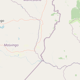
Map view of Gonarezhou National Park

Use this park location map to pinpoint Gonarezhou National Park in Zimbabwe, understand its exact geographic position, and read its mapped placement within the surrounding landscape more clearly.

Pigeon | © OpenStreetMap contributors

Location context for Gonarezhou National Park

Masvingo Province
Park atlas

Map the regional protected landscapes and transfrontier conservation areas around Gonarezhou National Park for comparative atlas discovery.

Explore Other National Parks and Protected Areas Near Gonarezhou National Park
Continue your exploration of southern African conservation by browsing national parks and protected areas geographically adjacent to Gonarezhou National Park, including components of the Great Limpopo Transfrontier Park. Discover how connected wilderness areas and diverse protected landscapes extend beyond individual park boundaries, offering valuable regional context for environmental management.
National parkGaza Province

Banhine National Park National Park: Mapped Boundaries and Gaza Province Geographic Context

Discover the protected landscape identity of this national park.

Delve into the specifics of Banhine National Park, a designated national park situated within Gaza Province. This entry provides essential geographic details, focusing on its mapped protected area, its status as a national park, and how it fits within the broader regional geography of southern Mozambique. Understand the park's landform context and its atlas-relevant attributes for structured discovery.

Area
7,250 km²
Established
1973
IUCN
II
Relief
Lowland
National parkMozambique

Zinave National Park: A Mozambique National Park with Diverse Woodland and Savanna Landscapes

Explore its mapped terrain, riverine forests, and savanna ecosystems.

Zinave National Park in Mozambique is a significant protected area spanning 4,000 square kilometers. Its landscape comprises a rich variety of ecosystems, including miombo woodlands, mopane-dominated areas, acacia savannas, and distinct riverine forests along the Save River. This national park is strategically positioned within the Greater Limpopo Transfrontier Park, highlighting its importance for regional wildlife corridors and conservation geography. The terrain offers a unique insight into the transitional ecological zones of southern Africa, showcasing diverse natural habitats and mapping potential for its protected boundaries.

Area
4,000 km²
Established
1973
IUCN
II
Relief
Lowland
National parkManica Province

Chimanimani National Park: Map of Mozambique's Highest Mountain Landscape

Explore protected highland terrain and transfrontier conservation geography.

Chimanimani National Park stands as a vital protected area in Mozambique's Manica Province, celebrated for its rugged mountain landscape and the presence of Monte Binga, the country's highest point. As the Mozambican portion of the Chimanimani Transfrontier Park, it offers critical insights into cross-border conservation efforts and the preservation of unique montane ecosystems. Discover the park's geographic context, its elevation extremes, and the significance of its protected boundaries within the regional atlas.

Area
656 km²
Established
2020
IUCN
II
Relief
Mountain
Protected areaSouth Africa

Greater Mapungubwe Transfrontier Conservation Area: A Transboundary Protected Landscape in South Africa

Mapped savanna ecosystems and rich cultural heritage at the Limpopo River confluence.

The Greater Mapungubwe Transfrontier Conservation Area, situated in South Africa, stands as a remarkable example of collaborative conservation across national borders. This protected area protects diverse savanna landscapes, particularly around the confluence of the Shashe and Limpopo Rivers, and holds immense cultural value as home to the Mapungubwe Cultural Landscape, a UNESCO World Heritage Site. By examining its mapped geography and protected area status, users gain insight into the ecological corridors vital for wildlife and the ancient archaeological heritage preserved within this significant transfrontier initiative.

Area
4,872 km²
Established
2009
IUCN
VI
Relief
Upland
National parkSouth Africa

Kruger National Park: South Africa's Iconic National Park for Geographic Discovery

Explore savanna landscapes and mapped protected area boundaries.

Kruger National Park serves as a paramount example of a protected landscape, offering a rich tapestry of savanna ecosystems and varied terrain across South Africa's Lowveld. This canonical entry details its vast geographic scope, approximately 19,623 square kilometres, and its status as the nation's first national park. Understand the park's environmental context, from the Lebombo Mountains to the Limpopo River, and its integral role within larger transfrontier conservation initiatives, providing critical insight for atlas-based geographic exploration.

Area
19,623 km²
Established
1926
IUCN
II
Visitors
1.7M annual
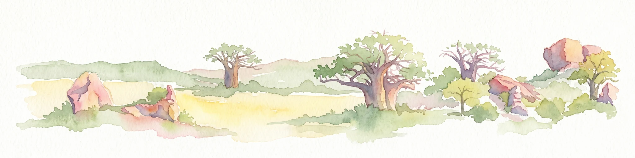
Watercolor illustration of a savanna landscape with scattered trees and rock formations
National parkLimpopo

Mapungubwe National Park: National Park with Rich Iron Age Archaeology and Savanna Landscapes

Explore Limpopo's unique protected area at the three-nation border.

Mapungubwe National Park is a vital protected area in South Africa's Limpopo region, renowned for its dual significance as a major archaeological site and a diverse natural landscape. This national park protects a significant portion of savanna ecosystems, including unique riparian forests and mopane woodlands, surrounding the historic Mapungubwe Hill. As part of the Greater Mapungubwe Transfrontier Conservation Area, it plays a crucial role in regional conservation, offering a distinct geographic perspective at the confluence of South Africa, Botswana, and Zimbabwe, and serving as a focal point for atlas-based discovery of protected lands.

Area
280 km²
Established
1998
IUCN
II
Relief
Lowland
National parkMatobo District

Matobo National Park: Detailed Protected Area and Landscape Geography in Matobo District

Explore its mapped boundaries and regional context.

Delve into the protected landscape of Matobo National Park, a significant national park situated in Matobo District, Zimbabwe. This entry focuses on providing a structured atlas view, highlighting the park's mapped boundaries and its integration within the regional geography. Understand Matobo National Park as a distinct protected area entity, perfect for users seeking detailed geographic context and landscape insights for map-based discovery and conservation analysis.

Area
424 km²
Established
1926
IUCN
II
Relief
Mountain
National parkZimbabwe

Nyanga National Park: Zimbabwe's Protected National Park Landscape Identity

Explore mapped boundaries and regional geography.

Nyanga National Park is a prime example of a protected landscape within Zimbabwe, offering distinct geographic features and mapped boundaries for detailed atlas exploration. As a national park, it serves as a critical point of reference for understanding the distribution of protected areas across Southeast Africa. This page provides foundational geographic context and landscape identity, allowing users to trace the park's physical presence and its role within the broader regional atlas.

Area
472 km²
Established
1926
IUCN
II
Relief
Mountain

Common questions about visiting, size, designation, and location context for Gonarezhou National Park

Gonarezhou National Park FAQs for park facts, access, geography, and protected area context
Find quick answers about Gonarezhou National Park, including protected-area facts, park geography, trail and visitor context, and how the park fits into its surrounding country and regional landscape.
MoriAtlas Explorer

Continue Your Protected Areas Search Across the Global Atlas

Deepen your exploration by continuing the structured search for national parks and protected areas worldwide. Utilize the comprehensive filtering capabilities to compare different conservation landscapes and refine your understanding of global park geography. Discover more about the distribution and characteristics of protected natural areas.

Global natural geography