Mori Atlas logo
Biosphere reserveGouritz Cluster Biosphere Reserve

Explore the unique mountain, coastal, and arid terrain where three major global biodiversity hotspots converge.

Gouritz Cluster Biosphere Reserve: Mapped Protected Landscapes in the Western Cape of South Africa

The Gouritz Cluster Biosphere Reserve spans an extraordinary range of environments across the Western Cape, encompassing sandy coastlines, deeply incised river valleys, and high mountain ridges reaching 2,240 metres. As the only place on Earth where the Fynbos, Succulent Karoo, and Maputaland-Pondoland-Albany hotspots overlap, this protected area offers a complex, multi-layered geographic system. The reserve provides a comprehensive look at the Cape Floristic Region, hosting high levels of plant endemism and diverse habitats ranging from sea level to elevated basin country.

biosphere reserveUNESCOWestern Capebiodiversity hotspotFynbosSucculent Karoo

Gouritz Cluster Biosphere Reserve

Biosphere reserve

Park overview

Structured park overview, official facts, and landscape profile for Gouritz Cluster Biosphere Reserve

Gouritz Cluster Biosphere Reserve park facts, protected area profile, and essential visitor context

Review the core facts for Gouritz Cluster Biosphere Reserve, including designation, size, terrain, visitor scale, habitats, and operating context in one park-focused overview.

About Gouritz Cluster Biosphere Reserve

The Gouritz Cluster Biosphere Reserve is one of South Africa's most ambitious protected-area designs, combining coastal, montane, and semi-arid environments into a single conservation framework. Stretching across the southern Western Cape, it links the Indian Ocean shoreline with inland ranges such as the Outeniqua, Langeberg, Kammanassie, Kouga and Swartberg mountains, producing a landscape where shallow marine terraces, deeply incised river valleys, estuaries, coastal lagoons, fynbos-covered slopes, and arid Karoo vegetation all occur within a single managed boundary.

Because of its scale and ecological complexity, the biosphere is organised into four sectors or clusters: Towerkop, Kammanassie, Langeberg and St. Blaize. This structure reflects the natural geography of the region, allowing different management priorities to be applied from the coast to the arid interior while maintaining ecological connectivity across the wider system. The reserve's altitudinal range, from sea level to peaks above 2,000 metres, supports an extraordinary sequence of vegetation types and microclimates.

What truly distinguishes the Gouritz Cluster is its status as the only place on Earth where three internationally recognised biodiversity hotspots overlap. Fynbos, the Succulent Karoo, and the Maputaland-Pondoland-Albany hotspot meet within the reserve, all of it sitting inside the Cape Floristic Region, the smallest but one of the richest of the world's six floral kingdoms. The result is exceptional plant endemism, including large numbers of Succulent Karoo endemics and Red List species, and a concentration of threatened invertebrates such as the Colophon beetles and endemic butterflies found nowhere else.

The reserve's conservation value is reinforced by the presence of three UNESCO World Heritage Sites within its broader footprint: the Swartberg Complex, the Boosmansbos Nature Reserve, and the Baviaanskloof area. Large mammals such as leopard range through its mountains, while populations of Cape mountain zebra and bontebok represent important conservation success stories for subspecies that are endemic to the Cape region.

Quick facts and research context for Gouritz Cluster Biosphere Reserve

The Gouritz Cluster Biosphere Reserve is a UNESCO-designated biosphere reserve covering a vast area of the Western Cape, South Africa, with Laingsburg as its nearest major town. It was established in 2015 and is governed as a single biosphere entity across four interconnected sectors that range from the southern coast to the inland mountains.

The reserve sits at the unique intersection of three global biodiversity hotspots and lies entirely within the Cape Florastic Region. It contains more than a thousand recorded plant species with exceptionally high endemism, recognised UNESCO World Heritage Sites, populations of Cape mountain zebra and bontebok, leopard populations in the mountains, and endemic invertebrates including Colophon beetles and rare butterflies.

Protection and recognition

Documented designation history, management scope, and official international recognition

Gouritz Cluster Biosphere Reserve Protection Status and UNESCO Recognition

Gouritz Cluster Biosphere Reserve maintains a documented mixed protection status, supported by its official UNESCO Biosphere Reserve designation established in 2015. Recorded designation history and international recognition sources define the baseline management framework for the protected landscape.

International recognition

Protection details

Protection scope
Mixed
Designated year
2015
Transboundary protection
No
Core area
6,258 km²
Buffer area
21,649.62 km²
Park context

Deeper park guide and search-rich context for Gouritz Cluster Biosphere Reserve

Gouritz Cluster Biosphere Reserve history, landscape, wildlife, and travel context

Explore Gouritz Cluster Biosphere Reserve through its history, landscape character, ecosystems, wildlife, conservation priorities, cultural context, and seasonal travel timing in a structured park guide built for atlas discovery and search intent.

Why Gouritz Cluster Biosphere Reserve stands out

The reserve is best known for being the only place in the world where three recognised biodiversity hotspots converge: Fynbos, Succulent Karoo, and Maputaland-Pondoland-Albany. This triple-hotspot setting, layered over a landscape that runs from sandy coastline to high mountain ridges, gives the area an unusually compressed diversity of plant and animal life within a single protected system. It is also recognised for its high concentration of endemic plant species, particularly within the Cape Floristic Region, and for threatened species such as Cape mountain zebra, bontebok, leopard, the enigmatic Colophon beetles, and endemic butterflies. The inclusion of three UNESCO World Heritage Sites within its boundaries adds a further layer of international recognition.

Gouritz Cluster Biosphere Reserve history and protected-area timeline

The Gouritz Cluster Biosphere Reserve was formally established on 7 March 2015, becoming the seventh and largest biosphere reserve in South Africa recognised under UNESCO's Man and the Biosphere Programme. Its creation reflected a growing recognition that the region's ecological complexity, spanning coastal lowlands, mountain ranges, and arid interior basins, could only be effectively conserved through a large-scale, multi-sector approach rather than a collection of separate protected areas.

The reserve's structure, divided into the four clusters of Towerkop, Kammanassie, Langeberg and St. Blaize, builds on the geography of existing protected landscapes, mountain catchments, and coastal zones. By unifying these into a single biosphere framework, managers aimed to better connect habitats, buffer wilderness areas, and integrate rural communities into conservation planning.

Beyond its modern conservation history, the region carries a far older human story. Archaeological work at Pinnacle Point near Mossel Bay, located within what is now the biosphere reserve, has produced evidence of shellfish exploitation by early humans around 164,000 years ago and the earliest known use of fire in toolmaking around 72,000 years ago. These finds have helped shape the view that the southern Cape coast is closely tied to the origins of modern humanity.

Many of the reserve's rural communities are also descended from, or culturally connected to, the ancient Khoisan people, the original inhabitants of the region. Contemporary livelihoods continue to rely heavily on agriculture, including ostrich farming, dairy, citrus, wine, grain, and sheep and cattle grazing, alongside an emerging but still underdeveloped tourism economy.

Gouritz Cluster Biosphere Reserve landscape and geographic character

The landscape of the Gouritz Cluster Biosphere Reserve is defined by sharp transitions between marine, mountain, and semi-arid environments. Along the coast, fine-grained sandy beaches and dunes alternate with wave-cut platforms and exposed rocky headlands. Deeply incised river valleys cut down through the coastal platform, often terminating in estuaries or forming coastal lagoons where freshwater meets the sea.

Inland from the coast, the Outeniqua and Langeberg mountains rise as a natural barrier separating the southern Cape from the interior, marking the boundary between wetter fynbos country and the drier Little Karoo. Further into the reserve, the Kammanassie, Kouga and Swartberg ranges form the northern and eastern edges of the system, with peaks reaching above 2,000 metres. Between these ranges lie valley basins and plains where vegetation gradually shifts toward arid Succulent Karoo.

This compressed geography, from sea-level shoreline to high mountain ridges and arid basin country, gives the reserve a remarkable variety of landforms within a relatively cohesive area. The elevational range, reaching approximately 2,240 metres at its highest point, supports a sequence of climatic zones and vegetation types that is unusual even by South African standards.

Gouritz Cluster Biosphere Reserve ecosystems, habitats, and plant life

Ecologically, the Gouritz Cluster Biosphere Reserve sits within the Cape Floristic Region, the smallest but one of the richest of the world's six floral kingdoms. The reserve is unusually significant because it is the only place where three recognised biodiversity hotspots converge: Fynbos, the Succulent Karoo, and the Maputaland-Pondoland-Albany hotspot. Each of these contributes a distinct suite of plant communities and ecological processes, and their overlap here produces exceptionally high plant diversity in a concentrated area.

The reserve records well over a thousand plant species, with very high levels of endemism, including Succulent Karoo endemics and numerous Red List species. Even the more arid inland portion contains hundreds of endemic plant species, illustrating that botanical richness is not limited to the wetter coastal mountains. Fynbos vegetation, characterised by fine-leaved shrubs and remarkable floral diversity, dominates much of the mountain terrain, while the drier valleys support succulent and shrubland communities typical of the Karoo.

The reserve also plays an important role in maintaining ecological connectivity across the southern Cape. By linking coastal, montane, and arid habitats within a single framework, it helps sustain migration routes, dispersal pathways, and the long-term resilience of plant communities facing climate change and habitat fragmentation.

Gouritz Cluster Biosphere Reserve wildlife and species highlights

The reserve supports a notable mix of large mammals, rare subspecies, and highly localised invertebrates. Two of its most important conservation targets are the Cape mountain zebra and the bontebok, both of which represent unique and threatened populations restricted to the Cape region. Their persistence within the reserve is a key marker of successful habitat protection.

Leopard populations are present across much of the reserve's mountainous terrain, where rugged topography and prey availability allow these predators to maintain viable ranges. The mountains also serve as important corridors for other large mammals and contribute to the reserve's role as a migratory pathway for terrestrial species moving between coastal and inland landscapes.

The invertebrate fauna is equally distinctive. The reserve hosts seven endemic species of the Colophon beetle genus, an unusual and scientifically intriguing group found only in parts of the Cape mountains, as well as fourteen endemic butterfly species. These invertebrates are important indicators of habitat health and underscore the high concentration of narrow-range endemics within the reserve.

Along the coast, estuaries and nearshore environments act as nursery areas for marine species, extending the reserve's ecological influence beyond its terrestrial boundaries and contributing to the productivity of the surrounding ocean.

Gouritz Cluster Biosphere Reserve conservation status and protection priorities

The Gouritz Cluster Biosphere Reserve represents a major conservation achievement, recognising and consolidating one of the most botanically important regions on Earth under a single protected framework. Its status as the only place where three recognised biodiversity hotspots intersect gives it outstanding global conservation significance, while its position within the Cape Floristic Region places it among the most biodiverse temperate areas on the planet.

By encompassing altitudinal zones from sea level to more than 2,000 metres and three distinct vegetation biomes, the reserve protects an unusually broad spectrum of habitats in a connected system. This connectivity is critical for maintaining migration routes, allowing species range shifts in response to climate change, and preserving gene flow between isolated populations of endemic plants and animals.

The reserve's conservation profile is strengthened by the inclusion of three UNESCO World Heritage Sites within its broader extent: the Swartberg Complex, Boosmansbos Nature Reserve, and the Baviaanskloof area. These sites amplify international recognition and bring additional protection standards to parts of the reserve. At the same time, management of the biosphere is shaped by the need to address significant socio-economic challenges, including high unemployment, poverty, inadequate services in informal settlements, and elevated rates of HIV and crime, making conservation here inseparable from rural development.

Gouritz Cluster Biosphere Reserve cultural meaning and human context

The cultural dimension of the Gouritz Cluster Biosphere Reserve is shaped both by deep antiquity and contemporary rural life. The southern Cape coast within the reserve has produced some of the most important archaeological evidence related to the origins of modern humans, including findings at Pinnacle Point near Mossel Bay that demonstrate early shellfish exploitation and some of the earliest known controlled use of fire in toolmaking.

Many present-day rural communities in the reserve trace part of their heritage to the ancient Khoisan people, the original inhabitants of the region. Contemporary populations include farmers of European descent and farm dwellers primarily identified as part of the Cape Coloured community, many of whom share this deeper ancestry. Intensive agriculture, including ostrich farming, dairy, citrus, wine, and grain production, alongside extensive sheep and cattle grazing, defines the rural economy.

Tourism is an additional, though still underdeveloped, contributor to local livelihoods. Together with the region's archaeological and indigenous heritage, this rural economic base forms an integral part of the biosphere reserve's identity, reflecting the UNESCO model that links conservation with sustainable human use of the landscape.

Top sights and standout views in Gouritz Cluster Biosphere Reserve

Among the Gouritz Cluster Biosphere Reserve's most distinctive highlights is its triple biodiversity hotspot status, the only place on Earth where Fynbos, Succulent Karoo, and the Maputaland-Pondoland-Albany hotspot overlap, combined with its full placement within the Cape Floristic Region. The reserve also stands out for its exceptionally high plant endemism, including hundreds of endemic species even in its arid interior.

The reserve's four-cluster structure of Towerkop, Kammanassie, Langeberg and St. Blaize captures an unusually complete ecological sequence from sandy coastline and estuaries to high mountain ridges and Karoo basins. The presence of three UNESCO World Heritage Sites within its boundaries, the Swartberg Complex, Boosmansbos Nature Reserve, and Baviaanskloof, reinforces its global importance.

It is also notable for supporting endemic wildlife such as Cape mountain zebra, bontebok, leopard, Colophon beetles and endemic butterflies, while encompassing landscapes that have produced archaeological finds central to our understanding of early modern human behaviour.

Best time to visit Gouritz Cluster Biosphere Reserve

The reserve's climate transitions rapidly from Mediterranean conditions along the coast and wetter mountains to semi-arid conditions inland, so the most rewarding times to visit depend strongly on which sector of the biosphere is being explored. In the coastal and fynbos-dominated mountain areas, late winter and spring tend to bring the highest wildflower displays, cooler temperatures, and lush vegetation following the rainy season, although conditions can be changeable.

In the drier inland sectors such as the Little Karoo and parts of the Swartberg region, autumn, winter and spring are generally more comfortable for travel, while summer can bring high temperatures and dry, harsh conditions. Wildlife viewing opportunities are shaped by these patterns, with cooler months often favouring animal activity in the open, while the wetter seasons emphasise botanical richness and green landscapes.

Across the reserve, planning around the climatic differences between coast and interior is the most important consideration, since attempting to experience both within a single short window can mean very different seasonal conditions in different sectors.
Monthly climate preview

Long-term representative point measurements of annual temperature and precipitation

Gouritz Cluster Biosphere Reserve Climate Normals and Monthly Weather Records

Historical climatology records reveal the measured annual temperature progression and monthly precipitation patterns across representative coordinates in Gouritz Cluster Biosphere Reserve. Detailed monthly climate data profiles provide deeper baseline context for analyzing long-term environmental trends across the protected landscape.
Annual mean17 °C
12 °C22 °C
Jan22°
Feb22°
Mar21°
Apr18°
May16°
Jun13°
Jul12°
Aug13°
Sep15°
Oct17°
Nov19°
Dec21°
Warmest month
February

22.1 °C

Coolest month
July

12.4 °C

Wettest month
November

1.6 mm/day

Driest month
September

0.9 mm/day

Park location guide

Geography guide, regional context, and park location map for Gouritz Cluster Biosphere Reserve

Gouritz Cluster Biosphere Reserve park geography, regions, and map view in South Africa

Understand where Gouritz Cluster Biosphere Reserve sits in South Africa through a broader geographic reading of the surrounding landscape, nearby location context, and its mapped position within the national park landscape.

How Gouritz Cluster Biosphere Reserve fits into South Africa

South Africa is the southernmost country in Africa, spanning 1.22 million km² with a population of over 63 million. The country operates with three capital cities, Pretoria (executive), Cape Town (legislative), and Bloemfontein (judicial), and is renowned for its biodiversity, national parks, and multicultural society.

Wider geography shaping Gouritz Cluster Biosphere Reserve in South Africa

South Africa occupies the southernmost region of Africa, with coastline along both the Atlantic Ocean to the west and the Indian Ocean to the east. The interior features elevated plateaus including the Highveld, with the Drakensberg escarpment marking the eastern highlands. The country shares borders with Namibia, Botswana, Zimbabwe, Mozambique, Eswatini, and Lesotho.

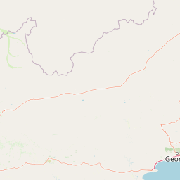
Map view of Gouritz Cluster Biosphere Reserve

Use this park location map to pinpoint Gouritz Cluster Biosphere Reserve in South Africa, understand its exact geographic position, and read its mapped placement within the surrounding landscape more clearly.

Pigeon | © OpenStreetMap contributors

Location context for Gouritz Cluster Biosphere Reserve

Western Cape
Park atlas

Compare regional protected landscapes, coastal zones, and mountain ranges across the Western Cape.

Explore Parks Near Gouritz Cluster Biosphere Reserve and Surrounding Protected Areas

Browse other parks near Gouritz Cluster Biosphere Reserve to examine connected regional geography and adjacent floral kingdoms. Extending the protected area comparison reveals wider patterns across coastal ecosystems and mountain reserves.
A soft watercolor painting of a rolling mountain landscape with light green and muted earth tones, featuring tufts of vegetation in the foreground.
Nature reserveWestern Cape
About 27 km away#1 closest

Northeast

Gamkaberg Nature Reserve: An Atlas Overview of Mountain Geography and Protected Biomes

A vital conservation landscape within the Western Cape of South Africa.

Gamkaberg Nature Reserve stands as a focal point for ecological research and conservation in the Little Karoo. Defined by a rugged mountain range and deep gorges, the reserve protects the critical habitat of the Cape mountain zebra. Its landscape reveals an unusual overlap of four Cape biomes, offering a deep look into the regional geography and biological history of the South African interior.

Area
94 km²
Established
1974
Relief
Mountain
Climate
Mediterranean
Wildlife reserveWestern Cape
About 32 km away#2 closest

Southeast

Gondwana Game Reserve: Geographic Overview of a Southern Cape Rewilding Landscape

Protected mountain and coastal savanna terrain in the Western Cape

Gondwana Game Reserve represents a deliberate conservation effort to restore large mammal populations to the southern coast of South Africa. Situated near the Garden Route, the reserve encompasses a complex mosaic of open plains, rolling hills, and mountain vistas, providing essential habitat connectivity for diverse wildlife species within a protected and managed ecosystem.

Area
110 km²
Relief
Mountain
Climate
Mediterranean
Access
Access unknown
A soft watercolor illustration showing a hazy mountain range behind undulating, brush-filled plains in pastel tones.
Protected areaWestern Cape Province
About 75 km away#3 closest

West

Boosmansbos Wilderness Area: Geographic Atlas and Protected Landscape Overview

Rugged Langeberg mountain terrain and endemic floral corridors

Boosmansbos Wilderness Area stands as a major protected block in the eastern Langeberg range. This profile maps the diverse topography, ranging from rocky mountain ridges to moist valley forests. Learn about the geographic significance of this wilderness, which encompasses rare botanical species and serves as a vital transition zone between fynbos and indigenous forest habitats within the Western Cape.

Area
142 km²
Relief
Mountain
Climate
Mediterranean
Access
Moderate access
National parkSouth Africa
About 78 km away#4 closest

East

Garden Route National Park: South Africa's Protected Landscape and Forest Atlas

Explore indigenous forests, coastal cliffs, and lake systems.

Garden Route National Park is a key national park in South Africa, celebrated for its rich indigenous forests and dramatic coastline. As a protected landscape, it offers a unique geographic profile, blending ancient woodlands with rugged coastal terrain and interconnected lake systems. This page serves as an atlas entry, detailing the park's spatial extent and its significance as a conservation area within the broader geography of South Africa.

Area
1,210 km²
Established
2009
IUCN
II
Relief
Mixed relief
A horizontal watercolor painting showing rolling green hills and distant mountain ridgelines with clusters of trees in the foreground.
Nature reserveWestern Cape
About 80 km away#5 closest

West

Grootvadersbosch Nature Reserve: Protected Forest Landscapes and Langeberg Geography

Indigenous forest terrain in the Western Cape foothills.

Grootvadersbosch Nature Reserve offers a deep look into the largest surviving indigenous forest patch within the Langeberg range. This protected area integrates diverse valley geography with historic colonial farm infrastructure, providing a unique site for studying the natural terrain and river catchments of the South African Overberg region.

Area
2.5 km²
Relief
Mountain
Climate
Mediterranean
Access
Access unknown
A minimalist watercolor painting depicting rolling hills and gentle valleys in muted green, yellow, and soft red tones on a white background.
Nature reserveWestern Cape
About 106 km away#6 closest

West

Anysberg Nature Reserve: Geographic Overview and Protected Landscape Mapping

A diverse mountain sanctuary in the Western Cape Karoo.

Anysberg Nature Reserve offers a deep look into the semi-arid mountain geography of South Africa's Western Cape. Spanning a rugged stretch of the Cape Fold Belt, the reserve highlights transitions between fynbos mountain slopes and succulent valley floors. This protected area serves as an essential case study for understanding how topography, ancient river courses, and varied soil conditions influence the distribution of endemic plant life and animal habitats across the Little Karoo region.

Area
796.29 km²
Established
1984
Relief
Mountain
Climate
Mediterranean
National parkWestern Cape
About 109 km away#7 closest

West

Bontebok National Park: A Unique Protected Landscape in South Africa's Western Cape

Mapping the endemic bontebok's habitat and diverse fynbos.

Bontebok National Park represents a singular achievement in conservation, dedicated to protecting the rare bontebok antelope and showcasing the extraordinary biodiversity of the Cape Floristic Region. Located in the Western Cape, this smallest of South Africa's national parks features a landscape of fynbos-covered foothills beneath the Langeberg Mountains, with the Breede River defining its southern edge. Explore its mapped boundaries and unique ecosystems, offering a concentrated natural discovery experience within a UNESCO World Heritage Site.

Area
27.86 km²
Established
1931
IUCN
II
Relief
Mixed relief
National parkSouth Africa
About 146 km away#8 closest

East

Knysna National Lake Area National Park: A Protected Landscape in South Africa

Explore its mapped boundaries and regional natural geography.

Knysna National Lake Area National Park is a key protected area in South Africa, offering a focused lens for understanding national park geography and protected landscapes. This entry provides an atlas-centric perspective on its landscape context, mapped terrain, and its significance as a distinct natural area within the broader South African geography. Explore the structured details of this park's protected boundaries and its contribution to the country's conservation map.

Access
Easy access
Scope
Mixed
Water
Water-dominated

Common questions about visiting, size, designation, and location context for Gouritz Cluster Biosphere Reserve

Gouritz Cluster Biosphere Reserve FAQs for park facts, access, geography, and protected area context

Find quick answers about Gouritz Cluster Biosphere Reserve, including protected-area facts, park geography, trail and visitor context, and how the park fits into its surrounding country and regional landscape.
MoriAtlas Explorer

Continue Your Protected Areas Search Across the Global Atlas

Deepen your exploration by continuing the structured search for national parks and protected areas worldwide. Utilize the comprehensive filtering capabilities to compare different conservation landscapes and refine your understanding of global park geography. Discover more about the distribution and characteristics of protected natural areas.

Global natural geography