Mori Atlas logo
Nearby park discovery

Geographic distribution and regional landscape context for nearby protected lands

Protected Areas and Nature Reserves Situated Near the Haff Réimech Wetland Reserve

This geographic overview maps the distribution of nature reserves and protected areas surrounding Haff Réimech in the Moselle River valley. It provides a regional perspective on the landscape by highlighting nearby sites within the Schengen area and across the broader Luxembourg border region, facilitating comparative exploration of alluvial and riparian terrain.

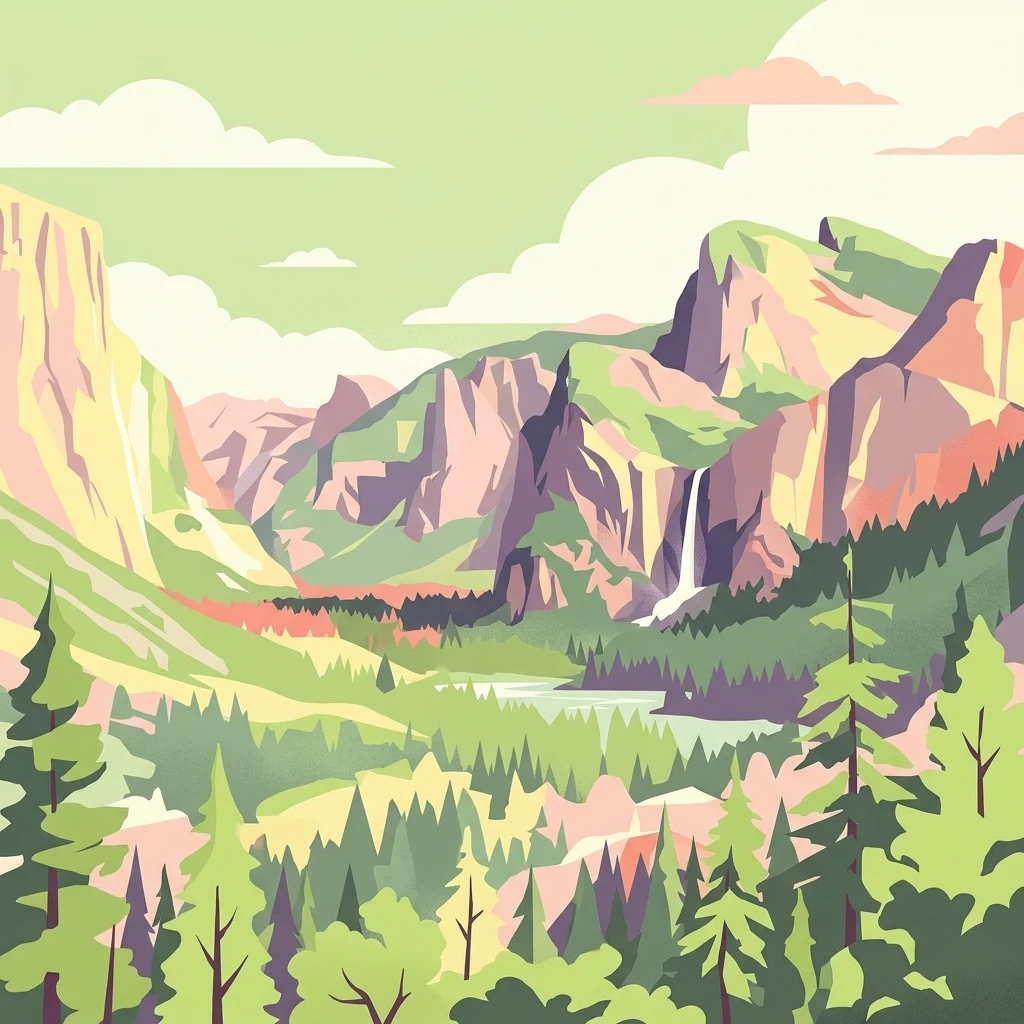
A stylized vector-style illustration of a green valley framed by steep, blocky mountain cliffs with a waterfall cascading down one side and a dense coniferous forest in the foreground.

A reclaimed Moselle floodplain of former gravel pits turned into one of Luxembourg's richest wetland reserves.

Haff Réimech

Haff Réimech is a protected wetland nature reserve in southeastern Luxembourg, situated in the commune of Schengen where the borders of Luxembourg, Germany, and France meet. It occupies a wide, flat section of the Moselle River valley, between the river itself on the east and the vineyard-covered slopes of the Luxembourg wine region to the west. The reserve covers roughly one hundred hectares and is made up largely of former sand and gravel extraction pits that have filled with groundwater to create a network of about forty shallow lakes and ponds. Today it ranks among the most ecologically valuable wetlands in the country and forms part of both the international Ramsar network of important wetlands and the European Natura 2000 network of protected nature areas. Biologically, Haff Réimech is most famous as a bird reserve. Some 230 bird species have been recorded in the area, including about 90 breeding species, and the site serves as a nesting, resting, and wintering area of significant importance within the wider region.

Location
Luxembourg
Park type
Nature reserve
Established
1998
Area
1 km²
Haff Réimech Nature Reserve Atlas
Regional park map

See the ranked park cluster in its geographic setting

Nearby parks around Haff Réimech

This regional map shows the same 20 nearby parks ranked below around Haff Réimech. Select a ranked marker to highlight that park’s boundary where boundary data is available.
Reference park: Haff RéimechRanked nearby parkSelected boundary: Haff Réimech20 nearby parks shown
20 nearby parks

Geographic distance, direction, and regional park comparisons surrounding Haff Réimech

Ranked Protected Areas and Parks Near Haff Réimech

Spatial proximity rankings organize surrounding protected areas and regional park geography relative to Haff Réimech using direct geographic measurements. Cross-referencing national boundaries and recorded environmental traits highlights wider conservation patterns across the surrounding landscape.
Nature reserveSaarland
9.4 km away#1 closest

East

Steilhänge der Saar Nature Reserve: Mapped Protected Landscapes and River Valley Geography

Protected river slopes and forested terrain in Saarland

The Steilhänge der Saar nature reserve encompasses steep, wooded hillsides rising above the Saar river valley. This consolidated protected area features complex ecological gradients between rocky, sun-exposed upper slopes and shadowed tributary streams, serving as a critical habitat zone and a defining feature of the regional Saarland landscape.

Area
10.86 km²
Established
2017
IUCN
IV
A horizontal watercolor painting depicting a gentle river flowing through a soft green landscape with trees and distant rolling hills.
Nature reserveLuxembourg
About 14 km away#2 closest

Northwest

Naturschutzgebitt Birelergronn Nature Reserve: Luxembourg Protected Valley Geography

A sandstone valley landscape in central Luxembourg.

Naturschutzgebitt Birelergronn encompasses a 270 hectare nature reserve in Luxembourg, recognized for its complex hydrological features and historic milling valley structure. The area highlights the geological significance of the Luxembourg Sandstone, supporting diverse alluvial forests and the expansive Neimillen wetland complex which defines the regional ecosystem.

Area
2.717 km²
Established
1999
Relief
Upland
Climate
Temperate
Nature reserveRheinland-Pfalz
About 16 km away#3 closest

North

Langheck bei Nittel Nature Reserve: A Detailed Atlas of Protected Moselle Landscapes

Ecological geography and calcareous grassland habitat in Rheinland-Pfalz

Langheck bei Nittel is a significant nature reserve located in the Upper Moselle valley of Germany. The site protects a rare mosaic of calcareous dry grasslands, shrubbery, and forest edges that host a high concentration of orchid species. As a critical component of the regional biotope network, it offers insight into the conservation of warm-loving flora and the management of stony, nutrient-poor landscapes.

Area
0.42 km²
Established
1998
A soft watercolor painting of a landscape featuring a small river or pond in the center, flanked by green trees on the left and pink-flowered trees on the right, with low hills in the distance.
Nature reserveLuxembourg
About 17 km away#4 closest

North

Naturschutzgebitt Kelsbaach Nature Reserve: A Geographical Overview of Luxembourg Landscapes

Dolomite rock formations and protected dry grassland ecosystems

Naturschutzgebitt Kelsbaach preserves a distinctive environmental gradient across the Moselle valley hillsides in Luxembourg. From exposed dolomite cliffs and arid plateau grasslands to the shaded Kelsbaach stream gorge, the reserve illustrates the complex interplay of regional geology and microclimate. This protected area offers a precise look at local biodiversity habitats and the lasting impact of historical land use on the natural terrain.

Area
0.755 km²
Established
1998
Relief
Upland
Climate
Temperate
Nature reserveLuxembourg
About 17 km away#5 closest

West

Naturschutzgebitt Däerebësch-Waal-Hellengerbësch: Protected Forest and Transboundary Geography

Nature reserve profile and regional landscape connectivity

Spanning 222 hectares across Bettembourg, Dudelange, and Frisange, this nature reserve preserves a contiguous forest landscape essential to the Natura 2000 network. The site is defined by its role as a cross-border ecological corridor, connecting Luxembourgish woodlands with the Forêt domaniale de Zoufftgen in France through a sophisticated wildlife bridge.

Area
2.223 km²
Established
2023
Relief
Upland
Climate
Temperate
Nature reserveLuxembourg
About 18 km away#6 closest

Northwest

Cornelysmillen-Schucklai Nature Reserve: Geographic and Protected Area Overview

Wetland ecosystems on the Luxembourg plateau

Cornelysmillen-Schucklai serves as a key protected area of national interest, encompassing a mosaic of marshland, meadows, and deciduous woodland. This reserve acts as a vital corridor for moisture-dependent plant communities and threatened bird populations, defining the hydrological character of the plateau region with its intricate stream systems and restored pond basins.

Area
1.437 km²
Established
2023
Relief
Upland
Climate
Temperate
Watercolor painting of a green, rolling landscape with scattered trees and soft, faded hills in the background.
Nature reserveLuxembourg
About 18 km away#7 closest

Northwest

Naturschutzgebitt Aarnescht Nature Reserve; Geographic Atlas and Protected Area Profile

Exploring calcareous dry grasslands and ecological mosaic habitats in Luxembourg

Discover the geographic composition of Naturschutzgebitt Aarnescht, a premier nature reserve in Luxembourg. This profile details the site's unique Keuper sediments, extensive orchid populations, and varied terrain, including traditional orchards and oak low-forests that form a vital protected landscape.

Area
0.752 km²
Established
1988
Relief
Upland
Climate
Temperate
Nature reserveLuxembourg
About 20 km away#8 closest

West

Beetebuerger Bësch: Nature Reserve and Protected Woodland Mapping in Luxembourg

A crucial reference site for forest ecology in southern Luxembourg

Beetebuerger Bësch stands as a designated nature reserve within the communes of Bettembourg, Leudelange, and Roeser. This protected forest landscape is managed to allow natural woodland development, providing researchers and visitors with a view of old growth dynamics, saproxylic invertebrate habitats, and restored riparian zones along the Koleschgriecht stream.

Area
2.373 km²
Established
2005
Relief
Lowland
Climate
Temperate
A minimalist watercolor illustration featuring rolling green hills, patches of trees, and a soft, light-toned foreground against a white background.
Nature reserveLuxembourg
About 21 km away#9 closest

West

Naturschutzgebitt Haard: Exploring Luxembourg's Largest Reclaimed Nature Reserve

Geography of a transformed iron-mining industrial landscape

Naturschutzgebitt Haard encompasses vast quarry faces and pioneer meadows, serving as a critical biodiversity hub within southern Luxembourg. The area offers an intricate landscape mosaic of calcareous grassland, recovering forest, and dramatic mining cliffs, providing a window into how post-industrial ground evolves into a protected refuge for specialized orchid and butterfly species.

Area
5.943 km²
Established
1994
Relief
Upland
Climate
Temperate
Watercolor painting of a green, rolling hillside landscape with faint pink floral details in the foreground.
Nature reserveRheinland-Pfalz
About 23 km away#10 closest

Northeast

Perfeist bei Wasserliesch: Protected Grassland and Botanical Mapping in Rheinland-Pfalz

A regional sanctuary for rare orchids and calcareous meadow flora.

Perfeist bei Wasserliesch represents a significant protected area within the German Moselle landscape. Spanning 22 hectares of dry, sun-exposed calcareous soil on the Liescher Berg, the reserve offers a focused look at open grassland ecology. Its unique status as a botanical reference point highlights how small-scale protected land maintains rare plant species and fragile meadow habitats against the backdrop of the surrounding Moselle valley hill country.

Area
0.22 km²
Established
1986
Nature reserveRhineland-Palatinate
About 23 km away#11 closest

Northeast

Wiltinger Saarbogen: Mapping the Natural Saar River Meander and Floodplain Habitats

A critical protected nature reserve in the Rhineland-Palatinate river landscape.

Wiltinger Saarbogen remains a rare, natural river arc within the Saar valley. This protected area offers a deep look into riverine geography, featuring a concentrated mosaic of gravel banks, reed-fringed wetlands, and riparian forests that stand in contrast to the engineered shipping canals of the region.

Area
1.67 km²
Established
1997
Watercolor painting of a green, rolling landscape with scattered trees and soft hills against a light background.
Nature reserveLuxembourg
About 25 km away#12 closest

West

Brucherbierg-Lallengerbierg Nature Reserve: Industrial Heritage and Protected Geography in Luxembourg

A restored Minett mining landscape and thriving dry-grassland ecosystem.

Brucherbierg-Lallengerbierg offers a window into the evolution of post-industrial terrain. Spanning 267 hectares in southern Luxembourg, the reserve protects a rugged landscape of cliffs, stony basins, and terraces that have been reclaimed by pioneer vegetation. Through careful ecological maintenance, the site serves as a prime example of habitat conservation, preserving a rare, open dry-meadow environment within the broader Minett industrial corridor.

Area
2.67 km²
Established
2016
Relief
Upland
Water
Minor water
A horizontal watercolor painting showing a quiet wetland with light green vegetation, a shallow pool of water reflecting soft purples, and gentle hills in the background on a white background.
Nature reserveSchifflange
About 25 km away#13 closest

West

Brill Nature Reserve: Wetland Geography and River Restoration in Schifflange

Exploring the protected Alzette River floodplain and riparian habitat mosaic

Brill Nature Reserve stands as an ecologically significant protected area within the heavily developed valley of Schifflange, Luxembourg. This wetland sanctuary showcases a successful river restoration project, creating a dense network of ponds, reedbeds, and river-delta woodlands that function as a crucial refuge for wildlife amidst urban surroundings.

Area
0.197 km²
Established
1988
Relief
Lowland
Scope
Terrestrial
Nature reserveLuxembourg
About 27 km away#14 closest

West

Ellergronn Nature Reserve: Mapping Protected Woodland and Industrial Collapse Terrain

An atlas of reclaimed post industrial habitats in southern Luxembourg

Ellergronn Nature Reserve acts as a case study in landscape reclamation, transforming former ironstone mining pits into a deep network of collapse ponds and diverse woodland. This protected area offers a look at how subsidence and quarrying have resulted in a unique mosaic of calcareous grasslands and forest pools, providing a clear map of Luxembourg's industrial environmental history.

Area
1.104 km²
Established
1988
Scope
Terrestrial
Water
Minor water
Watercolor painting of a rolling green forest landscape with a winding path and soft, abstract hills in the background.
Nature reserveRhineland-Palatinate
28 km away#15 closest

Northeast

Mattheiser Wald Nature Reserve: A Protected Forest Landscape in Rhineland-Palatinate

Ecological mapping of urban forest and valley terrain

Mattheiser Wald represents a vital nature reserve and Natura 2000 site in the Trier region. The area is characterized by high-value oak and hornbeam woodland, abandoned military disturbance zones that host rare wildlife, and an intricate stream valley system. This atlas entry provides a detailed look at the reserve's topography and its status as a critical conservation landscape within an urban environment.

Area
4.47 km²
Established
2003
Relief
Upland
Climate
Temperate
Watercolor painting of a tranquil lake surrounded by soft green trees, grassy banks, and rolling hills in the background under a pale sky.
Protected areaSaarland
About 28 km away#16 closest

Southeast

Dillinger See Protected Area: Saarland Floodplain Geography and Bird Sanctuary Map

Mapping wetland habitats and ecological terrain in Saarland

Dillinger See is a protected ecological lake situated within the Saar River floodplain in Saarland. This area serves as a sanctuary for diverse avian species, with its landscape defined by reed belts and restored island habitats. Learn about the geographic significance of this site as an EU bird protection area and its role in regional flood management.

Area
0.8 km²
Established
1980
Relief
Lowland
Access
Easy access
A soft, painterly watercolor illustration showing rolling green hills, distant ridgelines, and sparse trees against a white background.
Nature reserveGrand Est
About 30 km away#17 closest

Southeast

Réserve naturelle régionale de la zone humide du moulin de Velving et Téterchen: Protected Wetland Atlas

Regional nature reserve geography and wetland habitat mapping in Moselle

This protected area spans nearly 92 hectares of marshland and meadow in the Pays de Nied. The reserve stands as a representative example of restored wetland environments in northeastern France, featuring distinct calcareous peatland habitats and thriving meadow-nesting bird communities nestled within the Bruchbach valley.

Area
0.93 km²
Established
2009
IUCN
IV
Relief
Lowland
Nature reserveSaarland
About 32 km away#18 closest

Southeast

Westlich Berus Nature Reserve: Geography and Protected Land Profile in Saarland

An orchid-rich limestone landscape on the German-French border

Spanning the border between Germany and France, Westlich Berus functions as a sanctuary for calcareous habitats. The reserve protects a complex landscape of orchid-rich dry grasslands, ravine forests, and tufa-forming springs. Its compact footprint in the Saarland region offers deep insight into the biodiversity of limestone plateaus, providing a mapped look at the intersection of protected deciduous woodland and seepage wetlands.

Area
1.43 km²
Established
2016
IUCN
IV
A minimalist watercolor painting featuring soft, abstract layers of green hills, purple distant ridges, and a pale yellow sky against a white background.
Nature reserveRheinland-Pfalz
About 33 km away#19 closest

Northeast

Gillenbachtal Nature Reserve: Geography and Protected Woodland Boundaries in Rheinland-Pfalz

A rare forest gorge and orchid habitat near the city of Trier.

Trace the boundaries and ecological features of Gillenbachtal, a designated nature reserve characterized by its steep-sided forest gorge and varied microclimates. This area serves as a critical protected enclave featuring deadwood habitats, limestone outcrops, and traditional orchard meadows that contrast with the urban development of nearby Trier.

Area
38.49 km²
Established
1995
A soft watercolor illustration featuring distinctive sandstone rock formations in the foreground with rolling hills and a forested landscape in the distance.
Nature reserveNoumer
About 34 km away#20 closest

North

Eechelbuer-Lock: Protected Sandstone Plateau and Archaeological Landmark in Central Luxembourg

A unique nature reserve in the Noumer region with rare geological formations.

Eechelbuer-Lock serves as a vital protected landscape that blends geological oddity with archaeological depth. Located in Noumer, this sandstone plateau hosts the iconic Champignon rock and provides essential habitats for dry heath and juniper thickets. The site offers a clear view into central Luxembourg's protected geography, featuring a trapezoidal expanse where ancient stone carvings and prehistoric occupation sites remain preserved within the modern nature reserve boundaries.

Established
1972
Relief
Upland
Climate
Temperate
Scope
Terrestrial
Distance methodology

Geographic measurements, not driving distances

How nearby park distances are calculated

Distances use park boundaries whenever the available geometry allows it. When one or both boundaries are missing, the mapped park locations provide a clearly labelled estimate. Every value represents straight-line geographic separation and does not use roads or routing.

Boundary distance

Calculated between the nearest points of both park boundaries.

Location-to-boundary estimate

Estimated from one mapped park location to the nearest boundary of the other park.

Mapped-location estimate

Estimated between the mapped locations of both parks.

MoriAtlas Explorer

Explore the Mapped Geography and Protected Wetlands of Haff Réimech

Delve into the landscape composition and protected status of Haff Réimech through the MoriAtlas dataset. Examine the intersection of industrial history and wetland restoration as this reserve bridges the natural terrain of the Moselle river valley within the Schengen region.

Global natural geography