Mori Atlas logo
National parkHell's Gate National Park

Discover the mapped terrain and natural park boundaries within Nakuru County's unique geography.

Hell's Gate National Park: Explore Kenya's Protected Landscape and Regional Geography

Delve into the protected landscape of Hell's Gate National Park, a significant national park situated within Nakuru County, Kenya. This page offers an atlas-driven exploration of its geographic setting, focusing on mapped park boundaries and the surrounding natural terrain. Understand how this protected area fits into the regional geography, providing a valuable resource for detailed landscape context and comparative park discovery.

Volcanic LandscapeRift ValleyBirdwatchingCycling AllowedCamping AllowedGeothermal Energy

Hell's Gate National Park

National park

Park overview

Structured park overview, official facts, and landscape profile for Hell's Gate National Park

Hell's Gate National Park park facts, protected area profile, and essential visitor context
Review the core facts for Hell's Gate National Park, including designation, size, terrain, visitor scale, habitats, and operating context in one park-focused overview.

About Hell's Gate National Park

Hell's Gate National Park occupies a remarkable position in Kenya's protected area network, offering a combination of geological significance, accessibility, and recreational opportunity that distinguishes it from most other national parks in East Africa. Located within Nakuru County near the freshwater Lake Naivasha, the park sits at approximately 1,900 meters elevation along the floor of the Kenyan Rift Valley. The landscape is fundamentally volcanic in character, marked by extinct volcanoes, ancient lava flows forming obsidian, and the park's namesake feature: a narrow break in the towering cliff walls known as Hell's Gate Gorge. Two prominent volcanic plugs, Fischer's Tower and Central Tower, rise dramatically from the gorge floor, named after the German explorer Gustav Fischer who first reached the gorge in 1882. The park's establishment in 1984 recognized both the area's ecological value and its unique geological heritage, encompassing a territory of 68.25 square kilometers under the administration of the Kenya Wildlife Service. Beyond its natural features, the park contains the Olkaria geothermal complex, Africa's first geothermal power station, which generates significant electricity beneath the park's surface. The combination of dramatic volcanic scenery, wildlife protection, and human energy production creates a landscape of unusual complexity where natural and industrial elements coexist within a protected boundary.

Quick facts and research context for Hell's Gate National Park

Hell's Gate National Park lies in Kenya's Rift Valley Province within Nakuru County, positioned between Lake Naivasha and the eastern wall of the Rift Valley. The park was established in 1984 under the management of the Kenya Wildlife Service and covers an area of 68.25 square kilometers. Its elevation of around 1,900 meters provides a relatively cool highland climate. The park is notable for permitting recreational activities rarely allowed in other Kenyan protected areas, including hiking, cycling, motorcycling, and camping. The landscape is characterized by volcanic formations including the extinct Olkaria and Hobley's volcanoes, obsidian flows from ancient lava, and the dramatic Hell's Gate Gorge with its red cliff walls. The park also contains five geothermal power stations at Olkaria, representing Africa's pioneering geothermal energy development.

Park context

Deeper park guide and search-rich context for Hell's Gate National Park

Hell's Gate National Park history, landscape, wildlife, and travel context
Explore Hell's Gate National Park through its history, landscape character, ecosystems, wildlife, conservation priorities, cultural context, and seasonal travel timing in a structured park guide built for atlas discovery and search intent.

Why Hell's Gate National Park stands out

Hell's Gate National Park is best known for its extraordinary volcanic geology and the dramatic Hell's Gate Gorge, featuring towering red cliffs and the distinct volcanic plugs of Fischer's Tower and Central Tower. The park is one of only two Kenyan national parks where visitors can hike, cycle, and camp freely among wildlife, making it unique in the country's protected area system. Its proximity to Nairobi and the presence of active geothermal operations at Olkaria add further distinction, with the geothermal station beneath the park being the first of its kind in Africa. The park also gained cultural prominence as the visual inspiration for the landscape in Disney's The Lion King, drawing visitors who recognize the terrain from the animated film.

Hell's Gate National Park history and protected-area timeline

The naming of Hell's Gate National Park traces to the late nineteenth century, when European explorers first navigated the Rift Valley region. In 1883, the German explorer Gustav Fischer and his British counterpart Joseph Thomson both independently reached the gorge during their rival expeditions across East Africa. The dramatic landscape, with its narrow passage between towering red cliffs and volcanic formations, prompted them to apply the evocative name Hell's Gate, a designation that subsequently became formal upon the area's designation as a protected national park in 1984. Prior to European contact, the geological features of the area held significance for prehistoric human communities, as the narrow break in the cliffs once served as a tributary of a prehistoric lake that provided resources for early Rift Valley inhabitants. The early twentieth century brought volcanic activity to the region when Mount Longonot erupted, with volcanic ash from that event still detectable in the surrounding landscape around Hell's Gate. The park's modern history includes the development of geothermal energy operations beginning with the Olkaria I station in 1981, representing a pioneering African initiative in renewable geothermal power generation that has since expanded to include four additional stations.

Hell's Gate National Park landscape and geographic character

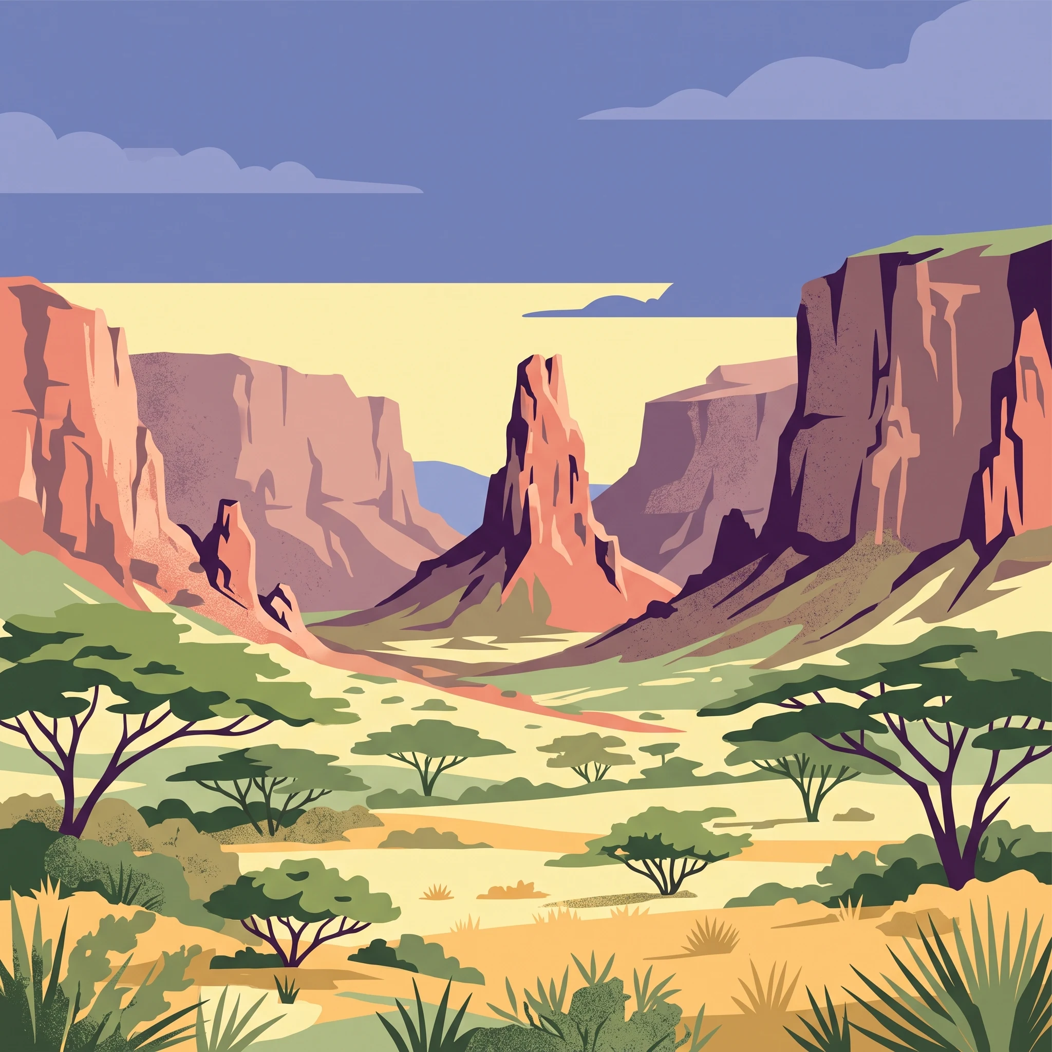
The landscape of Hell's Gate National Park is defined by volcanic geology and dramatic terrain that creates one of the most visually distinctive protected areas in Kenya. The central feature is Hell's Gate Gorge, a narrow break in the surrounding cliffs that gives the park its name, lined with red-colored cliff faces that contrast sharply with the surrounding savanna. Within the gorge rise two volcanic plugs, Fischer's Tower and Central Tower, which are rock columns formed from ancient volcanic activity and now stand as prominent landmarks within the park. The broader park territory encompasses the remnants of two extinct volcanoes, Olkaria and Hobley's, whose volcanic forms remain visible on the landscape. Obsidian formations from cooled molten lava appear throughout the park, providing evidence of the intense volcanic activity that shaped this region. A smaller gorge extends south from Central Tower, descending toward hot springs where rocky outcrops reach temperatures hot enough to cause burns and where sulfuric water emerges from the earth. The terrain varies from rocky cliff sections to more open volcanic plains, creating a landscape of considerable visual variety despite its relatively compact size of 68.25 square kilometers.

Hell's Gate National Park ecosystems, habitats, and plant life

The ecological character of Hell's Gate National Park reflects its position within the Rift Valley's highland environment at approximately 1,900 meters elevation. The park sits within a warm and dry climate zone despite its elevated position, creating conditions that support a mix of grassland and scattered bush vegetation across the volcanic terrain. The diverse habitats found within the park, ranging from rocky cliff areas to more open plains, support a corresponding variety of wildlife species. The geological features of the park, particularly the towering cliffs and volcanic formations, provide critical habitat for significant bird populations, with over 103 species recorded within the park boundaries. The red cliffs and rock faces offer nesting sites for raptors and other cliff-dwelling bird species, while the more open areas support savanna-associated wildlife. The presence of geothermal activity beneath the park adds another dimension to the ecological setting, with hot springs and associated moisture creating localized microhabitats within the broader dry landscape.

Hell's Gate National Park wildlife and species highlights

Hell's Gate National Park supports a notable diversity of wildlife despite its relatively modest size of 68.25 square kilometers. The large mammal community includes lions, leopards, and cheetahs as the primary predators, along with African buffaloes, zebras, common elands, hartebeests, Thomson's gazelles, hyenas, and baboons. The park has historically served as an important habitat for the rare bearded vulture, a species of particular conservation significance in East Africa. Over 103 bird species have been recorded within the park, including various vulture species, Verreaux's eagles, augur buzzards, and swifts. Smaller mammals present include hyrax, serval, and small populations of klipspringer antelope and Chanler's mountain reedbuck. The combination of cliff habitats, open plains, and volcanic terrain creates diverse ecological niches that support this varied wildlife community, with the park's lack of fencing allowing natural movement patterns among larger species.

Hell's Gate National Park conservation status and protection priorities

Hell's Gate National Park holds significance within Kenya's protected area system both for its geological heritage and its ecological communities. The designation as a Category II protected area under the IUCN framework recognizes the park's importance in conserving natural landscapes and the wildlife they support. The park's bird populations, particularly the bearded vulture, represent conservation priorities given the species' limited distribution in East Africa. However, the park faces notable conservation challenges from the expanding geothermal energy infrastructure that has developed within and adjacent to the park boundaries. As of 2019, significant portions of the park have been transformed into an industrial landscape featuring pipelines, power plants, and roads associated with the Olkaria geothermal complex. This development represents a tension between renewable energy production and landscape protection that characterizes the park's contemporary conservation context. The Kenya Wildlife Service manages the park aiming to balance protection of its natural values with the ongoing industrial operations beneath the surface.

Hell's Gate National Park cultural meaning and human context

Hell's Gate National Park exists within a landscape of cultural significance to the Maasai people, whose traditional territories encompass much of the Rift Valley region surrounding the park. The park includes a Maasai Cultural Center that provides educational programming about Maasai culture and traditions, offering visitors insight into the pastoralist heritage of the region's indigenous communities. This cultural dimension adds a human heritage layer to the park's natural and geological significance, recognizing the long-standing relationship between Maasai communities and the Rift Valley landscape. The dramatic terrain of the gorge and surrounding cliffs held practical significance for prehistoric human populations, as the narrow break in the cliffs once served as a tributary of a prehistoric lake that provided resources for early human communities in the Rift Valley. The park's proximity to Lake Naivasha also connects it to the broader cultural landscape of the Rift Valley region.

Top sights and standout views in Hell's Gate National Park

Hell's Gate National Park offers several standout features that distinguish it within Kenya's national park system. The dramatic Hell's Gate Gorge with its red cliffs and volcanic tower formations provides exceptional scenery unique among East African protected areas. The park's unusual permission for hiking, cycling, and camping without the restrictive vehicle-only access common in other Kenyan parks creates a more intimate visitor experience. The presence of active geothermal energy operations beneath the park, with five power stations generating significant electricity, represents an unusual integration of industrial infrastructure within a protected landscape. The park's proximity to Nairobi, approximately 90 kilometers away, makes it unusually accessible for visitors seeking a nature experience without extensive travel. The visual connection to Disney's The Lion King adds a cultural recognition factor that draws visitors familiar with the animated film's landscape inspiration.

Best time to visit Hell's Gate National Park

Hell's Gate National Park can be visited throughout the year, though the warm and dry climate that characterizes the park influences the optimal timing for different visitor experiences. The dry seasons typically offer clearer visibility for wildlife viewing and more comfortable conditions for hiking and cycling activities within the park. The period from June to October corresponds with Kenya's main dry season, when wildlife congregates more predictably around remaining water sources. The short rains from November to December and the long rains from March to May may affect trail conditions and visibility, though the park remains accessible year-round. Given the park's elevation of approximately 1,900 meters, conditions tend to be cooler than lower-lying areas in Kenya, making the midday hours more comfortable for outdoor activities compared to parks at lower elevations.
Park location guide

Geography guide, regional context, and park location map for Hell's Gate National Park

Hell's Gate National Park park geography, regions, and map view in Kenya
Understand where Hell's Gate National Park sits in Kenya through a broader geographic reading of the surrounding landscape, nearby location context, and its mapped position within the national park landscape.

How Hell's Gate National Park fits into Kenya

Kenya is a presidential republic in East Africa and the seventh-most populous country on the continent. Its capital is Nairobi, and it borders five countries and the Indian Ocean. The country features significant geographic diversity including Mount Kenya, the Rift Valley, and coastal regions.

Wider geography shaping Hell's Gate National Park in Kenya

Kenya is located in East Africa, bordering South Sudan to the northwest, Ethiopia to the north, Somalia to the east, Tanzania to the southwest, and Uganda and Lake Victoria to the west. The southeastern border meets the Indian Ocean. The geography includes the Rift Valley highlands with Mount Kenya, coastal plains, and northern arid regions.

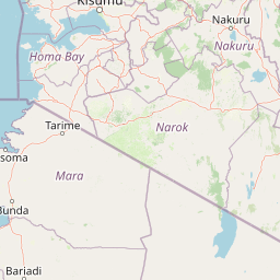
Map view of Hell's Gate National Park

Use this park location map to pinpoint Hell's Gate National Park in Kenya, understand its exact geographic position, and read its mapped placement within the surrounding landscape more clearly.

Pigeon | © OpenStreetMap contributors

Location context for Hell's Gate National Park

Nakuru County
Park atlas

Trace Kenya's Rift Valley protected landscapes and compare nearby park geography

Discover National Parks and Protected Areas Near Hell's Gate National Park
Continue your exploration from Hell's Gate National Park by browsing other national parks and protected areas situated within Kenya's diverse Rift Valley geography. Compare surrounding conservation landscapes, understand their unique geological features, and trace the regional spread of protected natural environments.
National parkNyeri County

Aberdare National Park: Mapped Protected Landscape in Nyeri County

National Park Geography and Atlas Context

Aberdare National Park is a protected national park located within Nyeri County, Kenya. This entry offers detailed geographic information and map context, highlighting its protected boundaries and landscape characteristics. Users can explore its regional setting, understand its specific terrain features, and discover its significance as a conservation area within the Kenyan geography. Access structured data that clarifies the park's identity as a vital protected landscape.

Area
767 km²
Established
1950
IUCN
II
Relief
Mountain
National parkKenya

Nairobi National Park: Detailed Geographic Overview and Protected Landscape Atlas

Explore the mapped boundaries and regional context of this Kenyan national park.

Nairobi National Park represents a significant protected national park entity within Kenya. This MoriAtlas entry provides detailed insight into its geographic placement and mapped landscape characteristics. Users can delve into the park's specific location, its protected boundaries, and its contribution to the regional geography of East Africa, facilitating structured map-based exploration and understanding of this vital conservation area.

Area
117 km²
Established
1946
IUCN
II
Relief
Mixed relief
National parkKenya

Mount Kenya National Park: Mapped Volcanic Landscape & Protected Area Geography

Kenya's high-altitude Afro-alpine ecosystems and mapped park boundaries.

Mount Kenya National Park safeguards a globally significant volcanic landscape and vital water resources for Kenya. This protected area above 3,000 meters features dramatic peaks, glaciers, and distinctive Afro-alpine flora. Explore its comprehensive mapped boundaries, understand its regional geographic importance, and discover the unique ecosystems that define this exceptional national park through detailed atlas context.

Area
715 km²
Established
1949
IUCN
II
Relief
Mountain
National parkKenya

Amboseli National Park: Kenya National Park Protected Landscape Atlas

Mapped geographic context and protected area boundaries.

Amboseli National Park is a protected national park in Kenya, offering a distinct geographic entity for exploration. This atlas-focused view details the park's mapped boundaries and regional landscape context. Understand its role as a national park and a significant protected area within the broader geography of Kenya for structured discovery.

Area
392 km²
Established
1974
IUCN
II
Visitors
120K annual
National parkNyanza Province

Ruma National Park: Kenya National Park within Nyanza Province Geographic Atlas

Explore its protected landscape and mapped geographic boundaries.

This MoriAtlas entry details Ruma National Park, a designated national park situated in Kenya's Nyanza Province. The focus is on its identity as a protected landscape, its specific geographic footprint, and its representation within a mapped atlas of natural areas. Users can investigate the park's terrain context, its regional placement, and the precise nature of its protected boundaries, offering structured geographic insight.

Area
120 km²
Established
1983
IUCN
II
Relief
Lowland
National parkEastern Province

Meru National Park National Park: Mapped Protected Boundaries and Eastern Province Geography

Explore regional landscape context and natural terrain.

Meru National Park represents a vital national park entity within the Eastern Province of Kenya, offering unique opportunities for structured geographic and atlas exploration. This page details its protected landscape identity, emphasizing mapped boundaries and the surrounding regional context. Users interested in conservation lands and natural terrain can find comprehensive details on Meru National Park's geographic significance and its role within the broader atlas of protected areas.

Area
870.44 km²
Established
1966
IUCN
II
Relief
Upland
National parkMara Region

Serengeti National Park: National Park Atlas and Protected Landscape Discovery

Explore savanna grasslands, regional geography, and mapped park boundaries.

Serengeti National Park, a significant national park within Tanzania's Mara Region, offers an unparalleled view into a vast protected landscape. This page provides access to the park's geographic identity, its defining savanna ecosystem, and its role as a critical component of the regional atlas. Understand the mapped extent of its protected boundaries and the unique natural context that supports its renowned wildlife.

Area
14,763 km²
Established
1940
IUCN
II
Visitors
350K annual
National parkTrans-Nzoia County

Saiwa Swamp National Park National Park: Mapped Protected Area in Trans-Nzoia County

Explore the geographic context and protected landscape features.

Saiwa Swamp National Park serves as a vital national park within Trans-Nzoia County, Kenya, offering a unique perspective on protected lands. This page details its mapped geography and landscape characteristics, providing essential context for atlas-based exploration of its protected boundaries and regional setting. Understand the specific features that define this important conservation area.

Area
3 km²
Established
1974
IUCN
II
Relief
Lowland

Common questions about visiting, size, designation, and location context for Hell's Gate National Park

Hell's Gate National Park FAQs for park facts, access, geography, and protected area context
Find quick answers about Hell's Gate National Park, including protected-area facts, park geography, trail and visitor context, and how the park fits into its surrounding country and regional landscape.
MoriAtlas Explorer

Continue Your Protected Areas Search Across the Global Atlas

Deepen your exploration by continuing the structured search for national parks and protected areas worldwide. Utilize the comprehensive filtering capabilities to compare different conservation landscapes and refine your understanding of global park geography. Discover more about the distribution and characteristics of protected natural areas.

Global natural geography