Why Herodion National Park stands out
Herodion is best known as King Herod the Great's ambitious building project, comprising an artificial mountain topped with a palace-fortress and a lower palace complex. The site's distinctive conical silhouette, standing approximately 235 meters above the surrounding plain, represents one of the most recognizable Herodian landmarks. The discovery of what is believed to be Herod's tomb on the slopes of the mountain made international headlines, confirming the site's royal association. The complex showcases sophisticated Roman engineering and decorative techniques that blended Hellenistic and Roman architectural traditions.
Herodion National Park history and protected-area timeline
Herod the Great began construction of Herodion around 23-20 BCE, transforming a natural hill into an artificial mountain as part of his ambitious building program across Judea. The site served as both a palace complex and a fortified retreat, demonstrating Herod's architectural vision and his desire to create a lasting monument to his rule. The artificial mountain was constructed by cutting terraces into the original hill and filling the intervening space with fill, creating a conical form that became the mountain's defining feature. Herodion served as one of his favorite retreats and was the site where he ultimately chose to be buried. Archaeological excavations, particularly those led by Professor Ehud Netzer, uncovered what is believed to be Herod's tomb on the mountain's slopes in 2007. The discovery confirmed ancient accounts that pointed to Herodion as the king's final resting place. Following the Bar Kokhba revolt in the 2nd century, the site was damaged and eventually abandoned. The area came under Israeli control following the Six-Day War in 1967, and the site was developed as a national park to preserve its archaeological heritage.
Herodion National Park landscape and geographic character
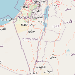
Herodion rises dramatically from the Judean Desert landscape approximately 12 kilometers southeast of Jerusalem, near the pre-1967 boundary between Israel and the West Bank. The artificial conical mountain, standing about 235 meters above the surrounding terrain, creates a distinctive silhouette visible across the desert plateau. The site occupies a strategic position overlooking the Jerusalem-to-Dead Sea road and the surrounding agricultural lands. The natural terrain of the Judean Desert provides a stark backdrop of limestone hills and dry valleys. The palace complex was built across multiple levels, taking advantage of the mountain's slopes to create dramatic architectural spaces. The lower palace spreads across the plain at the mountain's base, with remains of bathhouses, courtyards, and residential wings still visible. The landscape reflects the harsh desert environment while also showing traces of the sophisticated water systems Herod's engineers constructed to supply the palace complex.
Herodion National Park ecosystems, habitats, and plant life
The Judean Desert environment around Herodion is characterized by semi-arid conditions, with sparse vegetation adapted to the limited rainfall and rocky terrain. The national park's primary focus is on archaeological preservation rather than ecological conservation, but the surrounding desert landscape supports specialized desert flora including various drought-resistant shrubs and seasonal wildflowers. The harsh environment of the Judean Desert presents a stark contrast to the luxurious palace complex that once existed here, illustrating the ambition of Herod's building projects in challenging terrain. The area lies within a transition zone between the Mediterranean climate zone to the west and the desert climate to the east, creating a unique setting for the archaeological site.
Herodion National Park wildlife and species highlights
The desert environment around Herodion supports limited but distinctive wildlife adapted to the arid conditions. Desert reptiles, including various lizard species, can be found among the rocks and ruins. Birdlife includes species adapted to desert and cliff environments, such as various raptors that use the mountain's ruins as nesting sites. The surrounding agricultural areas attract different species, particularly during migration seasons. The wildlife presence is typical of Judean Desert ecosystems rather than specifically notable, as the site's significance lies primarily in its archaeological and historical value rather than biodiversity.
Herodion National Park conservation status and protection priorities
Herodion National Park was established to protect one of the most important Herodian sites in Israel and the West Bank. The national park designation provides legal protection for the archaeological remains and regulates visitor access to prevent damage to the sensitive structures. Conservation efforts have focused on stabilizing exposed structures, protecting decorative elements from weathering, and managing the site's exposure to visitors. The discovery of Herod's tomb reinforced the site's global significance and heightened conservation priorities. Ongoing archaeological work continues to reveal new information about the complex, requiring careful management of excavation areas and public access zones. The park represents a balance between making the heritage site accessible for education and research while ensuring its long-term preservation.
Herodion National Park cultural meaning and human context
Herodion holds profound cultural significance as a physical manifestation of King Herod the Great's ambitions and the historical period of the late Second Temple. The site represents one of the most complete examples of Herodian architecture, providing tangible evidence of the sophisticated building techniques and decorative traditions of the 1st century BCE. Herod, though a controversial figure in Jewish tradition, was responsible for some of the most ambitious construction projects in the region, including the Second Temple in Jerusalem. Herodion served as his personal monument and was intended to secure his legacy. The choice of this location, visible from Jerusalem, represented both a strategic and symbolic statement. The site's connection to Herod's burial, confirmed by archaeological discovery, adds to its significance as a royal necropolis. The complex reflects the cultural hybridity of Herod's kingdom, blending Jewish, Hellenistic, and Roman architectural and decorative traditions.
Top sights and standout views in Herodion National Park
The conical artificial mountain created by Herod remains the site's most dramatic feature, rising dramatically from the desert landscape. The remains of the upper palace include portions of columns, rooms, and the elaborate water systems that served the complex. The lower palace complex features the foundations of multiple buildings, including bathhouses with preserved hydraulic installations. The tomb attributed to King Herod, discovered on the mountain's slopes, represents one of the most significant archaeological finds related to the Herodian period. The panoramic views from the mountain top extend across the Judean Desert toward Jerusalem and the Dead Sea. The visitor experience combines exploration of the archaeological remains with understanding of Herod's ambitious building program.
Best time to visit Herodion National Park
The optimal time to visit Herodion National Park is during the cooler months from October through April, when daytime temperatures are comfortable for exploring the outdoor archaeological site. Summer months can bring extreme heat in the Judean Desert, making extended visits challenging. Spring and autumn offer particularly pleasant conditions and the desert landscape may display seasonal wildflowers. Morning visits are recommended to avoid the strongest sun and to enjoy the site before afternoon heat builds. The park is open year-round, though visitors should check current operating hours as these may vary by season. The desert location means clear skies are common, providing good visibility for the panoramic views from the mountain top.