
Mori Atlas logo
Nature reserveEin Gedi Nature Reserve

Discover the mapped boundaries and natural terrain of this key protected area.

Ein Gedi Nature Reserve: Protected Landscape and Geographic Context in Israel

Ein Gedi Nature Reserve stands as a notable protected landscape within Israel, offering a distinct geographic identity for atlas-based exploration. This page provides detailed insights into the reserve's mapped boundaries and its surrounding natural terrain, contextualizing its significance as a protected area within the broader geography of the region. Understand the unique landscape characteristics that define Ein Gedi Nature Reserve and its place in Israel's natural heritage.

Desert OasisNature ReserveWaterfallsArchaeological SiteBirdwatchingDead Sea Region
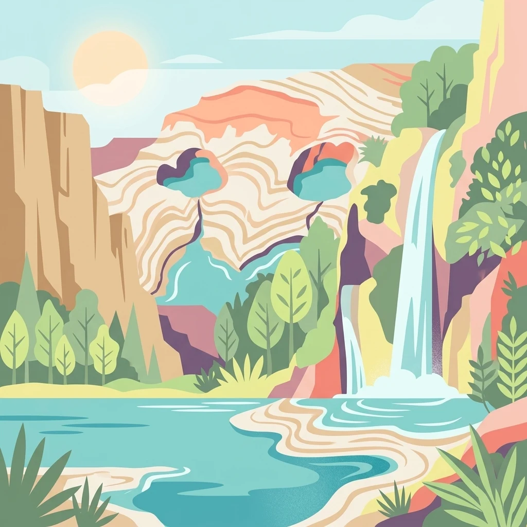
Illustration showing a waterfall flowing into a lake surrounded by cliffs and vegetation in a desert landscape

Ein Gedi Nature Reserve

Nature reserve

Park overview

Structured park overview, official facts, and landscape profile for Ein Gedi Nature Reserve

Ein Gedi Nature Reserve park facts, protected area profile, and essential visitor context

Review the core facts for Ein Gedi Nature Reserve, including designation, size, terrain, visitor scale, habitats, and operating context in one park-focused overview.

About Ein Gedi Nature Reserve

Ein Gedi Nature Reserve stands as one of Israel's most significant protected areas, representing a unique ecological phenomenon where desert and oasis intersect in a dramatic landscape along the Dead Sea shoreline. The reserve occupies the eastern slopes of the Judean Desert, a region of extreme aridity where annual precipitation averages only a few centimeters, yet the presence of multiple perennial springs has created a verdant ecological island that supports remarkable biodiversity. Five springs emerge within the reserve, with the David and Arugot streams flowing year-round and generating the water resources that have made this location important for human settlement since prehistoric times. The ecological significance of Ein Gedi extends beyond its springs, as the reserve encompasses a range of habitats from salt marsh areas near the Dead Sea shore to desert wadis and rocky slopes on the plateau above. The vegetation communities present at Ein Gedi represent a remarkable botanical synthesis, with species from tropical regions thriving alongside desert-adapted plants and Mediterranean elements, creating what is effectively a living museum of ecological convergence. The reserve's proximity to Masada and the Qumran Caves has made it a central destination for visitors exploring the historical and archaeological heritage of the Dead Sea region, while its natural attractions stand independently as a world-class desert wilderness experience.

Quick facts and research context for Ein Gedi Nature Reserve

Located in the Judean Desert along the western shore of the Dead Sea, Ein Gedi Nature Reserve protects a unique desert oasis ecosystem at elevations ranging from 423 meters below sea level at the Dead Sea shore to 200 meters above sea level on the desert plateau. The reserve features two permanent streams, Nahal David and Nahal Arugot, fed by perennial springs that produce approximately three million cubic meters of water annually. The site is one of Israel's most important nature reserves, established in 1971 and expanded in 1988, and receives approximately one million visitors per year making it among the most visited nature sites in the country. The reserve is administered separately from the adjacent Ein Gedi Archaeological Park, which preserves Roman and Byzantine-era Jewish settlement remains including a synagogue.

Protection and recognition

Tracing the terrestrial protection framework and documented management scope of this reserve.

Documented Protection Status and Conservation Framework of Ein Gedi Nature Reserve

Evaluating the documented protection status of Ein Gedi Nature Reserve highlights its formal classification as a terrestrial conservation landscape. Accessing these verified registry records and designation details helps researchers compare official protection frameworks across global geographic regions.

Protection details

Protection scope
Terrestrial
Transboundary protection
No
Park context

Deeper park guide and search-rich context for Ein Gedi Nature Reserve

Ein Gedi Nature Reserve history, landscape, wildlife, and travel context

Explore Ein Gedi Nature Reserve through its history, landscape character, ecosystems, wildlife, conservation priorities, cultural context, and seasonal travel timing in a structured park guide built for atlas discovery and search intent.

Why Ein Gedi Nature Reserve stands out

Ein Gedi is best known for its spectacular desert oasis setting, where permanent springs create lush green valleys cascading with waterfalls amid the stark Judean Desert landscape. The reserve is famous for its population of Nubian ibex, which are regularly spotted on the rocky desert slopes, as well as for supporting an extraordinary concentration of birdlife with over 200 migratory species passing through during spring and fall. The Chalcolithic temple, one of the oldest known religious structures in the region, and the connection to biblical history as the site identified with Hazazon Tamar add significant archaeological prestige. The ongoing formation of sinkholes caused by the declining water level of the Dead Sea has also made the site a subject of environmental interest.
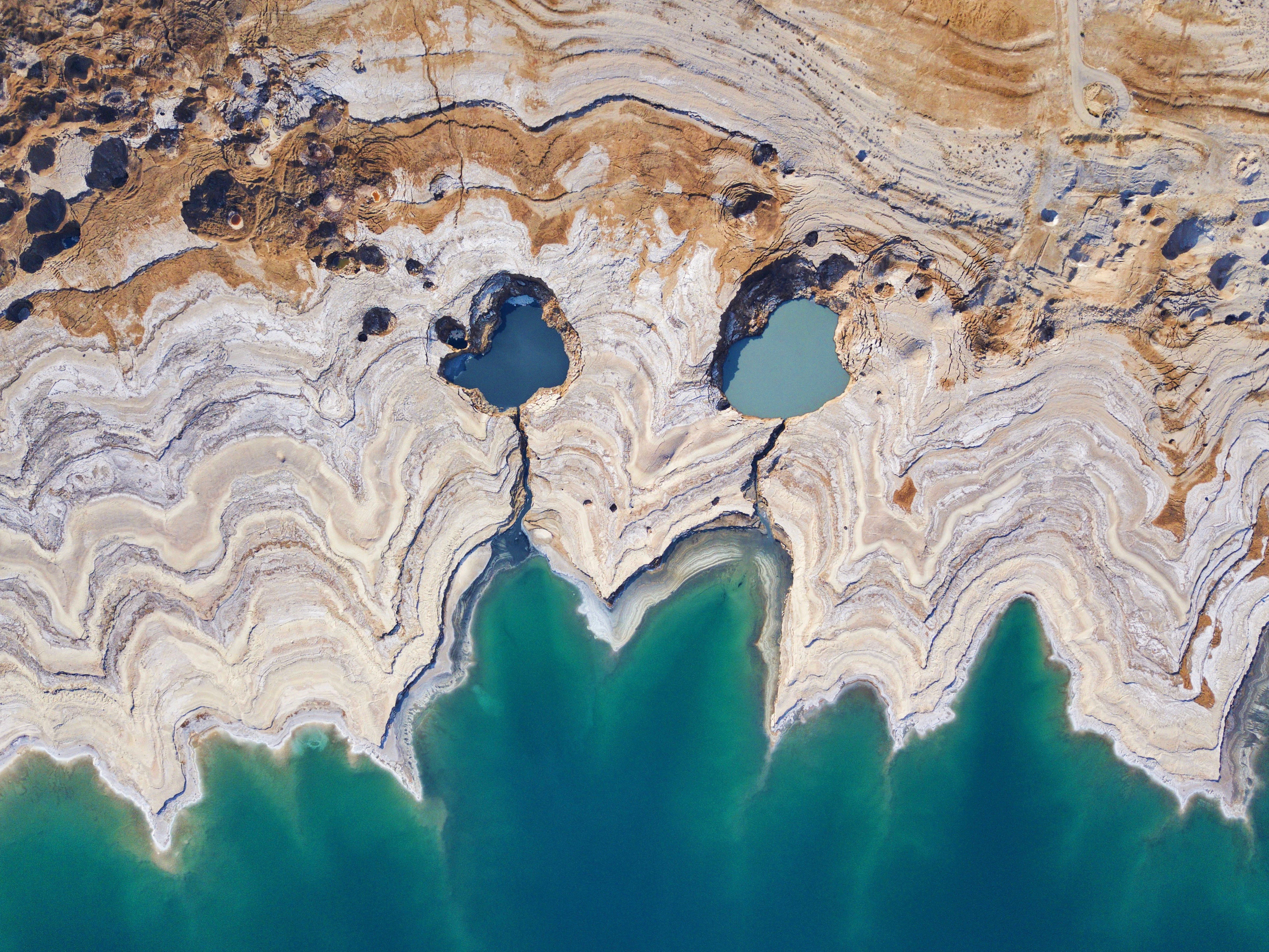
Aerial view showing two distinct sinkholes filled with water, surrounded by layered rock formations and a body of water
Aerial view of two water-filled sinkholes at Ein Gedi Nature Reserve near the Dead Sea

Ein Gedi Nature Reserve history and protected-area timeline

The history of Ein Gedi spans thousands of years, with the site holding significance from the Chalcolithic period through biblical times and into the modern era. The location is identified with the biblical Hazazon Tamar, a city mentioned in the Hebrew Bible that was renowned for its palm groves and date palm cultivation. Archaeological evidence at the nearby Tel Goren, the ancient mound adjacent to the nature reserve, reveals continuous habitation from the Iron Age through the Byzantine period, with the settlement serving at various times as a royal city of Judah and a frontier town in the Roman and Byzantine periods. The Chalcolithic shrine discovered within the reserve represents one of the earliest known religious structures in the region, attracting worshippers more than 5,000 years ago. During the Jewish-Roman wars, Ein Gedi served as a refuge, with historical references noting that David sought shelter in the area when fleeing from King Saul. The settlement experienced destruction during the Babylonian exile, revival in the fifth century BCE, and peak prosperity during the Herodian period before ultimately declining after the seventh century CE. The modern kibbutz Ein Gedi was established in the 1950s, and the nature reserve was declared in 1971, formalizing protection for this historically significant desert landscape.

Ein Gedi Nature Reserve landscape and geographic character

The landscape of Ein Gedi Nature Reserve presents a striking contrast between arid desert and lush oasis environments, shaped by the dramatic elevation gradient from the Dead Sea shore to the Judean Desert plateau. The reserve encompasses approximately 14 square kilometers of terrain characterized by deep wadis carved by seasonal flash floods, rocky desert slopes interspersed with alluvial fans, and the verdant corridors surrounding the perennial streams. The most dramatic topographic feature is the descent from the plateau at roughly 200 meters above sea level down to the Dead Sea shore at 423 meters below sea level, creating a landscape of steep cliffs, terraced slopes, and narrow canyon passages. The water-rich areas feature cascading waterfalls, with the David Falls and Arugot Falls representing the most spectacular examples of the spring-fed streams descending through the desert. The salt crusts of the Dead Sea shoreline and the karst terrain created by dissolving underground salt deposits contribute to an ever-changing landscape, particularly as the declining water level of the Dead Sea has accelerated sinkhole formation in the area. The combination of stark desert cliffs, verdant stream valleys, and the shimmering expanse of the Dead Sea creates one of the most visually dramatic protected landscapes in the Middle East.
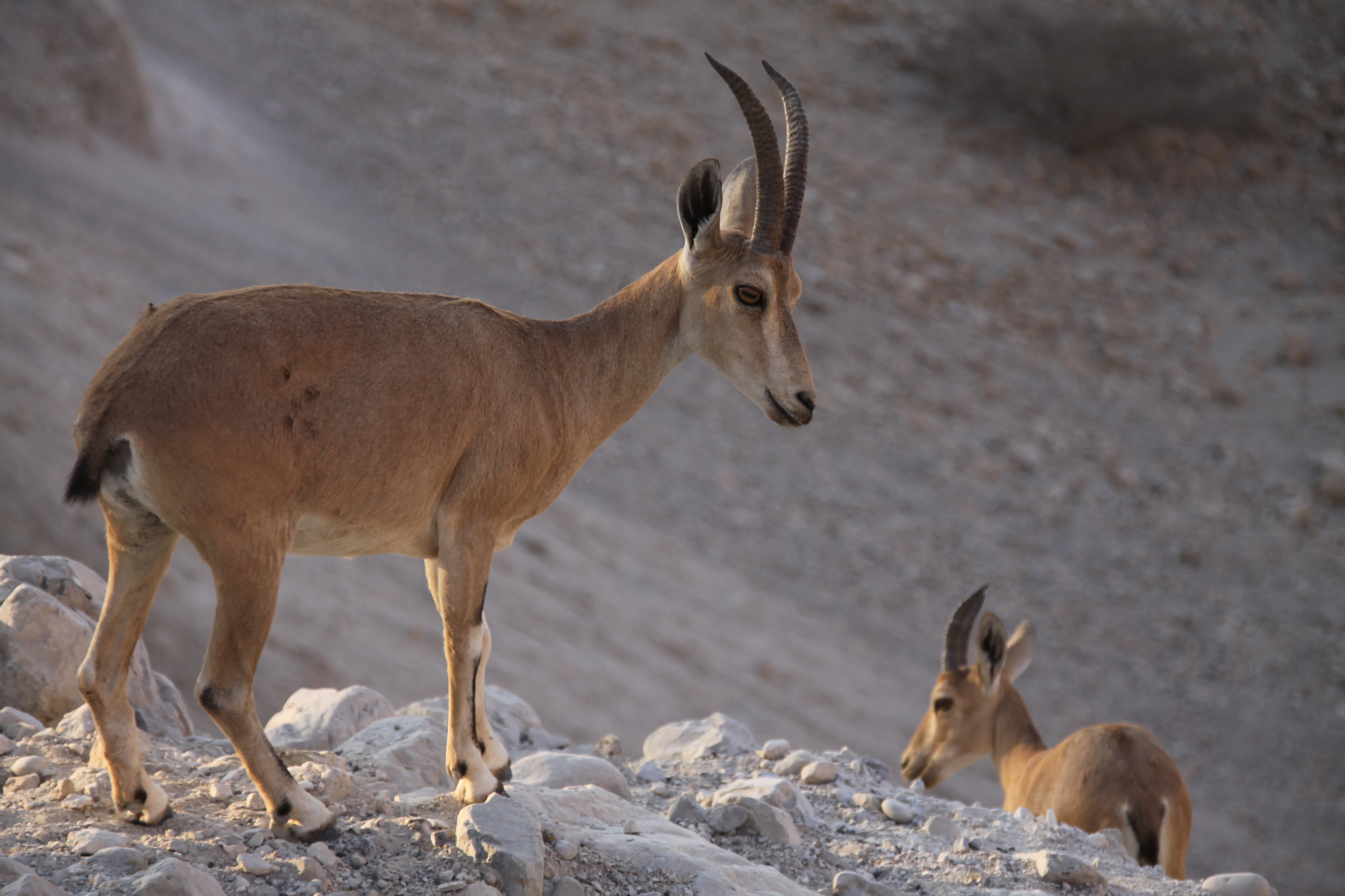
Two Nubian Ibexes on rocky desert terrain with a dry, sloped background
Two Nubian Ibexes standing on rocky terrain in Ein Gedi Nature Reserve

Ein Gedi Nature Reserve ecosystems, habitats, and plant life

The ecological character of Ein Gedi is defined by the convergence of multiple biogeographic zones in a desert setting, creating a biodiversity hotspot that supports species from tropical, Mediterranean, desert, and steppe origins. The perennial water sources support riparian vegetation communities dominated by acacia trees, tamarisk, and oleander, while the surrounding desert slopes host drought-adapted species including the toxic Sodom apple and various salt-tolerant plants near the Dead Sea shore. The springs generate approximately three million cubic meters of water annually, much of which is utilized for agriculture in the region, with the remainder creating the wetland habitats that sustain the reserve's ecological richness. The botanical diversity is remarkable for a desert environment, with the reserve serving as a refuge for species that cannot survive in the surrounding arid terrain. The bird population is particularly significant, with resident species supplemented by over 200 migratory species that pass through during the spring and autumn migration seasons, making Ein Gedi a prime location for birdwatching in Israel. The karst groundwater system beneath the reserve, with its network of caves conveying water between sinkholes, represents a unique geological feature that influences both the hydrology and the ongoing landscape dynamics of the area.
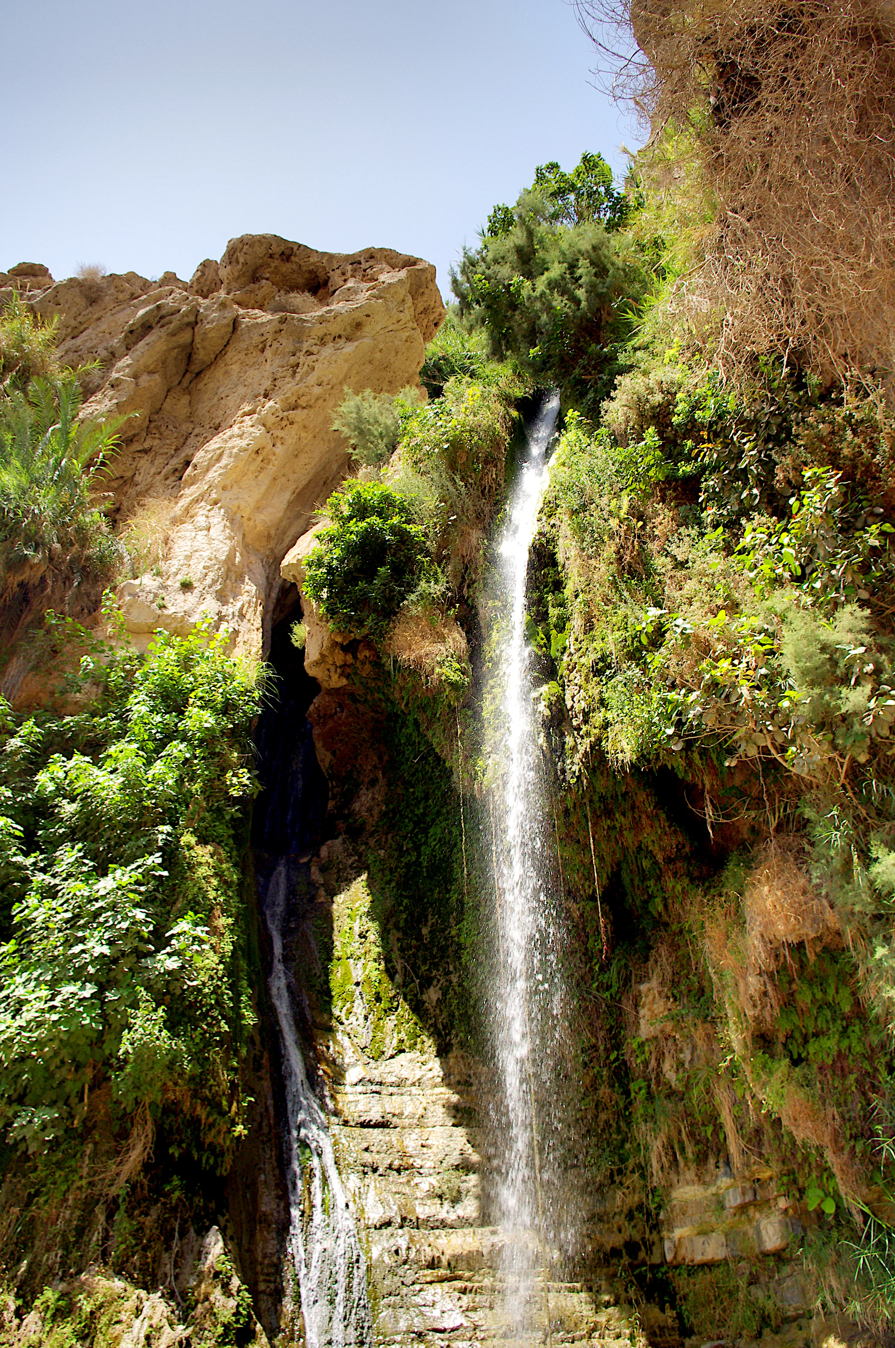
A tall waterfall cascading down rocky cliffs surrounded by dense green vegetation under a clear blue sky
David Waterfall in Ein Gedi Nature Reserve, Israel

Ein Gedi Nature Reserve wildlife and species highlights

The wildlife of Ein Gedi Nature Reserve is characterized by species adapted to extreme desert conditions as well as those exploiting the unique water resources, creating a diverse assemblage of mammals, birds, and reptiles. The Nubian ibex is the most iconic large mammal species, with populations regularly observed on the rocky desert slopes and cliffs surrounding the stream valleys, their mastery of the steep terrain making them a favorite subject for wildlife photographers and visitors. The rock hyrax, a small mammal resembling a guinea pig, is another characteristic species of the reserve, often seen basking on rocks in the morning sun near the stream areas. Birdlife is exceptionally rich, with the reserve's position along the Great Rift Valley migration route bringing hundreds of species through seasonally, while resident birds including various sunbirds, bulbuls, and warblers exploit the oasis habitats. The combination of desert, rocky terrain, and wetland environments supports a reptile population including several snake species and lizards adapted to the harsh conditions. The ecological structure of the reserve, with its water sources creating distinct habitat islands within the desert, supports higher wildlife densities than would otherwise be expected in this arid region, making each encounter with wildlife a memorable aspect of visiting Ein Gedi.
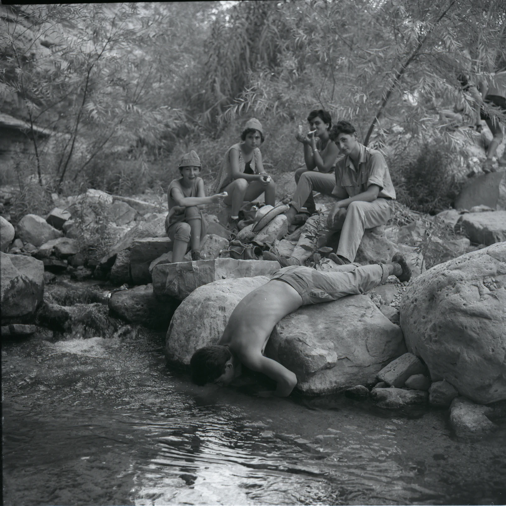
Black-and-white photograph showing several people near a stream in a rocky, vegetated area with vegetation in the background
People interacting with a stream in Ein Gedi Nature Reserve

Ein Gedi Nature Reserve conservation status and protection priorities

Ein Gedi Nature Reserve represents one of Israel's most important conservation achievements, protecting a unique desert ecosystem that would otherwise face significant degradation from development pressure and water extraction. The reserve's establishment in 1971 and subsequent expansion in 1988 reflects a growing recognition of the scientific and ecological value of the oasis, which serves as a critical refuge for species that cannot survive in the surrounding desert. The management challenge at Ein Gedi is complicated by the ongoing environmental changes affecting the Dead Sea region, particularly the declining water level that has accelerated sinkhole formation and altered the hydrological balance of the area. The Israel Nature and Parks Authority monitors these changes and implements adaptations to protect both visitors and the ecological integrity of the reserve as the landscape transforms. The reserve also preserves important archaeological resources, with the management approach balancing natural and cultural heritage conservation. The popularity of Ein Gedi, with approximately one million annual visitors, creates significant pressure on the environment, making visitor management and sustainable tourism practices essential components of the conservation strategy.

Ein Gedi Nature Reserve cultural meaning and human context

The cultural context of Ein Gedi extends far beyond its modern status as a nature reserve, encompassing millennia of human presence shaped by the life-giving springs that make this desert location habitable. The site appears in the Hebrew Bible as Hazazon Tamar, the city of date palms that was destroyed during the Babylonian exile and subsequently revived during the Persian and Hellenistic periods. The name Ein Gedi itself appears in biblical texts, and the area is associated with David's flight from Saul, adding to the site's historical prestige. The Roman and Byzantine-period synagogue discovered in the adjacent archaeological park testifies to the continued Jewish presence at Ein Gedi through late antiquity, while the Chalcolithic temple represents one of the earliest examples of religious practice in the region. The modern kibbutz established in the 1950s continues the tradition of human settlement, with the internationally acclaimed botanical garden and eco-park demonstrating contemporary approaches to living sustainably in this challenging environment. The cultural landscape reflects the intersection of ancient agricultural practices, biblical history, archaeological discovery, and modern ecological awareness.

Top sights and standout views in Ein Gedi Nature Reserve

The highlights of Ein Gedi Nature Reserve combine natural spectacle with historical depth, beginning with the spectacular David Falls and Arugot Falls where spring water cascades through desert canyons. The population of Nubian ibex, often visible on the rocky slopes, provides exceptional wildlife viewing opportunities in a dramatic setting. The archaeological remains including the rare Chalcolithic temple offer connections to ancient religious practices dating back over 5,000 years. The botanical diversity, with plants from four biogeographic regions growing together, creates a living demonstration of ecological convergence. The contrast between the stark Judean Desert and the lush oasis environment provides one of the most visually striking landscapes in any protected area. The visitor experience is enhanced by the proximity to other significant sites including Masada, Qumran, and the Dead Sea beaches, making Ein Gedi a gateway to understanding the historical and natural heritage of this region.

Best time to visit Ein Gedi Nature Reserve

The best time to visit Ein Gedi is during the cooler months from October through April, when daytime temperatures are moderate and comfortable for hiking the desert trails. Summer months from May through September bring extreme heat that can exceed 40 degrees Celsius in the lower elevations, making outdoor activity dangerous during midday hours. The spring and autumn seasons offer the additional advantage of migratory bird passages, with hundreds of species passing through the reserve during these periods, creating exceptional birdwatching opportunities. Winter can bring occasional rain that may affect access to some trails, though the desert landscape responds dramatically to any precipitation with temporary waterfalls and renewed vegetation growth. Early morning visits are recommended year-round to observe wildlife activity and experience the peaceful atmosphere before visitor numbers increase.

Monthly climate preview

Long-term representative point measurements of monthly temperature and precipitation rhythm

Ein Gedi Nature Reserve Climate Normals and Annual Weather Patterns

Historical coordinate data records significant seasonal shifts in average monthly maximum temperatures and minimal rainfall totals across the surveyed representative point. Detailed monthly breakdowns provide deeper insight into long-term climate normals for comparative geographic analysis.
Annual mean22 °C
12 °C30 °C
Jan12°
Feb13°
Mar16°
Apr21°
May25°
Jun28°
Jul30°
Aug30°
Sep28°
Oct25°
Nov19°
Dec14°
Warmest month
July

30.1 °C

Coolest month
January

12 °C

Wettest month
January

1.5 mm/day

Driest month
June

0 mm/day

Park location guide

Geography guide, regional context, and park location map for Ein Gedi Nature Reserve

Ein Gedi Nature Reserve park geography, regions, and map view in Israel

Understand where Ein Gedi Nature Reserve sits in Israel through a broader geographic reading of the surrounding landscape, nearby location context, and its mapped position within the national park landscape.

How Ein Gedi Nature Reserve fits into Israel

Israel is a parliamentary republic in the Southern Levant, established in 1948 as a Jewish homeland. It borders Lebanon, Syria, Jordan, and Egypt, with Mediterranean coastline and access to the Red Sea. Jerusalem is the capital, though its status is contested, while Tel Aviv is the largest urban area. The country has a high-income economy with strong technology and innovation sectors.

Wider geography shaping Ein Gedi Nature Reserve in Israel

Israel occupies the Southern Levant region of West Asia. It is bordered by Lebanon to the north, Syria to the northeast, Jordan to the east, and Egypt to the southwest. The western coast lies on the Mediterranean Sea, while the southern tip reaches the Red Sea. The eastern border includes the Dead Sea, Earth's lowest point. The country occupies the West Bank, Gaza Strip, and Golan Heights.

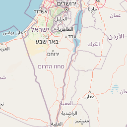
Map view of Ein Gedi Nature Reserve

Use this park location map to pinpoint Ein Gedi Nature Reserve in Israel, understand its exact geographic position, and read its mapped placement within the surrounding landscape more clearly.

Pigeon | © OpenStreetMap contributors

Location context for Ein Gedi Nature Reserve

Judean Desert
Natural feature types

Discover the Geographic Features within the Ein Gedi Nature Reserve Atlas

Navigate the diverse natural landforms, wadis, and spring systems that characterize the Ein Gedi Nature Reserve landscape. MoriAtlas provides a structured spatial overview of the natural terrain and geological landmarks essential to understanding this protected desert oasis.
Recorded earthquake history

Review the Historical Earthquake Catalogue for Ein Gedi Nature Reserve

Access the comprehensive dataset of seismic activity associated with the desert terrain of Ein Gedi Nature Reserve. MoriAtlas provides a clear view of historical records, including magnitudes and event dates, to assist in better understanding the regional seismic context of this protected landscape.

Ein Gedi Nature Reserve Earthquake Records

Catalogued events

17 events

Strongest magnitude

Magnitude 5.3

Most recent event

Jan 15, 2026

This history includes earthquakes recorded inside the park or within 50 km of its borders

Visualize the striking contrast of lush oases, arid desert terrain, and cascading waterfalls within this protected area.

Ein Gedi Nature Reserve: Visual Exploration of its Dramatic Oasis Landscapes and Desert Scenery

Gain a comprehensive visual understanding of Ein Gedi Nature Reserve through its diverse imagery. Examine the stark Judean Desert cliffs, verdant stream valleys, and dramatic waterfalls like Nahal David. The gallery reveals the unique protected-area character, showcasing its extraordinary ecological convergence and crucial desert oasis habitats.

Aerial view showing two distinct sinkholes filled with water, surrounded by layered rock formations and a body of water

Rock arch formation framing a small water pool in a desert landscape

Two Nubian Ibexes on rocky desert terrain with a dry, sloped background

A tall waterfall cascading down rocky cliffs surrounded by dense green vegetation under a clear blue sky

Black-and-white photograph showing several people near a stream in a rocky, vegetated area with vegetation in the background

Park atlas

Browse a curated list of national parks and protected areas in the surrounding Judean Desert and Dead Sea region, expanding your geographic understanding.

Explore Other Protected Areas and National Parks Near Ein Gedi Nature Reserve, Comparing Judean Desert Landscapes

After exploring the unique oasis environment of Ein Gedi Nature Reserve, discover other significant protected areas and national parks situated within the stark Judean Desert and along the dramatic Dead Sea coastline. Compare the diverse desert landscapes, perennial springs, and archaeological sites across these nearby conservation regions to trace a broader geographic and ecological context.
National parkIsrael
About 9.4 km away#1 closest

South

Masada National Park: Explore Israel's Iconic Protected Desert Fortress and Landscape

Discover mapped boundaries and archaeological significance in the Judean Desert.

Masada National Park preserves a remarkable historical fortress and palace complex set within the dramatic desert terrain of Israel's Judean Desert. This protected area is renowned for its archaeological importance, showcasing sophisticated ancient engineering and its role as the final stronghold of the Jewish revolt. The stark, beautiful landscape surrounding the plateau offers significant geographic context, allowing for an atlas-style exploration of its terrain, mapped boundaries, and the wider Dead Sea region.

IUCN
V
Scope
Terrestrial
Water
Minor water
Season
Year-round
Nature reserveJordan
About 17 km away#2 closest

East

Wadi Mujib Nature Reserve: Explore Jordan's Dramatic Canyon Protected Landscape

Discover mapped boundaries and arid biodiversity within this unique rift valley gorge.

Wadi Mujib Nature Reserve represents a significant protected landscape in Jordan, celebrated for its deep desert canyon and dramatic slot canyon terrain. Situated in the Dead Sea region, this reserve protects a remarkable range of geography, from its lowest points near the Dead Sea to surrounding mountain terrain. Its status as a UNESCO biosphere reserve highlights its importance for arid biodiversity and its role as a migratory bird flyway, offering a distinct atlas-level discovery of Jordan's natural heritage.

Area
212 km²
Established
1987
IUCN
IV
Relief
Mountain
National parkIsrael
About 24 km away#3 closest

Northwest

Herodion National Park: A Key National Park within Israel's Protected Landscape Atlas

Explore its mapped boundaries and geographic terrain.

Herodion National Park stands as a significant protected area within Israel, contributing vital context to the nation's atlas of natural landscapes. This national park designation highlights its role in conservation and offers a unique opportunity to study its specific geography, terrain, and mapped boundaries. By focusing on the park's protected landscape identity, users can gain structured insights into Israel's conservation efforts and regional geographic features, enhancing any atlas exploration.

Scope
Terrestrial
National parkIsrael
About 27 km away#4 closest

Southwest

Tel Arad National Park: Discover Israel's Protected Landscape and Mapped Geography

Explore protected area boundaries and regional terrain context.

Delve into Tel Arad National Park, a key protected area in Israel offering insights into its unique landscape and geographic setting. This park provides a focal point for understanding protected land distribution, mapped terrain features, and the regional natural context within the Levant. Utilize this atlas entry to explore the park's specific geographic identity and conservation significance.

Watercolor painting of a landscape with mountains, water, and vegetation
National parkIsrael
About 28 km away#5 closest

North

Qumran National Park: National Park Atlas Exploration and Geographic Context in Israel

Mapped terrain and protected landscape identity in Israel.

Delve into Qumran National Park, a significant national park situated in Israel. This detailed exploration focuses on its protected landscape identity, mapped boundaries, and its place within the country's diverse geography. Understand the unique natural context and regional significance of Qumran National Park through an atlas-driven perspective.

Relief
Lowland
Climate
Arid
Access
Moderate access
Scope
Terrestrial
National parkIsrael
About 41 km away#6 closest

North

Qasr el Yahud National Park: Exploring Protected Landscape and Geographic Identity in Israel

Mapped boundaries and regional natural landscape context.

Qasr el Yahud National Park is a designated protected area in Israel, serving as a crucial site for understanding regional geography and landscape context. This page facilitates detailed exploration of its protected land identity, mapped geographic boundaries, and its place within the natural terrain of the area, offering users a clear view of its atlas significance.

National parkIsrael
About 41 km away#7 closest

Northwest

Castel National Park: A National Park for Geographic Discovery in Israel

Investigate the mapped protected landscape and regional terrain.

Castel National Park represents a key protected area within Israel, focusing on the discovery of its mapped terrain and geographic identity. As a national park, it serves as a crucial entity for understanding regional conservation landscapes and the distribution of protected areas across Israel. This detailed view allows for focused exploration of the park's boundaries and its contribution to the country's natural heritage, offering valuable context for atlas-based geographical inquiry.

Relief
Mountain
Climate
Mediterranean
Scope
Terrestrial
Water
No major water
Nature reserveJordan
42 km away#8 closest

South

Fifa Nature Reserve Nature Reserve: Protected Landscape Discovery in Jordan

Mapped natural terrain and protected area context.

Fifa Nature Reserve represents a distinct protected natural landscape within Jordan. This entry offers users a detailed atlas-style view of the reserve's protected boundaries and its place within the country's geography. Explore the mapped terrain and understand the significance of this nature reserve for structured geographic discovery and protected-area research.

Area
23.2 km²
Established
2011
Relief
Lowland
Climate
Arid

Common questions about visiting, size, designation, and location context for Ein Gedi Nature Reserve

Ein Gedi Nature Reserve FAQs for park facts, access, geography, and protected area context

Find quick answers about Ein Gedi Nature Reserve, including protected-area facts, park geography, trail and visitor context, and how the park fits into its surrounding country and regional landscape.
MoriAtlas Explorer

Continue Your Protected Areas Search Across the Global Atlas

Deepen your exploration by continuing the structured search for national parks and protected areas worldwide. Utilize the comprehensive filtering capabilities to compare different conservation landscapes and refine your understanding of global park geography. Discover more about the distribution and characteristics of protected natural areas.

Global natural geography