
Streams
Park geography
Structured data covering boundary area, elevation relief, and natural feature distribution.
Geographic Profile of Ein Gedi Nature Reserve in the Judean Desert, Israel
This geographic profile details the physical characteristics of Ein Gedi Nature Reserve, covering its 14 km squared area within the Judean Desert. The terrain includes elevation extremes ranging from -423 meters to 200 meters, supporting complex riverine and desert ecosystems featuring numerous springs, waterfalls, and cliff formations.
Desert oasis with year-round waterfalls, ancient archaeological sites, and remarkable biodiversity on the shore of the shrinking Dead Sea
Ein Gedi Nature Reserve
Ein Gedi Nature Reserve is a celebrated oasis in the Judean Desert of Israel, situated on the eastern slopes descending toward the Dead Sea coast near the ancient fortress of Masada and the Qumran Caves. Declared in 1971 and expanded in 1988, the reserve encompasses approximately 14,000 dunams of dramatic desert terrain centered on a cluster of perennial springs that have supported life in this arid environment for millennia. The name Ein Gedi, meaning spring of the kid or fountain of the kid, reflects the water-rich character that makes this location a striking anomaly in one of the most arid regions in the world. The reserve is renowned for its remarkable ecological diversity, with vegetation drawing from tropical, desert, Mediterranean, and steppe biomes, creating a unique confluence of species rarely found together. Visitors are drawn to the spectacular waterfalls of Nahal David and Nahal Arugot, where water flows year-round despite the surrounding desert landscape. Beyond its natural significance, the reserve contains important archaeological remains including a rare Chalcolithic shrine and connections to biblical-era settlements.
- Location
- Israel
- Park type
- Nature reserve
- Established
- 1971
- Area
- 14 km²
Location overview
Coastal classification and regional placement in the Judean Desert
Geographic Positioning of Ein Gedi Nature Reserve in Israel
Ein Gedi Nature Reserve is situated within Israel and American Samoa, specifically located in the Judean Desert. The protected area features a designated coastal park status and remains entirely non-transboundary.
- Countries
- Israel
- Regions
- Judean Desert
- Primary location
- Israel
- Geographic setting
- Coastal
Boundary and coordinates
Spatial dimensions and geographic extent across 14 square kilometers.
Ein Gedi Nature Reserve Boundary Map and Spatial Geography
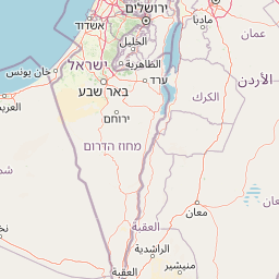
Interactive boundary mapping traces the limits of Ein Gedi Nature Reserve to provide spatial context. Regional datasets outline the estimated area of 14 square kilometers alongside geographic coordinates and center points.
- Boundary area
- 14.4 km²
- Boundary perimeter
- 32.6 km
- Northernmost point
- 31.4919° N
- Southernmost point
- 31.3974° N
- Easternmost point
- 35.4° E
- Westernmost point
- 35.3471° E
- Geographic centre
- 31.4544° N, 35.3761° E
- North–south span
- 10.5 km
- East–west span
- 5 km
Elevation and terrain
Recorded vertical range and physical features within the protected lowland landscape
Ein Gedi Nature Reserve Terrain and Elevation Profile Facts
Review the stored elevation summary detailing the vertical span across the protected lowland terrain. Explore recorded natural features with associated types and spatial relationships.
- Minimum elevation
- -423 m
- Maximum elevation
- 200 m
Selected named natural features
Waterfalls
מפל דוד
Cave entrances
מערת דודים
Streams
נחל צרויה
Streams
נחל דוד
Viewpoints
ראש מעלה איסיים
Environmental setting
Arid climate zones, sparse forest cover, and major water presence across lowland terrain
Environmental Setting and Landscape Classifications of Ein Gedi Nature Reserve
Stored landscape features, habitat types, and relief categories combine to form complementary interpretations of physical terrain settings. Recorded classifications link directly to relevant atlas destinations for broader regional context.
- Relief
- Lowland
- Climate
- Arid
- Water
- Major water bodies
- Forest cover
- Sparse forest
Landscape features
Valleys · Rivers · Waterfalls · Cliffs · Desert
Habitat types
Desert habitat · Riverine habitat · Wetland
Park atlas
Browse a curated list of national parks and protected areas in the surrounding Judean Desert and Dead Sea region, expanding your geographic understanding.
Explore Other Protected Areas and National Parks Near Ein Gedi Nature Reserve, Comparing Judean Desert Landscapes
After exploring the unique oasis environment of Ein Gedi Nature Reserve, discover other significant protected areas and national parks situated within the stark Judean Desert and along the dramatic Dead Sea coastline. Compare the diverse desert landscapes, perennial springs, and archaeological sites across these nearby conservation regions to trace a broader geographic and ecological context.
National parkIsrael
About 9.4 km away#1 closest
South

Masada National Park: Explore Israel's Iconic Protected Desert Fortress and Landscape
Discover mapped boundaries and archaeological significance in the Judean Desert.
Masada National Park preserves a remarkable historical fortress and palace complex set within the dramatic desert terrain of Israel's Judean Desert. This protected area is renowned for its archaeological importance, showcasing sophisticated ancient engineering and its role as the final stronghold of the Jewish revolt. The stark, beautiful landscape surrounding the plateau offers significant geographic context, allowing for an atlas-style exploration of its terrain, mapped boundaries, and the wider Dead Sea region.
- IUCN
- V
- Scope
- Terrestrial
- Water
- Minor water
- Season
- Year-round
Nature reserveJordan
About 17 km away#2 closest
East

Wadi Mujib Nature Reserve: Explore Jordan's Dramatic Canyon Protected Landscape
Discover mapped boundaries and arid biodiversity within this unique rift valley gorge.
Wadi Mujib Nature Reserve represents a significant protected landscape in Jordan, celebrated for its deep desert canyon and dramatic slot canyon terrain. Situated in the Dead Sea region, this reserve protects a remarkable range of geography, from its lowest points near the Dead Sea to surrounding mountain terrain. Its status as a UNESCO biosphere reserve highlights its importance for arid biodiversity and its role as a migratory bird flyway, offering a distinct atlas-level discovery of Jordan's natural heritage.
- Area
- 212 km²
- Established
- 1987
- IUCN
- IV
- Relief
- Mountain
National parkIsrael
About 24 km away#3 closest
Northwest
Herodion National Park: A Key National Park within Israel's Protected Landscape Atlas
Explore its mapped boundaries and geographic terrain.
Herodion National Park stands as a significant protected area within Israel, contributing vital context to the nation's atlas of natural landscapes. This national park designation highlights its role in conservation and offers a unique opportunity to study its specific geography, terrain, and mapped boundaries. By focusing on the park's protected landscape identity, users can gain structured insights into Israel's conservation efforts and regional geographic features, enhancing any atlas exploration.
- Scope
- Terrestrial
National parkIsrael
About 27 km away#4 closest
Southwest
Tel Arad National Park: Discover Israel's Protected Landscape and Mapped Geography
Explore protected area boundaries and regional terrain context.
Delve into Tel Arad National Park, a key protected area in Israel offering insights into its unique landscape and geographic setting. This park provides a focal point for understanding protected land distribution, mapped terrain features, and the regional natural context within the Levant. Utilize this atlas entry to explore the park's specific geographic identity and conservation significance.
National parkIsrael
About 28 km away#5 closest
North
Qumran National Park: National Park Atlas Exploration and Geographic Context in Israel
Mapped terrain and protected landscape identity in Israel.
Delve into Qumran National Park, a significant national park situated in Israel. This detailed exploration focuses on its protected landscape identity, mapped boundaries, and its place within the country's diverse geography. Understand the unique natural context and regional significance of Qumran National Park through an atlas-driven perspective.
- Relief
- Lowland
- Climate
- Arid
- Access
- Moderate access
- Scope
- Terrestrial
National parkIsrael
About 41 km away#6 closest
North
Qasr el Yahud National Park: Exploring Protected Landscape and Geographic Identity in Israel
Mapped boundaries and regional natural landscape context.
Qasr el Yahud National Park is a designated protected area in Israel, serving as a crucial site for understanding regional geography and landscape context. This page facilitates detailed exploration of its protected land identity, mapped geographic boundaries, and its place within the natural terrain of the area, offering users a clear view of its atlas significance.
National parkIsrael
About 41 km away#7 closest
Northwest
Castel National Park: A National Park for Geographic Discovery in Israel
Investigate the mapped protected landscape and regional terrain.
Castel National Park represents a key protected area within Israel, focusing on the discovery of its mapped terrain and geographic identity. As a national park, it serves as a crucial entity for understanding regional conservation landscapes and the distribution of protected areas across Israel. This detailed view allows for focused exploration of the park's boundaries and its contribution to the country's natural heritage, offering valuable context for atlas-based geographical inquiry.
- Relief
- Mountain
- Climate
- Mediterranean
- Scope
- Terrestrial
- Water
- No major water
Nature reserveJordan
42 km away#8 closest
South
Fifa Nature Reserve Nature Reserve: Protected Landscape Discovery in Jordan
Mapped natural terrain and protected area context.
Fifa Nature Reserve represents a distinct protected natural landscape within Jordan. This entry offers users a detailed atlas-style view of the reserve's protected boundaries and its place within the country's geography. Explore the mapped terrain and understand the significance of this nature reserve for structured geographic discovery and protected-area research.
- Area
- 23.2 km²
- Established
- 2011
- Relief
- Lowland
- Climate
- Arid
MoriAtlas Explorer
Continue Exploring Ein Gedi Nature Reserve's Protected Landscape and Regional Geography
Delve deeper into the mapped geography and protected landscape characteristics of Ein Gedi Nature Reserve. Understanding its specific natural terrain and its placement within Israel's atlas of protected areas provides essential context for further geographic exploration and appreciation of its unique environmental identity.
Browse next
Global natural geography
Explore related park routes
Explore MoriAtlas Global ParksBrowse All MoriAtlas ParksGlobal Park Map DiscoveryMoriAtlas: Browse All CountriesBrowse All MoriAtlas ContinentsNational Park Environment AtlasGrand Canyon National Park AtlasYellowstone National Park AtlasYosemite National Park Atlas and GeographySerengeti National Park AtlasGalápagos National Park Protected LandscapeBanff National Park Geography and AtlasKruger National Park Atlas EntryUluṟu-Kata Tjuṯa National Park AtlasExplore Uluru-Kata Tjuta National Park GeographyPlitvice Lakes National Park AtlasFiordland National Park Protected LandscapeGreat Smoky Mountains National Park AtlasAfghanistan National Parks and Protected AreasAlbania National Parks and Protected AreasAlgeria National Parks and Protected AreasAmerican Samoa National Parks and Protected AreasAndorra National Parks and Protected AreasAngola National Parks and Protected AreasAntarctica National Parks and Protected AreasAntigua and Barbuda Park List