

Mori Atlas logo
Wildlife reserveHincks Conservation Park

A vital wildlife reserve preserving native ecosystems within rural South Australia

Hincks Conservation Park: Understanding Protected Landscapes on the Eyre Peninsula

Hincks Conservation Park represents a significant protected area on the Eyre Peninsula of South Australia, serving as a remnant of native vegetation within a broader agricultural region. Established to manage natural resources and support biodiversity, the park forms a connected ecological complex alongside the adjacent Hincks Wilderness Protection Area. This atlas provides a detailed look at the park's geographic setting, its role as a refuge for native flora, and its history as a conservation site.

conservation parkeyre peninsulasouth australiashrublandnative vegetation refugesemi-arid habitat

Hincks Conservation Park

Wildlife reserve

Park overview

Structured park overview, official facts, and landscape profile for Hincks Conservation Park

Hincks Conservation Park park facts, protected area profile, and essential visitor context

Review the core facts for Hincks Conservation Park, including designation, size, terrain, visitor scale, habitats, and operating context in one park-focused overview.

About Hincks Conservation Park

Hincks Conservation Park sits on the Eyre Peninsula, a broad landmass in the southern part of South Australia that juts westward into the Great Australian Bight. The park lies inland from the peninsula's eastern coast, with the regional center of Port Lincoln to the south and the small agricultural town of Lock to the northwest. The surrounding landscape is one of low rolling country typical of the semi-arid southern Australian coast, where natural vegetation has increasingly been replaced by grazing and cropping land.

The conservation park originated in 1941, when a portion of land in what is now the locality of Tooligie received formal protected status. This early protection was later expanded and reorganized under the National Parks and Wildlife Act 1972, which remains the legislative framework for South Australia's parks and reserves. In 1993, additional land adjoining the original 1941 reservation was declared a conservation reserve under the Crown Lands Act 1929, and in 2004 this area was added to the conservation park, enlarging its footprint.

A further significant change came when the majority of the park's land was excised to create the Hincks Wilderness Protection Area, a separately designated reserve with a stronger wilderness focus. Hincks Conservation Park therefore represents a remnant of the original consolidated reserve, distinct from the wilderness area that surrounds or adjoins it. Together, the two reserves form a continuous mosaic of native habitat on the Eyre Peninsula.

The park's name is itself an interesting thread in South Australia's conservation history. One historical account attributes the name to Sir Cecil Stephen Hincks, who served as South Australian Minister of Lands, Irrigation and Repatriation between 1946 and 1963. Another account suggests that the park simply inherited its name from the earlier Hincks Conservation Reserve. Regardless of the precise origin of the name, the park stands as a tangible link between South Australia's older conservation system and its modern network of parks and wilderness areas.

Quick facts and research context for Hincks Conservation Park

Hincks Conservation Park is a small protected area of about 8.78 square kilometers on the Eyre Peninsula in South Australia, situated roughly 35 kilometers southeast of Lock and 95 kilometers north of Port Lincoln. It falls within the gazetted locality of Tooligie. The park was first proclaimed on 1 January 1941 and its current boundaries were formalized under the National Parks and Wildlife Act 1972, with additional land added in 2004.

The park is managed by the South Australian Department for Environment and Water and is classified as an IUCN Category VI protected area, a designation that allows sustainable use of natural resources alongside conservation goals. A portion of its original land allocation has since been reclassified as the separate Hincks Wilderness Protection Area, leaving Hincks Conservation Park as a smaller but still ecologically meaningful reserve within the regional protected-area network.

Protection and recognition

Examine the verified conservation standing and official protected area records for this reserve.

Hincks Conservation Park Protection Status and Designated Terrestrial Scope

Hincks Conservation Park maintains a documented terrestrial protection scope within its designated natural boundary. Review the verified administrative records and international recognition metrics associated with this protected landscape.

Protection details

Protection scope
Terrestrial
Park context

Deeper park guide and search-rich context for Hincks Conservation Park

Hincks Conservation Park history, landscape, wildlife, and travel context

Explore Hincks Conservation Park through its history, landscape character, ecosystems, wildlife, conservation priorities, cultural context, and seasonal travel timing in a structured park guide built for atlas discovery and search intent.

Why Hincks Conservation Park stands out

Hincks Conservation Park is best known as a protected fragment of Eyre Peninsula habitat, preserving native vegetation cover in a region otherwise dominated by agricultural land. It is recognized as part of a connected conservation landscape that includes the adjacent Hincks Wilderness Protection Area, together forming an important refuge for native flora and fauna on the peninsula. The park is also notable within South Australia's protected-area history as one of the older conservation reserves in the region, with origins dating back to 1941. Its evolution from an early protected parcel into a formally gazetted conservation park under the National Parks and Wildlife Act 1972 illustrates the state's gradual consolidation of its conservation estate.

Hincks Conservation Park history and protected-area timeline

The protection history of Hincks Conservation Park stretches back to 1 January 1941, when a portion of land in the Tooligie area was formally reserved. This early designation predates the modern national parks framework of South Australia and reflects an early state-level recognition of the area's conservation value.

In 1972, the conservation park was proclaimed under the National Parks and Wildlife Act 1972, the central piece of legislation governing South Australia's parks and reserves. This proclamation formalized the park's status and consolidated its management under the state conservation system.

A subsequent phase of change began in 1993, when a parcel of land adjoining the original reservation was gazetted as a conservation reserve under the Crown Lands Act 1929. In 2004, this land was incorporated into the conservation park, expanding its extent shortly before the majority of the combined land holding was excised to become the separate Hincks Wilderness Protection Area. The naming of the park and the related reserve has been attributed variously to Sir Cecil Stephen Hincks, a long-serving South Australian minister, and to the earlier Hincks Conservation Reserve.

Hincks Conservation Park landscape and geographic character

The park lies within the gently undulating country of the central-eastern Eyre Peninsula, a region shaped by long-term weathering under semi-arid climatic conditions. Topography in this part of South Australia tends to be subdued: low rises, shallow valleys, and broad plains characterize much of the surrounding countryside, with elevation changes occurring gradually rather than abruptly.

Native vegetation once blanketed much of the Eyre Peninsula, but extensive clearance for agriculture has left only scattered remnants. Hincks Conservation Park, together with its adjacent wilderness area, represents one of these surviving remnants and preserves something of the original land surface and soil patterns alongside its vegetation cover.

The park's setting between Port Lincoln and Lock places it firmly within a rural region dominated by broad-acre farming and grazing. As a protected island within this working landscape, the park offers a glimpse of the natural terrain of the peninsula as it existed before widespread agricultural development.

Hincks Conservation Park ecosystems, habitats, and plant life

Although the conservation park covers only a modest area of about 8.78 square kilometers, it is ecologically valuable as a refuge of native habitat in an extensively cleared region. The park lies within a broader semi-arid climatic zone where Mediterranean-type influences meet Australian dryland conditions, supporting plant communities adapted to relatively low rainfall and nutrient-poor soils.

Native ecosystems of this part of the Eyre Peninsula typically include shrublands, low woodlands, and ground-cover vegetation adapted to dry conditions. The conservation park preserves a sample of these communities, maintaining ecological functions such as soil stability, nutrient cycling, and habitat continuity for native species that would otherwise be restricted to narrower corridors of uncleared land.

By protecting a contiguous block of native vegetation, the park contributes to broader ecological processes across the peninsula. Its proximity to the larger Hincks Wilderness Protection Area strengthens this role, allowing native flora and fauna to move between reserves rather than being confined to a single small fragment.

Hincks Conservation Park wildlife and species highlights

The wildlife profile of Hincks Conservation Park reflects the broader faunal community of the Eyre Peninsula's surviving native vegetation patches. Native mammals, reptiles, and birds characteristic of South Australia's semi-arid shrublands and low woodlands are supported by the habitat the park conserves, including species that rely on intact stands of native vegetation for shelter and foraging.

Birdlife is a particularly important component of the park's ecological value. The mix of shrub layers, ground cover, and scattered woody vegetation typical of the region provides habitat for a range of native bird species, some of which may have declined elsewhere on the peninsula as a result of vegetation clearance.

The park's role as a refuge is enhanced by its connection to the surrounding Hincks Wilderness Protection Area, which together with the conservation park forms a larger block of continuous native habitat. This connectivity is important for wildlife that requires larger areas of intact vegetation to maintain viable populations.

Hincks Conservation Park conservation status and protection priorities

Hincks Conservation Park holds a meaningful position in South Australia's conservation estate as one of the older protected areas on the Eyre Peninsula. Its long history of protection, dating to 1941 and consolidated under the National Parks and Wildlife Act 1972, has allowed native vegetation and associated ecological processes to persist in a landscape otherwise dominated by agriculture.

The park's IUCN Category VI designation acknowledges that it is managed both for biodiversity protection and for sustainable use of natural resources. This framework allows management actions such as controlled grazing or other low-impact uses where appropriate, while still prioritizing the maintenance of native ecosystems.

A key element of the park's conservation significance is its role within the wider Hincks protected-area complex. The excision of most of its former land area to create the adjacent Hincks Wilderness Protection Area was itself a conservation-driven decision, intended to strengthen protection by establishing a higher level of wilderness management in the region. The remaining conservation park complements the wilderness area by contributing additional habitat and acting as a buffer zone at the margin of the larger reserve.

Hincks Conservation Park cultural meaning and human context

Hincks Conservation Park's cultural context is tied primarily to the broader history of land use and conservation on the Eyre Peninsula. The region has long been shaped by European agricultural settlement, with broad-scale clearance of native vegetation for grazing and cropping leaving only scattered patches of intact habitat. The existence of the park reflects early twentieth- and twenty-first-century recognition of the need to preserve representative samples of the peninsula's natural heritage within this working landscape.

The park's naming also connects it to South Australia's broader political and administrative history. One interpretation links its name to Sir Cecil Stephen Hincks, who served as South Australian Minister of Lands, Irrigation and Repatriation between 1946 and 1963. Whether the name honors this individual or derives from the earlier Hincks Conservation Reserve, the park stands as a reminder of the institutional figures and decisions that have shaped the state's conservation landscape.

Top sights and standout views in Hincks Conservation Park

Hincks Conservation Park's key distinguishing qualities lie in its long protection history and its role within a larger connected conservation landscape on the Eyre Peninsula. As one of the older reserves in South Australia, with origins stretching back to 1941, it carries both historical and ecological significance. Its formal proclamation under the National Parks and Wildlife Act 1972 in 1972 and its subsequent expansion in 2004 mark it as part of the state's progressively consolidated conservation system.

The park also stands out for its relationship with the adjacent Hincks Wilderness Protection Area, which was carved from the same original conservation land holding. Together the two reserves form a continuous block of native habitat in a region where intact vegetation is otherwise scarce, supporting biodiversity, ecological connectivity, and the long-term preservation of the Eyre Peninsula's characteristic semi-arid ecosystems.

Best time to visit Hincks Conservation Park

Hincks Conservation Park lies within South Australia's semi-arid Mediterranean climate zone, where conditions vary meaningfully between the cooler, wetter winter months and the warmer, drier summer period. Winter and spring tend to bring greener conditions, milder temperatures, and active vegetation growth across the Eyre Peninsula, making this period generally more comfortable for outdoor exploration and more rewarding for observing the park's native shrublands and ground cover.

Summer in the region can be hot and dry, with limited shade and higher evaporation rates that leave the landscape visibly parched. Visitors during this period should expect harsher conditions, while those visiting in winter and spring are more likely to encounter the landscape at its most vegetatively active. As ever in any semi-arid Australian environment, weather can shift quickly, and planning around seasonal conditions is advisable.
Monthly climate preview

Long term temperature and precipitation patterns across representative coordinates

Hincks Conservation Park Climate Normals and Monthly Weather Records

Hincks Conservation Park records measured monthly temperature and precipitation normals derived from long term representative point observations in South Australia. Reviewing the complete twelve month climate profile reveals detailed seasonal variations in average minimum and maximum temperatures across the protected landscape.
Annual mean17 °C
11 °C23 °C
Jan23°
Feb23°
Mar21°
Apr18°
May15°
Jun12°
Jul11°
Aug12°
Sep14°
Oct16°
Nov19°
Dec21°
Warmest month
January

23 °C

Coolest month
July

11.2 °C

Wettest month
June

1.9 mm/day

Driest month
January

0.5 mm/day

Park location guide

Geography guide, regional context, and park location map for Hincks Conservation Park

Hincks Conservation Park park geography, regions, and map view in Australia

Understand where Hincks Conservation Park sits in Australia through a broader geographic reading of the surrounding landscape, nearby location context, and its mapped position within the national park landscape.

How Hincks Conservation Park fits into Australia

Australia is a constitutional monarchy and federal parliamentary democracy comprising six states and ten territories. With a population of nearly 28 million, it is one of the world's most urbanised countries, with most people concentrated on the eastern seaboard. The country has a high Human Development Index and is known for its cultural diversity, ancient Aboriginal heritage, and unique wildlife.

Wider geography shaping Hincks Conservation Park in Australia

Australia occupies the entire Australian continent, the island of Tasmania, and numerous smaller islands. It is the world's flattest and driest inhabited continent, featuring vast deserts in the interior (the Outback), tropical rainforests along the eastern coast, and a coastline bordering the Indian and Pacific Oceans.

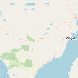
Map view of Hincks Conservation Park

Use this park location map to pinpoint Hincks Conservation Park in Australia, understand its exact geographic position, and read its mapped placement within the surrounding landscape more clearly.

Pigeon | © OpenStreetMap contributors

Location context for Hincks Conservation Park

South Australia
Recorded earthquake history

View Historical Seismic Records for Hincks Conservation Park

Consult the MoriAtlas collection of recorded earthquake events associated with the geography of Hincks Conservation Park. Examine historical data on epicentre proximity and event magnitude to understand the seismic context of this South Australian protected area.

Hincks Conservation Park Earthquake History

Catalogued events

1 event

Strongest magnitude

Magnitude 4.4

Most recent event

Jun 9, 1996

This history includes earthquakes recorded inside the park or within 50 km of its borders

Park atlas

Compare adjacent conservation reserves and regional protected areas across the Eyre Peninsula

Explore Parks Near Hincks Conservation Park and Surrounding Protected Landscapes

Continue browsing other parks near Hincks Conservation Park to examine connected semi-arid habitats and native vegetation refuges across the surrounding agricultural region. This regional comparison reveals broader conservation networks and protected land patterns throughout the southern Australian peninsula.
Wildlife reserveSouth Australia
56 km away#1 closest

Northeast

Darke Range Conservation Park: A Protected Woodland Sanctuary in South Australia

Geographic landscape and regional habitat exploration

Located near Darke Peak, this wildlife reserve safeguards threatened native peppermint gum woodland. The park functions as an ecologically significant pocket of intact vegetation, providing a window into the natural ridge terrain of the Eyre Peninsula that remains distinct from the surrounding rural land.

Area
6.93 km²
Established
1985
IUCN
VI
Relief
Mountain
Nature reserveSouth Australia
About 57 km away#2 closest

West

Cap Island Conservation Park: Nature Reserve and Offshore Marine Habitat in South Australia

Coastal granite island and protected seabird breeding landscape.

Situated off the coast of the Eyre Peninsula, Cap Island Conservation Park is a protected nature reserve serving as a critical sanctuary for pinnipeds and nesting seabirds. Its unique geological profile, featuring a granite base and calcarenite cap, creates a rugged offshore environment shaped by marine erosion and salt-tolerant vegetation. The reserve highlights the significance of isolated island ecosystems within the broader geography of South Australia.

Area
0.09 km²
Established
1967
IUCN
Ia
Relief
Lowland
Wildlife reserveSouth Australia
About 64 km away#3 closest

Northwest

Dakalanta Sanctuary: A Private Wildlife Reserve on the Northern Eyre Peninsula

Mapped regional geography and conservation habitat profiles

Dakalanta Sanctuary provides a significant example of private land conservation in South Australia. Covering 130 square kilometres of low hills and stabilized dunes, this reserve focuses on restoring native vegetation after past pastoral use. The area is vital for safeguarding semi-arid habitats like mallee woodlands, playing an active role in regional biodiversity protection and habitat connectivity.

Area
130 km²
Established
2002
Relief
Upland
Access
Access unknown
Nature reserveSouth Australia
About 67 km away#4 closest

Northeast

Carappee Hill Conservation Park: Atlas and Geographic Protected Area Profile

Nature reserve geography and Eyre Peninsula landscape context

Carappee Hill Conservation Park covers 8.5 square kilometres of rocky, elevated terrain in the locality of Darke Peak. As a designated conservation area and IUCN Category III site, it serves as a critical refuge for native vegetation, providing a clear map of protected landform heritage in central South Australia.

Area
8.5 km²
Established
1973
IUCN
III
Relief
Upland
A pale, abstract watercolor painting showing rolling green hills, trees, and a light sky against a white background.
Nature reserveSouth Australia
74 km away#5 closest

Northeast

Caralue Bluff Conservation Park: A Protected Nature Reserve on the Eyre Peninsula

Mapping regional landscape integrity in South Australia

Caralue Bluff Conservation Park encompasses a 21.5 square kilometre tract of land in South Australia, acting as a crucial element of the Eyre Peninsula landscape. Named for the nearby Caralue Bluff landform, this nature reserve safeguards essential bushland habitats within a highly developed rural setting. Analyze the park boundaries and terrain characteristics to better appreciate its function as a conserved natural refuge.

Area
21.57 km²
Established
1993
IUCN
VI
Scope
Terrestrial
National parkSouth Australia
76 km away#6 closest

South

Coffin Bay National Park: Protected Landscape and Geographic Context in South Australia

Explore the mapped boundaries and regional geography of this national park.

Coffin Bay National Park presents a distinct protected landscape within South Australia, offering a valuable point of entry for geographic discovery. This page details the park's national park designation and its mapped territory, crucial for understanding its role in Australia's atlas of natural areas. Delve into the park's specific geographic context and the outlines of its protected lands, providing a clear picture of its landscape within the state's broader terrain.

Area
309.76 km²
Established
1982
IUCN
II
Relief
Lowland
Wildlife reserveSouth Australia
About 80 km away#7 closest

Northwest

Cocata Conservation Park: Eyre Peninsula Protected Wildlife Reserve and Landscape Map

Geographic overview of South Australian conservation lands.

Cocata Conservation Park encompasses a vast semi-arid expanse on the Eyre Peninsula, characterized by gently undulating plains, calcrete-capped terrain, and open salt flats. Gain insights into the physical geography and habitat distribution of this important South Australian wildlife reserve through detailed regional mapping.

Area
167.62 km²
Established
1993
IUCN
VI
Scope
Terrestrial
National parkSouth Australia
81 km away#8 closest

South

Lincoln National Park National Park: Mapped Protected Area and Geographic Landscape Identity

South Australia's protected landscape with detailed park boundaries.

Gain a comprehensive atlas perspective on Lincoln National Park, a designated national park in South Australia. This resource details the park's mapped boundaries, offering clear geographic context and highlighting its role as a protected landscape. Understand its place within the regional geography of South Australia, providing essential data for landscape exploration and atlas-based research.

Area
216.38 km²
Established
1941
IUCN
II
Relief
Upland

Common questions about visiting, size, designation, and location context for Hincks Conservation Park

Hincks Conservation Park FAQs for park facts, access, geography, and protected area context

Find quick answers about Hincks Conservation Park, including protected-area facts, park geography, trail and visitor context, and how the park fits into its surrounding country and regional landscape.
MoriAtlas Explorer

Continue Your Protected Areas Search Across the Global Atlas

Deepen your exploration by continuing the structured search for national parks and protected areas worldwide. Utilize the comprehensive filtering capabilities to compare different conservation landscapes and refine your understanding of global park geography. Discover more about the distribution and characteristics of protected natural areas.

Global natural geography