
Mori Atlas logo
Protected areaHuanglong Scenic and Historic Interest Area

A high-altitude protected expanse featuring mineral-rich pools, alpine meadows, and glaciated mountain summits.

Huanglong Scenic and Historic Interest Area: Mapping the Travertine Karst Landscapes of Sichuan

Located in the Minshan Mountains of Sichuan Province, Huanglong Scenic and Historic Interest Area defines a distinctive high-altitude environment characterized by vast systems of colorful travertine terraces and deep forested gorges. This protected landscape preserves a rare geological sequence of mineral pools shifting in hue against the backdrop of snow-capped peaks. Explore the intricate natural boundaries and mountain terrain that establish this region as a significant center for karst conservation and ecological preservation in southwestern China.

travertine poolscolored poolskarsthigh-altitude landscapealpine sceneryUNESCO World Heritage

Huanglong Scenic and Historic Interest Area

Protected area

Park overview

Structured park overview, official facts, and landscape profile for Huanglong Scenic and Historic Interest Area

Huanglong Scenic and Historic Interest Area park facts, protected area profile, and essential visitor context

Review the core facts for Huanglong Scenic and Historic Interest Area, including designation, size, terrain, visitor scale, habitats, and operating context in one park-focused overview.

About Huanglong Scenic and Historic Interest Area

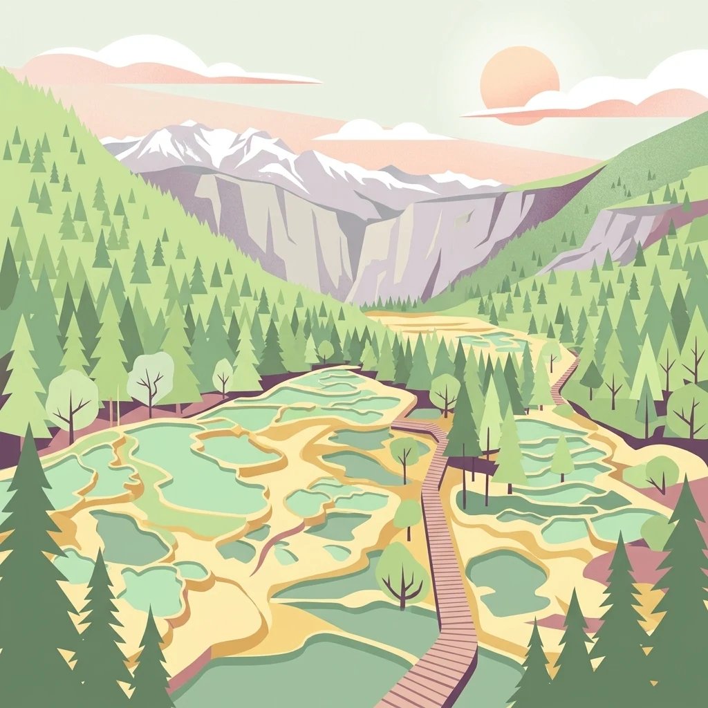
Huanglong Scenic and Historic Interest Area is a vast high-altitude landscape reserve in northern Sichuan, instantly recognizable for its long corridor of multicolored travertine pools that descend through a forested valley beneath glaciated peaks. The name Huanglong, meaning "Yellow Dragon," evokes the way the serpentine line of golden and turquoise pools appears to wind down the mountain like the body of a dragon among the trees. Within the broader scenic area, several distinct zones gather around this central valley, including the Danyunxia gorge, Munigou, the Xueshanliang ridge, Hongxingyan, and Xigou, each offering its own character of forest, water, and alpine scenery.

The geological drama of Huanglong is rooted in its travertine landscape, one of the largest and best-preserved of its type anywhere on Earth. Mineral-rich water emerges near the head of the valley and, over thousands of years, has built up enormous natural terraces, dams, and basins that hold the now-iconic pools. Across the main valley the pools step upward in elevation, producing distinct sections like the Welcoming Pools, the Lotus Platform Waterfall, the Golden Sand Floor, and the culminating Five-Color Pools at the top of the ascent. These pools, combined with surrounding waterfalls, sinkholes, and ridges, give the area a visual richness that has made it a benchmark for travertine karst scenery worldwide.

Beyond the geology, Huanglong is also defined by its ecological and cultural layers. Ancient temples, including Buddhist and Taoist shrines within the valley, connect the landscape to long regional traditions. The mountains above shelter important populations of endangered species, including the giant panda and the Sichuan snub-nosed monkey, lending the area genuine biodiversity value. Designated a UNESCO World Natural Heritage Site in 1992 alongside Jiuzhaigou, recognized as a national geopark, and rated as one of China's premier scenic zones, Huanglong occupies a singular place at the intersection of geology, ecology, and cultural landscape in southwest China.

Quick facts and research context for Huanglong Scenic and Historic Interest Area

Huanglong Scenic and Historic Interest Area is a UNESCO World Natural Heritage Site located in Songpan County, northern Sichuan Province, within the Aba Tibetan and Qiang Autonomous Prefecture. The protected zone covers around 60,000 hectares of high-altitude terrain at the foot of the Minshan range's principal peak, Xuebaoding, and stretches across multiple connected scenic sub-areas.

The site is internationally recognized for its travertine formations, which are often described as the largest and best preserved examples of their kind in the world. It is a national-level scenic area and a recognized Chinese national geopark, and it stands as one of China's highest-elevation protected landscapes, with much of the terrain above 3,000 meters and a number of peaks rising above 5,000 meters.

Protection and recognition

Examine official UNESCO World Heritage documentation and protected area recognition records.

Protection Status and International Recognition for Huanglong Scenic and Historic Interest Area

Huanglong Scenic and Historic Interest Area maintains documented protection status anchored by official UNESCO World Heritage recognition. Structured records assemble verified international designations and formal conservation frameworks for the protected landscape.
Park context

Deeper park guide and search-rich context for Huanglong Scenic and Historic Interest Area

Huanglong Scenic and Historic Interest Area history, landscape, wildlife, and travel context

Explore Huanglong Scenic and Historic Interest Area through its history, landscape character, ecosystems, wildlife, conservation priorities, cultural context, and seasonal travel timing in a structured park guide built for atlas discovery and search intent.

Why Huanglong Scenic and Historic Interest Area stands out

Huanglong is most famous for its vast system of colored travertine pools arrayed along the Huanglong Valley, which run from roughly 3,200 meters up to about 3,576 meters in elevation. The pools shimmer in constantly shifting hues of turquoise, jade, gold, and amber, formed by calcium carbonate deposits carried by mineral-rich spring water cascading down the mountainside. The result is a long ribbon of saturated color set against glacial peaks and deep forest, often compared to a celestial landscape brought down to the human scale. Equally important is the broader natural setting: the snow-capped summit of Xuebaoding, the neighboring Danyunxia gorge, and surrounding forests and meadows that, together with the pools, create one of the most distinctive mountain-scenic combinations in China and a defining example of high-altitude travertine karst in the world.
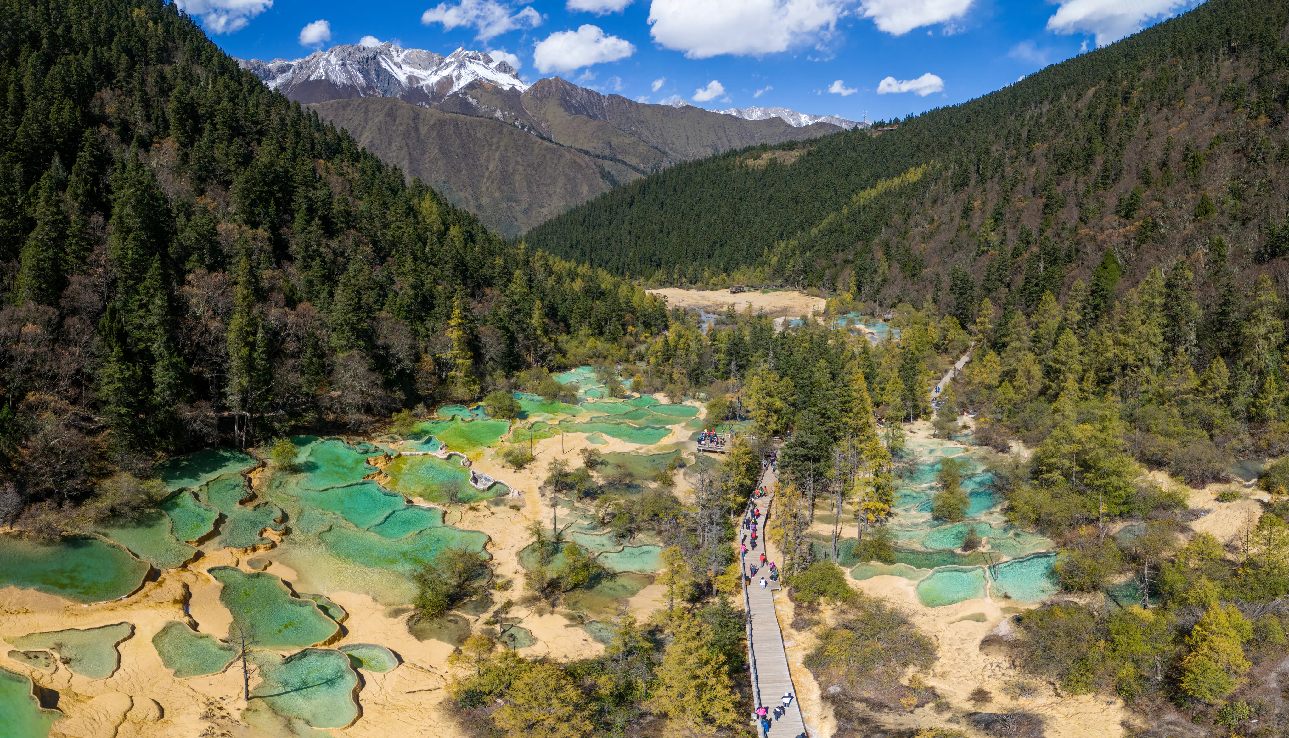
Huanglong aerial panoramic view 2023

Huanglong Scenic and Historic Interest Area history and protected-area timeline

Huanglong's cultural legacy long predates its modern protected status. Buddhist and Taoist temples within the main valley, including the Huanglong Middle Temple and the more remote Huanglong Ancient Temple, reflect centuries of religious activity in these mountains and tie the landscape to broader patterns of pilgrimage and spiritual life across the Sichuan highlands.

The modern era of the area began with its national recognition as a protected scenic zone within the Chinese scenic-area system, which formalized the conservation of the valley's pools, forests, and surrounding peaks. The pivotal moment internationally came in December 1992, when UNESCO inscribed Huanglong and Jiuzhaigou together as a single World Natural Heritage Site under natural criterion (vii), citing the exceptional natural beauty of the travertine landscapes and glacial scenery. In subsequent years the area was additionally designated as a national geopark, and it has been marketed and managed among China's highest-tier scenic destinations, cementing its place on both the national and global heritage maps.

Huanglong Scenic and Historic Interest Area landscape and geographic character

The central landscape of Huanglong is the long, narrow Huanglong Valley itself, a roughly 7.5-kilometer trough running about 1.5 kilometers wide beneath the towering peak of Xuebaoding. The valley floor is a stepped sequence of travertine terraces and basins, and at almost every elevation its pools reflect different tones, depending on mineral content, water depth, and the angle of sunlight. This unusual landscape, dominated by calcium carbonate rather than typical limestone karst towers or caves, sets the visual signature of the area apart from almost anywhere else.

Surrounding the main valley are dramatically varied terrains. To the side lies Danyunxia, a steep forested gorge cut by mountain streams and waterfall chains, while further out are Munigou's quieter landscapes, the alpine ridges of Xueshanliang, and the red-rock cliffs of Hongxingyan. The whole reserve sits at elevations largely above 3,000 meters, with seven peaks rising beyond 5,000 meters. The combination of glaciated summits, canyon walls, dense conifer forest, and patterned alpine meadows gives Huanglong a compact but exceptionally layered high-mountain environment.
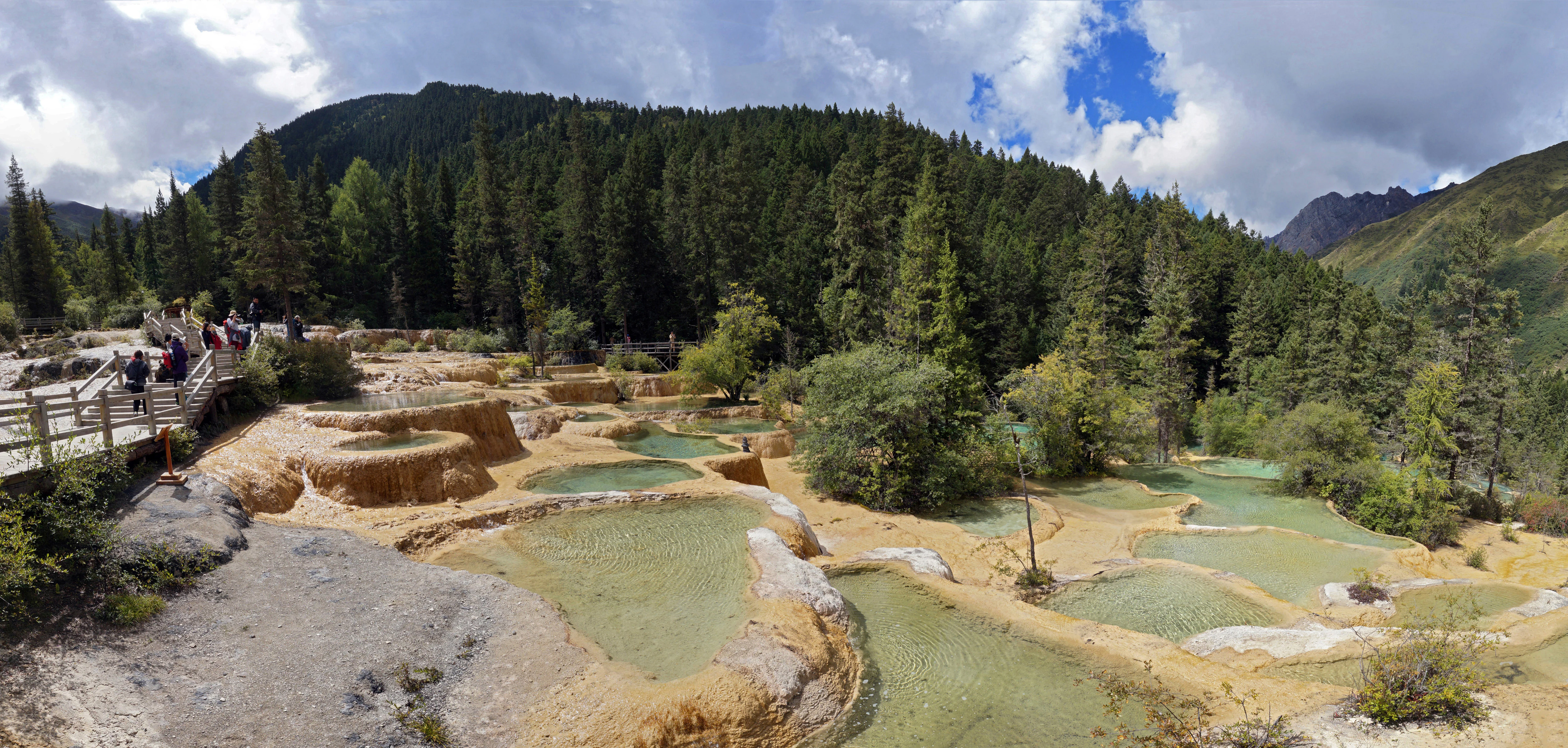
Welcome Ponds at Huanglong
The Welcome Ponds, a series of terraced travertine pools at the entrance of Huanglong

Huanglong Scenic and Historic Interest Area ecosystems, habitats, and plant life

The ecological character of Huanglong is shaped by its elevation. The dominant forests are cool, Himalayan-type conifer woodlands, with stands of spruce, fir, and other high-mountain conifers that clothe the valley walls and ridges surrounding the pools. At higher altitudes these forests thin into subalpine shrublands, alpine meadows, and eventually the bare rock and ice of the upper peaks. The valley floor's travertine pools and the wetlands that form around the spring outlets create a distinct micro-habitat pattern, where saturated mineral water supports specialized mosses, algae, and aquatic vegetation that in turn give the pools much of their vivid color.

This high-altitude setting also produces a mosaic of micro-climates, from sheltered, humid forest along the streams to cold, exposed slopes above the treeline. The result is an unusually compressed ecological gradient within a relatively compact area, where visitors can move from warm forest valley to alpine tundra-style ridge in a single excursion. Together with adjacent reserves such as Jiuzhaigou, Huanglong contributes to one of the most biologically important high-mountain regions in China.
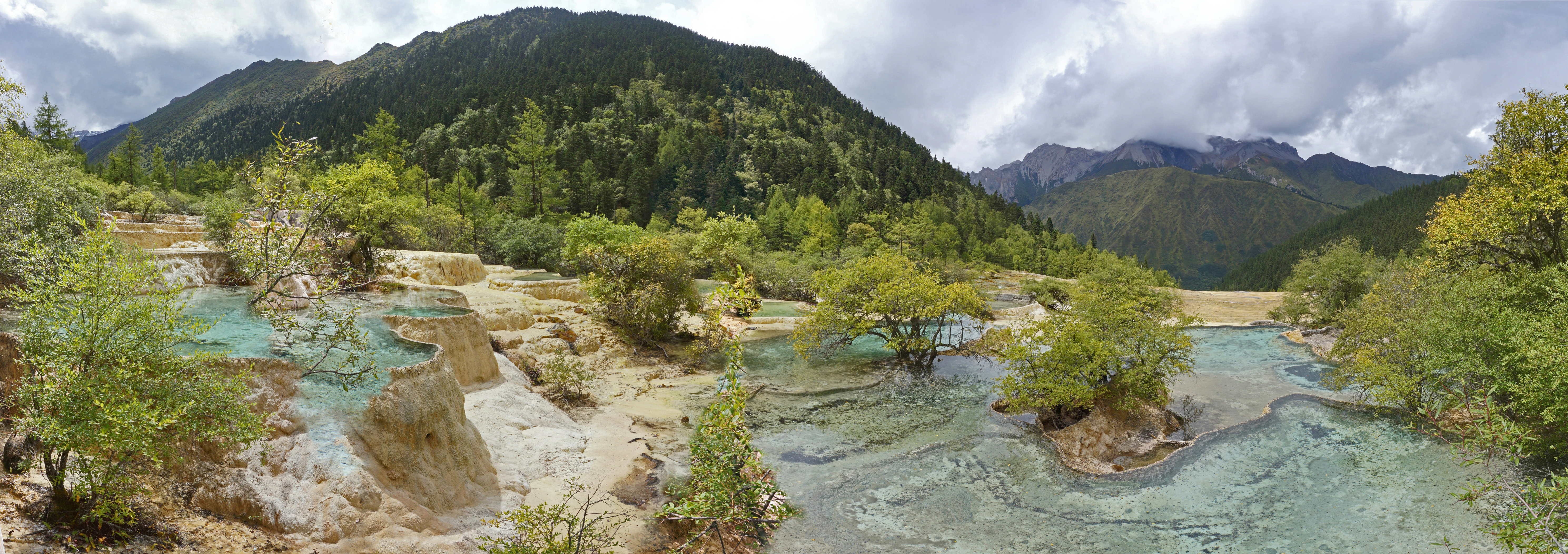
Suoluo Yingcai Pool in Huanglong
The colorful Suoluo Yingcai Pool landscape in Huanglong

Huanglong Scenic and Historic Interest Area wildlife and species highlights

Huanglong supports important populations of several large endangered mammals that depend on the Minshan mountain forests. Among the most notable are the giant panda, for which the broader Minshan region is a critical habitat, and the Sichuan golden snub-nosed monkey, also known as the Sichuan疣鼻 golden monkey, an unusual primate specialized to cold, high-elevation forests. Together these species give the area significant conservation weight beyond its scenic importance.

In addition to these flagship mammals, the varied forest, meadow, and alpine habitats within the reserve support a broader community of high-mountain wildlife typical of the eastern Tibetan Plateau margins. The combination of undisturbed forest cover, intact elevational gradients, and protected status makes the area meaningful not only for individual species but for the persistence of high-altitude forest ecosystems in the region.
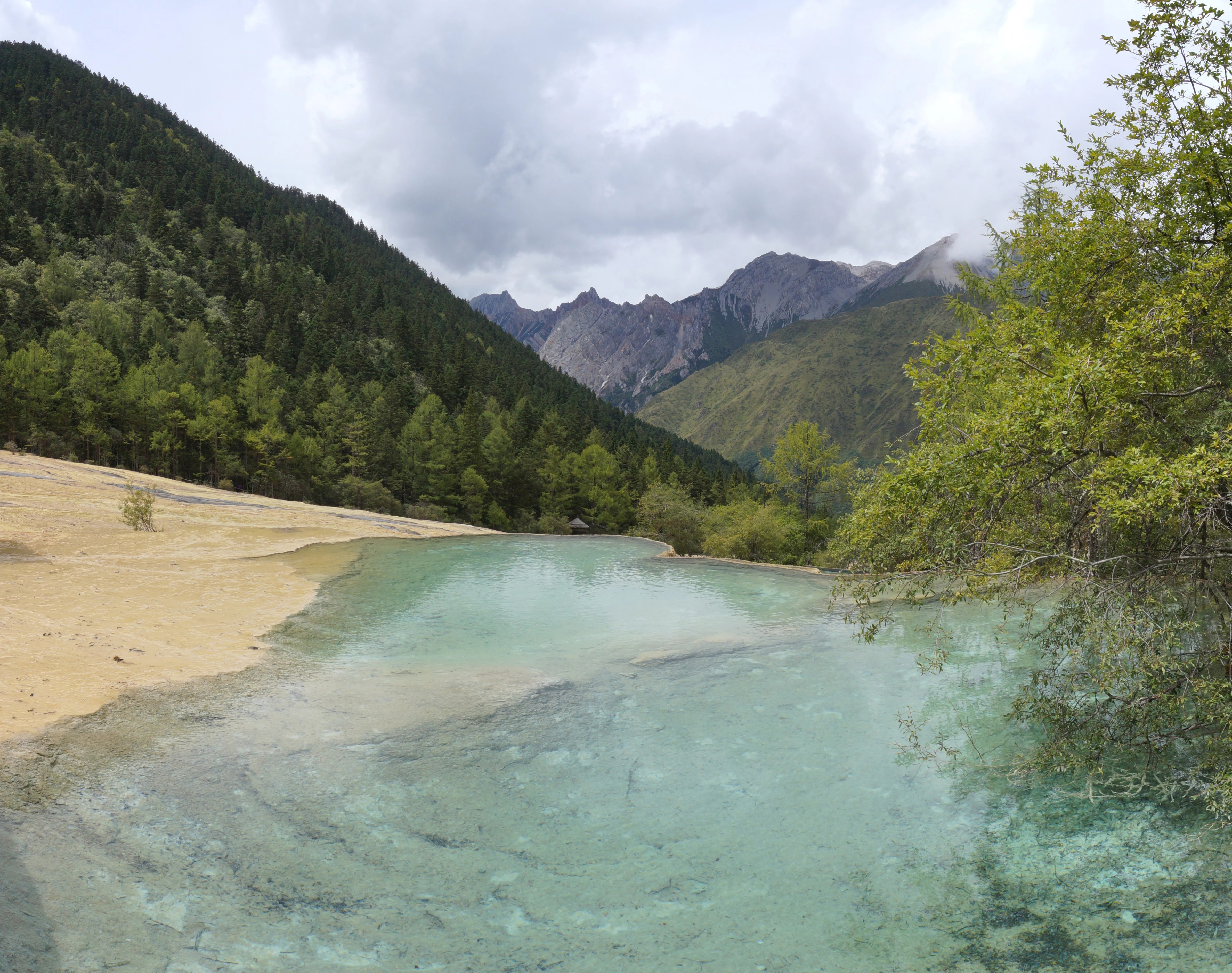
Mirroring Pond at Huanglong

Huanglong Scenic and Historic Interest Area conservation status and protection priorities

The principal conservation significance of Huanglong lies in the preservation of what is widely regarded as the world's largest and best-preserved travertine karst complex, a type of natural landscape that is globally rare and exceptionally vulnerable to changes in water chemistry, vegetation cover, and visitor pressure. The terraces and pools have been built up over geological timescales and depend on stable underground hydrology and forest cover, making their long-term survival an important natural heritage concern.

In addition to its geological protection, the area functions as a high-altitude refuge for endangered forest species including the giant panda and Sichuan snub-nosed monkey. Its combination of UNESCO World Natural Heritage status, national geopark recognition, and protected scenic-area designation provides overlapping layers of legal and institutional protection, while the broader Minshan landscape connects Huanglong to adjacent reserves, helping maintain ecological connectivity across one of the most biodiverse highland regions in China.

Huanglong Scenic and Historic Interest Area cultural meaning and human context

Culturally, Huanglong sits in a part of Sichuan where Tibetan and Qiang communities have long inhabited the highlands, and the broader Aba Tibetan and Qiang Autonomous Prefecture continues to host a rich mix of these traditions. Religious life in the area is also unusually layered: within a single valley, Buddhist and Taoist temples coexist alongside older landscape traditions, reflecting the way sacred geography in China's mountains often merges multiple spiritual lineages. Historic references describe the famed colored pools in language tied to immortals and heavenly realms, with Huanglong itself traditionally imagined as a dragon- or fairy-pool on Earth. That poetic framing has shaped how the area has been presented to visitors and remains part of its identity in Chinese cultural imagination.
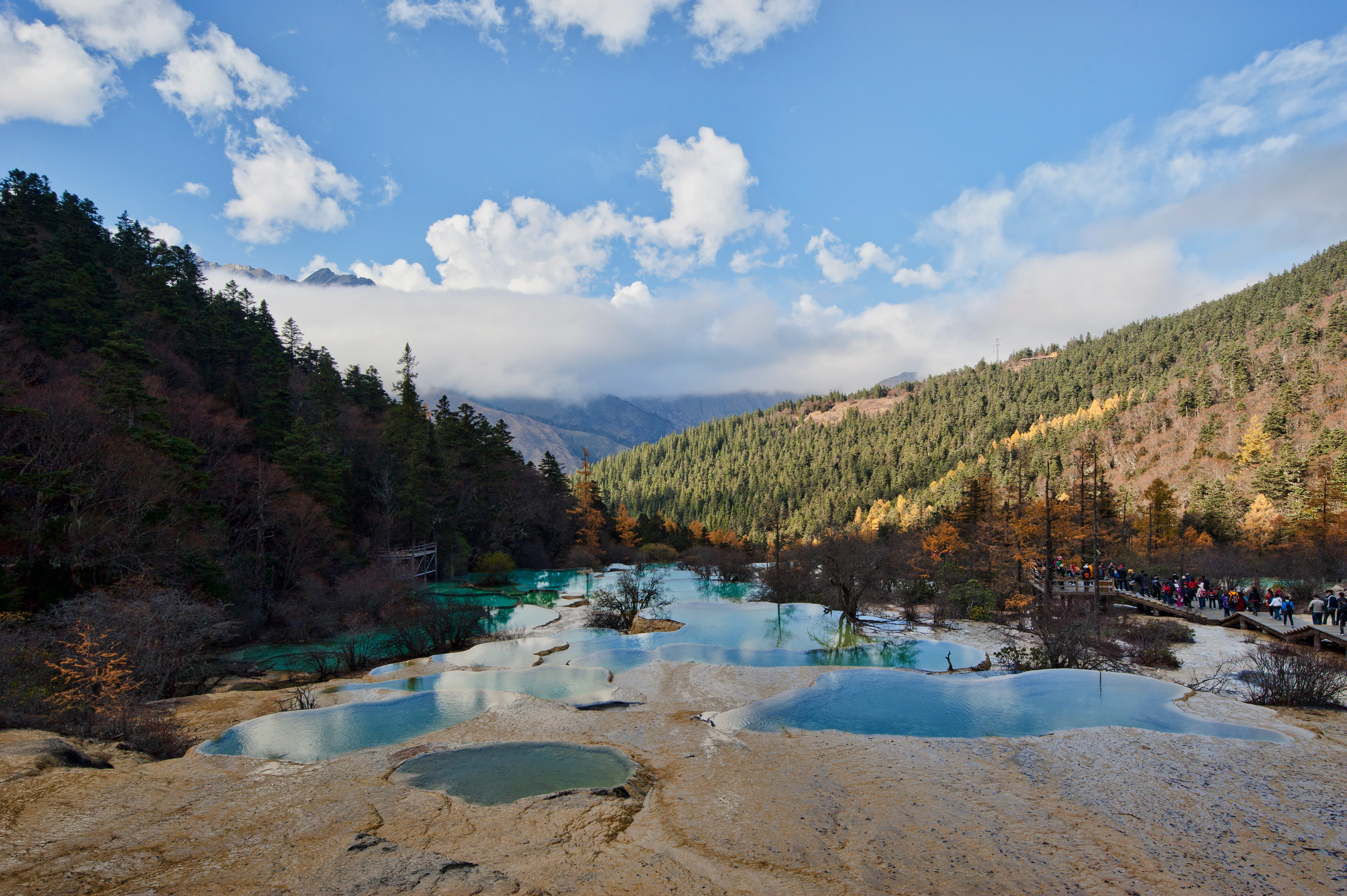
Huanglong colorful pools
Colorful mineral pools at Huanglong, Sichuan, China, during autumn 2011

Top sights and standout views in Huanglong Scenic and Historic Interest Area

Huanglong's signature highlight is the staircase of colored travertine pools that climbs more than three vertical kilometers through the valley, shifting color from mineral-deposit to mineral-deposit and creating what many travelers describe as the most concentrated palette of natural water colors in the world. Equally memorable is the contrast between these pools and the surrounding geography: the snow-clad summit of Xuebaiding, the upper forest, and the deep cliffs of the adjacent Danyunxia gorge.

Beyond the visual spectacle, the area is notable for its layered heritage status: a UNESCO World Natural Heritage Site, a Chinese national geopark, and a top-tier scenic area, all protecting a landscape that simultaneously serves as habitat for giant pandas and Sichuan snub-nosed monkeys. This blend of geology, biodiversity, and cultural tradition gives Huanglong a distinctive identity that goes beyond any single attraction.
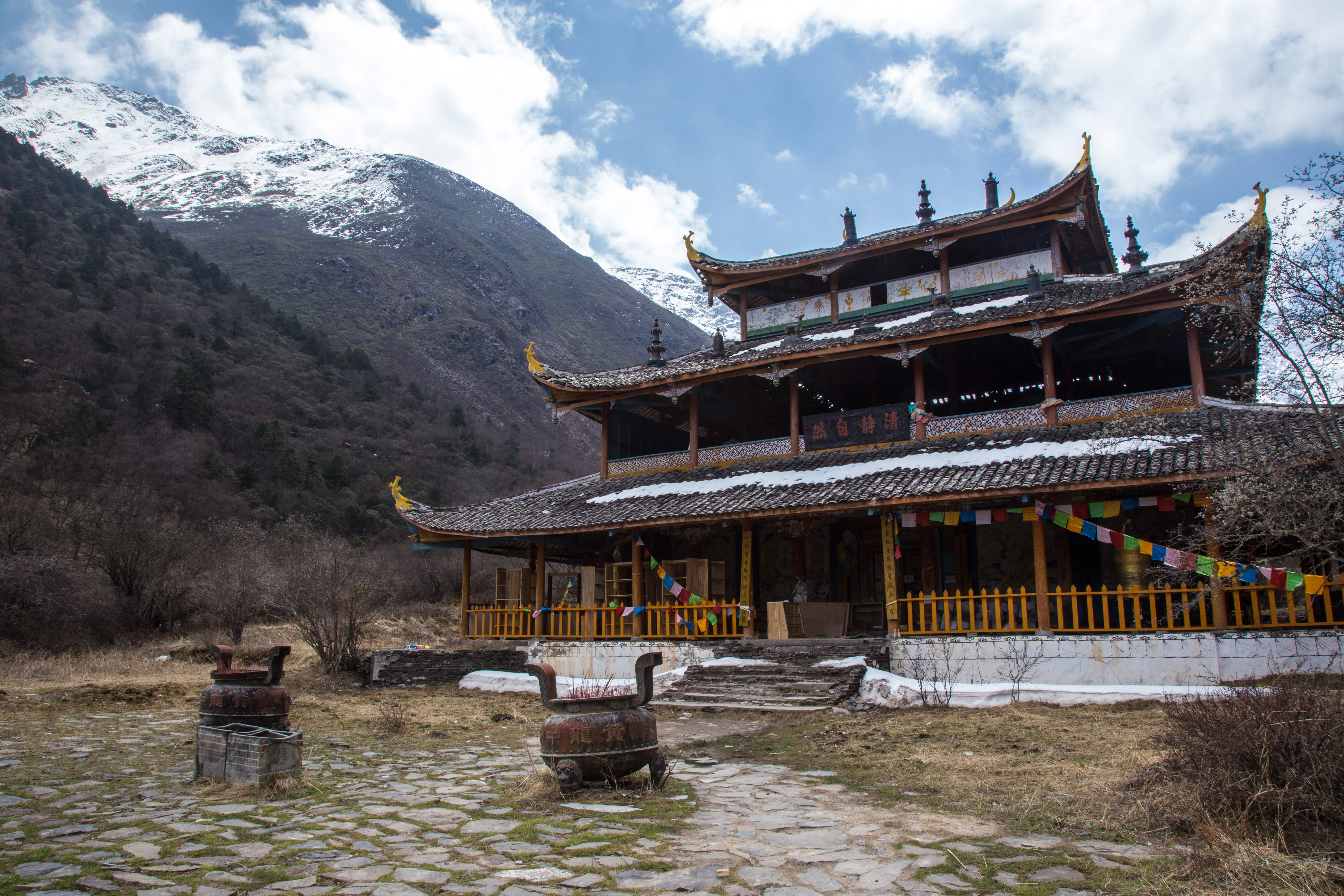
Huanglong Middle Temple
Tibetan Buddhist temple built during the Ming dynasty

Best time to visit Huanglong Scenic and Historic Interest Area

The character of Huanglong changes sharply with the seasons because of its elevation, which keeps much of the area above 3,000 meters. Late summer and early autumn, after the main summer rains have ended and before the deep winter freezes, generally offer the most comfortable conditions for viewing the pools, with stable weather, lush surrounding forest, and clearer views toward the snow-capped peaks above.

Winter transforms the park into a strikingly different frozen landscape, with the pools rimmed by ice and snow and the surrounding peaks deep under snow, while spring brings rushing snowmelt and a fresh green palette in the forests. Summer remains visually dramatic, especially in the color of the pools, but weather in the high mountains is more variable, and visitors should expect cooler temperatures and the possibility of rain at any time of the growing season.

Park guides

Targeted answers for navigating high-altitude travertine pools and mountain terrain.

Huanglong Scenic and Historic Interest Area Focused Guides and Planning Resources

Selected published guides provide structured answers to specific planning questions regarding high-altitude park terrain. Focused coverage examines seasonal considerations for visiting the travertine pools and surrounding mountain landscapes.
Monthly climate preview

Long-term monthly temperature and precipitation rhythm for a representative high-elevation coordinate

Huanglong Scenic and Historic Interest Area Climate Normals and Temperature Patterns

Long-term measurements for Huanglong Scenic and Historic Interest Area reveal a measured annual cycle of shifting monthly temperatures and precipitation rates from representative coordinate data. Examining the complete twelve-month record provides deeper insight into long-term climate normals across the protected landscape.
Annual mean3 °C
-7 °C12 °C
Jan-7°
Feb-4°
Mar-1°
Apr
May
Jun10°
Jul12°
Aug11°
Sep
Oct
Nov-2°
Dec-6°
Warmest month
July

11.7 °C

Coolest month
January

-7.1 °C

Wettest month
July

3.8 mm/day

Driest month
December

0.1 mm/day

Park location guide

Geography guide, regional context, and park location map for Huanglong Scenic and Historic Interest Area

Huanglong Scenic and Historic Interest Area park geography, regions, and map view in China

Understand where Huanglong Scenic and Historic Interest Area sits in China through a broader geographic reading of the surrounding landscape, nearby location context, and its mapped position within the national park landscape.

How Huanglong Scenic and Historic Interest Area fits into China

China is a unitary communist state in East Asia, governed by the Chinese Communist Party. The country's capital is Beijing, while Shanghai is the largest city by urban population. China has 33 province-level divisions including provinces, autonomous regions, municipalities, and special administrative regions. The nation has a long history spanning thousands of years, with achievements including the invention of gunpowder, paper, printing, and the compass.

Wider geography shaping Huanglong Scenic and Historic Interest Area in China

China is located in East Asia, bordering fourteen countries: Russia, North Korea, Vietnam, Laos, Myanmar, India, Bhutan, Nepal, Pakistan, Afghanistan, Tajikistan, Kyrgyzstan, Kazakhstan, and Mongolia. The country spans diverse terrain including deserts, mountains, plateaus, and river valleys. Major river systems include the Yellow River and Yangtze River. The coastline stretches along the East China Sea, South China Sea, and Yellow Sea.

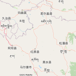
Map view of Huanglong Scenic and Historic Interest Area

Use this park location map to pinpoint Huanglong Scenic and Historic Interest Area in China, understand its exact geographic position, and read its mapped placement within the surrounding landscape more clearly.

Pigeon | © OpenStreetMap contributors

Location context for Huanglong Scenic and Historic Interest Area

Sichuan
Recorded earthquake history

Examine the Recorded Earthquake History of Huanglong Scenic and Historic Interest Area

Consult the historical catalogue of seismic events documented near the Huanglong Scenic and Historic Interest Area. This resource offers a clear, structured view of recorded epicentres and magnitudes as part of the broader MoriAtlas geographic database.

Huanglong Scenic and Historic Interest Area Earthquake History

Catalogued events

50 events

Strongest magnitude

Magnitude 6.9

Most recent event

Sep 4, 2021

This history includes earthquakes recorded inside the park or within 50 km of its borders

Visual exploration of travertine terraces, high mountain peaks, and colored pools

Huanglong Scenic and Historic Interest Area Photos and Landscape Scenery

Visual records capture the mineral-rich travertine pools and high-altitude alpine terrain that define Huanglong Scenic and Historic Interest Area. Photographic documentation helps researchers and visitors analyze the geological formations, forest environments, and protected-landscape character of the region.

Huanglong aerial panoramic view 2023

Huanglong Scenic Area landscape

Welcome Ponds at Huanglong

Suoluo Yingcai Pool in Huanglong

Mirroring Pond at Huanglong

Jinsha Pudi at Huanglong

Huanglong colorful pools

Huanglong Middle Temple

Huanglong Ancient Temple

Huanglong Five-Color Pond

Huanglong landscape view

Xishendong Cave

Qili Jinsha at Huanglong

Lianyan Lake, Huanglong

Liantai Waterfall

Park atlas

Compare regional protected areas and high-altitude mountain landscapes across the Minshan range

Exploring Parks Near Huanglong Scenic and Historic Interest Area

Browsing other protected areas near Huanglong Scenic and Historic Interest Area reveals connected high-altitude ecosystems and unique travertine karst formations. Comparing these regional reserves provides a broader geographic perspective on the mountain geography of southwestern China.
National parkChina
Park boundaries overlap#1 closest

Southeast

Giant Panda National Park: China's Premier Panda Habitat and Protected Landscape

Mapped terrain and conservation significance in the mountains of western China.

Giant Panda National Park is a critically important protected area in China, established to conserve the primary habitat for the giant panda. This national park, spanning a vast mountainous region across Sichuan, Gansu, and Shaanxi, integrates numerous former reserves into a unified landscape. It serves as a vital sanctuary, protecting approximately 80 percent of the world's wild panda population and offering deep insights into the geographic distribution and ecological requirements of these endangered animals.

Area
27,134 km²
Established
2020
IUCN
II
Relief
Mountain
National parkSichuan
Park boundaries overlap#2 closest

North

Jiuzhaigou National Park: Mapped Geography and Protected Area Overview in Sichuan, China

Travertine terrace systems and high mountain forest landscapes

Located on the edge of the Qinghai-Tibet Plateau, Jiuzhaigou is a protected landscape characterized by a network of clear alpine lakes known as haizi and extensive coniferous forest blocks. The park showcases a rare interplay of water and mineral-rich rock, creating expansive travertine dams and cascading waterfalls across its three main gullies. This atlas entry focuses on the regional geography, habitat distribution, and natural terrain that constitute the essential character of this prominent conservation area within the Min Mountains.

Area
720 km²
Established
1978
Relief
Mountain
Climate
Alpine
Nature reserveSichuan
139 km away#3 closest

South

Wolong National Nature Reserve: Mapping Sichuan's Rugged Mountain Protected Lands

A critical mountain nature reserve in the Qionglai range.

Delve into the geography of Wolong National Nature Reserve, a cornerstone of China's protected areas. This site offers insight into the vertical ecology of the eastern Qionglai Mountains, where steep river valleys and extensive bamboo forests characterize the transition toward the Tibetan Plateau. Access map-based insights into this essential wildlife corridor and its role in the larger regional landscape.

Area
2,000 km²
Established
1963
Relief
Mountain
Climate
Alpine
Nature reserveChina
About 338 km away#4 closest

East

Changqing Nature Reserve: Mountain Forest Geography and Conservation Mapping

A vital Qinling Range protected area in Shaanxi Province, China

This reserve provides a deep look at the biodiversity of the Qinling Mountains, featuring steep terrain, bamboo-rich slopes, and vital forest river corridors. It serves as a globally recognized model for protected area management and provides a habitat for rare species within its vertical landscape.

Area
300 km²
Established
1995
Relief
Mountain
Access
Access unknown
National parkQinghai
364 km away#5 closest

West

Sanjiangyuan National Park: Qinghai's High-Altitude Headwater Protected Landscape

Mapped geography of the Yellow, Yangtze, and Mekong river sources.

Sanjiangyuan National Park, situated in the high-altitude Qinghai region of China, is a crucial protected area established to safeguard the headwaters of three of Asia's most significant rivers: the Yellow, Yangtze, and Mekong. Covering an immense area with an average elevation exceeding 4,700 meters, the park preserves vital alpine wetlands, grasslands, and the source ecosystems that sustain hundreds of millions downstream. Its protected landscape identity is defined by its extreme elevation, vast marshlands, and its role as a critical water source, offering unparalleled opportunities for geographic and atlas-style exploration of pristine high-altitude terrain.

Area
190,700 km²
Established
2021
IUCN
II
Relief
Highland
Nature reserveSichuan
About 559 km away#6 closest

Southwest

Sichuan Yading National Nature Reserve: Mapped Protected Landscapes in Western Sichuan

High altitude terrain, glaciated peaks, and alpine geography.

Sichuan Yading National Nature Reserve is a significant protected area in the Garzê Tibetan Autonomous Prefecture, home to the Three Holy Mountains and extensive glacial features. This entry details the reserve geography, focusing on the distribution of alpine meadows, high elevation forests, and the dramatic vertical landscape carved by the Litang River tributaries.

Area
3,815.06 km²
Established
1996
Relief
Mountain
Climate
Alpine
Nature reserveZhaotong
About 571 km away#7 closest

South

Dashanbao Black-necked Crane National Nature Reserve Geographic and Atlas Overview

Protected highland wetlands within the Zhaotong regional geography.

Dashanbao Black-necked Crane National Nature Reserve is a nationally significant protected area in Zhaotong, representing a rare high-elevation wintering habitat for migratory cranes. This rugged plateau landscape features shallow marshlands, alpine grasslands, and an interconnected system of lakes that support delicate highland ecological zones. Use this atlas resource to understand the park terrain and its formal conservation boundaries within the broader context of northeast Yunnan.

Area
192 km²
Established
1990
Relief
Mountain
Climate
Subtropical
Protected areaHunan
705 km away#8 closest

Southeast

Wulingyuan Scenic and Historic Interest Area: Quartz-Sandstone Peak Forest and Protected Geography

Explore the tectonic landscape and forest-covered plateau in Hunan Province.

Wulingyuan Scenic and Historic Interest Area represents a massive protected landscape in Hunan, China, defined by its extraordinary density of quartz-sandstone pillars. This atlas record documents the geological signature of these vertical rock formations, the surrounding gorge networks, and the high-canopy forest environment that characterizes this significant regional landform.

Area
264 km²
Established
1982
Relief
Mountain
Climate
Subtropical

Common questions about visiting, size, designation, and location context for Huanglong Scenic and Historic Interest Area

Huanglong Scenic and Historic Interest Area FAQs for park facts, access, geography, and protected area context

Find quick answers about Huanglong Scenic and Historic Interest Area, including protected-area facts, park geography, trail and visitor context, and how the park fits into its surrounding country and regional landscape.
MoriAtlas Explorer

Continue Your Protected Areas Search Across the Global Atlas

Deepen your exploration by continuing the structured search for national parks and protected areas worldwide. Utilize the comprehensive filtering capabilities to compare different conservation landscapes and refine your understanding of global park geography. Discover more about the distribution and characteristics of protected natural areas.

Global natural geography