
Mori Atlas logo
Nature reserveIbachtal und Nebenbäche

Examining the ecological structure of valley corridors and riparian habitats in Bergisches Land

Ibachtal und Nebenbäche Nature Reserve: Mapped Stream Valley Geography and Protected Landscapes

(Naturschutzgebiet Ibachtal und Nebenbäche)

Ibachtal und Nebenbäche represents a key protected stream valley system located within the rolling terrain of the Oberbergischer Kreis. This nature reserve preserves a network of alder gallery forests, species-rich wet meadows, and forested side valleys that collectively form a vital riparian corridor. The area highlights the characteristic low mountain geography of the region, emphasizing the connectivity between narrow spring-fed brooks and the broader watershed.

stream valleybrookalder gallery forestwet meadowmoist meadowfloodplain grassland
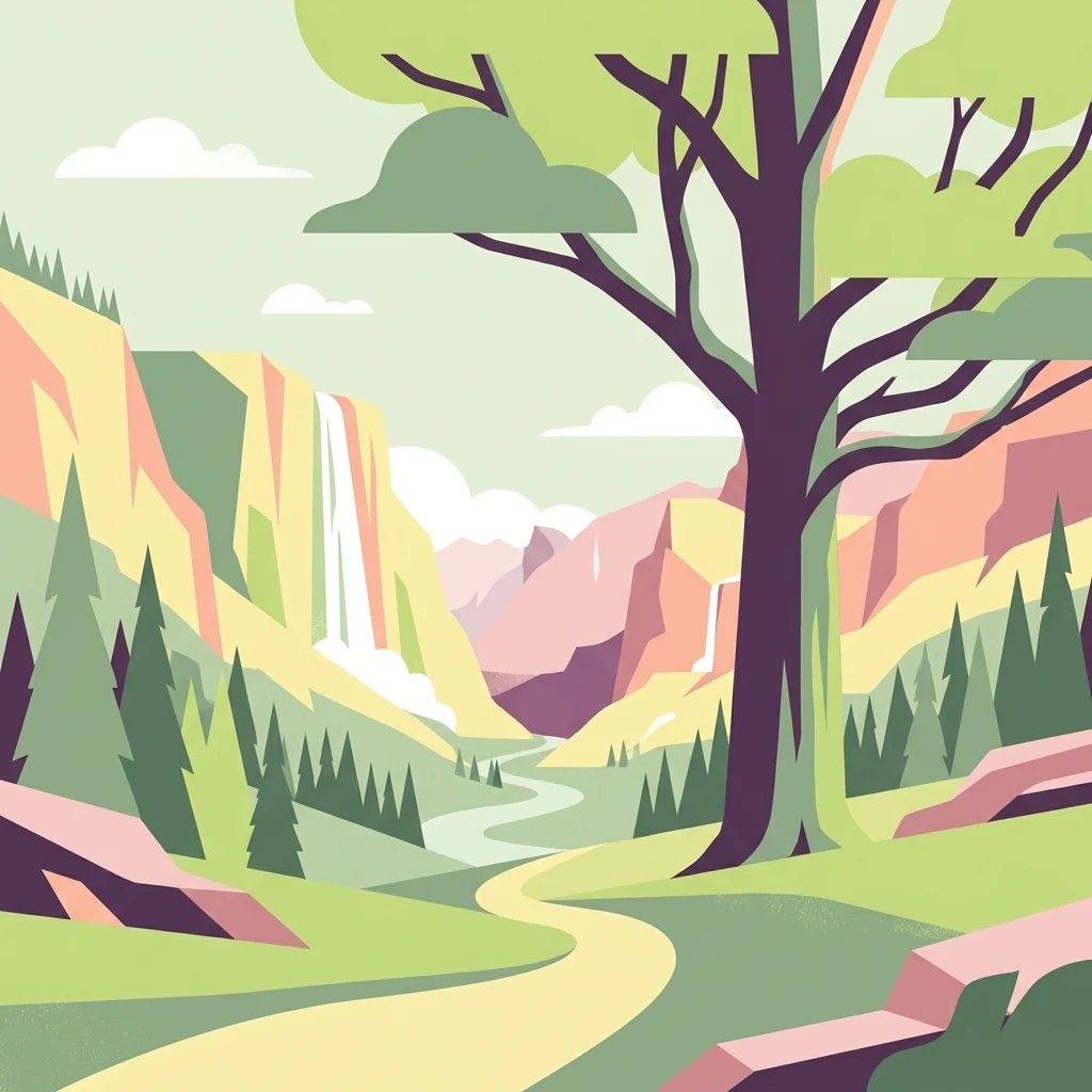
A flat, vector-style illustration of a valley with a winding path in the foreground, coniferous trees, a waterfall, and rocky cliffs under a light sky.

Ibachtal und Nebenbäche

Nature reserve

Park overview

Structured park overview, official facts, and landscape profile for Ibachtal und Nebenbäche

Ibachtal und Nebenbäche park facts, protected area profile, and essential visitor context

Review the core facts for Ibachtal und Nebenbäche, including designation, size, terrain, visitor scale, habitats, and operating context in one park-focused overview.

About Ibachtal und Nebenbäche

Ibachtal und Nebenbäche is a compact nature reserve in the Bergisches Land, the hill country east of the Rhine in North Rhine-Westphalia. Set within the municipal area of Wipperfürth in the Oberbergischer Kreis, it preserves a valley landscape shaped by water: the central axis is the Ibach, a small stream flowing from Ibach near Böswipper in a northeasterly direction toward the boundary with the neighboring municipality of Halver in the Märkischer Kreis. The protected area extends along this main valley and incorporates all of the smaller tributary valleys that join the Ibach from the north.

The defining feature of the reserve is the quality of its stream and floodplain habitats. The Ibach retains a near-natural course over long stretches, fringed by alder-dominated gallery forest that follows the watercourse through the valley. The floodplain is occupied by permanent grassland, much of which is still managed extensively, and within this grassland complex substantial areas of moist and wet meadow survive, including a particularly valuable wet meadow complex with small sedge stands southeast of Boxbüchen. The narrow side valleys contribute additional ecological value, with small spring brooks running through wooded ravines, including a notable stretch of old beech high forest west of Dahl.

Designated in 2013 under the state identifier GM-099, the reserve formally classifies as an IUCN Category IV area, indicating a habitat and species management focus. While modest in size at around 26.8 hectares and confined to elevations between roughly 290 and 350 meters, it is regarded as a representative example of a Bergisches Land stream valley, and its unusually high share of botanically diverse wet and moist grassland gives it statewide conservation relevance. The reserve fits into a wider network of similarly structured protected stream valleys across the Oberbergischer Kreis and surrounding region, contributing to landscape-scale connectivity for aquatic and wetland-dependent species.

Quick facts and research context for Ibachtal und Nebenbäche

Ibachtal und Nebenbäche is a nature reserve located in the Oberbergischer Kreis in North Rhine-Westphalia, within the municipal area of Wipperfürth. It was placed under formal protection in 2013 and is registered under the official identifier GM-099 in the state's nature conservation information system. The site covers a compact area of roughly 26.8 hectares along the Ibach stream and its tributaries.

The terrain lies between approximately 290 and 350 meters above sea level, with an average elevation of about 320 meters, characteristic of the rolling upland landscape of the Bergisches Land. The reserve is classified as IUCN Category IV, a Habitat and Species Management Area, reflecting its active role in maintaining specific habitats rather than functioning as strict wilderness. It is administered under the landscape plan of the Lower Landscape Authority of the Oberbergischer Kreis.

Protection and recognition

Analysis of official conservation registry records and international tracking data.

Ibachtal und Nebenbäche Protection Status and Documented Area Records

Ibachtal und Nebenbäche conservation data compiles documented protection status and official database references for geographic analysis. Structured records provide verified administrative metrics for the protected landscape without unverified assumptions.

Protection details

WDPA ID
555560695
Park context

Deeper park guide and search-rich context for Ibachtal und Nebenbäche

Ibachtal und Nebenbäche history, landscape, wildlife, and travel context

Explore Ibachtal und Nebenbäche through its history, landscape character, ecosystems, wildlife, conservation priorities, cultural context, and seasonal travel timing in a structured park guide built for atlas discovery and search intent.

Why Ibachtal und Nebenbäche stands out

The reserve is best known for protecting a representative stream valley system of the Bergisches Land, in which a near-natural brook is bordered by alder gallery forest and surrounded by extensive, botanically rich wet and moist meadows. Among its most distinctive elements is a particularly species- and structure-rich wet meadow complex with small sedge stands near Boxbüchen, alongside old-growth beech forest along one of the tributary spring brooks. These features combine to give the small reserve an ecological significance that extends beyond its modest size, since species-rich wet grassland of this quality has become rare across North Rhine-Westphalia. The reserve is also valued as a component of the regional stream connectivity system linking the Ibach to the Wupper river basin.
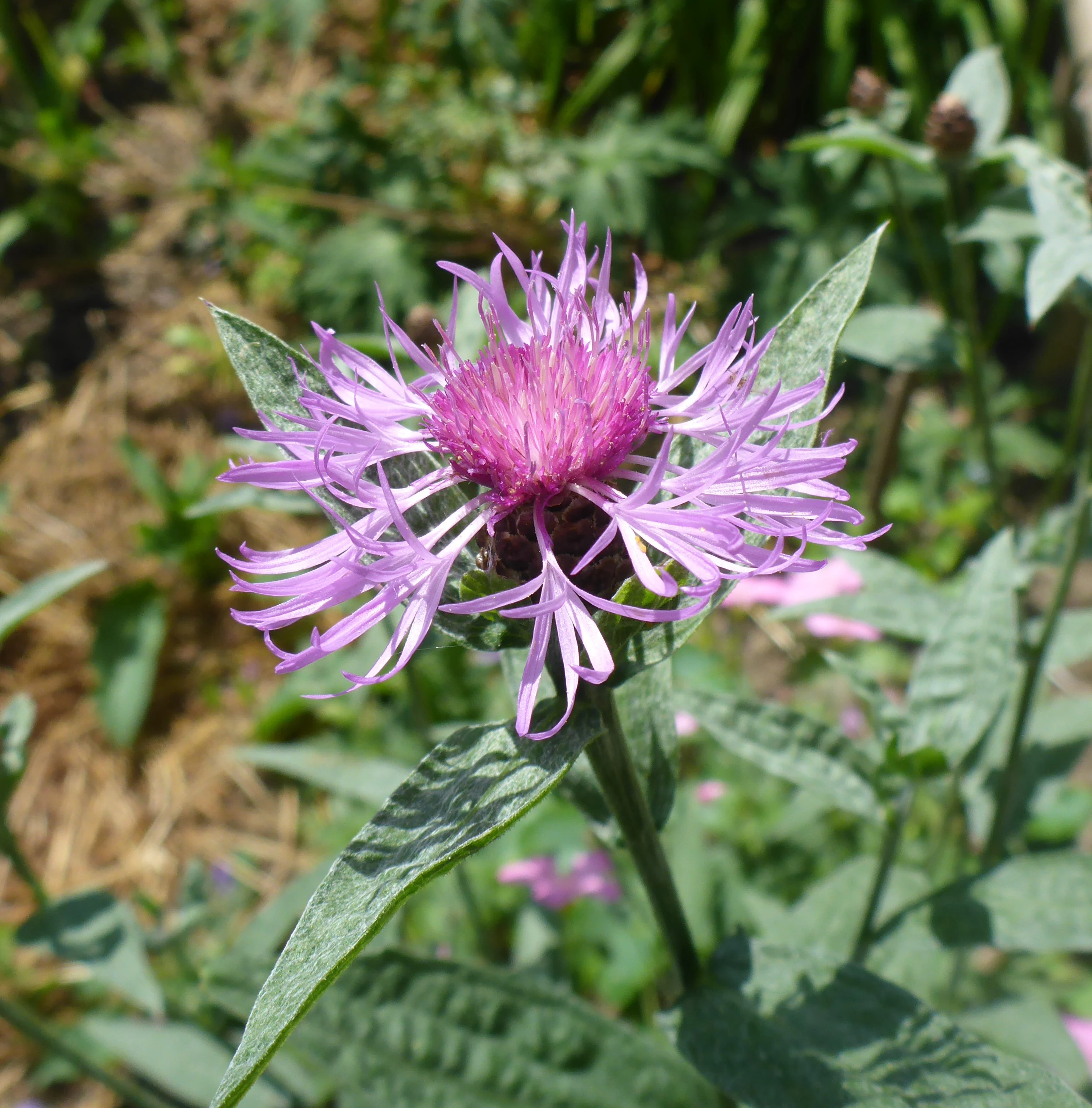
A close up view of a pink and purple brown knapweed flower head with elongated petals and green leaves, set against a soft blurred background.
A brown knapweed (Centaurea jacea) in bloom within the meadow habitat of the Ibachtal nature reserve.

Ibachtal und Nebenbäche history and protected-area timeline

The area that today forms the Ibachtal und Nebenbäche nature reserve gained formal protection in 2013, when it was designated by the Oberbergischer Kreis under the identifier GM-099 within the framework of the regional landscape plan (Landschaftsplan). Its establishment followed the recognition that, despite the heavy historical use of valleys in the Bergisches Land for agriculture and forestry, this particular stream system retained a near-natural course and a substantial extent of species-rich moist and wet grassland.

The protection reflects a long-running conservation interest in the headwater valleys of the Oberbergisches Kreis, where many small brooks feed into larger river systems such as the Wupper. By bringing the Ibach and its northern tributaries under formal nature reserve status, authorities sought to safeguard not only the stream itself but also the connected floodplain meadows and forested side valleys from further drainage, intensification, or conversion. No earlier predecessor protected area exists under the same name, and the reserve is therefore considered the current, defining protected entity of this landscape.

Ibachtal und Nebenbäche landscape and geographic character

The landscape of Ibachtal und Nebenbäche is shaped by a classic central European low mountain stream valley. Elevations range from about 290 to 350 meters, and the topography rolls gently in the style of the Bergisches Land, with the valley floor occupied by the Ibach and the surrounding slopes rising toward wooded ridges.

The valley itself is comparatively narrow and follows a northeasterly course from Ibach near Böswipper toward the boundary with Halver. The floodplain is broad enough to allow extensive areas of permanent grassland to develop alongside the stream, while the slopes above the floodplain carry forest cover, including species-rich deciduous woodland. Smaller side valleys branch off from the main valley toward the north, forming narrow, often steep ravines cut by tributary brooks. Where these tributaries emerge, the resulting wetter microclimate supports distinctive gallery forest and, on flatter ground, the moist and wet meadows that give the reserve much of its conservation value.
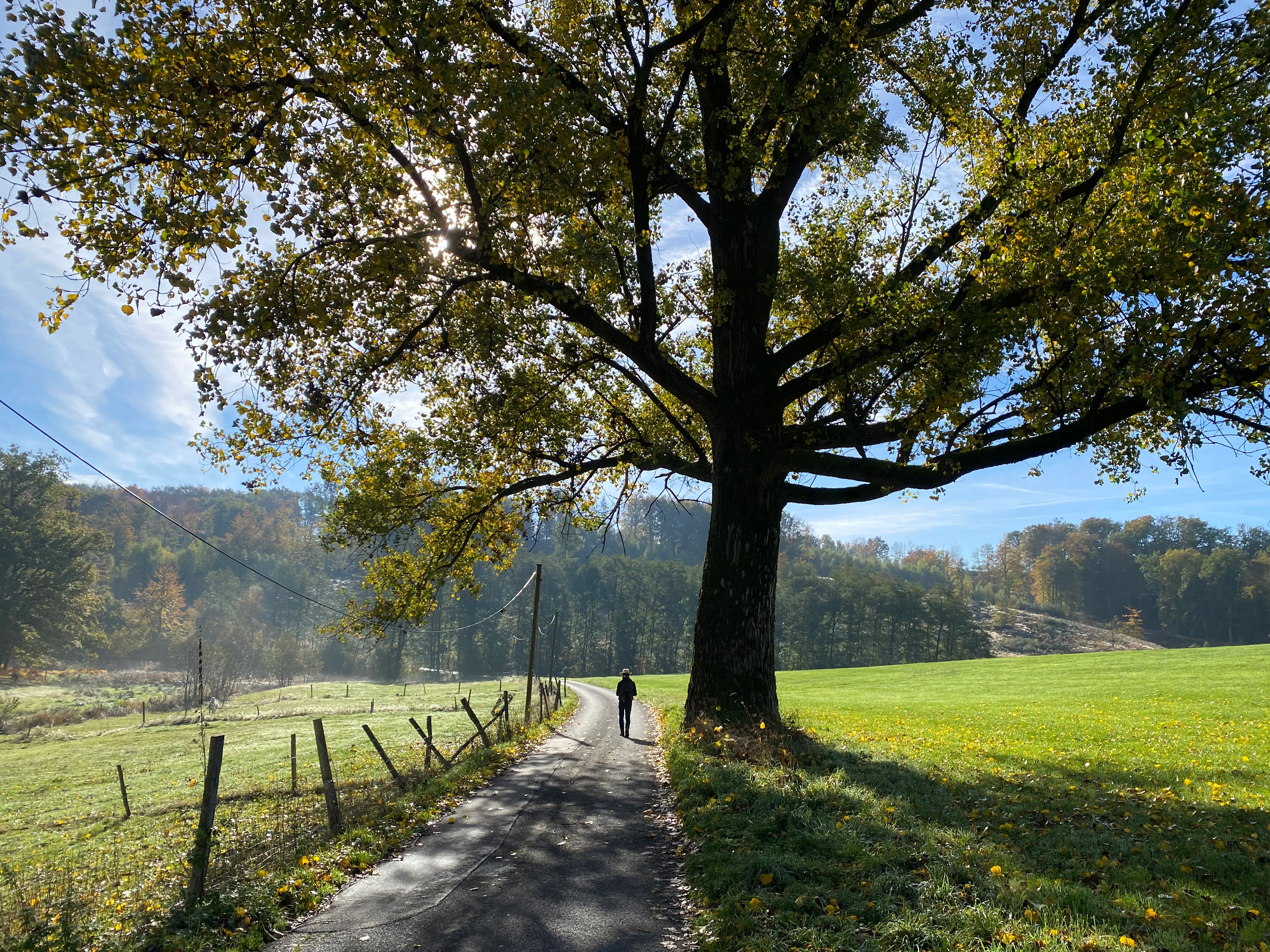
A person walks down a paved rural lane through a valley, flanked by a large spreading tree on the right and green meadows on both sides, with rolling hills in the background.
A person walking along a path through the Ibachtal valley, framed by a large mature tree.

Ibachtal und Nebenbäche ecosystems, habitats, and plant life

Ecologically, Ibachtal und Nebenbäche is dominated by a tightly linked sequence of stream, gallery forest, and meadow habitats. The Ibach flows through the valley in a near-natural state, and along much of its length it is accompanied by alder gallery forest, a wetland woodland type that thrives along brooks with fluctuating water levels.

The floodplain consists of permanent grassland, much of it still maintained as extensively used meadow rather than improved pasture, and large parts retain the character of moist and wet grassland, including small sedge-dominated stands. These communities are highly valued in North Rhine-Westphalia because they support plant species that depend on consistent soil moisture and traditional, low-intensity management. The narrow side valleys contribute an additional layer of habitat diversity, with shaded, spring-fed ravines, including a stretch of old beech high forest west of Dahl that contrasts noticeably with the wet meadows of the main valley floor.

Together, these elements make the reserve a compact but ecologically rich example of a Bergisches Land stream valley, and they form the basis for its function as a refuge and stepping stone within the wider network of similar habitats across the Oberbergischer Kreis.
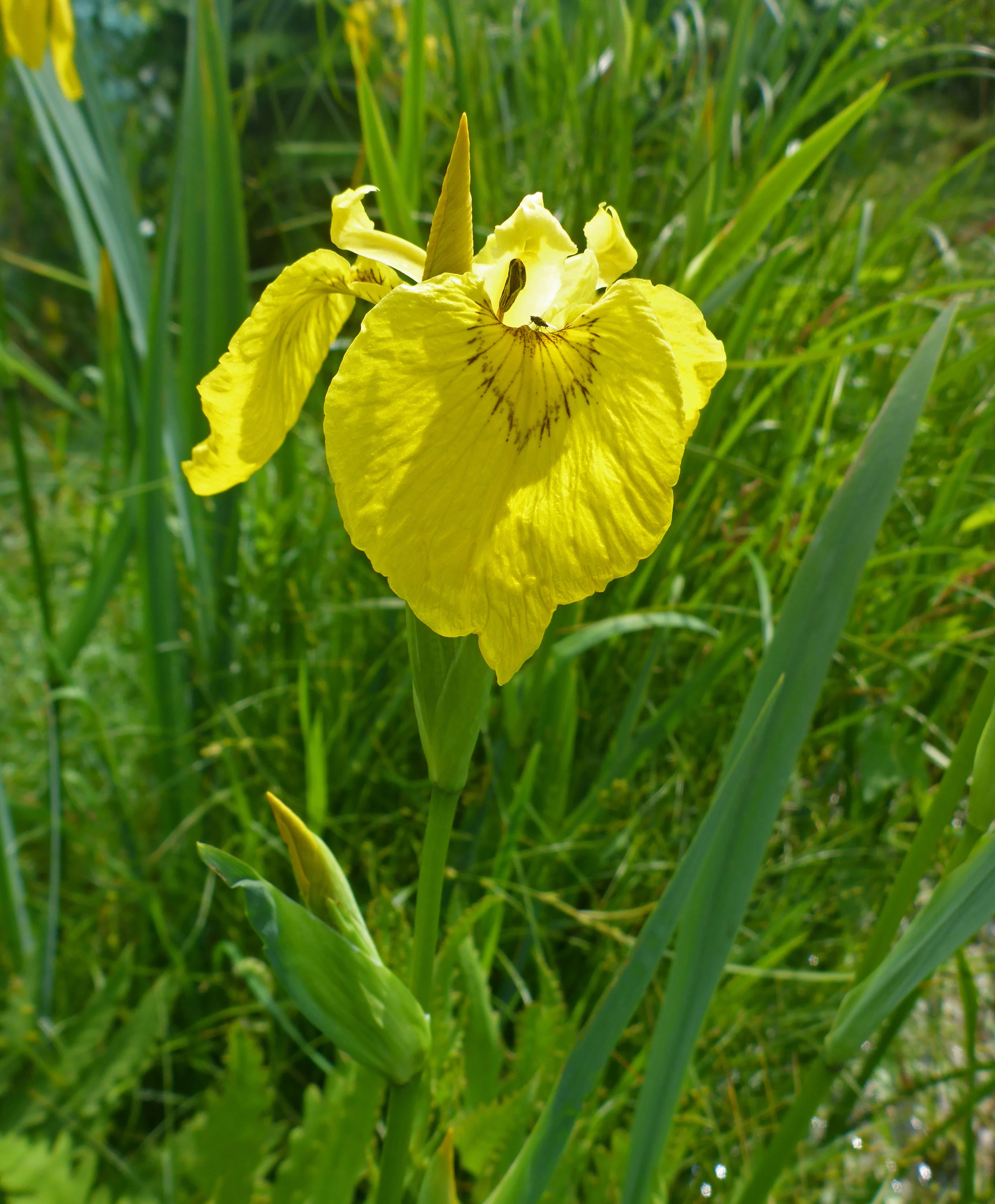
A close-up view of a vibrant yellow iris flower with slender green leaves in a natural meadow setting.
Yellow iris (Iris pseudacorus) blooming in the wetland meadows of the Ibachtal nature reserve.

Ibachtal und Nebenbäche wildlife and species highlights

The source material concentrates on the botanical and habitat character of Ibachtal und Nebenbäche rather than on specific fauna, and there is no detailed wildlife profile to draw on. The reserve's habitat mosaic of near-natural brook, alder gallery forest, moist and wet meadows, and old beech forest would generally support stream-associated invertebrates, amphibians in wet meadow margins, and typical woodland birdlife of the Bergisches Land, but specific species, populations, and seasonal patterns are not documented in the available sources.

Ibachtal und Nebenbäche conservation status and protection priorities

The conservation significance of Ibachtal und Nebenbäche rests on its role as a representative, still largely intact stream valley in a region where such systems have been heavily modified by drainage, agricultural intensification, and forestry. The presence of extensive moist and wet grassland alongside a near-natural brook gives the reserve value that extends well beyond its 26.8-hectare footprint, because such grassland complexes have become scarce across North Rhine-Westphalia as a whole.

The formal protection framework reflects this significance. Designated in 2013 under identifier GM-099 and classified as an IUCN Category IV Habitat and Species Management Area, the reserve combines habitat preservation with active management. Conservation objectives include allowing the brook to develop freely, removing culverting where possible to restore stream continuity, maintaining extensive use of floodplain grassland, and bringing abandoned wet meadows back into use. Forest management on the valley slopes is intended to remain close to nature, supporting the continuity of alder gallery forest along the Ibach and the old beech stands in the tributary valleys. As part of the regional stream connectivity system draining to the Wupper, the reserve also contributes to broader landscape-scale ecological coherence in the Bergisches Land.

Ibachtal und Nebenbäche cultural meaning and human context

The Ibachtal und Nebenbäche area lies within the cultural landscape of the Bergisches Land, a historically agricultural and forested hill region east of the Rhine in North Rhine-Westphalia. Small valleys like that of the Ibach have traditionally supported mixed land use, with meadows along the floodplain and woodland on the slopes, and the survival of low-intensity grassland use in this reserve reflects that longer cultural pattern.

Place names in and around the reserve, such as Ibach, Böswipper, Boxbüchen, and Dahl, point to the dispersed settlement pattern typical of the Wipperfürth area, where small farmsteads and hamlets are scattered across the valley and slope landscape. The reserve does not contain documented built heritage or named indigenous land associations, and there is no special cultural narrative attached to it beyond its role as a working agricultural valley that has retained much of its traditional character.

Top sights and standout views in Ibachtal und Nebenbäche

Among the strongest distinguishing features of Ibachtal und Nebenbäche are its alder gallery forest along a near-natural low-mountain brook, the unusually large share of species-rich moist and wet meadow within a compact area, and the inclusion of forested tributary side valleys, including an old beech stand west of Dahl. The reserve also stands out for being explicitly positioned within the regional stream network of the Bergisches Land, linking the Ibach to the broader Wupper river system.

Its designation as an IUCN Category IV area in 2013, combined with active management goals such as re-establishing wet meadow use and removing culverts, gives the reserve a clear conservation focus rather than a purely passive protection status.

Best time to visit Ibachtal und Nebenbäche

The source material does not provide seasonal guidance specific to Ibachtal und Nebenbäche. In general, late spring and early summer tend to be the most rewarding period for visiting Bergisches Land stream valleys of this kind, when moist meadows are in flower and the contrast between open floodplain, gallery forest, and shaded side valleys is at its most visible. Wet and overcast weather can also enhance the character of the brook corridors, while autumn brings color to the beech stands in the tributary valleys. Specific seasonal access, trail conditions, or infrastructure are not documented and should not be assumed.

Monthly climate preview

Long-term representative temperature and precipitation averages for Ibachtal und Nebenbache

Ibachtal und Nebenbache Climate Normals and Monthly Temperature Patterns

Representative coordinates record annual temperature swings from sub-zero winter minimums to warm summer maximums alongside steady monthly precipitation rates. Detailed monthly normals provide deeper insight into long-term climate rhythms across the protected area.
Annual mean9 °C
0 °C18 °C
Jan
Feb
Mar
Apr
May13°
Jun16°
Jul18°
Aug18°
Sep14°
Oct
Nov
Dec
Warmest month
July

18.3 °C

Coolest month
January

0.3 °C

Wettest month
December

3 mm/day

Driest month
April

1.8 mm/day

Park location guide

Geography guide, regional context, and park location map for Ibachtal und Nebenbäche

Ibachtal und Nebenbäche park geography, regions, and map view in Germany

Understand where Ibachtal und Nebenbäche sits in Germany through a broader geographic reading of the surrounding landscape, nearby location context, and its mapped position within the national park landscape.

How Ibachtal und Nebenbäche fits into Germany

Germany is a federal republic in Western and Central Europe with a population of over 83 million across sixteen constituent states. It is Europe's largest economy by nominal GDP and a major global exporter and importer. The capital is Berlin, and the country borders Denmark, Poland, Czech Republic, Austria, Switzerland, France, Luxembourg, Belgium, and the Netherlands.

Wider geography shaping Ibachtal und Nebenbäche in Germany

Germany is located in Western and Central Europe, spanning 357,022 km². It borders Denmark to the north, Poland and the Czech Republic to the east, Austria and Switzerland to the south, and France, Luxembourg, Belgium, and the Netherlands to the west. The country has coastlines on the Baltic Sea and North Sea to the north, with the Alps located in the southern region.

Map view of Ibachtal und Nebenbäche

Use this park location map to pinpoint Ibachtal und Nebenbäche in Germany, understand its exact geographic position, and read its mapped placement within the surrounding landscape more clearly.

Pigeon | © OpenStreetMap contributors

Location context for Ibachtal und Nebenbäche

North Rhine-WestphaliaOberbergischer Kreis

Visual exploration of alder gallery forests, wet meadows, and stream valley terrain

Ibachtal und Nebenbache Photos and Protected Landscape Scenery

Photographic records reveal the distinct valley floor typography, low mountain stream networks, and rare wet meadow habitats protected within the Bergisches Land region. Visual documentation provides clear insight into the ecological character, forested side ravines, and conservation topography of the reserve.

A close up view of a pink and purple brown knapweed flower head with elongated petals and green leaves, set against a soft blurred background.

A close up of a white Sneezewort yarrow flower with a yellow center, growing in a lush green meadow under a blue sky.

A person walks down a paved rural lane through a valley, flanked by a large spreading tree on the right and green meadows on both sides, with rolling hills in the background.

A close-up view of a vibrant yellow iris flower with slender green leaves in a natural meadow setting.

Park atlas

Compare surrounding valley landscapes and regional nature reserves

Other Parks and Protected Areas Near Ibachtal und Nebenbäche

Browse protected areas and stream valley reserves situated close to Ibachtal und Nebenbäche in the Bergisches Land region. Comparing these neighboring conservation zones provides deeper geographic context for regional low mountain ecosystems.
Nature reserveOberbergischer Kreis
About 4.3 km away#1 closest

Southeast

Wupperaue bei Gogarten Nature Reserve: Protected River Valley and Riparian Habitat

Geographic overview of the Wipper river corridor in North Rhine-Westphalia

Located in the Oberbergischer Kreis, this nature reserve protects a seven hectare stretch of the Wipper valley. The landscape is characterized by alder riparian forests, steep river banks, and moist flood meadows that function as an essential biological stepping stone for riverine biodiversity.

Area
0.07 km²
Established
2005
IUCN
IV
Relief
Lowland
Nature reserveOberbergischer Kreis
About 7.7 km away#2 closest

Southeast

Wipperaue Eulenbecke: A Detailed Map of Protected Riparian Landscapes and Habitats

Ecological geography within the Oberbergischer Kreis region

Wipperaue Eulenbecke protects a structured headwater stream and associated floodplain fragments along the upper Wupper river. Through its network of wet meadows, alluvial woodland, and tributary valleys, the reserve demonstrates the importance of small-scale aquatic conservation in a forested, mid-elevation landscape. Access detailed geographic data on its terrain, stream morphology, and connectivity within the wider regional conservation network.

Area
0.219 km²
Established
2005
IUCN
IV
Relief
Upland
Nature reserveNorth Rhine-Westphalia
About 8.4 km away#3 closest

West

Wupperaue bei Westenbrücke Nature Reserve Landscape and Geographic Mapping

Protected riparian floodplain in the Oberbergischer Kreis

This nature reserve protects a vital 2.3 kilometer segment of the Wupper river valley. Its landscape is characterized by a mosaic of wet meadows, alder and willow stands, and riparian corridors, providing a crucial stepping-stone habitat within the Hückeswagen area of North Rhine-Westphalia.

Area
0.318 km²
Established
2013
IUCN
IV
A soft watercolor illustration showing a misty, open wetland landscape with grassy foreground, a line of trees in the middle distance, and gentle hills in the background.
Nature reserveNordrhein-Westfalen
About 9.3 km away#4 closest

Southeast

Nass- und Feuchtgrünlandkomplex östlich Holzwipper Protected Wet Grassland Nature Reserve

Examining riparian valley geography in the Oberbergischer Kreis.

The Nass- und Feuchtgrünlandkomplex östlich Holzwipper protects a rare, small-scale mosaic of wet meadow, sedge communities, and river-fringe vegetation. This nature reserve serves as an essential ecological anchor for damp valley systems in the Nordrhein-Westfalen region, offering a clear view of specialized botanical landscapes and stream-side terrain.

Area
0.023 km²
Established
1998
IUCN
IV
A soft watercolor illustration of a green valley with a central stream or river winding through meadows towards distant hills.
Nature reserveOberbergischer Kreis
About 9.8 km away#5 closest

Northwest

Leiverbachtal und Talhänge: Protected Stream Valley and Forest Habitat in Oberbergischer Kreis

Examining the geography of a Bergisches Land nature reserve

Leiverbachtal und Talhänge stands as a significant nature reserve within the Oberbergischer Kreis, defined by its near-natural meandering stream and diverse riparian ecosystem. The site offers a detailed look at floodplain meadows, slope forest transitions, and the ongoing shift toward broadleaf woodland within the German Mittelgebirg landscape.

Area
0.92 km²
Established
2006
IUCN
IV
Relief
Upland
Watercolor painting of a rolling landscape with soft green hills, forest patches, and a winding stream.
Nature reserveGermany
About 11 km away#6 closest

Southwest

Schwarzenbachtal Nature Reserve: Regional Protected Landscape and Stream Valley Atlas

A mapped overview of protected habitats in North Rhine-Westphalia

Schwarzenbachtal serves as a vital protected area in Germany, defined by its elongated brook valley and intricate transitions between wet meadows and dry grassland mosaics. As part of the Bergisches Land stream network, this nature reserve illustrates the ecological significance of small-scale valley landscapes and their role in regional conservation geography.

Area
0.082 km²
Established
2013
Relief
Upland
Climate
Temperate
A horizontal watercolor illustration depicting rolling hills, forest patches, and a soft, hazy valley against a white background.
Nature reserveNorth Rhine-Westphalia
About 13 km away#7 closest

West

Mausbachtal Nature Reserve in North Rhine-Westphalia: Protected Stream Valley and Forest Landscapes

Regional stream valley network and deciduous forest landscape

This protected area in the Oberbergischer Kreis offers a window into the Bergische Hochflächen topography. The reserve highlights a mosaic of near-natural beech forest, wet meadows, and floodplain woodland, forming an integral link in the regional stream network connected to the Große Dhünn.

Area
0.237 km²
Established
2013
IUCN
IV
Nature reserveOberbergischer Kreis
About 14 km away#8 closest

Northwest

Wupper bei Radevormwald: Protected River Valley and Riparian Woodland Geography

Nature reserve landscape in the Oberbergischer Kreis region

Wupper bei Radevormwald serves as a critical protected area within the Wupper river corridor, featuring a mosaic of beech-oak forests and floodplain alder stands. The reserve highlights the contrast between calm, impounded reaches and energetic, meandering water sections, providing an essential study of river valley morphology and natural recovery in the Bergisches Land.

Area
1.208 km²
Established
2003
IUCN
IV
Relief
Upland

Common questions about visiting, size, designation, and location context for Ibachtal und Nebenbäche

Ibachtal und Nebenbäche FAQs for park facts, access, geography, and protected area context

Find quick answers about Ibachtal und Nebenbäche, including protected-area facts, park geography, trail and visitor context, and how the park fits into its surrounding country and regional landscape.
MoriAtlas Explorer

Continue Your Protected Areas Search Across the Global Atlas

Deepen your exploration by continuing the structured search for national parks and protected areas worldwide. Utilize the comprehensive filtering capabilities to compare different conservation landscapes and refine your understanding of global park geography. Discover more about the distribution and characteristics of protected natural areas.

Global natural geography