
Mori Atlas logo
Protected areaÁrea Protegida Municipal Ibare-Mamoré

A detailed look at the aquatic terrain, riverine ecosystems, and expansive floodplains of this Amazonian reserve

Área Protegida Municipal Ibare-Mamoré: Mapping the Protected Landscapes of the Beni Department

Área Protegida Municipal Ibare-Mamoré preserves a vital mosaic of forest, pampas, and seasonally flooded wetlands within the Beni Department of lowland Bolivia. The protected area centers on the confluence of the Ibare and Mamoré rivers, functioning as a critical hydrological corridor for the southwestern Amazon basin. This landscape supports a dynamic environment where aquatic and terrestrial habitats converge to sustain diverse species and traditional indigenous communities.

Amazonian floodplainLlanos de Moxoswetlandsriverine ecosystemtropical forestpampas
A stylized vector illustration of a tropical river landscape featuring symmetrical reflections of trees, palms, and foliage in calm water beneath a cloudy sky.

Área Protegida Municipal Ibare-Mamoré

Protected area

Park overview

Structured park overview, official facts, and landscape profile for Ibare-Mamoré Municipal Protected Area

Ibare-Mamoré Municipal Protected Area park facts, protected area profile, and essential visitor context

Review the core facts for Ibare-Mamoré Municipal Protected Area, including designation, size, terrain, visitor scale, habitats, and operating context in one park-focused overview.

About Ibare-Mamoré Municipal Protected Area

The Ibare-Mamoré Municipal Protected Area is a Bolivian conservation area situated in the southwestern Amazon basin, in the department of Beni. It lies to the west of Trinidad, the departmental capital, and occupies the westernmost portion of the municipality of Trinidad within the Cercado province. The reserve's boundaries are defined by the Ibare and Mamoré rivers and by neighboring municipalities, including Loreto to the south, San Javier to the north, and San Ignacio de Moxos to the west.

The landscape belongs to the Llanos de Moxos, a vast lowland mosaic of forests, savannas, wetlands, and slow-moving rivers that has long been recognized as one of Bolivia's most ecologically significant regions. Within this larger setting, the Ibare-Mamoré reserve protects a varied combination of terra firme and seasonally flooded forests, open pampas, and riverine wetlands. The hydrology is central to the area's character: the Ibare River, in particular, helps regulate the local water cycle, while the seasonal expansion and contraction of water across the floodplain shapes ecological processes throughout the year.

Climatically, the area experiences a hot and humid tropical regime, with average temperatures typically ranging from the high twenties Celsius to the upper thirties. Precipitation is concentrated between December and March, while a pronounced dry season runs from about July to October. Over recent decades, the alternation between wet and dry periods has become less predictable, with extended flooding in some years and modified dry seasons in others, a shift that carries direct consequences for both ecosystems and local communities.

Human presence is integral to the area's identity. Nine indigenous and peasant communities, as well as additional rural settlements, live within the protected area and have livelihoods that are closely intertwined with the rivers, forests, and floodplains. Fishing, subsistence agriculture on traditional plots and raised fields, livestock keeping, small-scale tourism, and seasonal extractive activities all shape everyday life here. This coexistence of biodiversity conservation, hydrological function, and living cultural landscapes distinguishes the Ibare-Mamoré within Bolivia's network of municipal protected areas.

Quick facts and research context for Ibare-Mamoré Municipal Protected Area

The Ibare-Mamoré Municipal Protected Area is located in the Cercado province of the Beni department in Bolivia, roughly six kilometers west of the city of Trinidad. Its setting within the Llanos de Moxos places it among the most ecologically dynamic floodplain landscapes in the southwestern Amazon basin, shaped by the seasonal interplay of rivers, forests, and open grasslands.

The reserve covers approximately 256 square kilometers, a little over fourteen percent of the municipal area, and protects a mix of forests, pampas, and wetlands straddling the Ibare and Mamoré rivers. It was formally established on March 18, 2011 through Municipal Ordinance No. 06/2011 and is notable both for its habitat value for species such as the bufeo and jaguar and for the cultural presence of indigenous and traditional communities within its boundaries.

Protection and recognition

Examining terrestrial conservation scope, designation parameters, and formal status.

Área Protegida Municipal Ibare-Mamoré Protection Status and Recognition Data

Terrestrial protection status and documented designation parameters frame the conservation scope for Área Protegida Municipal Ibare-Mamoré. Structured records aggregate official management context without external international recognition sources.

Protection details

Protection scope
Terrestrial
Transboundary protection
No
Park context

Deeper park guide and search-rich context for Ibare-Mamoré Municipal Protected Area

Ibare-Mamoré Municipal Protected Area history, landscape, wildlife, and travel context

Explore Ibare-Mamoré Municipal Protected Area through its history, landscape character, ecosystems, wildlife, conservation priorities, cultural context, and seasonal travel timing in a structured park guide built for atlas discovery and search intent.

Why Ibare-Mamoré Municipal Protected Area stands out

The Ibare-Mamoré is best known for protecting a representative slice of the Llanos de Moxos landscape, where Amazonian forest, open pampas, and seasonally flooded wetlands converge between two major rivers. The area is closely associated with the presence of the Amazon river dolphin, locally known as bufeo, in waters shaped by the Ibare and Mamoré. It is also recognized for hosting emblematic mammals such as the jaguar, marsh deer, and river otter, alongside threatened birds including the harpy eagle and military macaw. This combination of rich aquatic and terrestrial habitats, set against a backdrop of indigenous communities, defines the protected area's broader ecological and cultural reputation.
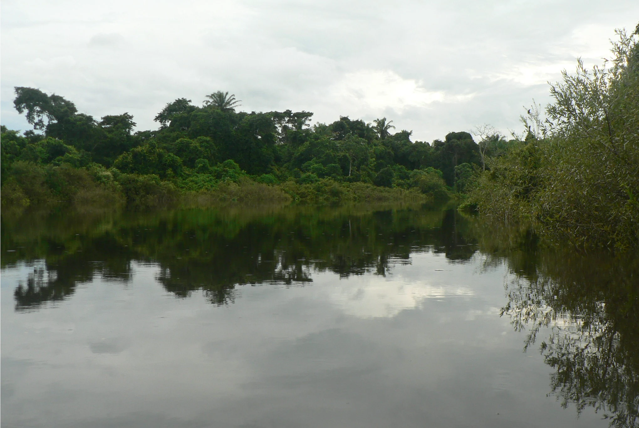
A wide, calm river reflecting the cloudy sky, bordered by dense tropical forest on the banks.
The Ibare River, a key feature of the Ibare-Mamoré protected area in the Bolivian lowlands.

Ibare-Mamoré Municipal Protected Area history and protected-area timeline

The Ibare-Mamoré Municipal Protected Area was formally established on March 18, 2011, through Municipal Ordinance No. 06/2011 of the municipality of Trinidad. The ordinance recognized the area between the Ibare and Mamoré rivers as a priority zone for sustainable development at the municipal level, framing conservation as inseparable from the well-being of local residents.

The decision built on growing awareness of the ecological importance of the Llanos de Moxos landscape and on concern for the safeguarding of habitats supporting emblematic species such as the Amazon river dolphin and jaguar. The creation of the protected area was also shaped by the recognition that traditional and indigenous communities living within the area are central to its long-term stewardship.

Since its designation, the area has served as a focal point for conservation planning, biodiversity monitoring, and discussions of sustainable land use around Trinidad, though specific management milestones remain sparsely documented in available sources.

Ibare-Mamoré Municipal Protected Area landscape and geographic character

The landscape of the Ibare-Mamoré reflects the classic character of the Llanos de Moxos, a low-relief mosaic shaped by rivers, flood pulses, and subtle variations in topography. The protected area lies in a transitional zone between terra firme forest, open grasslands, and extensive wetlands, with elevations that vary only gently across the reserve. Rivers, particularly the Ibare and Mamoré, are the dominant organizing features of the terrain.

Seasonal flooding is a defining element of the scenery. During the rainy months, large portions of the reserve are transformed into a shifting network of shallow lagoons, saturated grasslands, and flooded forest, while the dry season contracts this aquatic extent and exposes beaches, sandbars, and savanna. The result is a dynamic landscape that alternates between two very different visual modalities across the year, with the Ibare River playing a notable role in regulating local hydrology.

Beyond its rivers and floodplains, the area includes tracts of upland forest and open pampas, interspersed with small lagoons and riparian corridors. These landscape elements together give the protected area a layered character in which aquatic, wetland, and terrestrial environments are tightly interconnected.

Ibare-Mamoré Municipal Protected Area ecosystems, habitats, and plant life

Ecologically, the Ibare-Mamoré is a textbook example of Amazonian floodplain diversity. The reserve encompasses forest, pampas, and wetland habitats whose relative extent shifts markedly with the seasonal cycle of high and low waters. This alternation between submerged and emerged conditions supports a complex web of ecological niches, from flooded forests and floating meadows to drier savanna patches and permanent river channels.

The vegetation mosaic includes both forests of taller Amazonian stature and more open formations typical of the Moxos plains. The riverine vegetation along the Ibare and Mamoré adds another dimension, providing specialized habitats for fish, mollusks, and river-associated birds. The presence of permanent and seasonal lagoons further enriches the area's ecological profile, supporting amphibian, reptile, and aquatic mammal communities.

A 1998 biological study recorded the area as hosting at least 46 mammal species, 218 bird species, 13 reptile species, 28 amphibian species, and 175 butterfly species, indicating a level of biodiversity characteristic of well-conserved lowland Amazonian systems. This juxtaposition of forest, savanna, and aquatic habitats is what gives the Ibare-Mamoré its particular ecological identity within the department of Beni.

Ibare-Mamoré Municipal Protected Area wildlife and species highlights

Wildlife is one of the protected area's most defining features. The waters of the Ibare and Mamoré provide habitat for the Amazon river dolphin, locally known as bufeo, while terrestrial mammals include the jaguar, the endangered maned wolf, the bush dog, the spider monkey, the black howler monkey, the spectacled bear, the tapir, and the marsh deer. Smaller carnivores and typical Amazonian forest mammals round out a diverse mammal community. The giant otter and the neotropical otter further emphasize the area's strong association with healthy river ecosystems.

Birdlife is particularly rich, reflecting the variety of habitats available. Threatened and emblematic species recorded here include the harpy eagle, the military macaw, the crested guan, and the greater tinamou, along with a broader assemblage of waterbirds, raptors, and forest birds. Reptiles include the black caiman, while turtles such as the charapa and the river peta represent significant aquatic components of the regional herpetofauna.

The presence of such a wide range of charismatic and range-restricted species, from large cats and primates to freshwater dolphins and river turtles, gives the Ibare-Mamoré strong conservation significance and underlines its importance for the long-term survival of several threatened taxa in lowland Bolivia.

Ibare-Mamoré Municipal Protected Area conservation status and protection priorities

The Ibare-Mamoré was explicitly created to conserve a representative portion of the Llanos de Moxos landscape within the municipality of Trinidad, with the explicit goals of protecting biodiversity, sustaining hydrological function, and improving the well-being of resident communities. By safeguarding forests, pampas, and wetlands between two major rivers, the area contributes to maintaining ecological connectivity in a region where pressure from agriculture, cattle ranching, and urban expansion continues to grow.

The reserve's conservation profile is defined in large part by the threatened species it harbors, including the bufeo, jaguar, marsh deer, harpy eagle, military macaw, black caiman, and river turtles. Protecting habitats for these species is central to the area's designation, and the reserve also serves as a refuge for primates such as the spider monkey and black howler monkey. The Ibare River's role as a regulator of the regional water cycle adds a hydrological dimension to its conservation value.

Beyond species protection, the municipal-level designation reflects an effort to integrate conservation with the cultural and economic life of the nine indigenous and traditional communities living within the reserve. Long-term effectiveness depends on aligning these local livelihoods with habitat protection, and on addressing broader changes in the region's climate and hydrology, including shifts in flood and dry periods documented in recent decades.

Ibare-Mamoré Municipal Protected Area cultural meaning and human context

The Ibare-Mamoré is not only an ecological zone but also a living cultural landscape. Nine indigenous and peasant communities, as well as additional rural settlements, live within its boundaries, including Loma Suárez, Puerto Ballivián, Villa Victoria, Puerto Varador, Puerto Almacén, Puerto Geralda, Mangalito, Copacabana, and Laguna La Bomba, along with the El Carmen livestock estate. Many residents trace origins to Trinitario and Yuracaré indigenous heritage, reflecting the broader ethnic mosaic of the Beni lowlands.

Daily life in these communities is closely tied to the rivers Ibare and Mamoré. Subsistence fishing, small-scale agriculture on traditional plots and raised fields, livestock keeping, seasonal extraction of materials from riverbanks, and small-scale tourism are all part of the local economy. The proximity of Trinidad gives the area considerable tourism potential, while also placing it under pressure from urban growth.

This long-standing coexistence of indigenous communities, traditional livelihoods, and biodiversity-rich habitat gives the Ibare-Mamoré a distinctive cultural dimension that complements its ecological value and shapes how conservation is conceived and practiced within the reserve.

Top sights and standout views in Ibare-Mamoré Municipal Protected Area

The protected area's standout qualities lie in the combination of its hydrological setting, its biodiversity, and its cultural presence. The Ibare and Mamoré rivers define the reserve's boundaries and its ecological rhythms, while the surrounding mosaic of forest, pampas, and wetlands represents one of the most intact expressions of the Llanos de Moxos landscape near any major Bolivian city.

Equally important is the area's capacity to support emblematic species such as the bufeo, jaguar, marsh deer, harpy eagle, and military macaw, alongside a much wider assemblage of mammals, birds, reptiles, amphibians, and butterflies. Layered onto that ecological richness is the presence of indigenous and traditional communities whose livelihoods are woven into the same riverine and floodplain systems that the reserve is meant to protect.

Best time to visit Ibare-Mamoré Municipal Protected Area

The character of a visit to the Ibare-Mamoré is strongly shaped by the alternating wet and dry seasons of the Beni lowlands. Between roughly December and March, the rains intensify and large parts of the reserve become flooded, transforming forests and pampas into an extensive aquatic landscape. This is a particularly striking period for observing waterbirds, flooded-forest ecosystems, and the dynamics of the Ibare and Mamoré rivers, though access to some areas becomes more difficult.

From about July to October, the dry season brings significantly reduced rainfall, lower river levels, and a more accessible, open landscape. This period can favor terrestrial wildlife observation and easier movement through the area, while the rivers remain important features of the scenery. In recent years, the boundaries between these seasons have become less predictable, with longer or shifted flood and dry periods that can affect conditions on the ground.
Monthly climate preview

Long-term temperature ranges and monthly precipitation averages across representative terrain

Área Protegida Municipal Ibare-Mamoré Climate and Annual Weather Patterns

Representative coordinates record sustained thermal patterns alongside pronounced shifts in monthly precipitation from the wet season into drier months. Reviewing the complete twelve-month climatology profile clarifies the multi-year temperature and rainfall distribution across the protected landscape.
Annual mean26 °C
24 °C29 °C
Jan26°
Feb26°
Mar26°
Apr25°
May24°
Jun24°
Jul24°
Aug27°
Sep28°
Oct29°
Nov27°
Dec27°
Warmest month
October

28.5 °C

Coolest month
June

24.1 °C

Wettest month
February

9.6 mm/day

Driest month
August

1.1 mm/day

Park location guide

Geography guide, regional context, and park location map for Ibare-Mamoré Municipal Protected Area

Ibare-Mamoré Municipal Protected Area park geography, regions, and map view in Bolivia

Understand where Ibare-Mamoré Municipal Protected Area sits in Bolivia through a broader geographic reading of the surrounding landscape, nearby location context, and its mapped position within the national park landscape.

How Ibare-Mamoré Municipal Protected Area fits into Bolivia

Bolivia, officially the Plurinational State of Bolivia, is a landlocked country in central South America. It features diverse geography including the Andean mountain range, Amazonian plains, Gran Chaco, and the Pantanal wetland. The country has a population of approximately 11.4 million and is administratively divided into nine departments, with La Paz as the seat of government and Sucre as the constitutional capital.

Wider geography shaping Ibare-Mamoré Municipal Protected Area in Bolivia

Bolivia is located in central South America, bordered by Brazil to the north and east, Paraguay to the southeast, Argentina to the south, Chile to the southwest, and Peru to the west. The country is divided between a western Andean region and tropical lowlands to the east and north. It includes the Amazonian plain, Gran Chaco, temperate valleys, the high-altitude Altiplano plateau, and part of the Pantanal wetland along its eastern border.

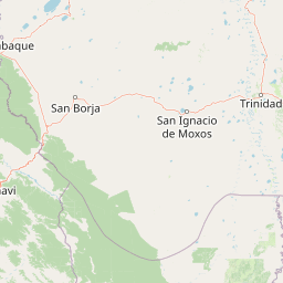
Map view of Ibare-Mamoré Municipal Protected Area

Use this park location map to pinpoint Ibare-Mamoré Municipal Protected Area in Bolivia, understand its exact geographic position, and read its mapped placement within the surrounding landscape more clearly.

Pigeon | © OpenStreetMap contributors

Location context for Ibare-Mamoré Municipal Protected Area

Beni Department
Recorded earthquake history

View the Recorded Earthquake History for Área Protegida Municipal Ibare-Mamoré

Examine the historical record of seismic activity associated with the geography of Área Protegida Municipal Ibare-Mamoré. This dedicated MoriAtlas resource provides clear access to logged earthquake events, magnitude data, and spatial relationships within the Beni Department to support broader geographic study.

Área Protegida Municipal Ibare-Mamoré Earthquake History

Catalogued events

3 events

Strongest magnitude

Magnitude 6.6

Most recent event

Sep 12, 2019

This history includes earthquakes recorded inside the park or within 50 km of its borders

Visual reference guide to lowland Bolivia wetlands, riverine habitats, and seasonal floodplains

Área Protegida Municipal Ibare-Mamoré Photos and Landscape Scenery

Visual records illustrate the shifting mosaic of flooded forests, open pampas, and river confluences that define the protected landscape. Detailed photography provides clear insight into the complex terrain and aquatic habitats supporting regional biodiversity across the Amazon basin.

A wide, calm river reflecting the cloudy sky, bordered by dense tropical forest on the banks.

Park atlas

Compare adjacent lowland ecosystems, riverine wetlands, and regional conservation areas

Parks Near Área Protegida Municipal Ibare-Mamoré and Surrounding Protected Landscapes

Browse nearby protected areas sharing the wetland ecologies and riverine habitats found around Área Protegida Municipal Ibare-Mamoré. Extending geographic comparison across these neighboring reserves reveals broader patterns within the lowland Bolivian terrain.
Protected landscapeBeni
About 26 km away#1 closest

Southeast

Parque Municipal y Área Natural de Manejo Integrado Gran Mojos: Regional Geography

Protected floodplain ecosystems in the Beni department of Bolivia.

Analyze the spatial distribution of this large protected area located in the Mamoré River basin. Learn about its dual-designation structure, bridging core municipal forests with integrated management zones that preserve vital lowland Amazonian habitats and endemic biodiversity within the Llanos de Moxos ecoregion.

Area
5,804.3 km²
Established
2017
Relief
Lowland
Scope
Terrestrial
Regional parkBeni
About 99 km away#2 closest

West

Parque regional Yacuma: Geographic Overview and Protected Landscape Mapping

Riparian ecosystems and flooded savanna terrain in Beni, Bolivia

Explore the expansive floodplain mosaic of Parque regional Yacuma, where the Yacuma and Beni river systems create a vital refuge for lowland wildlife. The park offers an essential view into the seasonal transitions of northern Bolivia, bridging pre-Andean forests and inundated savanna plains that define this significant regional conservation corridor.

Area
1,200 km²
Established
1990
Water
Major water bodies
A horizontal watercolor painting depicting a soft-focus landscape with green hills, a winding river, and reddish marshy foreground vegetation.
Biosphere reserveBolivia
About 129 km away#3 closest

West

Reserva de Biosfera Estación Biológica del Beni: Protected Landscape and Geographic Atlas

Examining the Amazonian lowland mosaic of northern Bolivia

The Reserva de Biosfera Estación Biológica del Beni sits within the wide alluvial plains of the Llanos de Moxos. This protected area features a unique, flat terrain where tropical forest fragments persist as islands amidst seasonally flooded palm savannas, cyperaceous marshes, and shallow lagoons, providing a critical study area for Amazonian biodiversity.

Area
1,350 km²
Established
1982
Relief
Lowland
Climate
Tropical
National parkBolivia
About 150 km away#4 closest

Southwest

Isiboro Sécure National Park and Indigenous Territory: Bolivian Protected National Park Atlas

Mapped protected boundaries and regional landscape context.

Investigate Isiboro Sécure National Park and Indigenous Territory as a key protected national park within Bolivia's expansive geography. This resource offers detailed views of its mapped natural landscape and its regional significance as a protected area. Understand the park's geographic attributes and its contribution to the country's conservation atlas through structured map-based exploration.

Area
13,721.8 km²
Established
1965
IUCN
II
Relief
Mixed relief
Nature reserveBeni Department
About 158 km away#5 closest

Northwest

Reserva natural Barba Azul: A Protected Savanna Sanctuary in the Beni Department

Mapping flooded grasslands and gallery forest ecosystems

Reserva natural Barba Azul stands as a key protected area within the Bolivian Amazon lowlands. This nature reserve, centered in the Beni Department, preserves a rare mosaic of motacú palm forests and seasonal wetlands that serve as a critical stronghold for endangered parrots and migratory shorebirds within the larger Llanos de Moxos region.

Area
110 km²
Established
2008
Relief
Lowland
Climate
Tropical
Protected landscapeSanta Cruz
About 161 km away#6 closest

Southeast

Área Natural de Manejo Integrado Humedales del Norte Protected Landscape and Wetland Atlas

Mapping the floodplain ecosystems of northern Santa Cruz, Bolivia.

An extensive protected area in northern Santa Cruz that sustains vital Amazonian river systems and seasonal wetland mosaics. This landscape supports complex hydrological functions, including the regulation of climate and regional water cycles, through its vast network of periodically flooded forest tracts and permanent waterways.

Area
4,900.51 km²
Established
2012
Relief
Lowland
Scope
Terrestrial
A horizontal watercolor painting of a river landscape with lush green vegetation in the foreground and soft, hazy hills in the background.
Protected areaBeni
About 199 km away#7 closest

Northwest

Área protegida municipal Pampas del río Yacuma: Protected Area and Wetland Geography

A large-scale municipal sanctuary in the Bolivian Amazon

This significant protected area encompasses the expansive floodable savannas of the Llanos de Moxos. Its mosaic of forest islands and riverine wetlands provides a critical refuge for endemic species and iconic Amazonian wildlife. The geography is shaped by the Yacuma River, creating a seasonal environment that bridges indigenous heritage with modern conservation land management.

Area
6,164.53 km²
Established
2007
Visitors
16K annual
Relief
Lowland
National parkCochabamba Department
226 km away#8 closest

South

Carrasco National Park: National Park Status and Protected Landscape Geography

Explore mapped boundaries within Cochabamba Department.

Carrasco National Park, situated within the Cochabamba Department, represents a critical national park entity. This focus provides users with an atlas-centric view of its protected landscape, detailing its geographic significance and mapped features. Understand the park's terrain and regional context, offering a clear perspective on its conservation value and mapped presence.

Area
6,226 km²
Established
1991
IUCN
II
Relief
Mountain

Common questions about visiting, size, designation, and location context for Ibare-Mamoré Municipal Protected Area

Ibare-Mamoré Municipal Protected Area FAQs for park facts, access, geography, and protected area context

Find quick answers about Ibare-Mamoré Municipal Protected Area, including protected-area facts, park geography, trail and visitor context, and how the park fits into its surrounding country and regional landscape.
MoriAtlas Explorer

Continue Your Protected Areas Search Across the Global Atlas

Deepen your exploration by continuing the structured search for national parks and protected areas worldwide. Utilize the comprehensive filtering capabilities to compare different conservation landscapes and refine your understanding of global park geography. Discover more about the distribution and characteristics of protected natural areas.

Global natural geography