
Mori Atlas logo
Nature reserveIberá Provincial Reserve

Mapping the extensive lagoons, flooded grasslands, and freshwater reservoirs of the Corrientes Province wilderness.

Iberá Provincial Reserve: An In-Depth Look at Argentina's Vast Wetland Geography and Protected Landscape

(Reserva Provincial Iberá)

Iberá Provincial Reserve represents one of South America's most significant freshwater systems, covering a complex mosaic of shallow lagoons, bogs, and seasonally flooded marshes within Corrientes Province. This massive protected area encompasses distinct conservation units that safeguard a shifting interface of sandy hills and aquatic ecosystems. Use these resources to visualize the park boundaries and understand the regional geography that defines this essential Argentine wetland.

wetlandsfreshwater reserveslagoonssubtropical climatewetland birdsmarsh deer habitat
A stylized illustration of a mountain landscape at sunset, featuring a tall waterfall cascading down rocky cliffs into a river, surrounded by a lush forest under a pastel-colored sky.

Iberá Provincial Reserve

Nature reserve

Park overview

Structured park overview, official facts, and landscape profile for Iberá Provincial Reserve

Iberá Provincial Reserve park facts, protected area profile, and essential visitor context

Review the core facts for Iberá Provincial Reserve, including designation, size, terrain, visitor scale, habitats, and operating context in one park-focused overview.

About Iberá Provincial Reserve

Iberá Provincial Reserve stands as one of the defining protected landscapes of South America, a sprawling system of freshwater habitats in the heart of the Corrientes wetlands of northeastern Argentina. Confusing and disorienting on the ground, the reserve is a seamless blend of land and water, where floating mats of vegetation, shallow permanent lagoons, seasonally flooded grasslands, and pockets of dry sandy upland form a single interconnected mosaic. The name Iberá itself comes from the Guaraní phrase meaning "bright water," reflecting how the landscape's defining identity is more about reflective wetlands than dramatic terrestrial features.

The reserve harbors a significant portion of the broader Iberá Wetlands, a continental-scale freshwater system stretching well beyond the reserve's formal boundaries and recognized internationally as a Ramsar site in 2002. Within the reserve sit two separately managed protected units: Iberá Provincial Park, created in 2009 from public provincial lands, and the larger Iberá National Park, formally established by Argentina's Congress in December 2018 on lands assembled by the Conservation Land Trust and later donated to the Argentine state. The remaining lands across the reserve are largely working cattle ranches, making the area a notable example of a large conservation landscape shared between strictly protected cores and traditional rural land use.

Ecologically, Iberá stands out for its combination of subtropical wetland habitats and a distinctly Argentine fauna that includes marsh deer, pampas deer, maned wolf, neotropical otters, capybaras, and both species of Argentine caiman. With roughly 350 bird species recorded, and active reintroduction work on the red-and-green macaw, the reserve is increasingly viewed as both a critical refuge for native species and a flagship site for rewilding and sustainable ecotourism in the country.

Quick facts and research context for Iberá Provincial Reserve

Iberá Provincial Reserve is located in the northwest of Corrientes Province in northeastern Argentina, with the nearest major town being Concepción. The reserve was established on April 15, 1983, and protects roughly 1.3 million hectares, spanning an estimated 14% of Corrientes Province and making it Argentina's largest protected area. It overlaps with a Ramsar-listed wetland core officially known as Lagunas y Esteros del Iberá, designated in 2002 under reference number 1162, and contains the separately administered Iberá Provincial Park and Iberá National Park within its broader footprint.

Protection and recognition

Terrestrial conservation framework established in the year 2002

Iberá Provincial Reserve Protection Status and Designation History

Documented protection metrics for Iberá Provincial Reserve outline the terrestrial conservation scope and formal designation timeline established in 2002. Verified administrative records capture the baseline protection status without imported international recognition sources.

Protection details

Protection scope
Terrestrial
Designated year
2002
Transboundary protection
No
Park context

Deeper park guide and search-rich context for Iberá Provincial Reserve

Iberá Provincial Reserve history, landscape, wildlife, and travel context

Explore Iberá Provincial Reserve through its history, landscape character, ecosystems, wildlife, conservation priorities, cultural context, and seasonal travel timing in a structured park guide built for atlas discovery and search intent.

Why Iberá Provincial Reserve stands out

The reserve is best known for protecting a vast mosaic of freshwater wetlands, including some of the largest shallow permanent lagoons in the continent and extensive seasonally flooded grasslands, within a subtropical climate where annual rainfall reaches around 1,700 millimeters. It is also recognized for its remarkable and recovering biodiversity, ranging from marsh deer, pampas deer, maned wolf, neotropical otter, capybara, and both Argentine caiman species, to a rich bird community of about 350 species that anchors the region's growing ecotourism appeal.
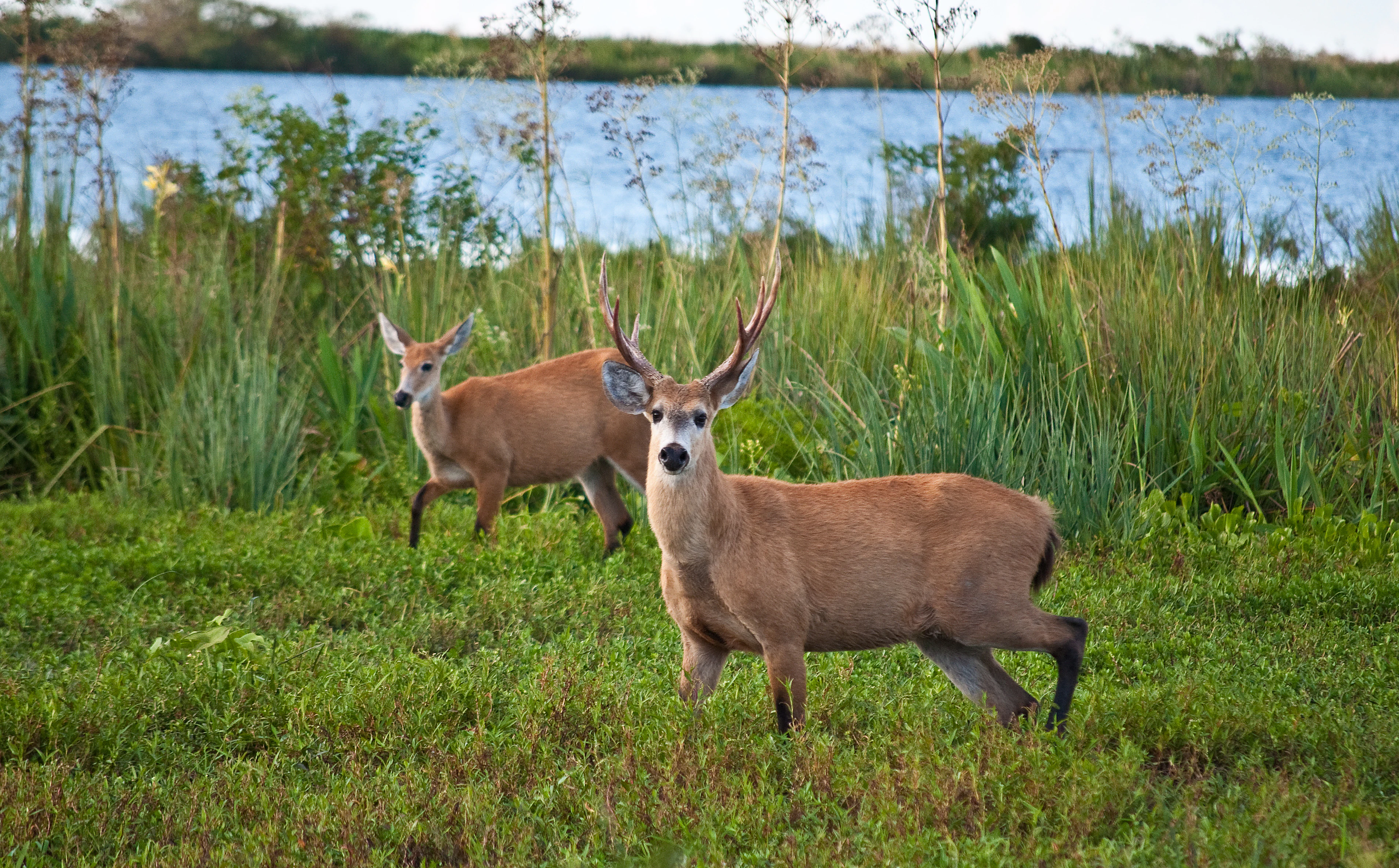
Two marsh deer, one a buck with antlers, standing in lush green grass with a body of water in the background.
Two marsh deer standing in the wetland vegetation of Iberá Provincial Reserve.

Iberá Provincial Reserve history and protected-area timeline

Iberá Provincial Reserve was formally established on April 15, 1983, creating what would become Argentina's largest protected area and giving formal protection to a substantial share of the Iberá Wetlands. In 1995 the reserve's wetland values earned international recognition when a 24,500-hectare core area, officially designated Lagunas y Esteros del Iberá, was listed as a Wetland of International Importance under the Ramsar Convention, registered in January 2002.

A second major phase of institutional development began in 2009, when Iberá Provincial Park was created from public lands controlled by Corrientes Province, carving out a strictly protected core in the southwestern portion of the reserve. The most transformative chapter, however, came through the work of the Conservation Land Trust, a private foundation established by the conservationists Doug and Kristine Tompkins, which began acquiring former cattle ranches inside the reserve in 1999. By 2015, the foundation had donated those lands to the Argentine state, enabling Congress to formally create Iberá National Park on December 5, 2018, expanding the federal conservation footprint at the heart of the broader reserve.

Iberá Provincial Reserve landscape and geographic character

The landscape of Iberá Provincial Reserve is defined primarily by water, expressed as an enormous patchwork of shallow permanent lagoons, sluggish sloughs and courses, swamps, bogs, and extensive floodplains. The largest of these waterbodies, the eponymous Iberá Lagoon and Luna Lagoon, frame the village of Colonia Carlos Pellegrini, while Fernández, Galarza, Medina, Paraná, and Trin each exceed roughly 15 square kilometers in surface area. The lagoon system is normally very shallow but can swell to depths of more than three meters during major flood events.

Dry land is comparatively scarce and takes the form of low, sandy hills that rise modestly above the floodplains. The visual boundary between solid ground and swamp is often indistinct, as semi-submerged vegetation creates an almost seamless surface and natural dams, formed by the tangled roots of floating plant mats, can become firm enough to walk on. This constantly shifting ground-water interface makes spatial orientation in the field famously difficult.

The reserve sits within a markedly subtropical climate. Annual rainfall averages around 1,700 millimeters, concentrated in autumn and spring, while summer is intensely hot and humid, with daytime highs often exceeding 45°C, and winter is cooler and considerably drier, occasionally dropping to sub-zero minima.
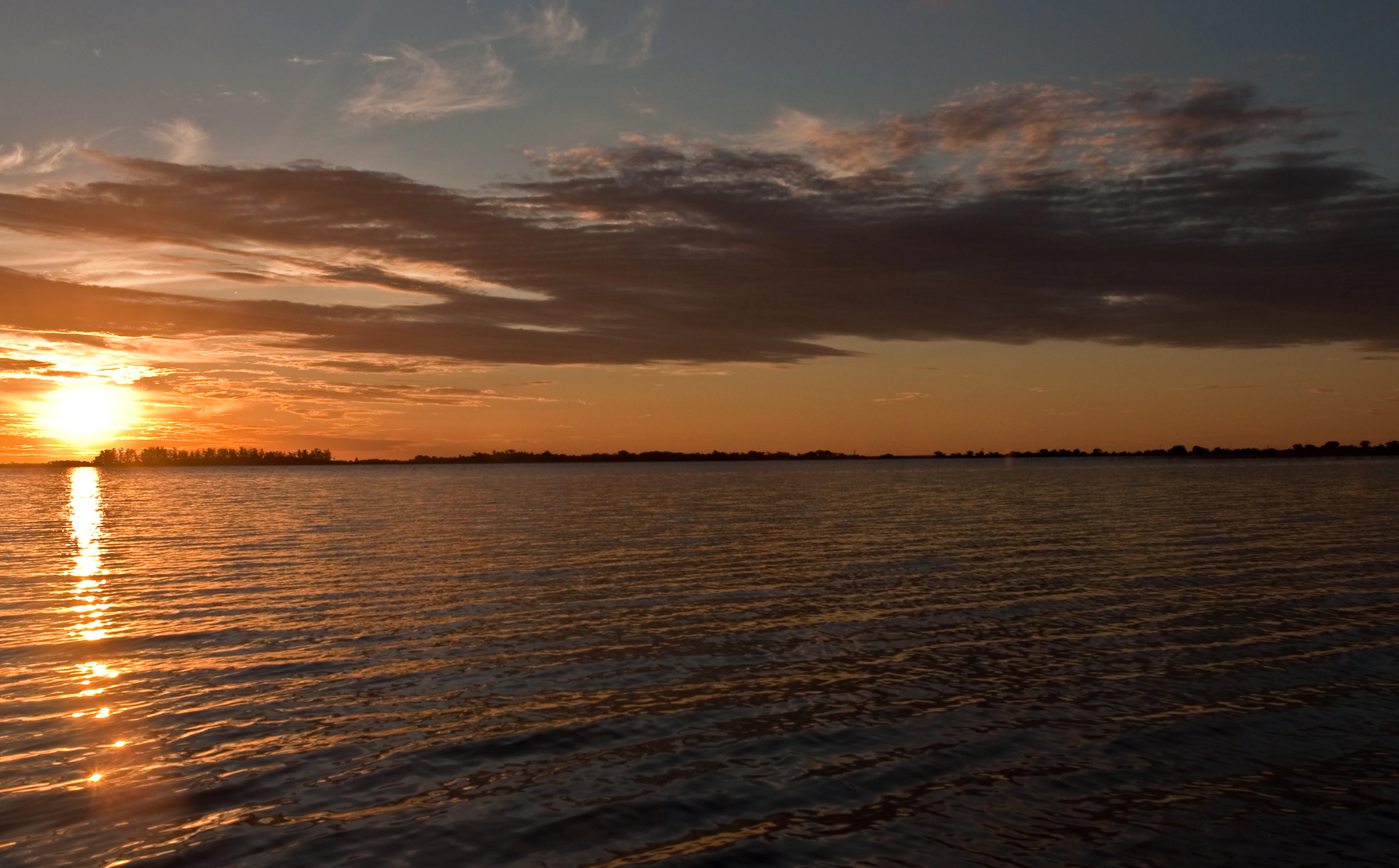
A wide sunset view over calm open water with silhouetted distant shorelines and clouds catching the golden light.
Sunset over the expansive waters of the Iberá Wetlands.

Iberá Provincial Reserve ecosystems, habitats, and plant life

Iberá Provincial Reserve protects one of the most ecologically significant freshwater wetland complexes in South America, encompassing a broad gradient of habitats from open permanent lagoons and seasonally flooded grasslands to dense floating and emergent vegetation. These habitats support a distinctive mix of wetland-dependent species alongside animals more associated with the surrounding Chaco and Espinal ecological regions.

Beyond the iconic large mammals and reptiles that visitors tend to associate with Iberá, the reserve sustains a rich aquatic and semi-aquatic ecological community, including caimans, otters, capybaras, and abundant waterbirds, all dependent on the integrity of the flood pulses and shallow water systems. The flora includes extensive floating vegetation mats that engineer the very surface of the wetlands, creating dams, islands, and shifting habitat mosaics.

As a Ramsar-listed Wetland of International Importance, Iberá is recognized for its contribution to continental freshwater storage and biodiversity, and for its role in supporting seasonal migrations and habitat connectivity across the broader Iberá Wetlands system that extends well outside the reserve's official boundaries.
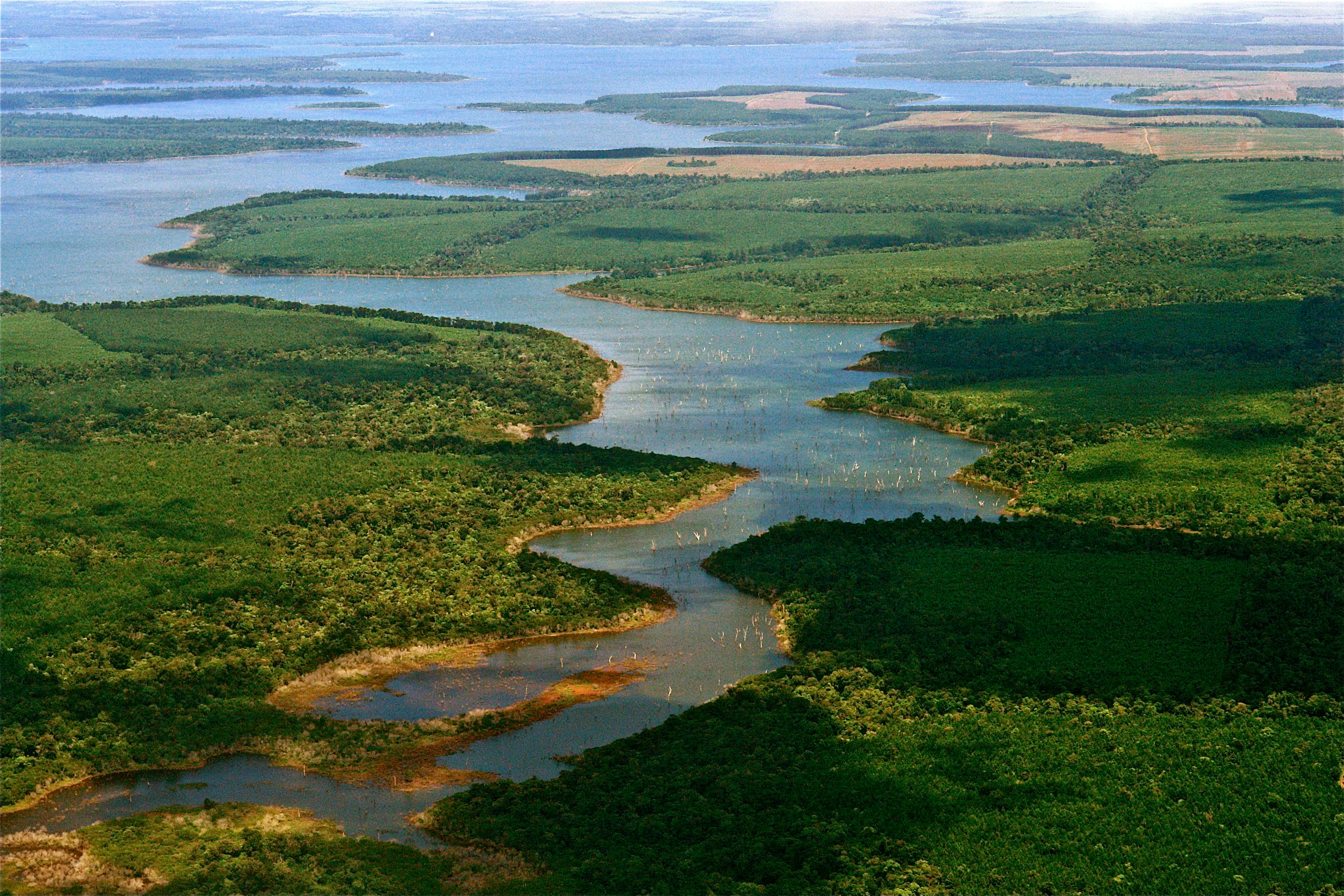
An aerial view showing a winding waterway surrounded by green vegetation and marshy islands in the Iberá Wetlands.
Aerial perspective of the interconnected waterways and wetlands within the Iberá Provincial Reserve.

Iberá Provincial Reserve wildlife and species highlights

Iberá Provincial Reserve is celebrated for its rich and largely recovering native fauna, four of whose species have been declared provincial natural monuments: the neotropical otter, the maned wolf, the pampas deer, and the marsh deer. The marsh deer in particular is among the largest native herbivores of the esteros and a flagship species of the wetlands.

The reserve is home to both Argentine species of caiman, locally known as the yacaré negro (yacare caiman) and yacaré overo (broad-snouted caiman), and to the world's largest rodent, the capybara, all of which thrive in the shallow, vegetation-rich lagoons and slow-moving sloughs. Around 350 bird species have been recorded, including raptors, waders, and aquatic specialists that fuel a growing birdwatching identity for the region.

A particularly visible conservation story is the reintroduction of the red-and-green macaw, listed as critically endangered in Argentina, where the species had been effectively absent for decades. A coalition of organizations, including the World Parrot Trust, Aves Argentinas, and the Conservation Land Trust, began importing captive birds from Britain in 2015, with the first pair of British-origin birds released in February 2019, marking an early step in restoring one of Argentina's most charismatic lost species.
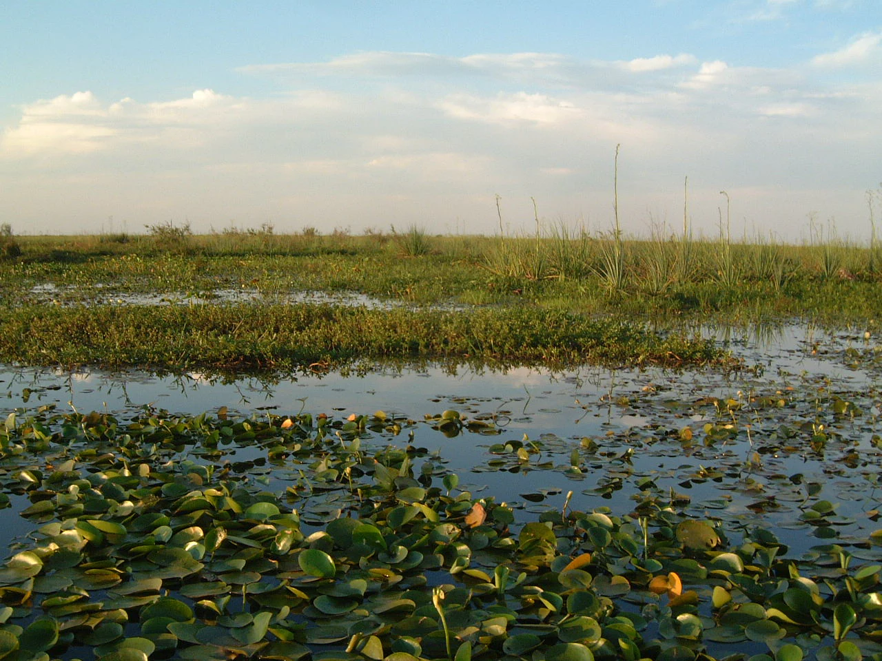
A wide, low-angle view of the marshlands at Laguna del Iberá, featuring calm water covered in lily pads and patches of tall grasses under a soft, cloudy sky.
The expansive wetlands of Laguna del Iberá within the Iberá Provincial Reserve.

Iberá Provincial Reserve conservation status and protection priorities

Iberá Provincial Reserve represents one of the most ambitious large-scale conservation efforts in Argentina, combining formal protection with active ecological restoration across a vast working landscape. Its Ramsar designation in 2002, under the official name Lagunas y Esteros del Iberá, cemented its status as a Wetland of International Importance and underscored its role as a continental freshwater reservoir.

The creation over time of layered protection categories within the reserve, including Iberá Provincial Park in 2009 and Iberá National Park in 2018, has progressively strengthened conservation outcomes on the ground. The Conservation Land Trust has played a central role in this process, removing most cattle from acquired lands, halting the widespread practice of burning vegetation to boost cattle forage, replacing haphazard burn regimes with carefully managed fires, and removing interior fences to restore wildlife movement across the landscape.

These efforts are increasingly framed around sustainable ecotourism as a mechanism to align local economic interests with conservation, with the goal of building durable support for the broader recovery of native species and wetland processes across the Iberá basin.

Iberá Provincial Reserve cultural meaning and human context

The identity of Iberá is rooted in the Guaraní language and culture of northeastern Argentina, with the name itself derived from the Guaraní phrase meaning "bright water," reflecting centuries of indigenous connection to the wetlands. The region around the reserve today retains a traditional Corrientes cultural identity, expressed in small rural settlements such as Colonia Carlos Pellegrini on the shore of Iberá Lagoon, where local livelihoods have long been interwoven with ranching, fishing, and increasingly ecotourism.
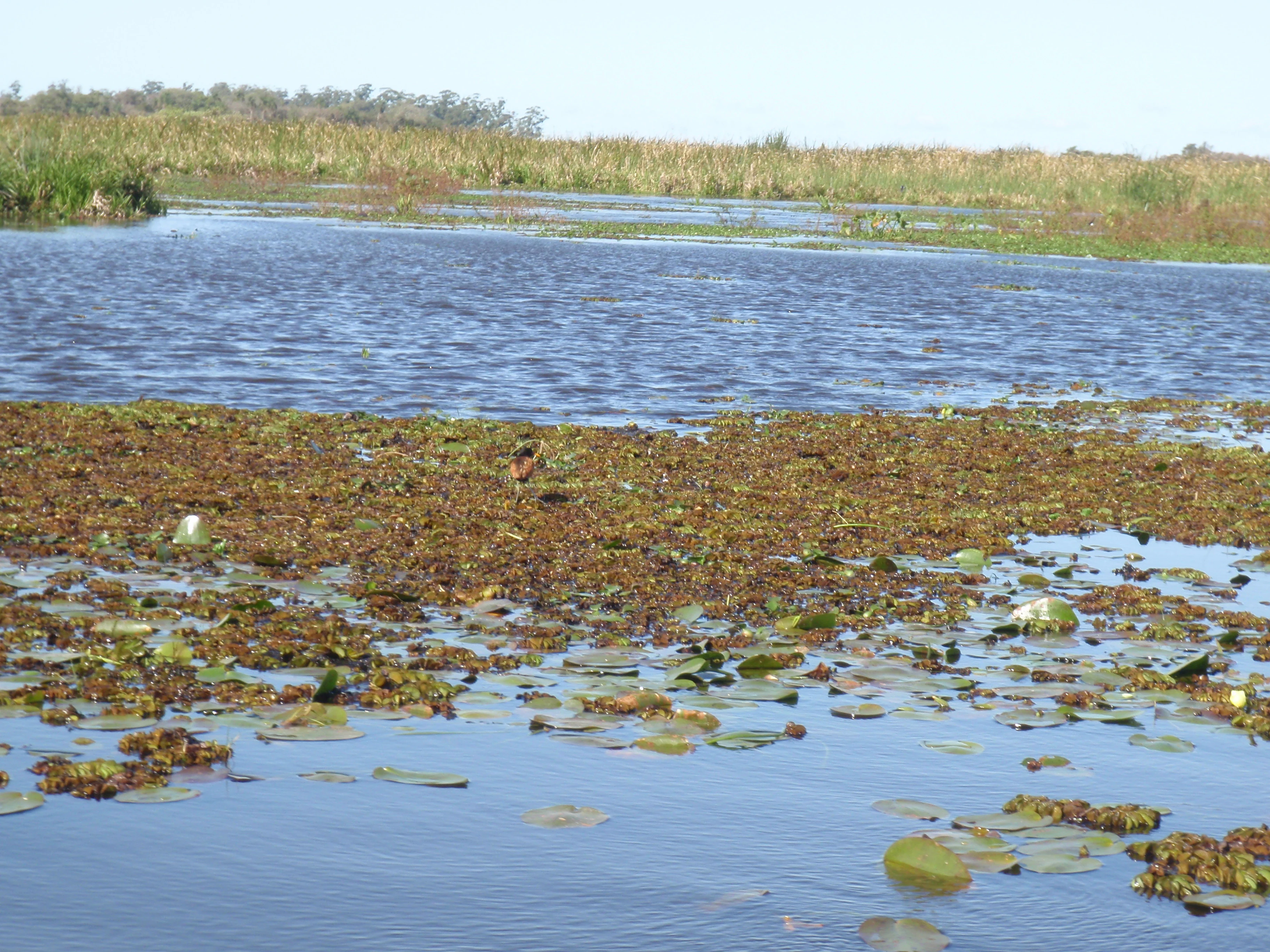
A wide view of a sunlit lagoon filled with floating aquatic plants, with a dense grassy shoreline in the distance.
A view of the lagoon and floating aquatic vegetation in the Iberá Wetlands.

Top sights and standout views in Iberá Provincial Reserve

Iberá Provincial Reserve stands out for the sheer scale and ecological integrity of one of South America's largest freshwater wetland complexes, anchored by vast shallow lagoons and a contiguous mosaic of swamps, bogs, and seasonally flooded grasslands. Its layered protection model, combining a massive provincial reserve with the more recent Iberá Provincial Park and Iberá National Park, demonstrates a unique blend of strict protection and working landscape.

The reserve's wildlife roster is exceptional, including four provincial natural monument species, around 350 bird species, both Argentine caimans, capybara, and an active macaw reintroduction program. Combined with recent restoration work that has removed cattle, controlled burning, and restored free wildlife movement, Iberá offers a distinctive model of wetland recovery at continental scale.

Best time to visit Iberá Provincial Reserve

The subtropical climate of Iberá shapes two broad periods of interest for visitors. The cooler dry winter months tend to offer more comfortable temperatures, fewer mosquitoes, more reliably dry access around the reserve's limited upland areas, and excellent conditions for observing wildlife concentrated around the permanent lagoons. Autumn and spring, while marked by heavier rainfall, can bring lush landscapes, high water levels, and rich bird activity, while the very hot and humid summer months bring the most intense ecological dynamics but also challenging heat.

Monthly climate preview

Long-term representative point measurements tracking monthly temperature and precipitation rhythm

Iberá Provincial Reserve Climate Normals and Annual Temperature Patterns

Representative point records for Iberá Provincial Reserve trace a measured annual cycle featuring peak monthly temperatures reaching thirty-eight degrees Celsius alongside varying precipitation averages. Examining the complete twelve-month profile provides deeper analytical insight into long-term climate normals across the protected landscape.
Annual mean21 °C
14 °C27 °C
Jan27°
Feb26°
Mar25°
Apr21°
May17°
Jun15°
Jul14°
Aug16°
Sep18°
Oct21°
Nov23°
Dec26°
Warmest month
January

27.3 °C

Coolest month
July

13.6 °C

Wettest month
October

6 mm/day

Driest month
August

1.9 mm/day

Park location guide

Geography guide, regional context, and park location map for Iberá Provincial Reserve

Iberá Provincial Reserve park geography, regions, and map view in Argentina

Understand where Iberá Provincial Reserve sits in Argentina through a broader geographic reading of the surrounding landscape, nearby location context, and its mapped position within the national park landscape.

How Iberá Provincial Reserve fits into Argentina

Argentina is a federal republic located in the southern cone of South America, bordering Chile, Bolivia, Paraguay, Brazil, Uruguay, and the Atlantic Ocean. With an area of 2,780,085 km², it is the second-largest country in South America and the eighth-largest globally. The capital and largest city is Buenos Aires, and the official language is Spanish. The country claims sovereignty over the Falkland Islands, South Georgia and the South Sandwich Islands, and a portion of Antarctica.

Wider geography shaping Iberá Provincial Reserve in Argentina

Argentina occupies the southern portion of South America, sharing the Southern Cone region with Chile to the west. The country borders Bolivia and Paraguay to the north, Brazil to the northeast, Uruguay and the South Atlantic Ocean to the east, and the Drake Passage to the south. The Andes mountain range runs along the western border, while the Pampas plains dominate the central region. Argentina also claims territories in Antarctica.

Map view of Iberá Provincial Reserve

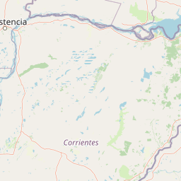
Use this park location map to pinpoint Iberá Provincial Reserve in Argentina, understand its exact geographic position, and read its mapped placement within the surrounding landscape more clearly.

Pigeon | © OpenStreetMap contributors

Location context for Iberá Provincial Reserve

Corrientes Province

Explore protected area photography, shallow lagoons, and subtropical marsh habitats.

Iberá Provincial Reserve Photos and Scenery: Visualizing the Wetland Landscape

Visual documentation captures the vast mosaic of shallow permanent lagoons, sluggish sloughs, and flooded grasslands defining the protected area. Examining park photography reveals the shifting ground water interfaces and distinct ecological character of South American wetlands.

Two marsh deer, one a buck with antlers, standing in lush green grass with a body of water in the background.

A wide view of the Iberá Wetlands at sunset, featuring tall grasses rising from the dark water under a dramatic sky with large, multi-colored clouds.

A wide sunset view over calm open water with silhouetted distant shorelines and clouds catching the golden light.

An aerial view showing a winding waterway surrounded by green vegetation and marshy islands in the Iberá Wetlands.

A wide, low-angle view of the marshlands at Laguna del Iberá, featuring calm water covered in lily pads and patches of tall grasses under a soft, cloudy sky.

A close-up view of wetland flora, including green marsh grasses and clusters of small purple flowers in the foreground, with a field of tall grasses and palm trees in the distance under a bright sky.

A wide view of a sunlit lagoon filled with floating aquatic plants, with a dense grassy shoreline in the distance.

Park atlas

Compare regional wetland reserves, surrounding landscapes, and connected habitats

Explore Protected Areas and Other Parks Near Iberá Provincial Reserve

Browse other parks near Iberá Provincial Reserve to compare regional protected landscapes and wetland habitats across northeastern Argentina. Discovering adjacent conservation areas provides broader geographic context for the extensive freshwater systems of Corrientes Province.
National parkCorrientes Province
About 63 km away#1 closest

North

Mburucuyá National Park: National Park in Corrientes Province, Argentina

Iconic yatay palm savannas and diverse wetland ecosystems.

As a key national park within Argentina's Corrientes Province, Mburucuyá National Park offers a unique atlas-scale view of ecological convergence. It preserves expansive yatay palm savannas, critical wetland habitats within the Iberá Wetlands, and lush subtropical forests. The park's boundaries define an area where the Humid Chaco, Espinal, and Selva Paranaense biomes meet, creating a landscape of exceptional biodiversity and geographic significance for regional conservation and mapped exploration.

Area
176.82 km²
Established
2001
IUCN
II
Relief
Lowland
National parkCorrientes Province
About 73 km away#2 closest

Northeast

Iberá National Park: National Park Atlas Exploration in Corrientes Province

Mapped protected area context and regional geography.

Delve into the atlas view of Iberá National Park, a designated national park situated in Corrientes Province, Argentina. This detailed entry clarifies the park's protected landscape identity and its contribution to the regional geography of northeastern Argentina. Understand its mapped boundaries and explore its significance as a conservation area within the Mesopotamia region.

Area
1,835 km²
Established
2018
IUCN
II
Relief
Lowland
Wildlife reserveArtigas Department
About 178 km away#3 closest

South

Área de manejo de hábitats y/o especies Rincón de Franquía: Protected Wildlife Reserve and Riverine Geography

Ecological mapping of Uruguay's northern borderland habitats

Área de manejo de hábitats y/o especies Rincón de Franquía protects an exceptionally rich floodplain environment at the confluence of the Uruguay and Cuareim rivers. As a central node in a tri-national ecological corridor, this reserve offers a deep look into the connectivity of riverine forest, riparian woodland, and seasonal wetlands in northern Uruguay's Artigas Department.

Area
12.29 km²
Established
2013
Relief
Lowland
Scope
Terrestrial
National parkChaco Province
About 260 km away#4 closest

Northwest

Chaco National Park: Protected Landscape and Regional Geography Atlas

Explore mapped boundaries within the Eastern Chaco's unique ecosystem.

Chaco National Park is an important protected area in Chaco Province, Argentina, dedicated to preserving the unique Eastern Chaco ecosystem. Covering 150 square kilometers, its landscape comprises warm lowland terrain with scrubland, savanna, swamp areas, and scattered lakes. This national park is recognized for its efforts to conserve the distinctive quebracho forests and supports a rich array of wildlife, making it a key site for understanding regional protected-area geography and landscape context.

Area
150 km²
Established
1954
IUCN
II
Relief
Lowland
National parkParaguay
About 300 km away#5 closest

North

Ypoá National Park: Paraguay's Protected Wetland Landscape and Lake Ecosystem

Explore mapped boundaries and significant bird habitats in the Ñeembucú region.

Ypoá National Park is a critical protected area in Paraguay, renowned for its extensive wetland ecosystems dominated by Lake Ypoá. This national park encompasses a rich mosaic of marshlands, riparian forests, and aquatic vegetation, making it a significant habitat for numerous bird species, including several rare and endemic types. Its designation as a Ramsar Wetland underscores its ecological importance, offering a unique lens for understanding landscape context and protected-area geography within South America.

Area
1,000 km²
Established
1992
IUCN
II
Relief
Lowland
National parkItapúa Department
About 315 km away#6 closest

Northeast

San Rafael National Park: National Park Protected Landscape & Geographic Overview

Discover the mapped boundaries and regional setting in Itapúa.

San Rafael National Park is a significant protected area designated as a national park in Paraguay's Itapúa Department. This page serves as an atlas-centric entry point, offering a detailed view of its geographic scope, mapped park boundaries, and its role as a conservation landscape. Users can explore the park's terrain and its place within the regional geography for a structured understanding of its protected status.

Area
693.04 km²
Established
1992
IUCN
II
Relief
Upland
Protected landscapeRivera
About 340 km away#7 closest

Southeast

Valle del Lunarejo Protected Landscape: Mapped Geography and Terrain in Rivera, Uruguay

A rugged river valley protected area in the Uruguayan north.

Valle del Lunarejo represents a unique geological contact zone in Rivera, Uruguay, characterized by dramatic basaltic cliffs, dense gallery forests, and a network of stream-fed waterfalls. This protected landscape offers a detailed look at the interplay between Mesozoic volcanic flows and sandstone deposits, shaping a distinct terrain that diverges from the surrounding plains. The area provides essential context for understanding northern Uruguayan topography and the distribution of diverse habitats within the National System of Protected Areas.

Area
292.86 km²
Established
2001
Relief
Mixed relief
Climate
Subtropical
National parkEntre Ríos Province
About 360 km away#8 closest

South

El Palmar National Park: Protected Area Atlas and Geographic Exploration in Entre Ríos

Discover mapped park boundaries and regional landscape context.

El Palmar National Park offers a dedicated space for understanding protected landscapes within Argentina. As a designated national park situated in Entre Ríos Province, it serves as a crucial point for exploring mapped natural terrain and regional geography. This entry provides specific details on its protected area status and its contribution to the broader atlas of conservation lands in the Mesopotamia region.

Area
85 km²
Established
1966
IUCN
II
Access
Easy access

Common questions about visiting, size, designation, and location context for Iberá Provincial Reserve

Iberá Provincial Reserve FAQs for park facts, access, geography, and protected area context

Find quick answers about Iberá Provincial Reserve, including protected-area facts, park geography, trail and visitor context, and how the park fits into its surrounding country and regional landscape.
MoriAtlas Explorer

Continue Your Protected Areas Search Across the Global Atlas

Deepen your exploration by continuing the structured search for national parks and protected areas worldwide. Utilize the comprehensive filtering capabilities to compare different conservation landscapes and refine your understanding of global park geography. Discover more about the distribution and characteristics of protected natural areas.

Global natural geography