
Mori Atlas logo
Nature reserveIbergeregg

Tracing the mapped boundaries, peatland ecosystems, and pre-Alpine landscape character of the Ibergeregg plateau

Ibergeregg Nature Reserve: A Detailed Geographic Atlas of this Swiss Alpine Pass and Wetland Protected Area

Ibergeregg sits as a significant mountain pass and nature reserve within the central Swiss canton of Schwyz, anchoring a unique highland saddle between the Muota and Sihl watersheds. This protected area spans a critical peatland complex, encompassing diverse raised bogs and rare moor forests that define the local pre-Alpine terrain. Our atlas documentation traces the park boundaries, hydrologic context, and mountain geography, providing a clear window into the ecological and structural importance of this highland landscape.

mountain passcanton of Schwyzraised bogsflat moorsmoor forestspeatland
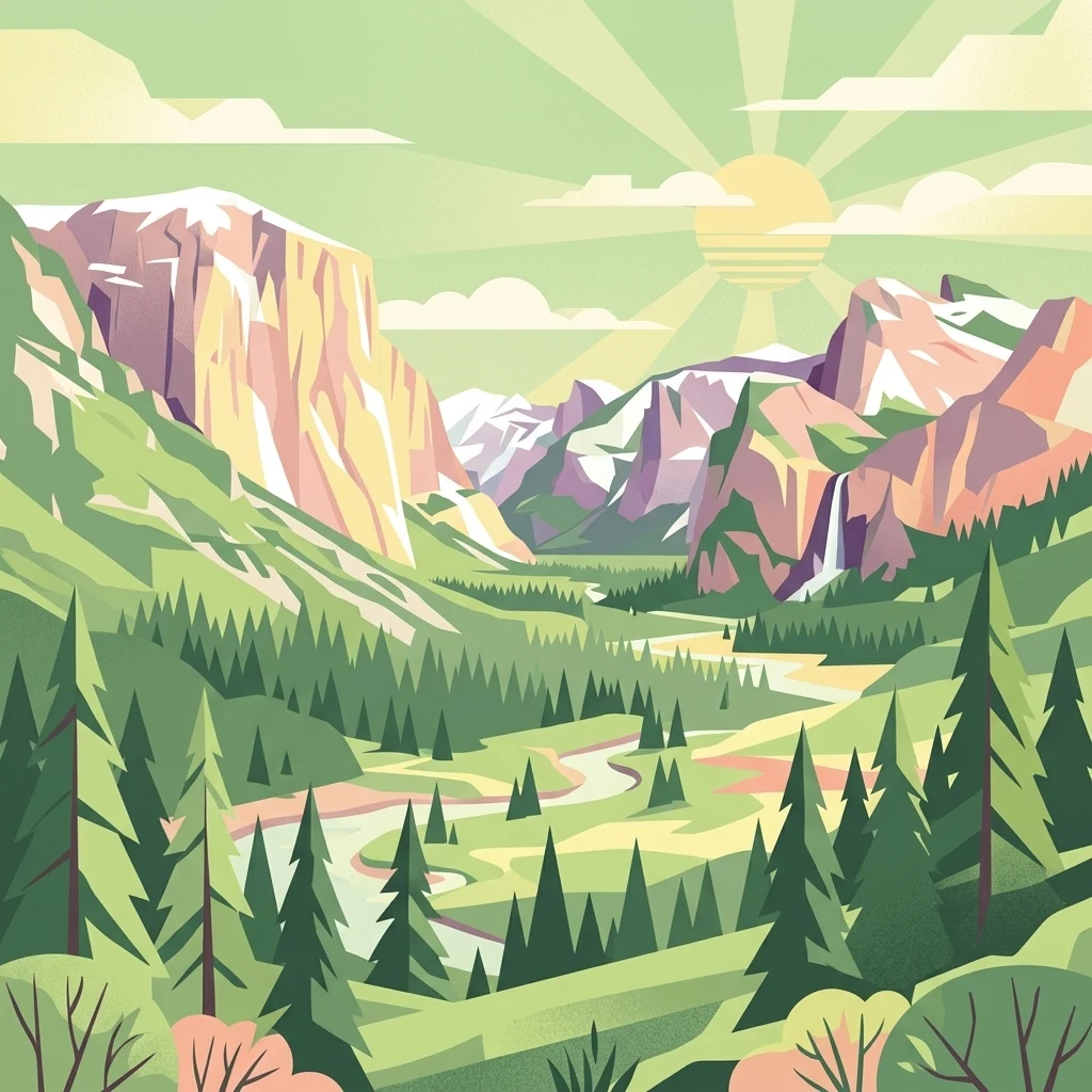
Stylized vector illustration showing a mountainous alpine landscape with a sunlit sky, a central winding river, coniferous forests, and distant peaks.

Ibergeregg

Nature reserve

Park overview

Structured park overview, official facts, and landscape profile for Ibergeregg

Ibergeregg park facts, protected area profile, and essential visitor context

Review the core facts for Ibergeregg, including designation, size, terrain, visitor scale, habitats, and operating context in one park-focused overview.

About Ibergeregg

Ibergeregg is a small but ecologically rich mountain pass in central Switzerland, forming a low, broad saddle in the pre-Alpine terrain of Canton Schwyz. The pass road climbs roughly 11 kilometers from Schwyz to the summit, then descends about 9 kilometers toward Oberiberg, with the highest point sitting at approximately 1,406 meters above sea level. This gentle profile makes Ibergeregg a year-round transport corridor as well as a starting point for hikes and excursions into the surrounding summits such as Furggelenstock (1,656 m) to the north and Firstspitz (1,624 m) to the south.

Ecologically, the high plateau around Ibergeregg is one of the most significant peatland landscapes in the region. Numerous raised bogs and flat moors occupy the relatively flat terrain near the pass, supporting specialized flora and fauna adapted to nutrient-poor, waterlogged conditions. The surrounding slopes are blanketed by moor forests, a protected woodland type that has become rare across central Europe. These habitats combined earned the area recognition as a cantonal nature reserve and, in 2019, as the Swiss Landscape of the Year.

The pass also functions as a hub for regional tourism. It provides road and bus access to the Mythenregion ski area near Brunni SZ and to the larger Hoch-Ybrig ski network. On the western side, the route connects to the cantonal capital Schwyz, where the A4 motorway provides access toward Zurich and Lucerne and the A2 connects southward toward the Gotthard. On the eastern side, the road continues through Unteriberg to Einsiedeln and the Sihlsee, anchoring Ibergeregg in a network of culturally and recreationally important alpine destinations.

Because of this mix of wetlands, moor forest, alpine panoramas, and transport heritage, Ibergeregg functions as both a working mountain pass and a protected natural landscape, offering visitors an accessible encounter with one of the more intact highland bog ecosystems in the Swiss pre-Alps.

Quick facts and research context for Ibergeregg

Ibergeregg is a year-round open mountain pass in Canton Schwyz, Switzerland, sitting at approximately 1,406 meters above sea level. It links Schwyz with Oberiberg and Unteriberg along a paved pass road that continues toward Einsiedeln and the Sihlsee. The area is a cantonal nature reserve protecting extensive raised bogs, flat moors, and moor forests, and was named Swiss Landscape of the Year in 2019.

Protection and recognition

Documented conservation parameters and official establishment timeline for Ibergeregg.

Ibergeregg Protection Status, Terrestrial Scope, and Designation History

Terrestrial protection status for Ibergeregg centers on its established designation year of 2019 within a local management framework. Documented recognition metrics outline the official conservation parameters associated with this protected area.

Protection details

Protection scope
Terrestrial
Designated year
2019
Transboundary protection
No
Park context

Deeper park guide and search-rich context for Ibergeregg

Ibergeregg history, landscape, wildlife, and travel context

Explore Ibergeregg through its history, landscape character, ecosystems, wildlife, conservation priorities, cultural context, and seasonal travel timing in a structured park guide built for atlas discovery and search intent.

Why Ibergeregg stands out

Ibergeregg is best known for its extensive system of raised bogs and moor forests on the high plateau, which form one of the most important peatland complexes in Canton Schwyz. The pass is also recognized as a scenic alpine crossing with broad views toward the Urner Alps and Lake Lucerne, and as the western gateway to the Mythenregion and Hoch-Ybrig winter sports areas. Its combination of protected wetland habitat, traditional alpine landscape, and easy accessibility from Schwyz and Einsiedeln gives the pass a distinctive identity that bridges conservation value with regional recreation.
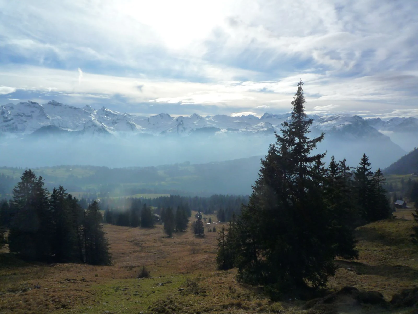
An alpine landscape with a grassy foreground and evergreen trees leading to distant snow-capped mountains shrouded in low-lying mist under a cloudy sky.
A scenic view of the Ibergeregg mountain pass in Switzerland, with mist rolling through the alpine landscape.

Ibergeregg history and protected-area timeline

Ibergeregg has been used as a mountain crossing since the late Middle Ages, when a pack trail known as the Schwyzerweg connected Iberg with Schwyz via the pass. Built in the 14th century as the shortest route between the two settlements, this trail formed the basis of the historical land connection between the Muota valley and the highlands east of Schwyz.

The first proper road across Ibergeregg was opened to traffic in 1873, marking the transition from a medieval mule path to a modern alpine pass road. A summer bus service between Schwyz and Oberiberg has operated across the pass since 1947, linking the communities on either side for residents and visitors alike. The small Marienkapelle, a chapel at the pass, was consecrated in 1961.

Skiing history also runs through the pass. The Clubhaus Eseltritt, the ski and clubhouse of the SAC Am Albis section, has stood about 1.5 kilometers below the pass summit toward Schwyz since 1933 and remains a traditional starting point for winter excursions in the area. More recently, in 2019, the moor forests of Ibergeregg were designated the Swiss Landscape of the Year, recognizing both their ecological value and their long-standing role in the cultural landscape of Canton Schwyz.

Ibergeregg landscape and geographic character

The landscape of Ibergeregg is shaped by its position as a high, relatively flat saddle in the pre-Alpine zone of central Switzerland. At about 1,406 meters above sea level, the pass sits in a gentle basin framed by two prominent peaks: the Furggelenstock at roughly 1,656 meters to the north and the Firstspitz at about 1,624 meters to the south. This wide plateau form gives the pass a distinctly different feel from the steep, narrow alpine passes further south.

From the summit, the views open dramatically. To the south, the higher Urner Alps fill the horizon, while to the west, Lake Lucerne frequently appears below a sea of fog that settles in the lower valleys, creating the striking layered landscapes the pass is known for. The surrounding slopes transition between open alpine pasture, closed coniferous forest, and the wet, open peatland surfaces of the bog zone.

Hydrologically, Ibergeregg sits on a watershed between two important drainage systems. East of the pass rise the headwaters of the Minster, a river that later feeds into the Sihl, while the western flanks drain into the Muota and the broader Muotatal. The flat terrain and water-retentive geology of the plateau have made it especially well suited to the formation of the bog and moor systems that define the area today.
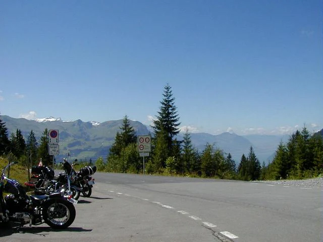
A group of motorcycles parked on the side of a paved road at a mountain pass, with evergreen trees and distant alpine peaks under a clear blue sky.
Motorcycles parked at the Ibergeregg mountain pass in Switzerland.

Ibergeregg ecosystems, habitats, and plant life

The defining ecological feature of Ibergeregg is its concentration of raised bogs and flat moors on the high plateau. These peatlands depend on consistently high groundwater and low nutrient availability, conditions the relatively flat, poorly drained basin around the pass provides unusually well. Together they form one of the more important peatland complexes in Canton Schwyz and are the reason the area is protected as a cantonal nature reserve.

Surrounding the open peat surfaces, the slopes and fringes of the wetlands support a distinctive mosaic of moor forests. These woodlands, shaped by waterlogged soils and adapted tree species, are considered rare across central Europe and are now a focal habitat for conservation in the region. The combination of open bog, transitional mire, and forested peat edge creates a layered ecosystem structure with strong habitat diversity.

Above the wetlands, the pre-Alpine vegetation transitions into coniferous forests and alpine pasture typical of the Schwyz highlands. The protected status of the bogs and moor forests means that land use in the core zones is limited, helping preserve both the hydrology of the peatlands and the species communities that depend on them. The 2019 designation as Swiss Landscape of the Year reflected both the ecological function and the cultural value of this long-standing, semi-natural highland landscape.

Ibergeregg wildlife and species highlights

The bog and moor forest habitats of Ibergeregg support wildlife communities adapted to cool, wet, nutrient-poor environments. Peatland bird species, moorland specialists, and forest fauna associated with the coniferous and wooded peat systems are characteristic of the area, while the surrounding alpine pastures and forests extend the range of habitat available for larger mammals typical of the Swiss pre-Alps.

Wetland-dependent invertebrates and plant species of conservation interest occupy the raised bogs and flat moors, and the mosaic of open peat, mire edge, and moor forest increases overall species diversity in a relatively compact area. Although the pass is not framed primarily in terms of iconic large mammals, its ecological value lies more in the integrity of its peatland and moor forest fauna and flora.

Because the area is protected and managed as a cantonal nature reserve, the wildlife dimension of Ibergeregg is best understood as part of its broader ecological and conservation identity, which is centered on preserving intact peatland processes and the species they sustain.

Ibergeregg conservation status and protection priorities

Ibergeregg is recognized as a cantonal nature reserve because of the ecological importance of its peatland and moor forest systems. The bogs and flat moors of the pass are among the more intact examples of this habitat type in Canton Schwyz, and they play a key role in preserving biodiversity, regulating local hydrology, and storing carbon in peat soils.

The conservation significance of the pass rose to national prominence in 2019, when its moor forests were named the Swiss Landscape of the Year. This recognition highlighted both the ecological value of the peatland and forest systems and their role within the traditionally managed cultural landscape of the Schwyz highlands. It reinforced the area's status as a priority site for the protection of peatland habitats in the pre-Alps.

At the practical level, the protected designation of the bogs and surrounding moorland constrains land use in the core zones, helping maintain the hydrological conditions that peatlands require. Combined with its role as a landscape of regional cultural and natural heritage, Ibergeregg stands as a working example of how a heavily used mountain pass can remain ecologically significant in a densely populated part of Switzerland.

Ibergeregg cultural meaning and human context

Ibergeregg sits within the traditional cultural landscape of Canton Schwyz, where alpine settlement, seasonal pasture use, and small mountain chapels have long shaped how highland passes are inhabited. The Marienkapelle at the pass, consecrated in 1961, continues this tradition of modest religious structures marking important alpine crossings.

The pass is also tied to local folklore through its association with the Ybriger Stein, a landscape feature linked to the legend of the Ybriger Riesen Hans Winz. According to tradition, the pass represents the ancestral location of this giant figure, which has given the area a layer of regional folkloric identity beyond its practical role as a transportation route.

The Clubhaus Eseltritt, run since 1933 by the SAC Am Albis section, anchors the pass in Swiss alpine club culture and reflects a long tradition of mountaineering and ski touring in the Schwyz highlands. Together these elements give Ibergeregg a cultural depth that complements its ecological and touristic significance.

Top sights and standout views in Ibergeregg

Ibergeregg's standout qualities include its extensive raised bog and flat moor complex, designated as a cantonal nature reserve and recognized nationally in 2019 as part of the Swiss Landscape of the Year. The pass also offers one of the more accessible gateways to the Mythenregion and Hoch-Ybrig ski areas, combined with year-round road and bus access from Schwyz and Einsiedeln.

Best time to visit Ibergeregg

Ibergeregg is a year-round destination because the pass road remains open in all seasons. Winter brings reliable snow cover and access to the surrounding ski areas, while late spring and early summer are particularly rewarding when the high bogs come alive and the views toward the Urner Alps are typically clearest. Late summer and early autumn offer stable weather and good conditions for exploring the moor forests and surrounding peaks on foot. Fog is more frequent in the lower valleys than on the pass itself, which often sits above a striking sea of fog, especially in autumn and winter.

Monthly climate preview

Track representative annual temperature swings and monthly precipitation patterns for Ibergeregg

Ibergeregg Climate Normals and Long Term Weather by Month

Representative coordinate measurements indicate long term temperature variations alongside consistent monthly precipitation across the terrain of Ibergeregg. Reviewing the complete twelve month profile provides deeper insight into historical climate normals without relying on short term forecasts.
Annual mean6 °C
-4 °C15 °C
Jan-4°
Feb-4°
Mar
Apr
May10°
Jun13°
Jul15°
Aug15°
Sep11°
Oct
Nov
Dec-3°
Warmest month
July

15.4 °C

Coolest month
January

-4.3 °C

Wettest month
June

5.8 mm/day

Driest month
February

2.9 mm/day

Park location guide

Geography guide, regional context, and park location map for Ibergeregg

Ibergeregg park geography, regions, and map view in Switzerland

Understand where Ibergeregg sits in Switzerland through a broader geographic reading of the surrounding landscape, nearby location context, and its mapped position within the national park landscape.

How Ibergeregg fits into Switzerland

Switzerland is a landlocked federal republic in Central Europe comprising 26 cantons, with Bern as the federal city and Zurich as the largest city. The country features the Swiss Alps, Swiss Plateau, and Jura Mountains, with German, French, Italian, and Romansh as official languages. It is noted for its political neutrality, direct democracy traditions, and strong economy.

Wider geography shaping Ibergeregg in Switzerland

Switzerland is located in Central Europe at the intersection of Western and Southern Europe. It is bordered by Germany to the north, France to the west, Austria and Liechtenstein to the east, and Italy to the south. The country is geographically divided among the Swiss Alps (covering most of the territory), the Swiss Plateau (where most of the population resides), and the Jura Mountains. Switzerland is landlocked.

Map view of Ibergeregg

Use this park location map to pinpoint Ibergeregg in Switzerland, understand its exact geographic position, and read its mapped placement within the surrounding landscape more clearly.

Pigeon | © OpenStreetMap contributors

Location context for Ibergeregg

Schwyz

Explore high plateau terrain, raised bogs, and pre-Alpine scenery across the protected nature reserve

Ibergeregg Photos and Landscape Imagery: Visualizing the Alpine Pass Environment

Visual documentation of Ibergeregg reveals the intricate topography of its high plateau, featuring rare raised bogs, flat moors, and expansive mountain vistas. Examining these protected-area photographs helps observers understand the unique pre-Alpine terrain and ecological character of the Swiss mountain pass.

An alpine landscape with a grassy foreground and evergreen trees leading to distant snow-capped mountains shrouded in low-lying mist under a cloudy sky.

A panoramic alpine landscape showing a layer of fog in the distant valley, surrounded by rolling green hills, coniferous trees, and traditional wooden farm structures in the foreground.

A group of motorcycles parked on the side of a paved road at a mountain pass, with evergreen trees and distant alpine peaks under a clear blue sky.

Park atlas

Compare adjacent pre-Alpine reserves, high plateau bogs, and regional mountain crossings

Parks Near Ibergeregg and Surrounding Protected Landscapes in Central Switzerland

Browse protected areas near Ibergeregg to compare pre-Alpine terrain, peatland habitats, and regional mountain reserves. Expanding the search reveals connected highland geography and broader conservation landscapes across central Switzerland.
A soft watercolor painting of undulating green hills, meadows, and a winding path against a white background.
Protected landscapeSwitzerland
About 19 km away#1 closest

Northwest

Glaziallandschaft Lorze, Sihl mit Höhronenkette und Schwantenau: Landscape and Terrain Atlas

A study of glacial formations and protected Swiss ecosystems.

Trace the moraine-dominated terrain and river gorges of this nationally recognized protected landscape. From the drumlin fields near Menzingen to the rare peatland habitats of the Schwantenau, this area offers a comprehensive look at the geological and hydrological history of the Swiss Pre-Alps.

Area
10.808 km²
Relief
Mountain
Climate
Alpine
Access
Moderate access
Protected landscapeZürich
About 25 km away#2 closest

Northwest

Wildnispark Zürich: Atlas and Geographic Overview of the Protected Landscape

Swiss nature reserve located in the Canton of Zürich

Wildnispark Zürich manages roughly twelve square kilometers of land, bridging the gap between urban density and wild forest environments. The site includes the Sihlwald, a large tract of mixed beech forest, and the Langenberg wildlife area. This atlas entry covers the park geography, its role within the Mittelland forest corridor, and the distribution of protected zones that support native European species.

Area
12 km²
Established
2009
Visitors
600K annual
Relief
Upland
A soft watercolor painting of a wetland landscape with rolling hills, grassy plains, and gentle water channels in muted green and pink tones.
Nature reserveSt. Gallen
About 28 km away#3 closest

Northeast

Kaltbrunner Riet Nature Reserve and Wetland Landscape in the Canton of St. Gallen

Mapping the protected fen habitats and agricultural wetland remnants of the Linthebene.

Kaltbrunner Riet serves as a primary nature reserve in the canton of St. Gallen, encompassing critical lowland fen and amphibian spawning habitats. As a protected Ramsar wetland, the reserve offers an essential window into the historic Linthebene landscape, showcasing how traditional meadow management sustains biodiversity across the Swiss plateau.

Area
0.5 km²
Established
1914
Relief
Lowland
Climate
Temperate
A soft watercolor painting of rolling hills and distant mountains in light green and muted tones.
Biosphere reserveLucerne
About 44 km away#4 closest

West

Entlebuch Biosphere Reserve: Mapped Protected Landscapes in the Canton of Lucerne

Exploring karst formations and alpine wetland ecosystems

Entlebuch stands as a pioneering example of community-driven conservation in the Swiss Alps. This protected landscape encompasses extensive peatlands, forested slopes, and the iconic Schrattenfluh karst massif. Use this geographic entry to understand the regional topography and the spatial distribution of protected habitats throughout this central Swiss valley.

Area
397 km²
Established
2001
Relief
Mountain
Climate
Alpine
A horizontal watercolor painting depicting a soft-focus mountain landscape with green rolling hills in the foreground and pale yellow mountain silhouettes in the distance.
Protected landscapeGraubünden
About 46 km away#5 closest

South

Greina, Piz Medel: Exploring the Geography of a Swiss Protected Landscape

High-alpine plateau, glacier forelands, and mountain peaks.

The Greina, Piz Medel protected area is defined by the contrast between its broad, level plateau and the surrounding ring of summits in the Adula Alps. This high-altitude region holds nationally important floodplains, diverse dry meadows, and active glacial basins that cross the European watershed, providing a profound study in alpine terrain and environmental conservation.

Area
150 km²
Established
1996
Relief
Mountain
Climate
Alpine
Regional parkGraubünden
About 48 km away#6 closest

Southeast

Naturpark Beverin: Exploring Alpine Gorges and Cultural Landscapes in Graubünden

A regional nature park shaped by high alpine ridges and ancient settlement traditions.

Naturpark Beverin encompasses a vast, multi-layered environment in the Swiss Alps. The area is defined by the sharp vertical contrast between carved river gorges like the Viamala and high-elevation ridges. Beyond the rugged mountain terrain, this protected landscape preserves centuries of pastoral history through the distinct settlement traditions of its Romanesque and Walser valleys.

Area
515 km²
Established
2013
Relief
Mountain
Climate
Alpine
A minimalist watercolor painting depicting a winding river through a flat alpine valley surrounded by gentle mountain ridges.
Nature reserveGraubünden
About 49 km away#7 closest

Southeast

Aue Plaun la Greina Nature Reserve: Geography and Mapped Landscape Context

A protected high-alpine floodplain in the Swiss canton of Graubünden.

Aue Plaun la Greina sits within a high plateau between three major Adula mountain massifs, defined by its braided river channels, glacial moraines, and sensitive alpine mire habitats. The reserve protects a unique ecosystem that survives in a harsh, tundra-like climate at the heart of the European watershed, representing a major achievement in regional landscape preservation and geological study.

Area
0.39 km²
Established
1992
IUCN
IV
Relief
Mountain
Watercolor painting of a green landscape with rolling hills, meadows, and a water body in the foreground against a light background.
Protected areaSwitzerland
About 54 km away#8 closest

Southwest

Rhonegletschervorfeld Protected Area: Alpine Glacier Geography and Mapping

Proglacial landscape and glacial history in the Swiss Alps.

The Rhonegletschervorfeld provides an unparalleled view into the geomorphology of the Swiss Alps, showcasing a continuous record of ice loss through moraines, exposed bedrock, and emerging meltwater systems. Situated near the Furka Pass, this protected area serves as an essential reference for glaciology, offering a clear visual timeline of glacier retreat that has shaped modern alpine tourism and climate science. Explore the mapped terrain where the Rhone River headwaters emerge from the retreating ice.

Area
13.58 km²
Relief
Mountain
Climate
Alpine
Access
Easy access

Common questions about visiting, size, designation, and location context for Ibergeregg

Ibergeregg FAQs for park facts, access, geography, and protected area context

Find quick answers about Ibergeregg, including protected-area facts, park geography, trail and visitor context, and how the park fits into its surrounding country and regional landscape.
MoriAtlas Explorer

Continue Your Protected Areas Search Across the Global Atlas

Deepen your exploration by continuing the structured search for national parks and protected areas worldwide. Utilize the comprehensive filtering capabilities to compare different conservation landscapes and refine your understanding of global park geography. Discover more about the distribution and characteristics of protected natural areas.

Global natural geography