

Mori Atlas logo
Protected areaInterview Island

A remote forested landscape featuring a unique feral elephant habitat and rugged coastal terrain

Interview Island Protected Area: Mapping the Geography of the Andaman Archipelago

Interview Island serves as a significant protected area within the Andaman and Nicobar Islands, defined by its elongated 101 square kilometer landmass and distinctive forested plateau. This geography stretches from low northern plains to a southern summit reaching 113 meters, surrounded by complex Bay of Bengal waters. The island offers a study in remote wilderness, notable for its semi-wild feral elephant population and minimal human presence.

Andaman Islandsferal elephantsremote islandforested plateauBay of BengalIndian islands

Interview Island

Protected area

Park overview

Structured park overview, official facts, and landscape profile for Interview Island

Interview Island park facts, protected area profile, and essential visitor context

Review the core facts for Interview Island, including designation, size, terrain, visitor scale, habitats, and operating context in one park-focused overview.

About Interview Island

Interview Island is one of the more remote inhabited islands of the Andaman archipelago, situated to the west of the Austen Strait between North Andaman Island and Middle Andaman Island. It belongs to the Interview Group, a cluster of islands within the broader Andaman chain that lies in the Bay of Bengal under the administration of India's union territory of Andaman and Nicobar Islands. The island's location, well to the north of the territorial capital Port Blair, contributes to its isolated and lightly developed character.

Geographically, Interview Island is a sizeable landmass of about 101 square kilometers, elongated in shape with a length of roughly 23 kilometers. Its northern end is low, gradually rising southward to a wooded plateau that reaches the island's highest elevation of around 113 meters. The southern tip features cliffs with a small rocky pinnacle just offshore, and the surrounding waters include foul ground stretching several kilometers to the north-northeast, adding to the challenges of coastal navigation in the area.

The island is most famous for an unusual ecological feature: a population of feral elephants. These elephants are believed to descend from animals brought to the island for timber and forestry operations. Although early references suggested a population in the range of 80 to 90 individuals, more realistic estimates place the actual number at roughly a dozen animals surviving in the forested interior. Their presence on a remote tropical island is rare and gives Interview Island a distinctive place among India's wild spaces.

Human presence on the island has always been minimal. There is typically only one very small village, and the 2011 census recorded just sixteen residents in a single household. The island was opened to tourists in 1997, but remains essentially abandoned as a settlement, with only a few forest wardens, police personnel, and coast guard staff posted there. A lighthouse on the west coast, historically maintained alongside a small wildlife monitoring station, was damaged by the 2004 Indian Ocean tsunami and later repaired, though the wildlife station itself was eventually evacuated in 2015 when its funding was discontinued.

Access to Interview Island requires a boat journey from Mayabunder, the nearest mainland settlement on North Andaman, across the Austen Strait. The trip takes several hours by dinghy, reinforcing the island's sense of remoteness. Despite its small population and limited infrastructure, the island retains ecological interest due to its forested plateau, coastal cliffs, and unusual resident elephant population.

Quick facts and research context for Interview Island

Interview Island is part of the Andaman Islands archipelago, located in the Bay of Bengal about 125 kilometers north of Port Blair. It covers roughly 101 square kilometers and rises to about 113 meters at its highest wooded plateau. Administratively it falls within the North and Middle Andaman district and the Mayabunder sub-district (taluk) of the Andaman and Nicobar union territory.

The island has a very small permanent population of around sixteen people, concentrated in a single settlement, and access is by dinghy across Austen Strait from Mayabunder. It is recognized for a population of feral elephants, reputedly numbering in the dozens though likely closer to about a dozen in practice, which originated from animals imported for forestry operations.

Park context

Deeper park guide and search-rich context for Interview Island

Interview Island history, landscape, wildlife, and travel context

Explore Interview Island through its history, landscape character, ecosystems, wildlife, conservation priorities, cultural context, and seasonal travel timing in a structured park guide built for atlas discovery and search intent.

Why Interview Island stands out

Interview Island is best known for its small population of feral elephants that roam the forested interior of a remote Andaman island. These elephants are believed to be descendants of animals brought to the island for forestry work, which were later abandoned or left to range freely when operations ceased. Beyond the elephants, the island is also recognized for its largely undisturbed wooded plateau and its relative isolation within the Andaman archipelago. The combination of low human population, limited access, and forested landscape gives Interview Island a distinctive profile compared to more populated or developed islands in the chain.

Interview Island history and protected-area timeline

Interview Island does not have a deeply documented colonial or settlement history in available sources, and its modern history is closely tied to forestry and wildlife monitoring rather than large-scale human habitation.

During the period when forestry operations were active in parts of the Andamans, elephants were brought to Interview Island to assist with timber work. After those operations wound down, the animals were reportedly left on the island, where they established a feral population that has since attracted attention from ecologists and naturalists.

In more recent decades, a lighthouse on the island's west coast served as a permanent human outpost, and until 2015 a small wildlife station operated there to monitor bird populations. Both had resident staff, including a lighthouse keeper drawn from the police. The lighthouse was severely damaged by the tsunami generated by the 2004 Indian Ocean earthquake, which inundated much of the island, but it was later repaired.

At the end of 2015, the wildlife monitoring station was evacuated after its budget was discontinued. Since then, the permanent human footprint on Interview Island has been limited to a few forest wardens, police personnel, and coast guard staff tasked largely with anti-poaching duties. The island was opened to tourists in 1997 but has not developed into a visitor hub, remaining one of the more abandoned yet ecologically distinctive islands in the Andaman chain.

Interview Island landscape and geographic character

Interview Island has an elongated shape stretching roughly 23 kilometers from north to south, with a maximum width of nearly 7 kilometers. It covers about 101 square kilometers of land surrounded by the waters of the Bay of Bengal.

The topography is uneven across the island's length. The northern end of Interview Island is low-lying, with terrain that gradually rises as one moves southward. The interior culminates in a wooded plateau reaching about 113 meters, the highest point on the island. This plateau gives the southern half of the island a more elevated and consistently forested character compared to the flatter north.

The coastline is varied, with the west coast historically hosting the lighthouse and any associated settlement. The southern end of the island terminates in cliffs, with a small rocky pinnacle roughly 7 meters high lying close offshore just beyond them. A zone of foul ground extends about 2 miles (3.2 kilometers) to the north-northeast of the island, creating navigational hazards for vessels approaching from that direction.

Interview Island ecosystems, habitats, and plant life

Interview Island's interior is dominated by forest that blankets much of the island and stretches up across the island's central plateau. This wooded cover, combined with low population pressure, gives the island an unusually intact landscape relative to more developed parts of the Andaman archipelago.

The transition from low northern terrain to a higher, forested southern plateau creates distinct vegetation zones within a relatively small area. Coastal habitats around the island include cliff environments at the southern tip and more sheltered fringes nearer the western settlements, while the inland plateau supports continuous tree cover that has historically provided habitat for both resident birds and large mammals.

The wildlife monitoring station maintained until the end of 2015 reflected the island's recognized value for birdlife and habitat observation. Even without an active monitoring station, the forested plateau and minimal disturbance continue to provide ecological conditions that support bird populations across the island.

Interview Island wildlife and species highlights

The defining wildlife feature of Interview Island is its population of feral elephants. These animals are believed to descend from elephants originally brought to the island to assist with forestry operations. Once those operations ended, the elephants were left to range freely, and they have since established a self-sustaining presence in the island's forests.

Estimates of their numbers have varied. Early references suggested a population of 80 to 90 individuals, though more grounded observations indicate that the actual population is likely much smaller, probably on the order of about a dozen animals. Regardless of the exact count, the existence of a feral elephant population on a remote tropical island is rare and gives the island unique ecological significance.

The island has also been associated with birdlife monitoring. A dedicated wildlife station operated on Interview Island specifically to observe birds until it was evacuated at the end of 2015 when funding ran out. While detailed species records are not described in available sources, the presence of full-time monitoring indicates that the island supports bird populations of recognized interest to wildlife authorities.

Interview Island conservation status and protection priorities

Interview Island's conservation significance lies primarily in the unusual persistence of its feral elephant population and the relatively undisturbed state of its forested landscape. The island's low human population, absence of large-scale settlement, and limited infrastructure have helped preserve a wooded environment that would be hard to maintain on more developed islands in the Andaman chain.

The presence of a forest warden contingent, supported by police and coast guard personnel, plays an anti-poaching role rather than active habitat management. Their work helps to discourage illegal hunting and disturbance of wildlife, including the elephants that range across the interior plateau.

Although the dedicated wildlife monitoring station closed at the end of 2015 due to budgetary reasons, the island continues to function as a low-impact refuge where the combinaison of remoteness, forest cover, and minimal human pressure supports a distinctive ecological profile. The feral elephants in particular highlight Interview Island as a place where a non-native but established mammal population continues to exist under semi-wild conditions within an Indian tropical setting.

Interview Island cultural meaning and human context

Interview Island has extremely limited contemporary cultural or human context. With only about sixteen residents recorded in the 2011 census, concentrated in a single small settlement on the eastern side of the island, there is no broad community or deep regional identity tied to the island in the way that exists on more populated Andaman neighbors.

The administrative context places Interview Island firmly within the Mayabunder taluk, connecting it culturally and administratively to the town of Mayabunder on nearby North Andaman Island. Travel between the two is by dinghy across Austen Strait, a journey of several hours that reinforces the closeness of Interview Island's small population to the mainland settlement hub while keeping the island itself culturally sparse.

There is little available documentation of indigenous Andamanese cultural presence specifically on Interview Island in modern sources, though the broader Andaman archipelago is well known for its indigenous heritage. The island's cultural footprint today is defined more by the presence of forest wardens, police, and coast guard staff than by any established local community.

Top sights and standout views in Interview Island

Interview Island's standout features include its population of feral elephants, descendants of forestry elephants now ranging freely across a forested interior plateau. The island also offers a notably intact wooded landscape, rising gradually from low northern terrain to a wooded southern summit of about 113 meters.

Its extreme remoteness, reachable only by a multi-hour dinghy crossing from Mayabunder, and its very small population give the island a near-abandoned character that contrasts with busier Andaman destinations. The combination of minimal settlement, anti-poaching presence, and unusual wildlife makes Interview Island one of the more distinctive and least disturbed islands in the Andaman chain.

Best time to visit Interview Island

As a remote, lightly visited island in the tropical Bay of Bengal, weather and sea conditions are the most important seasonal factors for any potential visit. The Andaman Islands generally experience a warmer, more humid climate from roughly March through September, with the heaviest monsoon conditions typically affecting the region between May and September when rough seas and rainfall can complicate boat travel.

The cooler, drier months from around November to February tend to offer calmer seas and more comfortable temperatures, which is usually favorable for the several-hour dinghy crossing from Mayabunder across Austen Strait. Because access is by small boat and the island lacks developed tourist infrastructure, smoother sea conditions during these months would generally support both safer travel and easier exploration of coastal and interior areas.

Wildlife observation, including potential sightings of the island's feral elephants in the forested plateau, is likely easier during drier periods when vegetation cover is less dense and animals may be more visible around water sources, though no detailed seasonal wildlife patterns are documented for the island in available sources.
Monthly climate preview

Long term temperature and monthly precipitation averages across the representative coordinate

Interview Island Climate Normals and Measured Annual Weather Patterns

Representative point records outline annual temperature averages ranging from 26.27 degrees Celsius to 29.10 degrees Celsius alongside distinct monthly precipitation variations from 0.36 to 12.36 millimeters per day. Examining the complete twelve month dataset provides deeper insight into measured baseline climate rhythms for Interview Island.
Annual mean28 °C
26 °C29 °C
Jan26°
Feb26°
Mar27°
Apr29°
May29°
Jun29°
Jul28°
Aug28°
Sep28°
Oct28°
Nov28°
Dec27°
Warmest month
May

29.1 °C

Coolest month
January

26.3 °C

Wettest month
June

12.4 mm/day

Driest month
February

0.4 mm/day

Park location guide

Geography guide, regional context, and park location map for Interview Island

Interview Island park geography, regions, and map view in India

Understand where Interview Island sits in India through a broader geographic reading of the surrounding landscape, nearby location context, and its mapped position within the national park landscape.

How Interview Island fits into India

India is a South Asian country bordered by the Indian Ocean, Arabian Sea, and Bay of Bengal. It shares land borders with Pakistan, China, Nepal, Bhutan, Bangladesh, and Myanmar. The country has a population of over 1.4 billion people and operates as a federal parliamentary republic with its capital in New Delhi.

Wider geography shaping Interview Island in India

India occupies the Indian subcontinent in South Asia, bordered by the Arabian Sea to the southwest, the Bay of Bengal to the southeast, and the Indian Ocean to the south. It shares land borders with Pakistan to the west, China, Nepal, and Bhutan to the north, and Bangladesh and Myanmar to the east. The territory also includes the Andaman and Nicobar Islands in the Indian Ocean.

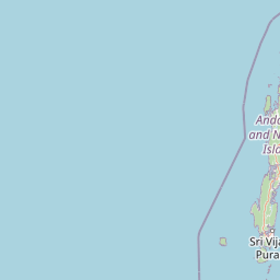
Map view of Interview Island

Use this park location map to pinpoint Interview Island in India, understand its exact geographic position, and read its mapped placement within the surrounding landscape more clearly.

Pigeon | © OpenStreetMap contributors

Location context for Interview Island

Andaman and Nicobar Islands
Park atlas

Compare adjacent island reserves and regional protected areas in the Andaman chain

Exploring Parks Near Interview Island and Surrounding Protected Landscapes

Continue geographic comparison by browsing other protected areas and tropical island reserves located near Interview Island. Regional park data helps trace connected island ecosystems and coastal conservation landscapes across the surrounding sea.
Wildlife reserveAndaman and Nicobar Islands
About 32 km away#1 closest

Northeast

Bamboo Island Wildlife Sanctuary: Mapping Coastal Protected Landscapes in the Andaman Archipelago

Coastal habitat, coral reefs, and littoral forest geography

Bamboo Island Wildlife Sanctuary represents a crucial protected area within the Andaman and Nicobar Islands, focusing on the interface between unique littoral bamboo thickets and surrounding marine reef environments. This reserve highlights the role of small island geography in conserving coastal stability and sensitive marine habitats within the Indian Bay of Bengal territory.

Area
0.05 km²
Established
1987
IUCN
IV
Relief
Lowland
Wildlife reserveAndaman and Nicobar Islands
About 35 km away#2 closest

Southeast

Cuthbert Bay Wildlife Sanctuary: Coastal Habitat and Sea Turtle Nesting Ground

Eastern Middle Andaman protected coastal geography

Cuthbert Bay Wildlife Sanctuary covers 5.8 square kilometres of critical coastal terrain along the eastern Middle Andaman coastline. Renowned for its concentration of sea turtle nesting beaches, the reserve supports diverse coastal ecosystems ranging from open sand to inland forest patches. It serves as a compact but vital ecological anchor within the broader landscape of the Andaman and Nicobar Islands.

Area
5.8 km²
Established
1997
IUCN
IV
Scope
Terrestrial
Wildlife reserveAndaman and Nicobar Islands
About 38 km away#3 closest

South

Flat Island Wildlife Sanctuary: Protected Island Geography in the Andaman and Nicobar Islands

Coastal wildlife reserve and isolated island terrain

Flat Island Wildlife Sanctuary stands as a distinct, low lying protected area within the Andaman and Nicobar Islands. Its compact oval shape and shoreline focused landscape provide a clear example of the archipelago's small scale, uninhabited marine reserves. This protected island serves as a vital geographic marker for those mapping the diverse coastal habitats found across the Bay of Bengal.

Area
2.48 km²
Relief
Lowland
Climate
Tropical
Access
Remote access
National parkIndia
About 43 km away#4 closest

Northeast

Saddle Peak National Park: Mapped Boundaries and National Park Geography

Explore India's protected landscapes and regional terrain.

Saddle Peak National Park stands as a distinct national park within India, offering rich opportunities for geographic exploration. Examine its mapped boundaries and understand its specific landscape characteristics. This entry serves as a vital point for comprehending the park's protected status and its contribution to the atlas of India's natural terrain.

Area
32.54 km²
Established
1979
IUCN
II
Relief
Mountain
Wildlife reserveAndaman and Nicobar Islands
About 69 km away#5 closest

Northeast

Kwangtung Island Wildlife Sanctuary: Protected Forest and Shoreline Atlas

Geography and island habitat analysis in North Andaman.

Kwangtung Island Wildlife Sanctuary preserves a representative tropical island forest and coastal ecosystem in the North Andaman Islands. This wildlife reserve offers insight into the region's distinctive island-based conservation, featuring a dense mosaic of vegetation and marine-influenced margins that support a range of native Andaman fauna.

Area
0.57 km²
Established
1987
IUCN
IV
Relief
Lowland
National parkAndaman and Nicobar Islands
About 74 km away#6 closest

Southeast

North Button Island National Park: Protected Landscape and Mapped Geographic Identity

Explore the mapped boundaries and regional natural terrain.

Gain a clear understanding of North Button Island National Park as a distinct protected landscape within the Andaman and Nicobar Islands region. This entry offers detailed geographic context, focusing on the park's mapped boundaries and its role within the archipelago's natural terrain. It serves as a foundational element for understanding this Indian National Park's place in a broader atlas of conservation areas.

Area
114 km²
Established
1979
National parkAndaman and Nicobar
About 76 km away#7 closest

Southeast

Middle Button Island National Park: National Park within Andaman and Nicobar's Geography

Explore protected landscape context and mapped park boundaries.

Middle Button Island National Park represents a significant protected natural landscape, offering users a focused entry point for geographic discovery. As a designated national park, it contributes distinct mapped boundaries and terrain characteristics to the Andaman and Nicobar region's atlas data. Understanding its specific identity helps contextualize the broader protected-area network and regional geography. This page details the park's role as a conserved territory, vital for those seeking structured landscape and geography information.

Area
64 km²
Established
1979
Relief
Lowland
Climate
Tropical
National parkAndaman and Nicobar Islands
About 80 km away#8 closest

Southeast

South Button Island National Park: Mapped Boundaries and Regional Protected Landscape

Key National Park in the Andaman and Nicobar Islands

South Button Island National Park is a protected natural area offering critical insight into the geography of the Andaman and Nicobar Islands. This detailed view focuses on its mapped boundaries and its significance as a national park within this Indian archipelago. Understanding its position within the regional geography provides essential context for exploring protected lands and natural landscapes across the Andaman and Nicobar Islands.

Area
5 km²
Relief
Lowland
Climate
Tropical
Access
Moderate access

Common questions about visiting, size, designation, and location context for Interview Island

Interview Island FAQs for park facts, access, geography, and protected area context

Find quick answers about Interview Island, including protected-area facts, park geography, trail and visitor context, and how the park fits into its surrounding country and regional landscape.
MoriAtlas Explorer

Continue Your Protected Areas Search Across the Global Atlas

Deepen your exploration by continuing the structured search for national parks and protected areas worldwide. Utilize the comprehensive filtering capabilities to compare different conservation landscapes and refine your understanding of global park geography. Discover more about the distribution and characteristics of protected natural areas.

Global natural geography