
Rivers
Park geography
Analyzing the physical terrain, mountain landscape features, and regional boundaries
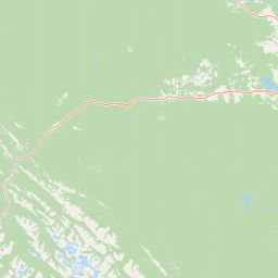
Structured Geographic Profile and Mapped Boundaries of Jasper National Park in Alberta
Jasper National Park in Alberta spans a recorded land area of 10878 square kilometers. This detailed geography profile documents the mountain relief, including major rivers, streams, and lakes within the protected territory. Explore the environmental characteristics, including boreal forests, alpine meadows, and glacier-fed waters defined by the park boundary.
Related tags
UNESCO World Heritage SiteGlaciersIcefieldsMountain ParksDark-Sky Preserve
Canada's largest Rocky Mountain park with glaciers, lakes, and dark-sky preserve status
Jasper National Park
Jasper National Park is the largest national park within Alberta's Rocky Mountains, spanning approximately 10,878 square kilometers of pristine wilderness in western Canada. Established as Jasper Forest Park in 1907 and redesignated as a national park in 1930, this vast protected area encompasses dramatic mountain landscapes, extensive glacial systems, deep river valleys, and diverse ecosystems that support abundant wildlife. The park forms part of the UNESCO World Heritage Site known as the Canadian Rocky Mountain Parks, recognized in 1984 for their outstanding universal value including rugged mountain peaks, ice fields, glaciers, alpine meadows, waterfalls, and karst cave systems. Jasper serves as the headwaters for major river systems including the Athabasca River, which flows into the Mackenzie River basin, and features the Columbia Icefield, one of the most accessible glacial systems in North America.
- Location
- Canada
- Park type
- National park
- Established
- 1907
- Area
- 10,878 km²
Location overview
Understanding the administrative alignment within Alberta, Canada
Geographic Setting and Regional Context of Jasper National Park
Jasper National Park is situated within the province of Alberta in western Canada. The interior land mass sits entirely within a single national territory as an inland protected area.
- Countries
- Canada
- Regions
- Alberta
- Primary location
- Alberta
- Geographic setting
- Inland
Boundary and coordinates
Geographic dimensions and coordinate limits covering 10,878 square kilometers.
Jasper National Park Boundary Map and Geographic Limits
Interactive boundary mapping provides clear spatial context for the protected area. Accompanying geographic statistics offer detailed insights on the total land area, geographic center, and coordinate span.
- Boundary area
- 11,240.8 km²
- Boundary perimeter
- 838 km
- Northernmost point
- 53.4812° N
- Southernmost point
- 52.127° N
- Easternmost point
- 116.7957° W
- Westernmost point
- 119.5448° W
- Geographic centre
- 52.8513° N, 117.9836° W
- North–south span
- 150.7 km
- East–west span
- 185.4 km
Terrain and natural features
Explore recorded glaciers, peaks, waterfalls, and lakes within the protected landscape
Jasper National Park Mountain Terrain and Natural Features
Stored mountain classifications define the protected terrain encompassing glaciers, peaks, waterfalls, and lakes. Linked feature cards supply names, types, measurements, and spatial relationships.
Selected named natural features
Peaks
Rebakah Peak
3,210 m
Streams
Excelsior Creek
Streams
Alpland Creek
Peaks
Mount Dromore
2,660 m
Ridges
Bedson Ridge
Environmental setting
Boreal climate zones, mountain relief, and forest cover classifications
Jasper National Park Environmental Classifications and Physical Settings
Recorded landscape features, habitat types, and relief categories offer complementary frameworks for reading physical settings across Jasper National Park. Stored classifications connect directly to broader atlas destinations sharing similar environmental profiles.
- Relief
- Mountain
- Climate
- Boreal
- Water
- Major water bodies
- Forest cover
- Mostly forested
- Seasonality
- Year-round
Landscape features
Mountains · Valleys · Glacier · Rivers · Lakes · Waterfalls · Cliffs · Karst · Cave
Habitat types
Boreal forest · Montane forest · Alpine meadow · Riverine habitat · Wetland
Park atlas
Trace the rugged mountain landscapes and conservation zones surrounding Jasper National Park within the broader Canadian Rockies.
Explore More National Parks and Protected Landscapes Near Jasper National Park
After exploring the glacial systems and alpine terrain of Jasper National Park, expand your discovery to include other significant protected areas. Trace the interconnected network of national parks and conservation landscapes within the Canadian Rockies, understanding their distinct geographical features and conservation value.
National parkCanada
Park boundaries overlap#1 closest
Southeast

Banff National Park: Exploring Canada's Iconic National Park Protected Landscape and Geography
Mapped park boundaries and regional geographic context for Banff National Park.
Gain a structured understanding of Banff National Park as a key protected area within Canada. This resource details its identity as a national park, providing insights into its geographic setting and mapped landscape. It serves as a vital point for atlas-based discovery, helping to contextualize Banff National Park's significance within Canada's protected lands and natural terrain.
- Area
- 6,641 km²
- Established
- 1885
- IUCN
- II
- Visitors
- 4.1M annual
State or regional parkBritish Columbia
About 62 km away#2 closest
Southwest
Pyramid Creek Falls Provincial Park: Mapped Geography and Protected Natural Landscape
Glacial cascades and North Thompson River valley terrain
This protected area centers on a vertical, two-stage waterfall spilling from a hanging valley high above the North Thompson River. Characterized by its glacier-fed creek and steep forested slopes, the park functions as a key geological landmark within the rugged, mountainous interior of British Columbia.
National parkBritish Columbia
70 km away#3 closest
Southeast
Yoho National Park: Mapped Protected Area in British Columbia's Geography
Exploring the park's protected boundaries and terrain.
Yoho National Park is presented here as a distinct national park within British Columbia's vast geographic framework. This page provides a structured view of its protected land status, allowing for detailed exploration of its mapped boundaries and surrounding natural landscapes. Understand Yoho National Park's place in the Canadian atlas through its specific geographic features and protected area context.
- Area
- 1,313 km²
- Established
- 1886
- IUCN
- II
- Visitors
- 663.9K annual
National parkColumbia-Shuswap Regional District
74 km away#4 closest
South
Glacier National Park: A National Park within Canada's Protected Landscape Atlas
Explore its mapped boundaries and regional geography.
Glacier National Park represents a significant protected area entity within the broader Canadian geography. This page offers an atlas-oriented perspective on its identity as a national park, focusing on its mapped geographic spread and role as a conservation landscape. Users can explore the park's place within the Columbia-Shuswap Regional District and understand its distinct contribution to the national protected area framework.
- Area
- 1,349 km²
- Established
- 1886
- IUCN
- II
- Visitors
- 4M annual
National parkBritish Columbia
108 km away#5 closest
South
Mount Revelstoke National Park: Explore Protected Landscape Geography and Mapped Boundaries
British Columbia's National Park Atlas Entry
Delve into the protected landscape of Mount Revelstoke National Park, a critical national park located in British Columbia. This entry provides a detailed look at its mapped geographic extent and protected area identity, offering valuable context for regional atlas exploration. Understand the park's distinct contribution to the mapped natural landscapes of Canada.
- Area
- 260 km²
- Established
- 1914
- IUCN
- II
- Visitors
- 775.2K annual
National parkBritish Columbia
113 km away#6 closest
Southeast
Kootenay National Park: National Park Protected Landscape and Geographic Context
Explore Kootenay National Park's mapped terrain and regional geography.
Kootenay National Park is a protected national park located in British Columbia, Canada. This dedicated detail page provides an atlas-style exploration of its geographic identity, focusing on its mapped boundaries and the surrounding natural terrain. Understand how Kootenay National Park fits into the larger regional geography, offering rich context for protected landscape discovery and analysis.
- Area
- 1,406 km²
- Established
- 1920
- IUCN
- II
- Visitors
- 574.1K annual
State or regional parkBritish Columbia
About 186 km away#7 closest
South
Mara Provincial Park: Protected Shoreline and Geographic Features in British Columbia
Mapping the Shuswap region's essential day-use lakeshore environment
Situated on the southern edge of Mara Lake, Mara Provincial Park functions as a key protected site in the Shuswap region of British Columbia. This area provides public access to sandy beaches and serves as the primary boat launch for the surrounding interior lake system, preserving natural terrain against private lakeshore development.
- Area
- 0.05 km²
- Established
- 1958
- IUCN
- II
- Relief
- Lowland
Wildlife reserveAlberta
191 km away#8 closest
North
Saskatoon Lake Migratory Bird Sanctuary: Protected Wetland Landscape in Alberta
Geographic overview of sanctuary boundaries and habitat zones
Examine the territorial footprint and environmental setting of Saskatoon Lake Migratory Bird Sanctuary. This site highlights the intersection of shallow aquatic basins and boreal parkland vegetation, providing a deep look into protected areas within the Grande Prairie region of Alberta.
- Area
- 11.5 km²
- Established
- 1948
- IUCN
- III
MoriAtlas Explorer
Continue Exploring Jasper National Park's Mapped Geography and Protected Boundaries
Delve deeper into the geographic identity of Jasper National Park by examining its mapped boundaries and regional context within Alberta. Understanding the park's precise location and protected landscape features offers valuable insight for atlas-based discovery. Continue your exploration to grasp the full scope of this significant Canadian national park and its place in the natural world.
Browse next
Global natural geography
Explore related park routes
Explore MoriAtlas Global ParksBrowse All MoriAtlas ParksGlobal Park Map DiscoveryMoriAtlas: Browse All CountriesBrowse All MoriAtlas ContinentsNational Park Environment AtlasGrand Canyon National Park AtlasYellowstone National Park AtlasYosemite National Park Atlas and GeographySerengeti National Park AtlasGalápagos National Park Protected LandscapeBanff National Park Geography and AtlasKruger National Park Atlas EntryUluṟu-Kata Tjuṯa National Park AtlasExplore Uluru-Kata Tjuta National Park GeographyPlitvice Lakes National Park AtlasFiordland National Park Protected LandscapeGreat Smoky Mountains National Park AtlasAfghanistan National Parks and Protected AreasAlbania National Parks and Protected AreasAlgeria National Parks and Protected AreasAmerican Samoa National Parks and Protected AreasAndorra National Parks and Protected AreasAngola National Parks and Protected AreasAntarctica National Parks and Protected AreasAntigua and Barbuda Park List