

Mori Atlas logo
Nature reserveJezioro Obradowskie Nature Reserve

A rare lowland peatland complex defined by dark dystrophic waters and undisturbed forest transitions.

Jezioro Obradowskie Nature Reserve: Mapped Protected Landscapes and Bog Ecosystems in Lubelskie Voivodeship

Jezioro Obradowskie Nature Reserve represents a critical protected wetland system situated within the Lasy Parczewskie forest complex in Lubelskie Voivodeship. This site acts as a key reference for bog geography, featuring a rare dystrophic lake surrounded by active peat-forming vegetation, mires, and diverse forest stands. Recognized within the West Polesie International Biosphere Reserve, the area supports a dense concentration of legally protected plant species and serves as an essential habitat for regional conservation mapping.

peatlanddystrophic lakebogmireSphagnumprotected forest
A flat vector illustration showing a calm lake in the foreground, with a waterfall cascading down cliffs in the background under a bright sun.

Jezioro Obradowskie Nature Reserve

Nature reserve

Park overview

Structured park overview, official facts, and landscape profile for Jezioro Obradowskie Nature Reserve

Jezioro Obradowskie Nature Reserve park facts, protected area profile, and essential visitor context

Review the core facts for Jezioro Obradowskie Nature Reserve, including designation, size, terrain, visitor scale, habitats, and operating context in one park-focused overview.

About Jezioro Obradowskie Nature Reserve

Jezioro Obradowskie Nature Reserve is one of the small but ecologically dense protected areas of the Lublin region in eastern Poland. Set within the broader Lasy Parczewskie forest landscape, it preserves a complete peatland unit: a dystrophic lake at its center, surrounded by a mosaic of bog, marsh, and forest communities that have developed over long periods with minimal disturbance.

The reserve's primary value is ecological rather than scenic. The dystrophic lake is the type of habitat usually only found in regions with intact peat-forming processes, where organic matter accumulates in cool, acidic, nutrient-poor conditions and produces the dark, tea-colored waters characteristic of such lakes. Around it, the vegetation has organized itself naturally into the typical zonation of bog systems, with floating and rooted aquatic mats, sedge and Sphagnum mires, transitional bog woodland, and on drier ground, mixed forest stands dominated by species suited to acidic, peaty soils.

Declared in 1975, the reserve has been under active conservation management, recognizing that some of its most sensitive communities need ongoing intervention to prevent degradation. Its inclusion in international frameworks, notably the West Polesie International Biosphere Reserve and two Natura 2000 sites, marks it as a site of significance not only at the Polish national level but also in the wider European network of protected habitats.

Quick facts and research context for Jezioro Obradowskie Nature Reserve

Jezioro Obradowskie Nature Reserve is a peatland-type nature reserve in eastern Poland, in the Lublin Voivodeship, within the Lasy Parczewskie forest area managed by the Parczew Forest District. It was established by ministerial order in March 1975, with its primary purpose being the protection of a dystrophic lake and its associated bog and forest communities.

The reserve covers a compact area of roughly 82 hectares, of which about 34 hectares are forested. It is classified as a biocoenotic and physio-coenotic reserve focused on natural and semi-natural communities, and it is managed under active conservation rules. It also falls within international protection frameworks, including the West Polesie International Biosphere Reserve and two Natura 2000 areas.

Protection and recognition

Examine terrestrial protection scope and documented designation frameworks

Jezioro Obradowskie Nature Reserve Protection Status and Governance Data

Jezioro Obradowskie Nature Reserve maintains a documented terrestrial protection scope within the regional conservation framework. Official records compile available designation history and management parameters for detailed environmental analysis.

Protection details

Protection scope
Terrestrial
Transboundary protection
No
Park context

Deeper park guide and search-rich context for Jezioro Obradowskie Nature Reserve

Jezioro Obradowskie Nature Reserve history, landscape, wildlife, and travel context

Explore Jezioro Obradowskie Nature Reserve through its history, landscape character, ecosystems, wildlife, conservation priorities, cultural context, and seasonal travel timing in a structured park guide built for atlas discovery and search intent.

Why Jezioro Obradowskie Nature Reserve stands out

The reserve is best known for its dystrophic lake, a deep, acidic, dark-water body of the kind sometimes called a 'black lake,' surrounded by actively forming peatlands and old forest stands. Such combinations of dystrophic water, raised bog vegetation, and natural woodland are rare in lowland Poland and form the core identity of this protected area. It is also recognized for its remarkably rich population of legally protected plant species. The list of protected flora includes bog specialists such as sundews, dwarf birch, Lapland willow, and several rare orchids, as well as clubmosses and other moisture-loving species typically associated with intact peatland systems.
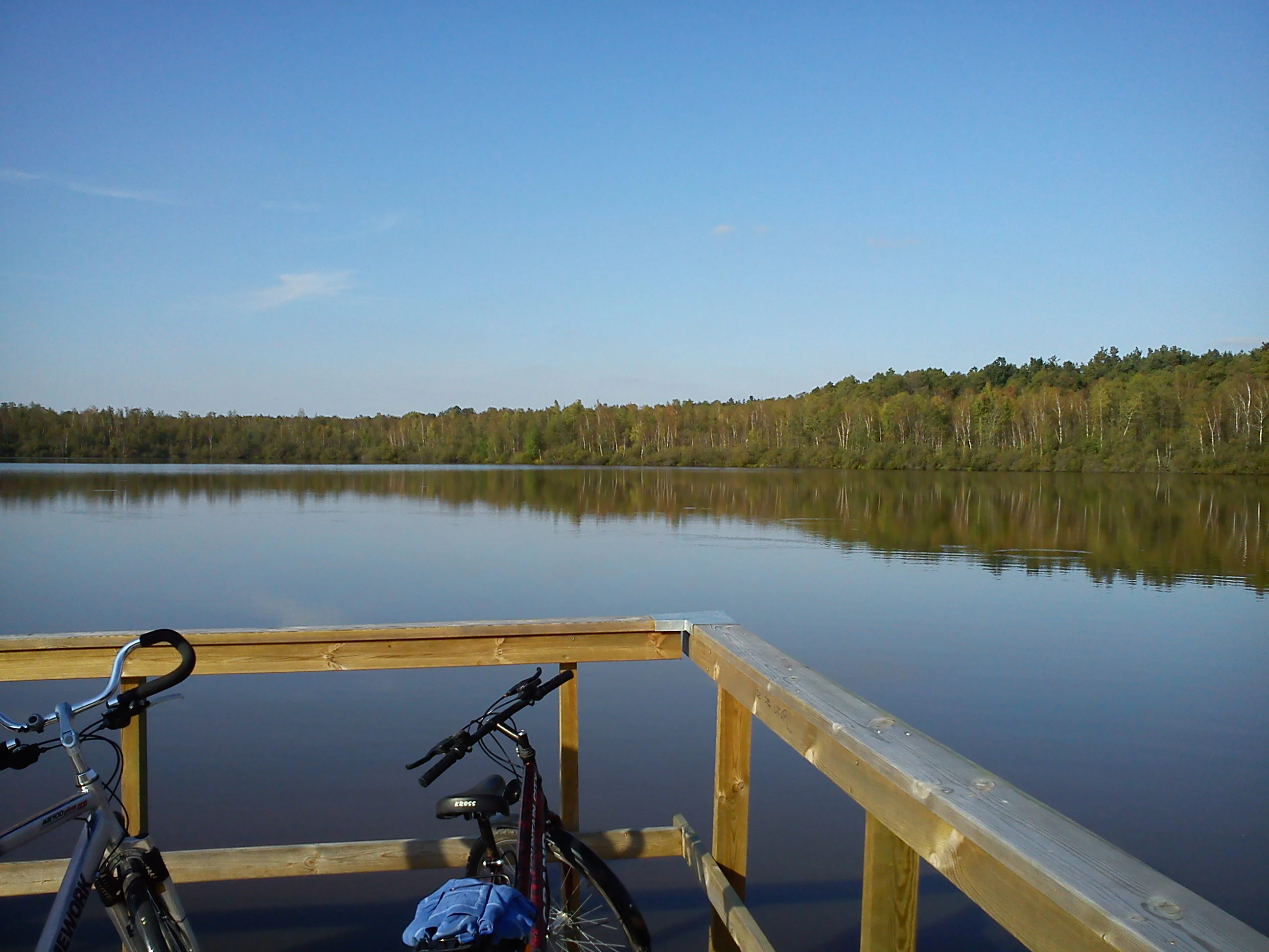
A wooden observation deck railing in the foreground with two parked bicycles, overlooking a still, dark lake surrounded by a dense forest under a clear blue sky.
A view from the observation deck overlooking the water in Jezioro Obradowskie Nature Reserve.

Jezioro Obradowskie Nature Reserve history and protected-area timeline

The reserve was established by the Minister of Forestry and the Wood Industry in March 1975, under legal notice published in the Polish official gazette. From the beginning, its purpose was clearly defined: to safeguard the dystrophic lake and the natural peatland and forest communities along with their rare floral components.

Throughout the decades since its designation, the reserve has remained under the administration of the Parczew Forest District and has continued without a formal protection plan, operating instead under defined active conservation tasks. Its legal status expanded when it was recognized as part of the West Polesie International Biosphere Reserve, and more recently when Polish and European networks incorporated it into overlapping Natura 2000 sites.

The reserve's history reflects a gradual broadening of its protection context: from a national-level designation focused on local biodiversity and the specific lake system, toward an integrated role within international biosphere and European ecological networks.

Jezioro Obradowskie Nature Reserve landscape and geographic character

The landscape of Jezioro Obradowskie is shaped by its defining feature: a dystrophic lake that sits within a shallow depression fed by peat-influenced waters. The lake is not a wide, open expanse but rather a dark, still body whose color and chemistry reflect the surrounding bog vegetation and accumulated organic matter.

Around the lake, the terrain rises only gently through a narrow belt of mire and bog forest, before transitioning into the broader Lasy Parczewskie stands. The whole reserve occupies part of the Zaklęsłość Sosnowicka mesoregion, a lowland area characterized by subtle glacial and post-glacial relief, kettle-like depressions, and conditions favorable for peat formation. The result is a quiet, low-elevation landscape where the visual drama comes not from altitude or relief but from the striking contrast between the dark lake surface, the pale green and russet tones of bog vegetation, and the shaded forest canopy.

Jezioro Obradowskie Nature Reserve ecosystems, habitats, and plant life

Ecologically, the reserve is shaped by the interplay between an acidic, nutrient-poor lake and the peatland systems that have developed around it. The core habitat is a dystrophic lake ecosystem, surrounded by actively accumulating peat substrates and supporting plant communities typical of such conditions. These include open Sphagnum-dominated mires, sedge and cottongrass communities, and transitional zones where bog vegetation grades into bog woodland and eventually into mixed forest on firmer ground.

The vegetation reflects the classic ecological zonation of lowland peatlands. In the wettest parts, floating mats and submerged species dominate. As the peat becomes more stable, scattered shrubs such as dwarf birch and Lapland willow appear, along with sundews and other insectivorous plants. Toward the forest edge, the vegetation shifts into mossy, acidic-soil woodland communities that complete the peatland-to-forest gradient within a short distance.

Jezioro Obradowskie Nature Reserve wildlife and species highlights

The reserve is primarily valued for its botanical richness rather than its large mammal fauna, and most of the formally documented wildlife interest centers on specialized plant species. Among the protected flora recorded here are several sundews, including round-leaved sundew and intermediate sundew, as well as Lapland willow, dwarf birch, and a notable set of orchids adapted to bog and moist woodland conditions.

The presence of clubmosses and other moisture-dependent species indicates the persistence of suitable microhabitats, including shaded mossy banks, bog edges, and forest clearings where soil moisture remains high. Although the source material does not detail the avian or invertebrate fauna, the reserve's overlap with a designated Natura 2000 bird protection area suggests that the broader mosaic of forest, bog, and open water provides important habitat for wetland and woodland bird species typical of eastern Poland.

Jezioro Obradowskie Nature Reserve conservation status and protection priorities

Conservation significance at Jezioro Obradowskie rests on the integrity of its peatland-forming processes and the survival of rare bog-dependent flora. The reserve protects a complete lowland peatland system, from its acidic lake through its surrounding mires to the adjacent forest edge, making it a reference site for dystrophic lake and bog conservation in eastern Poland.

Its designation in 1975 marked it as a priority area for preserving natural bog communities that have become increasingly rare across Europe. Modern protection layers reinforce this role: the reserve lies within the West Polesie International Biosphere Reserve and is included in two Natura 2000 sites, one designated for habitats and one for birds. These overlapping frameworks mean that management must consider both Polish and European conservation priorities.

Active conservation measures apply to the area even though there is no formal protection plan, reflecting the recognition that without ongoing management, key bog communities could degrade through natural succession, drainage, or vegetation change.

Top sights and standout views in Jezioro Obradowskie Nature Reserve

Jezioro Obradowskie Nature Reserve stands out for its compact but complete representation of a lowland peatland system centered on a dystrophic lake, a habitat type that has become increasingly scarce in central Europe. Within a small area, visitors and researchers can move from open water through active Sphagnum mires into bog woodland and finally into mixed forest, observing the ecological transitions typical of an undisturbed peatland complex.

The reserve's legal and international status also gives it particular weight: it is part of the West Polesie International Biosphere Reserve and overlaps with two Natura 2000 areas, placing it within both national and European conservation networks. Its long list of legally protected plant species, including sundews, orchids, dwarf birch, and Lapland willow, makes it a notable reference site for bog botany in the region.

Best time to visit Jezioro Obradowskie Nature Reserve

Visits to bog reserves such as Jezioro Obradowskie are most rewarding in late spring and summer, when the surrounding vegetation is in active growth and flowering periods for many of the protected species, including orchids and sundews, are most visible. At this time the contrast between the dark lake water and the bright greens of the bog and forest vegetation is also at its most pronounced.

Autumn brings quieter conditions, cooler temperatures, and richer coloration in the bog vegetation and surrounding Lasy Parczewskie forest, while winter can highlight the still, dark surface of the dystrophic lake and the snow-covered bog terrain. Because the area centers on peatland habitats, visitors generally use the dedicated educational boardwalk, which keeps impact low year-round and offers safe access regardless of season.
Monthly climate preview

Long-term representative monthly temperature and precipitation data patterns

Jezioro Obradowskie Nature Reserve Climate Normals and Annual Temperature Rhythm

Representative coordinate sampling records the measured annual temperature and precipitation rhythm across twelve months at Jezioro Obradowskie Nature Reserve. Detailed monthly climate profiles provide complete temperature and precipitation averages for deeper geographic comparison.
Annual mean8 °C
-4 °C21 °C
Jan-4°
Feb-3°
Mar
Apr
May14°
Jun18°
Jul21°
Aug20°
Sep14°
Oct
Nov
Dec-2°
Warmest month
July

20.6 °C

Coolest month
January

-4.2 °C

Wettest month
July

2.5 mm/day

Driest month
January

1.2 mm/day

Park location guide

Geography guide, regional context, and park location map for Jezioro Obradowskie Nature Reserve

Jezioro Obradowskie Nature Reserve park geography, regions, and map view in Poland

Understand where Jezioro Obradowskie Nature Reserve sits in Poland through a broader geographic reading of the surrounding landscape, nearby location context, and its mapped position within the national park landscape.

How Jezioro Obradowskie Nature Reserve fits into Poland

Poland, officially the Republic of Poland, is a Central European country spanning from the Baltic Sea in the north to the Carpathian Mountains in the south. It borders Germany, Czech Republic, Slovakia, Ukraine, Belarus, Lithuania, and Kaliningrad Oblast. The country has a temperate climate, diverse landscapes, and is known for its rich history, cultural heritage, and strong economic position within the EU.

Wider geography shaping Jezioro Obradowskie Nature Reserve in Poland

Poland occupies 312,696 km2 in Central Europe, extending from the Baltic Sea coast in the north to the Sudetes and Carpathian Mountains in the south. It borders Germany to the west, Czech Republic and Slovakia to the south, Ukraine and Belarus to the east, and Lithuania and Kaliningrad Oblast to the northeast. The landscape includes lowland plains, uplands, and mountain ranges.

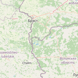
Map view of Jezioro Obradowskie Nature Reserve

Use this park location map to pinpoint Jezioro Obradowskie Nature Reserve in Poland, understand its exact geographic position, and read its mapped placement within the surrounding landscape more clearly.

Pigeon | © OpenStreetMap contributors

Location context for Jezioro Obradowskie Nature Reserve

Lubelskie Voivodeship

Visual reference for dystrophic lakes, peatland habitats, and protected forest terrain

Jezioro Obradowskie Nature Reserve Photos and Landscape Scenery

Examine detailed visual records of Jezioro Obradowskie Nature Reserve to understand its unique dystrophic lake and surrounding peatland habitats. High-resolution imagery reveals the distinct lowland terrain, dark water chemistry, and protected vegetation defining this eastern Poland conservation area.

A wooden observation deck railing in the foreground with two parked bicycles, overlooking a still, dark lake surrounded by a dense forest under a clear blue sky.

Park atlas

Compare regional wetland reserves and neighboring lowland forest ecosystems.

Exploring Parks Near Jezioro Obradowskie Nature Reserve and Surrounding Protected Landscapes

Browsing other parks near Jezioro Obradowskie Nature Reserve reveals related lowland wetlands, peatland formations, and forest ecosystems across the surrounding region. Extending the geographic comparison helps trace broader protected landscapes, regional habitat types, and connected conservation areas.
National parkPoland
About 16 km away#1 closest

Southeast

Polesie National Park: Protected National Park in Poland's Eastern Lowlands

Explore its mapped wetland geography and unique glacial terrain.

Polesie National Park represents a key protected landscape within eastern Poland, notable for its vast wetland complexes, including extensive peat bogs and marshes interspersed with pine forests on sandy dunes. This national park showcases a distinct geography shaped by glacial processes, offering a unique perspective on lowland ecosystems and their conservation. MoriAtlas allows for a structured discovery of its protected boundaries and the surrounding regional context, providing an atlas-driven understanding of this vital natural territory.

Area
97.52 km²
Established
1979
IUCN
II
A watercolor painting showing a panoramic view of a marshy landscape with green grasses, light-colored water, and distant trees on a white background.
National parkLublin Voivodeship
About 19 km away#2 closest

Southeast

Poleski Park Narodowy: Protected Wetlands and Glacial Geography in Lublin Voivodeship

Exploration of peatlands, kettle lakes, and boreal-style marshes

Poleski Park Narodowy encompasses a diverse mosaic of fens, transitional bogs, and dense marsh forests within the Lublin Voivodeship. This protected area serves as a primary reference for understanding the glacial-relict biodiversity and flat, water-defined terrain characteristic of the historic Polesie region in eastern Poland.

Area
97.6 km²
Established
1990
Visitors
41K annual
Relief
Lowland
Nature reserveLubelskie Voivodeship
About 32 km away#3 closest

East

Las Ochoża imienia Marka Kellera: Forest Nature Reserve and Landscape Mapping in Poland

A study of protected wetland forests and early medieval archaeological terrain.

Las Ochoża imienia Marka Kellera protects a critical 193-hectare mosaic of alder swamps and riparian habitats situated in the Zaklęsłość Sosnowicka mesoregion. This nature reserve, integrated into the Natura 2000 Uroczysko Mosty-Zahajki bird protection area, provides a rare window into the natural forest processes of eastern Poland. The site serves as a vital hydrological nexus and features a preserved medieval hillfort on a secluded forest island.

Area
1.929 km²
Established
2024
Relief
Lowland
Scope
Terrestrial
Nature reserveLublin Voivodeship
About 35 km away#4 closest

Southeast

Jezioro Świerszczów Nature Reserve: A Detailed Geographic Atlas of Eastern Polish Protected Lands

Regional peatland and lake basin landscape context

Located in Lublin Voivodeship, Jezioro Świerszczów represents an essential study in lowland mire ecosystems. The reserve protects a small lake and surrounding transitional peatland, supporting a compact landscape mosaic that includes aquatic vegetation, alder carrs, and oak-hornbeam forest zones.

Area
0.461 km²
Established
1959
Relief
Lowland
Climate
Temperate
Protected areaLublin Voivodeship
About 45 km away#5 closest

Southeast

Poleska Dolina Bugu Protected Landscape: Mapped Atlas and Geographic Overview

Key Natura 2000 river valley site in Lublin Voivodeship

Poleska Dolina Bugu is a regionally vital protected area comprising six connected enclaves along the Bug River. The site features a mosaic of oxbow lakes, alkaline fens, molinia meadows, and riparian woodlands that define the lowland geography of eastern Poland. Access structured data on this Habitats Directive site to understand its surface composition, floodplain connectivity, and specialized conservation habitats.

Area
81.732 km²
Relief
Lowland
Scope
Terrestrial
Water
Major water bodies
Nature reservePoland
About 49 km away#6 closest

Southeast

Rezerwat przyrody Bachus: Protected Nature Reserve and Forest Atlas in Eastern Poland

Mapping sessile oak woodlands and protected landscape boundaries

Rezerwat przyrody Bachus is a notable nature reserve in Poland, recognized for its role in preserving sessile oak within the broader Chełmski Landscape Park. This atlas entry provides geographic context on the reserve, detailing its position within the lowland terrain of the Lubelskie region and its importance as an edge-of-range forest sanctuary.

Area
0.826 km²
Established
1958
Relief
Lowland
Climate
Temperate
A horizontal watercolor illustration depicting a calm lake with marshy shores, reeds, and distant low hills.
Nature reserveWojewództwo lubelskie
About 50 km away#7 closest

East

Rezerwat przyrody Jezioro Orchowe: Protected Area and Wetland Geography Map

Wetland ecosystems and peatland terrain in Województwo lubelskie.

The Rezerwat przyrody Jezioro Orchowe nature reserve protects a distinct dystrophic lake and surrounding mire complex in eastern Poland. This site offers deep insight into the transition between aquatic, peatland, and forested habitats within a glacial depression of the Bug river valley. Its documented plant communities represent a key reference for understanding the ecological structure of the wider Polesie lowland region.

Area
0.582 km²
Established
1996
Relief
Lowland
Climate
Temperate
Nature reserveLubelskie Voivodeship
About 57 km away#8 closest

Southeast

Rezerwat przyrody Małoziemce: Nature Reserve Protected Areas and Geographic Map Context

A faunal reserve within the Łęczna-Włodawa Lake District

Rezerwat przyrody Małoziemce represents a specialized faunal protected area in Lubelskie Voivodeship. Established for the preservation of heron breeding colonies, the site is defined by its lowland, marshy terrain and its strategic inclusion within the larger Sobiborski Landscape Park. This entry provides detailed geographic perspective on how this forest and wetland complex fits into the regional network of protected landscapes near the Polish-Ukrainian border.

Area
0.38 km²
Established
1988
Scope
Terrestrial

Common questions about visiting, size, designation, and location context for Jezioro Obradowskie Nature Reserve

Jezioro Obradowskie Nature Reserve FAQs for park facts, access, geography, and protected area context

Find quick answers about Jezioro Obradowskie Nature Reserve, including protected-area facts, park geography, trail and visitor context, and how the park fits into its surrounding country and regional landscape.
MoriAtlas Explorer

Continue Your Protected Areas Search Across the Global Atlas

Deepen your exploration by continuing the structured search for national parks and protected areas worldwide. Utilize the comprehensive filtering capabilities to compare different conservation landscapes and refine your understanding of global park geography. Discover more about the distribution and characteristics of protected natural areas.

Global natural geography