
Mori Atlas logo
Marine protected areaJoão Vieira and Poilão Marine National Park

Mapping the protected marine landscape of João Vieira and Poilão Marine National Park within Bolama Region.

João Vieira and Poilão Marine National Park: Marine Protected Area Exploration and Geographic Context

(Parque Nacional Marinho João Vieira e Poilão)

João Vieira and Poilão Marine National Park represents a key marine protected area situated within the Bolama Region. This dedicated page provides an atlas-driven view, focusing on the park's geographic identity, its protected marine boundaries, and its role within the regional landscape. Users can explore its placement and understand its significance as a mapped natural entity for structured discovery.

Marine National ParkSea Turtle Nesting SiteBijagós ArchipelagoGuinea-Bissau Protected AreasIsland EcosystemWest Africa Marine Conservation

João Vieira and Poilão Marine National Park

Marine protected area

Park overview

Structured park overview, official facts, and landscape profile for João Vieira and Poilão Marine National Park

João Vieira and Poilão Marine National Park park facts, protected area profile, and essential visitor context
Review the core facts for João Vieira and Poilão Marine National Park, including designation, size, terrain, visitor scale, habitats, and operating context in one park-focused overview.

About João Vieira and Poilão Marine National Park

João Vieira and Poilão Marine National Park represents one of West Africa's most important marine conservation areas, protecting a unique ensemble of islands, coastal ecosystems, and marine biodiversity within the broader Bijagós Archipelago, which itself is recognized as a UNESCO biosphere reserve. The park's marine territory encompasses both shallow coastal waters and deeper oceanic zones, creating diverse habitat conditions that support abundant marine life. The terrestrial components include islands covered in sub-humid forest and oil palm vegetation, interspersed with mangrove systems along shorelines. Poilão Island holds particular significance not only for its biological importance but also as a sacred site in local indigenous culture, a status that historically helped protect turtle populations from exploitation by surrounding communities. The park's creation marked a culmination of conservation efforts that began with scientific turtle tagging programs in 1994 and formal negotiations with local communities starting in the late 1990s. Today the park is managed under the direction of Guinea-Bissau's Institute of Biodiversity and Protected Areas, which has developed a National Action Plan specifically for the conservation of sea turtles within the park boundaries.

Quick facts and research context for João Vieira and Poilão Marine National Park

The park covers 495 square kilometers, of which approximately 47,943 hectares is ocean, making it one of the larger marine protected areas in West Africa. It protects four main islands in the southeastern Bijagós Archipelago: João Vieira, Meio, Cavalos, and Poilão. Poilão Island spans 43 hectares with 2.3 kilometers of sandy beach along its 4-kilometer coastline. The park was formally established through decree 6-A/2000 in August 2000, following years of negotiation with local communities who have historically used these islands for seasonal fishing, palm harvesting, and agriculture. The islands are uninhabited today but receive regular visits from local communities engaged in traditional resource harvesting activities.

Park context

Deeper park guide and search-rich context for João Vieira and Poilão Marine National Park

João Vieira and Poilão Marine National Park history, landscape, wildlife, and travel context
Explore João Vieira and Poilão Marine National Park through its history, landscape character, ecosystems, wildlife, conservation priorities, cultural context, and seasonal travel timing in a structured park guide built for atlas discovery and search intent.

Why João Vieira and Poilão Marine National Park stands out

João Vieira and Poilão Marine National Park is best known for its globally significant sea turtle nesting populations. Poilão Island supports the largest green sea turtle nesting colony in Africa and ranks among the five largest in the world, with approximately 40,000 nests recorded on the island in 2014, including more than 1,000 nests on some individual nights. The park's beaches serve as nesting grounds for three species of sea turtles: green sea turtles, hawksbill turtles, and olive ridley turtles. The islands also support 163 documented bird species, including grey parrots and several tern species, while the surrounding waters host populations of humpback dolphins, bottlenose dolphins, and diverse fish communities.

João Vieira and Poilão Marine National Park history and protected-area timeline

The establishment of João Vieira and Poilão Marine National Park emerged from a decade of growing scientific attention to the region's exceptional sea turtle populations and increasing recognition of the need for formal protection. Turtle tagging research began on the islands in 1994, providing early documentation of the significant nesting populations that drew turtles to Poilão and surrounding islands. During the late 1990s, researchers documented concerning instances of itinerant poaching, while local communities informed scientists that they had observed apparent declines in turtle populations compared to historical levels. These findings catalyzed negotiations between conservation authorities and local communities in the Bijagós region to establish formal protection for what were considered sacred areas. The process of creating the protected area began in 1998, culminating in official establishment through decree 6-A/2000 in August 2000. Since the park's creation, management efforts have included the implementation of a National Action Plan for the Conservation of Sea Turtles by the Institute of Biodiversity and Protected Areas. Beginning in 2019, conservation programs expanded to include relocating eggs from overlapping nests on Poilão and Meio islands to João Vieira island to further protect developing embryos.

João Vieira and Poilão Marine National Park landscape and geographic character

The park protects a distinctive cluster of islands in the southeastern portion of the Bijagós Archipelago, a chain of more than eighty islands off the coast of Guinea-Bissau. The four principal islands within the park boundaries are João Vieira, Meio, Cavalos, and Poilão, each characterized by low-lying terrain and sandy coastlines. Poilão Island, the smallest of the major islands, covers 43 hectares with approximately 2.3 kilometers of its 4-kilometer coastline consisting of sandy beaches that provide critical nesting habitat for sea turtles. The islands support sub-humid forest vegetation dominated by oil palm trees, while mangrove systems fringe the coastlines and provide important coastal protection and habitat functions. The marine environment within the park boundaries encompasses approximately 47,943 hectares of ocean, including both shallow coastal waters and deeper offshore areas, creating diverse conditions that support different marine species assemblages.

João Vieira and Poilão Marine National Park ecosystems, habitats, and plant life

The ecological character of João Vieira and Poilão Marine National Park reflects a convergence of terrestrial, coastal, and marine ecosystems that together support exceptional biodiversity. The island forests, though relatively small in area, contain important populations of grey parrots and provide nesting habitat for several seabird species including West African crested terns, Caspian terns, and black terns. The mangrove systems that border the islands serve as critical nurseries for juvenile fish and shellfish species while also providing coastal protection and carbon storage functions. The marine environment hosts diverse fish communities including species from the Caranx and Lutjanus genera, as well as shark populations. Perhaps most significantly, the park's shallow coastal waters and protected beaches create ideal conditions for sea turtle reproduction, with the park supporting what is believed to be the most important nesting aggregation of green sea turtles in the Eastern Atlantic. The combination of marine, mangrove, and forest habitats within a relatively compact area makes this park a biodiversity hotspot of regional and global significance.

João Vieira and Poilão Marine National Park wildlife and species highlights

The wildlife of João Vieira and Poilão Marine National Park is defined above all by its extraordinary sea turtle populations. Three species of sea turtles use the park's beaches for nesting: green sea turtles, hawksbill turtles, and olive ridley turtles. Green sea turtles represent the most abundant species, with Poilão Island supporting what amounts to approximately five percent of the global green sea turtle population. A 2000 survey documented an estimated 7,400 green sea turtle nests on Poilão along with six hawksbill turtle nests, while by 2014 this had grown to approximately 40,000 total nests on the island. The park supports remarkable nesting densities, with many nests overlapping on Poilão and Meio islands due to the sheer volume of turtles returning to these shores. The surrounding waters host marine mammals including humpback dolphins and bottlenose dolphins. Terrestrial wildlife includes grey parrots in the forest canopy, while the islands serve as breeding grounds for West African crested terns, Caspian terns, and black terns. In total, 163 bird species have been documented across the islands.

João Vieira and Poilão Marine National Park conservation status and protection priorities

João Vieira and Poilão Marine National Park holds exceptional conservation significance as the most important sea turtle nesting site in Africa and one of the most significant in the world. The five percent of global green sea turtle population that nests on Poilão Island alone represents a conservation responsibility of global proportions, particularly given that green turtle populations have declined globally while the local population has remained stable. The park's designation as a marine protected area provides formal framework for protecting both the nesting beaches and the surrounding waters that serve as feeding and developmental habitat for multiple sea turtle species. The creation of the National Action Plan for the Conservation of Sea Turtles demonstrates institutional commitment to species-specific protection measures. The cultural significance of Poilão as a sacred site historically provided informal protection that complemented formal conservation measures. The park's inclusion within the broader Bijagós Archipelago, which holds biosphere reserve status, situates this protected area within a larger landscape of conservation priority for West Africa.

João Vieira and Poilão Marine National Park cultural meaning and human context

While the islands within João Vieira and Poilão Marine National Park are uninhabited today, they maintain profound cultural significance for the indigenous communities of the Bijagós Archipelago. Poilão Island is considered a sacred site by local people, a status that has historically provided meaningful protection for nesting sea turtles. Traditional cultural beliefs prevented local communities from harvesting turtle eggs from Poilão, unlike on other islands in the archipelago where such practices occurred. Turtles from these waters have historically served as important resources for local communities while also holding cultural significance in traditional practices. The surrounding communities maintain connections to these islands through seasonal activities including fishing, palm tree harvesting, and limited agriculture. The establishment of the park required negotiation with these local communities during the 1990s to ensure continued access to areas considered sacred, reflecting the complex relationship between traditional cultural practices and formal conservation frameworks.

Top sights and standout views in João Vieira and Poilão Marine National Park

The extraordinary sea turtle nesting concentrations on Poilão and Meio islands represent the park's most remarkable wildlife phenomenon, with tens of thousands of nests laid annually across just two islands. The fact that five percent of the global green sea turtle population chooses Poilão alone as a nesting destination makes this park irreplaceable in global marine conservation. The sacred status of Poilão Island in local culture created a historical conservation legacy that helped preserve this remarkable turtle population despite other pressures across the region. The park protects a complete cross-section of West African marine biodiversity, from coastal mangroves and seabird colonies to oceanic dolphin populations and diverse fish communities. The Bijagós Archipelago's designation as a biosphere reserve underscores the broader ecological importance of this island cluster.

Best time to visit João Vieira and Poilão Marine National Park

The optimal period for visiting João Vieira and Poilão Marine National Park corresponds with the sea turtle nesting season, which peaks during the West African dry season from November through March. During this period, visitors have the highest likelihood of witnessing turtle nesting activity, particularly on Poilão Island where nesting densities are most extreme. The dry season offers more reliable weather conditions for boat travel between islands, though conditions can still vary. The wet season from May to October brings heavier rainfall and rougher sea conditions that may limit access to the more remote islands within the park. Visitors interested in both turtle nesting and birdlife may find value in visiting during the migratory bird season, which overlaps with the turtle nesting period. The park's remote location and limited infrastructure mean that visits require advance planning and coordination with local conservation authorities.

Park location guide

Geography guide, regional context, and park location map for João Vieira and Poilão Marine National Park

João Vieira and Poilão Marine National Park park geography, regions, and map view in Guinea-Bissau
Understand where João Vieira and Poilão Marine National Park sits in Guinea-Bissau through a broader geographic reading of the surrounding landscape, nearby location context, and its mapped position within the national park landscape.

How João Vieira and Poilão Marine National Park fits into Guinea-Bissau

Guinea-Bissau is a West African nation that gained independence from Portugal in 1974. The country covers 36,125 km² along the Atlantic coast, bordered by Senegal and Guinea. Its capital is Bissau. The nation is characterized by ethnic diversity, with Balanta and Fula being the largest groups, and Portuguese as its official language. Guinea-Bissau has experienced political instability since independence and remains one of the poorest countries globally.

Wider geography shaping João Vieira and Poilão Marine National Park in Guinea-Bissau

Guinea-Bissau is located in West Africa along the Atlantic Ocean. It borders Senegal to the north and Guinea to the southeast. The country consists of low-lying coastal plains with inland hills and forests. The Geba River basin dominates the interior landscape.

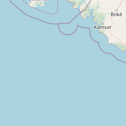
Map view of João Vieira and Poilão Marine National Park

Use this park location map to pinpoint João Vieira and Poilão Marine National Park in Guinea-Bissau, understand its exact geographic position, and read its mapped placement within the surrounding landscape more clearly.

Pigeon | © OpenStreetMap contributors

Location context for João Vieira and Poilão Marine National Park

Bolama Region
Park atlas

Discover marine and island protected landscapes across the Bijagós Archipelago, comparing regional conservation efforts and unique West African habitats.

Explore Other National Parks and Protected Areas Near João Vieira and Poilão Marine National Park
Continue exploring from João Vieira and Poilão Marine National Park, browsing other national parks and protected areas within the Bijagós Archipelago and its West African marine geography. Compare diverse island ecosystems, vital sea turtle nesting sites, and varied coastal conservation landscapes to grasp broader regional protected-area contexts.
National parkGuinea-Bissau

Orango National Park: Protected Landscape and Geographic Atlas Explorer in Guinea-Bissau

Discover mapped park boundaries and regional natural terrain.

Delve into the protected-area identity of Orango National Park, a significant national park located in Guinea-Bissau. This page provides essential geographic context, mapping details, and landscape character for atlas-driven exploration. Understand how Orango National Park fits within the broader regional geography of West Africa, offering a focused view of protected lands for dedicated discovery.

Area
1,582 km²
Established
2000
IUCN
II
Relief
Lowland
National parkZiguinchor Region

Basse Casamance National Park: National Park with Mapped Boundaries in Ziguinchor Region

Detailed protected landscape and regional geography context.

Basse Casamance National Park serves as a critical protected area, offering users a clear view of its national park designation and its specific geographic location within Senegal. This entity is vital for understanding conservation landscapes and mapped terrain in the Ziguinchor Region. The platform provides structured data on its protected boundaries, allowing for focused atlas exploration and a deeper appreciation of its regional geographic significance without leaving the core park identity.

Area
50 km²
Established
1970
IUCN
II
Climate
Tropical
National parkGambia

Kiang West National Park: National Park Detail and Protected Landscape Geography

Explore mapped boundaries and regional context in The Gambia.

Kiang West National Park serves as a crucial point for understanding protected natural areas within The Gambia, West Africa. This national park's identity is rooted in its geographic setting along the Gambia River, offering a distinct landscape context and mapped territory. Users can explore its boundaries and place within the nation's conservation network, contributing to a structured understanding of regional geography and protected lands.

Area
115 km²
Established
1987
IUCN
II
Relief
Lowland
Wildlife reserveGambia

Bao Bolong Wetland Reserve: West African Wildlife Reserve with Extensive Mangrove Ecosystems

Explore mapped terrain and crucial protected wetland boundaries.

Bao Bolong Wetland Reserve in Gambia is a significant protected area renowned for its ecological importance as a Ramsar wetland and Important Bird Area. This wildlife reserve features the tallest mangrove trees in the Senegambia region, transitioning through salt marshes to savanna, all centered around the Bao Bolong tributary's estuary. Its complex hydrological network and diverse habitats support 268 bird species and are crucial for the endangered West African manatee, offering a rich landscape for geographic and protected-area discovery.

Area
220 km²
Established
1996
IUCN
VI
Relief
Lowland
Nature reserveGambia

Abuko Nature Reserve: A Protected Nature Reserve in Gambia's Landscape

Explore its mapped boundaries and geographic context.

Abuko Nature Reserve is a protected natural area situated in Gambia, offering a distinct focus for understanding protected landscapes. This entry provides essential details for atlas-based discovery, highlighting the reserve's mapped boundaries and its role within the regional geography. Examine Abuko Nature Reserve to gain clarity on its protected status and its contribution to the mapped natural terrain of West Africa.

Area
1.07 km²
Established
1968
IUCN
IV
Relief
Lowland
National parkGambia

Tanbi Wetland Complex National Park: A Mapped Protected Area in The Gambia

Explore its protected boundaries and regional landscape.

Delve into the geographic identity of Tanbi Wetland Complex National Park, a designated protected area within The Gambia. This page provides essential atlas-level information, focusing on its mapped natural landscape and its role as a significant national park. Understand the park's protected status and its geographical context along the Gambia River, offering a clear entry point for conservation landscape discovery.

Area
45 km²
Established
2001
IUCN
II
Relief
Lowland
National parkGambia

Tanji Bird Reserve National Park: Coastal Wetlands and Avian Diversity in Gambia

Explore unique geography and protected landscape boundaries.

Tanji Bird Reserve National Park showcases a distinctive coastal landscape where the Atlantic Ocean meets lagoons, dry woodland, and dune scrub. This 612-hectare protected area in The Gambia is celebrated for its incredible birdlife, with nearly 300 species recorded, including significant Palearctic migrants and the nation's sole breeding seabird colonies on the Bijol Islands. The reserve offers a rich context for understanding West African protected areas, mapped terrain, and coastal ecosystem geography.

Area
6.12 km²
Established
1993
IUCN
II
Relief
Lowland
National parkGambia

Niumi National Park: Gambia's Extensive Mangrove Forest and Coastal Wetland Protected Area

Explore the mapped boundaries and unique delta geography of this important national park.

Niumi National Park, situated in The Gambia, is a crucial protected coastal area celebrated for its vast Rhizophora mangrove forests and diverse wetland ecosystems. As a designated national park and Ramsar site, it serves as a critical habitat for numerous migratory bird species, particularly terns, and supports vulnerable marine life. Its landscape is characterized by tidal channels, brackish lagoons, and intertidal mudflats, creating a dynamic and ecologically significant protected zone that is a focal point for understanding West African coastal geography and conservation.

Area
49.4 km²
Established
1987
IUCN
II
Relief
Lowland

Common questions about visiting, size, designation, and location context for João Vieira and Poilão Marine National Park

João Vieira and Poilão Marine National Park FAQs for park facts, access, geography, and protected area context
Find quick answers about João Vieira and Poilão Marine National Park, including protected-area facts, park geography, trail and visitor context, and how the park fits into its surrounding country and regional landscape.
MoriAtlas Explorer

Continue Your Protected Areas Search Across the Global Atlas

Deepen your exploration by continuing the structured search for national parks and protected areas worldwide. Utilize the comprehensive filtering capabilities to compare different conservation landscapes and refine your understanding of global park geography. Discover more about the distribution and characteristics of protected natural areas.

Global natural geography
