Mori Atlas logo
Protected areaJoseph Battell Wilderness

Mapping the high-elevation core of Vermont's Green Mountain National Forest and its historic ridgeline geography.

Joseph Battell Wilderness: An Atlas of Protected Appalachian Ridges and Forested Mountain Terrain

The Joseph Battell Wilderness encompasses twelve thousand acres of protected mountain terrain in Addison County, Vermont. This high-elevation landscape is defined by a linear chain of summits exceeding three thousand feet, including the Great Cliffs and Gillespie Peak. Through this geographic atlas, examine the deep ravines, northern hardwood forests, and the path of the historic Long Trail as it traverses the ridgelines from Brandon Gap to Middlebury Gap.

wilderness areaGreen MountainsVermontnational forestridge hikingcliffs

Joseph Battell Wilderness

Protected area

Park overview

Structured park overview, official facts, and landscape profile for Joseph Battell Wilderness

Joseph Battell Wilderness park facts, protected area profile, and essential visitor context

Review the core facts for Joseph Battell Wilderness, including designation, size, terrain, visitor scale, habitats, and operating context in one park-focused overview.

About Joseph Battell Wilderness

The Joseph Battell Wilderness sits at the heart of the Green Mountain National Forest in central Vermont, occupying a substantial block of high ridge country in Addison County. It comprises a nearly continuous chain of forested summits and steep intervening drainages that form a transitional landscape between Vermont's lower valleys and the higher northern peaks of the Green Mountains. The wilderness's identity is shaped both by its dramatic terrain and by the conservation legacy of Joseph Battell, whose early twentieth-century land gift laid the groundwork for what later became protected federal land.

Geographically, the wilderness runs roughly north-south, with the Long Trail passing through its full length between Brandon Gap to the south and Middlebury Gap to the north. The ridgeline includes a series of named summits that collectively define the wilderness experience: the Great Cliffs and Mount Horrid in the southern section, Cape Lookoff Mountain and Gillespie Peak in the central high country, and Romance Mountain, Worth Mountain, Monastery Mountain, and Philadelphia Peak toward the north. Several of these peaks offer sweeping views westward across the Champlain Valley and eastward into the broader Green Mountain uplands. The terrain between the summits is incised by small brooks and drainages, with the Sucker Brook Trail and related paths providing quieter alternatives to the main Long Traverse.

In administrative terms, the Joseph Battell Wilderness is one of eight congressionally designated wilderness areas within the Green Mountain National Forest and is managed by the United States Forest Service. Its establishment in 2006, under the New England Wilderness Act, marked the culmination of a long process that began with Battell's 1915 bequest of core lands to Middlebury College, subsequent sales of those lands to the federal government in the 1930s and 1950s, and ultimately the consolidation of this high-country block as permanently protected wilderness. Today the area functions as both a refuge for forest wildlife and a destination for backpackers and day hikers seeking a classic Vermont ridge experience.

Quick facts and research context for Joseph Battell Wilderness

The Joseph Battell Wilderness is located in Addison County, Vermont, within the Green Mountain National Forest. It spans approximately 12,336 acres and is managed by the U.S. Forest Service as part of the National Wilderness Preservation System. The area contains numerous summits above 3,000 feet, including Mount Horrid, the Great Cliffs, Cape Lookoff Mountain, Gillespie Peak, Romance Mountain, Worth Mountain, Monastery Mountain, and Philadelphia Peak. The wilderness was officially designated in 2006 under the New England Wilderness Act and is named for Vermont philanthropist Joseph Battell.

Protection and recognition

Examine the documented terrestrial protection scope and conservation status records

Joseph Battell Wilderness Protection Status and International Recognition

Joseph Battell Wilderness maintains a documented terrestrial protection scope within the regional protected area network. Conservation records outline the established management framework and official designation history for the protected landscape.

Protection details

Protection scope
Terrestrial
Transboundary protection
No
Park context

Deeper park guide and search-rich context for Joseph Battell Wilderness

Joseph Battell Wilderness history, landscape, wildlife, and travel context

Explore Joseph Battell Wilderness through its history, landscape character, ecosystems, wildlife, conservation priorities, cultural context, and seasonal travel timing in a structured park guide built for atlas discovery and search intent.

Why Joseph Battell Wilderness stands out

The Joseph Battell Wilderness is best known for its concentration of mid-elevation Green Mountain summits above three thousand feet, including dramatic cliff faces such as the Great Cliffs and Mount Horrid. It is closely tied to Joseph Battell's legacy as a Vermont environmentalist, and to the Long Trail, which runs through the wilderness from Brandon Gap to Middlebury Gap. The protected ridge-and-valley system, with its headwater streams, northern hardwood forest, and overlook views across central Vermont, gives the area its distinctive wilderness character.

Joseph Battell Wilderness history and protected-area timeline

The history of the Joseph Battell Wilderness is closely tied to the life of Joseph Battell, a Middlebury, Vermont, philanthropist and environmentalist who lived from 1839 to 1915. Battell acquired considerable land in the Green Mountains, with a vision of preserving it as open, undeveloped space. Upon his death in 1915, he bequeathed a substantial block of mountainous land as a 'park' to Middlebury College, with the intent that it remain in a largely natural state.

For several decades, Middlebury College held and managed these lands, but beginning in the 1930s and continuing into the 1950s, the college sold nearly all of the Battell lands to the U.S. Forest Service. These federal acquisitions were instrumental in establishing the northern unit of what would become the Green Mountain National Forest. Over time, as the National Forest matured and the wilderness concept gained national traction, segments of this high-elevation terrain became candidates for formal wilderness designation.

The decisive moment came in 2006 with the passage of the New England Wilderness Act, which established several new wilderness areas across the region. Under this legislation, the core Battell ridge country was formally designated as the Joseph Battell Wilderness, named in honor of the man whose original bequest had set the conservation process in motion. The designation placed the area under the heightened protection of the National Wilderness Preservation System, where it remains today as one of eight wildernesses within the Green Mountain National Forest.

Joseph Battell Wilderness landscape and geographic character

The landscape of the Joseph Battell Wilderness is defined by a long, linear chain of forested summits separated by steep ravines and small brooks. The wilderness contains numerous named peaks with elevations of at least three thousand feet, including the Great Cliffs at roughly 3,000 feet, Mount Horrid at about 3,216 feet, Cape Lookoff Mountain near 3,320 feet, Gillespie Peak at approximately 3,366 feet, Romance Mountain at about 3,145 feet, Worth Mountain near 3,234 feet, Monastery Mountain around 3,224 feet, and Philadelphia Peak at roughly 3,203 feet. Gillespie Peak stands as the highest point in this group.

The southern portion of the wilderness is particularly notable for its cliff scenery, where the Great Cliffs and Mount Horrid present exposed rock faces and dramatic drop-offs that are visible from below and from neighboring ridges. Moving north, the terrain shifts into a more rolling but still steeply dissected high-country, with Cape Lookoff Mountain providing one of the wilderness's best-known viewpoints. The ridgeline connecting Monastery Mountain, Worth Mountain, and Romance Mountain forms the core of the area and corresponds roughly to the lands originally bequeathed by Joseph Battell.

Between these summits, the landscape descends into cool, shaded valleys carrying small headwater streams. The Sucker Brook drainage and similar valleys create a network of quiet, less-traveled terrain that complements the more exposed ridges. The overall effect is a classic northern Appalachian mountain landscape, with mixed hardwood and conifer cover, exposed cliff bands, and a strong sense of elevation change within a relatively compact area. The Long Trail captures much of this character, climbing and descending repeatedly as it traverses the wilderness from Brandon Gap in the south to Middlebury Gap in the north.

Joseph Battell Wilderness ecosystems, habitats, and plant life

The Joseph Battell Wilderness protects a representative block of central Vermont's northern hardwood and montane forest ecosystems. The lower and middle slopes are dominated by hardwood species typical of the Green Mountains, while the higher elevations and exposed ridge crests support more tolerant, often stunted, mixed woodland with elements of boreal character. Cool, moist ravines and headwater stream corridors contribute additional ecological complexity, with the Sucker Brook drainage being among the more ecologically distinct microhabitats in the wilderness.

The combination of cliff faces, steep slopes, and forested benches creates a variety of habitats within a relatively small area. Cliff environments around the Great Cliffs and Mount Horrid host specialized plant communities adapted to thin soils and harsh exposure, while the deeper, sheltered valleys retain more mesic forest conditions. This gradient from exposed rock to dense forest is one of the defining ecological features of the wilderness and supports a corresponding range of wildlife communities.

Because much of the land was acquired from Middlebury College and has had a long history of low-intensity use, the forest cover within the wilderness is relatively mature. The wilderness designation itself reinforces ecological integrity by limiting roadbuilding, mechanized use, and large-scale management interventions, allowing natural processes to play out across the ridgeline and valley systems.

Joseph Battell Wilderness wildlife and species highlights

The Joseph Battell Wilderness supports wildlife typical of central Vermont's higher-elevation forests, including species associated with both northern hardwood and mixed conifer habitats. Deer, black bears, and moose are among the larger mammals likely to use the area, while smaller mammals such as red fox, fisher, marten, and various squirrels thrive in the mature forest mosaic. The wilderness's extensive cliff faces also provide nesting and denning habitat for raptors and other cliff-dwelling species.

Bird life in the wilderness reflects the elevation gradient that defines the area. Lower-elevation deciduous forest supports songbirds typical of New England hardwoods, while the higher ridges, exposed cliffs, and cooler microclimates attract species more often associated with northern or montane environments. The combination of cliff habitat, mature forest, and remote interior terrain gives the wilderness a quiet, undisturbed quality that benefits sensitive species requiring large blocks of unbroken forest.

The relative remoteness of the interior, combined with the wilderness's protected status, makes the Battell Wilderness an important refuge for species sensitive to human disturbance. Hunters, hikers, and naturalists visiting the area occasionally encounter signs of larger mammals along the Long Trail and side paths, although wildlife observation here is as much about listening for birds in dense forest as about spotting large mammals on the open ridges.

Joseph Battell Wilderness conservation status and protection priorities

The conservation significance of the Joseph Battell Wilderness lies both in its ecological value and in its administrative protection. As part of the National Wilderness Preservation System, the area receives the highest level of protection available for federal public lands, with restrictions on road construction, mechanized travel, commercial logging, and other forms of development. This protection preserves the area as a continuously forested, largely roadless block within an otherwise working landscape of farms, private woodlots, and small towns.

The wilderness also serves as a critical component of a much larger conservation network. It sits within the Green Mountain National Forest and is closely linked to other wilderness areas in Vermont, forming part of a connected corridor of protected high country. The Long Trail, which passes through the entire length of the wilderness, further enhances the area's conservation role by providing a low-impact route for human recreation while concentrating use along a single historical alignment rather than dispersing it across the landscape.

At a historical level, the Battell Wilderness embodies a century-long chain of conservation decisions, beginning with Joseph Battell's original bequest and continuing through the college-to-federal land transfers of the 1930s and 1950s, the eventual formation of the northern unit of the Green Mountain National Forest, and the 2006 New England Wilderness Act designation. Its protection today reflects both the foresight of early conservationists and the modern wilderness movement's emphasis on preserving representative examples of America's natural landscapes.

Joseph Battell Wilderness cultural meaning and human context

The cultural identity of the Joseph Battell Wilderness is inseparably tied to the figure it is named for. Joseph Battell was a prominent Middlebury philanthropist and environmentalist who, in the early twentieth century, sought to preserve substantial Green Mountain acreage as permanent open space. His 1915 bequest of mountainous 'park' land to Middlebury College reflected a conservation ethic that, while different in legal mechanism from today's wilderness designations, anticipated the same goal of keeping high-country landscapes undeveloped.

Middlebury College's stewardship of these lands in the early to mid-twentieth century, followed by its sale of the Battell lands to the U.S. Forest Service, marked a transition from private institutional conservation to federal public-land management. That shift ultimately enabled the creation of the northern unit of the Green Mountain National Forest and, decades later, the formal wilderness designation under the New England Wilderness Act. The trail heritage of the area, including the Long Trail running through it, also contributes to a regional culture of long-distance hiking and ridge travel that has shaped how Vermonters relate to the Green Mountains.

Top sights and standout views in Joseph Battell Wilderness

A continuous ridge of summits above three thousand feet, with Gillespie Peak as the highest point and the Great Cliffs and Mount Horrid providing the most dramatic cliff scenery. A wilderness anchored by lands originally bequeathed by Vermont philanthropist Joseph Battell, now permanently protected under the National Wilderness Preservation System. The Long Trail passes through the entire length of the wilderness between Brandon Gap and Middlebury Gap, anchoring it as a premier Vermont backpacking corridor. A network of quieter side trails, including the Sucker Brook Trail, offering lower-impact experiences in the interior valleys. A defining mix of northern hardwood forest, exposed cliff habitat, and cool headwater ravines typical of central Vermont's Green Mountains.

Best time to visit Joseph Battell Wilderness

The Joseph Battell Wilderness can be visited across multiple seasons, but character varies significantly with the time of year. Late spring and early summer bring lush green forest cover, rushing brooks in the headwater valleys, and a full leaf canopy that colors the ridgelines, though trail conditions can remain muddy into early June and bugs may be heavy in sheltered valleys. Late summer and early autumn are often considered the most comfortable hiking window, with cooler nights, reduced insect pressure, and increasingly clear views from cliff overlooks and high peaks.

Autumn is especially striking in the Battell Wilderness, as the mixed hardwood cover along the ridges turns to shades of red, orange, and yellow, while exposure and elevation can produce early snow and rime ice on the highest summits. Winter brings a quieter, snow-covered landscape with opportunities for snowshoeing and ski touring along the Long Trail and side paths, though conditions in this high terrain can be harsh and require true winter preparation. Spring mud and icy shoulders often linger into the warmer months on north-facing slopes, so timing a visit around stable weather and gradual drying can make the experience more comfortable.

Monthly climate preview

Long-term temperature ranges and precipitation averages across representative coordinates

Joseph Battell Wilderness Climate Normals and Monthly Weather Patterns

Historical climate data for Joseph Battell Wilderness records a wide annual temperature spread alongside consistent monthly precipitation patterns spanning the representative coordinate. Exploring the complete twelve-month profile provides deeper analytical context for long-term regional weather trends.
Annual mean6 °C
-9 °C20 °C
Jan-9°
Feb-8°
Mar-2°
Apr
May12°
Jun18°
Jul20°
Aug19°
Sep15°
Oct
Nov
Dec-5°
Warmest month
July

20 °C

Coolest month
January

-8.8 °C

Wettest month
June

3.8 mm/day

Driest month
February

2.1 mm/day

Park location guide

Geography guide, regional context, and park location map for Joseph Battell Wilderness

Joseph Battell Wilderness park geography, regions, and map view in United States of America

Understand where Joseph Battell Wilderness sits in United States of America through a broader geographic reading of the surrounding landscape, nearby location context, and its mapped position within the national park landscape.

How Joseph Battell Wilderness fits into United States of America

The United States of America is a federal presidential republic and one of the world's largest countries by area and population. It consists of 50 states across a vast territory spanning multiple time zones, with its capital in Washington, D.C. and largest city in New York City. The nation has a diverse economy, influential political system, and significant cultural and military presence globally.

Wider geography shaping Joseph Battell Wilderness in United States of America

The United States occupies a vast territory in North America, bordered by Canada to the north and Mexico to the south. The 48 contiguous states stretch from the Atlantic to the Pacific Ocean, while Alaska occupies the northwestern region and Hawaii is an archipelago in the Pacific. The country encompasses diverse terrain including the Rocky Mountains, Appalachian Mountains, Great Plains, and extensive river systems.

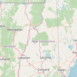
Map view of Joseph Battell Wilderness

Use this park location map to pinpoint Joseph Battell Wilderness in United States of America, understand its exact geographic position, and read its mapped placement within the surrounding landscape more clearly.

Pigeon | © OpenStreetMap contributors

Location context for Joseph Battell Wilderness

Addison CountyVermont
Park atlas

Discover adjacent Green Mountain reserves and regional wilderness lands across Vermont

Parks Near Joseph Battell Wilderness and Related Protected Areas to Compare Next

Browsing nearby protected areas allows visitors to compare the high elevation ridgelines and northern hardwood forests of Joseph Battell Wilderness with other regional mountain terrain. Expanding the geographic scope reveals connected conservation landscapes and similar upland ecosystems throughout the surrounding region.
Watercolor painting of a lush green landscape featuring rolling hills in the distance, a meandering stream in the midground, and wetlands with cattails in the foreground.
Protected landscapeVermont
Mapped location lies within the park boundary#1 closest

Northwest

Green Mountain National Forest: Mapped Geography and Protected Landscape Analysis

Examining the wilderness backbone of Vermont's mountainous terrain

Gain insight into the expansive boundaries of Green Mountain National Forest, an essential protected area spanning the Green Mountains of Vermont. This profile details the forest's composition, ranging from high-elevation spruce-fir zones to mixed hardwood slopes and extensive federal wilderness corridors, providing a foundational geographic understanding of this vital northeastern landscape.

Area
1,615.31 km²
Established
1932
Relief
Mountain
Climate
Temperate
Protected landscapeVermont
About 58 km away#2 closest

South

Robert T. Stafford White Rocks National Recreation Area: Protected Landscape and Regional Geography

Southern Vermont wilderness, quartzite formations, and Appalachian Trail corridors.

Robert T. Stafford White Rocks National Recreation Area represents a unique fusion of protected forest and rugged geological character in southern Vermont. Known for the quartzite rockslides of Chaos Canyon and its inclusion of two distinct wilderness areas, this territory offers a complex terrain profile. Spanning over 36,000 acres, it serves as a central hub for regional backcountry exploration, blending dense hardwood ecosystems with the prominent rocky outcrops that define its distinct mountainous identity.

Area
147 km²
Established
1984
Water
Major water bodies
Protected landscapeNew Hampshire
About 71 km away#3 closest

East

White Mountain National Forest: Protected Landscape Atlas and Geographic Boundary Context

Mapping the alpine ridges and river valleys of New Hampshire

Delve into the geography of White Mountain National Forest, a primary federal protected landscape in the eastern United States. This overview details the mountainous terrain, including the Presidential Range and Pemigewasset Wilderness, providing a clear window into its spatial scale, watershed boundaries, and regional prominence within the New England landscape.

Area
3,038.59 km²
Established
1918
Relief
Mountain
Climate
Temperate
A horizontal watercolor painting depicting a winding river flowing through a lush, forested valley with rolling hills in the background.
Wildlife reserveVermont
About 82 km away#4 closest

South

Lye Brook Wilderness: Protected High Plateau and Forest Geography in Southern Vermont

Mapped wilderness boundaries within the Green Mountain National Forest

Spanning nearly 18,000 acres, Lye Brook Wilderness offers a deep dive into southern Vermont's natural geography. The area features a high forested plateau, complex brook valleys, and elevated ridgelines that characterize this established wilderness reserve. Ideal for those studying the regional landscape and its protected ecosystem, this record provides essential context on the forest cover, glacial terrain, and the geographic significance of this Vermont backcountry unit.

Area
73.34 km²
Established
1975
IUCN
Ib
Wildlife reserveBennington County
About 112 km away#5 closest

South

George D. Aiken Wilderness: Protected Forest Landscapes and Ridgelines in Vermont

Detailed geographic overview of a Green Mountain wilderness reserve

Spanning over 4,800 acres in Bennington County, the George D. Aiken Wilderness stands as a significant protected area within the southern Green Mountains. The terrain features narrow ridgelines, steep valleys, and a dense canopy of northern hardwoods that remain unmanaged to maintain wilderness standards. This area serves as a primary geographic anchor for Eastern wilderness preservation efforts in the United States.

Area
19 km²
Established
1984
IUCN
Ib
Relief
Mountain
A soft, painterly watercolor illustration showing a shallow waterway, green grassy islands, and soft rolling hills in the distance.
Nature reserveQuebec
About 173 km away#6 closest

Northwest

Îles de la Paix Migratory Bird Sanctuary: Protected Island Geography and Wetland Maps

A vital riverine habitat within the St. Lawrence River basin

Examine the unique river-island topography of the Îles de la Paix Migratory Bird Sanctuary in Quebec. This protected area offers a rare glimpse into a dynamic landscape of marshes and flooded forests, serving as a critical node in the St. Lawrence River migratory flyway near the Montreal metropolitan region.

Area
10.92 km²
Established
1972
IUCN
III
Relief
Lowland
A soft, watercolor painting of a calm river winding through a green landscape with trees and rolling hills in the background.
Wildlife reserveQuebec
About 174 km away#7 closest

Northwest

Réserve nationale de faune des îles de la Paix: Geography of an Island Wetland Refuge

A protected wildlife corridor in southwestern Quebec

The Réserve nationale de faune des îles de la Paix comprises a cluster of islands and protected wetlands in the St. Lawrence River. This site provides critical nesting and staging grounds within a managed habitat system, connecting forested terrestrial areas with expansive aquatic zones essential for migratory bird species.

Area
1.87 km²
Established
1977
IUCN
Ia
Relief
Lowland
A soft watercolor painting depicting a wide, marshy wetland scene with gentle green hills in the distance and reflections on the water surface.
Wildlife reserveQuebec
About 175 km away#8 closest

Northwest

Réserve nationale de faune du lac-Saint-François: A Protected Wetland Landscape in Quebec

Explore wildlife reserve boundaries, riparian habitats, and St. Lawrence River geography.

This protected area safeguards a diverse freshwater wetland complex along the St. Lawrence River. Covering marshes, cedar stands, and mixed hardwood forests, the reserve provides a critical sanctuary for migratory species. The geography of the site offers a unique look at transition zones between open water and inland plains, serving as a key node for bird conservation in Quebec.

Area
15.21 km²
Established
1978
IUCN
III
Relief
Lowland

Common questions about visiting, size, designation, and location context for Joseph Battell Wilderness

Joseph Battell Wilderness FAQs for park facts, access, geography, and protected area context

Find quick answers about Joseph Battell Wilderness, including protected-area facts, park geography, trail and visitor context, and how the park fits into its surrounding country and regional landscape.
MoriAtlas Explorer

Continue Your Protected Areas Search Across the Global Atlas

Deepen your exploration by continuing the structured search for national parks and protected areas worldwide. Utilize the comprehensive filtering capabilities to compare different conservation landscapes and refine your understanding of global park geography. Discover more about the distribution and characteristics of protected natural areas.

Global natural geography