
Mori Atlas logo
Nature reserveKamanų valstybinis gamtinis rezervatas

Examining the ecological boundaries, bog pools, and glacial topography of this northern Lithuanian reserve

Kamanų valstybinis gamtinis rezervatas: A Strictly Protected Wetland and Forest Landscape

Kamanų valstybinis gamtinis rezervatas serves as a vital natural reference area in the Akmenė District Municipality of northwestern Lithuania. This protected landscape safeguards an extensive raised bog system characterized by mineral ridges, quaking mires, and over 120 distinct bog pools. Surrounding spruce-dominated forests and birch groves complete this complex, strictly maintained wetland environment that provides a habitat for rare species identified in the national Red Data Book.

strict nature reserveraised bogpeatlandwetlandspruce forestconiferous forest
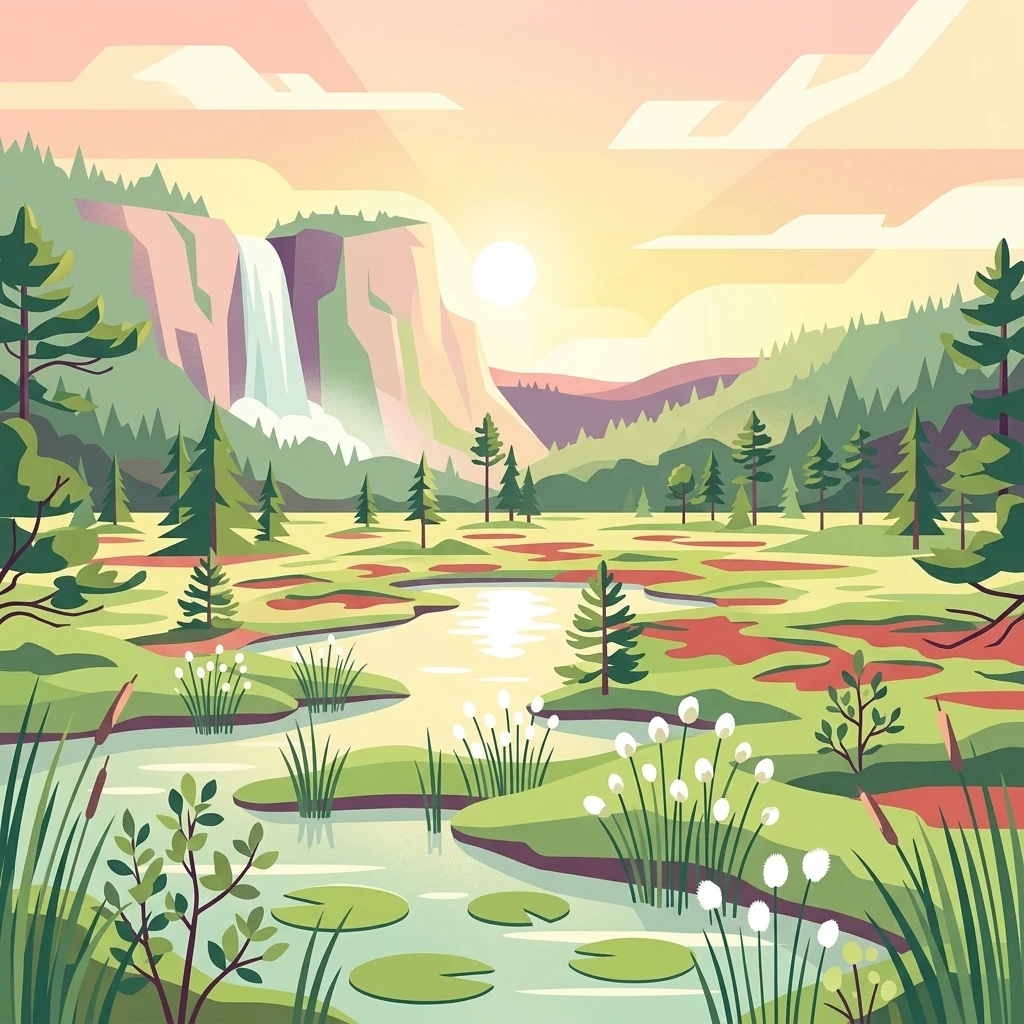
An illustration of a marshland with small ponds, scattered pine trees, and cotton grass in the foreground, with a waterfall and cliffs in the distance under a warm sunset sky.

Kamanų valstybinis gamtinis rezervatas

Nature reserve

Park overview

Structured park overview, official facts, and landscape profile for Kamanai Strict Nature Reserve

Kamanai Strict Nature Reserve park facts, protected area profile, and essential visitor context

Review the core facts for Kamanai Strict Nature Reserve, including designation, size, terrain, visitor scale, habitats, and operating context in one park-focused overview.

About Kamanai Strict Nature Reserve

Kamanai Strict Nature Reserve is one of Lithuania's most important wetland and forest protection areas, located in the Akmenė district in the northwestern part of the country. Established in 1979, it preserves a representative slice of the northern Lithuanian lowlands where flat clay plains meet extensive raised bog systems and boreal-style coniferous forest. The landscape is a classic example of a glacial lowland gradually transformed by millennia of peat accumulation, creating today a patchwork of raised bogs, transitional mires, bog pools, lakes, mineral ridges, and surrounding woodlands.

The reserve's terrain is dominated by the Kamanai raised bog, which is the heart of the protected area. The bog's surface is unusually rich in micro-relief, a legacy of past peat-cutting and mineral ridge formation that has produced a striking mosaic of small lakes, quaking mires, and forested islands. The Nimfėjai and Salos bog lakes, together with the larger Kamanai Lake, are major visual and ecological landmarks. Around the bog, the reserve's forests form a protective buffer of predominantly dark spruce stands, with pine woodlands in the southwestern parts and birch groves in the south.

Ecologically, Kamanai is significant well beyond its borders. It hosts 32 plant species, 5 fungi and lichen species, 6 mammal species, 46 bird species, and additional rare amphibians, fish, and invertebrates recorded in Lithuania's Red Data Book. Among the rare botanical finds are broad-leaved helleborine, hollow-rooted catchfly, and small-leaved sundew, while the bog pools support stands of white water lily and cranberries. The reserve's wildlife includes resident wolves, visiting lynx, hazel dormice, and a remarkably rich insect fauna. Birds are a particular draw, with breeding black storks, Eurasian sparrowhawks, black grouse, lapwings, and lesser spotted eagles all using the reserve.

Managed as a strict nature reserve under IUCN Category Ia, Kamanai is intended to remain a near-natural reference site where ecological processes unfold with minimal intervention. This level of protection makes it a key reference area for understanding the dynamics of northern Lithuanian peatlands and forests, and it serves as a baseline for conservation biology and ecological monitoring in the country. A visitor center at Pušų 2 in the Akmenė II settlement introduces the public to the reserve's natural values.

Quick facts and research context for Kamanai Strict Nature Reserve

Kamanai Strict Nature Reserve lies in the Akmenė district of northwestern Lithuania, with the nearest larger settlement being Akmenė II. The reserve was created on 29 June 1979 to preserve the largest and most valuable complex of clayey lowland plains in northern Lithuania, together with their characteristic landforms, vegetation, and wildlife.

Its core area spans roughly 3,935 hectares, encircled by a buffer protection zone of about 2,530 hectares. Peatlands occupy around 67 percent of the reserve's territory, with forests covering most of the remainder. Kamanai is classified as a strict nature reserve under IUCN Category Ia, and it is recognized as a nationally important site for bog conservation, Red Data Book species, and forest wetland protection.

Protection and recognition

Explore documented terrestrial boundaries and management scope parameters.

Kamanų valstybinis gamtinis rezervatas Protection Status and Official Designation Data

Documented protection records outline the terrestrial management scope and conservation boundaries established for Kamanų valstybinis gamtinis rezervatas. Structured facts provide clear reference details regarding the designated landscape and territorial administrative framework.

Protection details

Protection scope
Terrestrial
Transboundary protection
No
Core area
39.35 km²
Buffer area
25.3 km²
Park context

Deeper park guide and search-rich context for Kamanai Strict Nature Reserve

Kamanai Strict Nature Reserve history, landscape, wildlife, and travel context

Explore Kamanai Strict Nature Reserve through its history, landscape character, ecosystems, wildlife, conservation priorities, cultural context, and seasonal travel timing in a structured park guide built for atlas discovery and search intent.

Why Kamanai Strict Nature Reserve stands out

The reserve is best known for the Kamanai raised bog, a distinctive wetland landscape shaped by mineral ridges emerging from former peat surfaces. Where vegetation has overgrown these ridges, only their highest points remain visible as small islands named Avinas, Liepiai, and Trainauskienė, while elsewhere the bog has collapsed into more than a dozen quaking mires studded with over 120 bog pools. Equally famous are the picturesque Nimfėjai and Salos bog lakes with their scenic shorelines, and the central Kamanai Lake covering about 6 hectares. The reserve is also valued as a stronghold for rare and threatened wildlife, particularly black storks, lesser spotted eagles, and a rich population of typical northern bog and forest birds.
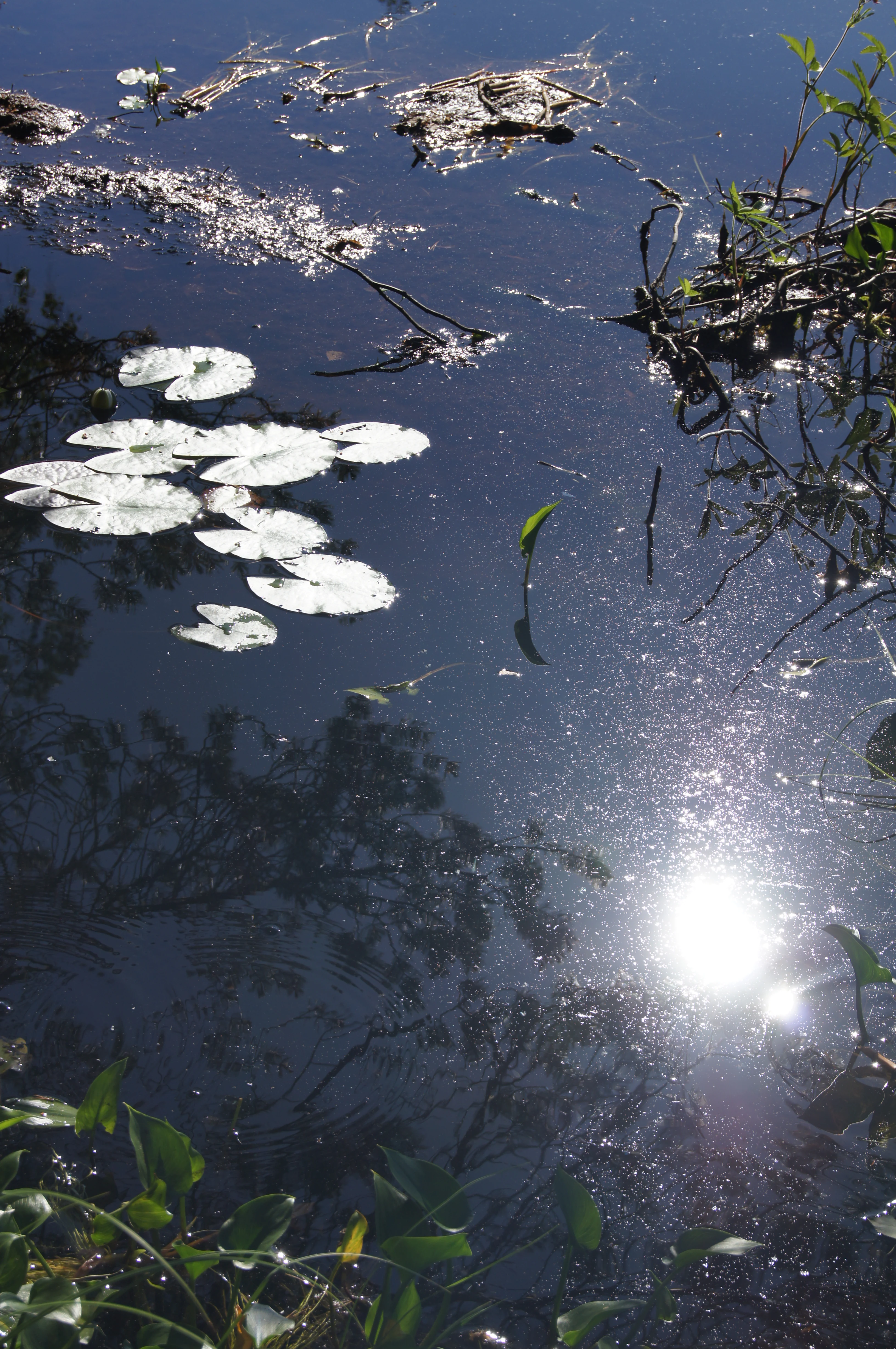
A close up view of a dark, still lake surface with sunlight reflecting on the water, white water lily pads floating on the surface, and some submerged branches and reeds near the edges.
Sunlight reflecting off a small lakelet in Kamanos State Nature Reserve, showing water lilies and vegetation.

Kamanai Strict Nature Reserve history and protected-area timeline

Kamanai Strict Nature Reserve was formally established on 29 June 1979, following growing recognition of the conservation value of the Kamanai peatland and surrounding forests. Its founding was driven by the need to protect the largest and most significant complex of clayey lowlands in northern Lithuania, along with the distinctive landforms, plants, and animals associated with them.

The 1979 designation brought together the full wetland-forest mosaic under a single management framework, balancing core reserve protection with an outer buffer zone. Over the following decades, Kamanai has come to be recognized as one of Lithuania's most important reference sites for raised bog and spruce forest conservation, and it has been integrated into broader national and international assessments of peatland protection. The reserve's public-facing role expanded with the development of a visitor center at Akmenė II, providing a base for educational and interpretive activities.

Kamanai Strict Nature Reserve landscape and geographic character

The landscape of Kamanai Strict Nature Reserve is shaped by a flat to gently undulating lowland terrain, typical of northern Lithuania's glacial plains. The visual centerpiece is the Kamanai raised bog, whose surface is broken by a remarkable pattern of mineral ridges, small islands, quaking mires, and bog pools. The islands of Avinas, Liepiai, and Trainauskienė rise like green outcrops from the surrounding peat, their summits still crowned by trees where vegetation has reclaimed the mineral ground.

South and west of the bog, the reserve transitions into extensive forests. Dark spruce stands dominate much of the wooded area, giving the interior a distinctly northern, shaded character. In the southwestern fringe, pine forests take over, while the southern parts feature more open birch groves. The contrast between the open, water-threaded bog landscape and the dense surrounding forest is one of the reserve's defining scenic qualities. The scenic shorelines of the Nimfėjai and Salos lakes and the central Kamanai Lake, around 6 hectares in size, add further visual interest within the bog itself.
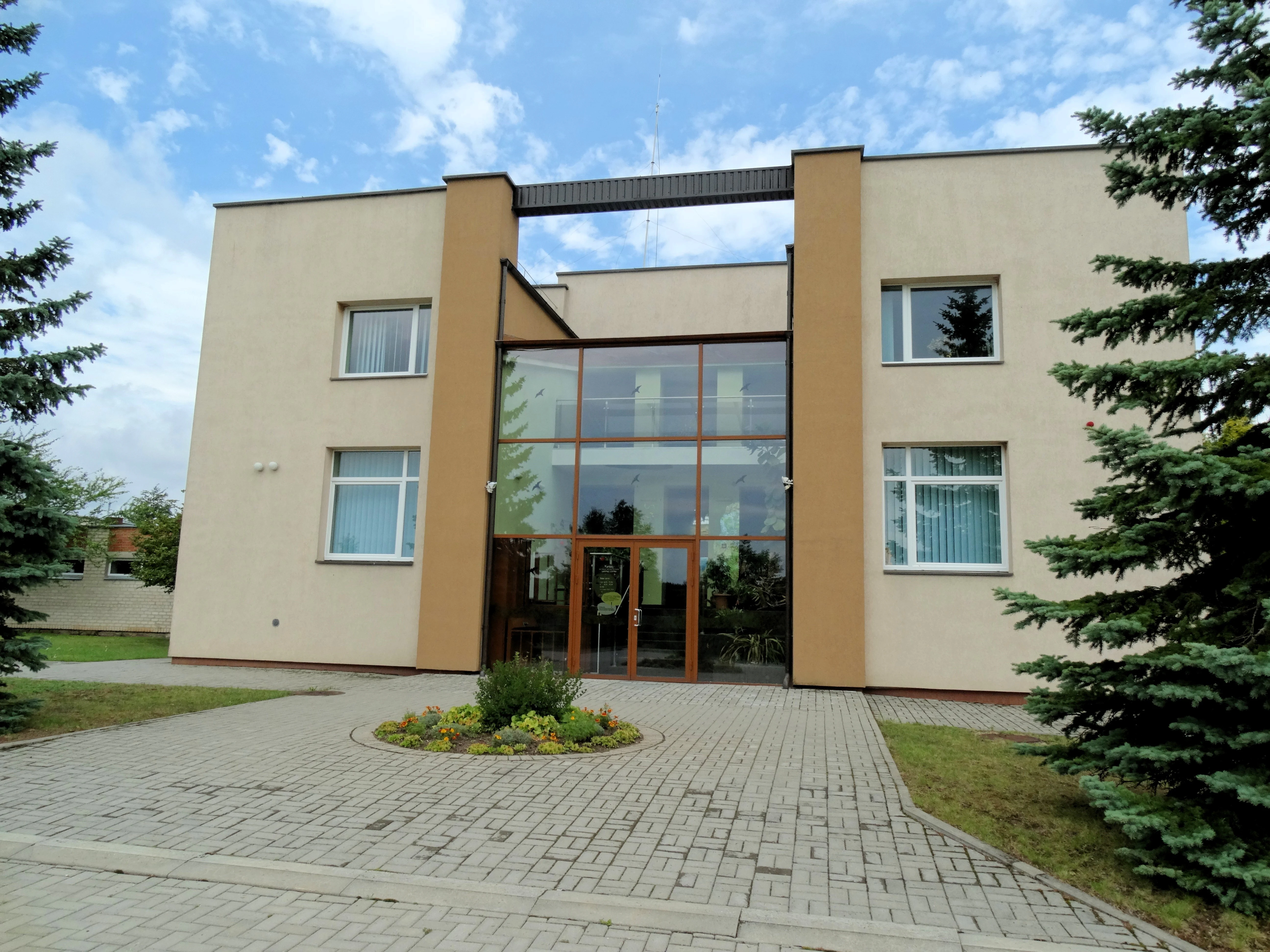
A modern two-story building with a light beige facade, featuring a central glass atrium entrance and a paved courtyard in front.
The Kamanos State Nature Reserve visitor center, which serves as the administrative building and point of contact for the park.

Kamanai Strict Nature Reserve ecosystems, habitats, and plant life

The reserve's ecological identity is defined by the interplay between raised bog, transitional mire, bog pools, and coniferous forest. The Kamanai peatland is a classic example of a northern Lithuanian raised bog, where peat accumulation over thousands of years has created a thick, dome-shaped mass of Sphagnum and other bog vegetation. The bog's edges grade into wet forest and mire communities, while its center holds the most ombrotrophic, nutrient-poor conditions.

Forests cover more than half of the reserve, and they are predominantly old-growth or near-natural spruce stands, with smaller areas of pine, birch, and mixed woodland. Together, the forest and bog create a gradient of habitat types, supporting a wide range of plant communities from relict boreal species in the spruce forests to specialized bog flora along the mires and pools. Aquatic and semi-aquatic habitats are abundant, including the bog pools and the Nimfėjai, Salos, and Kamanai lakes, which contribute to the overall hydrological and ecological diversity.
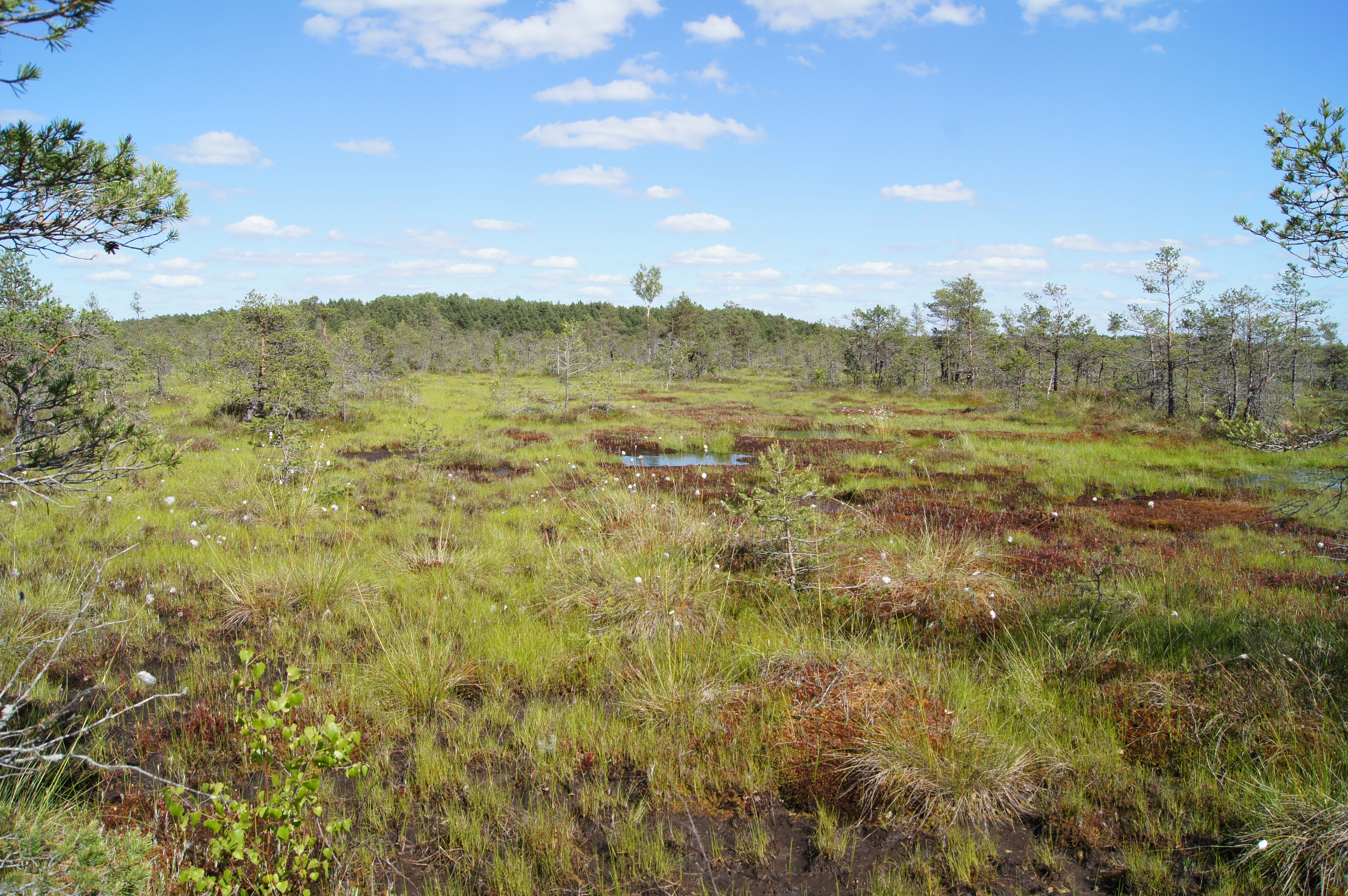
A wide view of a raised bog landscape with mossy green and reddish ground, scattered small coniferous trees, and a distant tree line under a bright blue sky.
The expansive Kamanai bog landscape, characterized by mossy ground, small pine trees, and pools of water.

Kamanai Strict Nature Reserve wildlife and species highlights

Kamanai supports a remarkable diversity of wildlife for a strictly protected reserve of its size. Wolves are resident in the area, while lynx pass through, reflecting the reserve's role as part of a wider landscape inhabited by large carnivores. The hazel dormouse, a small and elusive mammal, has also been recorded.

Birds are a particular highlight. The reserve is well known for its breeding black storks, a Red Data Book species in Lithuania, and for the presence of lesser spotted eagles, Eurasian sparrowhawks, lapwings, black grouse, and a wide range of typical bog and forest birds. The combination of open mire, bog pools, and surrounding forest creates nesting and feeding habitat for many species with different ecological requirements.

The reserve also has a rich insect fauna, with rare dragonflies such as the white-faced darter recorded near the Nimfėjai lakes. Bog pools, fens, and forest margins support diverse invertebrate communities, which in turn sustain the reserve's bird populations. Overall, Kamanai is recognized as a nationally important area for Red Data Book species across multiple groups, including plants, fungi, lichens, mammals, birds, amphibians, fish, and invertebrates.

Kamanai Strict Nature Reserve conservation status and protection priorities

Kamanai Strict Nature Reserve is designated at the highest level of protection, classified as an IUCN Category Ia strict nature reserve, where natural ecological processes are allowed to continue with minimal human disturbance. This makes it an important reference site for the long-term study of raised bog and spruce forest dynamics in Lithuania.

The reserve's conservation significance lies in the combination of its size, habitat diversity, and the presence of multiple Red Data Book species across plants, fungi, lichens, mammals, birds, amphibians, fish, and invertebrates. Of particular note are the populations of black stork, lesser spotted eagle, and rare bog plants such as small-leaved sundew and hollow-rooted catchfly. The protection of the surrounding spruce and pine forests, which act as a buffer for the peatland, is integral to maintaining the reserve's overall ecological integrity.

In the broader Lithuanian conservation context, Kamanai stands as a key component of the country's network of strict nature reserves and contributes to the protection of peatlands, which are among the most important carbon-storing and biodiversity-supporting ecosystems in the Baltic region.

Top sights and standout views in Kamanai Strict Nature Reserve

The Kamanai raised bog with its unusual ridge-and-pool relief, the small islands of Avinas, Liepiai, and Trainauskienė, and the network of more than 120 bog pools together form the reserve's most distinctive scenic and ecological feature. The picturesque Nimfėjai and Salos lakes, together with the central Kamanai Lake, add further focus within the bog landscape.

Equally noteworthy are the reserve's old spruce-dominated forests and the rare wildlife they and the bog support, from breeding black storks and lesser spotted eagles to resident wolves and visiting lynx. The reserve's IUCN Category Ia status underscores its role as a strictly protected natural reference site, while its visitor center at Akmenė II anchors its educational and interpretive role.

Best time to visit Kamanai Strict Nature Reserve

The reserve has a distinctly seasonal character that shapes the experience of a visit. Late spring and early summer are favorable for observing breeding birds and the fresh green flush of bog vegetation, while summer offers the warmest conditions for staying on the bog boardwalks and viewing the open water and flowering plants of the mire.

Autumn brings vivid colors to the surrounding birch and mixed forests and is generally one of the more comfortable seasons for walking and exploring the reserve's edges. Winter can transform the bog into a stark, quiet landscape where snow accentuates the contrast between dark spruce forest and paler open peatland, though peatland and forest access may be limited by weather and protection rules. Because Kamanai is a strict nature reserve, much of the territory is off-limits to general visitors, and experiences are largely focused on the visitor center, marked trails, and guided excursions rather than free-ranging travel across the reserve.
Monthly climate preview

Long-term representative temperature ranges and monthly precipitation patterns

Kamanų valstybinis gamtinis rezervatas Climate Normals and Annual Weather Rhythm

Representative coordinates record measured multi-year temperature shifts alongside steady daily precipitation averages across twelve distinct months. Detailed monthly records unpack complete seasonal normals and provide a comprehensive baseline for regional climate studies.
Annual mean6 °C
-4 °C18 °C
Jan-4°
Feb-4°
Mar
Apr
May11°
Jun15°
Jul18°
Aug17°
Sep12°
Oct
Nov
Dec-2°
Warmest month
July

17.5 °C

Coolest month
January

-4 °C

Wettest month
July

2.4 mm/day

Driest month
March

1.3 mm/day

Park location guide

Geography guide, regional context, and park location map for Kamanai Strict Nature Reserve

Kamanai Strict Nature Reserve park geography, regions, and map view in Lithuania

Understand where Kamanai Strict Nature Reserve sits in Lithuania through a broader geographic reading of the surrounding landscape, nearby location context, and its mapped position within the national park landscape.

How Kamanai Strict Nature Reserve fits into Lithuania

Lithuania is a unitary semi-presidential republic and one of three Baltic states in Northern Europe. It lies on the eastern coast of the Baltic Sea, with Vilnius as its capital and largest city. The country regained independence in 1990 after Soviet occupation and joined the European Union in 2004. Lithuania has a population of about 2.9 million and covers an area of 65,300 km².

Wider geography shaping Kamanai Strict Nature Reserve in Lithuania

Lithuania is situated on the eastern shore of the Baltic Sea in Northern Europe. It borders Latvia to the north, Belarus to the east and south, Poland to the south, and Russia's Kaliningrad Oblast to the southwest. The country also has a maritime border with Sweden to the west. The terrain is largely flat with rolling hills, numerous lakes, and rivers. The Nemunas River is the longest river in the country.

Map view of Kamanai Strict Nature Reserve

Use this park location map to pinpoint Kamanai Strict Nature Reserve in Lithuania, understand its exact geographic position, and read its mapped placement within the surrounding landscape more clearly.

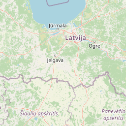
Pigeon | © OpenStreetMap contributors

Location context for Kamanai Strict Nature Reserve

Akmenė District Municipality

Visual exploration of raised bogs, wetland habitats, and northern forest terrain

Kamanų valstybinis gamtinis rezervatas Landscape and Scenery Photography

Visual records capture the distinctive topography of Kamanų valstybinis gamtinis rezervatas, revealing patterns across raised bogs, mineral ridges, and dense spruce forests. Photographic documentation offers clear insight into the protected terrain, remote wetland habitats, and scenic water bodies defining northern Lithuania.

A close up view of a dark, still lake surface with sunlight reflecting on the water, white water lily pads floating on the surface, and some submerged branches and reeds near the edges.

A close-up view of a dark-colored white-faced darter dragonfly with transparent, veined wings resting on a person's index finger, set against a blurred dark blue water background.

A modern two-story building with a light beige facade, featuring a central glass atrium entrance and a paved courtyard in front.

A wide view of a raised bog landscape with mossy green and reddish ground, scattered small coniferous trees, and a distant tree line under a bright blue sky.

Park atlas

Compare surrounding regional park geography and connected northern wetland landscapes

Explore Protected Areas and National Parks Near Kamanų valstybinis gamtinis rezervatas

Continue exploring regional protected landscapes and wetland reserves located near Kamanų valstybinis gamtinis rezervatas. Comparing adjacent conservation areas provides deeper insight into the glacial plain topography and forest ecosystems of northern Lithuania.
Watercolor painting showing rolling hills, a lake, and green forests under a soft sky
National parkLithuania
About 51 km away#1 closest

Southwest

Žemaitija National Park: Mapped Glacial Terrain and Samogitian Protected Landscape

Explore protected areas and natural geography in Northwestern Lithuania.

Žemaitija National Park is a protected natural reserve in Lithuania, defined by its distinctive glacially sculpted landscape. This park preserves over 217 square kilometers of hilly terrain, featuring significant lake systems like Lake Plateliai and substantial forest cover interspersed with wetlands. Users can explore the park's unique topographic character, its mapped geographic features, and its role as a vital protected area within the Samogitian region, offering a rich context for atlas-based discovery.

Area
217.54 km²
Established
1991
IUCN
II
Relief
Highland
Watercolor illustration showing a marshy landscape with forests and distant hills under a soft sky.
National parkLatvia
About 69 km away#2 closest

Northeast

Ķemeri National Park: Discover Latvia's Iconic Protected Bog and Wetland Geography

Explore a unique protected landscape with mapped bog ecosystems and regional natural terrain.

Ķemeri National Park in Latvia is a remarkable protected area, celebrated for its expansive and ecologically significant raised bog systems, particularly the Great Ķemeri Bog. This national park showcases a unique geographical character, featuring natural sulfur springs, therapeutic muds, and a series of ancient lagoon lakes that support rich birdlife. Its diverse wetland habitats and distinct peatland landscapes offer a compelling focus for atlas-based discovery and understanding the regional geography of the Latvian coast.

Area
381.65 km²
Established
1997
IUCN
II
Relief
Lowland
Watercolor painting of a landscape with a river flowing through grassy fields, trees, and mountains in the background
National parkLithuania
About 122 km away#3 closest

Southwest

Curonian Spit National Park: Atlas of Baltic Sand Dunes and Coastal Protected Areas

Exploring the narrow peninsula landscape of Lithuania

Curonian Spit National Park is a protected coastal terrain featuring massive sand dunes and coniferous forests situated along the Baltic Sea. This detailed map-based overview examines the geomorphology of the spit, the stabilization of the Nagliai reserve, and the regional geography that defines this unique ecological corridor within Lithuania.

Area
264.74 km²
Established
1991
IUCN
II
Visitors
400K annual
Watercolor illustration of a river flowing through a valley with hills and greenery
National parkLatvia
About 148 km away#4 closest

Northeast

Gauja National Park: Latvia's Largest National Park Atlas and Protected Landscape

Mapped terrain and diverse natural heritage in Vidzeme.

As Latvia's largest national park, Gauja offers a deep dive into a protected landscape defined by the ancient Gauja River valley and its spectacular Devonian sandstone cliffs. This page provides essential geographic context and atlas-style information, detailing the park's mapped boundaries, unique geological formations, and the rich tapestry of natural and cultural heritage that makes it a cornerstone of the region's protected lands. Explore the varied terrain, from river valleys to rolling uplands, all within a meticulously mapped conservation area.

Area
917.87 km²
Established
1973
IUCN
II
Relief
Mixed relief
Biosphere reserveLithuania
About 148 km away#5 closest

Southeast

Taujėnų, Užulėnio miškų biosferos poligonas: Protected Forest Landscapes of Lithuania

Central Baltic lowland conservation territory

Spanning central Lithuania, this biosphere reserve preserves a vast mosaic of deciduous, coniferous, and mixed forest lands. The territory supports high-quality bird habitats through disciplined forestry practices and the protection of complex wetland and peatland systems, making it a reference site for lowland forest conservation.

Area
44.19 km²
Established
2004
Relief
Lowland
Climate
Temperate
Biosphere reserveAnykščiai District Municipality
About 152 km away#6 closest

Southeast

Šimonių Giria Biosphere Reserve in Anykščiai District Municipality, Lithuania

Protected forest massif and glacial landscape mapping

Šimonių giria stands as a prominent biosphere reserve in northern Lithuania, offering an expansive, pine dominated woodland defined by post glacial sands, extensive peat bogs, and a network of interior lakes. This structured overview details the park geographical features, from its role in the Natura 2000 network to its critical function as a biodiversity monitoring site within the Anykščiai District Municipality.

Area
232.61 km²
Established
2004
Relief
Lowland
Climate
Temperate
Watercolor illustration of a river flowing through a forested landscape with mountains in the background
National parkLatvia
About 152 km away#7 closest

North

Slītere National Park: Latvia's Protected Coastal Landscape with Blue Hills and Bird Flyways

Explore the unique terrain and protected geography of this Baltic national park.

Slītere National Park represents a distinctive protected landscape on Latvia's Courland Peninsula, celebrated for its ancient geological formations like the Blue Hills (Zilie Kalni) and its role as a crucial bird migration corridor. The park's geography encompasses varied dune systems, wetland habitats, and rich broadleaf forests, offering a unique mapped environment. Discover the park's protected area boundaries and its significance within the regional Baltic geography, highlighting its unique ecosystem features and landscape context.

Area
164.14 km²
Established
2000
IUCN
II
Relief
Mixed relief
A watercolor painting showing a wide, calm river winding through a flat, green delta landscape under a hazy sky.
Regional parkLithuania
About 156 km away#8 closest

Southwest

Nemunas Delta Regional Park: Mapping the Wetland Mosaic of the Lithuanian Coast

Explore the complex hydrology and floodplain geography of this Ramsar-listed regional park

Nemunas Delta Regional Park protects a unique river delta landscape shaped by seasonal floods and intricate water channels. Covering the lowlands where the Nemunas River reaches the Baltic Sea, the park is a primary site for ornithological research and wetland conservation, home to Rusnė Island and Lake Krokų Lanka. This protected area offers profound insight into coastal delta formation and the ecological importance of lowland floodplains.

Area
239.5 km²
Established
1992
Relief
Lowland
Climate
Temperate

Common questions about visiting, size, designation, and location context for Kamanai Strict Nature Reserve

Kamanai Strict Nature Reserve FAQs for park facts, access, geography, and protected area context

Find quick answers about Kamanai Strict Nature Reserve, including protected-area facts, park geography, trail and visitor context, and how the park fits into its surrounding country and regional landscape.
MoriAtlas Explorer

Continue Your Protected Areas Search Across the Global Atlas

Deepen your exploration by continuing the structured search for national parks and protected areas worldwide. Utilize the comprehensive filtering capabilities to compare different conservation landscapes and refine your understanding of global park geography. Discover more about the distribution and characteristics of protected natural areas.

Global natural geography