
Mori Atlas logo
Wildlife reserveKambalakonda Wildlife Sanctuary

A dense peri-urban wildlife reserve situated within the hilly foothills of Andhra Pradesh.

Kambalakonda Wildlife Sanctuary: Mapping the Protected Forest Landscapes of the Eastern Ghats

Kambalakonda Wildlife Sanctuary encompasses a significant mosaic of dry evergreen forest, scrub, and meadows across the northern foothills of the Eastern Ghats. Located on the immediate outskirts of Visakhapatnam, this protected area preserves vital hilly terrain that provides a sanctuary for diverse mammals, reptiles, and birdlife. The reserve serves as a critical ecological refuge, balancing dense vegetation with open valleys in a unique peri-urban setting.

dry evergreen forestEastern Ghatsperi-urban sanctuarywildlife sanctuaryAndhra PradeshVisakhapatnam
A flat-style digital illustration of a serene landscape featuring a winding river in a valley, framed by rolling green and peach-colored mountains under a sunlit sky with soft clouds.

Kambalakonda Wildlife Sanctuary

Wildlife reserve

Park overview

Structured park overview, official facts, and landscape profile for Kambalakonda Wildlife Sanctuary

Kambalakonda Wildlife Sanctuary park facts, protected area profile, and essential visitor context

Review the core facts for Kambalakonda Wildlife Sanctuary, including designation, size, terrain, visitor scale, habitats, and operating context in one park-focused overview.

About Kambalakonda Wildlife Sanctuary

Kambalakonda Wildlife Sanctuary occupies a strategically important conservation position on the northern outskirts of Visakhapatnam, one of Andhra Pradesh's largest coastal cities. The sanctuary stretches across hilly terrain west of National Highway 16 and extends into the transitional landscape between the urban edge of Visakhapatnam, the town of Pendurthi, and the surrounding rural hinterland. It lies in the foothills of the Eastern Ghats, an ancient mountain chain that runs along much of eastern India, and its forested slopes form part of the broader ecological network of this range.

Ecologically, the sanctuary is a textbook example of the East Deccan dry evergreen forest type, a relatively uncommon formation that mixes evergreen tree species adapted to dry conditions with more open scrub and meadow vegetation. This combination produces a mosaic of habitats with varying levels of canopy cover, understory density, and ground vegetation. The terrain is hilly and uneven, with steep slopes and sheltered valleys that support different microhabitats within a relatively compact area. Open meadows provide grazing opportunities for herbivores, while denser scrub and forested slopes offer cover and nesting sites for a wide range of species.

The sanctuary's biodiversity profile is unusually rich for a reserve of its size and urban proximity. Mammals documented in the area include Indian muntjac, spotted deer, sambar deer, wild boar, Indian hare, jungle cat, ruddy mongoose, Asian palm civet, and several rarer species such as the Indian leopard, rusty-spotted cat, Indian wild dog, jackal, pangolin, and Madras treeshrew. Reptiles range from commonly observed species like rat snakes, Indian cobras, Bengal monitors, and Indian chameleons to rarer records of Indian pythons, vine snakes, Russell's vipers, and the locally notable Visakhapatnam limbless skink, a species of regional conservation interest.

Birdlife in the sanctuary is similarly varied, with common residents including the Indian paradise flycatcher, rufous treepie, black drongo, laughing dove, spotted dove, red-wattled lapwing, rose-ringed parakeet, pied crested cuckoo, spotted owlet, green bee-eater, Indian roller, red-whiskered bulbul, Indian robin, baya weaver, white wagtail, and pied kingfisher. Rarer sightings include the Indian golden oriole, Indian peafowl, grey francolin, eastern barn owl, Indian grey hornbill, banded bay cuckoo, painted spurfowl, and white-bellied sea eagle. The sanctuary also supports a notable butterfly fauna, with species such as the common Mormon, lime swallowtail, blue tiger, plain tiger, mottled emigrant, common crow, and great eggfly among the recorded inhabitants, contributing to its broader ecological significance.

Quick facts and research context for Kambalakonda Wildlife Sanctuary

Kambalakonda Wildlife Sanctuary is located in Visakhapatnam district, Andhra Pradesh, on the northern edge of the city of Visakhapatnam. It is classified as an IUCN Category IV protected area, reflecting its role in habitat and species management. The sanctuary covers roughly 70.70 square kilometers and has been under formal forest protection since 10 March 1970, when it came under the Andhra Pradesh Forest Department after previously being held by the Maharajah of Vizianagaram. Its vegetation is characterized by East Deccan dry evergreen forest mixed with scrub and meadows, set in the foothills of the Eastern Ghats. The Indian leopard is recorded as the sanctuary's indicator species, highlighting the area's value for larger mammal conservation within a peri-urban setting.

Protection and recognition

Documented terrestrial conservation framework and official recognition records

Kambalakonda Wildlife Sanctuary Protection Status and Administrative Scope

Kambalakonda Wildlife Sanctuary maintains a defined terrestrial protection scope within its regional conservation landscape. Official records outline the baseline administrative status and management framework governing the protected area.

Protection details

Protection scope
Terrestrial
Transboundary protection
No
Park context

Deeper park guide and search-rich context for Kambalakonda Wildlife Sanctuary

Kambalakonda Wildlife Sanctuary history, landscape, wildlife, and travel context

Explore Kambalakonda Wildlife Sanctuary through its history, landscape character, ecosystems, wildlife, conservation priorities, cultural context, and seasonal travel timing in a structured park guide built for atlas discovery and search intent.

Why Kambalakonda Wildlife Sanctuary stands out

Kambalakonda is best known for protecting a representative patch of East Deccan dry evergreen forest in the foothills of the Eastern Ghats, right on the doorstep of Visakhapatnam. Its varied terrain of hilly slopes, scrub, and meadows supports an unusually diverse mix of mammals, reptiles, birds, and butterflies for an area so close to a major urban center. The sanctuary also stands out for the Indian leopard's role as its indicator species, signaling the ecological value placed on apex predator habitat even within a relatively small, peri-urban reserve.
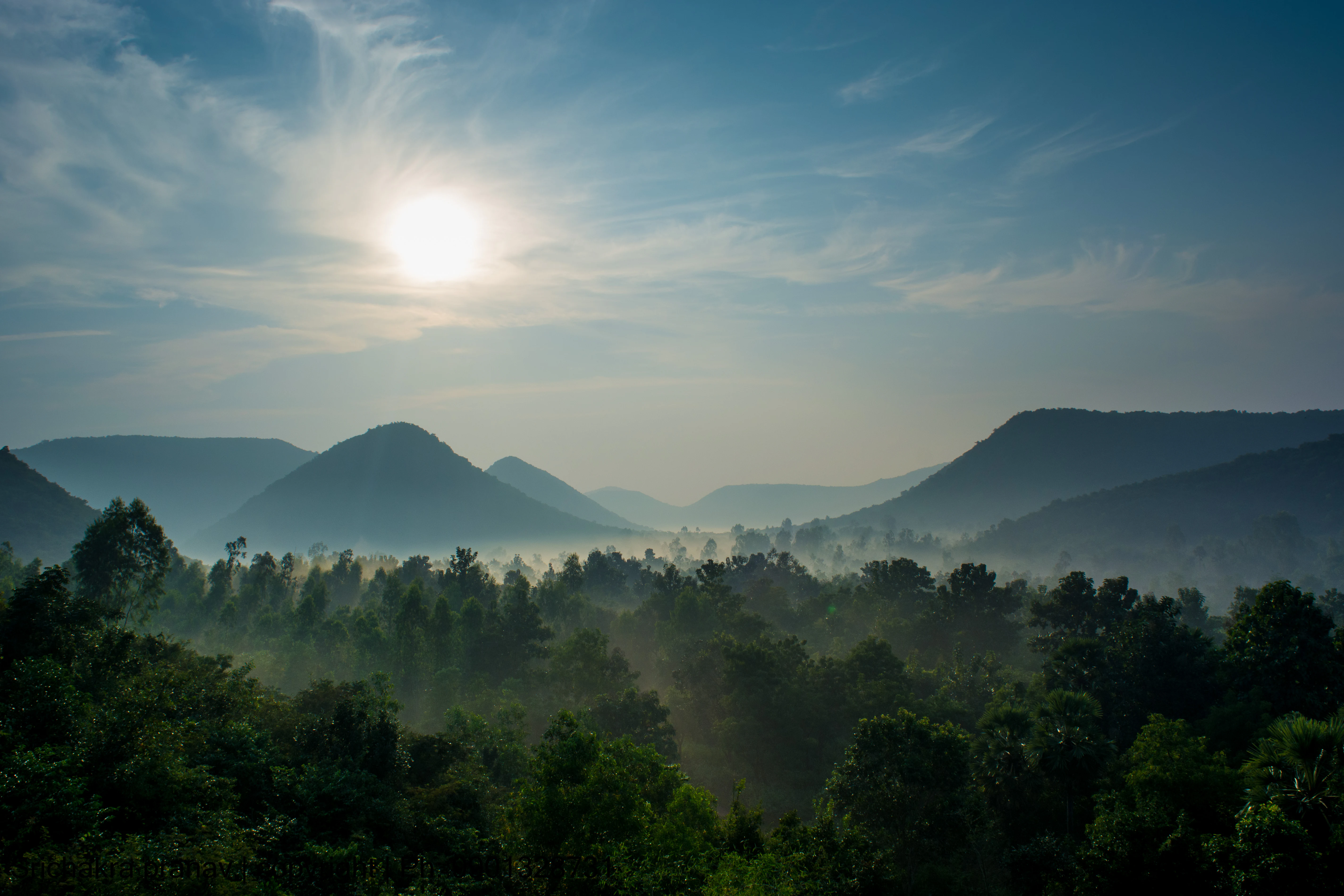
A scenic landscape view looking over a dense forest toward rolling hills under a bright, misty morning sky.
A misty sunrise over the hills of Kambalakonda Wildlife Sanctuary.

Kambalakonda Wildlife Sanctuary history and protected-area timeline

The land that now forms Kambalakonda Wildlife Sanctuary was historically under the control of the Maharajah of Vizianagaram before it was brought under modern forest administration. The transition to formal state protection occurred on 10 March 1970, when management of the area was transferred to the Andhra Pradesh Forest Department, marking the official establishment of the sanctuary.

Since then, the sanctuary has been managed as a forest reserve focused on habitat and species protection within the Eastern Ghats foothills. It has been classified as an IUCN Category IV protected area, acknowledging its role in active habitat and species management rather than strict wilderness preservation. Over the decades, the sanctuary has gained recognition both for its biodiversity and for its function as a peri-urban green space serving the rapidly growing city of Visakhapatnam. The surrounding landscape, including features like the Bakkannapalem reservoir, has continued to shape the sanctuary's identity as a refuge of dry evergreen forest in a region otherwise dominated by urban and agricultural land use.

Kambalakonda Wildlife Sanctuary landscape and geographic character

The topography of Kambalakonda Wildlife Sanctuary is shaped by its position in the foothills of the Eastern Ghats, producing a landscape of rounded hillocks, ridgelines, and gently sloping valleys. The terrain is described as hilly with steep slopes in several areas, with elevation changes creating a network of sheltered hollows and exposed crests. This varied relief contributes significantly to habitat diversity, supporting both denser forest patches on shaded slopes and more open scrub and meadow formations on flatter or sun-exposed ground.

The sanctuary sits between the expanding urban footprint of Visakhapatnam to its south and the wider rural landscape around Pendurthi to the north, with National Highway 16 forming a key reference point along its edge. Small reservoirs and seasonal drainage lines in the surrounding area, such as the Bakkannapalem reservoir, add hydrological features to the landscape and create transitional zones between forest and open land. The combination of hills, scrub valleys, and meadows gives the sanctuary a layered, mosaic-like appearance and offers continually changing vistas for visitors moving through its trails.
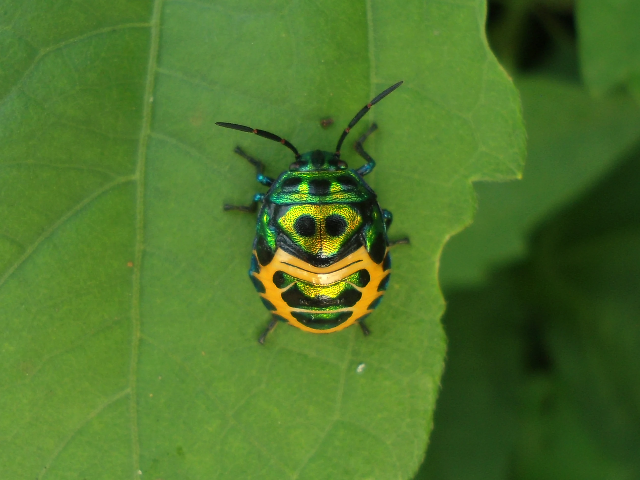
A close-up view of a small, bright green and orange shield-shaped bug, known as a pentatomid nymph, perched on a large green leaf.
A colorful pentatomid nymph resting on a green leaf in Kambalakonda Wildlife Sanctuary.

Kambalakonda Wildlife Sanctuary ecosystems, habitats, and plant life

Kambalakonda represents a characteristic example of East Deccan dry evergreen forest, a habitat type recognized for its mix of evergreen tree species adapted to seasonally dry conditions and more open, hardy scrub vegetation. This dry evergreen formation is relatively uncommon in peninsular India, making the sanctuary an important reference site for this vegetation type within the Eastern Ghats. The presence of scrub and meadow patches interwoven with the broader forest matrix creates a patchwork of habitats, each supporting different plant and animal communities.

The sanctuary's flora includes a wide range of tree, shrub, and understory species typical of the Eastern Ghats. Notable trees present in the area include teak, neem, Indian rosewood, East Indian satinwood, Indian ash, white teak, banyan, several fig species, jamun, golden shower tree, Indian mulberry, mountain pomegranate, and red cutch tree. Shrub and small tree species such as Indian licorice, sage-leaved alangium, bush plum, Indian screw tree, dinnerplate tree, indigo tree, and jungle berry contribute to the structural diversity of the understory. Indian thorny bamboo is also recorded, adding a distinctive grassy-tree component to certain parts of the forest. Altogether, this floral richness supports a complex mosaic of habitats and helps sustain the sanctuary's animal populations.
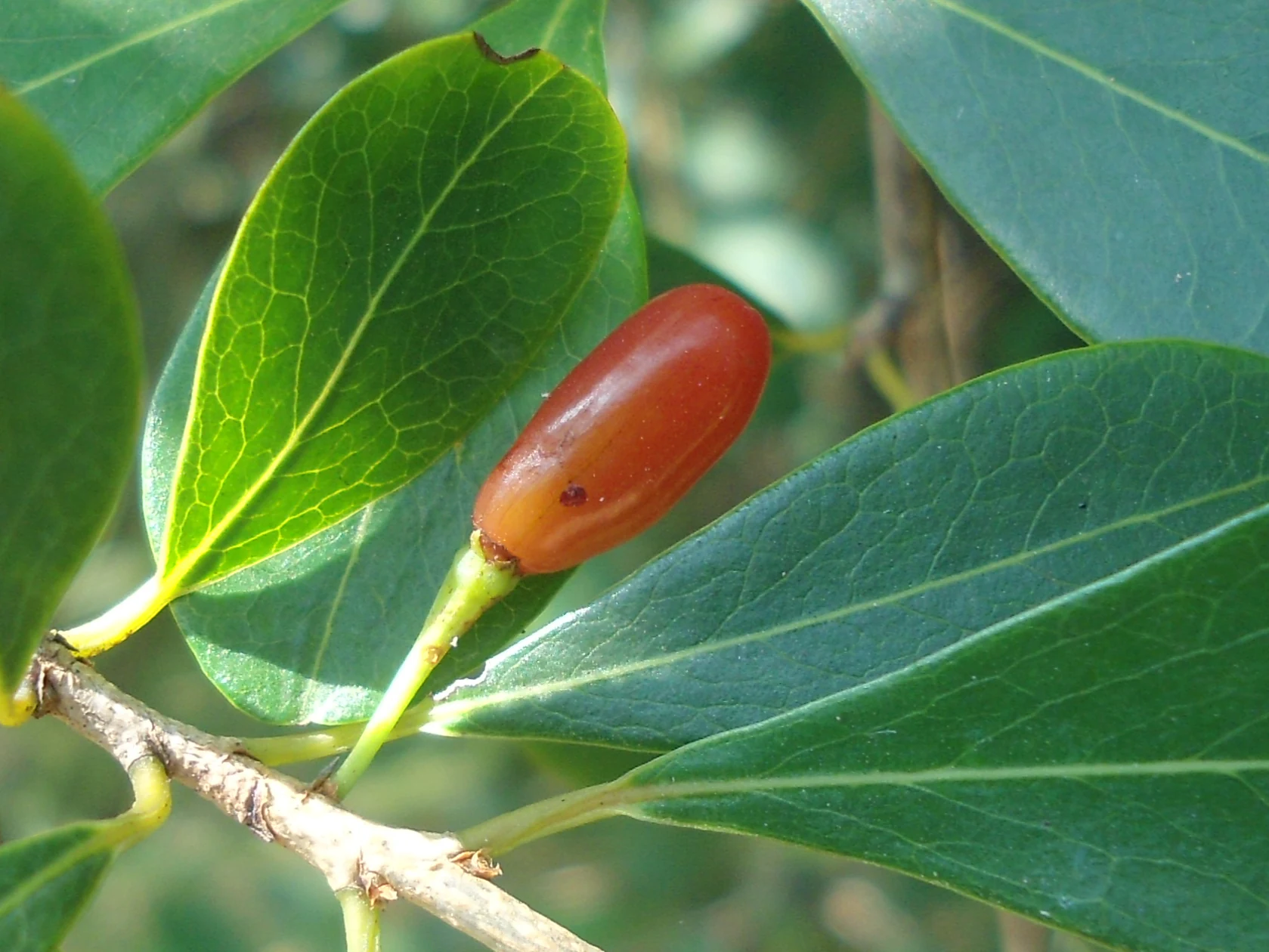
A close up view of a small, shiny, red oblong fruit growing from a green plant stem surrounded by smooth green leaves.
A single red fruit of the Erythroxylum monogynum, also known as the red cedar, observed in the forest.

Kambalakonda Wildlife Sanctuary wildlife and species highlights

The wildlife of Kambalakonda reflects the broader ecological richness of the Eastern Ghats dry evergreen forests. Among mammals, herbivores such as the Indian muntjac, Indian spotted chevrotain, sambar deer, spotted deer, wild boar, and Indian hare are commonly recorded, providing a prey base for the area's carnivores. Smaller carnivores and mesopredators are also present, with common sightings of jungle cats, ruddy mongooses, and Asian palm civets, while rarer observations include the rusty-spotted cat and the Indian leopard, the latter being recognized as the sanctuary's indicator species. Other mammals of conservation interest include the Indian jackal, Indian wild dog, Indian pangolin, and the Madras treeshrew, underlining the area's broader value for small and medium-sized mammal conservation.

Reptile diversity is similarly notable. The sanctuary supports several snake species, including the Indian python, Indian cobra, common Indian bronzeback, and rat snake, alongside rarer records of the common Asian vine snake and Russell's viper. The Indian chameleon and Bengal monitor are relatively common, while the Visakhapatnam limbless skink stands out as a species of considerable regional significance. Avian life is rich and varied, with a mix of resident forest birds, open-country species, and birds of prey. Commonly recorded species include the Indian paradise flycatcher, rufous treepie, black drongo, laughing dove, spotted dove, red-wattled lapwing, rose-ringed parakeet, spotted owlet, green bee-eater, Indian roller, red-whiskered bulbul, and pied kingfisher. Rarer sightings include the Indian peafowl, grey francolin, painted spurfowl, banded bay cuckoo, eastern barn owl, Indian grey hornbill, and white-bellied sea eagle. The sanctuary also hosts an abundant butterfly fauna, including species such as the common Mormon, lime swallowtail, blue tiger, plain tiger, mottled emigrant, common crow, great eggfly, anomalous nawab, and Indian sunbeam, adding to its profile as a year-round hub of invertebrate activity.
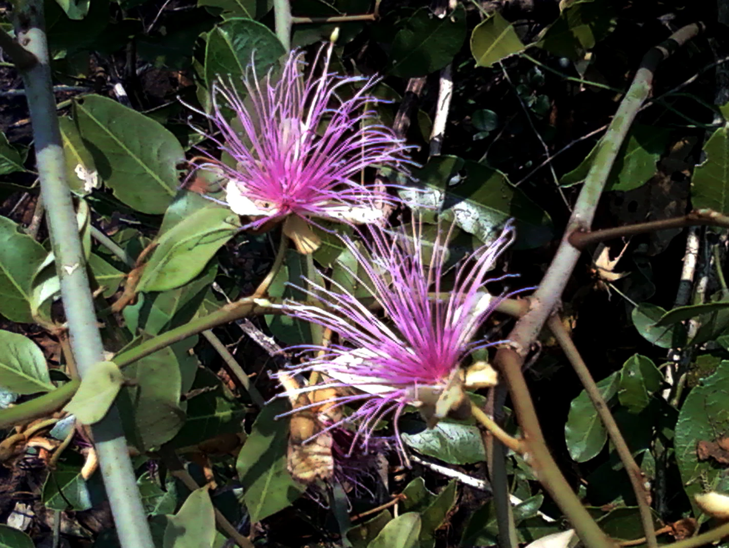
Close up view of two purple, spiky, star-shaped flowers with long stamen threads growing on a green, leafy shrub.
Purple Capparis zeylanica flowers blooming in Kambalakonda Wildlife Sanctuary.

Kambalakonda Wildlife Sanctuary conservation status and protection priorities

Kambalakonda Wildlife Sanctuary holds notable conservation importance as one of the few protected areas representing East Deccan dry evergreen forest near a major Indian coastal city. Its classification as an IUCN Category IV protected area underscores its role in active habitat and species management, balancing biodiversity protection with controlled public engagement. The choice of the Indian leopard as an indicator species reflects the management priority placed on maintaining habitat conditions suitable for wide-ranging carnivores, a hallmark of ecologically functional landscapes.

Beyond its biodiversity value, the sanctuary's position adjacent to Visakhapatnam gives it a strong role in peri-urban conservation, providing a green buffer, wildlife corridor function, and ecosystem services for a densely populated region. The mosaic of dry evergreen forest, scrub, and meadows supports ecological processes such as seed dispersal, predator-prey balance, and habitat connectivity with the broader Eastern Ghats landscape. Protection of this area contributes to the regional conservation of dry evergreen forest types, which are increasingly under pressure from urban expansion and land use change, and helps safeguard species of conservation concern such as the Indian leopard, rusty-spotted cat, Indian pangolin, and Visakhapatnam limbless skink.

Kambalakonda Wildlife Sanctuary cultural meaning and human context

The land that became Kambalakonda Wildlife Sanctuary was historically held by the Maharajah of Vizianagaram, reflecting the traditional role of regional royal estates in managing forested landscapes in northern Andhra Pradesh. The sanctuary's name derives from the nearby Kambalakonda hillock, which itself reflects long-standing local geographical identity in the area. Today, the sanctuary sits within a landscape that has shifted dramatically from princely-era landholdings to a peri-urban protected area serving the modern city of Visakhapatnam, and it has become an important site for environmental awareness, school visits, and recreational engagement with nature for the surrounding communities.
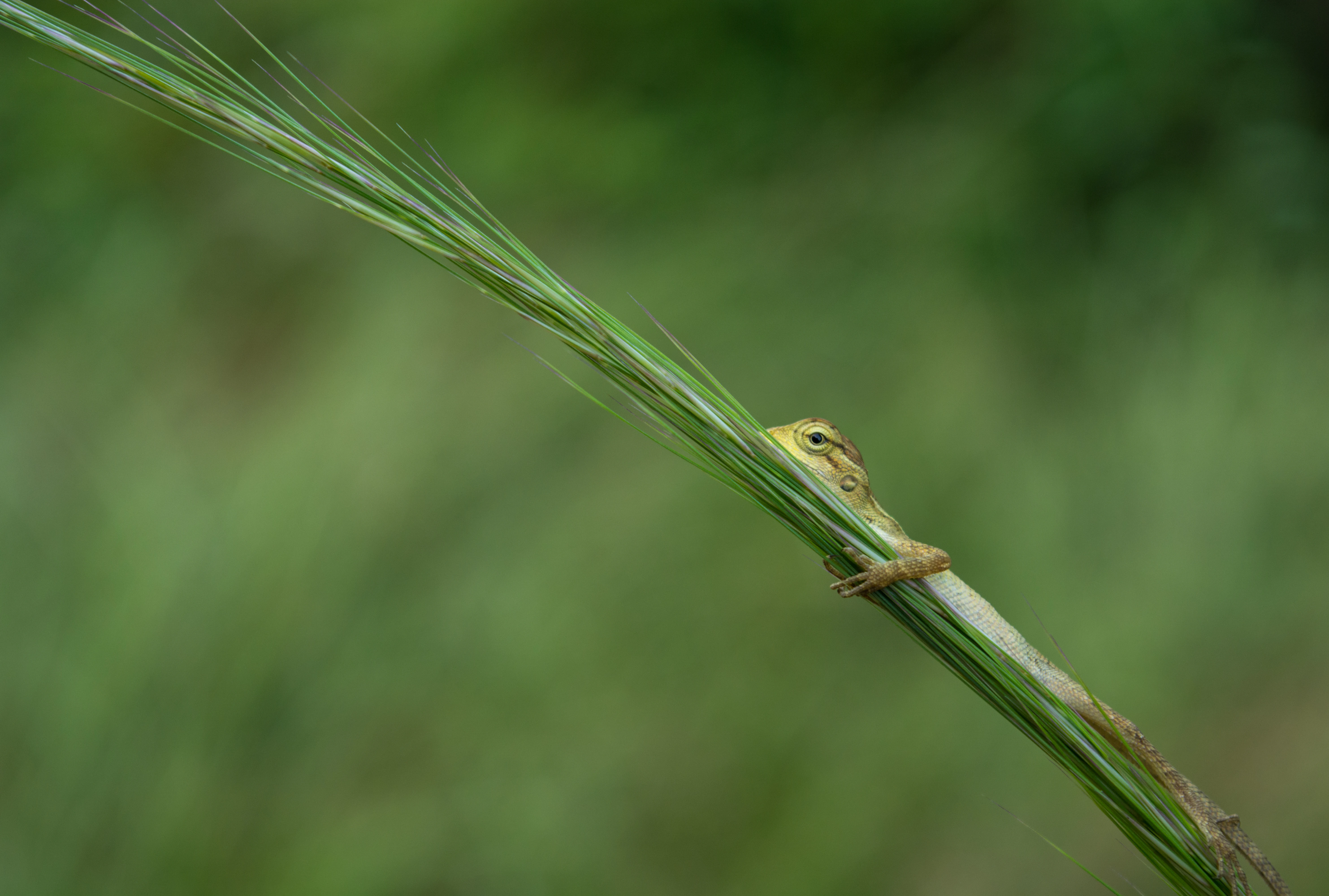
A small lizard partially hidden behind a long, green blade of grass, showing its head and front feet, with a soft-focus green background.
A small lizard, likely a Calotes, perched on a long blade of grass in Kambalakonda Wildlife Sanctuary.

Top sights and standout views in Kambalakonda Wildlife Sanctuary

Kambalakonda combines unusually high biodiversity with exceptional urban accessibility, offering a substantial patch of East Deccan dry evergreen forest just minutes from central Visakhapatnam. Its hilly terrain, mix of scrub and meadows, and Eastern Ghats setting create a varied landscape that supports a wide range of mammals, reptiles, birds, and butterflies, including several species of conservation concern such as the Indian leopard, Indian pangolin, and Visakhapatnam limbless skink. The sanctuary's role as a peri-urban refuge, its rich butterfly fauna, and its value for conservation education make it a distinctive protected area within Andhra Pradesh.
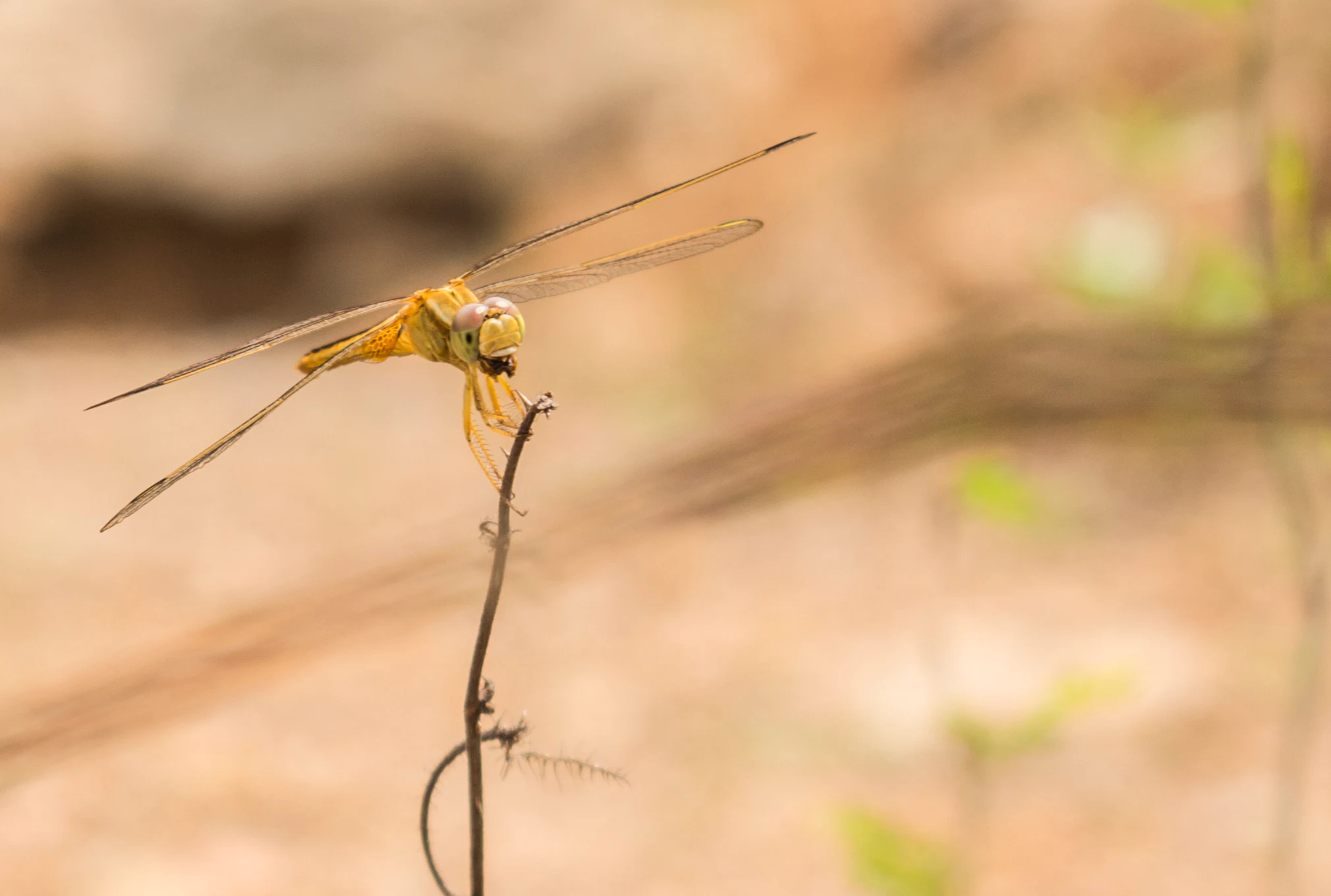
A yellow dragonfly resting on the tip of a thin, brown, curved twig against a blurred, out-of-focus background.
A yellow dragonfly perched on a thin twig in the Kambalakonda Wildlife Sanctuary.

Best time to visit Kambalakonda Wildlife Sanctuary

The sanctuary can be visited year-round, but the cooler and drier winter months from November through February are generally the most comfortable period for exploring its trails, birdwatching, and observing wildlife activity in the open scrub and meadow areas. The post-monsoon season typically brings greener vegetation and more active insect and butterfly populations, making it a rewarding period for those interested in the sanctuary's invertebrate diversity. Summer months can be hot and dry, although drier conditions may concentrate wildlife around remaining water sources and shaded forest patches.

Monthly climate preview

Examine long-term representative temperature ranges and monthly precipitation data across the coordinate.

Kambalakonda Wildlife Sanctuary Climate Normals and Annual Weather Patterns

Kambalakonda Wildlife Sanctuary exhibits measured annual temperature variations and distinct monthly precipitation rhythms based on long-term point observations. Reviewing the complete twelve-month profile provides deeper context on historical temperature bounds and rainfall distribution across the representative terrain.
Annual mean26 °C
20 °C31 °C
Jan21°
Feb24°
Mar28°
Apr30°
May31°
Jun29°
Jul27°
Aug26°
Sep26°
Oct25°
Nov22°
Dec20°
Warmest month
May

31.2 °C

Coolest month
December

20.3 °C

Wettest month
September

7.5 mm/day

Driest month
January

0.3 mm/day

Park location guide

Geography guide, regional context, and park location map for Kambalakonda Wildlife Sanctuary

Kambalakonda Wildlife Sanctuary park geography, regions, and map view in India

Understand where Kambalakonda Wildlife Sanctuary sits in India through a broader geographic reading of the surrounding landscape, nearby location context, and its mapped position within the national park landscape.

How Kambalakonda Wildlife Sanctuary fits into India

India is a South Asian country bordered by the Indian Ocean, Arabian Sea, and Bay of Bengal. It shares land borders with Pakistan, China, Nepal, Bhutan, Bangladesh, and Myanmar. The country has a population of over 1.4 billion people and operates as a federal parliamentary republic with its capital in New Delhi.

Wider geography shaping Kambalakonda Wildlife Sanctuary in India

India occupies the Indian subcontinent in South Asia, bordered by the Arabian Sea to the southwest, the Bay of Bengal to the southeast, and the Indian Ocean to the south. It shares land borders with Pakistan to the west, China, Nepal, and Bhutan to the north, and Bangladesh and Myanmar to the east. The territory also includes the Andaman and Nicobar Islands in the Indian Ocean.

Map view of Kambalakonda Wildlife Sanctuary

Use this park location map to pinpoint Kambalakonda Wildlife Sanctuary in India, understand its exact geographic position, and read its mapped placement within the surrounding landscape more clearly.

Pigeon | © OpenStreetMap contributors

Location context for Kambalakonda Wildlife Sanctuary

Andhra Pradesh

Visualizing Eastern Ghats dry evergreen forest habitats and hilly terrain.

Kambalakonda Wildlife Sanctuary Landscape and Scenery Photography

Visual records capture the rugged hillocks, wooded valleys, and scrub-laced meadows defining Kambalakonda Wildlife Sanctuary. Examining these protected-area photographs reveals the distinct ecological character and varied terrain of this peri-urban reserve.

A scenic landscape view looking over a dense forest toward rolling hills under a bright, misty morning sky.

A close-up view of a dark, spiky Pachliopta hector caterpillar crawling along a thin green leaf against a softly blurred natural background.

A close-up view of a small, bright green and orange shield-shaped bug, known as a pentatomid nymph, perched on a large green leaf.

A close up view of a small, shiny, red oblong fruit growing from a green plant stem surrounded by smooth green leaves.

Close up view of two purple, spiky, star-shaped flowers with long stamen threads growing on a green, leafy shrub.

Four pale greenish-yellow butterflies resting on brown, rocky, damp ground.

A small lizard partially hidden behind a long, green blade of grass, showing its head and front feet, with a soft-focus green background.

A yellow dragonfly resting on the tip of a thin, brown, curved twig against a blurred, out-of-focus background.

A close up view of three white, five-petaled star-shaped flowers with green centers, surrounded by glossy green oval leaves.

A wide, slightly hazy aerial view of green, forested rolling hills surrounding a calm, dark-colored lake or pond in a wildlife sanctuary.

A calm, reflective body of water surrounded by green hills and trees that have lost their leaves.

A close up view of several dense clusters of small, bright red spherical berries hanging from thin brown branches, surrounded by glossy green leaves in a forest environment.

A spotted deer standing on a dirt slope in a wooded forest area.

Close up view of the orange red flowers and green buds of a Helicteres isora plant with large green leaves in the background.

A large, textured, reddish-brown termite mound rising vertically in a forest clearing, with green foliage visible against a bright sky in the background.

A close up portrait of an Indian Peafowl showing its vibrant blue neck, crested head, and dark eye.

Park atlas

Compare surrounding foothill terrain and connected Eastern Ghats conservation landscapes

Explore Parks Near Kambalakonda Wildlife Sanctuary and Regional Protected Areas

Browse other parks near Kambalakonda Wildlife Sanctuary to examine related protected landscapes across the surrounding region. Comparing adjacent terrain helps trace ecological patterns and regional conservation boundaries beyond a single reserve.
A soft watercolor illustration of a river winding through green mangrove vegetation with distant hills under a light, hazy sky.
Wildlife reserveAndhra Pradesh
About 151 km away#1 closest

Southwest

Coringa Wildlife Sanctuary: Mapping Protected Mangrove Wetlands in Andhra Pradesh

Coastal delta geography and estuarine tidal landscape exploration

Coringa Wildlife Sanctuary represents one of the largest continuous stretches of mangrove forests in India. This protected area along the Godavari Estuary offers a rich study in coastal geography, where complex tidal channels, backwater systems, and deltaic landforms create a unique, sediment-rich wetland environment essential for local avian and aquatic life.

Area
235.7 km²
Established
1978
IUCN
IV
Relief
Lowland
National parkIndia
About 175 km away#2 closest

Northwest

Kanger Ghati National Park: National Park Atlas and Mapped Landscape Identity

Explore Kanger Ghati National Park's protected boundaries and regional geography.

Kanger Ghati National Park stands as a key protected national park entity within India, offering insights into its specific geographic setting and conservation landscape. This page details the park's mapped outlines and its role within the broader atlas of South Asia. Understand the natural terrain and regional context that define this protected area, providing a factual foundation for geographic discovery and landscape appreciation.

Area
200 km²
Established
1982
Relief
Mountain
Climate
Tropical
National parkAndhra Pradesh
About 197 km away#3 closest

West

Papikonda National Park: Andhra Pradesh National Park Protected Landscape and Map Exploration

Mapped protected area boundaries and regional geography context.

Papikonda National Park is a designated national park in Andhra Pradesh, India, serving as a crucial component of regional protected landscapes. This entry provides detailed information on its mapped boundaries and geographic positioning, essential for atlas-based exploration and understanding its natural terrain. Users can explore the specific context of Papikonda National Park within the broader geography of Andhra Pradesh through its structured park data.

Area
1,012.86 km²
Established
1978
IUCN
II
Relief
Upland
Wildlife reserveAndhra Pradesh
About 261 km away#4 closest

Southwest

Kolleru Bird Sanctuary Wildlife Reserve: Protected Wetland and Basin Geography Atlas

Mapped freshwater wetlands in Andhra Pradesh

Kolleru Bird Sanctuary represents an essential protected freshwater basin situated in the deltaic plains of Andhra Pradesh. The area supports a dynamic habitat of open water and reedbed environments that transition through the seasons. This record provides a clear geographic view of the sanctuary, highlighting its role as a key Ramsar-recognized wetland within the regional landscape context.

Area
673 km²
Established
1999
IUCN
IV
Relief
Lowland
National parkBijapur district
About 285 km away#5 closest

Northwest

Indravati National Park: National Park Status and Geographic Landscape Context

Explore mapped boundaries and regional geography in Bijapur district.

Indravati National Park represents a significant protected natural area, classified as a national park within India. This entry offers detailed insights into its geographic placement within Bijapur district, emphasizing its mapped protected landscape and its role in regional geography. It serves as a vital point for structured discovery of natural areas and their environmental context.

Area
1,258.37 km²
Established
1981
IUCN
II
Relief
Highland
A horizontal watercolor painting showing a soft landscape with distant mountains, gentle green hills, and light water reflections.
Protected areaOdisha
About 298 km away#6 closest

Northeast

Chilika Lake Protected Area: Mapping the Estuarine Geography of the Odisha Coast

A study of lagoon hydrology, barrier beaches, and protected wetland terrain.

Chilika Lake provides a significant case study in estuarine geography, where tidal influence from the Bay of Bengal meets the runoff of the Eastern Ghats. This expansive protected area is characterized by seasonal water fluctuations, extensive island groups, and a vital barrier spit. The landscape remains a critical reference for understanding coastal wetland development and hydrological connectivity within the broader Indian geographic context.

Area
1,165 km²
Established
1981
Visitors
40K annual
Relief
Lowland
Watercolor painting of a tranquil scene featuring green trees in the foreground, water, and soft, rolling hills in the background.
Wildlife reserveAndhra Pradesh
About 339 km away#7 closest

Southwest

Krishna Wildlife Sanctuary: Coastal Mangrove Landscapes in the Krishna River Delta

Protected estuarine geography in Andhra Pradesh

Discover the geographic extent and habitat composition of Krishna Wildlife Sanctuary. This protected area features dense mangrove forests and intricate tidal waterways across deltaic islands, serving as an important ecological corridor along the Bay of Bengal coast in Andhra Pradesh.

Area
194.81 km²
IUCN
IV
Relief
Lowland
Scope
Terrestrial
National parkMaharashtra
About 469 km away#8 closest

Northwest

Navegaon National Park: Maharashtra's Designated National Park for Atlas Exploration

Mapped protected area and regional landscape context.

Navegaon National Park is a designated national park offering rich opportunities for geographic discovery. Users can delve into its mapped boundaries and understand its protected landscape character within Maharashtra. This page provides structured data for exploring the park's role as a conservation area and its contribution to the natural geography of the region, ideal for atlas-based research.

Area
1,894.94 km²
Established
1975
IUCN
II
Visitors
50K annual

Common questions about visiting, size, designation, and location context for Kambalakonda Wildlife Sanctuary

Kambalakonda Wildlife Sanctuary FAQs for park facts, access, geography, and protected area context

Find quick answers about Kambalakonda Wildlife Sanctuary, including protected-area facts, park geography, trail and visitor context, and how the park fits into its surrounding country and regional landscape.
MoriAtlas Explorer

Continue Your Protected Areas Search Across the Global Atlas

Deepen your exploration by continuing the structured search for national parks and protected areas worldwide. Utilize the comprehensive filtering capabilities to compare different conservation landscapes and refine your understanding of global park geography. Discover more about the distribution and characteristics of protected natural areas.

Global natural geography