Mori Atlas logo
National parkKanger Ghati National Park

Understand the mapped boundaries and regional natural landscape of Kanger Ghati National Park.

Kanger Ghati National Park: National Park Protected Landscape and Geographic Context

(Kanger Valley National Park)

Kanger Ghati National Park represents a significant protected natural area within India, offering a unique lens into the country's diverse geography. This national park designation signifies its importance for conservation and landscape understanding. Explore the mapped outlines and the surrounding regional context that define Kanger Ghati National Park's place in the South Asian atlas, providing a factual basis for appreciating its natural landscape.

National ParksIndiaLimestone CavesWaterfallsDeciduous ForestsTiger Reserves

Kanger Ghati National Park

National park

Park overview

Structured park overview, official facts, and landscape profile for Kanger Ghati National Park

Kanger Ghati National Park park facts, protected area profile, and essential visitor context

Review the core facts for Kanger Ghati National Park, including designation, size, terrain, visitor scale, habitats, and operating context in one park-focused overview.

About Kanger Ghati National Park

Kanger Ghati National Park occupies a significant position among India's protected areas as a biodiverse forest ecosystem in the heart of the Bastar region of Chhattisgarh. The park derives its name from the Kanger River, which flows centrally through the protected area from northwest to southeast, carving deep gorges through the surrounding hills. Established in 1982, the park extends from the Teerathgarh waterfalls in the west to the Kolab River along the Odisha state boundary in the east, spanning approximately 33.5 kilometres in length and 6 kilometres in average width. The park's landscape is remarkably heterogeneous, encompassing low flat areas, steep slopes, plateaus, valleys, and seasonal stream courses that create diverse microhabitats throughout the area. The park is notable for its ecological significance, protecting one of the few remaining tracts of relatively untouched virgin forest in Peninsular India while providing refuge to substantial populations of large mammals including Bengal tigers and leopards. In 2025, the national park was included on the tentative list of UNESCO World Heritage Sites, recognizing its outstanding universal value.

Quick facts and research context for Kanger Ghati National Park

Kanger Ghati National Park spans roughly 200 square kilometres in the Bastar district of Chhattisgarh, India, approximately 30 kilometres southeast of Jagdalpur city. The park protects a valley ecosystem centred on the Kanger River, with terrain varying from low flat areas to steep slopes, plateaus, and deep gorges. Its limestone cave systems, including the famous Kotumsar Cave, represent some of India's most biologically explored subterranean environments. The park contains significant biodiversity with 49 mammal species, 144 bird species, and notable populations of apex predators including Bengal tigers and leopards.

Protection and recognition

Analyzing the terrestrial management scope and historical framework established in 1982.

Kanger Ghati National Park Protection Status and Designation History

Established in 1982 as a terrestrial sanctuary, Kanger Ghati National Park operates under a dedicated conservation framework to maintain its regional wilderness boundaries. Browse the verified designation details, historical timeline, and official protection metrics that define the geographic administration of the preserved forest landscape.

Protection details

Protection scope
Terrestrial
Designated year
1982
Transboundary protection
No
Park context

Deeper park guide and search-rich context for Kanger Ghati National Park

Kanger Ghati National Park history, landscape, wildlife, and travel context

Explore Kanger Ghati National Park through its history, landscape character, ecosystems, wildlife, conservation priorities, cultural context, and seasonal travel timing in a structured park guide built for atlas discovery and search intent.

Why Kanger Ghati National Park stands out

Kanger Ghati National Park is best known for its extraordinary limestone cave systems, particularly Kotumsar Cave which contains five chambers with stalactite and stalagmite formations and constant temperature conditions. The park also features Tirathgarh Waterfalls, where water cascades over 100 feet in a dramatic display often described as a milky fall due to its white appearance. The park protects one of the last remaining pockets of virgin untouched forests in Peninsular India and serves as a critical habitat for Bengal tigers, leopards, and the state bird, the Bastar hill myna.

Kanger Ghati National Park history and protected-area timeline

Kanger Ghati National Park was formally established in July 1982 as a protected area under Indian national park legislation, designated under IUCN Category II for national park status. The creation of the park reflected growing recognition of the ecological and biodiversity significance of the Kanger Valley region, which had long been inhabited by tribal communities and remained relatively的开发ed compared to other parts of central India. The park's boundaries were defined to encompass the central Kanger River valley and surrounding forested landscapes that had historically served as wildlife habitat. Following establishment, the park has been managed by the Conservator of Forest with support from the Chhattisgarh state forest department. The inclusion of the park on UNESCO's tentative list in 2025 represents a recent milestone, acknowledging its potential for world heritage designation based on its geological, ecological, and cultural values.

Kanger Ghati National Park landscape and geographic character

The physical landscape of Kanger Ghati National Park is characterized by its position within the Kanger River valley, where the river flows centrally through deep gorges flanked by steep hill ranges on both sides. The terrain is predominantly hilly, with the eastern half being particularly rugged and steep, while the western portion is comparatively less mountainous with interspersed small plateaus. The park's elevation ranges from 338 to 781 metres above mean sea level, creating conditions suitable for diverse forest types and wildlife habitats. The underlying geology is remarkably varied, with Cuddapah group rock formations dominating much of the area, including shales, limestones, sandstones, quartzites, and laterites. The northwestern section around Tirathgarh, Kamanar, and Kotamsar features notable limestone outcrops, while the northeastern area contains shale, quartzite, and granite formations. The park's drainage system consists of numerous seasonal nullahs that join the Kanger River from both sides, with major tributaries including Durmunda nullah, Champal Nallah, and Kala Jhodi from the north, and Munga Bahar Nallah, Ekta Jhodi, and Karanjl Jhodi from the south.

Kanger Ghati National Park ecosystems, habitats, and plant life

The ecological character of Kanger Ghati National Park is defined by its mixed moist deciduous forests, which represent one of the last significant tracts of relatively virgin forest remaining in Peninsular India. The forest composition is dominated by sal, teak, and bamboo trees, forming a dense canopy that supports diverse wildlife populations. Botanical surveys have documented 553 floral species within the park, including 12 species new to Chhattisgarh and 43 rare species. The park contains an in situ gene bank of medicinal plants, numerous grass species, climbers, wild sugarcane, ferns, and epiphytes, reflecting the ecological richness of this forest ecosystem. The Kanger River, one of the few perennial rivers in the Bastar district, serves as a critical water source and catchment for the broader Godavari River system. The park also features marshy areas formed by natural seepage in early dry seasons, particularly around Ekta Jhodi, Kyam nullah, Karanji Jhodi, and Rajamunda, which provide important wet habitats supporting wildlife throughout the year.

Kanger Ghati National Park wildlife and species highlights

Kanger Ghati National Park supports impressive biodiversity across multiple taxonomic groups, with documented populations of 49 mammal species, 144 bird species, 16 amphibian species, 37 reptile species, 56 fish species, 91 butterfly species, 26 moth species, and 113 spider species. The park is home to significant populations of large predators including Bengal tigers and Indian leopards, as well as prey species such as chital, sambar deer, and barking deer. Other notable mammals include mouse deer, wild cats, jackals, langurs, rhesus macaque, sloth bear, flying squirrels, wild boar, and striped hyena. The avian fauna is particularly diverse, featuring the Bastar hill myna which serves as Chhattisgarh's state bird, along with spotted owlet, red junglefowl, racket-tailed drongos, peacocks, parrots, steppe eagles, and red spurfowl. The park's limestone caves provide shelter for unique cave-dwelling species, including the blind cavefish Indoreonectes evezardi discovered in Kotumsar Cave. Reptiles including pythons, cobras, crocodiles, and monitor lizards inhabit the various habitats within the park.

Kanger Ghati National Park conservation status and protection priorities

Kanger Ghati National Park represents a significant conservation priority in central India due to its role in protecting one of the last remaining tracts of virgin forest in Peninsular India while providing critical habitat for endangered large mammal species including Bengal tigers. The park's inclusion on UNESCO's tentative list in 2025 acknowledges its potential outstanding universal value as a natural heritage site. The park's cave ecosystems have been recognized as India's most biologically explored subterranean environments, with documented populations of cave-dwelling organisms including bats, frogs, snakes, crickets, spiders, fishes, and millipedes. The park manages human-wildlife interaction through designated zones of influence ranging from 5 to 10 kilometres around its boundaries, with 48 villages within 5 kilometres of the park boundary. Conservation challenges include managing biotic pressure from surrounding villages, particularly in the Kotamsar Range where fuel wood and non-timber forest product needs create pressure on park edges.

Kanger Ghati National Park cultural meaning and human context

Kanger Ghati National Park exists within a landscape of significant tribal habitation and cultural heritage. The park comprises two administrative ranges, Kotamsar and Koleng, with the Kotamsar Range in the western portion containing revenue villages on its boundary and one forest village, Kotamsar, actually located inside the national park. The region is historically associated with tribal communities of the Bastar region, who have maintained traditional relationships with the forest landscape for generations. The park's notable geological features hold cultural significance beyond their ecological value, with Tirathgarh Falls featuring a temple dedicated to Shiva Parvati that attracts religious pilgrimage throughout the year. Local communities have known the Kotumsar Caves since approximately 1900, and the cave is also known by the tribal name Gupanpal or Kutamsar, reflecting the deep historical connection between indigenous peoples and these landscape features.

Top sights and standout views in Kanger Ghati National Park

Kanger Ghati National Park offers exceptional natural attractions including the spectacular Tirathgarh Waterfalls, known for its milky white cascading waters falling over 100 feet, and the extensive limestone cave systems of Kotumsar, Kailash, Dandak, and Devgiri, featuring actively forming stalactite and stalagmite structures. The park protects critical tiger and leopard habitat within its virgin forest landscapes, while the Kotumsar Cave represents a unique subterranean ecosystem with constant temperature and perpetual darkness supporting specialized cave organisms. The park's location approximately 30 kilometres from Jagdalpur makes it accessible for ecotourism while maintaining its wilderness character, with tourism routes provided for visiting key attractions including Kotamsar Cave, Kanger Dhara waterfalls, and the Tirathgarh Falls area.

Best time to visit Kanger Ghati National Park

The optimal visiting season for Kanger Ghati National Park spans from November through June, when weather conditions are most favorable for exploration and wildlife viewing. The post-monsoon period from November to February offers pleasant temperatures and typically clear conditions, making it ideal for visiting the Tirathgarh Waterfalls and exploring cave systems. The summer months of March through June provide warmer conditions but remain popular for wildlife viewing as animals become more active near water sources. Visitors should note that Kotumsar Cave is closed from mid-June through October during the rainy season. The Tirathgarh area is particularly popular from October through February when the waterfall flow is substantial and the surrounding forests display attractive greenery.
Monthly climate preview

Long-term representative temperature ranges and precipitation rhythm

Kanger Ghati National Park Climate Normals and Monthly Weather Patterns

Kanger Ghati National Park records measured monthly temperature variations alongside shifting precipitation averages across the long-term sampling period. Detailed monthly climate normals provide structured context for examining the complete annual temperature and rainfall cycle.
Annual mean25 °C
18 °C32 °C
Jan19°
Feb23°
Mar28°
Apr31°
May32°
Jun28°
Jul25°
Aug25°
Sep25°
Oct23°
Nov20°
Dec18°
Warmest month
May

31.8 °C

Coolest month
December

17.6 °C

Wettest month
August

11.7 mm/day

Driest month
December

0.2 mm/day

Park location guide

Geography guide, regional context, and park location map for Kanger Ghati National Park

Kanger Ghati National Park park geography, regions, and map view in India

Understand where Kanger Ghati National Park sits in India through a broader geographic reading of the surrounding landscape, nearby location context, and its mapped position within the national park landscape.

How Kanger Ghati National Park fits into India

India is a South Asian country bordered by the Indian Ocean, Arabian Sea, and Bay of Bengal. It shares land borders with Pakistan, China, Nepal, Bhutan, Bangladesh, and Myanmar. The country has a population of over 1.4 billion people and operates as a federal parliamentary republic with its capital in New Delhi.

Wider geography shaping Kanger Ghati National Park in India

India occupies the Indian subcontinent in South Asia, bordered by the Arabian Sea to the southwest, the Bay of Bengal to the southeast, and the Indian Ocean to the south. It shares land borders with Pakistan to the west, China, Nepal, and Bhutan to the north, and Bangladesh and Myanmar to the east. The territory also includes the Andaman and Nicobar Islands in the Indian Ocean.

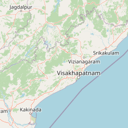
Map view of Kanger Ghati National Park

Use this park location map to pinpoint Kanger Ghati National Park in India, understand its exact geographic position, and read its mapped placement within the surrounding landscape more clearly.

Pigeon | © OpenStreetMap contributors
Park atlas

Compare mapped geography and protected landscapes across Chhattisgarh, India

Discover National Parks and Protected Areas Near Kanger Ghati National Park, Central India

Continue from Kanger Ghati National Park to explore a curated list of other national parks and protected areas across Central India. Compare diverse conservation landscapes, map their geographic spread, and trace regional patterns of biodiversity, including unique cave systems and forest ecosystems.
National parkBijapur district
About 111 km away#1 closest

Northwest

Indravati National Park: National Park Status and Geographic Landscape Context

Explore mapped boundaries and regional geography in Bijapur district.

Indravati National Park represents a significant protected natural area, classified as a national park within India. This entry offers detailed insights into its geographic placement within Bijapur district, emphasizing its mapped protected landscape and its role in regional geography. It serves as a vital point for structured discovery of natural areas and their environmental context.

Area
1,258.37 km²
Established
1981
IUCN
II
Relief
Highland
National parkAndhra Pradesh
About 152 km away#2 closest

South

Papikonda National Park: Andhra Pradesh National Park Protected Landscape and Map Exploration

Mapped protected area boundaries and regional geography context.

Papikonda National Park is a designated national park in Andhra Pradesh, India, serving as a crucial component of regional protected landscapes. This entry provides detailed information on its mapped boundaries and geographic positioning, essential for atlas-based exploration and understanding its natural terrain. Users can explore the specific context of Papikonda National Park within the broader geography of Andhra Pradesh through its structured park data.

Area
1,012.86 km²
Established
1978
IUCN
II
Relief
Upland
Wildlife reserveAndhra Pradesh
About 175 km away#3 closest

Southeast

Kambalakonda Wildlife Sanctuary: Mapped Geography and Protected Forest Landscapes

A diverse wildlife reserve in the Eastern Ghats foothills of Andhra Pradesh.

Kambalakonda Wildlife Sanctuary protects an essential patch of East Deccan dry evergreen forest near Visakhapatnam. The hilly topography and varied scrub-meadow ecosystems offer a distinct look at the region's biodiversity within the Eastern Ghats, serving as a primary site for conservation education and ecological study in southern India.

Area
70.7 km²
Established
1970
IUCN
IV
Relief
Upland
Wildlife reserveAndhra Pradesh
About 217 km away#4 closest

South

Coringa Wildlife Sanctuary: Mapping Protected Mangrove Wetlands in Andhra Pradesh

Coastal delta geography and estuarine tidal landscape exploration

Coringa Wildlife Sanctuary represents one of the largest continuous stretches of mangrove forests in India. This protected area along the Godavari Estuary offers a rich study in coastal geography, where complex tidal channels, backwater systems, and deltaic landforms create a unique, sediment-rich wetland environment essential for local avian and aquatic life.

Area
235.7 km²
Established
1978
IUCN
IV
Relief
Lowland
Wildlife reserveAndhra Pradesh
About 252 km away#5 closest

South

Kolleru Bird Sanctuary Wildlife Reserve: Protected Wetland and Basin Geography Atlas

Mapped freshwater wetlands in Andhra Pradesh

Kolleru Bird Sanctuary represents an essential protected freshwater basin situated in the deltaic plains of Andhra Pradesh. The area supports a dynamic habitat of open water and reedbed environments that transition through the seasons. This record provides a clear geographic view of the sanctuary, highlighting its role as a key Ramsar-recognized wetland within the regional landscape context.

Area
673 km²
Established
1999
IUCN
IV
Relief
Lowland
National parkMaharashtra
About 299 km away#6 closest

Northwest

Navegaon National Park: Maharashtra's Designated National Park for Atlas Exploration

Mapped protected area and regional landscape context.

Navegaon National Park is a designated national park offering rich opportunities for geographic discovery. Users can delve into its mapped boundaries and understand its protected landscape character within Maharashtra. This page provides structured data for exploring the park's role as a conservation area and its contribution to the natural geography of the region, ideal for atlas-based research.

Area
1,894.94 km²
Established
1975
IUCN
II
Visitors
50K annual
National parkChandrapur district
About 318 km away#7 closest

Northwest

Tadoba Andhari Tiger Reserve National Park: Mapped Protected Landscape Discovery

Geographic context within Chandrapur district, India.

Investigate Tadoba Andhari Tiger Reserve as a national park, focusing on its distinct protected landscape characteristics. This detail page provides structured insights into its mapped boundaries and its position within the regional geography of Chandrapur district, essential for a comprehensive understanding of India's protected natural areas.

Area
1,727.59 km²
Established
1955
IUCN
II
Relief
Highland
Wildlife reserveAndhra Pradesh
About 349 km away#8 closest

South

Krishna Wildlife Sanctuary: Coastal Mangrove Landscapes in the Krishna River Delta

Protected estuarine geography in Andhra Pradesh

Discover the geographic extent and habitat composition of Krishna Wildlife Sanctuary. This protected area features dense mangrove forests and intricate tidal waterways across deltaic islands, serving as an important ecological corridor along the Bay of Bengal coast in Andhra Pradesh.

Area
194.81 km²
IUCN
IV
Relief
Lowland
Scope
Terrestrial

Common questions about visiting, size, designation, and location context for Kanger Ghati National Park

Kanger Ghati National Park FAQs for park facts, access, geography, and protected area context

Find quick answers about Kanger Ghati National Park, including protected-area facts, park geography, trail and visitor context, and how the park fits into its surrounding country and regional landscape.
MoriAtlas Explorer

Continue Your Protected Areas Search Across the Global Atlas

Deepen your exploration by continuing the structured search for national parks and protected areas worldwide. Utilize the comprehensive filtering capabilities to compare different conservation landscapes and refine your understanding of global park geography. Discover more about the distribution and characteristics of protected natural areas.

Global natural geography