Mori Atlas logo
Wildlife reserveKapama Game Reserve

Analyzing the terrain and protected boundaries within the eastern Lowveld bushveld landscape

Kapama Game Reserve: A Comprehensive Geographic Overview of the Limpopo Wildlife Reserve

Kapama Game Reserve encompasses roughly 13,000 hectares of diverse bushveld savanna and riverine woodland in the Limpopo province of South Africa. Situated within the broader Blyde River corridor, the reserve represents a vital mosaic of protected land that links the varied habitats of the Lowveld. This site provides detailed spatial context on the topography, ecosystem distribution, and regional geography that define this significant privately managed conservation area.

private game reserveLowveldBig FivesafariLimpopobushveld savanna

Kapama Game Reserve

Wildlife reserve

Park overview

Structured park overview, official facts, and landscape profile for Kapama Game Reserve

Kapama Game Reserve park facts, protected area profile, and essential visitor context

Review the core facts for Kapama Game Reserve, including designation, size, terrain, visitor scale, habitats, and operating context in one park-focused overview.

About Kapama Game Reserve

Kapama Game Reserve is one of the larger privately owned protected areas in South Africa's Limpopo province, situated in the Lowveld between the Drakensberg escarpment and the broader Kruger ecological landscape. Spanning about 13,000 hectares near the town of Hoedspruit, the reserve forms part of an important network of private conservation land that buffers and extends the wildlife habitat of adjoining national parks. Its terrain combines riverine woodland along the Blyde River, open mixed bushveld, and transitional slopes that create varied habitats for both browsing and grazing species.

The reserve was established in 1993, when Johann Roode, originally purchasing the land for cattle grazing, recognized that the local ecosystem required active protection. He shifted the property's purpose from livestock use to conservation and tourism, and the reserve has remained in family ownership. This transition mirrors a wider shift in the Lowveld, where former farmland has increasingly been consolidated into private game reserves that complement South Africa's formal national park system.

Ecologically, Kapama supports an unusually complete cross-section of the mammal fauna typical of the eastern Lowveld, including the Big Five group of African bush elephant, southern white rhinoceros, lion, African leopard, and African buffalo. The reserve is also home to cheetah, spotted hyena, African wild dog, hippopotamus, South African giraffe, and a wide range of antelope such as impala, blue wildebeest, and greater kudu. Birdlife is similarly diverse, including conspicuous raptors such as the dark chanting goshawk, which is regularly recorded in the reserve's mixed woodland habitats.

The reserve's strategic location, scale, and long-term private management have helped it function as both a wildlife refuge and a working example of private conservation in Limpopo. As a result, Kapama occupies a recognized place within the regional mosaic of protected areas that sustain South Africa's mixed bushveld ecosystems.

Quick facts and research context for Kapama Game Reserve

Kapama Game Reserve is a privately owned nature reserve of approximately 13,000 hectares located in the Limpopo province of South Africa, near the town of Hoedspruit. It lies in the Lowveld bioregion adjacent to the Kruger National Park landscape and along the Blyde River system. The reserve was founded in 1993 and remains under the ownership of the family of its founder, Johann Roode. Its protected area supports elephants, white rhinos, lions, leopards, and African wild dogs, alongside more than 40 other mammal species typical of the eastern Lowveld.

Protection and recognition

Examining documented terrestrial protection parameters and management scope for Kapama Game Reserve

Kapama Game Reserve Protection Status and Terrestrial Conservation Scope

Kapama Game Reserve maintains a documented terrestrial protection scope within its regional landscape. Structured records outline the formal conservation framework and associated management designations for this protected area.

Protection details

Protection scope
Terrestrial
Transboundary protection
No
Park context

Deeper park guide and search-rich context for Kapama Game Reserve

Kapama Game Reserve history, landscape, wildlife, and travel context

Explore Kapama Game Reserve through its history, landscape character, ecosystems, wildlife, conservation priorities, cultural context, and seasonal travel timing in a structured park guide built for atlas discovery and search intent.

Why Kapama Game Reserve stands out

Kapama is best known for being a privately managed Big Five reserve in the Limpopo Lowveld, where wildlife ranging from elephant and white rhinoceros to lion, leopard, and African wild dog coexist within a single 13,000-hectare property. The reserve is also recognized for its proximity to Kruger National Park, its position along the Blyde River, and its long-standing role as a privately run conservation and safari destination in the greater Lowveld ecosystem.
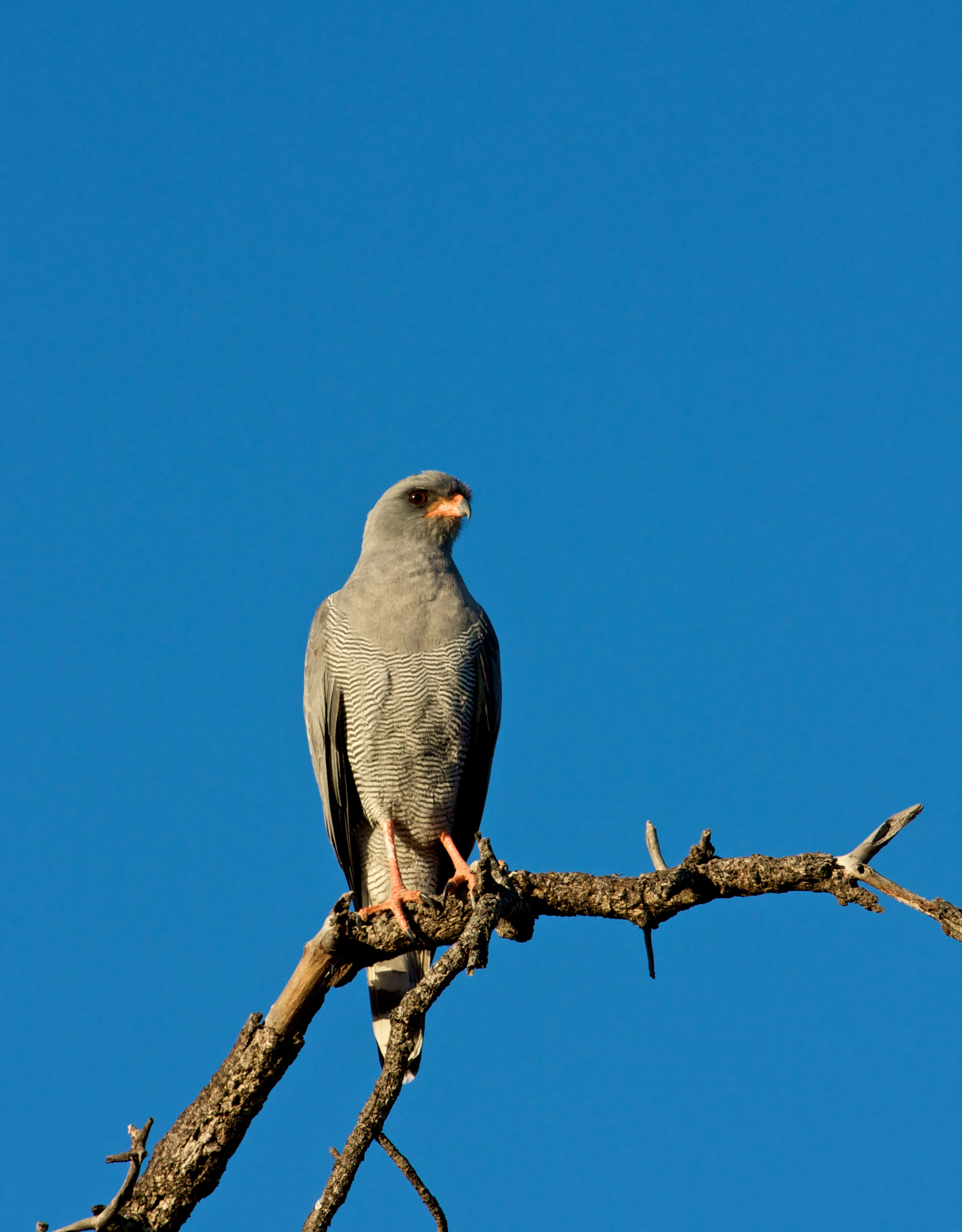
A dark chanting goshawk with grey plumage and reddish-orange legs perched on a dry tree branch against a clear blue sky.
A dark chanting goshawk perched on a bare branch at Kapama Game Reserve.

Kapama Game Reserve history and protected-area timeline

Kapama Game Reserve was founded in 1993 on land in Limpopo province originally purchased for cattle grazing. Its founder, Johann Roode, recognized that the local ecosystem required active stewardship rather than continued livestock use, and shifted the property's purpose toward conservation and low-impact tourism. Since that change in land use, the reserve has been progressively developed as a managed wilderness area while remaining in private family ownership.

Kapama Game Reserve landscape and geographic character

Kapama lies within the Lowveld of Limpopo, a bioregion defined by broad river valleys, mixed bushveld, and the foothills leading up toward the escarpment. The reserve's terrain is shaped by the Blyde River and its associated tributaries, which cut through the property and create riverine corridors lined with denser woody vegetation. Away from the river frontages, the land transitions into open savanna and mixed bushveld typical of the eastern Lowveld, supporting a mosaic of grassland, woodland, and thicket habitats that are characteristic of the broader region between Hoedspruit and Kruger National Park.
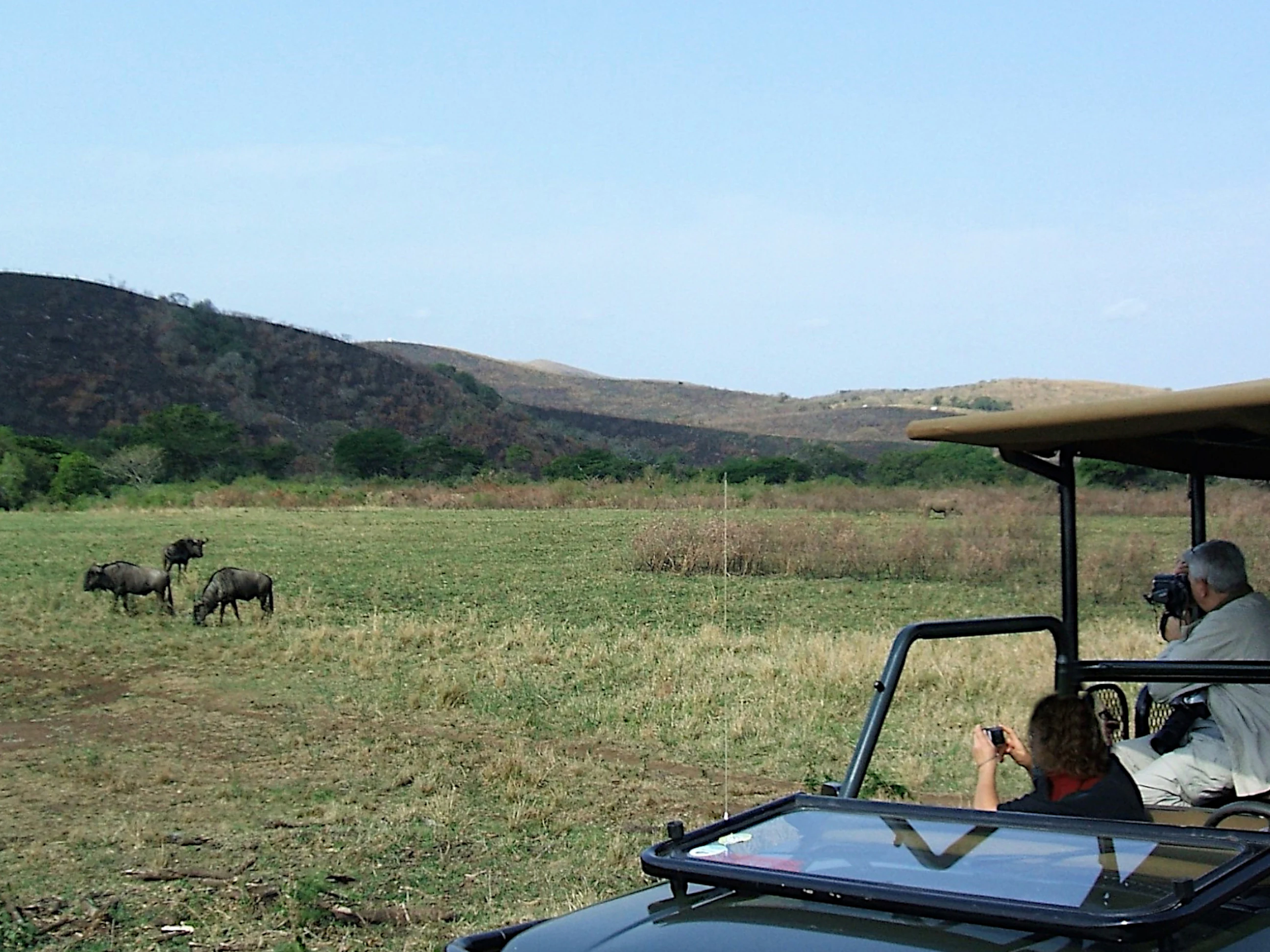
A safari vehicle with two tourists photographing a group of wildebeest in an open savanna landscape with hills in the background.
Visitors on a safari game drive observe wildebeest in Kapama Game Reserve.

Kapama Game Reserve ecosystems, habitats, and plant life

The ecological character of Kapama reflects its position within the Lowveld savanna biome, where seasonal rainfall, riverine influence, and varied topography produce a patchwork of habitats supporting high species diversity. Riverine woodland along the Blyde River corridor contrasts with drier mixed bushveld away from the watercourse, while local topography introduces microhabitats typical of the eastern Lowveld. These factors together maintain ecosystems capable of supporting both resident large mammal populations and the seasonally variable bird communities typical of the region.

Kapama Game Reserve wildlife and species highlights

Kapama supports a mammal community characteristic of the eastern Lowveld, including African bush elephant, African buffalo, southern white rhinoceros, hippopotamus, and South African giraffe. Carnivores recorded on the reserve include lion, African leopard, cheetah, spotted hyena, and African wild dog, the last being of particular conservation interest as one of Africa's most threatened large carnivores. Antelope diversity is also notable, with impala, blue wildebeest, and greater kudu among the species regularly present.

The reserve's birdlife is consistent with the broader Lowveld avifauna and includes conspicuous raptors such as the dark chanting goshawk, which is associated with the mixed woodland habitats that fringe the reserve's open areas. This raptor presence, combined with the range of large mammals, reinforces Kapama's ecological identity as a working Lowveld wilderness.

Kapama Game Reserve conservation status and protection priorities

As a privately owned protected area of around 13,000 hectares, Kapama contributes to the broader conservation network of the Lowveld by maintaining habitat for threatened and ecologically important species such as white rhinoceros, African wild dog, and lion. Its function as private conservation land adjoining larger protected landscapes illustrates how private reserves in Limpopo help buffer and extend formal park systems. Long-term family ownership has supported continuity of land management, an element that is often critical to the success of private conservation initiatives in southern Africa.

Top sights and standout views in Kapama Game Reserve

Kapama stands out for combining a substantial privately protected land area with the ecological variety of the Blyde River Lowveld. Its founding story, transitioning from cattle ranching to active conservation, reflects the broader shift in the region toward private reserve management. Equally important is its wildlife profile, which spans the Big Five and extends to species of conservation concern such as African wild dog, giving the reserve value both as a safari destination and as a functional piece of the regional conservation landscape.

Best time to visit Kapama Game Reserve

In the Lowveld, the dry winter months from roughly May through August are typically considered the most favorable for game viewing, when vegetation thins, animals concentrate around remaining water sources, and cooler temperatures make extended time on safari more comfortable. The summer wet season, from around November through March, brings higher temperatures and lush scenery, and remains productive for birdwatching and viewing newborn animals, though dense vegetation can make some sightings more challenging.
Monthly climate preview

Long-term representative temperature and precipitation rhythm across the year

Kapama Game Reserve Climate Normals and Monthly Weather Patterns

Historical data for Kapama Game Reserve records measured average temperatures ranging from 16.78 to 25.28 degrees Celsius alongside varying monthly precipitation levels. Reviewing these multi-year climate patterns provides baseline meteorological context across the twelve-month cycle.
Annual mean22 °C
17 °C25 °C
Jan25°
Feb25°
Mar24°
Apr22°
May19°
Jun17°
Jul17°
Aug19°
Sep22°
Oct23°
Nov25°
Dec25°
Warmest month
December

25.3 °C

Coolest month
July

16.8 °C

Wettest month
January

3.9 mm/day

Driest month
June

0.3 mm/day

Park location guide

Geography guide, regional context, and park location map for Kapama Game Reserve

Kapama Game Reserve park geography, regions, and map view in South Africa

Understand where Kapama Game Reserve sits in South Africa through a broader geographic reading of the surrounding landscape, nearby location context, and its mapped position within the national park landscape.

How Kapama Game Reserve fits into South Africa

South Africa is the southernmost country in Africa, spanning 1.22 million km² with a population of over 63 million. The country operates with three capital cities, Pretoria (executive), Cape Town (legislative), and Bloemfontein (judicial), and is renowned for its biodiversity, national parks, and multicultural society.

Wider geography shaping Kapama Game Reserve in South Africa

South Africa occupies the southernmost region of Africa, with coastline along both the Atlantic Ocean to the west and the Indian Ocean to the east. The interior features elevated plateaus including the Highveld, with the Drakensberg escarpment marking the eastern highlands. The country shares borders with Namibia, Botswana, Zimbabwe, Mozambique, Eswatini, and Lesotho.

Map view of Kapama Game Reserve

Use this park location map to pinpoint Kapama Game Reserve in South Africa, understand its exact geographic position, and read its mapped placement within the surrounding landscape more clearly.

Pigeon | © OpenStreetMap contributors

Location context for Kapama Game Reserve

Limpopo

Visual reference guide to Lowveld bushveld, riverine corridors, and protected habitats

Kapama Game Reserve Photos and Landscape Scenery

Visual documentation of Kapama Game Reserve reveals the varied terrain, riverine woodland, and open savanna that define the eastern Lowveld ecosystem. Examining protected area photography provides clear geographic context for understanding regional habitats, topography, and wildlife environments.

A dark chanting goshawk with grey plumage and reddish-orange legs perched on a dry tree branch against a clear blue sky.

A male lion with a full mane sits in tall, dry savanna grass, looking to the right with a savanna landscape of shrubs and trees in the background.

A safari vehicle with two tourists photographing a group of wildebeest in an open savanna landscape with hills in the background.

Park atlas

Discover related national parks and regional conservation areas across the eastern Lowveld

Explore Parks Near Kapama Game Reserve and Surrounding Protected Landscapes

Compare Kapama Game Reserve with adjacent protected areas across the Lowveld bushveld and regional river corridors. Continuing through surrounding wildlife habitats reveals the broader mosaic of conserved terrain spanning the Limpopo escarpment foothills.
Wildlife reserveLimpopo
About 16 km away#1 closest

Southeast

Thornybush Game Reserve: A Protected Wildlife Landscape in Limpopo, South Africa

Mapped savanna corridors and riverine ecological zones

Located in the Limpopo province of South Africa, Thornybush Game Reserve is an essential private wildlife area known for its open savanna and rich riparian vegetation. By maintaining an unfenced boundary with the neighboring national park, it acts as a critical extension of the Greater Kruger wilderness. This entry details its geographical scope, terrain features, and its function as a managed, integrated component of the regional conservation landscape.

Area
140 km²
Water
Minor water
National parkSouth Africa
About 29 km away#2 closest

Northeast

Kruger National Park: South Africa's Iconic National Park for Geographic Discovery

Explore savanna landscapes and mapped protected area boundaries.

Kruger National Park serves as a paramount example of a protected landscape, offering a rich tapestry of savanna ecosystems and varied terrain across South Africa's Lowveld. This canonical entry details its vast geographic scope, approximately 19,623 square kilometres, and its status as the nation's first national park. Understand the park's environmental context, from the Lebombo Mountains to the Limpopo River, and its integral role within larger transfrontier conservation initiatives, providing critical insight for atlas-based geographic exploration.

Area
19,623 km²
Established
1926
IUCN
II
Visitors
1.7M annual
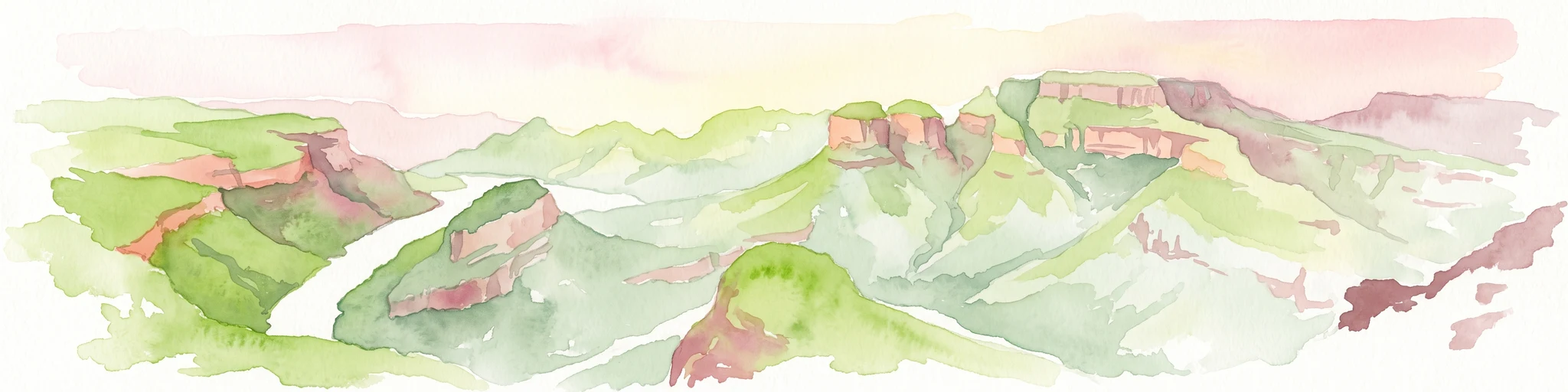
A horizontal watercolor painting depicting the Blyde River Canyon with green slopes, reddish cliff faces, and a winding river.
Nature reserveMpumalanga
About 30 km away#3 closest

Southwest

Blyde River Canyon Nature Reserve: Escarpment Geography and Protected Landscape Map

Mapping river-carved canyons and plateau ecosystems in Mpumalanga

Blyde River Canyon Nature Reserve protects a vast stretch of the Mpumalanga Drakensberg, characterized by vertical cliffs, rocky massifs, and deep river gorges. This atlas-focused resource highlights the reserve's geological landmarks, including the Three Rondavels and Bourke's Luck Potholes, offering a clear view of the complex terrain and protected natural boundaries defining this northeastern South African landscape.

Area
290 km²
Established
1965
Relief
Mountain
Climate
Subtropical
Nature reserveMpumalanga
About 31 km away#4 closest

East

Timbavati Private Nature Reserve: Protected Landscape and Regional Map Overview

Savanna bushveld geography in Mpumalanga, South Africa

Spanning over 534 square kilometres, Timbavati Private Nature Reserve provides a crucial habitat mosaic within the Mpumalanga region. The area is defined by its pioneering unfenced conservation model, linking private land with the Greater Kruger National Park to protect a broad spectrum of woodland habitats and diverse savanna ecosystems.

Area
534 km²
Established
1956
Relief
Upland
Climate
Subtropical
Nature reserveLimpopo
About 31 km away#5 closest

North

Balule Nature Reserve: Mapping the Protected Lowveld Savannah and Olifants River Corridor

An open-system wilderness integral to the Greater Kruger ecological network.

Explore the geographic identity of Balule Nature Reserve, a vast protected area in South Africa characterized by its integration with the Greater Kruger wilderness. The terrain encompasses a rich mix of mopane-dominated woodland, riverine forest along the Olifants River, and open subtropical bushveld that supports significant wildlife migrations.

Area
400 km²
Relief
Lowland
Climate
Subtropical
Access
Moderate access
A soft watercolor illustration showing rolling green hills with sparse native vegetation, set against a pale, warm-toned horizon.
Biosphere reserveLimpopo
About 36 km away#6 closest

North

Kruger to Canyons Biosphere: An Atlas of Protected Lands and Geographic Diversity in Limpopo

Integrated conservation across savanna, canyon, and montane ecosystems

Covering the stretch between the Letaba and Sabie Rivers, this biosphere reserve serves as a vital conservation landscape in South Africa. Its unique geography captures the transition from rugged escarpment cliffs to open bushveld, showcasing a high density of protected land and biodiversity. Use this map-oriented resource to understand the structural role of the biosphere as a model for landscape-scale environmental management and its geographic placement within the Limpopo province.

Area
28,748.1 km²
Established
2001
Relief
Mixed relief
Access
Access unknown
Wildlife reserveMpumalanga
About 46 km away#7 closest

Southeast

Manyeleti Game Reserve: Protected Area Boundaries and Lowveld Landscape Mapping

Ecological connectivity within the Mpumalanga conservation mosaic.

Manyeleti Game Reserve offers significant insights into the Lowveld landscape of Mpumalanga. Known for its unfenced connection to neighboring wildlife areas, the reserve provides a case study in contiguous protected land management and bushveld geography that sustains large mammal populations across regional boundaries.

Area
227.5 km²
Established
1967
Water
Minor water
Season
Year-round
Wildlife reserveMpumalanga
About 64 km away#8 closest

Southeast

Sabi Sand Game Reserve: Geographic Atlas and Protected Landscape Mapping in Mpumalanga

Mapping riparian corridors and savanna ecosystems in eastern South Africa

Sabi Sand Game Reserve provides a foundational study in private conservation landscapes, situated within the Lowveld of Mpumalanga. The reserve is uniquely defined by the Sand and Sabie Rivers, which sculpt the local terrain and support diverse riparian habitats. This atlas-focused entry examines the reserve as a complex, unfenced entity adjacent to Kruger National Park, highlighting its role in regional conservation geography and the spatial distribution of its renowned private concessions.

Area
650 km²
Established
1948
Relief
Lowland
Climate
Subtropical

Common questions about visiting, size, designation, and location context for Kapama Game Reserve

Kapama Game Reserve FAQs for park facts, access, geography, and protected area context

Find quick answers about Kapama Game Reserve, including protected-area facts, park geography, trail and visitor context, and how the park fits into its surrounding country and regional landscape.
MoriAtlas Explorer

Continue Your Protected Areas Search Across the Global Atlas

Deepen your exploration by continuing the structured search for national parks and protected areas worldwide. Utilize the comprehensive filtering capabilities to compare different conservation landscapes and refine your understanding of global park geography. Discover more about the distribution and characteristics of protected natural areas.

Global natural geography