Mori Atlas logo
Nearby park discovery

Geographic mapping of protected landscapes and wilderness areas near the reserve

National Parks and Protected Areas Surrounding Kapama Game Reserve in Limpopo, South Africa

Explore the regional geography of the eastern Lowveld through protected areas surrounding Kapama Game Reserve. This overview displays the spatial distribution of nearby parks, providing context for the broader conservation mosaic stretching between the Blyde River and the Kruger region.

Related tags

private game reserveLowveldBig FivesafariLimpopo

A privately protected Lowveld reserve along the Blyde River, supporting the Big Five across 13,000 hectares of bushveld.

Kapama Game Reserve

Kapama Game Reserve is a privately owned protected area in the Limpopo province of South Africa, covering roughly 13,000 hectares of Lowveld bushveld near the town of Hoedspruit. The reserve sits in a landscape shaped by the Blyde River corridor and the greater Kruger region, an area well known for its mix of riverine woodland, open savanna, and rugged escarpment foothills. Founded in 1993 by Johann Roode, the reserve was originally acquired as cattle-grazing land before its owner recognized the ecological value of the area and began developing it for conservation and tourism. Today Kapama is managed as a multi-use private reserve that supports populations of African elephant, white rhinoceros, lion, leopard, and African wild dog, alongside a wide range of smaller mammals and raptors typical of the eastern Lowveld. Its scale and proximity to Kruger National Park place Kapama within a larger mosaic of protected landscapes that together sustain some of South Africa's most important wildlife populations. The reserve is particularly noted for combining conventional Big Five safaris with conservation-focused land management and community-oriented programs, reflecting the broader role that private reserves play in extending protected habitat beyond the boundaries of South Africa's national parks.

Location
South Africa
Park type
Wildlife reserve
Established
1993
Area
130 km²
Kapama Game Reserve Map and Geography
Regional park map

See the ranked park cluster in its geographic setting

Nearby parks around Kapama Game Reserve

This regional map shows the same 20 nearby parks ranked below around Kapama Game Reserve. Select a ranked marker to highlight that park’s boundary where boundary data is available.
Reference park: Kapama Game ReserveRanked nearby park20 nearby parks shown
20 nearby parks

Distance ranked comparison of surrounding conservation landscapes and regional park geography

Parks and Protected Areas Geographically Near Kapama Game Reserve

Geographic separation values and directional alignment establish a structured ranking for protected areas situated near Kapama Game Reserve. Analyzing these surrounding landscapes provides clear comparative context on regional ecosystems without implying shared terrain or travel routes.
Wildlife reserveLimpopo
About 16 km away#1 closest

Southeast

Thornybush Game Reserve: A Protected Wildlife Landscape in Limpopo, South Africa

Mapped savanna corridors and riverine ecological zones

Located in the Limpopo province of South Africa, Thornybush Game Reserve is an essential private wildlife area known for its open savanna and rich riparian vegetation. By maintaining an unfenced boundary with the neighboring national park, it acts as a critical extension of the Greater Kruger wilderness. This entry details its geographical scope, terrain features, and its function as a managed, integrated component of the regional conservation landscape.

Area
140 km²
Water
Minor water
National parkSouth Africa
About 29 km away#2 closest

Northeast

Kruger National Park: South Africa's Iconic National Park for Geographic Discovery

Explore savanna landscapes and mapped protected area boundaries.

Kruger National Park serves as a paramount example of a protected landscape, offering a rich tapestry of savanna ecosystems and varied terrain across South Africa's Lowveld. This canonical entry details its vast geographic scope, approximately 19,623 square kilometres, and its status as the nation's first national park. Understand the park's environmental context, from the Lebombo Mountains to the Limpopo River, and its integral role within larger transfrontier conservation initiatives, providing critical insight for atlas-based geographic exploration.

Area
19,623 km²
Established
1926
IUCN
II
Visitors
1.7M annual
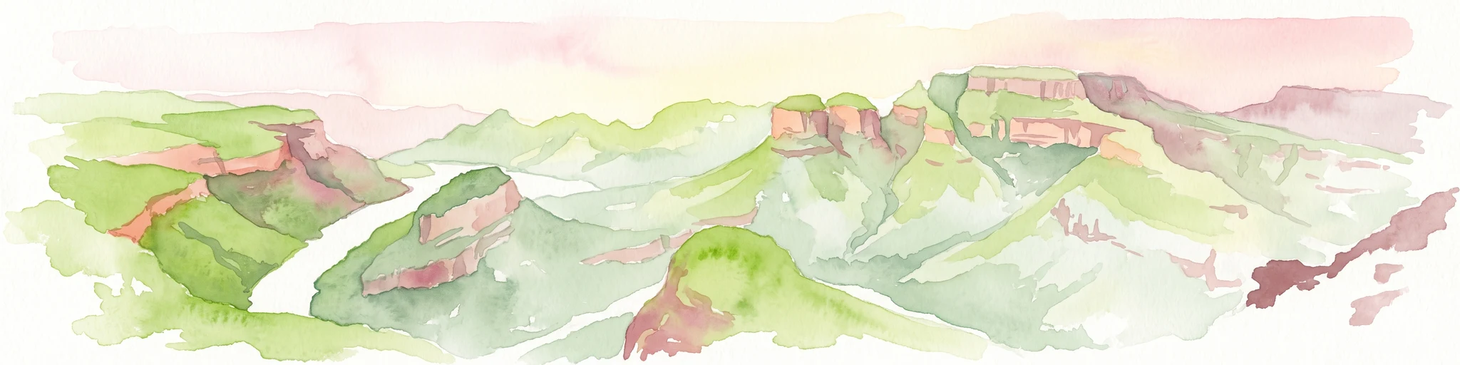
A horizontal watercolor painting depicting the Blyde River Canyon with green slopes, reddish cliff faces, and a winding river.
Nature reserveMpumalanga
About 30 km away#3 closest

Southwest

Blyde River Canyon Nature Reserve: Escarpment Geography and Protected Landscape Map

Mapping river-carved canyons and plateau ecosystems in Mpumalanga

Blyde River Canyon Nature Reserve protects a vast stretch of the Mpumalanga Drakensberg, characterized by vertical cliffs, rocky massifs, and deep river gorges. This atlas-focused resource highlights the reserve's geological landmarks, including the Three Rondavels and Bourke's Luck Potholes, offering a clear view of the complex terrain and protected natural boundaries defining this northeastern South African landscape.

Area
290 km²
Established
1965
Relief
Mountain
Climate
Subtropical
Nature reserveMpumalanga
About 31 km away#4 closest

East

Timbavati Private Nature Reserve: Protected Landscape and Regional Map Overview

Savanna bushveld geography in Mpumalanga, South Africa

Spanning over 534 square kilometres, Timbavati Private Nature Reserve provides a crucial habitat mosaic within the Mpumalanga region. The area is defined by its pioneering unfenced conservation model, linking private land with the Greater Kruger National Park to protect a broad spectrum of woodland habitats and diverse savanna ecosystems.

Area
534 km²
Established
1956
Relief
Upland
Climate
Subtropical
Nature reserveLimpopo
About 31 km away#5 closest

North

Balule Nature Reserve: Mapping the Protected Lowveld Savannah and Olifants River Corridor

An open-system wilderness integral to the Greater Kruger ecological network.

Explore the geographic identity of Balule Nature Reserve, a vast protected area in South Africa characterized by its integration with the Greater Kruger wilderness. The terrain encompasses a rich mix of mopane-dominated woodland, riverine forest along the Olifants River, and open subtropical bushveld that supports significant wildlife migrations.

Area
400 km²
Relief
Lowland
Climate
Subtropical
Access
Moderate access
A soft watercolor illustration showing rolling green hills with sparse native vegetation, set against a pale, warm-toned horizon.
Biosphere reserveLimpopo
About 36 km away#6 closest

North

Kruger to Canyons Biosphere: An Atlas of Protected Lands and Geographic Diversity in Limpopo

Integrated conservation across savanna, canyon, and montane ecosystems

Covering the stretch between the Letaba and Sabie Rivers, this biosphere reserve serves as a vital conservation landscape in South Africa. Its unique geography captures the transition from rugged escarpment cliffs to open bushveld, showcasing a high density of protected land and biodiversity. Use this map-oriented resource to understand the structural role of the biosphere as a model for landscape-scale environmental management and its geographic placement within the Limpopo province.

Area
28,748.1 km²
Established
2001
Relief
Mixed relief
Access
Access unknown
Wildlife reserveMpumalanga
About 46 km away#7 closest

Southeast

Manyeleti Game Reserve: Protected Area Boundaries and Lowveld Landscape Mapping

Ecological connectivity within the Mpumalanga conservation mosaic.

Manyeleti Game Reserve offers significant insights into the Lowveld landscape of Mpumalanga. Known for its unfenced connection to neighboring wildlife areas, the reserve provides a case study in contiguous protected land management and bushveld geography that sustains large mammal populations across regional boundaries.

Area
227.5 km²
Established
1967
Water
Minor water
Season
Year-round
Wildlife reserveMpumalanga
About 64 km away#8 closest

Southeast

Sabi Sand Game Reserve: Geographic Atlas and Protected Landscape Mapping in Mpumalanga

Mapping riparian corridors and savanna ecosystems in eastern South Africa

Sabi Sand Game Reserve provides a foundational study in private conservation landscapes, situated within the Lowveld of Mpumalanga. The reserve is uniquely defined by the Sand and Sabie Rivers, which sculpt the local terrain and support diverse riparian habitats. This atlas-focused entry examines the reserve as a complex, unfenced entity adjacent to Kruger National Park, highlighting its role in regional conservation geography and the spatial distribution of its renowned private concessions.

Area
650 km²
Established
1948
Relief
Lowland
Climate
Subtropical
National parkMozambique
About 94 km away#9 closest

Northeast

Limpopo National Park: Mozambique's Savanna Ecosystem and Protected Landscape

Explore its mapped boundaries and transfrontier park significance.

Limpopo National Park is a protected national park in Mozambique, distinguished by its savanna ecosystem and its critical role as the eastern segment of the Great Limpopo Transfrontier Park. This page offers an atlas-driven exploration of its geographic scope, mapped protected area boundaries, and its function as a key wildlife migration corridor, providing essential context for understanding this significant conservation landscape.

Area
10,000 km²
Established
2002
IUCN
II
Relief
Lowland
Protected areaLimpopo
About 105 km away#10 closest

Northwest

Wolkberg Wilderness Area: Protected Mountain Geography and Quartzite Ridge Landscapes

Mapping the diverse Afromontane ecosystems of the Limpopo escarpment

Wolkberg Wilderness Area protects a high-altitude transition zone in South Africa, where quartzite massifs rise sharply above the surrounding plains. This reserve features a rugged, low-infrastructure environment defined by mist-influenced forests, clean mountain rivers, and steep boulder slopes. Analyze the geographic boundaries and terrain features that make this reserve a critical sanctuary for regional bird species and forest-loving plant communities.

Area
220 km²
Established
1977
Relief
Mountain
Climate
Subtropical
Nature reserveMpumalanga
About 129 km away#11 closest

Southwest

Verloren Valei Nature Reserve: Highveld Grassland and Wetland Protected Area Geography

Steenkampsberg plateau landscape in Mpumalanga, South Africa.

Verloren Valei Nature Reserve protects a remarkable high-altitude highland plateau ecosystem near Dullstroom. Featuring rolling grasslands and a complex network of wetlands, this region provides a critical refuge for rare bird species, indigenous flora, and distinct plateau biodiversity across a diverse mosaic of rocky ridges and marshy terrain.

Area
58.91 km²
Relief
Upland
Access
Access unknown
Scope
Terrestrial
Protected areaMpumalanga
About 150 km away#12 closest

South

Makhonjwa Mountains: Geologically Ancient Protected Landscape in Eastern South Africa

Atlas mapping of the Barberton Greenstone Belt and Mpumalanga terrain

Spanning 120 by 60 kilometres, the Makhonjwa Mountains represent a vital scientific archive of Paleoarchean history. This protected area offers a deep look into volcanic komatiite rocks, ancient meteor impact evidence, and complex highland ecosystems that define the geography of the Mpumalanga border region.

Established
2018
Relief
Mountain
Scope
Terrestrial
Water
Minor water
Wildlife reserveLimpopo
About 169 km away#13 closest

West

Polokwane Game Reserve: A Comprehensive Geographic Profile of a Limpopo Wildlife Reserve

Mapped boundaries and natural habitat in northern South Africa

Spanning 2,800 hectares of grassy plains and bushveld, Polokwane Game Reserve serves as a critical municipal protected area near the urban core of Polokwane. This geographic overview highlights the reserve's unique eastern ridge flora, its chain of riverine waterholes, and the spatial distribution of its protected landscape within the Limpopo province.

Area
28 km²
Established
1977
Relief
Upland
Climate
Subtropical
State or regional parkLimpopo
About 210 km away#14 closest

North

Nwanedi Provincial Park: Geography, Protected Landscapes, and Regional Terrain in Limpopo

A study of river confluence and woodland ecosystems in South Africa

Nwanedi Provincial Park sits at the meeting point of the Nwanedi and Luphephe Rivers in the far north of Limpopo province. This protected area features a mosaic of habitats, ranging from mountain foothills and rocky ridgelines to sheltered riverine woodlands. The presence of twin dams provides a consistent water source for the surrounding lowveld, creating a significant ecological intersection that serves as a focal point for regional biodiversity and natural terrain mapping.

Area
111.7 km²
Relief
Mountain
Scope
Terrestrial
Water
Major water bodies
National parkGaza Province
About 212 km away#15 closest

Northeast

Banhine National Park National Park: Mapped Boundaries and Gaza Province Geographic Context

Discover the protected landscape identity of this national park.

Delve into the specifics of Banhine National Park, a designated national park situated within Gaza Province. This entry provides essential geographic details, focusing on its mapped protected area, its status as a national park, and how it fits within the broader regional geography of southern Mozambique. Understand the park's landform context and its atlas-relevant attributes for structured discovery.

Area
7,250 km²
Established
1973
IUCN
II
Relief
Lowland
National parkEswatini
About 218 km away#16 closest

South

Hlane Royal National Park: Eswatini's Vast Protected Savanna Woodland Landscape

Mapped geography and protected area context in northeastern Eswatini.

Delve into Hlane Royal National Park, Eswatini's most extensive protected territory, a prime example of lowland bushveld savanna. This national park is defined by its expansive woodland terrain, dotted with ancient trees and seasonal water pans, creating a dynamic landscape. It is an essential component for understanding the regional geography and the distribution of protected areas within Southern Africa, offering significant opportunities for landscape exploration.

Area
300 km²
IUCN
VI
Relief
Lowland
Climate
Subtropical
Nature reserveLimpopo Province
About 236 km away#17 closest

West

Nylsvley Nature Reserve: A Geographical Overview of Limpopo Province's Wetland Landscapes

Protected floodplain ecosystems and seasonal riverine terrain

Nylsvley Nature Reserve protects a vast, shallow floodplain and surrounding open woodland, creating a high-density conservation zone in the Limpopo Province. Its terrain is defined by the seasonal interaction of the Nyl River, extensive reedbeds, and unique botanical communities. This profile examines the reserve as a significant reference point for understanding the interplay between floodplain geography, savanna bushveld, and inland wetland habitats.

Area
40 km²
Established
1998
Relief
Lowland
Access
Access unknown
Biosphere reserveLimpopo
About 238 km away#18 closest

West

Waterberg Biosphere: A Protected Sandstone Massif in Limpopo Province South Africa

Geology, mapping, and ecological zones of the Waterberg range

The Waterberg Biosphere stands as a major protected region in South Africa, formed by ancient sandstone layers sculpted into mesas and deep gorges. This massif bridges ecological zones from highland savanna to riverine habitats, anchoring a network of game reserves and wilderness areas through its distinctive geological and historical landscape identity.

Area
6,540.33 km²
Established
2001
Relief
Mountain
Climate
Subtropical
Nature reserveLimpopo Province
About 253 km away#19 closest

Northwest

Blouberg Nature Reserve: Geographic Map and Protected Landscape Overview in Limpopo, South Africa

Tracing the savanna and mountain transition zones of a northern protected area

Blouberg Nature Reserve offers a distinctive look at the Limpopo landscape, encompassing steep sandstone cliffs, old-growth mountain forest patches, and open baobab-studded plains. This protected area stands as a focal point for understanding the ecological transition between the Soutpansberg range and the Limpopo lowveld. Use this atlas resource to understand the park's internal topography, its specific habitat boundaries, and its regional position as a significant node for raptor conservation in southern Africa.

Area
93.6 km²
Established
1990
Relief
Mountain
Climate
Subtropical
Watercolor illustration depicting a winding river through a grassy landscape with rolling hills and distant trees under a soft yellow sky.
Wildlife reserveGauteng
About 277 km away#20 closest

Southwest

Dinokeng Game Reserve: Geographic Atlas and Protected Wildlife Area Profile

Savanna Landscapes and Riverine Corridors in Gauteng

Dinokeng Game Reserve functions as a primary wildlife sanctuary within Gauteng, South Africa, featuring a diverse mosaic of grassland and riverine bushveld. This atlas profile details the reserve geographic layout, from the Pienaars River watercourses to its integrated conservation zones, providing a clear overview of the terrain that supports its status as a significant regional protected area.

Area
210 km²
Established
2011
Relief
Upland
Climate
Subtropical
Distance methodology

Geographic measurements, not driving distances

How nearby park distances are calculated

Distances use park boundaries whenever the available geometry allows it. When one or both boundaries are missing, the mapped park locations provide a clearly labelled estimate. Every value represents straight-line geographic separation and does not use roads or routing.

Boundary distance

Calculated between the nearest points of both park boundaries.

Location-to-boundary estimate

Estimated from one mapped park location to the nearest boundary of the other park.

Mapped-location estimate

Estimated between the mapped locations of both parks.

MoriAtlas Explorer

Continue Exploring the Geographic Landscape of Kapama Game Reserve

Deepen your understanding of Kapama Game Reserve through a detailed geographic breakdown of its 13,000 hectare protected area. MoriAtlas offers a structured view of the terrain and regional context that define this essential Limpopo wildlife habitat, perfect for those studying South African conservation landscapes.