
Mori Atlas logo
Protected landscapeKaweka Forest Park

Mapping the rugged terrain, alpine peaks, and diverse forest ecosystems of this central North Island reserve

Kaweka Forest Park: A Mountainous Protected Landscape in the Hawke's Bay Region of New Zealand

Kaweka Forest Park stands as a defining protected landscape in the central North Island, characterized by the dramatic Kaweka Range and its high-altitude alpine summits. This geography encompasses a layered mosaic of regenerating native forest, exotic pine plantations, and steep river valleys feeding into the Mōhaka River catchment. The terrain reveals a complex intersection between managed forestry and raw, mountainous wilderness.

forest parkmountain rangepine plantationwilding conifersHawke's Baycentral North Island
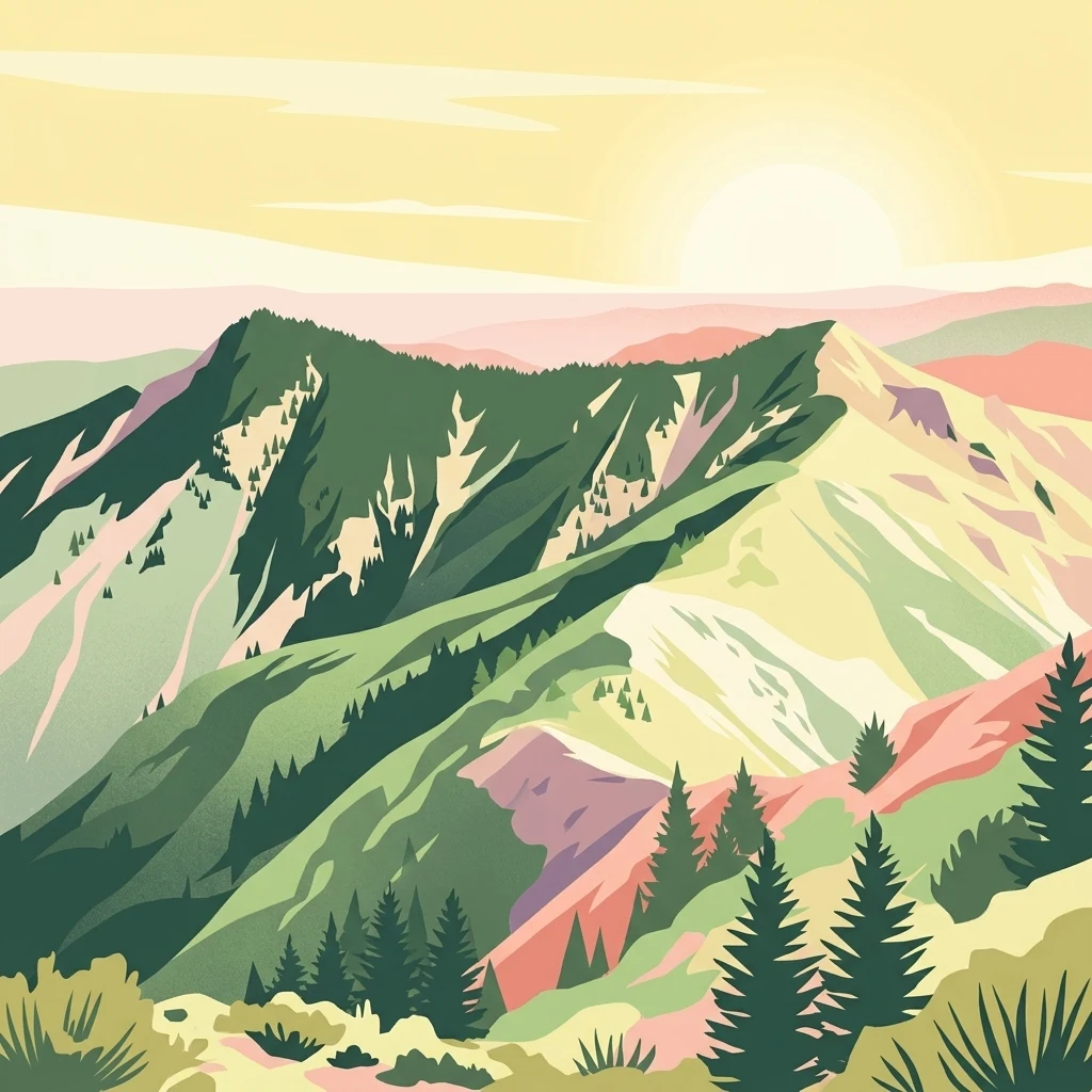
A stylized illustration of mountainous forest terrain with ridgelines and evergreen trees under a soft, golden sky.

Kaweka Forest Park

Protected landscape

Park overview

Structured park overview, official facts, and landscape profile for Kaweka Forest Park

Kaweka Forest Park park facts, protected area profile, and essential visitor context

Review the core facts for Kaweka Forest Park, including designation, size, terrain, visitor scale, habitats, and operating context in one park-focused overview.

About Kaweka Forest Park

Kaweka Forest Park is one of the larger forest parks in the central North Island of New Zealand and a defining geographical feature of the Hawke's Bay region. Its name comes from the Kaweka Range, the chain of mountains that forms its backbone and gives the park both its topographic personality and much of its scenery. The park is adjacent to Kaimanawa Forest Park, and together they represent a substantial corridor of protected forest, plantation, and mountain country in the interior of the North Island.

The park's identity is shaped by the contrast between its high, often harsh mountain terrain and the large areas of exotic pine plantation that cover its lower slopes and valleys. Pinus radiata plantations, together with plantation areas shared with neighbouring land, dominate much of the visible forest cover in places, while native vegetation persists in higher, more inaccessible parts of the range. This makes Kaweka Forest Park visually distinctive within New Zealand's conservation estate, blending working forestry with mountain wilderness and active ecological restoration.

Recreationally, the park supports hiking, hunting, and exploration of its backcountry valleys and ridgelines, and the hot springs in the Mōhaka River catchment provide a localised point of interest within an otherwise rugged landscape. As a New Zealand Department of Conservation area, it is managed as an important block of protected land that bridges the populated eastern coastal area around Napier with the more remote interior ranges of the central North Island.

Quick facts and research context for Kaweka Forest Park

Kaweka Forest Park is located in the Hawke's Bay region of New Zealand on the North Island's central plateau country, with the nearest city being Napier on the east coast. It is administered by the New Zealand Department of Conservation and covers around 59,000 hectares of land that includes the Kaweka Range, forest, plantation, and river valleys.

The park's highest peak is Kaweka at 1,724 metres, and the terrain includes the Mangatutu Hot Springs near the Mōhaka River. The area was cleared for farming in the late nineteenth century, abandoned by about 1900, designated as State Forest in the 1960s, and formally established as Kaweka Forest Park in 1972.

Protection and recognition

Documented terrestrial protected area status and official management scope

Kaweka Forest Park Protection Status and Conservation Recognition

Kaweka Forest Park maintains a documented terrestrial protection status covering native terrain and regional forest landscapes. Verified administrative records outline the official designation framework and conservation parameters without supplementary international recognitions.

Protection details

Protection scope
Terrestrial
Transboundary protection
No
Park context

Deeper park guide and search-rich context for Kaweka Forest Park

Kaweka Forest Park history, landscape, wildlife, and travel context

Explore Kaweka Forest Park through its history, landscape character, ecosystems, wildlife, conservation priorities, cultural context, and seasonal travel timing in a structured park guide built for atlas discovery and search intent.

Why Kaweka Forest Park stands out

Kaweka Forest Park is best known for the Kaweka Range itself, a rugged mountain chain in the central North Island that includes some of the region's highest peaks. It is also well known for its vast forest and plantation character, blending native regeneration, exotic pine forestry, and high-altitude alpine terrain within a single large protected landscape. Another defining feature is the Mangatutu Hot Springs, located within the park near the Mōhaka River. The park's identity is also closely tied to the ongoing ecological issue of wilding conifers, which spread from the plantation areas into surrounding native habitats, making Kaweka a notable case study in New Zealand's pine plantation landscape and its consequences for native ecosystems.
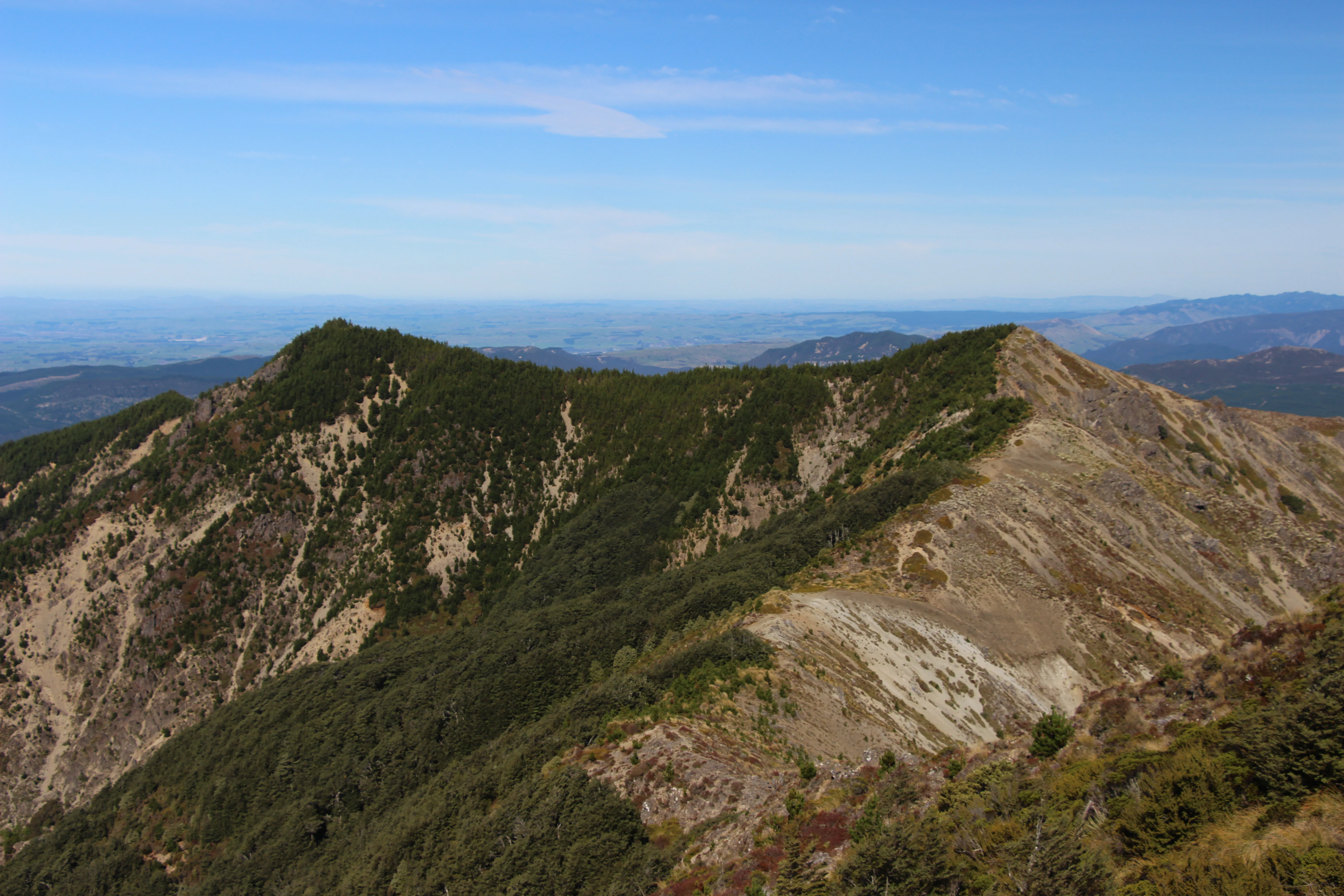
A wide landscape view of a mountain range with forested slopes, rocky ridgelines, and distant valleys under a clear blue sky.
A view of the rugged ridgeline of the Kaweka Range in Kaweka Forest Park.

Kaweka Forest Park history and protected-area timeline

The history of Kaweka Forest Park begins in the late nineteenth century, when European settlers cleared large parts of the land for farming. The combination of steep terrain and poor soils quickly made agriculture unsustainable, and by around 1900 most farming activity in the area had been abandoned.

For several decades the land reverted largely to scrub and regenerating forest before being formally brought into state management. In the 1960s the area was designated as a State Forest, and during this period large parts of the landscape were replanted with exotic pine trees, fundamentally reshaping the vegetation cover of the lower and middle elevations.

In 1972 the area was formally established as Kaweka Forest Park, giving it a dedicated protected status as a forest park within New Zealand's conservation and recreational framework. The legacy of both the original land clearance and the subsequent pine planting continues to shape the ecological challenges of the park, particularly the spread of wilding conifers beyond the original plantation boundaries.

Kaweka Forest Park landscape and geographic character

The landscape of Kaweka Forest Park is dominated by the Kaweka Range, a chain of rugged hills and mountains that rises above the surrounding interior of the North Island. The highest point is Kaweka itself, reaching 1,724 metres, and the range includes other summits such as the visually distinctive Two Tits, which tops out at 1,418 metres. These peaks give the park a strong alpine character and create the steep, dissected terrain that defines much of its geography.

Around and below the mountains, the landscape falls into deeply cut river valleys, with the Mōhaka River catchment being a major feature. The river system includes the Mangatutu Hot Springs, a notable geothermal expression within the park. Forest and pine plantation cover much of the visible slopes, while the higher elevations expose rocky ridges, tussock, and open alpine terrain typical of the central North Island mountains.

The combination of plantation forestry, regenerating native cover, and rugged mountain scenery gives Kaweka Forest Park a complex, layered appearance, with the eye moving from the managed geometric lines of pine blocks up to the irregular skyline of the range itself.

Kaweka Forest Park ecosystems, habitats, and plant life

Ecologically, Kaweka Forest Park is a transitional landscape where plantation forestry and native regeneration meet the harsher conditions of the central North Island mountains. The lower and middle elevations are heavily dominated by Pinus radiata plantations, planted across former farmland during the twentieth century, while the higher slopes and steeper valleys retain more native vegetation, including forest types natural to the Kaweka Range.

This mosaic creates important habitat variability. The plantation areas, despite being non-native, provide shelter and structure that can support a range of native wildlife, and the regenerating forest pockets and undisturbed higher-country vegetation preserve remnants of the original ecological community that once covered the broader region. The rivers and valleys associated with the Mōhaka catchment add freshwater habitat to this mix, and features like the Mangatutu Hot Springs create distinctive micro-environments within the broader landscape.

Kaweka Forest Park wildlife and species highlights

Because the park covers extensive plantation and regenerating native forest across a substantial elevation gradient, it supports a varied bird and animal community typical of the central North Island's protected forest landscapes. The mix of pine forest and native cover provides habitat for common New Zealand forest birds, while the higher country offers more open environments typical of the central plateau's alpine and subalpine fauna.

The park's position beside Kaimanawa Forest Park and its large size give it an important role as a refuge for wildlife in the central North Island, with the connected ranges allowing broader movement of species across the landscape. Wilding conifer populations in the park create ongoing ecological tensions, since their spread into native habitats can transform the character of the understorey and affect food resources for native fauna.

Kaweka Forest Park conservation status and protection priorities

Kaweka Forest Park matters from a conservation perspective because it protects a large connected block of land in the central North Island where native regeneration, plantation forestry, and mountain ecosystems coexist under a single management framework. The park helps to maintain ecological connectivity in a region where much of the surrounding land has been heavily modified by farming and plantation.

A defining conservation issue is the presence and spread of wilding conifers, particularly Pinus radiata escaping from plantation blocks within and adjacent to the park. Once established outside plantations, these trees can transform native habitats, alter water use, and fundamentally change the composition of the regenerating forest. Managing this spread is central to conserving the native ecological values of the park.

The park's elevation range, including alpine environments up to more than 1,700 metres, also gives it importance for protecting the higher-altitude ecosystems of the central North Island.

Kaweka Forest Park cultural meaning and human context

The cultural context of Kaweka Forest Park reflects the broader pattern of European settlement across the central North Island, where land was cleared for farming during the colonial expansion of the late 1800s. The failure of that farming, due to steep terrain and thin soils, is itself a notable part of the regional story and is reflected in the phases of clearance, abandonment, replanting, and eventual protection that shaped the park.

The park also sits within a wider New Zealand tradition of forest parks as multiple-use landscapes, combining timber production, recreation, hunting, and ecological protection. This blend of working forestry and protected landscape is a significant part of how Kaweka is understood locally, as both a utilitarian resource and a natural area of regional importance.

Top sights and standout views in Kaweka Forest Park

Among Kaweka Forest Park's strongest points of distinction are the Kaweka Range itself, including its highest peak at 1,724 metres and iconic subsidiary summits like Two Tits. The presence of the Mangatutu Hot Springs within the Mōhaka River catchment provides a distinctive geothermal feature rarely associated with forest park landscapes.

The contrast between vast pine plantation, regenerating native forest, and rugged alpine terrain gives the park a layered identity that is unusual in New Zealand's protected areas. Combined with its administrative connection to the nearby Kaimanawa Forest Park, this makes Kaweka Forest Park one of the more substantial blocks of protected country in the central North Island.

Best time to visit Kaweka Forest Park

Kaweka Forest Park's climate is mild in summer and cool to cold at higher elevations in winter, with regular rainfall throughout the year. The warmer months are generally the most comfortable for exploring the lower valleys and pine plantation areas, while the high country remains cooler even in mid-summer. Winter brings cooler temperatures and freezing conditions to higher elevations, with occasional snow on the Kaweka Range.

For visitors interested in hiking, hunting, or simply experiencing the range in clearer conditions, late spring through autumn tends to offer the most reliable access to the lower and middle parts of the park. The park receives substantial annual rainfall, so conditions can change quickly at any time of year, and visitors heading into the high country should be prepared for cooler and wetter conditions than those experienced in nearby Napier.
Monthly climate preview

Measured monthly weather patterns and representative coordinate averages for Hawke's Bay terrain

Kaweka Forest Park Climate Normals, Long-Term Temperature and Precipitation Rhythm

Representative coordinate records show measured monthly temperature ranges alongside consistent precipitation averages across the protected landscape. Examining the full twelve-month profile provides complete historical climate data for the protected area.
Annual mean10 °C
5 °C16 °C
Jan16°
Feb16°
Mar14°
Apr11°
May
Jun
Jul
Aug
Sep
Oct
Nov11°
Dec14°
Warmest month
February

15.8 °C

Coolest month
July

4.9 °C

Wettest month
June

3.1 mm/day

Driest month
February

2 mm/day

Park location guide

Geography guide, regional context, and park location map for Kaweka Forest Park

Kaweka Forest Park park geography, regions, and map view in New Zealand

Understand where Kaweka Forest Park sits in New Zealand through a broader geographic reading of the surrounding landscape, nearby location context, and its mapped position within the national park landscape.

How Kaweka Forest Park fits into New Zealand

New Zealand is an island nation in the southwestern Pacific Ocean comprising two main islands and numerous smaller islands. Located east of Australia across the Tasman Sea, it features varied topography with the Southern Alps running along the South Island and volcanic terrain on the North Island. The country was settled by Maori people between 1280 and 1350, followed by European exploration beginning in 1642, and became a Dominion in 1907 before gaining full independence in 1947.

Wider geography shaping Kaweka Forest Park in New Zealand

New Zealand lies in the southwestern Pacific Ocean, east of Australia across the Tasman Sea. The country consists of two main islands, the North Island and South Island, plus over 600 smaller islands. The North Island features volcanic plateaus and hills while the South Island is dominated by the Southern Alps mountain range. The country has a long coastline and is surrounded by the Pacific Ocean.

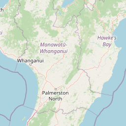
Map view of Kaweka Forest Park

Use this park location map to pinpoint Kaweka Forest Park in New Zealand, understand its exact geographic position, and read its mapped placement within the surrounding landscape more clearly.

Pigeon | © OpenStreetMap contributors

Location context for Kaweka Forest Park

Hawke's Bay
Recorded earthquake history

View the Historical Earthquake Catalogue for Kaweka Forest Park

Examine the collection of recorded seismic events associated with the geography of Kaweka Forest Park. This catalogue provides transparent access to historical event data including magnitudes and epicentre locations, helping to build a comprehensive view of regional seismic activity.

Kaweka Forest Park Earthquake History

Catalogued events

228 events

Strongest magnitude

Magnitude 6

Most recent event

Oct 26, 2025

This history includes earthquakes recorded inside the park or within 50 km of its borders

Visual reference for alpine terrain, pine plantations, and protected North Island habitats.

Kaweka Forest Park Photos and Landscape Scenery

Visual documentation of Kaweka Forest Park reveals the rugged mountain terrain, exotic pine plantations, and native forest cover defining the central North Island range. Examining protected area imagery provides clear insight into the complex topography, river valleys, and evolving ecological landscape of the region.

A wide landscape view of a mountain range with forested slopes, rocky ridgelines, and distant valleys under a clear blue sky.

Park atlas

Compare adjacent mountain ranges and surrounding regional conservation areas

Explore Other Parks Near Kaweka Forest Park and Related Protected Landscapes

Continue geographic comparison by browsing other protected areas situated near Kaweka Forest Park and the central North Island. Broaden regional park discovery to examine connected mountain terrain and adjacent forest landscapes.
A minimalist watercolor painting of rolling hills and grassy landscape under a white background.
Protected areaManawatu-Whanganui Region
Park boundaries overlap#1 closest

West

Kaimanawa Forest Park: A Deep Dive into Protected Forest Terrain and Regional Mountain Geography

Remote backcountry wilderness within the Manawatu-Whanganui Region

Spanning the high country of the Rangitikei District, Kaimanawa Forest Park offers a vast, forested wilderness experience distinct from the surrounding volcanic cones. This atlas entry details the park's structural role as a protected conservation area, tracing its boundaries across rugged mountain ridges and deep valleys that define the heart of New Zealand's central North Island landscape.

Area
759.57 km²
Established
1969
Relief
Mountain
Climate
Temperate
National parkNew Zealand
31 km away#2 closest

West

Tongariro National Park: New Zealand's Premier Volcanic National Park Atlas

Explore mapped terrain, active volcanoes, and unique dual World Heritage values.

Tongariro National Park, situated in New Zealand's North Island, is a globally significant protected area celebrated for its dramatic volcanic landscapes and profound cultural heritage. As the nation's oldest national park, it features three active volcanoes: Mount Ruapehu, Mount Ngauruhoe, and Mount Tongariro, set within a diverse terrain that includes forests, alpine zones, and the Rangipo Desert. Its dual World Heritage status underscores its importance for both natural attributes and its sacred cultural landscape, offering rich opportunities for geographic and atlas exploration.

Area
795.96 km²
Established
1887
IUCN
II
Relief
Mountain
Protected landscapeWaikato
55 km away#3 closest

Northwest

Pureora Forest Park: Ancient Rainforests and Protected Mountain Landscapes in Waikato

Regional geography and mapped native forest boundaries

Pureora Forest Park represents a significant protected area in the central North Island of New Zealand, defined by its towering podocarp giants and complex volcanic terrain. The park serves as a prime example of an intact rainforest ecosystem, featuring dense broadleaf canopies, deep river valleys, and significant remnants of ancient forest history. Its geography, shaped by both geological upheaval and centuries of growth, provides an essential record of the natural heritage preserved across the Waikato and Manawatu-Whanganui regions.

Area
759.57 km²
Established
1978
Relief
Mountain
Water
Major water bodies
National parkNew Zealand
83 km away#4 closest

West

Whanganui National Park: Protected Wilderness Landscape and Geographic Context

Explore the mapped boundaries and natural terrain of this national park.

Whanganui National Park offers a unique blend of natural wilderness and significant cultural history, centered on the Whanganui River valley. This protected area safeguards one of New Zealand's most extensive lowland forest ecosystems, providing vital habitat and showcasing a landscape deeply intertwined with Māori traditions and historical settlement. Understanding its geographical setting and mapped protected boundaries reveals its importance as a distinct national park.

Area
742 km²
Established
1986
IUCN
II
Relief
Lowland
Watercolor painting of a green landscape featuring rolling hills, forested slopes, and a body of water in the foreground against a light, misty background.
Marine protected areaNew Plymouth District
144 km away#5 closest

West

Parininihi Marine Reserve: A Detailed Atlas of New Zealand's Coastal Marine Protected Area

Mapping the ecological sanctuary and reef geography in the New Plymouth District.

Gain insights into the geography of Parininihi Marine Reserve, a protected marine environment north-east of New Plymouth. This record outlines the reserve's structural features, from the iconic White Cliffs coastline to the complex underwater canyons and pinnacles of the Pariokariwa Reef. Learn about the seafloor terrain and the ecological distribution of invertebrate colonies and fish populations that define this crucial New Zealand marine reserve.

Area
18 km²
Established
2006
Relief
Lowland
Climate
Temperate
Watercolor painting of Moutohora Island featuring green volcanic hills, coastal vegetation, and a soft pink water surface.
Wildlife reserveBay of Plenty
About 151 km away#6 closest

North

Moutohora Island Wildlife Reserve: Volcanic Geography and Coastal Protected Area

Exploration of a restored island sanctuary in the Bay of Plenty

Moutohora Island is a protected wildlife refuge defined by its volcanic heritage and active geothermal features. The landscape comprises twin peaks, valleys, and coastal cliffs that provide a secure habitat for breeding seabirds and native forest restoration efforts. This island offers a distinct look at maritime conservation and geological remnants within the broader Bay of Plenty regional geography.

Area
1.43 km²
Established
1965
Relief
Upland
Access
Highly restricted
A wide, panoramic watercolor illustration showing layers of green rolling hills in the foreground, a line of green trees in the mid-ground, and soft purple and pink mountains in the background against a pale yellow sky.
Protected areaNew Zealand
About 158 km away#7 closest

Northwest

Pirongia Forest Park: Mapped Geography and Protected Landscapes in the Waikato Region

Volcanic summits and native podocarp forest boundaries

Gain a deeper understanding of Pirongia Forest Park through its complex volcanic geology and dense native vegetation. This resource outlines the park's fragmented ridges, limestone stream systems, and its role as a biogeographic bridge within the Waikato landscape of New Zealand.

Area
167.7 km²
Established
1971
Relief
Mountain
Climate
Temperate
Protected landscapeNew Zealand
About 164 km away#8 closest

Southwest

Tararua Forest Park: Protected Landscape Geography and Mapped Natural Terrain

Defining the rugged mountain spine of New Zealand's southern North Island

Covering the core of the Tararua Range, this protected landscape represents a vital ecological corridor in New Zealand. The terrain offers a diverse gradient of native forests, steep river valleys, and windswept alpine ridges. It serves as a primary example of forest conservation and complex mountain geography within the island nation's larger network of protected lands.

Area
1,149.93 km²
Established
1954
Relief
Mountain
Climate
Temperate

Common questions about visiting, size, designation, and location context for Kaweka Forest Park

Kaweka Forest Park FAQs for park facts, access, geography, and protected area context

Find quick answers about Kaweka Forest Park, including protected-area facts, park geography, trail and visitor context, and how the park fits into its surrounding country and regional landscape.
MoriAtlas Explorer

Continue Your Protected Areas Search Across the Global Atlas

Deepen your exploration by continuing the structured search for national parks and protected areas worldwide. Utilize the comprehensive filtering capabilities to compare different conservation landscapes and refine your understanding of global park geography. Discover more about the distribution and characteristics of protected natural areas.

Global natural geography