Mori Atlas logo
National parkKejimkujik National Park

Discover the mapped geography and protected area boundaries of Kejimkujik National Park.

Kejimkujik National Park: A Protected National Park Landscape in Nova Scotia

(Kejimkujik National Park and National Historic Site)

Kejimkujik National Park stands as a significant protected national park within the geographic context of Nova Scotia. This page offers an atlas-style exploration of its protected landscape identity, providing insight into its mapped boundaries and regional terrain. Understand Kejimkujik National Park's place within the broader natural geography, making it a key destination for detailed park discovery and geographic understanding.

National ParkNational Historic SiteDark Sky PreserveAcadian ForestMi'kmaq HeritageOld-Growth Forest
Stylized illustration of a river flowing through a forested mountain valley with rocky outcrops and coniferous trees under a pastel sky

Kejimkujik National Park

National park

Park overview

Structured park overview, official facts, and landscape profile for Kejimkujik National Park

Kejimkujik National Park park facts, protected area profile, and essential visitor context
Review the core facts for Kejimkujik National Park, including designation, size, terrain, visitor scale, habitats, and operating context in one park-focused overview.

About Kejimkujik National Park

Kejimkujik National Park and National Historic Site represents a remarkable convergence of natural and cultural heritage in southwestern Nova Scotia. The park's dual designation reflects its extraordinary significance as both a protected natural landscape and a living testament to Mi'kmaq presence spanning millennia. The inland portion, which shares boundaries with the national historic site, protects a vast forested upland plain situated between Nova Scotia's South Shore and Annapolis Valley regions. This landscape has been a critical travel corridor and resource harvesting territory for the Mi'kmaq, who used the Mersey River and associated waterways as major transportation routes connecting the Bay of Fundy to the Atlantic coast. Beyond its ecological and cultural significance, the park is notable for its inclusion within the UNESCO Southwest Nova Biosphere Reserve, recognizing its outstanding biodiversity value in partnership with the adjoining Tobeatic Wilderness Area. The park's coastal component, Kejimkujik Seaside, added in 1988, ensures representation of mainland Nova Scotia's unique Atlantic coastal ecosystems within Canada's national parks system, protecting coastal barrens, bogs, barrier beaches, and lagoons.

Quick facts and research context for Kejimkujik National Park

Kejimkujik National Park occupies 404 square kilometres in southwestern Nova Scotia, spanning three municipalities: Annapolis, Queens, and Digby. Established in 1967 as a national park with national historic site designation added in 1994, it forms part of the UNESCO Southwest Nova Biosphere Reserve. The landscape features a flat plain with Mount Tom as the highest point at 180 metres, underlain by Precambrian to Ordovician quartzite, slate, and Devonian granite. Fifteen percent of the park is covered by water, with 46 lakes including Kejimikujik Lake. The park contains approximately 500 Mi'kmaq petroglyphs dating to the 1700s and 1800s, representing one of the most important Indigenous archaeological sites in Atlantic Canada.

Park context

Deeper park guide and search-rich context for Kejimkujik National Park

Kejimkujik National Park history, landscape, wildlife, and travel context
Explore Kejimkujik National Park through its history, landscape character, ecosystems, wildlife, conservation priorities, cultural context, and seasonal travel timing in a structured park guide built for atlas discovery and search intent.

Why Kejimkujik National Park stands out

Kejimkujik is best known for its unique dual designation as both a national park and national historic site, recognizing its exceptional Mi'kmaq cultural landscape and natural heritage. The park preserves around 500 Indigenous petroglyphs carved into slate beds along Kejimikujik Lake, depicting Mi'kmaq life, European colonial themes, and animals including caribou that have since been extirpated from the region. The inland area is renowned as a dark-sky preserve with some of the best stargazing in southern Canada, hosting an annual Dark Sky Weekend. The park also contains some of the last remaining old-growth Acadian forest in the Canadian Maritimes, representing a rare ecological treasure in a region where most forests have been logged.

Wide view of a coastal landscape with dense evergreen forest in the foreground, a sandy beach, and blue ocean under clear sky
Coastal landscape view of Kejimkujik National Park's seaside annex with forested shoreline and blue ocean

Kejimkujik National Park history and protected-area timeline

The name Kejimkujik derives from the Mi'kmaq language, with interpretations including "tired muscles" (possibly referencing the physical effort of long canoe journeys), "swollen waters," or "attempting to escape." Some Mi'kmaw knowledge holders and Parks Canada indicate the name means "little fairies," and prior to the establishment of the national park, Kejimkujik Lake was known as Fairy Lake. For thousands of years, the Mi'kmaq used the park's canoe routes to travel between the Bay of Fundy and the Atlantic coast, with the Mersey River serving as a major inland travel corridor. The area around Kejimikujik Lake served as important fall and winter habitation and hunting territory, coinciding with the inland migration of caribou that provided a vital food resource. The Mi'kmaq also harvested abundant American eel, with evidence of eel weirs possibly dating back thousands of years. Following European colonization, Mi'kmaq families increasingly lost access to traditional hunting grounds as settlers cleared land for farming and logging, forcing many to take up farming or work as guides for wealthy sport fishermen and hunters. In the late 19th and early 20th centuries, the area became a popular destination for sport fishing, primarily for brook trout, and moose hunting, with the famous Kedge Rod and Gun Club hosting notable guests including Babe Ruth and Zane Grey. In 1969, the Government of Canada designated the area as a national park recognizing its Mi'kmaq history, intact old-growth Acadian forest, and rare wildlife communities. The national historic site designation followed in 1994.

Kejimkujik National Park landscape and geographic character

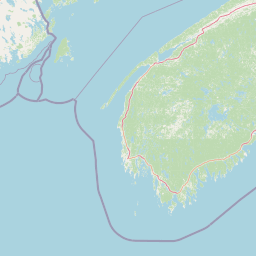
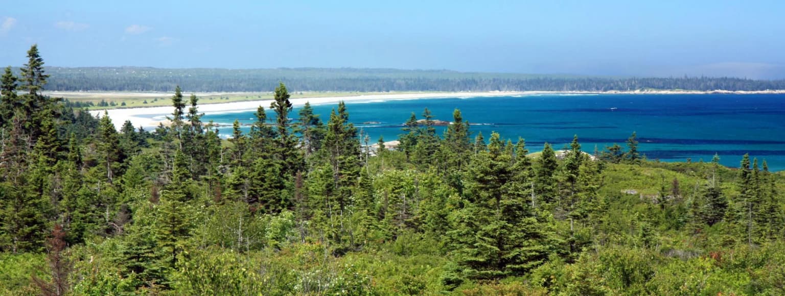
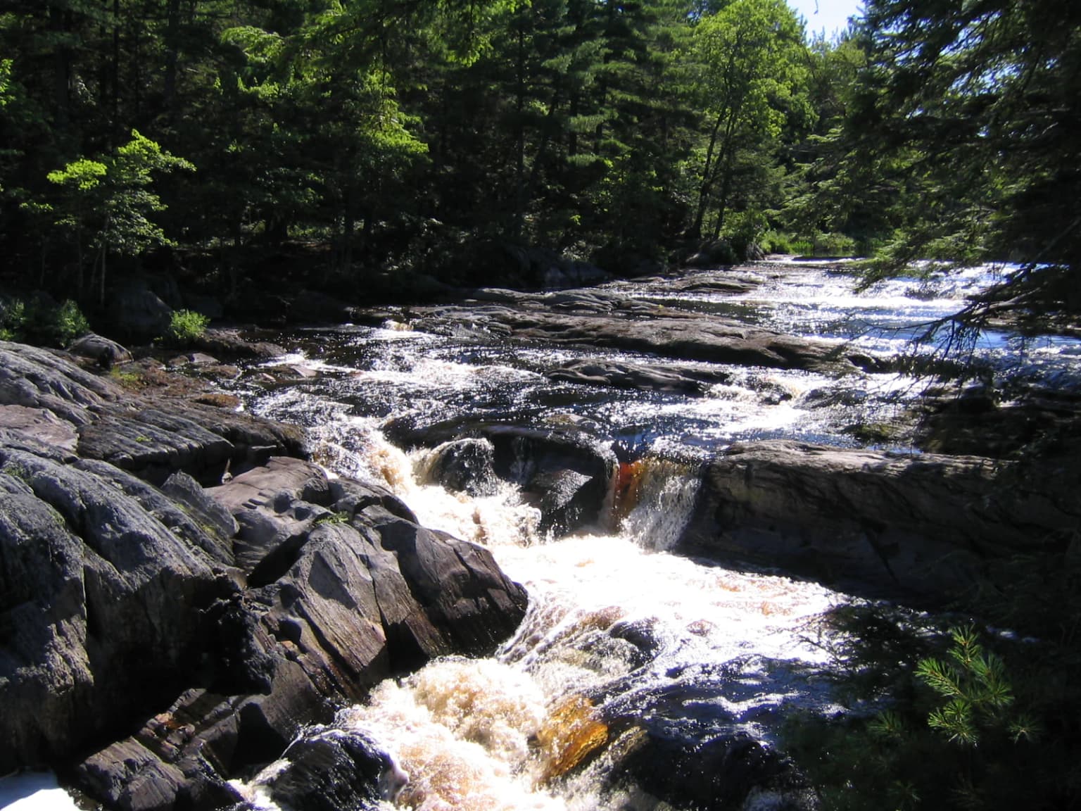
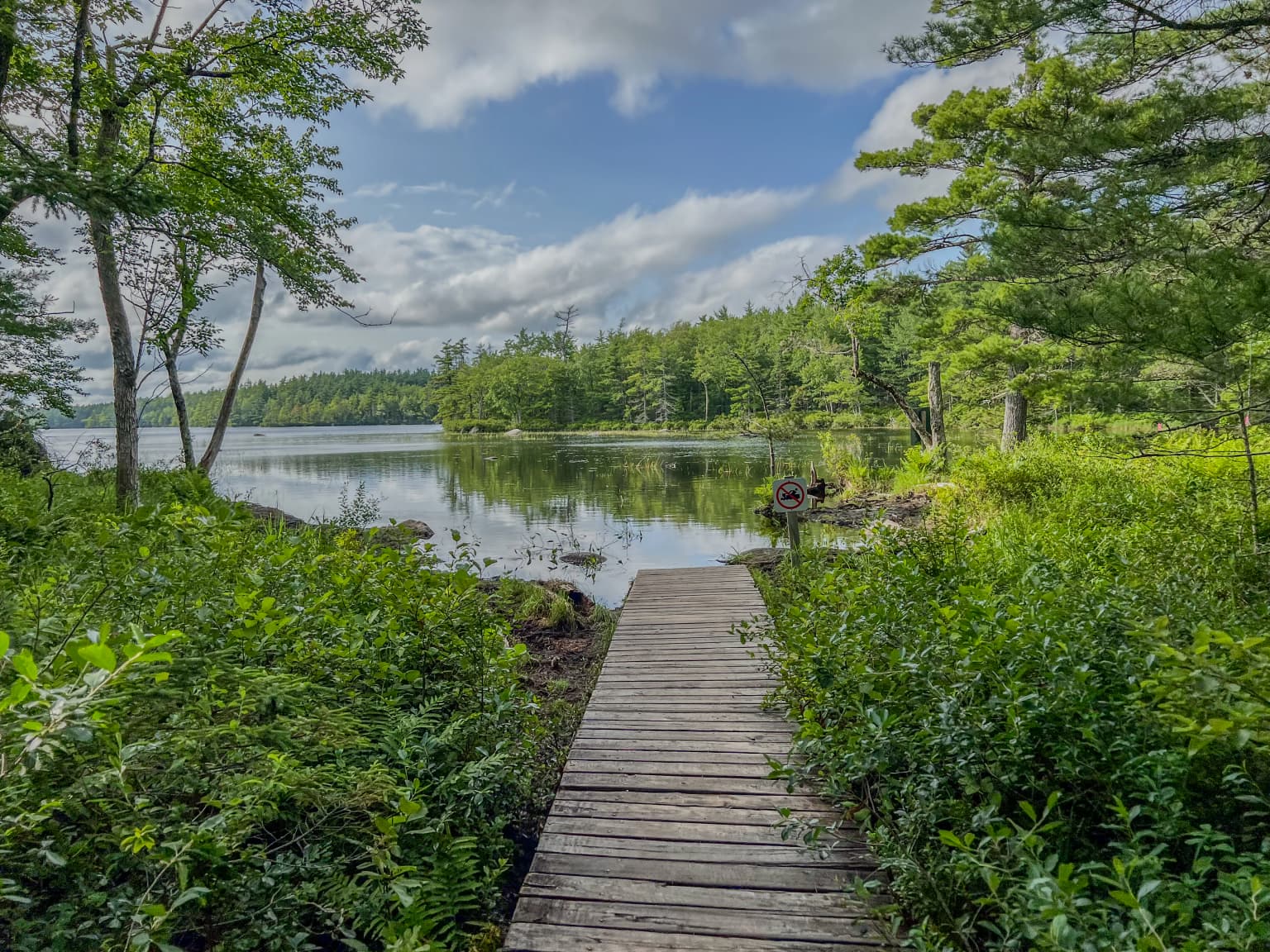
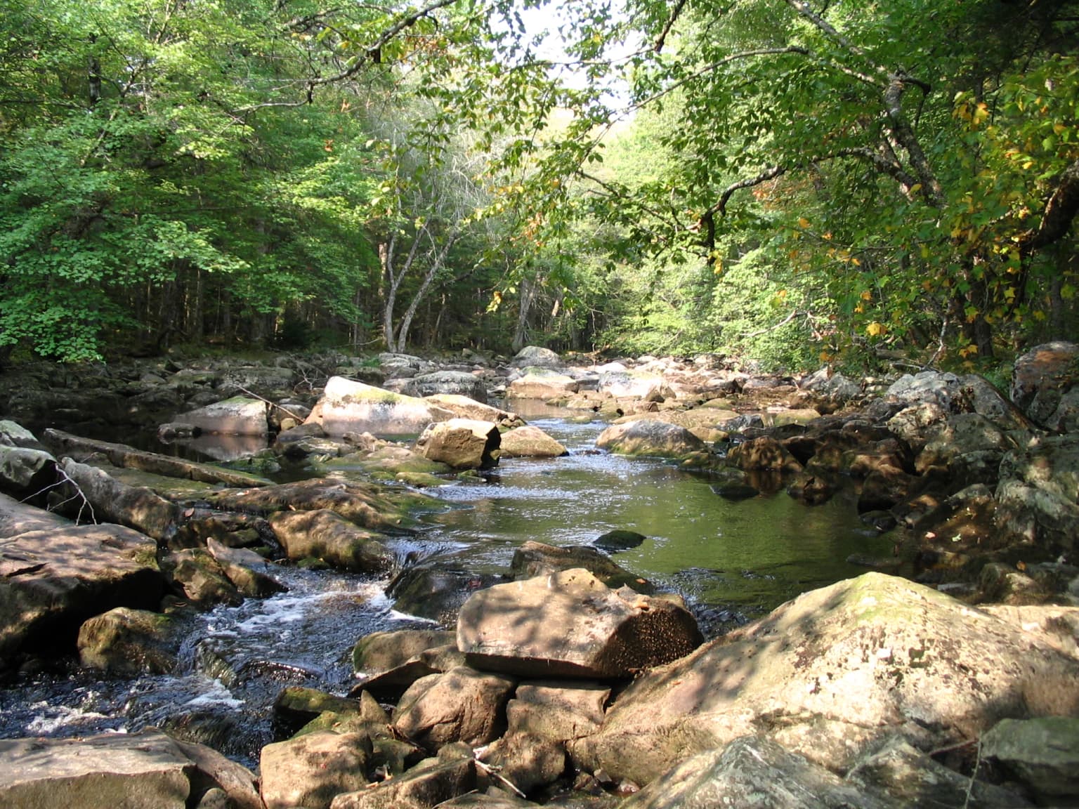
Kejimkujik National Park occupies a flat plain in southwestern Nova Scotia with modest relief, where the highest point, Mount Tom, reaches just 180 metres above sea level. The underlying bedrock consists of Precambrian to Ordovician quartzite and slate, with Devonian granite, all of which provide limited nutrients to the soils that develop above them. Podzols dominate well-drained areas while poorly-drained areas feature Gleysols and extensive peat bogs. The landscape bears the imprint of the Last Glacial Period, with drumlins, glacial erratics, and eskers scattered throughout the park. Fifteen percent of the park is covered by lakes, with some 46 lakes occurring within its boundaries, including Kejimikujik Lake, the second largest freshwater lake in mainland Nova Scotia. Major rivers include the Mersey River, which drains the interior including Kejimikujik Lake to the Atlantic Ocean, and the Shelburne River which flows just south of the park. The Kejimkujik Seaside component protects 22 square kilometres of coastal wilderness along Nova Scotia's Atlantic coast, featuring coastal barrens, rare humidity-dependent forests, bogs, barrier beaches, and shallow lagoons, including St. Catherine's River Beach, one of the largest protected beaches in the province.

White-water rapids flowing over dark rocks in a forested river scene
Rapids of the Mersey River in Kejimkujik National Park, Nova Scotia

Kejimkujik National Park ecosystems, habitats, and plant life

Kejimkujik protects extensive areas of Acadian forest, including both upland forests and forested wetlands. While much of the forest is second growth resulting from logging and forest fires in the two centuries before park establishment, several areas retain original old-growth forest representing some of the last remaining old-growth in the Canadian Maritimes. Old-growth stands consist primarily of eastern hemlock, yellow birch, American beech, sugar maple, and red maple, with approximately one-fifth of the forest consisting of conifer species. Hemlock forests face threat from the invasive hemlock woolly adelgid, first detected in the park in 2018. The park is considered a hotspot for Atlantic Coastal Plain Flora, a group of 90 unrelated plants, many rare in Canada, that specialize in high-disturbance, low-fertility habitats. Two of the three Canadian lakes hosting water pennywort are found here. Overall, some 544 vascular plant species have been documented, including diverse wildflowers from April through October, several carnivorous plants, and a high diversity of parasitic plants. The park also hosts 22 square kilometres of unique coastal ecosystems at the Seaside, including distinctive lichen assemblages with several species at risk.

Wooden boardwalk surrounded by dense green foliage leading to a calm lake with forested shoreline under a partly cloudy sky.
Wooden boardwalk leading through lush green vegetation to Big Dam Lake in Kejimkujik National Park.

Kejimkujik National Park wildlife and species highlights

Kejimkujik supports remarkable biodiversity with 34 mammal species documented, including snowshoe hare, northern flying squirrel, North American beaver, porcupine, North American river otter, fisher, American ermine, bobcat, eastern coyote, American black bear, and white-tailed deer. Moose, once common, are now very rare and listed as endangered in mainland Nova Scotia. American marten were reintroduced in 1986 and persist in low densities. The park is considered a regional hotspot for herptile diversity, hosting a greater variety of amphibians and reptiles than anywhere else in Atlantic Canada, including Blanding's turtle and eastern ribbonsnake, both species at risk in Canada. Birds commonly encountered include hermit thrush, ovenbird, white-breasted nuthatch, American woodcock, eastern wood pewee, barn swallow, northern parula, yellow-bellied sapsucker, ruffed grouse, common loon, barred owl, and American black duck. Common loons in the park have the highest methyl mercury levels in their blood of any loons in North America, affecting reproduction. The park's waterways support native fish including brook trout, though populations have been dramatically reduced by invasive chain pickerel confirmed in 2018. Kejimkujik Seaside supports coastal wildlife including American black bear, white-tailed deer, raccoon, American mink, harbour seals, grey seals, and important nesting habitat for endangered piping plover.

A river with flowing water and large rocks surrounded by forest trees in fall colors
River flowing through rocky terrain with autumn foliage

Kejimkujik National Park conservation status and protection priorities

Kejimkujik's conservation significance is twofold: it protects both irreplaceable Mi'kmaq cultural heritage and outstanding ecological communities within the UNESCO Southwest Nova Biosphere Reserve. The dual national park and national historic site designation, established in 1994, recognizes that the entire landscape holds cultural significance as a Mi'kmaq territory of forested upland plain containing petroglyph sites, historical habitation areas, travel routes, and burial grounds. The park protects some of the last remaining old-growth Acadian forest in the Canadian Maritimes, representing a critical ecological attribute. Kejimkujik Seaside protects unique coastal ecosystems including rare forests, barrens, bogs, and estuaries that support species at risk such as piping plover and blue felt lichen. Conservation challenges include the invasive hemlock woolly adelgid threatening eastern hemlock forests, European green crab impacting eelgrass beds and soft-shelled clam populations at the Seaside, and chain pickerel devastating native brook trout populations. The dark-sky preserve designation adds an astronomical conservation dimension, with the International Astronomical Union naming minor planet 497593 Kejimkujik in honour of the park's night sky protection.

Kejimkujik National Park cultural meaning and human context

Kejimkujik holds profound significance as a Mi'kmaq cultural landscape. The Mi'kmaq have used the area for thousands of years, traveling ancient canoe routes from the Bay of Fundy to the Atlantic coast. The Mersey River served as a major travel corridor to the Kejimikujik Lake area where Mi'kmaq lived and hunted during fall and winter months, coinciding with caribou migration. The park contains approximately 500 Mi'kmaq petroglyphs carved into slate, primarily on the eastern side of Kejimikujik Lake, depicting canoes, wigwams, traditional regalia, European ships, Christian symbols, and animals including caribou. These glyphs date to the 1700s and 1800s, illustrating aspects of Mi'kmaw life shortly after European colonization. The area remains spiritually significant to the Mi'kmaq despite no longer serving as a residential area. Parks Canada offers interpretive programming including guided petroglyph tours, a recreated traditional Mi'kmaw encampment with authentic wigwam, storytelling events, and an annual workshop demonstrating Mi'kmaw birchbark canoe building. The park also holds significance from the sport fishing era of the late 19th and early 20th centuries, when it hosted notable guests including Babe Ruth and Zane Grey.

Top sights and standout views in Kejimkujik National Park

Kejimkujik offers exceptional paddling opportunities along historic Mi'kmaq canoe routes, with many backcountry campsites accessible only by water. The park maintains a network of portages, some centuries old, connecting its numerous lakes. The petroglyphs represent one of the most significant Indigenous archaeological sites in Atlantic Canada, with only one site accessible to the public via guided summer tours. The dark-sky preserve designation provides outstanding stargazing, with the annual Dark Sky Weekend featuring astronomy programming and constellation storytelling. The Seaside component protects St. Catherine's River Beach, one of Nova Scotia's largest protected beaches, with turquoise coastal waters, coastal hiking trails, and important birdwatching opportunities. The old-growth Acadian forest stands represent rare remnants of the pre-colonial Maritime landscape. Backcountry camping options include 46 wilderness campsites and two historic cabins, one original to the sporting era.

Best time to visit Kejimkujik National Park

Kejimkujik offers distinct seasonal experiences across its four-season humid continental climate. Summer months bring warm conditions with July averages around 19.6°C, lower precipitation than winter, and optimal conditions for paddling, camping, and exploring the Seaside beaches. The annual Dark Sky Weekend typically occurs during summer, offering ideal conditions for stargazing. Spring and fall provide transitional experiences with milder temperatures, though weather can be unpredictable. Winter transforms the park with cold conditions, January averages of -5°C, and high snowfall averaging 244 cm annually, creating opportunities for winter wildlife viewing and solitude. Summer through early fall traditionally represents the peak visitation period, particularly for backcountry canoe routes, while shoulder seasons offer fewer crowds and different ecological viewing opportunities.

Park location guide

Geography guide, regional context, and park location map for Kejimkujik National Park

Kejimkujik National Park park geography, regions, and map view in Canada
Understand where Kejimkujik National Park sits in Canada through a broader geographic reading of the surrounding landscape, nearby location context, and its mapped position within the national park landscape.

How Kejimkujik National Park fits into Canada

Canada is a federal parliamentary constitutional monarchy spanning North America from the Atlantic to the Pacific and Arctic Oceans. With a population of over 41 million, it is officially bilingual in English and French at the federal level. The country gained independence from the United Kingdom through a gradual process culminating in 1982.

Wider geography shaping Kejimkujik National Park in Canada

Canada occupies the northern portion of North America, sharing its longest international border with the United States. The country extends from the Atlantic Ocean to the Pacific Ocean and northward into the Arctic Ocean, giving it the longest coastline of any nation.

Map view of Kejimkujik National Park

Use this park location map to pinpoint Kejimkujik National Park in Canada, understand its exact geographic position, and read its mapped placement within the surrounding landscape more clearly.

Pigeon | © OpenStreetMap contributors

Location context for Kejimkujik National Park

Nova Scotia

Visualizing Kejimkujik National Park's Acadian Forests, Ancient Mi'kmaq Landscapes, and Coastal Protected Area Terrain

Kejimkujik National Park: Explore its Unique Landscapes, Habitats, and Visual Identity through Park Photos
Browse a curated collection of photos showcasing Kejimkujik National Park's diverse inland lakes, expansive Acadian forests, and rugged coastal protected areas. These images offer an essential visual reference to comprehend the park's unique Mi'kmaq cultural landscapes, varied habitats, and overall environmental character, aiding in a richer understanding of this significant Canadian national park.

Wide view of a coastal landscape with dense evergreen forest in the foreground, a sandy beach, and blue ocean under clear sky

Common seals resting on rocky outcrop in ocean with waves crashing against rocks

White-water rapids flowing over dark rocks in a forested river scene

Wooden boardwalk surrounded by dense green foliage leading to a calm lake with forested shoreline under a partly cloudy sky.

A river with flowing water and large rocks surrounded by forest trees in fall colors

A beige canoe with green markings rests on sandy beach near calm blue water with forested shoreline under clear blue sky.

Park atlas

Map and compare diverse protected landscapes, coastal ecosystems, and forest reserves across Nova Scotia, expanding beyond Kejimkujik National Park.

Discover Other National Parks and Protected Areas Surrounding Kejimkujik National Park
Browse other national parks and diverse protected areas across Nova Scotia, tracing conservation landscapes near Kejimkujik National Park's unique inland and coastal territories. Compare these distinct park geographies to gain deeper insights into regional ecosystems, their protected status, and the broader natural heritage of the Canadian Maritimes.
National parkNew Brunswick

Fundy National Park: New Brunswick National Park Atlas and Geographic Exploration

Mapped protected landscape and regional park context.

Fundy National Park represents a vital protected area, offering rich geographic discovery within New Brunswick, Canada. This national park detail provides context for its mapped boundaries and landscape, supporting atlas-based exploration of its regional significance. Understand Fundy National Park's protected status and its contribution to the mapped natural terrain of eastern Canada.

Area
207 km²
Established
1948
IUCN
II
Visitors
303.6K annual
National parkMaine

Acadia National Park: A Protected Landscape within Maine's Regional Geography

Discover mapped boundaries and natural terrain context.

Delve into the protected landscape of Acadia National Park, a key entity within the geography of Maine. This dedicated atlas view helps you understand the park's mapped boundaries and its role within the broader regional context. Explore the natural terrain and understand how protected areas are situated geographically, enriching your understanding of conservation landscapes.

Area
198.6 km²
Established
1919
IUCN
V
Visitors
3.9M annual
National parkNew Brunswick

Kouchibouguac National Park: New Brunswick Protected Landscape Atlas

Mapped protected area boundaries and regional geography.

Kouchibouguac National Park is a designated national park offering a rich canvas for geographic discovery. This entry focuses on understanding its protected landscape, detailing its specific mapped boundaries within New Brunswick. It serves as a vital component for atlas exploration, providing the context needed to grasp the park's natural terrain and its significance within the regional geography.

Area
238 km²
Established
1969
IUCN
II
Visitors
243.5K annual
National parkPrince Edward Island

Prince Edward Island National Park: A Mapped Protected Landscape within Canada's Maritime Region

Discover its geographic context and natural terrain.

Prince Edward Island National Park offers a distinct protected area for exploration within the Canadian Maritimes. As a national park, it represents a commitment to preserving specific natural landscapes and their geographic characteristics. This resource provides insight into its mapped boundaries, regional setting on Prince Edward Island, and its contribution to the broader atlas of protected lands.

Area
27 km²
Established
1937
IUCN
II
Relief
Lowland
National parkNova Scotia

Cape Breton Highlands National Park: Mapped Protected Landscape in Nova Scotia

Discover its national park geography and natural terrain.

Uncover the protected landscape identity of Cape Breton Highlands National Park, a national park situated in Nova Scotia. This atlas-focused content details its mapped boundaries, regional geographic context, and natural terrain. It serves as a definitive resource for understanding the park's protected-area status and its contribution to the mapped natural landscapes of the region.

Area
949 km²
Established
1936
IUCN
II
Visitors
277.2K annual
National parkQuebec

Forillon National Park: Quebec National Park Protected Landscape and Geography

Explore mapped park boundaries and regional terrain.

Forillon National Park represents a crucial component of Quebec's protected lands, offering a rich subject for geographic discovery and atlas exploration. This national park's specific landscape characteristics and mapped boundaries provide essential context for understanding its role within the wider regional geography of Canada. Dive into the mapped terrain and protected area details that make Forillon National Park a unique element in any natural landscape atlas.

Area
244 km²
Established
1970
IUCN
II
Visitors
164.1K annual
National parkMinganie Regional County Municipality

Mingan Archipelago National Park Reserve: Mapped Protected Landscape

Discover its national park geography in Minganie

Mingan Archipelago National Park Reserve is a designated national park offering a distinct protected landscape within the Minganie Regional County Municipality. This entry provides core geographic context and mapped details crucial for atlas exploration. Understand the park's boundaries and its regional landscape setting for comprehensive discovery of Canada's protected natural areas.

Area
151 km²
Established
1984
IUCN
II
Visitors
44K annual
National parkCanada

Gros Morne National Park: A Canadian National Park for Geographic Exploration

Discover its mapped protected boundaries and regional landscape context.

Explore Gros Morne National Park, a designated National Park within Canada, offering deep insights into its protected landscape and geographic significance. This page details its mapped boundaries and natural terrain, providing essential context for understanding its role within Canada's broader atlas of protected areas. Engage with the specific geography of this park to deepen your knowledge of natural landscapes and conservation.

Area
1,805 km²
Established
2005
IUCN
II
Relief
Mountain

Common questions about visiting, size, designation, and location context for Kejimkujik National Park

Kejimkujik National Park FAQs for park facts, access, geography, and protected area context
Find quick answers about Kejimkujik National Park, including protected-area facts, park geography, trail and visitor context, and how the park fits into its surrounding country and regional landscape.
MoriAtlas Explorer

Continue Your Protected Areas Search Across the Global Atlas

Deepen your exploration by continuing the structured search for national parks and protected areas worldwide. Utilize the comprehensive filtering capabilities to compare different conservation landscapes and refine your understanding of global park geography. Discover more about the distribution and characteristics of protected natural areas.

Global natural geography