
Mori Atlas logo
Nature reserveKermadec Islands

A study of subtropical moist forest ecosystems, deep sea ridges, and protected marine corridors in the South Pacific.

Kermadec Islands Nature Reserve: Mapping the Volcanic Landscape of New Zealand's Remote Outlying Archipelago

(Kermadec Islands (Rangitāhua))

The Kermadec Islands represent a dramatic volcanic arc rising from the South Pacific, situated along a convergent plate boundary between the Kermadec Ridge and the deep Kermadec Trench. This nature reserve, administered by New Zealand, preserves a vital subtropical island system characterized by pōhutukawa forests, crater lakes, and steep coastal cliffs. The surrounding maritime environment forms one of the largest protected areas in the region, supporting essential seabird breeding colonies and whale migration corridors.

subtropical islandsvolcanic island arcuninhabited islandsnature reservemarine reserveseabird breeding
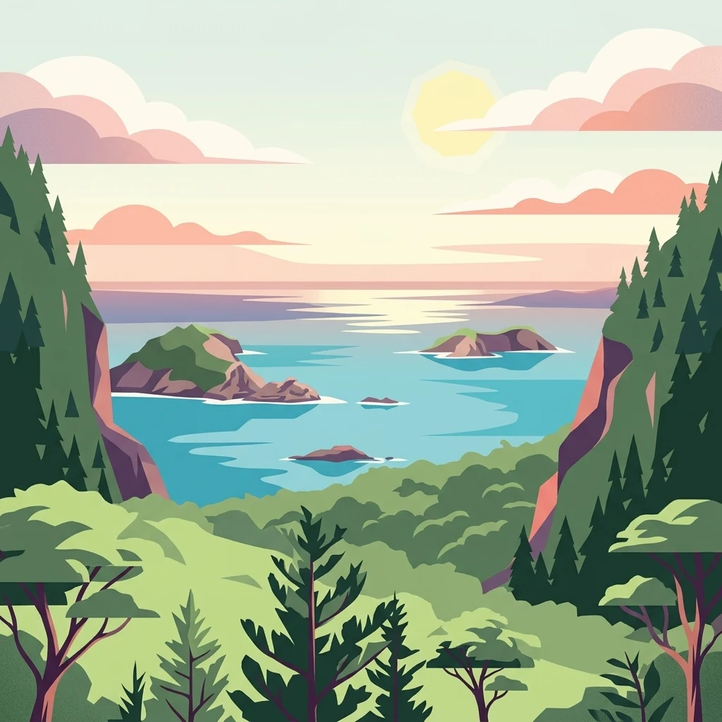
A digital illustration of a coastal landscape featuring rocky islands, calm blue waters, and lush green forests at sunrise.

Kermadec Islands

Nature reserve

Park overview

Structured park overview, official facts, and landscape profile for Kermadec Islands

Kermadec Islands park facts, protected area profile, and essential visitor context

Review the core facts for Kermadec Islands, including designation, size, terrain, visitor scale, habitats, and operating context in one park-focused overview.

About Kermadec Islands

The Kermadec Islands are a subtropical island arc in the South Pacific, sitting in the broad oceanic gap between New Zealand and Tonga. Stretching across several hundred kilometres of ocean, the arc consists of about sixteen islands and isolated rocks, of which Raoul Island, Macauley Island, Curtis Island, and Nugent Island are the principal land areas. Raoul Island dominates the group in size and elevation, with an active volcanic interior, forested slopes, and surrounding satellite islets, while the smaller islands represent eroded remnants of older volcanoes in the same chain.

The islands are administered by New Zealand as part of the New Zealand outlying islands, placed administratively in an Area Outside Territorial Authority rather than within any region or district. With no permanent civilian population, the only sustained human presence is the Raoul Island Station, a long-running meteorological and radio station combined with a Department of Conservation hostel for staff and volunteers. This outpost is the northernmost permanently inhabited point of New Zealand.

Ecologically, the Kermadecs are distinguished by their combination of subtropical forests, marine biodiversity, and limited human footprint. The terrestrial ecosystems are part of the Kermadec Islands subtropical moist forests ecoregion, recognised by the World Wildlife Fund, while the surrounding waters are protected within one of New Zealand's largest marine reserves. The islands are an important breeding area for petrels, shearwaters, and terns, and the broader Kermadec region has emerged as a significant corridor for humpback whales moving between tropical and Antarctic waters, with minke, sperm, beaked, killer whales, and dolphins also recorded nearby.

Their isolation and protected status shape a very different experience from more accessible national parks. Visits are tightly controlled by the Department of Conservation; access to Raoul is generally limited to conservation volunteers and those engaged in nature study, while visits to the other islands are typically restricted to scientific research. The islands therefore function less as a destination for casual tourism and more as a working conservation and research landscape, valued for what they preserve rather than what they offer as a leisure site.

Quick facts and research context for Kermadec Islands

The Kermadec Islands are a New Zealand-administered subtropical island arc in the South Pacific, about 800 to 1,000 kilometres northeast of the North Island and roughly the same distance southwest of Tonga. The group covers around 33.6 square kilometres across approximately sixteen islands and rocks, with Raoul Island by far the largest at about 29 square kilometres and a highest point of 516 metres at Moumoukai Peak. The islands are uninhabited aside from the Raoul Island Station, a Department of Conservation and meteorological outpost that serves as New Zealand's northernmost inhabited post. The islands were declared a nature reserve in 1937, and the surrounding sea was designated a marine reserve in 1990 covering about 7,480 square kilometres.

Protection and recognition

Examine documented protection scope, designation milestones, and recognition frameworks.

Kermadec Islands Protection Status and Designated Conservation History

Kermadec Islands features a mixed protection scope originating from its historical designation year of 1937. Structured conservation records outline the established management scope and international recognition parameters associated with the protected area.

Protection details

Protection scope
Mixed
Designated year
1937
Transboundary protection
No
Park context

Deeper park guide and search-rich context for Kermadec Islands

Kermadec Islands history, landscape, wildlife, and travel context

Explore Kermadec Islands through its history, landscape character, ecosystems, wildlife, conservation priorities, cultural context, and seasonal travel timing in a structured park guide built for atlas discovery and search intent.

Why Kermadec Islands stands out

The Kermadec Islands are best known for being one of the most isolated, well-preserved subtropical island systems in the South Pacific, where dense pōhutukawa-dominated forests, enormous seabird colonies, and rich whale and dolphin habitat combine within a substantial marine reserve. The islands and the Kermadec Ridge that connects them to New Zealand and Tonga also form a striking volcanic arc above the Kermadec Trench, with Raoul and Curtis among the active volcanoes that give the chain its dramatic ocean profile.
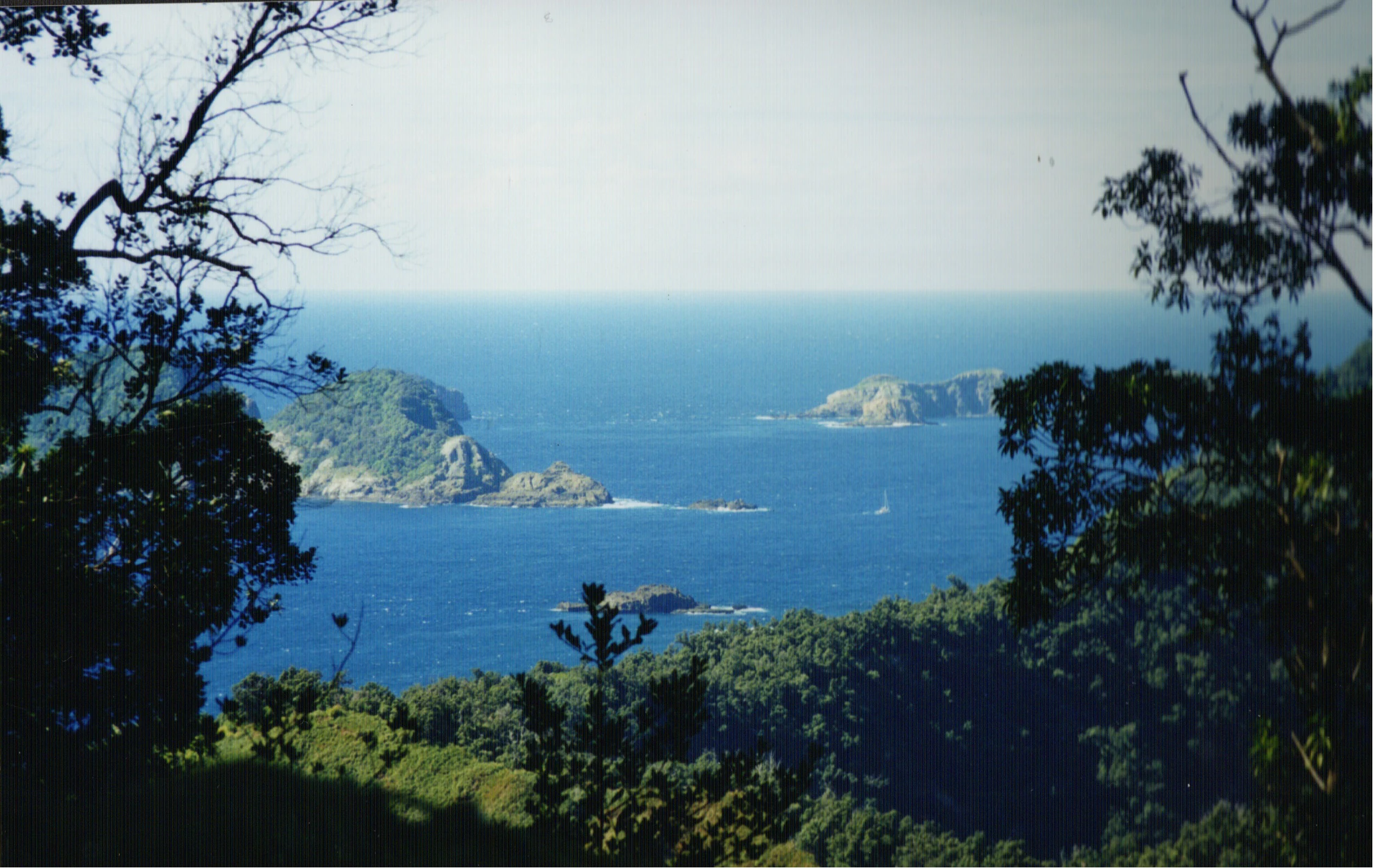
A distant view of several small, rugged islands rising from the deep blue ocean, framed by dark foreground trees and lush coastal vegetation.
A view overlooking the islands and surrounding waters of the Kermadec Islands from a vantage point on Raoul Island.

Kermadec Islands history and protected-area timeline

The Kermadec Islands have a layered human history that begins long before European contact. Polynesian voyagers reached the island group in around the fourteenth century, and possibly earlier in the tenth century, leaving traces of their presence in the form of introduced taro and candlenut growing wild on Raoul Island. The Polynesian name Rangitāhua, which translates roughly as 'the stopping-off place', reflects this role of the Kermadecs as a waypoint across the wider Pacific, rather than as a destination for permanent settlement. When the British transport Lady Penrhyn reached the islands in May 1788, however, the European crew found no inhabitants on these volcanic, rugged islands.

European and American interest in the Kermadecs grew with Pacific whaling in the nineteenth century. Whaling vessels from Britain, the United States, and Australia regularly visited the islands in search of fresh water, wood, and provisions; the whaler Fanny is recorded as the first such vessel to visit Raoul Island in 1823. Small-scale European settlement followed, with families growing food for passing whalers; among the longest-resident were the Bell family, who lived on Raoul Island from 1878 to 1914. The story of that family, recorded by writer Elsie K. Morton in 1957 as Crusoes of Sunday Island, remains one of the most widely referenced accounts of life on Raoul during the settler era.

Formal control of the islands passed to the British Crown in 1886, when HMS Diamond annexed them for the United Kingdom, and letters patent assigned them to the colony of New Zealand in 1887 at the request of the colonial parliament. New Zealand declared the islands a nature reserve in 1937, ending the period of casual settlement and beginning the modern conservation era. A government meteorological and radio station, combined with a hostel for Department of Conservation staff and volunteers, has since then maintained a continuous human presence on Raoul.

In the mid-twentieth century the Kermadecs briefly became a subject of strategic concern when, in 1955, the British Government considered them as a remote site for thermonuclear weapons testing. After advice from the Admiralty indicated the islands would be suitable, the British Prime Minister Anthony Eden wrote to New Zealand Prime Minister Sidney Holland requesting permission. Holland refused, citing likely public opposition ahead of the 1957 general election, and the proposal did not proceed. The episode remains a notable moment in the islands' political history and an example of how the group's remoteness has repeatedly drawn attention beyond its ecological value.

Kermadec Islands landscape and geographic character

The Kermadec Islands form a small but visually dramatic chain of volcanic landforms rising out of the open South Pacific. The islands occupy a narrow latitudinal band between roughly 29 and 31.5 degrees south, strung along the undersea Kermadec Ridge where the Pacific Plate subducts beneath the Indo-Australian Plate. To the east lies the Kermadec Trench, an approximately eight-kilometre-deep submarine depression, while the broader ridge continues southwest toward New Zealand and northeast toward Tonga.

Raoul Island dominates the group. It covers about 29 square kilometres, with numerous smaller satellite islets around its coastline, and rises to Moumoukai Peak at 516 metres. The island's interior features volcanic craters, including Green Lake and Blue Lake, and a varied topography of forested ridges, cliffs, and coastal terraces. The Raoul Island Station sits on northern terraces about 50 metres above the cliffs of Fleetwood Bluff. Macauley Island, the second largest at roughly three square kilometres when paired with neighbouring Haszard Island, lies about 110 kilometres to the south-southwest, while Curtis Island, with Cheeseman Island, is smaller still, reaching only 137 metres at its highest point. The northernmost island, Nugent Island, is barely 100 metres across, and the southern features include L'Esperance Rock, 80 kilometres southwest of Curtis, and L'Havre Rock, which surfaces only at low tide.

The climate is subtropical, with mean monthly temperatures around 22.4 degrees Celsius in February and 16.0 degrees Celsius in August, and annual rainfall of approximately 1,500 millimetres, somewhat lower between October and January. Beyond the islands themselves, the ridge's submarine peaks appear as seamounts scattered across adjacent waters, including Monowai Seamount, with around 120 metres of water above its summit, and the South Kermadec Ridge Seamounts further south; some of these have been observed to erupt, as with the 2012 Havre Seamount event that breached the ocean surface. From these dramatic submarine origins, the emerged islands retain the hallmarks of their volcanic past, including steep coastal cliffs, crater lakes, and in some cases open grasslands where former forests have been lost.
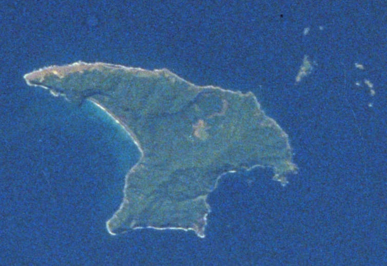
An aerial or satellite photograph of the volcanic Raoul Island surrounded by deep blue ocean water.
An aerial view of Raoul Island, the largest island in the Kermadec Islands group.

Kermadec Islands ecosystems, habitats, and plant life

The Kermadec Islands are classed by the World Wildlife Fund as a distinct ecoregion, the Kermadec Islands subtropical moist forests, part of the tropical and subtropical moist broadleaf forests biome within the Oceanian realm. The flora mixes New Zealand lineages with species that have arrived across the wider Pacific, producing an unusual island assembly. The islands support 113 native vascular plant species, of which 23 are endemic, alongside 52 native moss species and 89 native lichen and fungi species; an additional 152 introduced plant species have become established, mostly associated with past human activity.

Dense subtropical forest once blanketed Raoul Island and Macauley Island. Today it persists in greatest extent on Raoul, where Metrosideros kermadecensis, the Kermadec pōhutukawa, forms a continuous canopy roughly 10 to 15 metres above the ground. The native nīkau palm Rhopalostylis baueri is a second important canopy tree, sharing space with smaller trees, shrubs, ferns, and herbaceous plants such as Myrsine kermadecensis, Lobelia anceps, Poa polyphylla, Coprosma acutifolia, and Coriaria arborea. Two endemic tree ferns, Alsophila milnei and the rare and endangered Alsophila kermadecensis, contribute a distinctive understory layer.

Coastal exposure creates a clearly different plant community on the margins of the islands, where salt spray and wind limit tree growth. Here shrubs and ferns dominate, including Myoporum obscurum, Coprosma petiolata, Asplenium obtusatum, Cyperus ustulatus, Disphyma australe, and Ficinia nodosa. The contrast between sheltered inland forest and exposed coastal scrub is one of the most characteristic features of the islands' vegetation pattern, and it is particularly visible on Raoul's varied coastline.

Kermadec Islands wildlife and species highlights

With no native land mammals, the Kermadec Islands' terrestrial wildlife is defined by birds and the surrounding ocean. BirdLife International has recognised the group as an Important Bird Area, primarily because it supports breeding colonies of several pelagic seabird species. These include white-necked and black-winged petrels, wedge-tailed and little shearwaters, sooty terns, and blue noddies. The seabird colonies were once vastly larger, but nineteenth- and twentieth-century introductions of cats and rats reduced mainland island populations from millions to tens of thousands. Today, the largest surviving breeding aggregations tend to be on smaller offshore islets that are out of reach of invasive predators. An endemic bird subspecies, the Kermadec red-crowned parakeet, persists on the group, while the Kermadec megapode, formerly present on Raoul Island, was lost in the late nineteenth century.

The marine life around the islands is considerably richer and more varied than the terrestrial fauna. The waters have been documented as habitat for humpback whales, including animals that have been satellite-tagged from Raoul Island and tracked to feeding grounds around Antarctica and the Antarctic Peninsula. Minke whales, sperm whales, killer whales, less well-known beaked whales, and several dolphin species also move through the area. Southern right whales were historically abundant in southwestern Kermadec waters, though recent sightings are rare.

The deep environments of the Kermadec Ridge add a further, less visible layer of biodiversity. Hydrothermal vents along the ridge support extremophile communities, including the New Zealand blind vent crab. Tropical reef fish occasionally appear as strays within the marine reserve, and rare deep-sea species such as the velvet whalefish and anglerfish have been recorded in Kermadec waters through collaborative research with iwi, university, and government science partners. Sea turtles are very occasional visitors; in 2016, a rehabilitated hawksbill turtle named Koha was released near Raoul Island as part of a translocation effort.

Kermadec Islands conservation status and protection priorities

The conservation significance of the Kermadec Islands lies in their combination of relative isolation, surviving biodiversity, and a serious restoration effort following ecological damage from introduced mammals. New Zealand declared the islands a nature reserve in 1937 and designated the surrounding sea a marine reserve in 1990, creating one of the country's largest marine protected areas at roughly 7,480 square kilometres. The nature reserve framework tightly controls access; visits to Raoul Island are generally permitted only for Department of Conservation volunteers and others engaged in nature study, while the smaller islands are typically restricted to scientific research.

The islands' modern conservation story has been shaped substantially by past ecological harm. Cats, rats, and goats introduced during the whaling and settler eras devastated both forests and seabird colonies. Goats overgrazed Macauley Island so thoroughly that its forests were replaced by open grasslands, and they also altered the understory of Raoul Island. Rats and cats preyed heavily on seabirds, collapsing once-massive breeding colonies on the main islands to far smaller numbers on offshore islets that the predators never reached.

Restoration has been a long-term commitment. Goats were removed from Macauley in 1970 and from Raoul in 1984, after which forest recovery began. Ongoing programmes target the remaining rats and cats, as well as a number of invasive plant species. Research expeditions involving Auckland Museum, the University of Auckland, Massey University, NIWA, Te Papa, and iwi partners such as Ngāti Kurī have surveyed marine biodiversity, whale populations, and the unique communities of vents and seamounts, building a much more detailed understanding of what is being protected.

The proposed Kermadec Ocean Sanctuary, announced in 2015 by Prime Minister John Key at a scale of around 620,000 square kilometres, reflected an ambition to extend protection well beyond the existing marine reserve. The bill that would have created the sanctuary did not pass its second reading, however, and as of late March 2024 the work on it had been halted by the Government. The status of the Kermadecs as a nature reserve and marine reserve therefore remains the principal formal layer of protection.

Kermadec Islands cultural meaning and human context

The cultural dimension of the Kermadec Islands is anchored in two strands: a Polynesian history of transit rather than settlement, and a more recent New Zealand era of scientific and conservation outposts. The Polynesian name Rangitāhua, 'the stopping-off place', captures how the islands were used by ocean voyagers as a waypoint in the wider Moana-nui-a-Kiwa; introduced taro and candlenut on Raoul Island are interpreted as evidence of these passing presences in around the fourteenth century, and possibly earlier.

The European period brought short-lived cycles of settlement and provisioning tied to Pacific whaling, including the Bell family's residence on Raoul from 1878 to 1914, later chronicled in Elsie K. Morton's Crusoes of Sunday Island. The naming of the islands after the Breton captain Jean-Michel Huon de Kermadec, who visited them with the d'Entrecasteaux expedition in the 1790s, shows how the chain entered European cartography through French and British exploration rather than through settlement. The British annexation of 1886 and the assignment of the islands to New Zealand in 1887 cemented the modern administrative relationship.

Today, the cultural context of the islands continues to evolve through research partnerships that explicitly incorporate iwi knowledge. Documented collaborations with Ngāti Kurī, alongside university, museum, and government science institutions, link the Kermadecs to wider Māori and New Zealand engagement with the marine environment, especially around cetacean research, deep-sea species discovery, and the management of the marine reserve.

Top sights and standout views in Kermadec Islands

The Kermadec Islands stand out as one of the most intact subtropical island ecosystems left in the temperate South Pacific, with Raoul Island's pōhutukawa forests and offshore seabird colonies surviving in close proximity to active volcanism and some of the deepest ocean trench systems on Earth.

Another distinctive quality is the contrast of scale between very small land area and a very large marine reserve. Roughly 33 square kilometres of island support a World Wildlife Fund-recognised ecoregion, while nearly 7,500 square kilometres of surrounding ocean is formally protected. That combination of compact terrestrial richness and expansive marine protection, combined with both functioning as a research and restoration site rather than a tourism destination, gives the Kermadecs a profile quite unlike that of more accessible national parks.

Best time to visit Kermadec Islands

The Kermadec Islands' subtropical climate is mild year-round, with February averaging around 22 degrees Celsius and August around 16 degrees Celsius, and annual rainfall close to 1,500 millimetres. The slightly drier window from October to January offers somewhat reduced precipitation and would be the most temperate period for fieldwork-style conditions.

That said, the islands are not a typical visitor destination. Access is restricted by the Department of Conservation and is generally limited to conservation volunteers working on Raoul Island and to researchers on the other islands, so any concept of a tourist season is not really applicable. Anyone whose interest in the Kermadecs relates to seabird breeding activity, marine life, or restoration work would most often engage with the group through scientific or conservation programmes rather than through independent travel.

Monthly climate preview

Long-term monthly temperature averages and precipitation patterns for Kermadec Islands

Kermadec Islands Climate Normals and Measured Annual Temperature and Precipitation Rhythm

Representative coordinate records show average monthly temperatures ranging from seventeen to twenty-four degrees Celsius alongside steady year-round precipitation. Exploring the complete twelve-month profile reveals detailed monthly fluctuations across the protected area.
Annual mean20 °C
17 °C23 °C
Jan22°
Feb23°
Mar23°
Apr22°
May20°
Jun19°
Jul18°
Aug17°
Sep17°
Oct18°
Nov19°
Dec21°
Warmest month
February

23.1 °C

Coolest month
August

17.1 °C

Wettest month
March

3.9 mm/day

Driest month
October

1.8 mm/day

Park location guide

Geography guide, regional context, and park location map for Kermadec Islands

Kermadec Islands park geography, regions, and map view in New Zealand

Understand where Kermadec Islands sits in New Zealand through a broader geographic reading of the surrounding landscape, nearby location context, and its mapped position within the national park landscape.

How Kermadec Islands fits into New Zealand

New Zealand is an island nation in the southwestern Pacific Ocean comprising two main islands and numerous smaller islands. Located east of Australia across the Tasman Sea, it features varied topography with the Southern Alps running along the South Island and volcanic terrain on the North Island. The country was settled by Maori people between 1280 and 1350, followed by European exploration beginning in 1642, and became a Dominion in 1907 before gaining full independence in 1947.

Wider geography shaping Kermadec Islands in New Zealand

New Zealand lies in the southwestern Pacific Ocean, east of Australia across the Tasman Sea. The country consists of two main islands, the North Island and South Island, plus over 600 smaller islands. The North Island features volcanic plateaus and hills while the South Island is dominated by the Southern Alps mountain range. The country has a long coastline and is surrounded by the Pacific Ocean.

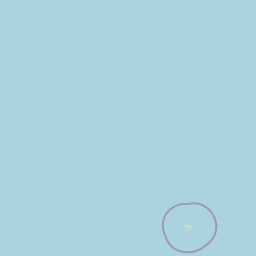
Map view of Kermadec Islands

Use this park location map to pinpoint Kermadec Islands in New Zealand, understand its exact geographic position, and read its mapped placement within the surrounding landscape more clearly.

Pigeon | © OpenStreetMap contributors

Visual exploration of remote volcanic terrain, subtropical moist forests, and marine reserves

Kermadec Islands Photos and Protected Landscape Scenery

Visual records reveal the dramatic volcanic relief, steep coastal cliffs, and dense pōhutukawa forests defining the Kermadec Islands. Examining these protected habitats provides direct insight into the rugged terrain and remote marine environments of the South Pacific.

A distant view of several small, rugged islands rising from the deep blue ocean, framed by dark foreground trees and lush coastal vegetation.

A blue-tinted Kermadec scalyfin fish swimming against a dark, rocky background.

An aerial or satellite photograph of the volcanic Raoul Island surrounded by deep blue ocean water.

Park atlas

Compare surrounding regional geography and connected marine reserves in the South Pacific

Explore Other Parks Near Kermadec Islands and Related Protected Landscapes

Continue browsing parks near Kermadec Islands to examine related protected landscapes across the surrounding region. Comparing adjacent marine reserves and island ecosystems provides broader geographic context for remote volcanic archipelagos.
National parkTonga
About 924 km away#1 closest

North

'Eua National Park: Tonga Protected Landscape and Geographic Context

Explore mapped boundaries and unique natural terrain within Tonga.

Access detailed geographic information and mapped boundaries for 'Eua National Park, Tonga's designated national park. This resource provides an atlas-style overview of the park's protected landscape identity, focusing on its natural terrain and its specific place within the broader geography of the Kingdom of Tonga. Understand the park's conservation significance through its landscape context and mapped distribution.

A pale, minimalist watercolor painting depicting soft green and pink hilly island silhouettes rising from a calm, white-toned sea.
Marine protected areaNew Zealand
About 971 km away#2 closest

Southwest

Poor Knights Islands Marine Reserve: Geography and Marine Protected Area Atlas

Exploring coastal cliffs and underwater volcanic terrain

The Poor Knights Islands Marine Reserve encompasses a protected 1,890 hectare marine environment renowned for its steep underwater walls and tunnel systems. Located off the coast of New Zealand, this reserve serves as a critical study area for marine conservation and ecosystem recovery. Explore the geological features, including the Northern Arch and rugged offshore rock stacks, which distinguish this maritime landscape.

Area
18.9 km²
Established
1981
Access
Access unknown
Scope
Marine
Nature reserveNorthland Region
About 975 km away#3 closest

Southwest

Poor Knights Islands Nature Reserve: Mapped Volcanic Geography and Protected Coastal Landscapes

A rugged island chain offshore from New Zealand's Northland Region.

The Poor Knights Islands serve as an essential protected landscape characterized by sheer volcanic cliffs, natural arches, and extensive sea cave systems. Rising sharply from the sea, these uninhabited islands function as a vital sanctuary for seabirds and native flora, providing a unique look into the deeply eroded remnants of ancient rhyolitic volcanic activity within New Zealand.

Area
2.714 km²
Established
1975
IUCN
Ia
Relief
Upland
A watercolor painting showing soft green hills rising above a light blue body of water, with a small patch of reddish-brown land visible in the foreground.
Protected areaAuckland Region
About 978 km away#4 closest

Southwest

Rakitu Island Protected Area: Volcanic Geography and Coastal Landscapes in the Hauraki Gulf

A protected offshore sanctuary near Great Barrier Island

Rakitu Island is an uninhabited 253-hectare protected area that represents a distinct volcanic landscape off the northeast coast of New Zealand. Formed from eroded rhyolite domes, the island features high coastal cliffs and a central valley that now supports native forest regrowth. This predator-free sanctuary offers an essential map perspective on small-scale island conservation and rugged maritime terrain.

Area
2.5 km²
Established
1994
Relief
Upland
Scope
Terrestrial
Wildlife reserveNew Zealand
About 989 km away#5 closest

Southwest

Cuvier Island Wildlife Reserve: Volcanic Geography and Conservation Sanctuary

Protected island terrain in New Zealand's Hauraki Gulf

Cuvier Island is a rugged, forested volcanic landmass serving as a protected wildlife sanctuary. This uninhabited site plays an essential role in New Zealand island restoration efforts, acting as a habitat for vulnerable seabirds and representing a unique intersection of volcanic topography and focused environmental recovery.

Area
1.95 km²
Relief
Upland
Access
Highly restricted
Scope
Mixed
A soft watercolor illustration of green island peaks rising from a calm pinkish water surface against a light, hazy sky.
Nature reserveNew Zealand
About 994 km away#6 closest

Southwest

Mercury Islands Nature Reserve: Volcanic Landscapes and Protected Island Geography

A coastal island group off the Coromandel Peninsula, New Zealand

The Mercury Islands form a structured volcanic chain characterized by dramatic cliffs, sheltered coves, and critical pest-free ecosystems. This protected area holds international significance for its seabird colonies and the well-preserved archaeological sites associated with early Māori history across the islands.

Established
1769
Relief
Upland
Access
Remote access
Scope
Mixed
A watercolor illustration of a soft green hilly landscape with distant peaks against a white background.
Nature reserveNew Zealand
About 1,009 km away#7 closest

Southwest

Hen and Chicken Islands Nature Reserve: Mapped Geography and Protected Island Terrain

Archipelago sanctuary and volcanic landscape offshore of New Zealand

Explore the geographic structure of the Hen and Chicken Islands, an uninhabited nature reserve that serves as a vital predator-free sanctuary. The archipelago displays varied volcanic terrain, from the dramatic central ridge of Hen Island to the rugged rocky reefs of the Marotiri islets, offering a clear window into the ecological conservation landscapes of the Northland region.

Area
8.44 km²
Established
1908
Relief
Highland
Climate
Subtropical
Nature reserveNew Zealand
About 1,013 km away#8 closest

Southwest

Waro Limestone Scenic Reserve: Karst Landscapes and Cultural Heritage in Northland, New Zealand

A study in geological formations and industrial history.

Waro Limestone Scenic Reserve offers a concentrated look at Northland geography, featuring vertical limestone outcrops and a flooded quarry set within rural farmland. As a protected nature reserve, it serves as a site of significant Māori cultural heritage while also preserving remnants of early New Zealand industrial activity, such as coal mining and lime extraction, which shaped the surrounding terrain.

Relief
Upland
Climate
Subtropical
Scope
Terrestrial
Water
Minor water

Common questions about visiting, size, designation, and location context for Kermadec Islands

Kermadec Islands FAQs for park facts, access, geography, and protected area context

Find quick answers about Kermadec Islands, including protected-area facts, park geography, trail and visitor context, and how the park fits into its surrounding country and regional landscape.
MoriAtlas Explorer

Continue Your Protected Areas Search Across the Global Atlas

Deepen your exploration by continuing the structured search for national parks and protected areas worldwide. Utilize the comprehensive filtering capabilities to compare different conservation landscapes and refine your understanding of global park geography. Discover more about the distribution and characteristics of protected natural areas.

Global natural geography