

Mori Atlas logo
National parkKhao Laem National Park

Discover the mapped boundaries and regional context of this prominent Thai national park.

Khao Laem National Park: Protected Area Geography and Map Exploration in Kanchanaburi

Khao Laem National Park stands as a significant protected natural landscape within Kanchanaburi Province, Thailand. This page offers a detailed atlas-style exploration of its geographic identity, focusing on its mapped protected boundaries and its role within the regional landscape. Understand the park's setting and its value for structured geographic discovery.

mountain parksreservoir landscapesWestern Forest Complexlimestone terrainwetland habitatsbirdwatching

Khao Laem National Park

National park

Park overview

Structured park overview, official facts, and landscape profile for Khao Laem National Park

Khao Laem National Park park facts, protected area profile, and essential visitor context
Review the core facts for Khao Laem National Park, including designation, size, terrain, visitor scale, habitats, and operating context in one park-focused overview.

About Khao Laem National Park

Khao Laem National Park occupies a remarkable position in Thailand's protected area system, representing the mountainous frontier region where the Tenasserim Range extends from Myanmar into western Thailand. The park's terrain is dominated by steep limestone ridges and valleys that channel numerous streams into the Khwae Noi River system. Road 323 bisects the park, providing access to the reservoir area and trailheads for exploration. The reservoir, created by the Vajiralongkorn Dam, has become an integral part of the park's character, transforming what might otherwise be a remote forest area into a landscape of islands, peninsulas, and waterways that support both wildlife and visitor activities. The park's location within the Western Forest Complex connects it to a larger ecological network that supports significant populations of forest-dependent species.

Quick facts and research context for Khao Laem National Park

Khao Laem National Park lies in Kanchanaburi Province, roughly 340 kilometers northwest of Bangkok, and is bounded by Thungyai Naresuan Wildlife Sanctuary, Lam Khlong Ngu National Park, and Thong Pha Phum National Park. The park's centerpiece is the Vajiralongkorn Reservoir, also known as Khao Laem Reservoir, which covers 388 square kilometers. The highest summit is Khao Khiao-Khao Yai at 1,767 meters. The area experiences a tropical monsoon climate with three distinct seasons: rainy from mid-May to October, cool from November to February, and hot from March to mid-May.

Park context

Deeper park guide and search-rich context for Khao Laem National Park

Khao Laem National Park history, landscape, wildlife, and travel context
Explore Khao Laem National Park through its history, landscape character, ecosystems, wildlife, conservation priorities, cultural context, and seasonal travel timing in a structured park guide built for atlas discovery and search intent.

Why Khao Laem National Park stands out

Khao Laem National Park is distinguished by its unique combination of mountain forest ecosystems surrounding a vast artificial reservoir, creating a peninsula-dominated landscape unlike typical Thai national parks. The park's limestone mountain range runs on a north-south axis, providing habitat for diverse wildlife within the Western Forest Complex. The area gained international attention as the filming location for Survivor NZ: Thailand, showcasing its rugged natural beauty to a global audience.

Khao Laem National Park history and protected-area timeline

Khao Laem National Park was formally established as Thailand's 67th national park when the declaration appeared in the Royal Gazette on November 8, 1991, with the designation coming into effect on December 5, 1991. The park's boundaries were subsequently modified in 2002 and again in 2009, adjustments that reflect the ongoing process of defining protected area borders in relation to reservoir levels and surrounding land uses. The park's relatively recent establishment places it among Thailand's modern protected areas, created during a period when the country was expanding its national park system to encompass the less-accessible mountain forest regions of the western frontier.

Khao Laem National Park landscape and geographic character

The physical landscape of Khao Laem National Park is defined by its steep limestone mountains that form part of the Tenasserim Range, running along a north-south axis through the park's interior. These mountains rise from the valley floors at approximately 100 meters elevation to summits approaching 1,800 meters, with Khao Khiao-Khao Yai standing as the highest peak at 1,767 meters. The mountains are heavily dissected by valleys and streams that flow toward the Khwae Noi River. The Khao Laem Reservoir, covering 388 square kilometers or roughly 26 percent of the park's total area, dominates the lower elevations and creates an extensive wetland and shoreline environment. The combination of rugged peaks, forested slopes, and the vast reservoir creates a visually distinctive landscape.

Khao Laem National Park ecosystems, habitats, and plant life

The park's vegetation consists primarily of mixed deciduous forest in both eastern and western sections, characterized by species adapted to seasonal monsoon conditions and the limestone substrate. This forest type supports a diverse community of trees including Aporosa villosa, Caryota urens, Croton persimilis, Lagerstroemia loudonii, and numerous other species. The forest transitions with elevation, though the primary cover is deciduous rather than the evergreen rainforest found in some Thai national parks. The reservoir and its associated wetlands add a distinct aquatic habitat to the terrestrial forest environments, creating ecological diversity within a relatively compact area.

Khao Laem National Park wildlife and species highlights

Khao Laem National Park supports a notable diversity of wildlife despite its relatively recent protection status. Mammal species recorded in the park include the lar gibbon, various squirrel species including the black giant squirrel and grey-bellied squirrel, and smaller mammals such as the Asian palm civet and several bat species. The bird population is particularly significant, with approximately 249 species from 67 families documented, including 145 passerine species and 107 non-passerine species. Notable birds include the great hornbill, red-headed trogon, and numerous babbler and thrush species. Reptiles include the tokay gecko, various skinks, and snakes such as the banded krait. Amphibians and fish species also occur throughout the park's streams and reservoir.

Khao Laem National Park conservation status and protection priorities

As a component of the Western Forest Complex, Khao Laem National Park contributes to one of Thailand's most important ecological corridors, a network of protected areas that supports transboundary wildlife populations and maintains forest connectivity across the Dawna-Tenasserim region. The park's inclusion in this complex positions it as part of a larger conservation landscape that extends across the Myanmar-Thailand border, supporting species that require extensive habitat ranges. The reservoir environment adds a different conservation dimension, providing aquatic habitat and supporting fish populations within the broader forest ecosystem.

Khao Laem National Park cultural meaning and human context

The park's name derives from the local Thai designation for the mountain and reservoir complex, with Khao meaning mountain in Thai. The area lies in proximity to communities that have historical connections to the frontier region between Thailand and Myanmar, though the park itself does not contain significant cultural heritage sites. The landscape has been shaped by the creation of the reservoir, which flooded previous land uses and created the current peninsula-dominated geography.

Top sights and standout views in Khao Laem National Park

The park offers several notable attractions including Namtok Kra Teng Jeng, a dramatic waterfall with 23 levels cascading over a two-kilometer stretch, Namtok Kroeng Kra Wai at five meters high, and Namtok Pha Tak, a five-tiered waterfall. The reservoir itself provides opportunities for boat-based exploration of its islands and shorelines. The mountain trails, particularly to higher elevations, offer views across the reservoir and into the surrounding forest. The combination of waterfall attractions, reservoir-based activities, and mountain hiking provides varied visitor experiences within a single protected area.

Best time to visit Khao Laem National Park

The optimal visiting period corresponds to the cool season from November through February, when average temperatures drop to around 14 degrees Celsius and rainfall is minimal. This period offers the most comfortable conditions for hiking and outdoor exploration. The hot season from March to mid-May brings temperatures averaging 38 degrees Celsius, making midday activities challenging. The rainy season from mid-May through October brings heavy rainfall, particularly in July and August, though this period may offer greener landscape conditions and fewer visitors.

Park location guide

Geography guide, regional context, and park location map for Khao Laem National Park

Khao Laem National Park park geography, regions, and map view in Thailand
Understand where Khao Laem National Park sits in Thailand through a broader geographic reading of the surrounding landscape, nearby location context, and its mapped position within the national park landscape.

How Khao Laem National Park fits into Thailand

Thailand is a Southeast Asian nation formerly called Siam, located in mainland Southeast Asia. It operates as a unitary parliamentary constitutional monarchy under King Vajiralongkorn. The country borders Myanmar, Laos, Cambodia, and Malaysia, with maritime boundaries involving Vietnam, Indonesia, and India. Thailand has a population of nearly 66 million and covers approximately 513,120 km². Historically, the Sukhothai Kingdom marks the beginning of Thai history, followed by the powerful Ayutthaya Kingdom.

Wider geography shaping Khao Laem National Park in Thailand

Thailand occupies mainland Southeast Asia with borders to Myanmar (west/northwest), Laos (east/northeast), Cambodia (southeast), and Malaysia (south). The country has coastline along the Gulf of Thailand to the southeast and the Andaman Sea to the southwest. The territory covers approximately 513,120 km².

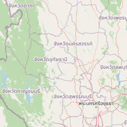
Map view of Khao Laem National Park

Use this park location map to pinpoint Khao Laem National Park in Thailand, understand its exact geographic position, and read its mapped placement within the surrounding landscape more clearly.

Pigeon | © OpenStreetMap contributors

Location context for Khao Laem National Park

Kanchanaburi Province
Park atlas

Trace shared ecosystems and unique protected landscapes across the Tenasserim Hills and Western Forest Complex, extending beyond Khao Laem.

Discover Nearby National Parks and Protected Areas Around Khao Laem National Park
Continue your exploration from Khao Laem National Park by browsing other national parks and protected areas within the surrounding Western Forest Complex. This offers a valuable opportunity to compare diverse mountain, reservoir, and limestone terrain, understanding the regional spread of conservation landscapes.
National parkKanchanaburi Province

Lam Khlong Ngu National Park: A Protected National Park in Kanchanaburi Province

Explore mapped boundaries and regional geography.

Lam Khlong Ngu National Park offers a distinct protected landscape within Kanchanaburi Province. As a national park, it contributes to the understanding of Thailand's diverse geography and conservation areas. Users can explore its mapped features and discover its place within the broader regional context of protected lands.

Area
673 km²
Established
2009
Relief
Mountain
Climate
Tropical
National parkKanchanaburi Province

Thong Pha Phum National Park: A Protected Landscape in Kanchanaburi Province, Thailand

National park mapped geography and regional context.

Thong Pha Phum National Park is a significant national park in Thailand, situated within Kanchanaburi Province. This page details its protected area status and provides essential geographic context, enabling users to explore its mapped boundaries and understand its role within the regional landscape. Focus on discovery of its natural terrain and atlas-relevant characteristics.

Area
1,236 km²
Established
2009
IUCN
II
Visitors
123.3K annual
National parkKanchanaburi Province

Khuean Srinagarindra National Park: A Protected Landscape in Kanchanaburi Province's Geography

Explore the mapped terrain and natural context of this national park.

Khuean Srinagarindra National Park stands as a distinct protected landscape within Kanchanaburi Province. This page provides a gateway to understanding its geographic identity, mapped boundaries, and natural terrain characteristics. As a national park, it offers rich opportunities for those seeking to explore the regional geography and protected areas of Thailand through a structured, atlas-focused lens.

Area
1,532 km²
Established
1981
IUCN
II
Visitors
71K annual
National parkKanchanaburi Province

Chaloem Rattanakosin National Park: National Park Status and Geographic Exploration

Mapped protected area in Kanchanaburi Province, Thailand.

Chaloem Rattanakosin National Park represents a crucial protected landscape within Kanchanaburi Province, identified as a national park. This entry offers a foundation for understanding its geographic boundaries and regional context, providing essential detail for atlas-based exploration of Thailand's natural protected areas and their mapped distribution across the landscape.

Area
59 km²
Established
1980
IUCN
II
Visitors
31.5K annual
Watercolor illustration of a serene landscape featuring a body of water, distant hills, and green vegetation
National parkKanchanaburi Province

Sai Yok National Park: Protected Landscape Boundaries and Regional Geographic Context

Explore the mapped terrain and park geography within Kanchanaburi.

Sai Yok National Park serves as a vital protected area within Kanchanaburi Province, offering a clear focus for geographic exploration and atlas-based understanding. This entry details the park's specific mapped boundaries and its role within the broader regional landscape context, providing essential data for comprehending its natural geography and conservation significance.

Area
500 km²
Established
1980
IUCN
II
Visitors
67.7K annual
National parkSuphan Buri Province

Phu Toei National Park: National Park Atlas and Mapped Landscape Exploration in Suphan Buri Province

Discover the protected area's geographic context and natural terrain.

Phu Toei National Park is a designated national park offering a unique perspective on protected landscapes within Suphan Buri Province, Thailand. This park serves as a crucial entity for atlas-based geographic discovery, highlighting its specific mapped boundaries and the surrounding natural terrain. Users can explore the park's inherent geographic character and its role within Thailand's network of conservation areas.

Area
317 km²
Established
1998
IUCN
II
Visitors
8.8K annual
National parkNakhon Sawan Province

Mae Wong National Park: National Park Protected Area and Geographic Setting

Mapped boundaries and regional landscape of Mae Wong.

Investigate Mae Wong National Park, a designated national park offering insights into its protected landscape identity. This entry provides structured geographic data, focusing on the park's mapped boundaries and its position within the broader regional context of Nakhon Sawan Province. Examine its role as a significant protected area for atlas-based discovery and geographic understanding.

Area
894 km²
Established
1987
IUCN
II
Visitors
51.8K annual
National parkKamphaeng Phet Province

Khlong Lan National Park: National Park Protected Landscape and Geography

Explore mapped boundaries and regional context in Kamphaeng Phet Province.

Delve into the specifics of Khlong Lan National Park, a protected area designated as a national park in Thailand's Kamphaeng Phet Province. This page offers a structured view of its geographic scope, emphasizing mapped park boundaries and the surrounding natural terrain. Understand its role as a significant protected landscape within the regional geography.

Area
300 km²
Established
1985
IUCN
II
Visitors
206.4K annual

Common questions about visiting, size, designation, and location context for Khao Laem National Park

Khao Laem National Park FAQs for park facts, access, geography, and protected area context
Find quick answers about Khao Laem National Park, including protected-area facts, park geography, trail and visitor context, and how the park fits into its surrounding country and regional landscape.
MoriAtlas Explorer

Continue Your Protected Areas Search Across the Global Atlas

Deepen your exploration by continuing the structured search for national parks and protected areas worldwide. Utilize the comprehensive filtering capabilities to compare different conservation landscapes and refine your understanding of global park geography. Discover more about the distribution and characteristics of protected natural areas.

Global natural geography