
Mori Atlas logo
Nature reserveKindelsee-Springluch

Explore the post-glacial terrain and lake-marsh mosaic within this restored protected area

Kindelsee-Springluch Nature Reserve: Mapping the Protected Wetland Landscapes of Brandenburg

(Naturschutzgebiet Kindelsee-Springluch)

Kindelsee-Springluch occupies a distinctive niche within the East Brandenburg Plateau as a restored wetland refuge defined by the Kindelsee lake and surrounding alder swamp forest. This protected area showcases a complex post-glacial mosaic of meltwater channels, reed belts, and wet meadows that demonstrate decades of hydrological recovery. The reserve serves as a significant case study in landscape restoration, illustrating how careful land management preserves ecological gradients from aquatic habitats to forested mineral soils near the Berlin metropolitan region.

wetlandssmall lakenature reservealderswamp forestwet meadowsreed belt
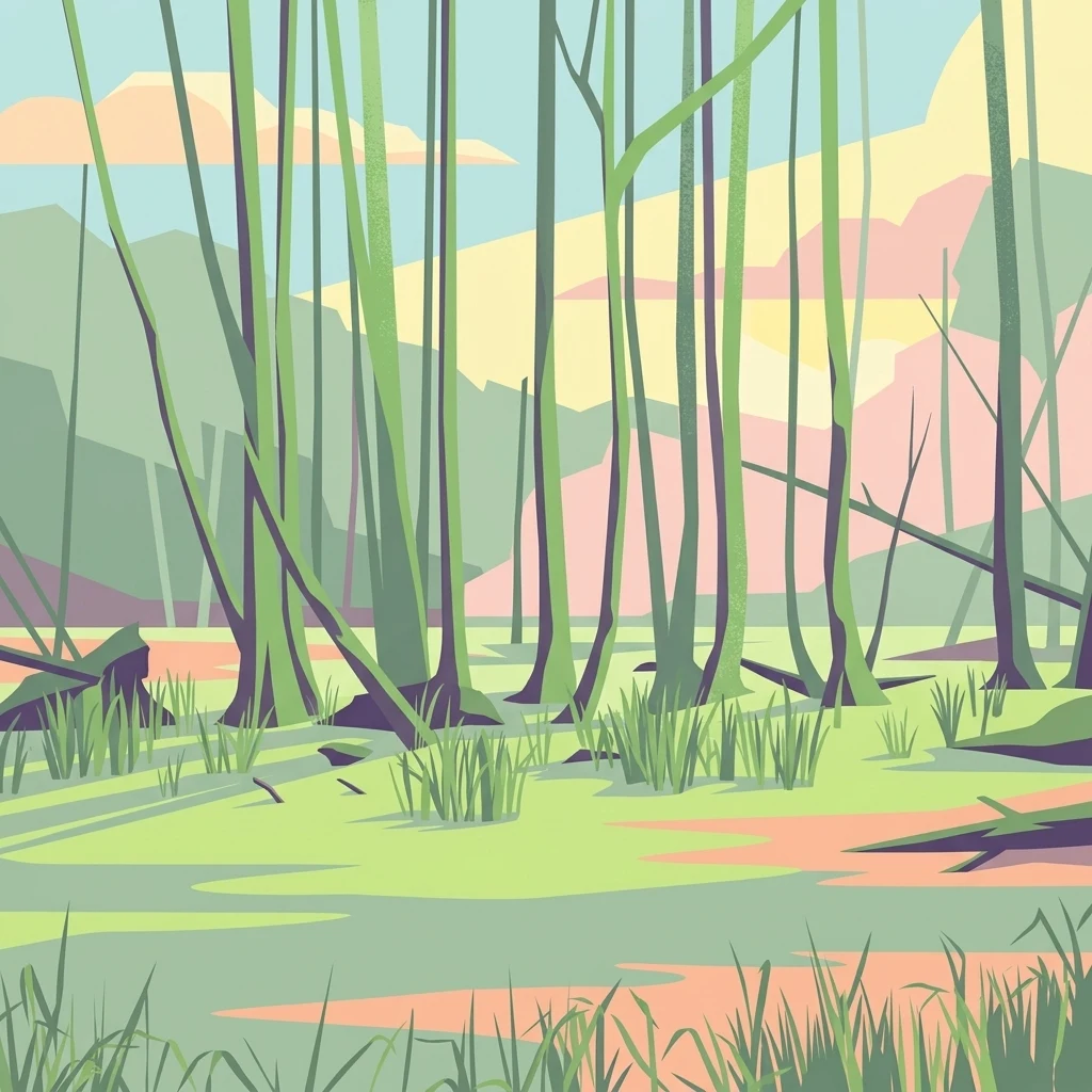
A minimalist, flat-style illustration of a swampy wetland featuring thin, vertical tree trunks rising from a grassy, marshy floor under a soft sky.

Kindelsee-Springluch

Nature reserve

Park overview

Structured park overview, official facts, and landscape profile for Kindelsee-Springluch

Kindelsee-Springluch park facts, protected area profile, and essential visitor context

Review the core facts for Kindelsee-Springluch, including designation, size, terrain, visitor scale, habitats, and operating context in one park-focused overview.

About Kindelsee-Springluch

Kindelsee-Springluch is a compact nature reserve on the edge of greater Berlin, occupying a transitional zone between the city's northern outskirts and the more rural landscapes of Brandenburg. Although only around 69 hectares in size, the reserve contains a striking diversity of habitats squeezed into a relatively small footprint, including open water, reed beds, wet meadows, sedge fens, alder swamp forest, oak mixed woodland, and sandy pine stands.

Geologically, the area belongs to the East Brandenburg Plateau, a landscape shaped by the last glaciation whose surface is incised by a network of post-glacial meltwater channels. In the Kindelsee-Springluch reserve, these channels have been filled over time by wind- and water-deposited sediments, producing the alternating sequence of mineral soils, organic layers, and waterlogged basins that supports such varied vegetation today. At the center of this mosaic lies the Kindelsee, the largest natural widening of the Kindelfließ stream, with a historical depth of roughly 12 to 15 meters.

The reserve also has a strong context as a near-urban protected area. Its forested share makes it an important local recreation resource, while at the same time it serves as a stepping-stone habitat within a regional biotope network linking the Tegeler Fließ to the Katharinensee. Since 2001, when the area received formal nature reserve status under Brandenburg law, active restoration, ranger stewardship, and targeted habitat management have aimed to maintain this unusual combination of biodiversity and public accessibility.

Quick facts and research context for Kindelsee-Springluch

Kindelsee-Springluch is a 69-hectare nature reserve (Naturschutzgebiet) in Brandenburg, Germany, located within the Westbarnim protected landscape and the Barnim Nature Park. It spans parts of the municipalities of Glienicke/Nordbahn and Schönfließ and lies in the post-glacial landscape of the East Brandenburg Plateau, shaped by ancient meltwater channels. The reserve features the Kindelsee lake, the Kindelfließ stream, alder swamp forests, wet meadows, sedge mires, and mixed oak-birch-pine woodland. Designated in 2001 after earlier hydrological damage, it is now partly owned and managed by the NABU-Stiftung Nationales Naturerbe, with active ranger oversight since 2009.

Protection and recognition

Examine documented protection records and official designation criteria for Kindelsee-Springluch.

Kindelsee-Springluch Protection Status and International Recognition Data

Kindelsee-Springluch brings together verified protected area designation records and official management context. Conservation researchers evaluate these structured environmental entries for reliable geographic analysis.

Protection details

WDPA ID
318652
Park context

Deeper park guide and search-rich context for Kindelsee-Springluch

Kindelsee-Springluch history, landscape, wildlife, and travel context

Explore Kindelsee-Springluch through its history, landscape character, ecosystems, wildlife, conservation priorities, cultural context, and seasonal travel timing in a structured park guide built for atlas discovery and search intent.

Why Kindelsee-Springluch stands out

Kindelsee-Springluch is best known for its wetland mosaic dominated by the Kindelsee lake, a recovering shallow lake surrounded by reed belts, sedge mires, willow scrub, and alder swamp forest. The reserve is particularly valued for its example of post-glacial landscape features on the East Brandenburg Plateau, where former meltwater channels have filled with sediment to form a layered sequence of wet woodland, meadow, and mire. It is also recognized for its conservation turnaround, since the lake once dried out after 1960s drainage works before rewetting restored its open water in the 1990s. The combination of recovering lake, adjoining wet meadows, and structurally rich mixed forests has made it a small but ecologically significant refuge near Berlin.
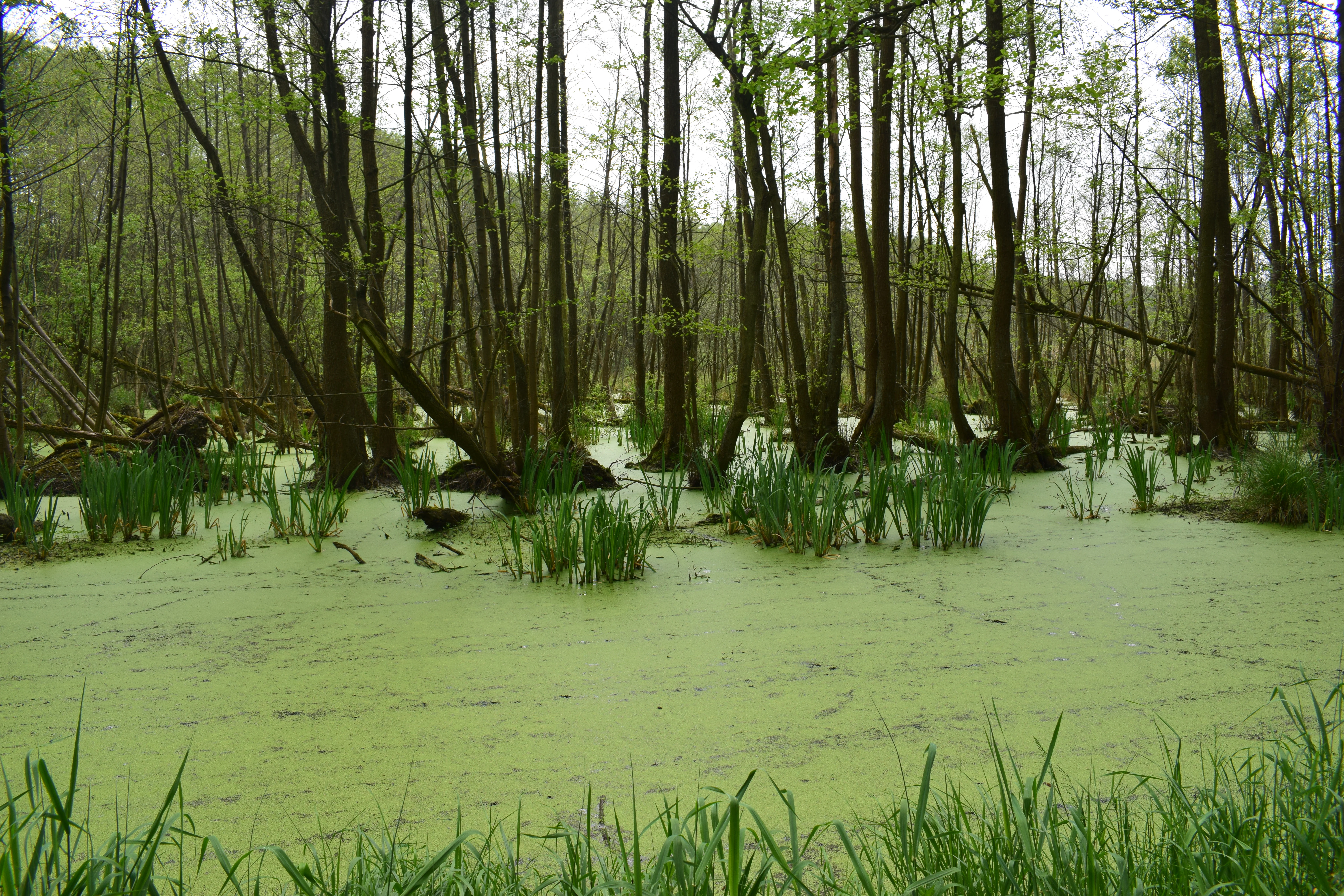
A dense green layer of duckweed covers the slow-moving surface of the Kindelfliess stream, surrounded by a swampy forest of thin trees.
The swampy waters of the Kindelfliess stream within the Kindelsee-Springluch nature reserve.

Kindelsee-Springluch history and protected-area timeline

The natural features of Kindelsee-Springluch have been shaped as much by past drainage and land-use decisions as by glacial geology. In the 1960s, agricultural improvement works rerouted the Kindelfließ stream around the Kindelsee, cutting the lake off from its inflow and causing its bed to fall dry for several years. The lake only began to recover in the 1990s, when the inflow of the Springluchgraben was redirected back into the Kindelfließ and then into the Kindelsee itself, allowing water levels to rise again.

In 2001, the Brandenburg Ministry of Agriculture, Environmental Protection and Spatial Planning formally designated the area as a nature reserve under an ordinance dated 22 July of that year. The ordinance defines the protected objects and aims of the reserve, sets out permissible and prohibited activities, and outlines management measures. In 2005, the NABU-Stiftung Nationales Naturerbe acquired 26.6 hectares from the BVVG privatization agency, including mixed birch, pine, and oak forest, abandoned wet grassland, and the reed margins of the Kindelsee; an additional 10 hectares followed in 2010.

Since 2009, volunteer reserve stewards (Schutzgebietsbetreuer) have coordinated ongoing monitoring, public outreach, and planning input. Management philosophy emphasizes process-based protection (Prozessschutz) across most NABU-owned land, leaving natural dynamics to shape woodland and wetland development rather than imposing intensive interventions, with active measures concentrated mainly on the meadows.

Kindelsee-Springluch landscape and geographic character

The reserve sits on the gently undulating terrain of the East Brandenburg Plateau, where the post-glacial land surface is incised by shallow valleys and channels left by meltwater at the end of the last ice age. Over thousands of years, these channels have been infilled by sediments and organic material, giving rise to the layered sequence of mineral soils, peaty hollows, and standing water bodies visible in the reserve today.

The most prominent physical feature is the Kindelsee, a small lake at the center of the protected area that represents the largest historical widening of the meandering Kindelfließ stream channel. A belt of reed roughly 30 meters wide hugs the open water and grades outward into willow scrub, wet meadows, and alder swamp woodland in the lowest, wettest positions. On slightly better-drained ground, mixed oak forest with birch and pine occupies the slopes and drier flats, producing a fine-grained mosaic of contrasting micro-landscapes.

Although the area is small and fairly flat, this internal variation between open water, marsh, wet woodland, and dry mixed forest gives the reserve a pronounced sense of habitat diversity and supports a continuous gradient from aquatic conditions through mire to mineral soils.

Kindelsee-Springluch ecosystems, habitats, and plant life

Ecologically, Kindelsee-Springluch is best understood as a wetland-dominated complex within a forest matrix. The lake and its surrounding reed belt, together with remnants of lowland mire and fen, constitute the core of the reserve's nature value. Sediment and organic material (Mudde) have accumulated in the lake bed over decades, so the Kindelsee is now nutrient-rich and heavily silted, with ongoing natural terrestrialization turning parts of the open water into reed, sedge, and scrub.

Around the wet core, willow thickets, sedge meadows, and alder swamp forest occupy the waterlogged lowlands, while acid-sensitive oak mixed woodland with birch and pine grows on the drier, more acidic soils of the surrounding slopes. The combination of base-rich and acidic substrates, together with the gradient between open water and closed forest, produces a varied flora in which marsh plants such as marsh hawk's-beard, marsh horsetail, marsh sedge, water dock, and marsh cinquefoil appear alongside woodland species including lily-of-the-valley and wych elm.

The reserve also functions as a connecting node in the broader biotope network of the area, linking wetland habitats along the Tegeler Fließ with those around the Katharinensee and providing continuity between forested and open-landscape protected areas in northern Brandenburg.

Kindelsee-Springluch wildlife and species highlights

Wildlife interest in Kindelsee-Springluch centers on the wetland fauna associated with the Kindelsee and its reed belt. Fish, amphibians, waterbirds, and a wide range of invertebrates use the lake and its margins, while Eurasian otters are recorded along the Kindelfließ, an indication of the recovering quality of the aquatic habitats.

The mixed forests surrounding the wetland provide additional habitat value for woodland species. Structurally varied stands with old trees, deadwood, and dense understory offer roosting and foraging opportunities for several bat species as well as cavity-nesting and ground-foraging birds. Annual ornithological surveys, carried out every April since 2010, have documented more than 30 bird species across woodland, scrub, meadow, and open water, including grey heron, mallard, common crane, white stork, red kite, and reed warbler around the lake, and typical woodland species such as middle spotted woodpecker, green woodpecker, Eurasian blackcap, common nightingale, Eurasian golden oriole, and Eurasian wren in the surrounding forest.

Kindelsee-Springluch conservation status and protection priorities

Kindelsee-Springluch was established as a nature reserve primarily to safeguard the Kindelsee lake and its associated wet lowland mire environment, to maintain the structural richness of the site's habitats, and to strengthen the regional biotope connection between the Tegeler Fließ and the Katharinensee. The lake's sedimentation zones are deliberately allowed to develop toward natural alder swamp forest, representing an explicit acceptance of ecological succession as part of the site's conservation trajectory.

Active management focuses on maintaining and restoring meadows and other open habitats, returning them where possible to their potential natural vegetation. A significant conservation challenge is the spread of the North American black cherry (Prunus serotina), an invasive species that suppresses native tree regeneration in the woodland and requires ongoing intervention. Conservation delivery is shared between the regional authorities and the NABU-Stiftung Nationales Naturerbe, which owns a substantial share of the land and coordinates ranger-based monitoring, public outreach, and habitat planning.

Kindelsee-Springluch cultural meaning and human context

Although the reserve itself is small and ecologically focused, its cultural context is shaped by its position on the historic rural fringe north of Berlin, in an area long used for agriculture, forestry, and small-scale fisheries. Past drainage and land consolidation projects left a clear imprint on the landscape, and the modern nature reserve is in part a reflection of efforts to restore what those works had compromised.

The presence of the NABU-Stiftung Nationales Naturerbe as a long-term landowner reflects a broader shift in German conservation practice toward securing sites through purchase by dedicated environmental foundations in addition to statutory protection. Volunteer stewardship by Schutzgebietsbetreuer since 2009 has also given the reserve a modest local tradition of citizen-led monitoring and engagement, making it a small but recognizable case of community-supported nature management near the capital.

Top sights and standout views in Kindelsee-Springluch

The reserve's strongest points of distinction lie in the combination of a recovering post-glacial lake, an unusually diverse wetland-forest mosaic within a compact area, and a clear story of ecological restoration after earlier drainage damage. Annual bird surveys since 2010 have built a credible picture of the site's avifauna, and the reserve's position within the broader Barnim Nature Park gives it added regional context.

Equally distinctive is the management approach itself, pairing strict process-based protection across most NABU-owned land with focused intervention to combat invasive black cherry and maintain open meadow habitats. The result is a small but well-integrated protected area that delivers both biodiversity outcomes and accessible near-urban nature experience.

Best time to visit Kindelsee-Springluch

Seasonal character at Kindelsee-Springluch is shaped mainly by the wetland and forest landscape rather than dramatic scenery changes. Spring is the most ecologically dynamic period, when waterbirds, including common crane and white stork, become more visible around the lake and reed margins, and woodland birds are at their most vocal. Late spring and early summer also bring the strongest display of wetland vegetation, with reeds, sedges, and wet-meadow plants at their peak.

Summer offers the lushest expression of the mixed forests and the most comfortable walking conditions along the trails around the lake. Autumn brings quieter conditions, richer forest colors, and increased chances of observing woodland species, while winter visits emphasize the structural variety of the habitat mosaic, with open water, reed stands, and bare deciduous trees creating strong visual contrast. As an urban-edge reserve, it remains a worthwhile year-round destination for short nature visits rather than a strongly seasonal destination.

Monthly climate preview

Track twelve-month temperature ranges and precipitation averages across Brandenburg

Kindelsee-Springluch Climate Normals and Long-Term Weather Patterns

Historical data records long-term monthly temperature swings alongside measured precipitation rates at a representative coordinate within Brandenburg. Accessing the complete climate profile reveals full numerical breakdowns for every month of the year.
Annual mean9 °C
-1 °C20 °C
Jan-1°
Feb
Mar
Apr
May14°
Jun18°
Jul20°
Aug20°
Sep15°
Oct
Nov
Dec
Warmest month
July

20.3 °C

Coolest month
January

-0.7 °C

Wettest month
July

2.4 mm/day

Driest month
April

1 mm/day

Park location guide

Geography guide, regional context, and park location map for Kindelsee-Springluch

Kindelsee-Springluch park geography, regions, and map view in Germany

Understand where Kindelsee-Springluch sits in Germany through a broader geographic reading of the surrounding landscape, nearby location context, and its mapped position within the national park landscape.

How Kindelsee-Springluch fits into Germany

Germany is a federal republic in Western and Central Europe with a population of over 83 million across sixteen constituent states. It is Europe's largest economy by nominal GDP and a major global exporter and importer. The capital is Berlin, and the country borders Denmark, Poland, Czech Republic, Austria, Switzerland, France, Luxembourg, Belgium, and the Netherlands.

Wider geography shaping Kindelsee-Springluch in Germany

Germany is located in Western and Central Europe, spanning 357,022 km². It borders Denmark to the north, Poland and the Czech Republic to the east, Austria and Switzerland to the south, and France, Luxembourg, Belgium, and the Netherlands to the west. The country has coastlines on the Baltic Sea and North Sea to the north, with the Alps located in the southern region.

Map view of Kindelsee-Springluch

Use this park location map to pinpoint Kindelsee-Springluch in Germany, understand its exact geographic position, and read its mapped placement within the surrounding landscape more clearly.

Pigeon | © OpenStreetMap contributors

Location context for Kindelsee-Springluch

Brandenburg

Visual reference guide for post-glacial wetlands, shallow lakes, and swamp forests

Kindelsee-Springluch Photos, Landscapes, and Protected-Area Scenery

Examine detailed photographs of Kindelsee-Springluch to analyze wetland mosaics, reed belts, and recovering post-glacial terrain. Visual documentation reveals the distinct ecological character of shallow lakes and alder swamp forests across the East Brandenburg Plateau.

A dense green layer of duckweed covers the slow-moving surface of the Kindelfliess stream, surrounded by a swampy forest of thin trees.

Park atlas

Compare nearby nature reserves and regional protected areas across the Brandenburg plateau.

Explore Other Parks Near Kindelsee-Springluch and Surrounding Protected Landscapes

Visitors exploring Kindelsee-Springluch can browse adjacent nature reserves and nearby protected wetlands to compare post-glacial terrains. Expanding the view across the surrounding region reveals connected conservation landscapes and similar woodland habitats.
A soft watercolor painting featuring green grasses in the foreground, calm water, and a tree line along the horizon.
Nature reserveBrandenburg
About 4.5 km away#1 closest

East

Schönerlinder Teiche Nature Reserve in Brandenburg: Protected Landscape and Geographic Atlas

Explore the wetland mosaic, bird-rich ponds, and grazing conservation areas

Schönerlinder Teiche offers a rare look at post-agricultural land transformation, featuring ponds, meadows, and reed habitats in the Brandenburg region. This nature reserve serves as an essential bird sanctuary and educational site, with water buffalo and Konik horses contributing to ongoing habitat maintenance. View the detailed geography of this protected area and its role within the wider Barnim Nature Park network.

Area
0.408 km²
Established
1997
IUCN
IV
Relief
Lowland
A pale, soft watercolor illustration showing rolling hills, sparse trees, and gentle inland dune slopes under a light sky.
Protected landscapeBerlin
About 8.1 km away#2 closest

Southwest

Baumberge Protected Landscape: Mapping Berlin's Glacial Sand Dunes and Rare Grassland Habitats

A vital protected ecosystem within the Tegeler Forst region

The Baumberge stand as one of the last remaining open inland dune sites in Berlin, encompassing a fragile 47 hectare mosaic of sand heath and dry grassland. These parabolic dunes provide a critical refuge for warmth-loving invertebrate species and rare flora, anchored by glacial sand deposits dating back to the last ice age. The area offers a significant window into the historical landscape evolution of the northern Berlin glacial valley.

Area
0.47 km²
Relief
Lowland
Climate
Temperate
Access
Easy access
A horizontal watercolor painting depicting a marshy landscape with ponds, green vegetation, and soft distant hills against a light background.
Nature reserveBerlin
About 8.2 km away#3 closest

East

Karower Teiche Nature Reserve: Mapped Protected Wetland Geography in Northeast Berlin

Transitional lowland fen and pond mosaic

Karower Teiche protects a unique 128 hectare wetland mosaic in the Pankow district of Berlin. Centered on four shallow ponds and extensive reedbeds, the reserve maintains a vital ecological corridor between the Barnim plateau and the Berlin glacial valley. This site provides essential habitat for amphibians and reed-specialist birds within an urban setting.

Area
1.286 km²
Established
1994
IUCN
IV
Relief
Lowland
Watercolor illustration showing a soft landscape with a pond, marsh vegetation, and a background of rolling hills or meadows.
Nature reserveBerlin
About 11 km away#4 closest

East

Mittelbruch Nature Reserve: Mapped Wetland Geography and Protected Landscape in Berlin

Examining lowland peat diggings and protected moorland ecosystems

Mittelbruch stands as a compact nature reserve in northeastern Berlin, featuring a layered landscape of former peat diggings and open moor meadows. This area plays a critical role in urban conservation by providing essential refuge for waterbirds and diverse meadow flora. Utilize the atlas to study the reserve's internal geography, including its managed reed belts and surrounding forest edges that form a distinct ecological mosaic within the city landscape.

Area
0.282 km²
Established
1997
IUCN
IV
Relief
Lowland
A horizontal watercolor illustration of a wetland scene with soft pink and green tones, showing sparse trees on the banks of a shallow, marshy water area under a pale sky.
Nature reserveBrandenburg
About 11 km away#5 closest

East

Ausstichgelände Röntgental: Brandenburg Nature Reserve and Protected Wetland Atlas

Mapped ecological landscapes on the Berlin metropolitan fringe

Investigate the detailed geography of Ausstichgelände Röntgental, a compact nature reserve in Brandenburg. Formed from nineteenth-century railway sand quarries, this protected area features a diverse mosaic of reed beds, open water, and alder carr forest. The site provides a compelling case study of post-industrial ecological recovery within the broader Barnim Nature Park landscape.

Area
0.248 km²
Established
1990
IUCN
IV
A horizontal watercolor illustration showing a pinkish-purple foreground of heathland vegetation transitioning into a line of light green trees against a pale, washed-out hilly background.
Nature reserveBrandenburg
About 11 km away#6 closest

Northeast

Schönower Heide Nature Reserve: An Atlas View of Brandenburg Protected Heathlands

A restored landscape of glacial dunes and sandy heath

Schönower Heide stands as a significant nature reserve in Brandenburg, Germany. The area protects a unique combination of open sand heath, pine woodland, and wetland meadows formed on post-glacial outwash plains. This protected landscape is recognized for its successful transition from former military terrain into a vibrant habitat for diverse flora and fauna, including managed populations of red deer and mouflon within its fenced boundaries.

Area
5.334 km²
Established
2000
IUCN
V
Relief
Lowland
Watercolor painting of a peaceful wetland landscape with lush green trees, reeds, and soft hills in the background under a light sky.
Nature reserveBerlin
About 12 km away#7 closest

Southeast

Malchower Aue Nature Reserve: A Detailed Atlas of Urban Protected Landscapes in Berlin

Wetland habitats and glacial terrain within the Berlin city limits.

Malchower Aue stands as a protected enclave of wetland diversity featuring a system of reed-fringed peat-cutting ponds, wet meadows, and rare dry-grassland vegetation on historical soil mounds. This site provides a vital geographic perspective on how post-glacial relief and human land-use history shape protected areas within the modern urban landscape of Berlin.

Area
0.222 km²
Established
1995
Relief
Lowland
Climate
Temperate
A watercolor illustration of a rural landscape with low hills, trees, and grassy meadow areas.
Nature reserveBrandenburg
About 14 km away#8 closest

East

Faule Wiesen bei Bernau Nature Reserve: Mapped Landscapes and Geography of Brandenburg

A vital Panke river corridor protecting rare meadow and woodland biomes.

Spanning 37 hectares near the northern edge of Berlin, Faule Wiesen bei Bernau offers a study in contrasting landscapes. The reserve features open wet meadows and small ponds alongside sandy dry grasslands and oak woodlands. It remains an essential ecological link within the Barnim district, preserving critical habitats for amphibians and orchids within the broader Brandenburg geography.

Area
0.37 km²
Established
2000
Relief
Lowland
Scope
Terrestrial

Common questions about visiting, size, designation, and location context for Kindelsee-Springluch

Kindelsee-Springluch FAQs for park facts, access, geography, and protected area context

Find quick answers about Kindelsee-Springluch, including protected-area facts, park geography, trail and visitor context, and how the park fits into its surrounding country and regional landscape.
MoriAtlas Explorer

Continue Your Protected Areas Search Across the Global Atlas

Deepen your exploration by continuing the structured search for national parks and protected areas worldwide. Utilize the comprehensive filtering capabilities to compare different conservation landscapes and refine your understanding of global park geography. Discover more about the distribution and characteristics of protected natural areas.

Global natural geography