Mori Atlas logo
National parkKings Canyon National Park

Discover mapped boundaries and regional context for this significant protected area.

Kings Canyon National Park National Park: Protected Landscape & California Geography

Kings Canyon National Park represents a distinct protected landscape within California, offering rich opportunities for geographic discovery and atlas exploration. This national park's mapped boundaries define a significant natural area, providing essential context for understanding the regional geography of California. Explore the protected territory of Kings Canyon National Park to grasp its unique place within the larger landscape and conservation atlas.

Sierra NevadaGiant SequoiasGlacial ValleysWilderness AreaMountain PeaksAlpine Lakes

Kings Canyon National Park

National park

Park overview

Structured park overview, official facts, and landscape profile for Kings Canyon National Park

Kings Canyon National Park park facts, protected area profile, and essential visitor context

Review the core facts for Kings Canyon National Park, including designation, size, terrain, visitor scale, habitats, and operating context in one park-focused overview.

About Kings Canyon National Park

Kings Canyon National Park occupies a remarkable position in California's Sierra Nevada, protecting a landscape of extraordinary geological and ecological significance. The park is divided into two distinct sections: a smaller western portion centered around Grant Grove, which contains most of the visitor facilities and the famous sequoia groves, and a much larger eastern section encompassing the deep canyons of the Middle and South Forks of the Kings River. Cedar Grove, located at the bottom of Kings Canyon, is the only part of the vast eastern portion accessible by road, reached via California State Route 180. The majority of the park is designated wilderness, requiring visitors to explore on foot or horseback to experience the backcountry's pristine alpine lakes, towering peaks, and untouched landscapes. The park's creation involved decades of political struggle between preservationists seeking to protect the wilderness and development interests hoping to construct hydroelectric dams in the canyon. Even after President Franklin D. Roosevelt expanded the park in 1940, the fight continued until 1965 when Cedar Grove and Tehipite Valley were finally annexed into the park, securing permanent protection for these spectacular landscapes.

Quick facts and research context for Kings Canyon National Park

Kings Canyon National Park covers 461,901 acres in the southern Sierra Nevada, making it one of the largest protected wilderness areas in California. The park's namesake canyon was carved by massive glaciers during the Ice Ages, creating the distinctive U-shaped valleys similar to those found in Yosemite. The park contains some of the world's largest stands of giant sequoia trees, including the General Grant Tree, the second largest tree on Earth by volume. Over 90 percent of the park is designated wilderness, with the majority accessible only by backcountry hiking trails. The Kings River drops more than 13,000 feet from the Sierra crest to the San Joaquin Valley, making it the longest undammed drop of any North American river.

Protection and recognition

Documenting the terrestrial boundary framework and designation history established in 1940.

Kings Canyon National Park Protection Status and Terrestrial Designation History

Researchers can verify the official terrestrial designation status and geographic boundary details of Kings Canyon National Park within the broader regional conservation network. Tracking documented establishment dates from 1940 provides essential clarity for mapping North American conservation areas and researching environmental frameworks.

Protection details

Protection scope
Terrestrial
Designated year
1940
Park context

Deeper park guide and search-rich context for Kings Canyon National Park

Kings Canyon National Park history, landscape, wildlife, and travel context

Explore Kings Canyon National Park through its history, landscape character, ecosystems, wildlife, conservation priorities, cultural context, and seasonal travel timing in a structured park guide built for atlas discovery and search intent.

Why Kings Canyon National Park stands out

Kings Canyon is renowned for its extraordinary depth and dramatic glacial scenery, often described as a rival to Yosemite Valley. The park protects the second-largest living tree on Earth, the General Grant Tree, located in the General Grant Grove of giant sequoias. The Redwood Mountain Grove within the park is the largest surviving sequoia grove in the world, covering more than 2,500 acres. The park's high country features multiple peaks exceeding 14,000 feet, including North Palisade at 14,248 feet, the highest point in the park. The combination of deep canyons, alpine lakes, pristine meadows, and ancient sequoia forests makes Kings Canyon one of the most ecologically diverse national parks in the United States.

Kings Canyon National Park history and protected-area timeline

Kings Canyon's human history stretches back approximately 6,000 to 7,000 years, with the Owens Valley Paiute and Yokuts peoples using the region for hunting, gathering, and trade. European exploration began in the early 19th century, with Spanish explorer Gabriel Moraga naming the Kings River in 1805. The area remained largely unexplored until the mid-1800s when John Muir's visits beginning in 1873 brought national attention to the region's spectacular scenery and similarity to Yosemite Valley. General Grant National Park was established in 1890 to protect the sequoia grove from logging, becoming the United States' fourth national park. For decades, the larger eastern section of the canyon remained in limbo as development interests proposed hydroelectric dams. President Franklin D. Roosevelt created Kings Canyon National Park in 1940 by expanding the original park to include over 400,000 acres of High Sierra wilderness. The final chapter of the dam controversy came in 1965 when Cedar Grove and Tehipite Valley were finally annexed into the park, ensuring permanent protection against development.

Kings Canyon National Park landscape and geographic character

Kings Canyon National Park showcases some of the most dramatic topography in North America, with vertical relief that exceeds almost any other location on the continent. The Sierra Crest forms the park's eastern boundary, with numerous peaks exceeding 14,000 feet including North Palisade, the park's highest point at 14,248 feet. The landscape was sculpted by massive valley glaciers during successive Ice Ages over the last 2.5 million years, which carved out the distinctive U-shaped valleys at Cedar Grove, Paradise Valley, and Tehipite Valley. These glacial valleys are characterized by flat meadow floors and exposed granite cliffs rising thousands of feet, similar in form to Yosemite Valley. Tehipite Dome, the largest granite dome in the Sierra Nevada, rises 3,500 feet above Tehipite Valley floor. The high country features hanging valleys, cirques, arêtes, and hundreds of alpine tarns. Zumwalt Meadow was formed by sediment accumulation behind a terminal moraine of a retreating glacier. Most of the mountains are composed of igneous intrusive rocks such as granite, diorite, and monzonite, formed at least 100 million years ago through subduction along the North American-Pacific Plate boundary.

Kings Canyon National Park ecosystems, habitats, and plant life

Kings Canyon National Park supports remarkable ecological diversity due to its vast elevation range from 4,500 feet to over 14,000 feet. Over 1,200 species of plants occur in the park, representing about 20 percent of all plant species in California. The park was designated by UNESCO in 1976 as part of the Sequoia-Kings Canyon Biosphere Reserve. At lower elevations, the Sierra foothill zone features chaparral, brush, and shrubs with oaks, sycamores, and willows along streams. The middle elevations contain extensive montane mixed-conifer forests of ponderosa pine, incense cedar, white fir, sugar pine, and giant sequoias. The Redwood Mountain Grove is the largest surviving sequoia grove in the world at over 2,500 acres. Approaching the subalpine zone, red fir, lodgepole pine, whitebark pine, mountain hemlock, and foxtail pine dominate. A total of 202,430 acres of old-growth forests are shared with Sequoia National Park.

Kings Canyon National Park wildlife and species highlights

The diverse habitats of Kings Canyon National Park support a rich variety of wildlife, including mule deer, Sierra Nevada bighorn sheep, mountain lions, and black bears. The park's mammal population also includes smaller species such as pikas and yellow-bellied marmots in the high country. The park supports diverse bird and reptile species, with gray-crowned rosy finches and American pipits found near alpine lakes and wetlands. The forks of the Kings River are well known for their wild trout, considered one of the finest large trout fisheries in California. The Park Service is actively involved in restoring the population of Sierra Nevada bighorn sheep, which are considered endangered in the area, with several bighorns released into the park in 2014. Grizzly bears were extirpated from the area by the early 1900s, but black bears remain common. Sensitive amphibian species such as mountain yellow-legged frogs and Yosemite toads inhabit the alpine wetlands.

Kings Canyon National Park conservation status and protection priorities

Kings Canyon National Park represents one of the most significant conservation achievements in American environmental history. The park's designation as a UNESCO Biosphere Reserve in 1976 recognizes its global importance as a protected ecosystem. Over 85 percent of the park was designated as wilderness by Congress in 1984, placing strict protections on its use and ensuring the preservation of its natural state. The Middle and South Forks of the Kings River were designated as Wild and Scenic in 1987, protecting them from development. The park's giant sequoia groves required active management interventions, including prescribed fire programs beginning in 1972, to ensure the trees' reproduction, as their natural fire regime had been suppressed since the early 20th century. The Sequoia-Kings Canyon Wilderness encompasses over 768,000 acres across both parks, representing nearly 90 percent of their combined area and providing crucial habitat connectivity for wide-ranging species.

Kings Canyon National Park cultural meaning and human context

The land now comprising Kings Canyon National Park has been inhabited by indigenous peoples for approximately 6,000 to 7,000 years. The Owens Valley Paiute, also known as the Eastern Monos, visited the region from their homeland east of the Sierra Nevada, while the Yokuts lived in the Central Valley and ventured into the mountains during summer. Some of the Eastern Mono migrated across the Sierra Nevada in the 1500s, becoming known as the Monaches or Western Mono, with one band living near Grant Grove. The native population suffered greatly during the 19th century, with a smallpox epidemic in 1862 devastating the Monache population. Historical European exploration began with Gabriel Moraga in 1805, followed by fur trappers in the 1820s and prospectors during the California Gold Rush. The Gamlin Cabin, built around 1872, is the oldest surviving structure in the park and represents the logging era that nearly destroyed the sequoia groves before the park was established.

Top sights and standout views in Kings Canyon National Park

Kings Canyon National Park offers unparalleled opportunities to experience some of America's most dramatic wilderness. The General Grant Tree, the second largest tree in the world by volume, stands in the heart of General Grant Grove and serves as the park's centerpiece. The Rae Lakes Loop backpacking trip is one of the most popular in the Sierra, passing through deep canyons, across high passes, and beneath towering peaks. The Zumwalt Meadow boardwalk provides accessible views of one of the few large flat areas in the park, with its dramatic granite cliffs and the Kings River cascading over glacial moraines. Tehipite Dome, the largest granite dome in the Sierra, offers challenging climbing routes accessible only by a nearly 30-mile roundtrip hike. The combined Pacific Crest Trail and John Muir Trail traverses the entire length of the park, providing access to some of the most remote and spectacular high country in the contiguous United States.

Best time to visit Kings Canyon National Park

The best time to visit Kings Canyon National Park depends on what experiences visitors seek. Summer, from June through September, offers the most accessible conditions for backcountry travel and the warmest temperatures in Cedar Grove, where temperatures can reach the 80s Fahrenheit. The high country is typically snow-free from late June through late October, though snow may persist into July in wet years. Spring and early summer bring rushing rivers and waterfalls at their peak flow, while wildflowers bloom in the meadows. Fall offers cooler temperatures, fewer crowds, and the opportunity to see autumn foliage in the deciduous groves. Winter transforms the park significantly, with heavy snowfall closing road access to Cedar Grove, though Grant Grove remains open year-round. The winter months offer excellent opportunities for cross-country skiing and snowshoeing in the Grant Grove area. Visitors should note that heavy snowfall typically occurs from November through April, with runoff peaking in May and June.

Monthly climate preview

Long term temperature and precipitation cycles mapped at representative mountain elevations

Kings Canyon National Park Monthly Climate Normals and Weather by Month

Long term data from a representative elevation of 2525.2 meters reveals a pattern of cold, precipitation heavy winter months contrasting with dry and warm summer cycles. Accessing the complete monthly profile provides detailed metrics on temperature variances, daily precipitation averages, and historical weather by month.
Annual mean5 °C
-3 °C17 °C
Jan-3°
Feb-3°
Mar-1°
Apr
May
Jun12°
Jul17°
Aug16°
Sep12°
Oct
Nov
Dec-3°
Warmest month
July

16.5 °C

Coolest month
December

-3.4 °C

Wettest month
January

4.1 mm/day

Driest month
August

0.2 mm/day

Park location guide

Geography guide, regional context, and park location map for Kings Canyon National Park

Kings Canyon National Park park geography, regions, and map view in United States of America

Understand where Kings Canyon National Park sits in United States of America through a broader geographic reading of the surrounding landscape, nearby location context, and its mapped position within the national park landscape.

How Kings Canyon National Park fits into United States of America

The United States of America is a federal presidential republic and one of the world's largest countries by area and population. It consists of 50 states across a vast territory spanning multiple time zones, with its capital in Washington, D.C. and largest city in New York City. The nation has a diverse economy, influential political system, and significant cultural and military presence globally.

Wider geography shaping Kings Canyon National Park in United States of America

The United States occupies a vast territory in North America, bordered by Canada to the north and Mexico to the south. The 48 contiguous states stretch from the Atlantic to the Pacific Ocean, while Alaska occupies the northwestern region and Hawaii is an archipelago in the Pacific. The country encompasses diverse terrain including the Rocky Mountains, Appalachian Mountains, Great Plains, and extensive river systems.

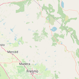
Map view of Kings Canyon National Park

Use this park location map to pinpoint Kings Canyon National Park in United States of America, understand its exact geographic position, and read its mapped placement within the surrounding landscape more clearly.

Pigeon | © OpenStreetMap contributors

Location context for Kings Canyon National Park

CaliforniaFresno CountyTulare County
Natural feature types

Browse the Natural Features and Geological Landmarks of Kings Canyon National Park

Navigate the diverse topography of Kings Canyon National Park by exploring its collection of named natural features. From glacial valleys to towering granite domes, MoriAtlas organizes the landscape data needed to understand the geographic complexity of this significant Sierra Nevada protected area.
Recorded earthquake history

Review the Historical Earthquake Catalogue for Kings Canyon National Park

Explore recorded seismic activity documented around the boundaries of Kings Canyon National Park. This historical data collection allows for detailed review of past earthquake events, magnitudes, and epicentre proximity within the southern Sierra Nevada region.

Kings Canyon National Park Earthquake History

Catalogued events

3,317 events

Strongest magnitude

Magnitude 6.4

Most recent event

Jul 30, 2026

This history includes earthquakes recorded inside the park or within 50 km of its borders

Park atlas

Explore the Sierra Nevada's Glacial Valleys, Giant Sequoias, and Mountain Protected Landscapes for Comparative Park Discovery

Discover Other National Parks and Protected Areas Near Kings Canyon National Park

Continue your exploration beyond Kings Canyon National Park by browsing other national parks and protected areas across the Sierra Nevada mountains. Compare the unique glacial valleys, ancient sequoia groves, and towering mountain peaks within the surrounding California protected landscape.
Protected landscapeCalifornia
Park boundaries overlap#1 closest

North

Inyo National Forest: An Atlas of Protected Landscapes and Sierra Nevada Geography

High altitude wilderness and volcanic terrain in Eastern California

Spanning from the arid Owens Valley floor to the 14,000 foot crest of the Sierra Nevada, Inyo National Forest remains a cornerstone of the American West. This protected landscape contains the Ancient Bristlecone Pine Forest, Mount Whitney, and the Mono Inyo volcanic chain, providing a dense geographic record of glacial, tectonic, and ecological diversity across a vast managed corridor.

Area
7,702.71 km²
Established
1907
IUCN
Ib
Relief
Mountain
Wildlife reserveTulare County
Park boundaries overlap#2 closest

South

Jennie Lakes Wilderness in Tulare County: Sierra Nevada Protected Landscape Map

High-country geography and wilderness boundaries

Jennie Lakes Wilderness offers a distinct look at high Sierra Nevada topography, featuring granite ridges, alpine lakes, and deep canyons. This Tulare County reserve acts as a critical transition zone between adjacent national parks, preserving a diverse mix of subalpine forests and rugged mountain peaks within its 10,500 acre boundary.

Area
42.72 km²
Established
1984
IUCN
Ib
Relief
Mountain
Wildlife reserveCalifornia
Park boundaries overlap#3 closest

Northwest

John Muir Wilderness: Sierra Nevada Protected Landscape and High Mountain Geography

California wilderness area with glacial basins and granite peaks

John Muir Wilderness represents one of the largest protected high-elevation areas in the contiguous United States. Spanning the Sierra Nevada crest, its granite terrain is sculpted by Pleistocene glaciation into sharp arêtes, deep canyons, and hundreds of alpine lakes. This wilderness serves as a vital geographic anchor for mountain ecosystems, offering an extensive look at the high-country landscape of eastern California.

Area
2,641.76 km²
Established
1964
IUCN
Ib
Relief
Mountain
Protected landscapeCalifornia
Park boundaries overlap#4 closest

South

Sequoia National Forest: Protected Sierra Nevada Geography and Mountain Terrain

A vast protected landscape spanning 1.1 million acres in California

Spanning Tulare, Kern, and Fresno counties, Sequoia National Forest preserves iconic giant sequoia groves across multiple river watersheds. The terrain features vertical relief exceeding 11,000 feet, showcasing a range of ecosystems from chaparral slopes and coniferous forests to glacial cirques and granite spires located within the southern Sierra Nevada range.

Area
4,829.17 km²
Established
1908
Relief
Mountain
Climate
Mediterranean
National parkCalifornia
Park boundaries overlap#5 closest

South

Sequoia National Park National Park: Geographic Identity and Protected Landscape Atlas

Explore mapped boundaries and the terrain of this California protected area.

Gain a structured understanding of Sequoia National Park as a protected landscape, focusing on its mapped geographic boundaries and its context within California. This entry provides foundational data for exploring the park's natural terrain and its role in a broader atlas of conservation lands, ideal for users seeking detailed geographic information.

Area
1,635.19 km²
Established
1890
IUCN
II
Visitors
1.2M annual
Protected landscapeCalifornia
Park boundaries overlap#6 closest

Northwest

Sierra National Forest: Protected Landscapes of the Central California Sierra Nevada

Geography of alpine lakes, conifer forests, and mountain basins

Spanning from 900 to nearly 14,000 feet in elevation, Sierra National Forest protects a massive vertical range of California terrain. Discover its iconic wilderness areas and reservoir-studded landscape, providing a deep look at the geographic connectivity between major national parks in the central Sierra Nevada.

Area
5,300 km²
Established
1893
Relief
Mountain
Climate
Alpine
National parkCalifornia
34 km away#7 closest

East

Death Valley National Park: Exploring California's Mapped Protected Landscape

View the geographic boundaries and desert terrain.

Access a detailed atlas perspective of Death Valley National Park, a protected national park situated in California. Understand the park's distinct mapped boundaries and its role within the regional geography. This resource highlights the unique desert landscape, offering focused insights into its protected-area identity and natural terrain for geographic discovery.

Area
13,848.4 km²
Established
1994
IUCN
II
Visitors
1.1M annual
Wildlife reserveFresno County
About 36 km away#8 closest

Northwest

Kaiser Wilderness: Exploring the Alpine Ridges and Glacial Terrain of the Central Sierra Nevada

A federally protected wilderness area in Fresno County, California.

Kaiser Wilderness offers a dense collection of signature Sierra Nevada landforms, including granite cliffs, subalpine forests, and high-altitude lakes. This wildlife reserve preserves a rugged, glacier-scoured interior that provides a distinct contrast to the surrounding regional landscape of the Sierra National Forest, making it a critical entity for understanding mid-elevation mountain ecology.

Area
92 km²
Established
1976
IUCN
Ib
Relief
Mountain

Common questions about visiting, size, designation, and location context for Kings Canyon National Park

Kings Canyon National Park FAQs for park facts, access, geography, and protected area context

Find quick answers about Kings Canyon National Park, including protected-area facts, park geography, trail and visitor context, and how the park fits into its surrounding country and regional landscape.
MoriAtlas Explorer

Continue Your Protected Areas Search Across the Global Atlas

Deepen your exploration by continuing the structured search for national parks and protected areas worldwide. Utilize the comprehensive filtering capabilities to compare different conservation landscapes and refine your understanding of global park geography. Discover more about the distribution and characteristics of protected natural areas.

Global natural geography