Mori Atlas logo
National parkKitulo National Park

Discover the mapped boundaries and regional geography of this vital protected area.

Kitulo National Park: Tanzania's Protected National Park Landscape in Njombe Region

Kitulo National Park stands as a significant protected area within Tanzania's Njombe Region, representing a unique national park entity for geographic exploration. This page delves into the park's identity as a mapped landscape, providing context for its role in the regional geography and its protected boundaries. It serves as a direct gateway to understanding the specific atlas and map-driven discovery value that Kitulo National Park offers, grounded in its factual geographic setting.

montane grasslandendemic florahighland conservationorchid habitatbiodiversity hotspotafroalpine ecosystem

Kitulo National Park

National park

Park overview

Structured park overview, official facts, and landscape profile for Kitulo National Park

Kitulo National Park park facts, protected area profile, and essential visitor context
Review the core facts for Kitulo National Park, including designation, size, terrain, visitor scale, habitats, and operating context in one park-focused overview.

About Kitulo National Park

Kitulo National Park occupies a distinctive position in Tanzania's protected area network as the first national park on the continent established primarily to conserve botanical resources. The Kitulo Plateau rises between two parallel mountain ridges in the southern highlands, creating a montane environment that supports ecosystems found nowhere else in Tanzania or East Africa. The park's elevation of around 2,600 metres places it in a climatic zone where Afroalpine vegetation thrives alongside bamboo thickets and evergreen forests. Beyond its botanical significance, the park encompasses the Livingstone Forest, a pristine montane woodland that represents the largest continuous forest cover in the Kipengere Range. The Ndumbi Forest at the eastern end of the park adds further diversity with its East African Cedar stands and a notable 100-metre waterfall. This combination of grassland, forest, and Afroalpine habitats makes Kitulo one of Africa's most botanically significant highland protected areas.

Quick facts and research context for Kitulo National Park

Kitulo National Park sits at roughly 2,600 metres elevation on the Kitulo Plateau in Tanzania's southern highlands, positioned between the Kipengere and Poroto mountain ranges. The park covers approximately 413 square kilometres and was formally established in 2005 as Tanzania's fourteenth national park, administered by the Tanzania National Parks Authority. It protects a unique combination of montane grassland and southern Rift montane forest-grassland mosaic, representing the first tropical African park created specifically to conserve flora. The area contains three restricted-range plant species endemic to the plateau and supports significant populations of endangered mammals including the Kipunji primate discovered in 2005.

Park context

Deeper park guide and search-rich context for Kitulo National Park

Kitulo National Park history, landscape, wildlife, and travel context
Explore Kitulo National Park through its history, landscape character, ecosystems, wildlife, conservation priorities, cultural context, and seasonal travel timing in a structured park guide built for atlas discovery and search intent.

Why Kitulo National Park stands out

Kitulo National Park is best known for its extraordinary floral diversity and seasonal wildflower displays that carpet the montane grasslands during the wet season. The plateau hosts approximately 350 plant species including dozens of ground orchids and other geophytes found nowhere else on Earth. The park is equally significant for its Livingstone Forest, the largest block of montane evergreen forest in the Kipengere Range, which shelter three globally threatened mammal species: the Kipunji (one of the world's 25 most endangered primates), the Rungwe dwarf galago, and Abbott's duiker. The rare combination of high-altitude grassland, bamboo thickets, and ancient forest creates an ecological profile unmatched elsewhere in tropical Africa.

Kitulo National Park history and protected-area timeline

The establishment of Kitulo National Park emerged from growing conservation concern about the unique flora of the Kitulo Plateau during the late 1990s and early 2000s. The Wildlife Conservation Society first proposed protection for the area in response to increasing international trade in orchid tubers and escalating hunting and logging pressures in the surrounding forests. In 2002, Tanzanian President Benjamin Mkapa announced the park's creation, and the protected area was formally gazetted in 2005, becoming Tanzania's fourteenth national park. The creation incorporated several former forest reserves, including the Livingstone Forest Reserve spanning 240.34 square kilometres and the Ndumbi Valley Forest Reserve established in 1956. The Tanzania National Parks Authority has indicated potential future expansion to include the neighbouring Mount Rungwe forest, which shares many of the same endemic species.

Kitulo National Park landscape and geographic character

The Kitulo Plateau landscape is defined by its position between two parallel mountain ranges, the Kipengere Mountains to the west and the Poroto Mountains to the east, creating a relatively flat highland area at approximately 2,600 metres above sea level. The plateau's montane grasslands stretch between the forested slopes of the surrounding mountains, interrupted by dense thickets of bamboo where the upper montane forests transition to high-altitude grasslands. The Livingstone Forest descends the southwestward-facing slopes of the park, representing the largest contiguous forest block in the entire Kipengere Range. The Ndumbi Forest at the eastern end of the park features East African Cedar among its montane evergreen species and contains a notable 100-metre waterfall. A narrow corridor of farms and tree plantations known as the Bujingijila Gap separates the Livingstone Forest from the forests of nearby Mount Rungwe.

Kitulo National Park ecosystems, habitats, and plant life

The ecological character of Kitulo National Park centres on its unusual combination of montane grassland, bamboo thicket, and evergreen forest ecosystems at high altitude in tropical Africa. The Kitulo Plateau supports approximately 350 plant species across its grasslands, with remarkable diversity in ground orchids, geophytes, and other flowering plants that define the area's botanical significance. Three plant species are endemic to the plateau itself: Brachystelma kituloensis, Impatiens rosulata, and Pterygodium ukingense. The montane forests feature bamboo (Yushania alpina) forming thickets between the upper forest zones and the high-altitude grasslands, while evergreen species including East African Cedar dominate the Ndumbi Forest. This mosaic of habitats creates ecological conditions more typical of East African mountains than of tropical Tanzania, making the park a critical site for understanding montane biodiversity in the region.

Kitulo National Park wildlife and species highlights

While Kitulo is celebrated primarily for its flora, the park supports a meaningful mammalian fauna adapted to its high-altitude environment. The montane grasslands are home to several antelope species including common duiker, steenbok, and southern reedbuck, alongside predators such as side-striped jackal and slender mongoose. The Livingstone Forest harbours three globally significant mammal species with extremely restricted ranges: the endangered Kipu nji primate (Rungwecebus kipunji), one of the world's 25 most endangered primates and discovered in the park area in 2005; the Rungwe dwarf galago, a newly described species; and Abbott's duiker, a forest-dwelling antelope. Plains zebra, once extirpated from the plateau in the 1960s by livestock farmers, were successfully reintroduced from Mikumi National Park in October 2018 and have since formed breeding herds.

Kitulo National Park conservation status and protection priorities

Kitulo National Park represents a landmark in African conservation as the first national park on the continent created primarily to protect botanical resources rather than wildlife. The park's establishment acknowledged that montane grasslands and their endemic flora required formal protection comparable to that granted to forest ecosystems and wildlife populations. The presence of three globally threatened mammal species in the Livingstone Forest underscores the broader conservation value of the protected area, which serves as a critical refuge for species found nowhere else. The park's creation also addressed the threat posed by international trade in orchid tubers and the pressures of logging and hunting that had been degrading the plateau's unique ecosystems. Future expansion to incorporate Mount Rungwe's forests could further strengthen protection for the endemic species that define this highland biodiversity hotspot.

Kitulo National Park cultural meaning and human context

The Kitulo Plateau holds deep cultural significance for local communities in Tanzania's southern highlands, who have long referred to the area as Bustani ya Mungu, meaning "The Garden of God" in Swahili. This reverent name reflects the local recognition of the plateau's exceptional natural beauty and the abundance of flowering plants that transform the landscape during the wet season. The plateau's human history includes periods of pastoral use and agriculture, particularly in the lower elevations, though the establishment of the park and incorporation of former forest reserves has reshaped the relationship between local communities and this highland landscape.

Top sights and standout views in Kitulo National Park

Kitulo National Park offers visitors the rare opportunity to experience one of Africa's most spectacular seasonal wildflower displays, with the montane grasslands transforming into a tapestry of colour during the November to April wet season. The park's significance as a botanical paradise is matched by its importance as a refuge for endemic primates, with the Kipunji representing one of the most exciting primate discoveries of the twenty-first century. The Livingstone Forest provides exceptional hiking opportunities through pristine montane woodland, while the Ndumbi Forest's 100-metre waterfall offers a dramatic natural attraction. The park's status as tropical Africa's first flora-focused national park makes it a destination of genuine conservation significance.

Best time to visit Kitulo National Park

The optimal time to experience Kitulo National Park coincides with the wet season from November through April, when the montane grasslands display their renowned wildflower blooms. This period sees the plateau carpeted with orchids, geophytes, and other flowering plants that have earned the area its "Serengeti of Flowers" nickname. The wet season also brings increased water flow to the Ndumbi Forest waterfall and supports the lush green character of the grasslands and forests. Visitors seeking to explore the Livingstone Forest and experience the park's wildlife should be prepared for high-altitude conditions and the possibility of rain, while those interested in the botanical displays should plan their visit to coincide with the peak flowering period.

Park location guide

Geography guide, regional context, and park location map for Kitulo National Park

Kitulo National Park park geography, regions, and map view in Tanzania
Understand where Kitulo National Park sits in Tanzania through a broader geographic reading of the surrounding landscape, nearby location context, and its mapped position within the national park landscape.

How Kitulo National Park fits into Tanzania

Tanzania, officially the United Republic of Tanzania, is a presidential republic in East Africa within the African Great Lakes region. It was formed in 1964 through the unification of Tanganyika and Zanzibar. The country is known for its diverse wildlife, national parks including Serengeti and Ngorongoro, and significant archaeological sites with important hominid fossils.

Wider geography shaping Kitulo National Park in Tanzania

Tanzania is located in East Africa within the African Great Lakes region. It is bordered by Uganda to the northwest, Kenya to the northeast, the Indian Ocean to the east, Mozambique and Malawi to the south, Zambia to the southwest, and Rwanda, Burundi, and the Democratic Republic of the Congo to the west. The country includes the mainland and the Zanzibar Archipelago.

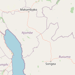
Map view of Kitulo National Park

Use this park location map to pinpoint Kitulo National Park in Tanzania, understand its exact geographic position, and read its mapped placement within the surrounding landscape more clearly.

Pigeon | © OpenStreetMap contributors

Location context for Kitulo National Park

Mbeya RegionNjombe Region
Park atlas

Map Surrounding Montane Grasslands, Forest Ecosystems, and Regional Protected Landscapes in Tanzania

Discover National Parks Near Kitulo National Park: Explore Adjacent Protected Areas
Browse other national parks and protected areas geographically connected to Kitulo National Park's unique montane grasslands and highland forests in Tanzania. Compare their diverse landscapes, conservation profiles, and ecological significance to deepen your understanding of the region's protected natural heritage.
National parkMalawi

Nyika National Park: Malawi National Park Atlas Exploration and Protected Landscape

Discover geographic context and mapped boundaries of this protected area.

Nyika National Park serves as a core entry for understanding Malawi's protected areas and natural landscapes through an atlas lens. Explore the park's designation as a national park, its geographic positioning within Malawi, and the mapped context that defines its protected status. This detail page provides a foundational view for appreciating the park's landscape and its contribution to the regional protected lands overview.

Area
3,134 km²
Established
1966
IUCN
II
Relief
Highland
National parkTanzania

Ruaha National Park: Tanzania National Park, Protected Landscape and Geographic Atlas

Mapped boundaries and regional landscape context for Ruaha National Park.

Explore the protected landscape of Ruaha National Park in Tanzania. This page provides detailed mapping of its boundaries and offers insights into its geographic setting. Understand its significance as a national park within the atlas of protected areas, focusing on its natural terrain and regional context without travel logistics.

Area
20,226 km²
Established
1964
IUCN
II
Visitors
21.3K annual
National parkKilolo District

Udzungwa Mountains National Park: Kilolo District Protected Area & Landscape Atlas

Explore mapped boundaries and regional geography for this Tanzanian national park.

Udzungwa Mountains National Park serves as a vital protected area within Kilolo District, offering a specific point of geographic focus for atlas exploration. Users can investigate its mapped boundaries and understand its role within the regional landscape context. This detailed entry provides essential data for comprehending the park's protected status and its contribution to Tanzania's network of natural areas.

Area
1,990 km²
Established
2012
IUCN
II
Relief
Mountain
National parkTanzania

Nyerere National Park: Tanzania's Immense Protected Area and Rufiji River Landscape

Explore the savanna and river delta geography of this national park.

Nyerere National Park represents one of Tanzania's most significant protected areas, sprawling across southeastern regions and offering a glimpse into largely untouched wilderness. The park's identity is deeply intertwined with the Rufiji River and its expansive delta, home to one of the world's largest mangrove forest systems. As a national park, its vastness and diverse terrain provide critical habitat, making it a key point for understanding protected land distribution and regional landscape context within Tanzania.

Area
30,893 km²
Established
2019
IUCN
II
Relief
Mixed relief
National parkKatavi Region

Katavi National Park: A Vast Protected Landscape in Tanzania's Katavi Region

Explore its unique floodplains, seasonal wetlands, and wildlife spectacles.

Katavi National Park is a significant national park located in the Katavi Region of Tanzania, spanning over 4,471 square kilometers. This remote protected area is characterized by extensive floodplains, the vital Katuma River system, and seasonal lakes like Lake Katavi and Lake Chada, which undergo dramatic changes throughout the year. The park's geography supports a dynamic ecosystem renowned for its large wildlife populations, including spectacular hippo gatherings during dry periods and vast herds of buffaloes and elephants roaming its uncrowded savannas. Katavi offers an unparalleled glimpse into a wild, untamed African landscape.

Area
4,471 km²
Established
1974
IUCN
II
Visitors
1.5K annual
National parkMuchinga Province

North Luangwa National Park: National Park Protected Landscape and Regional Geography

Mapped boundaries and geographic context within Muchinga Province.

North Luangwa National Park is a designated national park offering critical insights into Zambia's protected landscapes. This page provides an atlas-driven view of its geographic scope, emphasizing its mapped boundaries and its position within Muchinga Province. Explore the fundamental geography and protected area context that defines North Luangwa National Park for structured landscape discovery.

Area
4,636 km²
Established
1972
IUCN
II
Relief
Mixed relief
National parkZambia

Nsumbu National Park: Zambia's Lakeside Protected Landscape, Map Atlas, and Geographic Context

Mapped terrain and unique shoreline geography.

Nsumbu National Park stands as a vital protected landscape in Zambia, defined by its prominent position on Lake Tanganyika. The park's approximately 2,026 square kilometers showcase a dramatic geographic interplay between terrestrial environments, including miombo woodlands and rare Itigi-Sumbu thicket, and the vast aquatic expanse of the lake. Users exploring this atlas entry will find detailed information on the park's mapped boundaries, distinctive shoreline features like rocky cliffs and sandy beaches, and its overall role in the regional geography of Southern Africa.

Area
2,026 km²
Established
1985
IUCN
II
Relief
Lowland
National parkZambia

Luambe National Park: Detailed Geographic and Protected Area Atlas Information

Mapped landscape context within Zambia's natural regions.

This section provides an in-depth look at Luambe National Park, detailing its role as a protected area within the diverse geography of Zambia. Users can explore its mapped boundaries and understand its significance within the country's atlas of natural landscapes. The focus is on providing a concrete geographic perspective, essential for understanding how this national park fits into the regional conservation and landscape context of southern Africa.

Area
300 km²
IUCN
II
Relief
Upland
Climate
Tropical

Common questions about visiting, size, designation, and location context for Kitulo National Park

Kitulo National Park FAQs for park facts, access, geography, and protected area context
Find quick answers about Kitulo National Park, including protected-area facts, park geography, trail and visitor context, and how the park fits into its surrounding country and regional landscape.
MoriAtlas Explorer

Continue Your Protected Areas Search Across the Global Atlas

Deepen your exploration by continuing the structured search for national parks and protected areas worldwide. Utilize the comprehensive filtering capabilities to compare different conservation landscapes and refine your understanding of global park geography. Discover more about the distribution and characteristics of protected natural areas.

Global natural geography