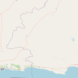
Why Knysna National Lake Area stands out
Knysna National Lake Area is best known for its dramatic coastal scenery, the iconic Knysna Heads sandstone cliffs that frame the estuary mouth, and its role as a critical habitat for marine and avian biodiversity. The estuary system supports important fish populations and serves as a feeding and breeding ground for various bird species. The surrounding indigenous forests are part of a broader forest complex that extends along the southern Cape coast, providing habitat for endemic species and contributing to the region's ecological richness.
Knysna National Lake Area history and protected-area timeline
The Knysna National Lake Area was established to protect the Knysna estuary and its surrounding coastal environments. The area's protection reflected recognition of the ecological importance of the lagoon system and the need to preserve the natural character of this part of the Garden Route coastline. Over time, the protected area has been managed as part of South Africa's national park system, with the designation providing formal protection for the coastal and estuarine habitats. The establishment of the protected area also acknowledged the region's significance for biodiversity and its value as a natural asset for the surrounding communities and visitors to the Garden Route.
Knysna National Lake Area landscape and geographic character
The landscape of Knysna National Lake Area is defined by the intersection of river, forest, and sea along South Africa's southern coast. The Knysna estuary occupies a broad tidal lagoon, flanked by marshland and mudflats that are exposed at low tide. The most striking visual feature is the Knysna Heads, a pair of towering sandstone cliffs that guard the estuary mouth and create a dramatic gateway between the protected lagoon and the open ocean. The surrounding terrain rises gently from the water's edge, with indigenous forest covering portions of the slopes and fynbos vegetation occurring on the drier ridges. The coastal setting includes elements of beach, dune, and rocky shore, contributing to the visual and ecological diversity of the protected area.
Knysna National Lake Area ecosystems, habitats, and plant life
The ecological character of Knysna National Lake Area reflects the broader patterns of South Africa's southern Cape coast, a region recognized globally for its biodiversity. The estuarine environment forms the core of the protected area, providing sheltered habitat for marine fish, crustaceans, and various invertebrate species. The mixture of open water, mudflat, reedbed, and forest edge creates diverse conditions that support different bird communities, with waterfowl, waders, and seabirds all present in the area. The surrounding indigenous forests and fynbos vegetation represent elements of the Cape Floristic Region, one of the world's six floral kingdoms and a hotspot of plant diversity. These vegetation types contribute to the ecological richness of the broader landscape and provide habitat for various terrestrial species.
Knysna National Lake Area wildlife and species highlights
Knysna National Lake Area supports notable wildlife populations, particularly in relation to birdlife and marine species associated with the estuary. The lagoon system provides important feeding and breeding habitat for various fish species, while the wetland areas and surrounding vegetation support diverse bird communities. The indigenous forest areas, though limited within the lake area itself, contribute to the broader habitat network that supports forest-dwelling species. The coastal position of the reserve also means that marine mammals may be present in the waters beyond the estuary mouth, with dolphins and seals occasionally observed in the nearshore ocean.
Knysna National Lake Area conservation status and protection priorities
The protection of Knysna National Lake Area reflects the ecological significance of South Africa's coastal and estuarine environments. The protected area contributes to the conservation of the Knysna estuary system, one of the few remaining relatively unaltered tidal lagoons along the southern coast. The habitats within the reserve form part of a broader network of protected areas along the Garden Route, a region of high conservation priority due to its biodiversity value. The protection of this coastal zone helps preserve important ecological processes, including tidal exchange, nutrient cycling, and the seasonal patterns that sustain the area's biodiversity.
Knysna National Lake Area cultural meaning and human context
The Knysna area has historical connections to indigenous Khoikhoi communities who inhabited the southern Cape coast prior to European settlement. The estuary and its productive waters would have provided resources for these local communities. The later development of Knysna as a town reflects the region's importance as a harbor and timber-processing center during the colonial period. The Knysna Heads have served as a maritime landmark and navigation point for vessels entering the estuary, contributing to the area's historical significance as part of the coastal shipping route along South Africa's southern coast.
Top sights and standout views in Knysna National Lake Area
The Knysna estuary and the iconic Knysna Heads represent the defining visual and experiential highlights of the protected area. The dramatic sandstone cliffs at the lagoon mouth create a striking entrance to the sheltered waters beyond and provide panoramic viewpoints over the coastal landscape. The estuary itself offers opportunities for exploring the productive tidal lagoon by boat, with its calm waters, marshland edges, and surrounding forest backdrop. The area's position along the Garden Route means it is accessible to visitors traveling this scenic coastal route and serves as a destination for those seeking to experience the natural landscapes of South Africa's southern coast.
Best time to visit Knysna National Lake Area
The Knysna National Lake Area can be visited throughout the year, though the seasonal patterns of the southern Cape influence the experience. Summer months from November to March bring warmer temperatures and generally dry conditions, making this a popular time for outdoor activities and estuary exploration. Winter months from June to August bring cooler temperatures and increased rainfall, which contributes to the lush quality of the surrounding vegetation but may limit some activities. The shoulder seasons of spring and autumn offer mild conditions and can provide good opportunities for visiting, with the added benefit of fewer crowds compared to the peak summer period.