
Why Kootenai National Forest stands out
Kootenai National Forest is best known for the Cabinet Mountains Wilderness, the long forest-lined expanse of Lake Koocanusa, and its unusually wet, Pacific-influenced climate compared with the rest of Montana. It is also recognized for the rich corridor of the Kootenai and Clark Fork rivers, which carve deep valleys through several distinct mountain ranges. The forest's combination of high mountains, abundant snowpack, dense conifer forests, and large roadless backcountry areas gives it a distinctive Northern Rockies identity that contrasts sharply with the drier plains and basins found elsewhere in the state.
Kootenai National Forest history and protected-area timeline
Kootenai National Forest was established in 1907, during the early wave of national forest designations in the American West that followed the transfer of forest reserves from the General Land Office to the newly created U.S. Forest Service. Its territory reflects the early-twentieth-century approach of setting aside mountainous, heavily forested drainages along the U.S.-Canada border as part of a national system of timber and watershed reserves.
Over the following decades the forest grew into both a working timber landscape and a recreational and conservation resource. The Cabinet Mountains Wilderness was eventually designated within and adjacent to the forest, protecting a major portion of the highest peaks and surrounding valleys.
The postwar era brought major changes to the region through hydroelectric development, especially the construction of Libby Dam on the Kootenai River, which created Lake Koocanusa and transformed both the river corridor and the local economy. More recently, groups such as the Kootenai Forest Stakeholders Association have brought together recreationists, timber operators, businesses, and conservationists to coordinate active forest management, fire-risk reduction, and sustainable harvest across the forest's vast landscape.
Kootenai National Forest landscape and geographic character
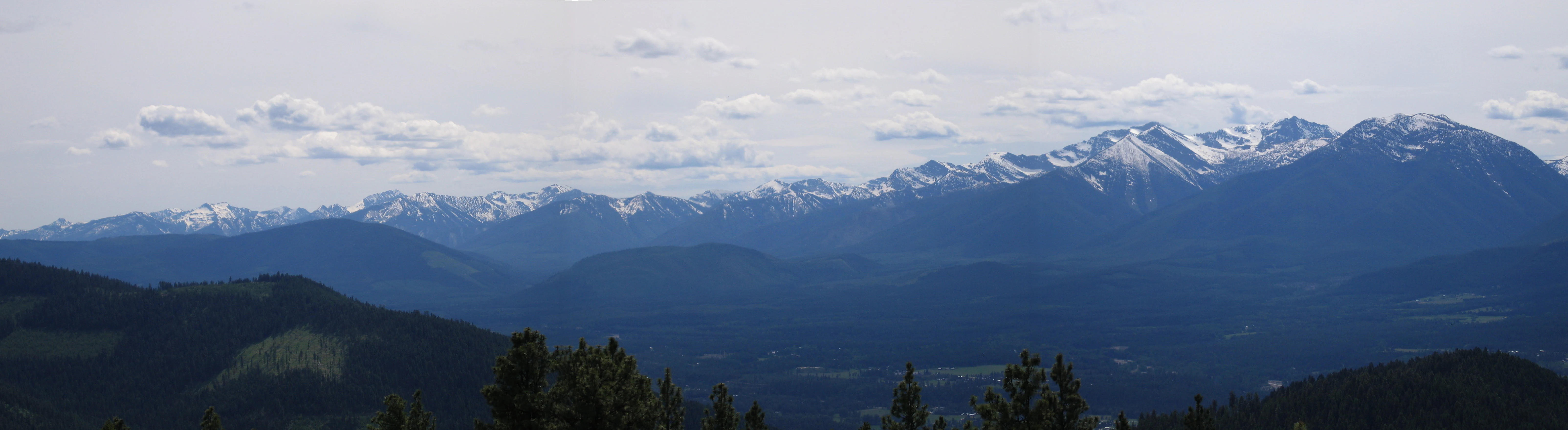
The landscape of Kootenai National Forest is a thickly forested montage of mountain ranges, river valleys, and lakes, clustered near the Montana-Idaho-Canada border. The Cabinet Mountains rise to the highest point in the forest at Snowshoe Peak, 8,738 feet, while the surrounding Whitefish, Purcell, Bitterroot, and Salish ranges create a pattern of parallel ridges and deeply cut valleys.
The Kootenai River is the single most dominant landscape feature, flowing through the forest and exiting Montana at the state's lowest elevation of 1,832 feet. Behind Libby Dam, the river has been transformed into the long, narrow Lake Koocanusa, whose forested shoreline runs nearly ninety miles north into Canada. Smaller rivers such as the Yaak, Fisher, Tobacco, and Vermillion add to the network of waterways, while more than 100 lakes give the area a distinctly water-rich feel compared with many other parts of Montana.
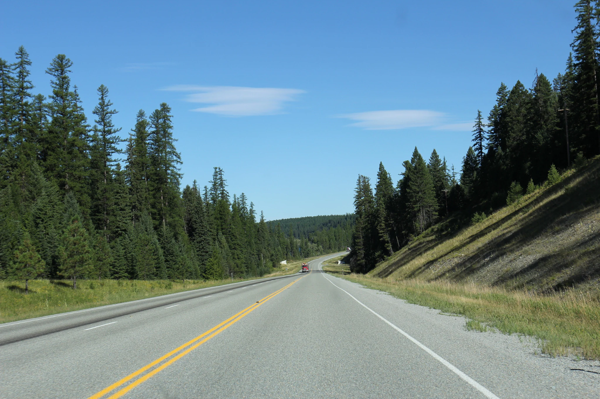
Vegetation is overwhelmingly coniferous, with continuous forest cover stretching from valley floors up across most of the mountainsides. The result is a landscape defined less by open meadows and high alpine zones and more by continuous, dense evergreen forest interrupted by rivers, reservoirs, and remote wilderness ridges.
Kootenai National Forest ecosystems, habitats, and plant life
Kootenai National Forest lies within the western, wetter portion of the Northern Rockies, where Pacific moisture sustains dense coniferous forest across most elevations. The forest's vegetation is dominated by evergreen species typical of the region, including Douglas-fir, lodgepole pine, spruce, and fir, with mountain hemlock appearing in higher and wetter sites.
Habitat diversity comes primarily from elevation and water rather than from dramatic shifts in vegetation type. The lower river valleys, like those of the Kootenai and Yaak rivers, support moist riparian corridors, while the slopes above transition into dry and mesic montane coniferous forest. Lakes, beaver-influenced wetlands, and small subalpine basins add further ecological variety.
The unusually high precipitation driven by the forest's modified Pacific maritime climate supports productive salmonid streams and a robust understory of shrubs and herbaceous plants, reinforcing the area's reputation as one of the most biologically productive national forests in the Northern Rockies.
Kootenai National Forest wildlife and species highlights
Wildlife in Kootenai National Forest reflects the broader Northern Rockies fauna associated with extensive coniferous forest, river valleys, and wilderness areas. Large mammals typical of the region, including elk, moose, deer, black bears, and mountain lions, inhabit the forest's backcountry and wilderness areas, particularly across the Cabinet Mountains and the Yaak and Fisher River drainages.
The forest's rivers and lakes, especially the Kootenai, Clark Fork, and Yaak systems and Lake Koocanusa, support fish populations central to both recreational fishing and conservation interest in the region. Wetlands, riparian corridors, and the edges of clearings and meadows provide habitat for a variety of songbirds, raptors, and waterfowl, while the wilderness and roadless portions of the forest offer relatively undisturbed habitat for species sensitive to human activity.
Kootenai National Forest conservation status and protection priorities
Kootenai National Forest holds significant conservation value as one of the largest contiguous blocks of forested public land in northwestern Montana. The Cabinet Mountains Wilderness, more than half of which lies within the forest, anchors a network of roadless and low-elevation terrain that protects habitat connectivity, watersheds, and scenic landscapes along the Canada-United States border.
The forest's hydroelectric system, particularly Libby Dam and Lake Koocanusa, illustrates the close connection between conservation, water management, and energy production. The forested shoreline of Lake Koocanusa, with no private property easements, unusually keeps a long stretch of reservoir edge entirely under public management.
More recently, partnerships like the Kootenai Forest Stakeholders Association have focused on active management aimed at reducing wildfire risk, maintaining healthy forest stands, sustaining timber harvests, and improving watershed condition, recognizing the forest as a working landscape that must simultaneously support ecological, economic, and recreational values.
Kootenai National Forest cultural meaning and human context
Kootenai National Forest occupies a region historically shaped by the Kootenai (Kootenay) people, whose name is echoed both in the forest and in the river system that defines its western edge. Euro-American settlement arrived later and remained comparatively sparse, anchored by small mill and railroad towns such as Libby, Troy, Eureka, Fortine, and Trout Creek, which today serve as the gateway communities for forest visitors.
The forest's modern cultural identity is closely tied to working-landscape traditions: logging, forest-product manufacturing, small-scale ranching, and outdoor recreation all play significant roles in the local economy. The presence of groups like the Kootenai Forest Stakeholders Association also reflects a regional culture of cooperative management, where timber operators, recreationists, business owners, and conservationists negotiate shared stewardship of the landscape.
Top sights and standout views in Kootenai National Forest
Kootenai National Forest's most distinctive features include the Cabinet Mountains Wilderness with Snowshoe Peak as its highest summit, and the long forested corridor of Lake Koocanusa stretching north into Canada.
The forest also stands out for its high rainfall and heavy snowfall, driven by a modified Pacific maritime climate that distinguishes it from the rest of Montana, and for the Pacific Northwest National Scenic Trail, which traces more than ninety miles through the forest as part of its longer 1,200-mile route.
Best time to visit Kootenai National Forest
Summer is generally the most accessible and varied season to experience Kootenai National Forest, when mountain trails, rivers, lakes, and the Cabinet Mountains Wilderness are typically free of heavy snow and ranger district offices are fully active. This period is well suited to hiking, fishing on Lake Koocanusa and smaller lakes, scenic drives along U.S. Highway 2 and U.S. Highway 93, and wildlife viewing in meadows and along riparian corridors.
Winter transforms the forest into a snow-covered landscape with heavy snowfall in the higher mountains and temperatures that occasionally drop dramatically during arctic outbreaks. Snowmobiling, cross-country skiing, and winter scenery along the forested lake shores and valley highways become the main draws, although deep snow and remote conditions limit access to many backcountry areas during this season.