
Why La Garita Wilderness stands out
La Garita Wilderness is best known for its expansive high-alpine terrain surrounding San Luis Peak, the dominant fourteener at the heart of the area. The wilderness showcases the open, rolling character of the volcanic La Garita Mountains, with broad basins, glacial cirques, and uninterrupted ridgelines that distinguish it from narrower, more rugged ranges nearby. The wilderness is also recognized for hosting segments of two of America's most significant long-distance trails: the Colorado Trail and the Continental Divide Trail. Combined with its size and elevation, this trail presence has made La Garita a notable destination for backpackers seeking extended, remote journeys through the southern Colorado Rockies.
La Garita Wilderness history and protected-area timeline
La Garita Wilderness was formally designated in 1964 as part of the early wave of Wilderness Area designations under the 1964 Wilderness Act, which established the legal framework for protecting federal lands as wilderness. Its designation placed the La Garita Mountains under the National Wilderness Preservation System, which prohibits roads, mechanized travel, and most forms of development in order to preserve the area's wilderness character.
The wilderness sits within lands historically managed by the U.S. Forest Service, and its administration is shared between the Gunnison National Forest and the Rio Grande National Forest. Since designation, the wilderness has been managed primarily for non-motorized recreation, wildlife habitat, and the preservation of backcountry conditions. Its inclusion of the Colorado Trail and the Continental Divide Trail reflects the long-standing role of the area as a corridor for travelers crossing the southern Rockies long before those modern trail systems were formalized.
La Garita Wilderness landscape and geographic character
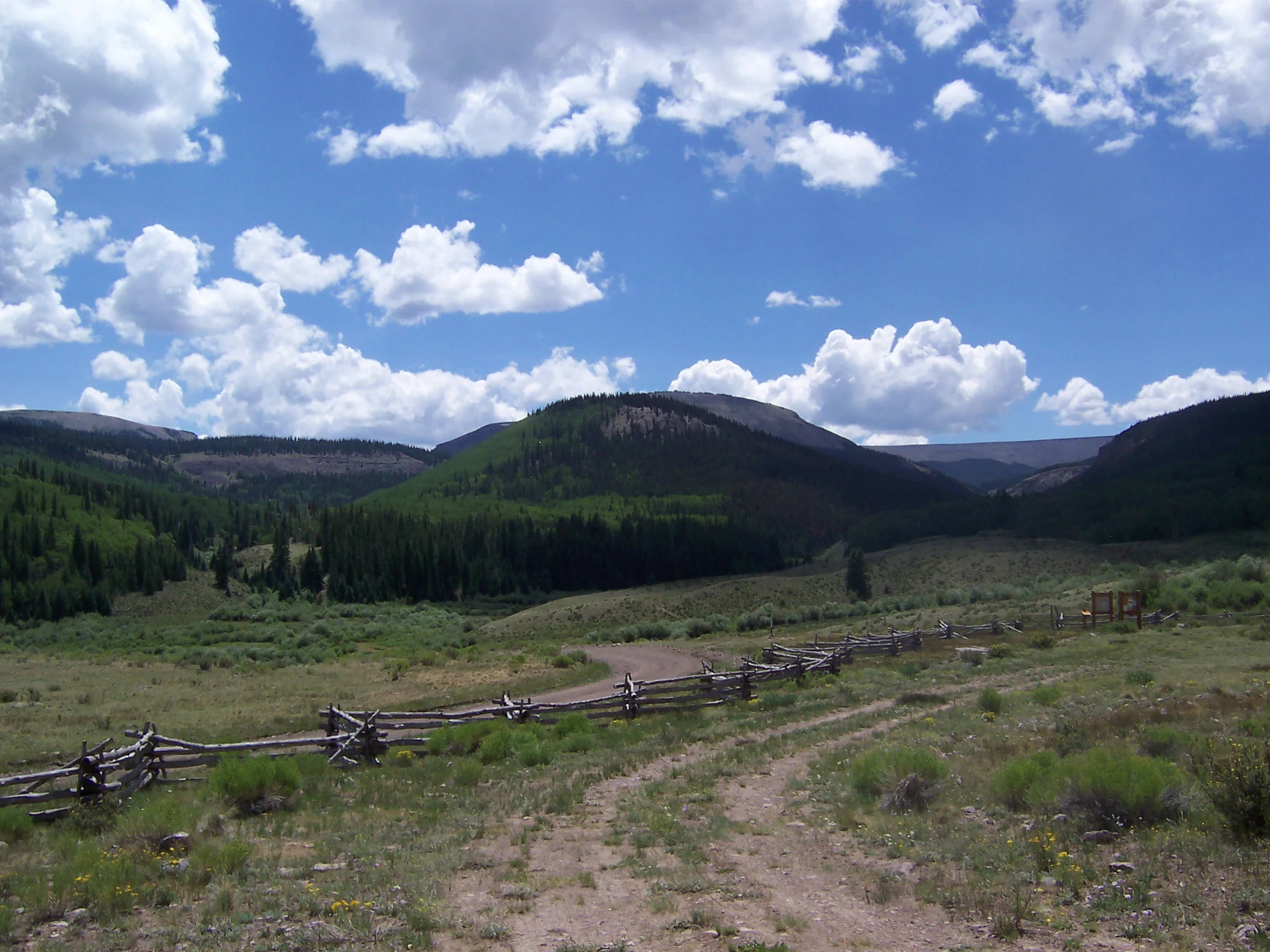
La Garita Wilderness showcases the defining terrain of the La Garita Mountains: broad, volcanic high country shaped by ancient eruptions and reshaped by glaciers during the Pleistocene. The topography is characterized by wide, rounded summits, expansive open basins, deep glacial cirques, and extensive slopes of loose volcanic rock. Unlike the jagged peaks of younger Colorado ranges, the La Garita Mountains display a more weathered, undulating profile, especially at higher elevations where past volcanic deposition has produced layered terrain that has been gradually worn down over millions of years.
San Luis Peak, the highest point at 14,014 feet, rises prominently from the central portion of the wilderness. The eponymous La Garita Peak, at 13,710 feet, anchors nearby terrain. Between these summits and across the broader wilderness, visitors encounter long ridgelines, high saddles, and broad valleys such as Saguache Park and Cochetopa Park, which serve as natural entry corridors into the heart of the wilderness. Creeping erosional features, glacial moraines, and talus fields further define the physical character of the area.
Water in the wilderness flows into watersheds that connect to the Rio Grande system to the east and various creeks draining westward into the Gunnison Basin. Streams often begin as snowmelt in alpine cirques and descend through forested valleys, creating the riparian corridors that contrast with the open high country above.
La Garita Wilderness ecosystems, habitats, and plant life
The ecological character of La Garita Wilderness reflects the strong elevation-driven zonation typical of the southern Rockies. Lower elevations feature mixed conifer forests, while middle elevations transition into subalpine spruce-fir stands. Above treeline, the landscape opens into expansive alpine tundra with a mosaic of grasses, sedges, and seasonally flowering wildflowers adapted to short, cool growing seasons.
Because of its large size and remote setting, the wilderness supports relatively intact ecological gradients. The transition from dense forest through open subalpine parkland to windswept alpine ridges happens within relatively short distances, creating habitat diversity in a compact area. Such conditions in the southern Rockies tend to support wildlife associated with both forested and alpine environments, and the wilderness's continuity of habitat contributes to its ecological significance within the region.
Riparian zones along creeks and in basin floors add another layer of habitat, with willows and other moisture-loving vegetation supporting both resident and migratory species. The broad basins like Saguache Park and Cochetopa Park also create important seasonal habitats that combine wet meadows with adjacent forest edges.
La Garita Wilderness conservation status and protection priorities
La Garita Wilderness's conservation significance lies in its scale, elevation, and the continuity of its habitat. As part of the National Wilderness Preservation System, it receives the highest level of protection available for federal lands in the United States, guarding against road construction, motorized use, and commercial development. The wilderness's designation helps maintain large, ecologically functional landscapes, an increasingly rare condition in the contiguous United States.
Its position along the Continental Divide and within two national forests further reinforces its conservation value. By linking high-elevation habitats across a broad swath of the southern Rockies, La Garita contributes to the connectivity that supports wide-ranging wildlife and resilient ecological systems. The wilderness also plays an important role in preserving watersheds that feed into the Rio Grande and Gunnison systems.
Top sights and standout views in La Garita Wilderness
The wilderness's most striking feature is the expansive, open alpine terrain surrounding San Luis Peak, where rolling volcanic ridges and glacial cirques create a sense of space uncommon in many Colorado mountain areas. Combined with the broad basins of Saguache Park and Cochetopa Park, the high country of La Garita offers some of the most accessible yet remote-feeling terrain in the southern Rockies.