Why La Muralla National Park stands out
La Muralla National Park is best known for its remarkable orchid diversity, with 123 species documented within the park boundaries. It also stands out for the discovery of three plant genera endemic to Honduras: Bartlettina williamsii, Saurauia molinae, and Tetrorchirium molinae. The park's biodiversity surveys have documented over 850 plant species, representing 410 genera across 127 botanical families, making it one of the most botanically significant protected areas in Honduras. The cloud forest habitats support complex ecological communities that are increasingly important as conservation priorities in Central America.
La Muralla National Park history and protected-area timeline
La Muralla was designated as a national park in January 1993, entering Honduras' protected area system during a period of expanding conservation legislation in Central America. Shortly after establishment, the Organization for the Protection of National Park La Muralla (OPMA) formed to support the park's management, though this community group eventually ceased operations due to insufficient funding. In 2002, the Association of Community Services Union (ASECUN) emerged to provide ongoing community support for La Muralla and related environmental initiatives. Conservation efforts have also involved the Honduran Institute of Forestry Conservation (ICF), the PANAM Foundation, the Project for Forests and Rural Productivity (PBPR), and The Nature Conservancy. Biodiversity documentation efforts began in 1992 through the Forestry Conservation Project of Honduras (CONSEFORH), which conducted the first systematic surveys of the park's flora.
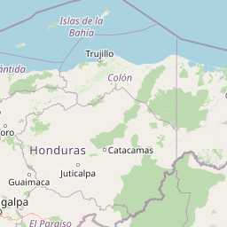
La Muralla National Park landscape and geographic character
The terrain of La Muralla National Park consists of rugged mountainous topography characteristic of the Sierra de Agalta, a significant mountain range in central Honduras. The landscape features steep slopes, narrow valleys, and elevation changes that create diverse microclimates and habitat gradients. Cloud forest dominates the higher elevations where moisture from persistent mist supports dense vegetation. The mountain terrain channels water through numerous small streams and drainage systems that feed into broader watershed networks in Olancho. The combination of elevation, aspect, and moisture creates a visually distinctive landscape of forested ridges descending into shadowed ravines.
La Muralla National Park ecosystems, habitats, and plant life
The ecological character of La Muralla is defined by its cloud forest environments, which represent some of the most biodiverse habitats in Honduras. The montane forests feature diverse tree species across multiple botanical families, with melastome, Lauraceae, Passifloraceae, and Solanaceae families well represented in documented surveys. The 2001 Paseo Pantera project cataloged 859 plant species within the park, including 65 newly recorded species for Honduras and three genera endemic to the country. These endemic discoveries, including Bartlettina williamsii, Saurauia molinae, and Tetrorchirium molinae, highlight the park's significance for botanical conservation. The cloud forest structure supports multiple vegetation layers, from canopy emergents through understory to ground cover, creating complex habitat complexity.
La Muralla National Park wildlife and species highlights
While the source material provides extensive botanical documentation, specific wildlife details are limited. The cloud forest environments of La Muralla would be expected to support diverse bird communities, small mammals, and arthropod fauna typical of Honduran montane forests. The park's protected status provides crucial habitat for species dependent on intact forest ecosystems. The biodiversity studies focused primarily on plant documentation, suggesting that wildlife surveys may represent an area for future research to fully characterize the park's fauna.
La Muralla National Park conservation status and protection priorities
La Muralla National Park represents an important conservation target within Honduras, protecting forest habitats that face pressure from logging, agriculture expansion, and fuelwood collection across Olancho. The discovery of endemic plant species within the park underscores its irreplaceable conservation value. However, the park's management has struggled with limited government support, a challenge affecting many protected areas in Honduras. Community organizations and international partnerships have provided essential support for conservation activities. The buffer zone surrounding the core protected area helps maintain landscape connectivity and provides a transitional area where sustainable land use practices can reduce edge effects on the park's interior habitats.
La Muralla National Park cultural meaning and human context
La Muralla National Park is situated within Olancho Department, one of Honduras' most sparsely populated regions where traditional agricultural practices and forest dependency remain part of local livelihoods. The park's territory spans three municipalities, with community groups like ASECUN playing roles in supporting both conservation and local development objectives. The relationship between park management and surrounding communities represents an important dimension of the protected area's long-term viability, as local support influences enforcement effectiveness and sustainable resource use in buffer zones.
Top sights and standout views in La Muralla National Park
The park's 123 documented orchid species represent a major highlight, making it particularly significant for orchid enthusiasts and botanical researchers. The presence of three Honduras-endemic plant genera distinguishes La Muralla from most other Central American protected areas. The extensive plant documentation, with nearly 860 species recorded, provides a relatively thorough baseline for understanding the park's botanical richness. The cloud forest setting creates atmospheric landscapes of mist-covered ridges and verdant ravines that define the park's visual character.
Best time to visit La Muralla National Park
The optimal visiting period for La Muralla National Park falls during the dry season typically spanning December through April, when conditions facilitate easier trail access and clearer visibility. The park's cloud forest character means that mist and moisture persist year-round, with the wet season from May through November bringing heavier rainfall that can complicate exploration. The dry months offer the most stable conditions for visitors interested in wildlife observation and landscape photography, though the cloud forest's characteristic mist remains part of the experience regardless of season. Morning hours often provide the best opportunities for wildlife activity and atmospheric conditions.