
Mori Atlas logo
Wildlife reserveLac de Bagré

Understanding the hydrology, reservoir boundaries, and riverine terrain of this Burkina Faso protected area.

Lac de Bagré Wildlife Reserve: A Mapped Geographical Overview of a Sahelian Wetland Landscape

Lac de Bagré is a prominent artificial reservoir located in central-eastern Burkina Faso, extending 50 kilometers along the historic path of the Nakambé River. As a designated Ramsar wetland site, the area serves as a vital hydrological anchor within the broader Sahelian landscape, characterized by its linear valley formation and seasonal riverine tributaries. This protected wildlife reserve supports complex freshwater ecosystems and represents a significant transition zone for regional biodiversity and traditional agricultural patterns.

artificial lakereservoirRamsar sitewetlandSahelian landscapeWhite Volta basin
A flat vector-style illustration of a river scene at sunset, featuring a canoe in the foreground, a single acacia-style tree, and a waterfall cascading from rocky cliffs in the background.

Lac de Bagré

Wildlife reserve

Park overview

Structured park overview, official facts, and landscape profile for Lac de Bagré

Lac de Bagré park facts, protected area profile, and essential visitor context

Review the core facts for Lac de Bagré, including designation, size, terrain, visitor scale, habitats, and operating context in one park-focused overview.

About Lac de Bagré

Lac de Bagré is one of the principal inland water bodies of Burkina Faso, created in the early 1990s when the Bagré Dam was completed on the Nakambé River, the local name for the White Volta. The reservoir sits at the boundary between two of Burkina Faso's administrative regions, the Centre-Est and Centre-Sud, crossing the provinces of Boulgou and Zoundwéogo. Although technically an artificial lake, it has developed considerable ecological significance and now functions as a major natural and semi-natural feature of the regional landscape.

Geographically, the lake extends over a long axis of roughly 50 kilometers, running from the commune of Bagré in the south to areas near Béguédo and Fingla in the north, with a maximum width of about 12 kilometers. Its catchment covers tens of thousands of square kilometers of the wider Nakambé basin, and it is sustained by a network of tributaries including the Lempa, Koulipélé, Niassa, Tcherbo, and Doubégué rivers. This hydrological setting gives the lake a strong influence over downstream flows as well as over local water availability, agriculture, and fisheries.

Beyond its physical scale, Lac de Bagré has become an important symbolic and practical site for the surrounding communities. The waters support traditional fishing by residents of the commune of Bagré, and the surrounding banks are used for irrigated agriculture in a region where water is otherwise scarce for much of the year. At the same time, the lake has assumed a conservation profile: the surrounding region has historically been affected by onchocerciasis (river blindness), an endemic health challenge linked to fast-flowing river habitat, and the calmer reservoir environment changes the local disease landscape. The lake's biodiversity value, especially its aquatic and wetland habitats, led to its designation as a Ramsar site in October 2009.

Quick facts and research context for Lac de Bagré

Lac de Bagré is an artificial reservoir on the Nakambé (White Volta) River in Burkina Faso, straddling the Centre-Est and Centre-Sud regions across the Boulgou and Zoundwéogo provinces. The lake was created by the Bagré Dam, with construction beginning in 1990 and the reservoir filling starting in 1992. It covers a surface area of approximately 368 square kilometers within a larger catchment basin, and sits at an altitude of around 214 meters.

The reservoir is fed by the Nakambé and its tributaries, and serves as both a fishery and an agricultural water source for the surrounding communes. It has held Ramsar wetland status since 2009, reflecting its recognized importance for birds, aquatic habitats, and resident wildlife such as hippopotamuses.

Protection and recognition

Examine official records, management scope, and recognition history for Lac de Bagré.

Lac de Bagré Protection Status and Designated Conservation Context

Lac de Bagré maintains documented conservation boundaries and official protected area records within the regional atlas. Review verified designation data, management classifications, and international recognition details for this protected wetland landscape.

Protection details

Transboundary protection
No
Park context

Deeper park guide and search-rich context for Lac de Bagré

Lac de Bagré history, landscape, wildlife, and travel context

Explore Lac de Bagré through its history, landscape character, ecosystems, wildlife, conservation priorities, cultural context, and seasonal travel timing in a structured park guide built for atlas discovery and search intent.

Why Lac de Bagré stands out

Lac de Bagré is best known as one of Burkina Faso's largest freshwater reservoirs, formed by the Bagré Dam on the Nakambé River and recognized internationally under the Ramsar Convention for its wetland biodiversity. The lake is particularly notable for the population of hippopotamuses living in its waters, which draws local tourism to a small eco-tourism center near Bagré-Village. Its long, narrow shape extending some 50 kilometers through the Sahelian landscape also makes it a defining hydrological and ecological feature of central-eastern Burkina Faso, transforming a stretch of the White Volta into a permanent inland water body within an arid regional context.
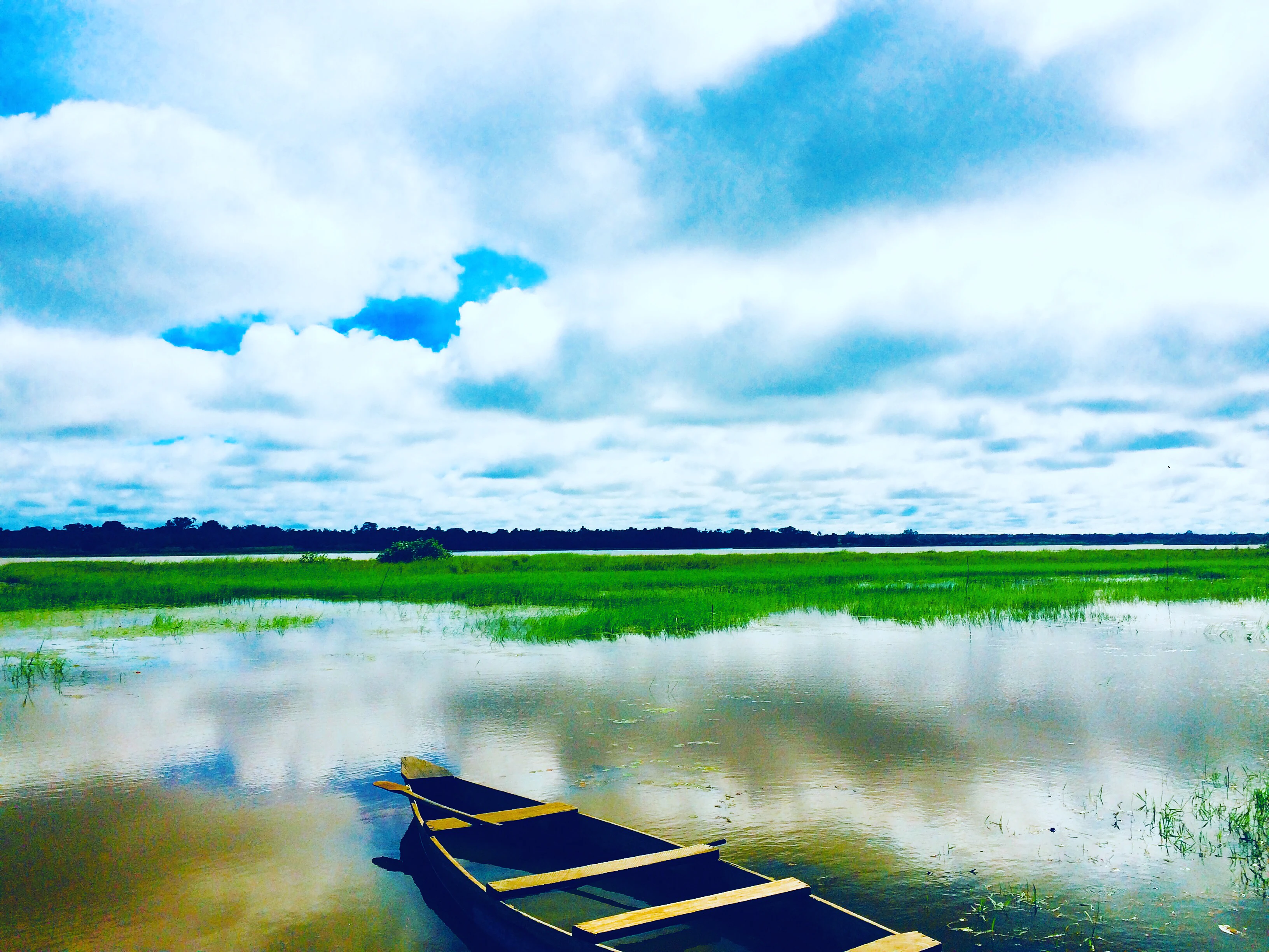
A small wooden fishing boat moored in shallow grassy water with a bright, cloudy blue sky reflecting on the surface at Lac de Bagré.
A wooden fishing boat resting on the calm waters of Lac de Bagré.

Lac de Bagré history and protected-area timeline

The origins of Lac de Bagré are tied directly to the construction of the Bagré Dam, a large infrastructure project on the Nakambé River in central-eastern Burkina Faso. Construction works began in 1990, and the reservoir began filling in 1992, marking the moment when the existing river course was transformed into the elongated artificial lake that exists today. The dam and lake take their name from the commune of Bagré, on whose territory the dam itself is located.

In the decades since its filling, the lake has progressively assumed roles beyond simple water storage. It became a sustained resource for local fishing and irrigation-based agriculture, and gradually built a reputation for its wildlife populations, most notably the hippopotamuses inhabiting its waters. In October 2009, recognition of its ecological importance came at the international level through designation under the Ramsar Convention on Wetlands, formalizing its status as a protected wetland of regional significance.

Alongside these ecological and economic developments, the lake has also reshaped the human geography of the area. The health profile of surrounding villages, historically affected by river-based diseases such as onchocerciasis, has influenced settlement patterns, with some populations historically moving away from riverside areas toward drier zones. More recently, a small eco-tourism initiative near Bagré-Village has begun to associate the lake's name with local leisure and visitor activity, marking a new chapter in its post-construction history.

Lac de Bagré landscape and geographic character

Lac de Bagré occupies a long, narrow valley trace through the central-eastern Burkinabé landscape, following the historical course of the Nakambé River and filling it with a broad but elongate body of standing water. The lake stretches from southern Bagré up toward Béguédo and Fingla, with a north-south extent of about 50 kilometers and a maximum east-west width of around 12 kilometers, giving the reservoir a distinctly linear silhouette shaped by the underlying river valley.

The surrounding terrain is characteristic of the Sahelian and north-Sudanian transition zone, with seasonally dry land cover that contrasts sharply with the permanent expanse of the lake itself. The western shore and the broader catchment draw in additional water from tributaries such as the Lempa, Koulipélé, Niassa, Tcherbo, and Doubégué, which feed the reservoir along its length and help shape small inlets, bays, and shoreline indentations. The lake sits at an altitude of roughly 214 meters.

The juxtaposition of this large, calm water body within an otherwise dry and seasonal landscape gives the site a dramatic visual and ecological character. Its long reflective surface, fringed by riparian vegetation and bordered by agricultural land along the banks, makes it one of the most prominent landscape features of the Boulgou and Zoundwéogo provinces, and a defining element of the broader Nakambé valley in Burkina Faso.
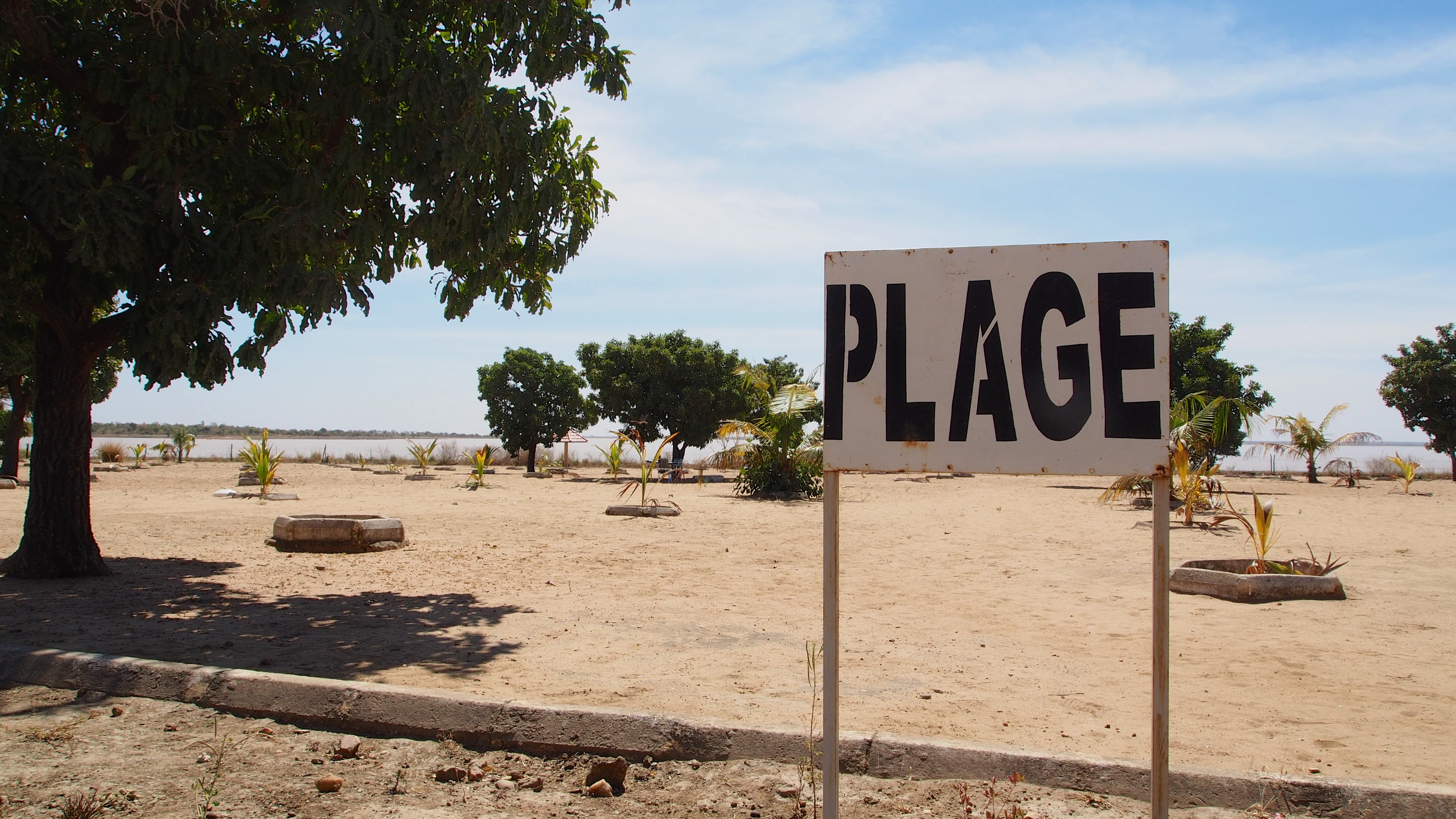
A white sign with large black letters reading PLAGE standing in a sandy area near trees and a lake.
A sign marking the beach area at Lac de Bagré.

Lac de Bagré ecosystems, habitats, and plant life

Lac de Bagré functions ecologically as a permanent wetland enclave embedded within an otherwise seasonally arid Sahelian environment. Its mix of open water, fringing vegetation, and inflow zones creates a range of aquatic and semi-aquatic habitat types that are scarce in the surrounding landscape, supporting both resident and visiting species.

The lake's tributaries, including the Lempa, Koulipélé, Niassa, Tcherbo, and Doubégué rivers, contribute localized inflows that diversify shoreline conditions, while the main Nakambé channel anchors the broader hydrological system. The combination of stable water levels, varied shoreline geometry, and a wide catchment basin gives the site consistent habitat quality through dry seasons when many other regional water bodies shrink or disappear.

Vegetation along the lake reflects this transitional setting, with riparian and aquatic plant communities developing in the wet margins and along inflow stretches, while the surrounding dryland vegetation contributes to a mosaic of land and water habitats. It is this ecological mosaic, rather than any single habitat type, that underpins the site's biodiversity profile and its formal recognition as a protected wetland.

Lac de Bagré wildlife and species highlights

Lac de Bagré is most recognized for its population of hippopotamuses, reportedly numbering around one hundred individuals in the lake's waters. This resident hippopotamus population is one of the defining wildlife features of the site and the primary attraction for visitors to the small eco-tourism center near Bagré-Village.

Beyond hippopotamuses, the lake supports a wider community of aquatic and wetland-associated fauna, typical of large Sahelian reservoirs. The combination of open water, vegetated margins, and inflow zones from multiple tributaries provides habitat for fish populations as well as for waterbirds and other species adapted to standing or slow-moving fresh water. The site's designation as a Ramsar wetland in 2009 reflects this broader faunal significance, alongside its plant and habitat values.

The local communities around the lake have long relied on its fish stocks as an important food and income resource, integrating the lake's wildlife into everyday rural life as well as into tourism.

Lac de Bagré conservation status and protection priorities

Lac de Bagré's principal conservation significance lies in its formal designation as a Ramsar site on 7 October 2009, an international recognition of its importance as a wetland under the Convention on Wetlands of International Importance. This status reflects the lake's value for biodiversity, waterbird habitat, and broader wetland-dependent species within Burkina Faso's Sahelian and north-Sudanian landscape.

The reservoir's permanent water surface stands out in a region where natural lakes and rivers are heavily seasonal, making it a critical refuge habitat during dry periods. Its tributaries, including the Lempa, Koulipélé, Niassa, Tcherbo, and Doubégué rivers, feed into a catchment of tens of thousands of square kilometers, enhancing its regional ecological reach beyond the lake's shoreline itself.

At the same time, the conservation context of the site is closely intertwined with human pressures. Historical concerns around onchocerciasis in the area, ongoing use of the lake for fisheries and irrigation, and the development of small-scale tourism near Bagré-Village all shape how the wetland is managed and experienced. The Ramsar designation helps anchor its protection profile against these competing demands, framing the lake as a site where biodiversity, livelihoods, and regional water management intersect.

Lac de Bagré cultural meaning and human context

The cultural context of Lac de Bagré is shaped by the rural and riverine communities of the communes along the Nakambé valley, particularly the commune of Bagré in the Boulgou province. The lake is woven into the daily life of these communities through fisheries, irrigated agriculture, and the patterns of settlement and movement that have accompanied the transformation of the river into a reservoir.

Local livelihoods have adapted to the presence of the lake since the early 1990s, when the dam was completed and the reservoir began filling. Fishing on the lake has become an established activity for residents of Bagré and surrounding villages, while agriculture along its banks takes advantage of reliable water access in an otherwise seasonally dry region. At the same time, health pressures, historically centered on onchocerciasis in the river zone, have influenced how communities position themselves in relation to the water.

More recently, the lake has begun to develop a modest local tourism identity, anchored by a small eco-tourism center near Bagré-Village that draws visitors interested in the lake's wildlife, particularly its hippopotamus population. This adds a newer cultural layer, linking the lake to local leisure, environmental awareness, and small-scale hospitality alongside its older roles as a fishing and farming resource.

Top sights and standout views in Lac de Bagré

Lac de Bagré stands out as one of Burkina Faso's largest artificial lakes, stretching roughly 50 kilometers through the country's central-east on the Nakambé River. Its designation as a Ramsar wetland in 2009 highlights its ecological value at the international level, while its resident hippopotamus population gives it a distinctive wildlife personality that few other inland lakes in the country can claim.

The lake also functions as a working landscape, supporting traditional fishing, irrigation-based agriculture, and a growing local eco-tourism scene centered on a small facility near Bagré-Village. The combination of large-scale hydrological transformation, biodiversity significance, and everyday human use makes it a multifaceted site within Burkina Faso's protected-area network.

Best time to visit Lac de Bagré

The character of a visit to Lac de Bagré is heavily influenced by the regional Sahelian climate, with a clear contrast between a wet season that fills the surrounding landscape and a long dry season that emphasizes the lake's role as a permanent water body. Visiting during or shortly after the rainy season typically means greener surroundings, higher water levels, and more active conditions around tributaries and shoreline habitats, which can benefit general scenery and birdlife interest.

During the dry season, when most of the surrounding land turns brown and water becomes scarce across the region, the lake becomes especially prominent as a refuge for wildlife and a gathering point for visitors interested in the resident hippopotamus population. Conditions are generally drier and sunnier, and the calmer, more stable water levels make wildlife viewing along the banks easier. Travelers sensitive to heat may find the cooler, greener wet-season months more comfortable, while those most interested in wildlife concentration at the water's edge may prefer the dry season.
Monthly climate preview

Long term temperature and precipitation measurements for Burkina Faso

Lac de Bagré Climate Normals and Annual Weather Patterns

Representative coordinates track measured monthly temperature swings from 24.34 degrees Celsius to 32.06 degrees Celsius alongside varying precipitation averages. Examining the complete twelve month profile reveals detailed long term meteorological rhythms across the protected area.
Annual mean28 °C
24 °C32 °C
Jan25°
Feb28°
Mar31°
Apr32°
May31°
Jun29°
Jul27°
Aug26°
Sep26°
Oct27°
Nov26°
Dec24°
Warmest month
April

32.1 °C

Coolest month
December

24.3 °C

Wettest month
August

7.8 mm/day

Driest month
December

0 mm/day

Park location guide

Geography guide, regional context, and park location map for Lac de Bagré

Lac de Bagré park geography, regions, and map view in Burkina Faso

Understand where Lac de Bagré sits in Burkina Faso through a broader geographic reading of the surrounding landscape, nearby location context, and its mapped position within the national park landscape.

How Lac de Bagré fits into Burkina Faso

Burkina Faso is a landlocked West African nation. The Mossi people settled the area in the 11th and 13th centuries, establishing kingdoms such as Ouagadougou, Tenkodogo, and Yatenga. The French colonized the region in 1896 as part of French West Africa, and the country gained independence in 1960 as the Republic of Upper Volta before being renamed Burkina Faso in 1984 by President Thomas Sankara.

Wider geography shaping Lac de Bagré in Burkina Faso

Burkina Faso is a landlocked country in West Africa, bordered by Mali to the northwest, Niger to the northeast, Benin to the southeast, Togo and Ghana to the south, and Ivory Coast to the southwest. The terrain consists primarily of a peneplain with some laterite plateaus in the southeast. The country has several major rivers including the Mouhoun, Nakambe, and Comoé, though most are seasonal.

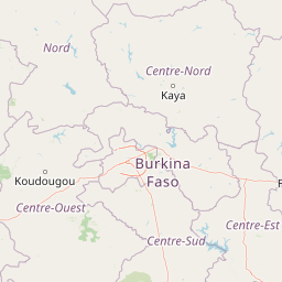
Map view of Lac de Bagré

Use this park location map to pinpoint Lac de Bagré in Burkina Faso, understand its exact geographic position, and read its mapped placement within the surrounding landscape more clearly.

Pigeon | © OpenStreetMap contributors

Visualizing the reservoir terrain, riparian vegetation, and Sahelian wetland habitats

Lac de Bagré Photos and Protected Landscape Scenery

Examine professional field photography capturing the expansive waters, shoreline habitats, and seasonal terrain features of Lac de Bagré. Visual records reveal the distinct ecological character of this major wetland reservoir within its surrounding dry landscape context.

A small wooden fishing boat moored in shallow grassy water with a bright, cloudy blue sky reflecting on the surface at Lac de Bagré.

A wide view of an arid savanna-like plain with a single mature green tree in the midground and a calm, muddy-colored lake stretching across the horizon under a clear blue sky.

A white sign with large black letters reading PLAGE standing in a sandy area near trees and a lake.

Park atlas

Compare regional wetlands, river basins, and surrounding conservation landscapes

Other Parks and Protected Areas Near Lac de Bagré in Central Eastern Burkina Faso

Visitors exploring Lac de Bagré can continue browsing adjacent protected areas and regional wetland reserves across the Nakambé River basin. Comparing surrounding terrain helps place this artificial reservoir within the broader ecological context of Burkina Faso.
Watercolor depiction of a river flowing through a landscape with green trees and distant mountains under a light sky
National parkBurkina Faso
About 80 km away#1 closest

West

Kaboré Tambi National Park: Burkina Faso's Largest National Park and Protected Landscape

Explore the mapped savanna and birdwatching geography of this vital West African area.

Kaboré Tambi National Park represents a critical protected area in Burkina Faso, spanning a considerable expanse of Sudan-Guinea savanna. The park's geography is defined by the Nazinon River and a mosaic of woodland and grassland ecosystems, making it a significant site for understanding regional protected lands and landscape ecology. It offers a valuable point of reference for atlas-based exploration of West African natural areas.

Area
1,555 km²
Established
1976
IUCN
II
Relief
Lowland
A soft, light-toned watercolor painting of a river flowing through a park or nature reserve with gentle hills and scattered trees in the background.
Nature reserveOubritenga
About 116 km away#2 closest

Northwest

Forêt classée de Gonsé Nature Reserve: Protected Landscape and Geographic Atlas Record

Sudano-Sahelian woodland and Massili River floodplain context

Examine the protected landscape of Forêt classée de Gonsé, a nature reserve in the Oubritenga region of Burkina Faso. This record details the park's savanna recovery, riverine habitats, and the legacy of its reforestation history as part of the West African Sudano-Sahelian interface.

Relief
Lowland
Climate
Subtropical
Access
Easy access
Scope
Terrestrial
National parkSavanes Region
About 127 km away#3 closest

Southeast

Fosse aux Lions National Park: National Park Exploration in Togo's Savanes Region

Mapped protected area geography and landscape context.

Fosse aux Lions National Park represents a distinct protected landscape within the Savanes Region of Togo. This entry focuses on its identity as a national park, providing structured information on its geographic placement and mapped boundaries. It serves as a core element for understanding the distribution of protected areas and the specific natural terrain within this region of Togo, aiding in comprehensive atlas-style exploration.

Area
16.5 km²
Established
1954
IUCN
II
Relief
Lowland
Protected areaKompienga Province
About 151 km away#4 closest

East

Lac de la Kompienga: Geography and Mapped Protected Landscapes in Kompienga Province

A landmark hydroelectric reservoir and wetland habitat

Lac de la Kompienga constitutes a primary water resource and ecological site within the dry savanna of Burkina Faso. This artificial reservoir creates a vital wetland mosaic, supporting diverse aquatic birdlife and fisheries while functioning as a critical component of the regional Volta Basin hydrology. The site captures the transition between engineered water management and the natural dry woodland ecosystems characteristic of the Est Region.

Area
175.45 km²
Established
1988
Relief
Lowland
Scope
Terrestrial
National parkSavannah Region
About 178 km away#5 closest

Southwest

Mole National Park: A Premier Protected Landscape in Ghana's Savannah Region

Explore mapped boundaries and Guinea savannah ecosystems.

Mole National Park represents a significant protected landscape within Ghana's Savannah Region, serving as the country's largest national park and a crucial conservation area for West African wildlife. The park's geography is defined by extensive Guinea savannah, characterized by grasslands with scattered woodlands and a prominent escarpment along its southern edge. Its vast expanse offers a unique opportunity to study mapped park boundaries and understand the ecosystem's role in regional conservation efforts. Discover the unique landscape context and protected area identity of this major West African wildlife refuge.

Area
4,840 km²
Established
1958
IUCN
II
Visitors
17.8K annual
National parkBenin
About 201 km away#6 closest

East

Pendjari National Park: Mapping Benin's Primary Protected Savanna Ecosystem and Wilderness

Located in northwestern Benin, bordering the WAP transboundary complex.

Pendjari National Park represents a significant conservation landscape in West Africa, featuring a complex geography of river-fed riparian forests, sprawling savanna plains, and the high-elevation cliffs of the Atakora mountain range. This protected area offers a look into an intact savanna wilderness, serving as a vital sanctuary for large mammals and diverse bird species within its clearly defined boundaries.

Area
2,755 km²
IUCN
II
Relief
Highland
Climate
Subtropical
A watercolor painting showing a wide, panoramic landscape featuring dry, open terrain, low rolling hills in the background, and sparse vegetation, including distinctive baobab trees.
National parkAtacora Department
About 201 km away#7 closest

East

Parc national de la Pendjari: Geographic Atlas and Protected Area Overview in Atacora Department

Savanna plains and quartzite mountain ridges in West Africa

Parc national de la Pendjari represents an ecologically vital protected landscape in the Atacora Department of Benin. This atlas overview details its complex geography, ranging from the flat sandstone peneplain to the permanent waters of the Pendjari River. Learn how these boundaries support one of the most significant contiguous savanna ecosystems in West Africa, featuring diverse habitats from gallery forests to open woodlands.

Area
4,700 km²
Established
1961
IUCN
II
Visitors
7K annual
Wildlife reserveUpper West Region
About 201 km away#8 closest

Southwest

Gbele Resource Centre Wildlife Reserve: A Regional Atlas of Protected Savanna Landscapes

Mapped geography and protected woodland in Ghana

Gbele Resource Centre represents one of the most substantial protected savanna landscapes in northwestern Ghana, spanning over 500 square kilometres of Sudano-Sahelian woodland. The terrain is defined by the seasonal Kulpawn River and a distinct composition of African baobab and sycamore fig trees, which together anchor an important ecological corridor. This reserve provides a vital opportunity to map and understand the conservation geography and avian diversity that distinguish the Upper West Region from other parts of the country.

Area
565 km²
Relief
Lowland
Scope
Terrestrial
Water
Minor water

Common questions about visiting, size, designation, and location context for Lac de Bagré

Lac de Bagré FAQs for park facts, access, geography, and protected area context

Find quick answers about Lac de Bagré, including protected-area facts, park geography, trail and visitor context, and how the park fits into its surrounding country and regional landscape.
MoriAtlas Explorer

Continue Your Protected Areas Search Across the Global Atlas

Deepen your exploration by continuing the structured search for national parks and protected areas worldwide. Utilize the comprehensive filtering capabilities to compare different conservation landscapes and refine your understanding of global park geography. Discover more about the distribution and characteristics of protected natural areas.

Global natural geography